The Peoria train depot was constructed in 1895 at a cost of $1,455 by the Santa Fe, Prescott and Phoenix Railway Company. The wood-frame structure served the agricultural and ranching interests in Peoria and areas west of Phoenix until 1972. The . . . — — Map (db m126698) HM
Originally built in 1899 as the Arizona and Utah Railway, this short-line reached almost twenty five miles from the siding at McConnico on the Sante Fe to the White Hills. In 1904, a storm washed out much of the route. In 1905, the Sante Fe acquired . . . — — Map (db m48288) HM
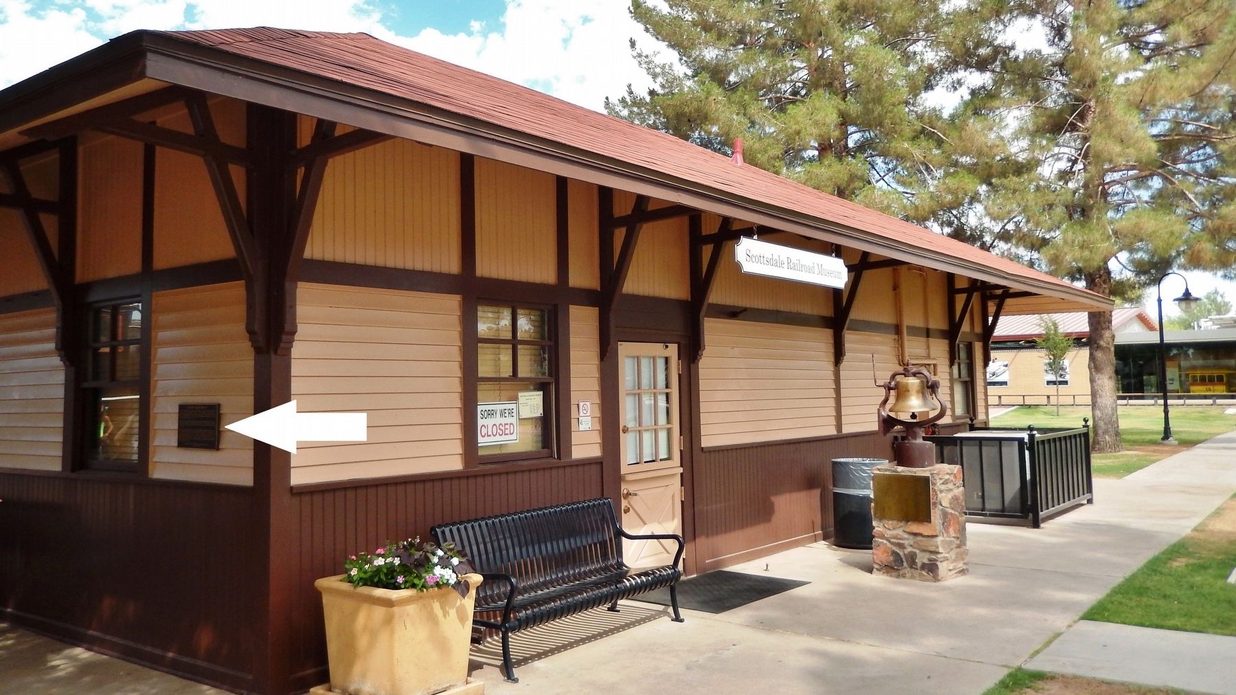
This building has been placed on
The National Register of
Historic Places
By the United States Department of the Interior.
Atchinson, Topeka & Sante Fe
Railroad Depot
Built 1907
Kingman's early existence depended upon the . . . — — Map (db m29412) HM
Dedicated to Lewis Kingman, born North Bridgewater, Mass., 1845, died Mexico City, 1912.
A civil engineer who pioneered railroad location and construction in the western United States and Mexico.
During 1886-87 he supervised the . . . — — Map (db m29424) HM
Engine 3759
Engine No. 3759, is a mighty steam engine from an era nearly 100 years ago. An era of iron horses that sped across thousands of miles; an era that has always been entwined with Kingman. But just what is No. 3759, besides one of . . . — — Map (db m194743) HM
Presented to the city of Kingman as an historical monument in 1967 by the Santa Fe Railway Company.
This "Mountain Type" coal-burning steam locomotive was built in 1927 by the Baldwin Locomotive Works. It was rebuilt and converted to oil fuel . . . — — Map (db m29360) HM
Chief Engineer of the Western Div. of the Atlantic and Pacific Railroad. Town named by John W. Young contractor for the railroad.
24 September 1881 — — Map (db m36388) HM
Across the Puerco River, the tracks of the Burlington Northern Santa Fe Railroad stretch for miles to the east and to the west. With no landforms or forests to block your view, you can see very long trains from beginning to end. More than 60 trains . . . — — Map (db m119934) HM
The Santa Fe Railway
Cyrus K. Holliday founded the Atchison, Topeka and Santa Fe Railway, better known as the Santa Fe, in 1859. The Santa Fe bought the Atlantic and Pacific's Western Division in 1897 and transferred the division headquarters . . . — — Map (db m209797) HM
The Little Colorado River and its tributaries supplied a vital water source to the area's earliest inhabitants and travelers. The watershed sustained the nearby Homol'ovi villages of the Ancestral Puebloans. A passable ford across the river allowed . . . — — Map (db m209669) HM
La Posada was the last of the great
Fred Harvey/Santa Fe Railway hotels.
This is the masterpiece of
Mary Jane Colter
considered by many to be
the greatest of all
Southwestern architects.
La Posada is on the National and State . . . — — Map (db m32787) HM
In 1863, the United States government created the Arizona Territory from land it acquired during the Mexican-American War and the 1848 Treaty of Guadalupe-Hidalgo. Its northern region remained isolated and undeveloped until the railroad arrived. . . . — — Map (db m209689) HM
Winslow's location as a livestock, trade goods, and lumber shipping point contributed to its growth and stability in the first half of the 20th century. The Santa Fe Railway shipped goods to markets across the country, which in turn made the . . . — — Map (db m209733) HM
After World War II, Winslow's growth slowed as technology reduced the railroad industry's manpower requirements. In 1979, downtown businesses were devastated when the Interstate 40 bypass opened. Today, the economy is more diversified, and Winslow's . . . — — Map (db m239387) HM
[ Four markers are mounted on the four sides around the base of the monument. ]Side A:
Southern Pacific Railroad Map
Epes commanded the "Randolph Lines" that connected Phoenix and southern Arizona's outlying communities . . . — — Map (db m38936) HM
The El Paso and Southwestern Railroad, originally owned by the Phelps Dodge Company, was extended from El Paso into Tucson in the fall of 1912. The handsome depot of classical design, featuring a large rotunda with a stained glass dome, was . . . — — Map (db m83028) HM
Locomotive 1673
Locomotive # 1673, a Mogul 2 – 6 – 0 type engine, was built by Schenectady Locomotive Works in 1900 and logged over 1,000,000 miles for the Southern Pacific Company, primarily in southern Arizona. In 1955 it was donated to . . . — — Map (db m49938) HM
The S.P.R.R., building the nation's second transcontinental rail line eastward from California, reached Tucson on March 20, 1880. It was the occasion for one of the greatest celebrations in the history of the city and foretold the coming of a new . . . — — Map (db m83229) HM
Across from the Main Gate on May 12, 1898, Charles F. Hoff, Manager of the Tucson Street Railway Company, drove the final spike completing tracks to the downtown business district and residential areas farther south. Mule-drawn streetcars traveled a . . . — — Map (db m83245) HM
The Apache Trail was created by Native American tribes traveling between their summer homes in the mountains and winter homes in the desert. The Trail became a roadway in 1905, for use in hauling supplies to the construction site of Roosevelt Dam. . . . — — Map (db m145828) HM
This locomotive is a gift to the citizens of Kearny, Arizona, by the Kennecott Copper Corporation. This is a Porter Air Locomotive, used by Kennecott Copper Corporation in the original underground Ray Copper Mine. It was used to transport men, ore, . . . — — Map (db m232147) HM
Established June 14, 1887. A small conical red peak gave Red Rock its name. Red Rock was a major cattle shipping point via the S.P. Railroad. This post office celebrated its
Centennial in June 1987. — — Map (db m31190) HM
The New Mexico and Arizona Railroad which served Patagonia, was built by the Santa Fe in 1881-82 and was operated after 1897 by the Southern Pacific. The last portion of this line, terminating at Patagonia, was abandoned in 1962.
The Patagonia . . . — — Map (db m24108) HM
Congress, Arizona was born as a gold mining camp on the side of the
Date Creek Mountains where locally known prospector Dennis May claimed
to have discovered gold in 1870, although his claim of discovery continues
to be disputed. In 1887, May . . . — — Map (db m235866) HM
Two electric locomotives and one ore car recently were put on display on Main Street. The locomotives, "motors" to the miners, and the ore car are 36-inch gauge, the same size track used by the narrow gauge railroad that traveled between Jerome . . . — — Map (db m157600) HM
Prescott’s first railroad arrived on December 31, 1886. The current depot was built by the Santa Fe, Prescott and Phoenix Railway, also known as the “Peavine”, in 1907. Designed in the Mission Revival style of poured concrete with a . . . — — Map (db m18767) HM
Wooden coaches were built around 1875 by Southern Pacific Railroad shops in Sacramento, California, and were used for passenger service in the railroad's southern division.
In 1913, this car was converted for railroad maintenance and was then . . . — — Map (db m29002) HM
The Arkansas & Oklahoma Railroad, owned by John Bayless and William Felker, was the train route west from Bentonville to Gravette from 1898 to 1900. Besides transporting passengers, this route played a major role in the growth of the Ozark fruit . . . — — Map (db m167938) HM
United States Department of Interior
National Register of Historic Places
Kansas City Southern Railway Caboose #383 has been placed on the National Register of Historic Places for its local significance and for its engineering as a rare and . . . — — Map (db m224965) HM
Mar. 20, 1839 Trail of Tears Mar. 8, 1847 Robinson's Crossroads First Post Office Feb. 5, 1858 Name changed to Bloomington Sept. 18, 1858 Butterfield Stage Stop to 1861 Dec. 9, 1862 Civil War Skirmishes Aug. 24, 1864 "Camp Mudtown" Mar. 9, 1881 . . . — — Map (db m33712) HM
The St. Louis & San Francisco Railroad was established
in 1881. Lowell was a village at that time. The 1889 Goodspeed's History of Benton County says greens, fruits, poultry, timber and railroad ties shipped extensively from the depot. The . . . — — Map (db m93263) HM
It was located above Jim Dye's Drug Store, currently Sam Alexander's Drug Store. The building was constructed in 1913 for the railroad offices and the city paid $35,000 to have them moved from Leslie. The M&NA was crucial to the economic development . . . — — Map (db m141868) HM
Built in Berlin, Germany 1934, 600 millimeter gauge (24 inch) (same engines are used at Silver Dollar City). Engine was found near Orlando, Fla. in 1989. Was bought by gentleman from Switzerland and hauled to Eureka Springs same year. Plans are to . . . — — Map (db m80172) HM
The Eureka Springs Railroad opened in February, 1883. As the first trains arrived at the original station house, a finely crafted wooden structure, passengers were met by horse drawn carriages and hacks which quickly carried them to the best . . . — — Map (db m80173) HM
First by horseback, wagons or on foot, invalids from all over this region flocked to Eureka Springs in 1879 to seek cures from the miraculous healing springs. But soon there were easier ways to arrive - stagecoaches, then trains. This laid a base . . . — — Map (db m80211) HM
The first railroad through this area was the Mississippi, Ouachita and Red River, begun in 1854 and extending westward from the Mississippi River. In 1875 it became the Little Rock, Mississippi and Texas railroad. In 1887 the north-south main line . . . — — Map (db m229488) HM
The town of Columbia was located on the Mississippi River about two miles east of this point. In 1833 the Chicot County seat was moved to Columbia from Villemont due to river bank erosion. Columbia became a thriving port and the location of a . . . — — Map (db m167545) HM
Since Crowley's Ridge provided the only natural route for north-south travel across the lowlands of northeastern Arkansas, an Indian trail and later a military road crossed the river here. About 1840 Abraham Seitz established a ferry which was later . . . — — Map (db m4912) HM
This active and restored railroad depot, completed
around 1902 by the Frisco Railroad Company, stands
as a living memorial to the entrepreneurial spirit and
the great periods of commerce that railroads brought
to our city.
As early as . . . — — Map (db m243970) HM
By a natural turn in the Arkansas River, Van Buren began at
the water's edge in 1818, straight down this hill. So, the first
muddy trail from the river came directly and in directly to this
spot - and became the hub of activity for Van Buren and . . . — — Map (db m243972) HM
John Drennen made profitable choices during his diverse professional life as merchant, bank trustee, plantation owner, and Indian agent.
He linked his future to the fledgling town of Van Buren, and built his family home here, . . . — — Map (db m120426) HM
The first court house in Faulkner County was erected in 1873 on this site, the town of Conway then being known as Conway Station, on the Little Rock and Ft. Smith Railroad. The county was named for “Sandy” Faulkner of “Arkansas Traveler” fame. — — Map (db m229576) HM
The caboose was a home away from home for railroad men, a place as individual as the men themselves. Here the conductor and brakeman could prepare a hot meal, catch up on much needed sleep, wash off the grease and coal dust, or finish daily tasks, . . . — — Map (db m192099) HM
Built in 1885 for the Kansas City, Ft. Scott & Memphis Railroad, Mammoth Spring Depot rapidly became the social hub of the community. Area residents were fascinated with the comings and goings of the massive steam engines and enjoyed the excitement . . . — — Map (db m192097) HM
Brick walkways were a common feature of Victorian era train depots, as were slate roofs and the diamond-shaped panes of the dormer windows. Another interesting feature was the extra-deep eaves, built to shelter passengers and freight from the . . . — — Map (db m192098) HM
You are standing on the support for a bridge across Spring Lake. The bridge provided an important link between the train station and the city of Mammoth Spring. The first bridge, made of wood, was replaced by a steel bridge. The steel bridge was . . . — — Map (db m192168) HM
This property has been placed on the National Register of Historic Places by the United States Department of the Interior. Arkansas Historic Preservation Program. Department of Arkansas Heritage. — — Map (db m130032) HM
The railroad reached Malvern in
1870, and the narrow-gauge
Diamond Jo Line from there to
Hot Springs was completed in
1875. The track was changed to
standard gauge in 1889. This, in
effect, brought intercontinental
service to the city. — — Map (db m211166) HM
The original tracks of the
Hot Springs Railway Company
covered almost two miles, and its
operations began in 1875 with two
cars. This was the oldest
continuously operating streetcar
system in Arkansas. By 1893
electrically operated . . . — — Map (db m211154) HM
Created by the Randolph Rose Collection using the Lost Wax Cast Bronze method, these sculptures are titled "All Aboard." The Group Portrays a Train Conductor calling a woman and her daughter to catch a train in the 1920's.
First settled in . . . — — Map (db m246093) HM
This tree is believed to have been planted in 1912 when the railroad station was built. Local residents remember the days when its limbs were so long that they nearly touched the ground. A cannon sat next to this tree prior to World War II but this . . . — — Map (db m161918) HM
The last bag of mail hung on this pole was October 14, 1967 at Ward, Arkansas. This was also the final day of operation for the Railway Post Office in the state. — — Map (db m161919) HM
In 1909, the merchants of Hope paid to have the names of their business imprinted into a sidewalk which led from the old Garland School to Fair Park.
A portion of those squares were removed in 1995 for use in this new sidewalk at the train . . . — — Map (db m161920) HM
March 12, 1999. On this day two Hope natives
visited the Hope Visitor Center and museum.
President William Jefferson Clinton, in town to
dedicate his restored birthplace house, was
escorted through the center by life-long friend
Thomas Franklin . . . — — Map (db m161917) HM
This two man inspection car was built in 1948 by Fairmont Railway Motors. Signalmen especially, relied on this motor car for transportation as they inspected signals, automatic switches and crossing gates.
Known for its light weight and easy . . . — — Map (db m161915) HM
Donated to City of Batesville 1960
This H.K. Porter locomotive 0-4-0 tank
engine was built by H.K. Porter Co.
Pittsburg, Pa. in 1927 weighing 21 tons.
Owners J.C. White Eng. Co. Mex. City, Mex.
Unknown Lbr. Co. in Louisiana
Alcoa in . . . — — Map (db m242388) HM
Much of what we currently know and enjoy
as Walnut Ridge is built upon the work of an
enterprising, 19th Century businessman by the
name of John Rhea. His life, and even his death,
are the stuff of local legend.
John A. Rhea was born in . . . — — Map (db m170301) HM
In 1828 the town of Oakland Grove was founded. By 1861 the name had been changed to Austin, according to a false local legend the once thriving town of over 30 residences was almost selected as the state capitol beginning in 1858 the town was a . . . — — Map (db m116644) HM
Hicks' Station, located on the Memphis & Little Rock Railroad between DeValls Bluff and Huntersville (N Little Rock), guarded the eastern approaches to the capital city. During the Little Rock Campaign, Confederate cavalry used it as a staging area . . . — — Map (db m72142) HM WM
Joseph Taylor Robinson Home - 204 NE Front St. Practiced law in Lonoke - 1893-1912 U.S. Congressman - 1902-1913. Governor of Arkansas - January - March 1913. U.S. Senator - 1913-1937. Lonoke was named for lone oak tree, surveyor's landmark for . . . — — Map (db m65710) HM
The Lonoke Depot has been placed on the National Register of Historic Places by the United States Department of the Interior. Built in 1912, it was an important stop on Arkansas' oldest railroad, the Memphis to Little Rock line. The depot is a . . . — — Map (db m211575) HM
1888 - A group of railroad and timber investors, led by George W. Fouke, built the Texarkana, Shreveport, & Natchez (T.S. & N) Railroad. It extended south from Texarkana to Boggy Creek.
1889 - Led by James Franklin Shaw, the Seventh . . . — — Map (db m173676) HM
About a mile south of this point is the natural gap or narrows of the Caddo River, famed in history and legend. A pioneer road through the gap connected Fort Smith with Old Washington and other points, with a toll bridge spanning the river. The . . . — — Map (db m201469) HM
This boxcar and the gifts it carried are a reminder of American support of France during two world wars, and of France's gratitude for that support. Such gestures between peoples deserve a lasting place in our memories.
People to People . . . — — Map (db m107797) HM
Kirkbride Potts, with help from his wife Pamelia Logan Potts, designed and constructed this large and stately building between 1850 and 1858. He patterned it after the Classical Revival style he knew in his home state of Pennsylvania; however, he . . . — — Map (db m120871) HM
DeValls Bluff was strategically important to both the Union and Confederate armies as a major White River port and as head of the Memphis and Little Rock Railroad. It became a key Union supply depot after its fall 1863 occupation, as well as a . . . — — Map (db m96455) HM
DeValls Bluff’s status as an excellent riverport and the head of the Memphis and Little Rock Railroad made it an important base for both Confederate and Union forces. Hoping to block Federal ships from moving up the White River, Major Gen. Thomas . . . — — Map (db m96666) HM
DEVALL’S BLUFF, ARKANSAS
August 23, 1863.
GENERAL: Having reconnoitered the different routes, I have decided to commence my line of operations at this point, and have moved the depot and hospital here to-day. The site chosen is a . . . — — Map (db m96672) HM
Rising from the Boston Mountains, the White River meanders 720 miles to its junction with the Arkansas River in the southeastern part of the state. The fast-moving water kept the White River from suffering the build-up of silt that made such rivers . . . — — Map (db m96674) HM
The Memphis and Little Rock Railroad was the first railroad to run in Arkansas. It was chartered in 1853, but when the Civil War began, only two sections were complete. One, running from DeValls Bluff to north of Little Rock, was finished in . . . — — Map (db m96454) HM
On the eve of the Civil War, the Memphis to Little Rock Railroad had completed a line between Hopefield across the Mississippi River from Memphis and Madison in eastern Arkansas. A second section between DeValls Bluff and the north side of the . . . — — Map (db m96673) HM
With a swift current and deep channel that allowed deeper-draft vessels to use it reliably as far north as Batesville, the White River was the most important river in Civil War Arkansas and was used extensively by both sides.
The Confederate . . . — — Map (db m96669) HM
DeValls Bluff was ideally situated to be an important location in the Civil War. The riverport was located at a point on the White River that was navigable at all seasons, a distinct advantage over Arkansas River sites that were frequently isolated . . . — — Map (db m96667) HM
Coming of the railroad led to the naming of Jacksonville in 1870 for Nicholas W. "Nick" Jackson (1832 - 1916), a land owner and mule owner who donated the depot site to the Old Cairo & Fulton Railroad with the provision that the new station be named . . . — — Map (db m183518) HM
Near this spot stood the substantial brick home of Alexander George (1812-1877), a wealthy German immigrant active in Little Rock's business, civic, social and political circles. Built during the 1858 to 1859 period, the George House with its . . . — — Map (db m121455) HM
Constructed in 1899, the Choctaw Route Station served as a passenger depot for the Choctaw, Oklahoma and Gulf Railroad Company, before becoming the property of the Rock Island Railroad in 1902.
The station served as a major passenger terminal on . . . — — Map (db m121451) HM
Post-Civil War, railroads became vital to the Arkansas
economy. Point of Rocks was a natural support for
a railroad bridge on the river. In October 1872,
construction began at the Little Rock with several
tons of rock removed from the . . . — — Map (db m116541) HM
[Left marker]
This property
has been placed
on the
National
Register of
Historic Places
by the United States
Department of the
Interior — — Map (db m211488) HM
What we know today as The Heights, known earlier as Pulaski Heights, started as a place called Forest Park, Little Rock's largest private park. The last stop on the trolley line, the park was created by the streetcar company to draw visitors to this . . . — — Map (db m161349) HM
Arkansas's sole Civil War rail line, the Memphis and Little Rock Railroad, ran from DeValls Bluff to what is now North Little Rock. After U.S. troops occupied the capital in 1863, the Union army built warehouses, shops, and other railroad facilities . . . — — Map (db m116260) HM
Before automobiles or airplanes, trains were the popular way to travel. At speeds of up to 65 mph (105 km), people traveled faster and farther than ever before. Besides visiting family and friends, trains took people to new and exotic places for . . . — — Map (db m156899) HM
Ordered from the American Car and Foundry Company in 1938, this car is one of the last heavyweight passenger cars built (181,700 pounds). Originally built as a chair car that carried 52 passengers, it was rebuilt in the 1970's to a diner bunk car . . . — — Map (db m164156) HM
Beginning in 1943 a total of 1200 all steel troop sleepers were built by Pullman Standard for the mass transport of military personnel during World War II. The cars sleep 29 soldiers and 1 porter. In 1943 the M.K.T. bought 30 troop sleepers for . . . — — Map (db m164157) HM
Belonged to a family of wealthy coffee merchants. He became interested in financing the completion of the Kansas City Southern Railway. A town on this railway was named for him and he personally selected De Queen.
1897 — — Map (db m121278) HM
In 1866 General Nathan Bedford Forrest, along with about 1,000 workmen, pitched camp in the vicinity of what is now Front Street on land belonging to the Izard and Prewett families. By 1868 they had succeeded in making a cut through Crowley’s Ridge . . . — — Map (db m92609) HM
Thomas Hough founded Augusta in 1848, naming
it after his favorite cousin, Miss Augusta Cald,
of Virginia. For generations it was known as
Chickasaw Crossing. The first settlers came in
1820. It was incorporated in 1861. During the
Civil . . . — — Map (db m116630) HM
[Center and Main Marker:]
This plaque marks the terminus of the First Transcontinental Passenger train that started in New York City and terminated at Alameda Point Pier on September 6, 1869. Erected by the U.S. Naval Air . . . — — Map (db m150959) HM
On September 6, 1869 first Transcontinental
Railroad train linking two great oceans, and
consisting of twelve cars and three locomotives
passed here on way to a wharf terminal west
of here, a location now covered by lagoon
for take-off . . . — — Map (db m150265) HM
In 1918, the City of Alameda invested some of the profits from its Municipal Lighting
Plant in a railroad. The "belt line,” so called because it traveled around, rather than
into a city, ran 1.16 miles along Clement Avenue from Pearl Street . . . — — Map (db m157021) HM
Before the Ice Age waned about 10,000 years ago, this area was part of a wide valley
through which the Sacramento River flowed on its way to the Pacific Ocean near the
Farallon Islands. The river spilled over a waterfall at the Golden Gate . . . — — Map (db m174544) HM
City of Berkeley Landmark
designated in 1978
James Loring Baker was an early Berkeley landowner, developer, and civic leader. He was one of the signers of the incorporation papers for the Town of Berkeley and it was he who delivered them to . . . — — Map (db m54332) HM
8758 entries matched your criteria. Entries 201 through 300 are listed above. ⊲ Previous 100 — Next 100 ⊳