2889 entries match your criteria. The first 100 are listed. ⊳
US Indian Wars Topic
By Tim Carr, August 1, 2009
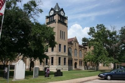
Autauga County Courthouse
| 1 ► Alabama, Autauga County, Prattville — A County Older Than the State, Autauga County — |
| On East 4th Street west of North Court Street, on the right when traveling west. | |||
| 2 ► Alabama, Baldwin County, Blakeley — The Apalachee Village — |
| On Franklin Street, 0.4 miles north of Washington Avenue, on the right when traveling west. | |||
| 3 ► Alabama, Baldwin County, Lottie — History of Lottie, Alabama — |
| On Jack Springs Road at Lottie Road (County Road 61), on the right when traveling south on Jack Springs Road. | |||
| 4 ► Alabama, Baldwin County, Stockton — First Creek War — Battles in Alabama & Baldwin County — |
| Near Alabama Route 225, on the left when traveling north. | |||
| 5 ► Alabama, Baldwin County, Stockton — Fort Mims And The Creek Indian War, 1813-14 — |
| On Fort Mims Road north of Boatyard Road (County Route 80), on the right. | |||
| 6 ► Alabama, Baldwin County, Stockton — The Society War of 1812 in the State of Alabama — |
| Near Alabama Route 225, on the left when traveling north. | |||
| 7 ► Alabama, Baldwin County, Tensaw — Fort Mims — — 500 yards → — |
| On Boatyard Road (County Road 80) at Fort Mims Road, on the left when traveling west on Boatyard Road. | |||
| 8 ► Alabama, Barbour County, Eufaula — Chief Eufaula (Yoholo Micco) — In Life and Legend — Creek Heritage Trail — |
| On East Broad Street east of North Livingston Avenue. | |||
| 9 ► Alabama, Barbour County, Eufaula — The Creek Town of Eufaula — Creek Heritage Trail — |
| On East Broad Street east of North Livingston Avenue, on the right when traveling west. | |||
| 10 ► Alabama, Barbour County, Eufaula — The Second Creek War in the Eufaula Area — Creek Heritage Trail — |
| On East Broad Street east of North Livingston Avenue, on the right when traveling west. | |||
| 11 ► Alabama, Barbour County, Louisville — Louisville and "Old Alabama" — Creek Heritage Trail — |
| On North Main Street (Alabama Route 51) 0.6 miles south of West Street, on the right when traveling south. | |||
| 12 ► Alabama, Barbour County, Louisville — The Battles of Hobdy's Bridge and Pea River — Creek Heritage Trail — |
| On North Main Street (Alabama Route 51) 0.6 miles south of West Street, on the right when traveling south. | |||
| 13 ► Alabama, Barbour County, Louisville — The Opening of the Second Phase of the Second Creek War — Creek Heritage Trail — |
| On North Main Street (Alabama Route 51) 0.6 miles south of West Street, on the right when traveling south. | |||
| 14 ► Alabama, Barbour County, Midway — Fort Browder / 15th Alabama Infantry — |
| On Woody Johnson Road, 0.1 miles east of County Route 79, on the left when traveling east. | |||
| 15 ► Alabama, Barbour County, Midway — Fort Browder / 15th Alabama Infantry — |
| On U.S. 82 close to County Road 79, on the left when traveling west. | |||
| 16 ► Alabama, Blount County, Blountsville — Blountsville — |
| On Main Street (U.S. 231) at Lee Street West, on the left when traveling north on Main Street. | |||
| 17 ► Alabama, Blount County, Oneonta — Blount County — A County Older Than the State — |
| On Second Avenue East (US Highway 231) at 4th Street North, on the right when traveling west on Second Avenue East (US Highway 231). | |||
| 18 ► Alabama, Butler County, Forest Home — The Butler Massacre / Fort Bibb — |
| On Pineapple Highway (Alabama Route 10) 0.8 miles west of Bibb Road (County Road 5), on the right when traveling west. | |||
| 19 ► Alabama, Butler County, Greenville — In Memory of Captain William Butler — |
| On South Park Street south of Walnut Street, on the right when traveling north. | |||
| 20 ► Alabama, Butler County, Greenville — Pioneer Cemetery — |
| On South Park Street at Deming Street, on the left when traveling south on South Park Street. | |||
| 21 ► Alabama, Butler County, Greenville — The Federal Road and The Palings / Fort Dale 1818 — |
| On Fort Dale Road (Alabama Route 185) 0.3 miles north of Sherling Lake Road, on the right when traveling south. | |||
| 22 ► Alabama, Calhoun County, Alexandria — Lincoyer — and The Battle of Tallasehatchee — |
| On McCullars Lane west of County Road 73, on the left when traveling west. | |||
| 23 ► Alabama, Calhoun County, Alexandria — Tallasseehatchee — Creek Indian War 1813-14 — Nov. 3, 1813 — |
| On U.S. 431, 2 miles north of State Route 144, on the right when traveling south. | |||
| 24 ► Alabama, Calhoun County, Alexandria — The Tallasahatchie Battle Field — |
| On McCullars Lane west of County Road 73, on the left when traveling west. | |||
| 25 ► Alabama, Calhoun County, Oxford — Creek Indian Campaign Memorial — |
| On Main Street south of East Oak Street, on the right when traveling north. | |||
| 26 ► Alabama, Clarke County, Campbell — Creek Indian War — 1812-1813 — |
| On Wood Bluff Road, 1.5 miles west of Alabama Route 69, on the right when traveling west. | |||
| 27 ► Alabama, Clarke County, Gainestown — The Canoe Fight — |
| On Madison Road (County Road 33) at Tennessee Road, on the right when traveling north on Madison Road. | |||
| 28 ► Alabama, Clarke County, Grove Hill — Elijah & Isaac Pugh — |
| On U.S. 84 at milepost 40 at Crescent Road, on the right when traveling east on U.S. 84. | |||
| 29 ► Alabama, Clarke County, Rockville — Gravesite of Major Jeremiah Austill — |
| On Rockville Road (County Road 15) at Suel Road, on the right when traveling south on Rockville Road. | |||
| 30 ► Alabama, Clarke County, Suggsville — Fort Madison-Creek War 1812-13 — |
| On Bird Jackson Road (County Road 35) 5.9 miles south of Simmons Creek Road, on the left when traveling south. | |||
| 31 ► Alabama, Clarke County, Whatley — Fort Sinquefield — |
| On Fort Sinquefield Road west of U.S. 84. | |||
| 32 ► Alabama, Clarke County, Whatley — Kimbell - James Massacre — ←½ mile— — |
| On U.S. 84 at County Road 22, on the right when traveling west on U.S. 84. | |||
| 33 ► Alabama, Clarke County, Whatley — Old Indian Trail — |
| On Old Line Road (County Road 35) 2 miles north of U.S. 84, on the right when traveling north. | |||
| 34 ► Alabama, Clarke County, Winn — Fort Landrum Site — |
| On Berrys Chapel Road, 0.7 miles north of Winn Road (Route 3), on the right when traveling north. | |||
| 35 ► Alabama, Clay County, Ashland — Clay County and the Creek Indian War of 1813-14 / Clay County and the Creek Indian Confederacy — |
| On Court Square (Alabama Route 9) at 1st Avenue North, on the right when traveling west on Court Square. | |||
| 36 ► Alabama, Clay County, Delta — Native American Footsteps — |
| 37 ► Alabama, Clay County, Goodwater — Battle of Enitachopko — Creek Indian War 1813-14. — ← 4 mi. E. — |
| On Shady Grove Road (Alabama Route 9) at Alabama Route 63, on the right when traveling north on Shady Grove Road. | |||
| 38 ► Alabama, Conecuh County, Bermuda — Old Federal Road — |
| On County Road 5 at County Road 20, on the right when traveling north on County Road 5. | |||
| 39 ► Alabama, Conecuh County, Pine Orchard — Old Federal Road — Fort Warren — |
| On Old Federal Road (County Road 5) south of County Road 42, on the left when traveling south. | |||
| 40 ► Alabama, Covington County, Florala — Lake Jackson — |
| On 3rd Street (Alabama Route 55) north of 2nd Avenue, on the right when traveling north. | |||
| 41 ► Alabama, Dale County, Ariton — Veterans Memorial Bridge - 1921 / Grist Mill - Indian Battle - Recreation — |
| On U.S. 231 north of State Road 123, on the right when traveling north. | |||
| 42 ► Alabama, Dale County, Ozark — Sam Dale — |
| On Unnamed road west of Myrtle Drive, in the median. | |||
| 43 ► Alabama, Elmore County, Tallassee — Tukabatchee / Tokvpvcce — |
| On Tukabatchee Road (State Highway 229) at Taylor Road, on the right when traveling south on Tukabatchee Road. | |||
| 44 ► Alabama, Elmore County, Wetumpka — Fort Jackson — |
| On West Fort Toulouse Road, 0.3 miles south of Jackson Park Road, on the right when traveling south. | |||
| 45 ► Alabama, Etowah County, Attalla — Camp Wills — |
| On 5th Avenue Northeast (U.S. 431) at Cleveland Avenue, on the right when traveling south on 5th Avenue Northeast. | |||
| 46 ► Alabama, Etowah County, Rainbow City — Site of 1784 Indian Massacre — |
| On Rainbow Drive (U.S. 411) east of Peteet Street, on the right when traveling east. | |||
| 47 ► Alabama, Henry County, Shorterville — "Irwin Empire" |
| On Alabama Route 10, 0.4 miles north of County Road 91, on the left when traveling north. Reported damaged. | |||
| 48 ► Alabama, Jefferson County, Clay — Pioneer Massey Cemetery — |
| Near Advent Circle. | |||
| 49 ► Alabama, Jefferson County, Clay — Wear Cemetery — |
| On Old Springville Road / County Road 30, on the left when traveling north. | |||
| 50 ► Alabama, Lawrence County, Oakville — Historic Indians — |
| 51 ► Alabama, Lowndes County, White Hall — Holy Ground Battlefield — |
| On Freedom Road (County Road 23) at U.S. 80, on the right when traveling north on Freedom Road. | |||
| 52 ► Alabama, Lowndes County, White Hall — Holy Ground Battlefield — |
| Near Holy Ground Road, 2.3 miles north of Jones Bluff Road (County Road 40). | |||
| 53 ► Alabama, Madison County, Huntsville — Late Indian Wars — 1866–1890 — |
| Near Monroe Street Northwest at Washington Street Northwest, on the left when traveling east. | |||
| 54 ► Alabama, Madison County, Huntsville — Seminole Wars / Mexican War — |
| On Monroe Street Northwest at Washington Street Northwest, on the left when traveling east on Monroe Street Northwest. | |||
| 55 ► Alabama, Madison County, New Hope — Fort Deposit Trail — |
| On Main Street south of Washington Avenue, on the right when traveling north. | |||
| 56 ► Alabama, Marshall County, Guntersville — History of Guntersville — |
| On Florida Short Route/Gunter Avenue (U.S. 431) at Lurleen B Wallace Drive, on the right when traveling south on Florida Short Route/Gunter Avenue. | |||
| 57 ► Alabama, Monroe County, Burnt Corn — Burnt Corn Spring — |
| On Conecuh County Road 5 (County Road 5) at Burnt Corn Loop, on the right when traveling south on Conecuh County Road 5. | |||
| 58 ► Alabama, Monroe County, Burnt Corn — Old Federal Road — Burnt Corn — |
| On Old Federal Road (County Road 5) at County Road 15, on the right when traveling south on Old Federal Road. | |||
| 59 ► Alabama, Monroe County, Perdue Hill — Fort Claiborne — Creek Indian War 1813-1814 — |
| On U.S. 84 at Grain Elevator Road and Lena Landegger Highway, on the left when traveling west on U.S. 84. | |||
| 60 ► Alabama, Monroe County, Uriah — Creek Indian Removal — |
| On Alabama Route 21 at milepost 19 at H-Kyle Road, on the right when traveling north on State Route 21. | |||
| 61 ► Alabama, Montgomery County, Montgomery — Resistance and War / Alabama Fever — |
| Near North Bainbridge Street at Dexter Avenue. | |||
| 62 ► Alabama, Pike County, Banks — Hobdy's Bridge: Last Indian Battles in Alabama — |
| On Alabama Route 130, 1.7 miles west of County Road 9, on the right when traveling west. | |||
| 63 ► Alabama, Russell County, Fort Mitchell — Fort Mitchell — <----- 5 miles ----- — |
| Near U.S. 165. | |||
| 64 ► Alabama, Russell County, Fort Mitchell — Fort Mitchell — |
| On Unnamed road, 0.2 miles east of Alabama Route 165, on the right when traveling east. | |||
| 65 ► Alabama, Russell County, Fort Mitchell — Fort Mitchell — Built 1813 By General John Floyd — |
| Near Old Federal Road east of Alabama Route 165, on the left when traveling east. | |||
| 66 ► Alabama, Russell County, Fort Mitchell — United States Indian Trading Post |
| On Old Federal Road, 0.2 miles east of Alabama Route 165, on the left when traveling east. Reported unreadable. | |||
| 67 ► Alabama, Russell County, Phenix City — "Emperor" Brims, Mary Musgrove and Chief William McIntosh — Creek Heritage Trail — |
| Near Dillingham Street at Brickyard Road (Route 61). | |||
| 68 ► Alabama, Russell County, Phenix City — Coweta and Northeastern Russell County: — Focal Point for Creek-American Diplomacy — Creek Heritage Trail — |
| On Dillingham Street at Brickyard Road (Route 61) on Dillingham Street. | |||
| 69 ► Alabama, Russell County, Seale — Creek Settlements in Russell County — Creek Heritage Trail — |
| On Longview Street at Jackson Street, on the right when traveling north on Longview Street. | |||
| 70 ► Alabama, Russell County, Seale — Early Russell County and the Town of Seale — Creek Heritage Trail — |
| On Longview Street at Jackson Street, on the right when traveling north on Longview Street. | |||
| 71 ► Alabama, Russell County, Seale — John Bacon McDonald — |
| On Longview Street, 0.4 miles north of Chapel Street, on the left when traveling north. | |||
| 72 ► Alabama, Russell County, Seale — The Second Creek War in Russell County — Creek Heritage Trail — |
| On Longview Street at Jackson Street, on the right when traveling north on Longview Street. | |||
| 73 ► Alabama, Shelby County, Chelsea — City Of Chelsea — Incorporated March 1, 1996 — Mayor S. Earl Niven — |
| Near Chelsea Road (County Road 47) near County Road 39. | |||
| 74 ► Alabama, St. Clair County, Ashville — A County Older Than The State, St. Clair — |
| On 6th Avenue at Court Street West, on the left when traveling east on 6th Avenue. | |||
| 75 ► Alabama, St. Clair County, Ashville — John Looney House — Circa 1820 — |
| On Greensport Road (County Route 24), on the left when traveling east. | |||
| 76 ► Alabama, St. Clair County, Cropwell — Andrew Jackson — |
| On Mays Drive at Hardwick Road, on the right when traveling north on Mays Drive. | |||
| 77 ► Alabama, St. Clair County, Ohatchee — Fort Strother — |
| On State Highway 144 at Valley Drive, on the right when traveling north on State Highway 144. | |||
| 78 ► Alabama, Talladega County, Fayetteville — Fayetteville — |
| On Old Fayetteville Road (County Route 34) at Caudies Lake Road, on the right when traveling east on Old Fayetteville Road. | |||
| 79 ► Alabama, Talladega County, Sylacauga — Fort Williams — 12 miles west — |
| On Fort Williams Street, on the right when traveling east. | |||
| 80 ► Alabama, Talladega County, Talladega — Battle Of Talladega — Nov. 9, 1813 — |
| On East Battle Street at Court Street North, on the right when traveling west on East Battle Street. | |||
| 81 ► Alabama, Tallapoosa County, Dadeville — Battle Of Horseshoe Bend — One hundredth anniversary — 1814 - 1914 — |
| On North Broadnax Street at West Cusseta Street, on the right when traveling south on North Broadnax Street. | |||
| 82 ► Alabama, Tallapoosa County, Daviston — A Bloody Contest — Horseshoe Bend National Military Park — National Park Service, U.S. Department of the Interior — |
| Near Battlefield Park Tour Road, on the left. | |||
| 83 ► Alabama, Tallapoosa County, Daviston — Charge! — Horseshoe Bend National Military Park — National Park Service, U.S. Department of the Interior — |
| Near Battlefield Park Tour Road, on the left. | |||
| 84 ► Alabama, Tallapoosa County, Daviston — Designed for Defense — Horseshoe Bend National Military Park — National Park Service, U.S. Department of the Interior — |
| Near Battlefield Park Tour Road, on the left. | |||
| 85 ► Alabama, Tallapoosa County, Daviston — Horseshoe Bend Campaign Combatants — |
| 86 ► Alabama, Tallapoosa County, Daviston — Horseshoe Bend National Military Park — Who Were the Creek? — National Park Service, U.S. Department of the Interior — |
| On Battlefield Park Tour Road, on the left. | |||
| 87 ► Alabama, Tallapoosa County, Daviston — The High Ground — Horseshoe Bend National Military Park — National Park Service, U.S. Department of the Interior — |
| Near Battlefield Park Tour Road, on the left. | |||
| 88 ► Alabama, Tallapoosa County, Daviston — Tohopeka in Flames — Horseshoe Bend National Military Park — National Park Service, U.S. Department of the Interior — |
| On Battlefield Park Tour Road, on the left. | |||
| 89 ► Alabama, Tallapoosa County, Daviston — While the Long Roll Was Beating — Horseshoe Bend National Military Park — |
| Near Battlefield Park Tour Road, on the left. | |||
| 90 ► Alabama, Tallapoosa County, Daviston — Who Were the Creek? — Horseshoe Bend National Military Park — |
| Near Horseshoe Bend Road (Alabama Route 49) 2.1 miles north of Freeman Road, on the left when traveling north. | |||
| 91 ► Alabama, Tallapoosa County, Daviston — With Deer Tails in Their Hair — Horseshoe Bend National Military Park — National Park Service, U.S. Department of the Interior — |
| On Battlefield Park Tour Road, on the right. | |||
| 92 ► Alabama, Tallapoosa County, New Site — Battle Of Emucfau — – 5 miles south → — January 22, 1814 — |
| On State Highway 22 East at Church Street, on the right when traveling north on State Highway 22 East. | |||
| 93 ► Alabama, Winston County, Houston — M1841 Mountain Howitzer — |
| On County Road 63 at County Road 61, on the left when traveling south on County Road 63. | |||
| 94 ► Arizona, Apache County, Alpine — The Old Bushvalley Fort — |
| On U.S. 180 at milepost 427.7, on the left when traveling west. | |||
| 95 ► Arizona, Cochise County, Benson — Four miles southeast at Council Rocks — Apache peace treaty with Cochise was ratified in 1872 — |
| Near Interstate 10 at milepost 320. | |||
| 96 ► Arizona, Cochise County, Bowie — Apache Pass - A Corridor Through Time — Fort Bowie National Historic Site — |
| On Apache Pass Road, 13 miles south of Business Interstate 10, on the left when traveling west. | |||
| 97 ► Arizona, Cochise County, Bowie — Bascom-Cochise Meeting Site — |
| Near Fort Bowie Trail, 0.6 miles Apache Pass Road. | |||
| 98 ► Arizona, Cochise County, Bowie — Cavalry Barracks — |
| Near Fort Bowie Trail, 1.5 miles south of Apache Pass Road. | |||
| 99 ► Arizona, Cochise County, Bowie — Centennial of Chiricahua Apache/U.S. Cessation of Hostilities 1886 — |
| On West Fifth Street, on the left when traveling west. | |||
| 100 ► Arizona, Cochise County, Bowie — Commanding Officer's Quarters — |
| Near Fort Bowie Trail, 1.5 miles south of Apache Pass Road. | |||
2889 entries matched your criteria. The first 100 are listed above. Next 100 ⊳