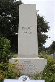
Captain Frederick W. Bruce, for whom Bruce Park is named, was born in New Hampshire in 1856. In 1869 young Bruce was sent to live with his uncle Elisha Bruce in St. Augustine, Florida, but that same year, at age 13, ran away to sea, an adventure . . . — — Map (db m93090) HM
The point of land where the St. Johns River turns sharply east on its way to the ocean is by far the most prominent river point in the area known today as Old* Arlington. In 1772 this land was part of two plantations purchased by Captain William . . . — — Map (db m238191) HM
In 1772 Capt. William Reddy purchased two 400-acre tracts of land located where the St. Johns River bends eastward on its way to the Atlantic Ocean, naming them Hampstead and Point Plantations. Though Capt. Reddy only owned the property for two . . . — — Map (db m238188) HM
During Florida's 20-year British period from 1763 to 1783, St. Isabel was originally part of a 10,000 acre plantation granted in 1766 to the Earl of Bessborough, and later purchased in 1769 by London merchant Samuel Potts. After Florida was ceded . . . — — Map (db m238201) HM
The 8,000 acre Strawberry Mills and Plantation, part of a Spanish sawmill grant to Francis Richard, Jr., was purchased by John S. Sammis circa 1840. Sammis, a native of New York, moved to Florida in the 1820s and worked briefly for prominent . . . — — Map (db m139252) HM
The origin of the name has been lost. In any case, as a lifelong resident of this community, Mrs. Olivia Forest, stated
"life was sweet" in Sugar Hill. From its origins in the early 1900s through its hey-days - the 1920s to the 1960s - the height . . . — — Map (db m237304) HM
Historic references to the plantation house on Fort George Island are tantalizingly brief. The first detailed descriptions of the house and structural changes were recorded in the 20th century. From this vantage point, you can see the changes that . . . — — Map (db m40536) HM
The birthplace of African-American archaeology can be traced to Kingsley Plantation, where archaeologists in 1968 first began to search for artifacts that reflected African identity. Many of the slaves that lived here during Zephaniah Kingsley's era . . . — — Map (db m40852) HM
Artifacts recovered by archaeologists provide clues as to who these enslaved African men, women and children were. This is most easily recognized within the realm of spirituality or religion, which is resistant to change. However, the physical . . . — — Map (db m41193) HM
After the Civil War, slavery ended, but former slaves continued to live on the island. In this new era, former slaves and new landowners had to make difficult choices.
In 1869 the Rollins family settled at the former plantation and called it . . . — — Map (db m145390) HM
The plantation house symbolizes the owners and their freedom. The cabin ruins stand behind you as a testament to the enslaved and their lives of forced labor.
Explore the plantation grounds and discover the stories of plantation owners and . . . — — Map (db m40007) HM
In the spring of 1814, Zephaniah Kingsley relocated his family to this sea island plantation. Over the next two decades he developed his controversial views on race, society, and slavery.
Kingsley was a successful businessman who had strong . . . — — Map (db m40035) HM
The plantation era was a time in our history of opportunity, political contradictions and great cruelty.
For planters, like Zephaniah Kingsley, it was a time for amassing land and wealth. For enslaved Africans who produced the wealth it was a . . . — — Map (db m40085) HM
Imagine ... instead of the empty historic building and peaceful riverfront of today, a slave owner's family sits watching from the porch of their comfortable home as cargo-laden boats pass by on the river.
Breezes off the water cool the . . . — — Map (db m40043) HM
Imagine...instead of a lush green landscape of today, a long dusty road stretches to the slave cabins and field beyond.
Bent over cotton plants, under the hot sun with dust-filled air, enslaved people toil day in and day out amidst the odor of . . . — — Map (db m40077) HM
(side 1)
Pilot Town
The St. Johns River provided trade access that supported the economy of the Fort George Island plantations. Cotton and sugar from the plantations were transported on the river to trading posts. Early Spanish . . . — — Map (db m106389) HM
Cash crops, like sea island cotton, indigo, and sugar cane, made a profit for the owner. Other crops, like potatoes, okra, and yams, fed the families of both owners and slaves.
Sea island cotton was highly prized because of its long, strong, . . . — — Map (db m40143) HM
The House at the North end will be in the course of a month a very comfortable habitation, & in any other country a handsome situation. John McQueen, Jr., 1798
Planter John McQueen built the original portion of the house with the use of . . . — — Map (db m145389) HM
The exploitation of enslaved people differed throughout the Americas. However, the bottom line was profit for the owner, while for the slave it was loss of freedom.
Slaves were possessions. They were viewed as a valuable commodity to be bought . . . — — Map (db m83539) HM
Constructed nearly 200 hundred years ago, these cabins were home to enslaved people. Following emancipation, former slaves lived here and worked the land. Slowly, individuals and families moved away, leaving the buildings to fall into ruin. . . . — — Map (db m40543) HM
Slaves actively resisted bondage by purposefully slowing down their work pace, faking illness, or even mutilating themselves in order to lessen their value as human property.
Resisting the inhumanity of their enslaved condition, slaves . . . — — Map (db m40657) HM
In front of you are the remains of 25 cabins, the homes of 60 to 80 men, women, and children. These people had the strength to survive the misery of slavery.
Before dawn, slaves left for their day's labor, or to use their specialized skills. . . . — — Map (db m40689) HM
The island's landscape has changed dramatically since the plantation era. Gone are the roofs, fruit trees, wells, and garden plots. Trees and grasses now replace fields once tilled by slaves.
To be a slave was to be a human being under . . . — — Map (db m40847) HM
The slave quarters were a place to find identity and strength through family, faith, and shared experiences.
Many American traditions originate from the daily activities and beliefs of enslaved people. Practices that survive today revolve . . . — — Map (db m41248) HM
From the earliest age, children were trained to do their parents' work. They were terrified of the punishment their parents endured. Parents taught their enslaved children strict obedience so they could survive. And yet, like children today, they . . . — — Map (db m41272) HM
You are standing at the edge of two worlds. You are leaving the world of the owner and entering the world of the slave.
The cabin ruins before you are a vivid testament to the generations of slaves who lived there. On them depended the . . . — — Map (db m40120) HM
Many crops were grown on the plantation, but sea island cotton produced the highest profit. Growing and processing it required a complex work structure.
The task system was used to manage the many specialized requirements of sea island cotton . . . — — Map (db m40499) HM
The Cosmo community is located on the road that during the days of plantations led from the town of Fulton to St. Augustine, Florida. The origin of the Cosmo name remains a mystery but the residents of this small, close-knit black community took . . . — — Map (db m172514) HM
In 1806 Anna Madgigine Jai, a 13 year old girl of royal lineage in Senegal, West Africa, was sold into slavery and brought to the port of Havana, Cuba. There she was purchased by 38-year-old Zephaniah Kingsley, Jr., a wealthy white plantation . . . — — Map (db m138877) HM
From 1847 until sometime before 1860 Jacksonville University campus was the site of the Chesterfield farm of Anna Madgigine Jai Kingsley, former slave and widow of white plantation owner Zephaniah Kingsley. This farm was at the center of the . . . — — Map (db m138876) HM
(side 1)
James Hall
Soldier of the Revolution
James Hall was born on October 8, 1760, in Keene, New Hampshire. Records of the Continental Army indicate that James Hall of Keene was mustered into service about August 20, 1776. . . . — — Map (db m171493) HM WM
By the 1930s the African-American community of Sugar Hill continued to expand north and west of West Eighth Street and spilled over into another region, Mid-Westside Jacksonville, defined by the following boundaries, I-95 (east), Martin Luther . . . — — Map (db m149108) HM
Floral Bluff Plantation, originally part of a land granted to Italian immigrant Francis Richard by Spanish government in the 1790s, occupied over a half mile of riverfront property. Robert Bigelow, a Connecticut native and graduate of Yale . . . — — Map (db m139242) HM
In 1562, when France was being torn by religious strife, Gaspard de Coligny, Admiral of France, sent two vessels to the New World in search of a refuge for the oppressed Huguenots. Leading the expedition was the Huguenot explorer, Jean Ribaut, who . . . — — Map (db m33486) HM
Jacksonville’s Great Fire of May 3, 1901, destroyed a large a large part of the city and left nearly 10,000 people homeless. Numerous residents of the city relocated to other areas, including to the then-remote area of South Jacksonville, across the . . . — — Map (db m138016) HM
Dating back to the 1840's, the Philips-Craig Swamp Cemetery was a community burial ground for the old Philips settlement originally located along both sides of Old Kings Road (St. Augustine Road). Later erased by twentieth century subdivisions, this . . . — — Map (db m59099) HM
Historic Florida farm
In 1889 Mr. Harvey built his home near the Camp Milton site. When the State of Florida purchased property for the establishment of Whitehouse Field, the Harvey home was moved to the town of Whitehouse. In 2002, the . . . — — Map (db m143698) HM
Pre-European – Native Americans: Late Archaic, Timucuan, and Seminole Tribes.
1770-1775 – Abraham Jones was granted 2000 acres, then known as Maxton’s Creek Island, by King George III of England. He built a home and several small . . . — — Map (db m147337) HM
A legendary landmark in downtown Jacksonville, Florida, this majestic live oak tree is said to have sheltered settlers and natives during peace treaty talks. In the early 1900’s, an amusement park stood on the site, and today, it is the park . . . — — Map (db m142991)
Fifteen hundred thirty feet
north of this spot stood an
early Spanish fortification
- Fort San Nicholas -
Abandoned July 4, 1817
This marker erected by Jacksonville Chapter D.A.R. — — Map (db m220558) HM
This frame vernacular house was built in 1928 for Doane Martin Mungen, Sr. (1872-1948) and his wife Mary Elizabeth Mungen (1874-1955). It is located in the Oakland neighborhood, which was platted in 1869, and emerged in the 1870s as a working class . . . — — Map (db m58750) HM
(Front): This is a replica of the marker placed on or near this spot by Jean Ribaut May First 1562 in taking possession of Florida for France. (Back): Erected by the Florida Daughters of the American Revolution May First 1924 . . . — — Map (db m46578) HM
David Solomon Hill Miller, Englishman, first settled near here in 1799 and married Anna Hogans Bagley, widow, owner of a Spanish land grant of 300 acres west of this creek. D.S.H. Miller served Spain as Capt. Rural Militia of the St. Johns River, . . . — — Map (db m59097) HM
Born 1784-Died 1854. Captain Mounted Rangers, War of 1812.
1813-1815, U.S. Congressman from Kentucky
1821-1822, U.S. Judge, Eastern Florida.
1822-1834, First Civil Governor of Territory of Florida.
1838-1839, Member, Constitutional . . . — — Map (db m57597) HM
At this spot the Kings Road met the Apalache Trail, so connecting the English colonies and the Spanish settlements of the west with St. Augustine and New Smyrna — — Map (db m138343) HM
The founders of Second Missionary Baptist Church worshipped at Bethel Baptist Church with their slaves masters in the 1830s. They built their first separate wooden sanctuary in 1848 in the African American neighborhood of LaVilla. The first . . . — — Map (db m101663) HM
This narrow part of the St. Johns River, near a clear freshwater spring was a crossing point for Indians and early travelers. The Indian name Wacca Pilatka, meaning "Cow's Crossing", was shortened by the English to Cow Ford, and Jacksonville was . . . — — Map (db m58715) HM
Here at the foot of Market St. stood a bay tree which served as the starting point for the original survey of Jacksonville in June 1822. Market was the first street laid off and named. A total of 20 squares were platted, bounded by Ocean, Duval, . . . — — Map (db m58012) HM
The Oesterreicher-McCormick Homestead was built in 1873, and is one of the oldest remaining homes in the Beaches area. The building is a rare example of cracker-style architecture that was used in Florida. One of the main features of this . . . — — Map (db m108134) HM
The Pablo Beach FEC Foreman’s House was built in 1900 by the Florida East Coast Railway after it was bought by Henry Flagler. The house was built for the use of the local section foreman and his family, and represents a standard design used by the . . . — — Map (db m108179) HM
In 1901, one of the largest and most advanced southern pine sawmills east of the Mississippi River was built here. In the tradition of the era, the Alger-Sullivan Lumber Company built its own town to house and supply the families of mill workers. By . . . — — Map (db m120557) HM
Century, Florida Founded in 1900 to house mill employees of the Alger-Sullivan Lumber Company, formed in 1900 by General Russell A. Alger - Governor of Michigan, U.S. Senator, and President McKinley's Secretary of War - and by Martin H. . . . — — Map (db m102557) HM
The success of the American Revolution spurred population growth and movement in the early 19th century. While many Americans moved west to claim new land, some looked south to Spanish West Florida. The flood of new settlers and increased pressure . . . — — Map (db m130794) HM
Though several European nations controlled Pensacola in its 460-year history, Spain reigned the longest. Spain made Pensacola the capital city of West Florida, turning the small, rural town into a thriving municipal center. Two hundred years ago, . . . — — Map (db m183441) HM
Pensacola Bay has been a valuable resource for populations from prehistoric to modern times. The relationship between these people and their environment is often reflected in archaeological sites submerged beneath local waters. In addition to many . . . — — Map (db m130819) HM
In 1825, George Barkley purchased Lot 31 and
within 10 years acquired several surrounding
lots. The construction date of the Barkley
House is unknown, but is likely to be around
1835. This structure is the oldest masonry
building in . . . — — Map (db m177110) HM
In 1763, a treaty transferred Spanish Florida to the British and Pensacola
became the capital of West Florida. The civilian government arrived in
1764 and set up a town grid with streets, house lots, and garden lots
surrounding the centrally . . . — — Map (db m183479) HM
In 1908, shortly after the extension of the trolley line west from Pensacola, Lucius Screven Brown (1874-1963) developed housing on seven blocks bounded by what is now Pace Boulevard, Strong Street, “W” Street and Gadsden Street. Brown’s . . . — — Map (db m110450) HM
Here, the Commanding Officer and his guests dined on exotic
local fare using fine imported porcelain. The British built
wood-burning brick ovens in an outdoor cooking area. Near
these ovens, archaeologists found food remains including
alligator . . . — — Map (db m183469) HM
From 1754 until 1821, a succession of Spanish and British forts were constructed in this area of Pensacola. You are standing at the west end of the forts. They extended nearly 200 yards eastward. The Spanish, then the British, and again the . . . — — Map (db m80168) HM
Daniel F. Sullivan and his brother Martin, born in Ireland, arrived in Pensacola after the Civil War. Possessing a remarkable talent for business, the brothers purchased lumber mills and wharfs on Pensacola Bay and vast areas of timberland in . . . — — Map (db m80038) HM
(Left panel)
De Soto Trail
1539-1540
You are standing along the historic route of the conquistador Hernando de Soto and his expedition through the Florida Native American territories in his quest for gold and glory. . . . — — Map (db m126595) HM
Born in Italy in 1777, Desiderio Quina served the Spanish army in the Louisiana Infantry Regiment. He was later employed in Pensacola as an apothecary for the John Forbes Company where he married Margarita Bobe. His son Desiderio was born in 1817 . . . — — Map (db m80044) HM
A native of Spain, Don Manuel Gonzalez joined the army at Madrid and was sent to New Orleans. After his discharge he was granted passage through the Choctaw and Creek Nations to Pensacola. At Pensacola, he was a successful cattle rancher. He opened . . . — — Map (db m80051) HM
Born Dorothy Camber, to a British plantation owner at South Carolina, Dorothy married lawyer George Walton at Savannah shortly before the beginning of the American Revolution. George Walton attended the Continental Congress in Philadelphia signing . . . — — Map (db m80043) HM
A native of Maine, Ebenezer Dorr spent fourteen months as a prisoner of war in England during the War of 1812. He was captain of his own ship for many years, trading at ports around the world. In about 1827,
Dorr moved his family to Escambia County . . . — — Map (db m80050) HM
Side 1
Emanuel Point Shipwrecks
In August 1559, eleven ships under command of Don Tristan de Luna y Arellano sailed into Pensacola Bay, then called Ochuse, to establish a new colony for Spain. Intended to stake a claim on the . . . — — Map (db m102003) HM
The Pensacola streets you walk on today are the same ones used in 1821.
The city's layout follows a plan made during the British period (1763-1781).
British Principal Surveyor Elias Durnford redesigned the old Spanish town
using a grid system. . . . — — Map (db m183445) HM
This is the site of the Spanish Presidio Santa Maria de Galve (1698-1719). It was the first permanent settlement in Pensacola and only the second successful permanent settlement in Florida. It was founded in 1698 by Captain Juan Jordan de Reina and . . . — — Map (db m183415) HM
Spanish colonists officially moved to what is now downtown Pensacola in
1756 after a series of hurricanes destroyed their settlement on Santa Rosa
Island. The population was small but diverse, including people of European
and African heritage . . . — — Map (db m183471) HM
Old Punta del Gorda, skirted by Spanish ships of Maldonado 1540, de Luna 1559, Pez 1693, Ariola 1698. Spanish mission to Yamassee Indians nearby 1750. In British grant to Wm. Aird and Benj. Wormell in 1760s; Spanish grants to Francis Gabarron . . . — — Map (db m146487) HM
These bricks are part of the foundation for the
garrison kitchen that served military troops and
government officials inside the British Fort of
Pensacola from 1767 to about 1813. The kitchen
had four rooms with separate doorways, two
windows, . . . — — Map (db m183519) HM
T.T. Wentworth, Jr. Florida State Museum
Built in 1907 during a downtown building boom, this building was originally City Hall. It is the earliest example of Mediterranean Revival architecture in Pensacola. In 1985, a new City Hall built on . . . — — Map (db m91127) HM
received West Florida from Spain
and raised the flag of the U.S.
July 17, 1821
—
To recall the flags of five
nations which have been raised in
turn ten times over Pensacola
Spain 1559-1719+1723-1763+1783-1821
France . . . — — Map (db m80072) HM
(Side 1)
The Hawkshaw site has supported prehistoric and historic occupations which span a period of nearly 2,000 years. It was inhabited around A.D. 150 by groups of Native Americans whom archaeologists call the Deptford Culture. Scientific . . . — — Map (db m72238) HM
A native of Aberdeen, Scotland, John Innerarity was the nephew of Spanish Pensacola's leading merchant William Panton. He arrived in Pensacola in 1802 to become managing clerk of the Panton, Leslie and Co. trading post. However, his uncle had died . . . — — Map (db m80078) HM
Site of plantation La Punta Gabaron owned 1814-1849 by Carlos Lavalle (Lavallet, Lavallette), born in 1772 of French parents in British Mobile. After Redcoats routed here in 1781, mother brought family to Spanish Pensacola. Carlos became a . . . — — Map (db m146499) HM
In the year of Pensacola's 450th anniversary celebration of the Luna expedition, Their Majesties King Juan Carlos I and Queen Sofia of Spain visited the city to commemorate our community's long Spanish heritage. In August 1559, an expedition . . . — — Map (db m52515) HM
Constructed in 1906 by Mabel Lewis, this frame vernacular structure was the home of generations of the Morrison family, including the parents of James Douglas (Jim) Morrison, the lead singer for The Doors. Before Robert Bruce (R.B.) and Frances . . . — — Map (db m110467) HM
The North Hill Preservation District occupies a 50-block area bound by Blount, Wright, Palafox, DeVilliers and Reus Streets, and represents one of the best preserved residential historic districts in Florida. After the Civil War, wealthy families . . . — — Map (db m72242) HM
At age nine, in 1859, Philip Keys Yonge moved to Pensacola with his family from Marianna, Florida. The Yonge family came to Florida from England during the British Colonial Period. He began a career in the lumber business in 1876 at the Muscogee . . . — — Map (db m80040) HM
In 1559, Don Tristan de Luna y Arellano sailed from Vera Cruz to Pensacola Bay in La Florida, to establish as the first permanent colony. The bay, also known as Ochuse and Panzacola, was reached by this sea pathway on August 15, 1559. A hurricane in . . . — — Map (db m183420) HM
St. Michael Catholic Parish traces its foundation to Don Tristan De Luna's landing on Aug. 14, 1559. Accompanied by five priests of the Dominican Order and one lay brother, the first Catholic Mass in what is the United States was celebrated at the . . . — — Map (db m148529) HM
Salvador Pons was the second son of John Pons, a seaman from Maryland, and Maria Rosario, a free woman of color. As a property owner who could read and write, Salvador was able to serve the Pensacola community as City Alderman beginning in 1869 and . . . — — Map (db m80048) HM
As a result of General Bernardo de Gálvez's 1781
attack on Pensacola during the American Revolution,
the British returned West Florida to Spain in 1783.
The Second Spanish occupation shaped much of the
modern city's design including many street . . . — — Map (db m183477) HM
Early Spanish explorers quickly
recognized the importance of
Pensacola and its waterways.
Remnants of conquistador Pánfilo
de Narváez's expedition sighted
Pensacola Bay as early as 1528. In 1539
and 1540, Francisco de Maldonado
waited in the . . . — — Map (db m177087) HM
Born on the island of Trinidad in 1812, Stephen Mallory's family eventually made Key West their home. Mallory studied law, volunteered in the Florida militia during the second Seminole War, and became Inspector of Customs at Key West. In 1830 . . . — — Map (db m80042) HM
This excavated area includes a part of the space where the Commanding Officer's Compound was located. It included a building, outbuildings, a formal garden area, and an outdoor kitchen. In addition, it was the center of Fort business, especially . . . — — Map (db m80170) HM
This flag pole is located in the same general location as the pole that was used to raise the American flag over Florida officially for the first time. After signing the agreements in a building located near the dig site, soldiers of both the . . . — — Map (db m80165) HM
The Early Life of T. T. Wentworth, Jr.
Theodore Thomas Wentworth Jr. was born July 26, 1898, in Mobile, Alabama, to Elizabeth Goodloe and T. T. Wentworth, Sr. In 1900, the Wentworth family moved to Pensacola.
Young Tom helped . . . — — Map (db m91123) HM
In the early 1800s, revolution and unrest loosened Spain's control over its colonies in the western hemisphere. As Spain dealt with greater crises elsewhere, Spanish Florida became vulnerable to British forces and their Native American allies, as . . . — — Map (db m183447) HM
Middle Passage to Pensacola
Beginning in the early 1500s and continuing for more than three
centuries, about 12 million enslaved Africans were transported
across the Atlantic Ocean from Africa to the Americas. This
transportation, known . . . — — Map (db m177047) HM
The Holden House was designed and built in 1918 by Sam Bortree (1859–1918) as a gift for his daughter, Ethel (1892–1977), and son-in-law, Thomas Holden (1892–1974). Holden was the town pharmacist and prominent in business, civic . . . — — Map (db m72918) HM
Welcome to the former homestead of Isaac I. Moody, Jr. one of four founding fathers of Flagler County. As the county's first major real estate developer and banker, the first politician of note and the prime mover in the development of the "Old . . . — — Map (db m220426) HM
This was the largest sugar mill in Florida. It was operated by Charles William Bulow and John Joachim Bulow from 1820 until it was burned by the Seminoles in 1836.
Sugar cane was planted in January and February and was ready for harvesting by . . . — — Map (db m100525) HM
The slave cabin sites evidence the life of enslaved Africans and their forced labor that built and operated this plantation.
The 40 cabins were home to 197 men, women, and children according to the 1830 U.S. Census.
Cabins were arranged . . . — — Map (db m191596) HM
Each 12 foot by 16 foot cabin had shingled roofs, board floors and walls, with a coquina fire place.
Cabins were outfitted with common household items such as furniture, storage containers and table wear.
A fire pit in the yard was used . . . — — Map (db m191605) HM
Plantations lined the banks of tidal waterways and freshwater rivers in northeast Florida by the late 1700s. Planters sought wealth from rice and indigo and later sea island cotton.
Florida’s Spanish government offered free ownership of land . . . — — Map (db m208300) HM
1261 entries matched your criteria. Entries 201 through 300 are listed above. ⊲ Previous 100 — Next 100 ⊳