On North Carson Street (Lincoln Highway) (Business U.S. 395) north of West Robinson Street, on the left when traveling north.
”Pony” Bob Haslam, considered to be the greatest of all Pony Express riders, rode for the Express from the beginning to the end. His route was through Carson City, one of the relay stations.
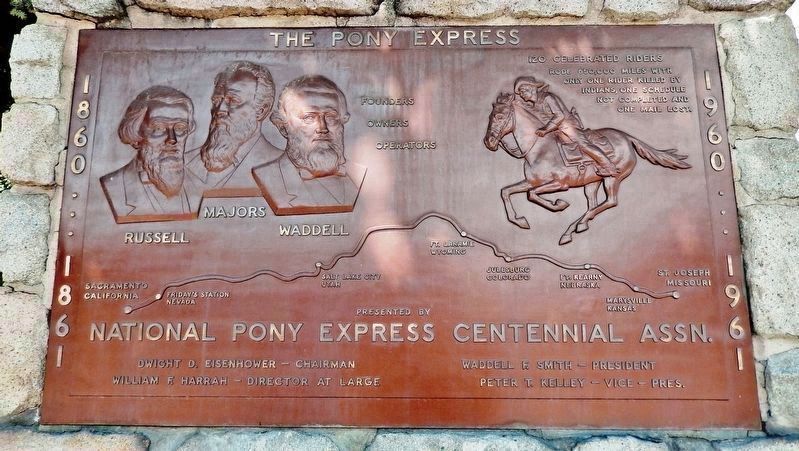
Erected by the Nevada Pony Express Centennial . . . — — Map (db m128553) HM
Abraham Curry, the “Father of Carson City”, accomplished more in his 15 year residence than most men hope to in a lifetime. Not only did he purchase the land in 1858 which is now Carson City, but laid out the townsite and built many of . . . — — Map (db m20874) HM
On Spooner Drive near Windridge Drive, on the right when traveling west.
In 1902 Marion Jefferson Blackwell purchased 360 acres from the State of Nevada, 556 acres of adjoining land from Sweeney’s Hot Springs and a lot with a house. He raised carp and catfish to sell commercially also hay and horses. Neighbors used the . . . — — Map (db m116178) HM
On South Carson Street (Business U.S. 395), on the right when traveling south.
[Front of Marker:]
Dedicated April 12, 1996
Carson City
Original Station
Apr. 3, 1860 - Nov. 20, 1861
by
Byron L. & Peggy Clark & Family
Bob & Tina McFadden
Mae & Jim Thorpe
The Bike Smith
Betty Young & Erica . . . — — Map (db m23038) HM
Near South Carson Street (U.S. 395/50) near East Musser Street.
Nevada's State Capital, one of the state’s oldest communities, was established in 1851 as Eagle Station, a trading post and ranch on the Carson Branch of the California Immigrant Trail, by Frank and Warren L. Hall, George Follansbee, Joe and . . . — — Map (db m20911) HM
On North Stewart Street, on the left when traveling south.
This is the site of the house and observatory of Nevada’s first weatherman, astronomer, and seismologist, Charles William Friend. Born in Prussia in 1835, Friend immigrated by way of South America to California during the 1849 Gold Rush. In 1867, he . . . — — Map (db m162166) HM
On East 3rd Street just east of South Stewart Street, on the right when traveling west.
This site was part of Carson City's Chinatown, which at one time was one of Nevada's largest Chinese Communities. In the 1880 Census Manuscript of Carson City, of the 789 Chinese, 706 were men and of these, 267 were married, 18 were widowed, 391 . . . — — Map (db m146930) HM
On West Appion Way at Snyder Avenue, on the right when traveling west on West Appion Way.
Centrally located between the first Nevada settlement at Genoa and the precious metal deposits of the Comstock Lode, Eagle Valley, site of present Carson City, was a vital link in land communications.
One of the key California emigrant routes, . . . — — Map (db m20802) HM
On U.S. 50 at Akron Way, on the right when traveling east on U.S. 50.
When the Comstock Lode was discovered in 1859, the problem of reducing the ore from the fabulously rich Virginia City mines had to be solved. Mills were built in Gold Canyon and Six Mile Canyon. In Washoe Valley, at Dayton, and on the Carson River . . . — — Map (db m55083) HM
Empire City was a milling town that was established in 1855. As you read this storyboard you are facing east toward Brunswick Canyon. The City of Empire was located to your right about 1/4 - 1/2 mile. At one time Empire City stretched for 3/4 of a . . . — — Map (db m89601) HM
On Kings Canyon Road, 0.1 miles south of Cooper Springs Court, on the right when traveling south.
Originally a Washoe Indian trail, Kings Canyon served as a gateway to Lake Tahoe following the gold rush to California. Eagle Station was established in 1851 near the mouth of the canyon, Dr. Benjamin King built his ranch the next year, and others . . . — — Map (db m163164) HM
"Continue descending but passing over sandy hills on the south of the road [south of Hwy 50]... Good grass and water 2 miles [to Clear Creek]" - James H. Compton, Sep 20, 1853 — — Map (db m228421) HM
Unveiled June 10, 1989
Artist: Buckeye Blake
It was the winter of 1843-44 when Kit Carson along with the John C. Fremont expedition worked his way south from Pyramid Lake looking for an easy route across the Sierra Nevada. Carson, depicted . . . — — Map (db m20897) HM
On U.S. 395 Alterate (Alternate U.S. 395) at Hobart Road, on the right when traveling south on U.S. 395 Alterate.
As early as 1863, two hotels with appurtenant stables were located here. In 1872, one hotel became a station on the newly-completed Virginia and Truckee Railroad between Carson City and Reno.
Crossing under the highway are three inverted . . . — — Map (db m244508) HM
Near South Carson Street (Business U.S. 395) at Fairview Drive, on the right when traveling south.
Logging wagon built in 1870 at Bassett Station, Yuba Pass. Used to haul lumber to the Sierra Buttes mines with teams of oxen. Presented to Nevada Day committee in 1950 by Ceasar P. Lombardi. — — Map (db m163897) HM
On North Minnesota Street at West King Street, on the right when traveling south on North Minnesota Street.
This house was built about 1860 of local sandstone for William Morris Stewart who lived here until 1862. He sold it to the Territorial Governor of Nevada, James W. Nye. The two men served as Nevada's first United States Senators after the . . . — — Map (db m162593) HM
On Pioneer Way, 0.5 miles south of U.S. 50, on the right when traveling south.
"We continued on following the river. The main road leaving the river for 12 miles. Over a strip of desert without grass or water the road along the river being a pack route and impracticable for wagons" - Calvin Taylor, Sep 17, 1850 — — Map (db m159073) HM
On Lincoln Highway (U.S. 50) 0.1 miles west of Trento Lane, on the right when traveling east.
"Ragtown...is a collection of tents and canvass shanties, where a tolerable meal can be had at one dollar a head. Whiskey is sold, cards are played, gambling pretty extensively carried on and hay sold" - Henry Sheldon Anable, Sep 1, 1852 — — Map (db m159072) HM
"Passing out of the canyon we went up [Edwards Creek] Valley between two ranges of mountains ... to Cold Springs where we ... prepared for crossing the sixty mile desert by cutting grass and fillings our kegs with water" - Lumin A. Scott, Aug 29, . . . — — Map (db m159358) HM
On U.S. 50, 5 miles east of Nevada Route 839, on the right when traveling east.
Fairview was part of the renewed interest in mining. Triggered by the strikes in Tonopah and Goldfield. Discoveries in 1905 of a rich silver float led to a boom that lasted through 1906 and 1907. A substantial town that boasted 27 saloons, hotels, . . . — — Map (db m67147) HM
On Reno Highway (U.S. 50) near Pioneer Way, on the right when traveling east.
Ragtown was never a town, but the name of a most welcome oasis and hamlet. This mecca on the banks of nearby Carson River received its name from the appearance of pioneer laundry spread on every handy bush around.
The Forty-Mile Desert, . . . — — Map (db m180202) HM
On U.S. 95, 0.9 miles south of Interstate 80, on the left when traveling south.
"Long before sunrise our teams were on the trail marching forward on the desert. Very little to note save the dust & brightness of the glittering sand. Now & then a grave, little donage & dead stock." - John Clark of Virginia, Aug 21, 1852 — — Map (db m149414) HM
On U.S. 50 at milepost 61.5, on the right when traveling west. Reported missing.
text from: Nevada State Historic Preservation Office
Located 13 miles to the north is the camp of Wonder, a major mining center in the early years of the twentieth century. Thomas J. Stroud and several others made the first locations in . . . — — Map (db m69651) HM
On U.S. 50 at California Road, on the right when traveling west on U.S. 50.
Hazen was named for William Babcock Hazen, who served under General Sherman in his "March to the Sea." The town, established in 1903 to house laborers working on the Newlands Irrigation Project south of here, included hotels, saloons, brothels, . . . — — Map (db m42328) HM
Near U.S. 95 at Interstate 80, on the right when traveling south.
Whichever direction your travels take you, you're going to have a similar experience to what the California-bound emigrants had. You're going to see the same country, except for the towns and the ranch meadows. The big difference, though, is that . . . — — Map (db m67359) HM
Near U.S. 95 at Interstate 80, on the right when traveling south.
The 40 Mile Desert, beginning here, is a barren stretch of waterless alkali wasteland. It was the most dreaded section of the California Emigrant Trail. If possible, it was traveled by night because of the great heat.
The route was first . . . — — Map (db m67348) HM
Near U.S. 95 at Interstate 80, on the right when traveling south.
Look at the barren country south of here just beyond this Rest Stop. This is the Forty-Mile Desert--a barren stretch of waterless alkali wasteland. It was the single-most dreaded section of the entire California Trail from the banks of the Missouri . . . — — Map (db m67357) HM
Near Nevada Route 361 south of Lincoln Highway (U.S. 50), on the right when traveling south.
Middlegate was named in 1850 by James Simson as he mapped the route for the Overland Stage Company. In his journal he writes that he thought the cuts in the mountains looked like 'gates' so he named each cut Westgate, Middlegate, and Eastgate to . . . — — Map (db m89452) HM
On Pahrump Valley Highway (Nevada Route 160 at milepost 17), on the left when traveling west.
This portion of the Old Spanish Trail was discovered in January, 1830, by Antonio Armijo during his first trip from Santa Fe to Los Angeles. The spring just north of this marker provided excellent water and fed meadows of luxuriant grass for draft . . . — — Map (db m213760) HM
James B. Wilson, a gold miner and veteran of the Civil war, arrived in southern Nevada in 1869. He first started a ranch near the original Las Vegas Rancho, but sold that property. In 1876 he homesteaded the Sandstone Ranch on this location with . . . — — Map (db m205214) HM
On Village Boulevard at Diamond Street, on the left when traveling east on Village Boulevard.
Stretching for 130 miles across Clark County, this historic horse trail became Nevada's first route of commerce in 1829 when trade was initiated between Santa Fe and Los Angles. The trail was later used by the wagons of the "49ers" and Mormon . . . — — Map (db m29218) HM
On U.S. 93, 0.4 miles north of Industrial Road, on the left when traveling north.
In 1930, Michael McKeever set up a small tent house in Hermenway Wash slightly north of Government Survey Camp #1, where he was a government cook. Soon other workers started building homes nearby, and the area became known as McKeeversville. . . . — — Map (db m69447) HM
May all who cross the canyon on this memorial bridge travel their life journeys with the strength and inspiration found in the high ideals and heroic deeds of these brave humble men.
In Memory of these men of heroic sprit who overcame . . . — — Map (db m46836) HM
On Nevada Highway near Avenue B, on the right when traveling east.
When the government built Boulder City, it didn't plan for children. But, as the Depression drove workers into southern Nevada to build Hoover Dam, workers brought their families with them. The new town and surrounding desert provided an exciting . . . — — Map (db m71106) HM
On Nevada Highway near Birch Street, on the right when traveling west.
Those that came to Boulder City to work on the dam lived in harsh conditions. The oppressive heat of the summers and the unbearable cold of the winters took its toll on many. Even the most mundane chores were difficult in this inhospitable . . . — — Map (db m71107) HM
Originally founded in 1931 as a community for the workers building Hoover Dam, Boulder City was the first planned community in southern Nevada. Designed by Saco Rienk DeBoer, it was a federal reservation. Only workers associated with the building or . . . — — Map (db m71903) HM
On Veterans Memorial Highway (U.S. 93) 1.3 miles west of U.S. 95, on the right when traveling west.
Named for an 1890's railroad which was never built, Railroad Pass first became a destination after Professor Robert T. Hill discovered alunite in the area in 1908. A mining district was formed, but only small amounts of gold were found. Mines in the . . . — — Map (db m214462) HM
Near Callville Road, on the left when traveling east.
About two miles in front of you, the remains of the town of Callville lie buried in silt on the bottom of Lake Mead. Originally developed as a port on the Colorado River to supply goods to Mormon settlements, Callville had long been a desolate . . . — — Map (db m3917) HM
On San Pedro Street, on the right when traveling east.
This small spring, first used by Anasazi and Paiute people, also sustained the caravan that pioneered a pack route now known as the Old Spanish Trail. En route to Los Angeles from Santa Fe, trader Antonio Armijo, 60 men and 100 mules camped here on . . . — — Map (db m39470) HM
On Spring Street (Nevada Route 161) 0.1 miles east of Vegas Street, on the left when traveling east.
George Fayle moved to southern Nevada from Calico, California in 1904. He settled at Goodsprings Junction, which was later renamed for his wife Jean. In 1912, he moved to Goodsprings. He built the Pioneer Saloon in 1913, later building the Fayle . . . — — Map (db m39472) HM
Seeking Pay Dirt
In 1908, mining engineer Robert T. Hill staked a claim in Railroad Pass hoping to find gold deposits as rich as those in Goldfield to the north and Searchlight to the south. Hill reasoned that gold could surely be found at . . . — — Map (db m46738) HM
On Las Vegas Boulevard (Nevada Route 161) 0.1 miles east of Interstate 15, on the right when traveling east.
Founded in 1904 as Goodsprings Junction, a station on the San Pedro, Los Angeles, and Salt Lake Railroad, Jean received its current name in 1905 when the post office was opened. It was named in honor of Jean Fayle, the wife of George Fayle who had . . . — — Map (db m129575) HM
According to the early history of Elko, Nevada, this curfew and fire bell played a vital role for local citizenry. It often rang to signal disastrous fires, deaths of celebrities, and celebrations.
Harbinger of both good tidings and bad, the . . . — — Map (db m201468) HM
On Main Street (Nevada Route 161), on the left when traveling south.
Built in 1911, The Yellow Pine Mining Company Railroad was a twelve and a half mile long narrow gauge railroad connecting the town of Goodsprings with the Union Pacific Railroad here in Jean. The railroad was built using materials from the defunct . . . — — Map (db m107085) HM
On South Valley View Boulevard at Meadows Lane, on the right when traveling north on South Valley View Boulevard.
The San Pedro, Salt Lake and Los Angeles Railroad bought Helen Stewart's Las Vegas Ranch in 1902, giving it control of the Las Vegas Springs and the water supply needed for the creation of Las Vegas in 1905. The railroad's subsidiary, the Las Vegas . . . — — Map (db m50274) HM
On South Valley View Boulevard at Meadows Lane, on the right when traveling north on South Valley View Boulevard.
Bubbling artesian springs flowed here until they were exhausted in the middle of the 20th century, over-pumped to serve the city's growing population.
These springs and the creek they created gave life to the center of the valley. They erupted . . . — — Map (db m51043) HM
On North Las Vegas Boulevard at Cashman Center, on the right when traveling south on North Las Vegas Boulevard. Reported missing.
This WWII neighborhood was named for the Nevada Biltmore Hotel which opened nearby in 1942. A WWII housing shortage called for the construction of several hundred homes for military personnel and their families. The federal government approved the . . . — — Map (db m51057) HM
Near East Washington Avenue near Las Vegas Boulevard North.
John Steele, one of the original L. D. S. missionaries, secured a mail grant for the Las Vegas Mission. The documents to establish the Post Office, and, appointing William Bringhurst Postmaster, were brought from Salt Lake City by Benjamin H Hulse, . . . — — Map (db m29294) HM
Helen Jane Wiser Stewart
April 16, 1854 - March 16, 1926
"The First Lady of Las Vegas"
"It will only be for two years," Archibald promised his wife Helen in 1882, coaxing her away from civilized Pioche, Nevada to a ranch in
middle . . . — — Map (db m241368) HM
Near East Washington Avenue near Las Vegas Boulevard North.
In 1855 Pres. Brigham Young appointed a company of men under the leadership of William Bringhurst to establish a colony at Las Vegas. The company left Salt Lake May 10 and arrived at Las Vegas June 14, 1855 and camped near this site. William . . . — — Map (db m234578) HM
Near East Washington Avenue east of Las Vegas Boulevard North.
Las Vegas had its beginning at this location on June 14, 1855, when thirty-two Mormon missionaries arrived from Utah under the leadership of William Bringhurst. They set to work establishing farm fields that summer, and began to build a 150-foot . . . — — Map (db m160162) HM
After founding Salt Lake City in 1847, the Mormon Church expanded its settlement westward. The Las Vegas Mission was established in June 1855 as an outpost roughly halfway between Salt Lake City and Southern California. Built alongside the Las Vegas . . . — — Map (db m50273) HM
On North Main Street at Fremont Street, on the right when traveling south on North Main Street. Reported missing.
On May 15, 1905, in this area, The City of Las Vegas was founded with the auction of lots in Clark's Las Vegas Townsite by San Pedro, Los Angeles & Salt Lake Railroad and Las Vegas Land & Water Company, predecessors of Union Pacific Railroad and . . . — — Map (db m47732) HM
On North Main Street at Fremont Street, on the right when traveling south on North Main Street. Reported missing.
This is a two sided marker
Side A:
Auction Site
At this site on May 15th 1905, the San Pedro, Los Angeles & Salt Lake Railroad auctioned off lots for the creation of the new city of Las Vegas. With 110 degree temperatures scorching . . . — — Map (db m47736) HM
On South 3rd Street, on the right when traveling south.
Las Vegas was established as a railroad town in 1905; at the head of Fremont Street, the Mission-style depot represented the railroad's dominance over the economic and social life of the town for several decades. The streets of downtown were laid . . . — — Map (db m47860) HM
On South 7th Street, on the right when traveling north.
This is a two sided marker
Side A:
Las Vegas High School
As the population of Las Vegas increased throughout the 1920s and the construction of Hoover Dam was assured, many saw the need for a new high school. Principal Maude Frazier . . . — — Map (db m47886) HM
On North Main Street at Paiute Drive, on the right when traveling south on North Main Street.
The Bureau of Indian Affairs (BIA) bought this ten-acre site in 1911 from Helen J. Stewart, former owner of the Las Vegas Ranch, to provide a home for the Southern Paiute Indians living in and near Las Vegas. With this purchase, the government . . . — — Map (db m51055) HM
On H Street at West McWilliams Avenue, on the right when traveling north on H Street.
Created by J.T. McWilliams in 1905, the Original Las Vegas Townsite was Las Vegas' first business and residential development.
J.T. McWilliams (photo top right) was hired to do survey work in and around the Las Vegas Valley for the San Pedro, . . . — — Map (db m51048) HM
On 400 S. 7th Street at Stanley W Cooper Pl, on the right when traveling south on 400 S. 7th Street.
Charles "Pop" Squires, often referred to as "the Father of Las Vegas" lived at this location, with his wife, Delphine, from 1931 until his death 1958.
Squires first arrived in the Las Vegas Valley in February 1905. He and his partners . . . — — Map (db m131061) HM
On North Las Vegas Boulevard at Foremaster Lane on North Las Vegas Boulevard.
Until 1914, when the railroad donated land for a city cemetery, people buried the dead in small family plots or on public land just north of the railroad-owened Las Vegas Ranch, east of Las Vegas Boulevard.
In pre-railroad times, the Paiute . . . — — Map (db m51056) HM
On East Charleston Boulevard at South 8th Street, on the right when traveling east on East Charleston Boulevard.
The City of Las Vegas Mayor and City Council
presents
An Art in Public Places Project by The City of Las
Vegas Arts Commission
In celebration of the Las Vegas Centennial
Sculpture by Steven Liguori
"Breaking Ground"
This 14' high . . . — — Map (db m47890) HM
On South Maryland Parkway at Jessica Avenue, on the left when traveling north on South Maryland Parkway.
Las Vegas' first tract subdivision, the Huntridge neighborhood was erected between 1941 and 1944 on land purchased in the 1920s by international businessman Leigh Hunt. After his death in 1931, Hunt's widow sold off large chunks of land. In December . . . — — Map (db m47893) HM
On E. Charleston Blvd., on the left when traveling west.
The Wengert residence was originally owned by Cyril S. and Lottie Wengert. Built in 1938, this Tudor Revival home was designed by Architect, H. Clifford Nordstrom, and was amongst the largest in Las Vegas. Prominent in Las Vegas social and business . . . — — Map (db m114796) HM
On S. Valley View Boulevard north of Alta Boulevard.
The famous Las Vegas Springs rose from the desert floor here, sending two streams of water across the valley to nurture the native grasses, and create lush meadows in the valley near Sunrise Mountain. The natural oasis of meadow and mesquite forest . . . — — Map (db m131317) HM
Few children traveled with the regular Spanish Trail caravans. The journey was long and dangerous. Young children were a burden and older ones were needed at home. Before 1841, families with children rarely moved to California. Those who mode the . . . — — Map (db m241715) HM
Life in the Las Vegas Valley in the 19th Century revolved around three ranches owned by 0.D. Gass/Archibald Stewart, Conrad Kiel and Jim Wilson.
The Gass/Stewart Ranch (1865-1905) was built on land developed earlier by the Mormons. The . . . — — Map (db m241716) HM
On South Cimarron Road at Eldora Avenue, on the right on South Cimarron Road.
By 1855 wagon roads linked Utah to California. To ease the long trip between Los Angeles and Salt Lake City, the LDS church established an outpost at an oasis called, Las Vegas, along the Old Spanish Trail/Mormon Road.
Thirty missionaries . . . — — Map (db m241723) HM
Near South Casino Drive, on the right when traveling south.
During the building of Davis Dam, the Nevada side of the river here became known as Tristate. In 1964, Don Laughlin was looking for an investment opportunity. He had sold his 101 Club in North Las Vegas, and flew over a closed saloon and motel . . . — — Map (db m46732) HM
On East 1st North at North Sandhill Boulevard, on the left when traveling east on East 1st North.
Abram Woodbury, one of the first permanent settlers in Mesquite, built a new home here circa 1919 and opened a mercantile store. He also built overnight cabins for tourists and operated Mesquite's first gas station. Abram purchased gasoline by the . . . — — Map (db m46762) HM
On Hughes Avenue, on the right when traveling north.
Circa 1901"We lived in a lumber granary and the old rock house. We traded for this lot and built a sixteen-foot square room. I borrowed Jim's team and wagon and worked at the sawmill to get lumber for our first home." It was braced on rocks and . . . — — Map (db m46764) HM
On Mesquite Boulevard, on the right when traveling east.
Mesquite proved a total failure after several years labor. And today only a few ravines and sand-filled ditches mark the place where the village once stood. —LDS Church Historian Andrew Jensen, 1891.
The remoteness of the area, . . . — — Map (db m1448) HM
On Mesquite Boulevard, on the right when traveling east.
… from weary travelers to women and their children who would come to visit … she never turned anyone away without feeding them. She would invite you to eat and then say ‘There’s plenty such as ’tis; … Bless her heart, it was as big as al . . . — — Map (db m1466) HM
On East 1st North, on the right when traveling east.
This is the oldest standing house in Mesquite and was continuously used as a residence from 1894 until 2003. The original portion of the house dates from circa 1880 occupation when Mesquite Flats was temporarily settled. The large rocks made the . . . — — Map (db m46748) HM
Stretching for 130 miles across Clark County, this historic horse trail became Nevada’s first route of commerce in 1829 when trade was initiated between Santa Fe and Los Angeles. The trail was later used by the wagons of the “49ers” and . . . — — Map (db m1414) HM
On East Mesquite Boulevard, on the right when traveling west.
Tithing Lot
Circa Late 1890s.
The southeast quarter of this block was originally owned by the Church of Jesus Christ of Latter Day Saints and was used as a tithing lot. Church members paid tithing in-kind donations of fruit, crops, etc., . . . — — Map (db m1282) HM
On West Mesquite Boulevard (Nevada Route 144) at Yucca Street, on the right when traveling west on West Mesquite Boulevard.
Virgin Valley was traveled by Jedediah Smith in 1826 and by Fremont in 1844.
The valley served as the right-of-way for the Old Spanish Trail (1829-1848) and for the Mormon road or southern route of travel to southern California.
The areas . . . — — Map (db m1279) HM
On Mesquite Boulevard, on the right when traveling east.
It was under William Abbott’s supervision that Mesquite was founded on a firm foundation. —Howard Pulsipher, Mesquite Pioneer.
At the age of eight, William journeyed from his birthplace in Ogden, Utah, to Bunkervile, . . . — — Map (db m1447) HM
On Nevada Route 169 at milepost 21, on the right when traveling south.
Rich in prehistoric, pueblo-type culture, and noted by the explorer Jedediah Smith in 1826, Moapa Valley is crossed by the Old Spanish Trail.
In 1865 Brigham Young sent 75 families to settle the area, to grow cotton for the people of Utah, and . . . — — Map (db m46780) HM
In 1869 Heleman Pratt, Wm. D. Kartchner and other L.D.S. Church members came to Overton; built adobe homes; planted vineyards and crops. In 1871 double taxation forced an exodus from Muddy Valley. Local investors acquired the land, resold to . . . — — Map (db m241359) HM
Near South Pioneer Road (State Highway 169), on the right when traveling north.
Existing today as a 30-mile series of adobe ruins, this “Lost City” was once the home of an ancient Anasazi Indian civilization. Beginning with the basketmakers (300 B.C.-A.D.700) & followed by the Pueblos (A.D.700-1150) this valley was . . . — — Map (db m145957) HM
On Pahrump Valley Highway (Nevada Route 160 at milepost 19) at Mt. Potosi Canyon Road, on the left when traveling west on Pahrump Valley Highway.
The desire of the Mormon settlements for economic self-sufficiency led to mining by missionaries for lead. In 1856 Nathaniel V. Jones was sent to recover ore from the "Mountain of Lead" 30 miles southwest of the mission at Las Vegas Springs. About . . . — — Map (db m29366) HM
On Nevada Route 165, 12.9 miles east of U.S. 95, on the left when traveling east.
In 1940, Charley Kenyon and Art Schroeder located a cave above the Colorado River, about twelve miles northeast of this spot. In it were the remains of southern Nevada's last great renegade, Queho, who had been dead about six months. Queho had grown . . . — — Map (db m29332) HM
On Kiel Way at East Carey Way, on the left when traveling north on Kiel Way.
Established by Conrad Kiel in 1875, this was one of the only two major ranches in Las Vegas Valley throughout the 19th century. The Kiel tenure was marked by violence. Neighboring rancher Archibald Stewart was killed in a gunfight here in 1884. . . . — — Map (db m22414) HM
On South Main Street, 0.1 miles south of West Perkins, on the right when traveling south.
During the early 1860's, Brigham Young directed that settlements be built in the area known today as the Moapa Valley. The water from the Muddy River, and the rich soil of the Valley, made the land a prime agricultural area for southern Nevada. . . . — — Map (db m47027) HM
On Valley of Fire Highway, on the right when traveling east.
John J. Clark was born in Canada in 1844.
He enlisted as a private in Company F of
the New York Infantry in 1862, serving
actively in the Civil War. After being shot
in the hand and contracting typhoid
fever, he was honorably discharged
6 . . . — — Map (db m32812) HM
In 1864 Brigham Young called for settlers to colonize the Muddy (now Moapa) Valley. On January 8, 1865, eleven men and three women arrived and began the first settlement at St. Thomas, now covered by the waters of Lake Mead. Later other settlements . . . — — Map (db m145959) HM
On Nevada Route 169, 0.1 miles south of Simplot Road, on the left. Reported missing.
Indians of a highly developed civilization lived throughout Moapa Valley from 300-1100 A.D. Several hundred ancient pithouses, campsites, rockshelters, salt mines and caves of "Anasazi" people make up what is commonly known as "Lost City." These . . . — — Map (db m241139) HM
On Mountain Vista Street, 0.1 miles south of East Russell Road, on the left when traveling south.
This historical marker commemorates the valor and service of pioneer scout Rafael Rivera, the first Caucasian of record to view and traverse Las Vegas valley. Scouting for Antonia Armijo's sixty man trading party from Abiquiu, N.M. in January 1830. . . . — — Map (db m29167) HM
The lush Muddy River Valley, shown below, is dramatically changed from January 1865 when the town's namesake, Thomas Smith and nearly a dozen Mormon men and women arrived at the confluence of the Virgin and Muddy Rivers to build the community of . . . — — Map (db m241138) HM
Originally known as Mesquite Valley, this area was first crossed in the 1850s by the Kingston Cutoff by the Old Spanish Trail. The first settlers did not arrive until 1876, when Miguel Navares began mining salt for the nearby Ivanpah mines. The . . . — — Map (db m107136) HM
George Frederick Colton can be considered to be the father of Searchlight. The Searchlight claim made on May 6, 1897 was the earliest claim of importance in what became the Searchlight Mining District. He is also credited with providing the name of . . . — — Map (db m29333) HM
On Cottonwood Cove Road at Michael Wendell Way, on the left when traveling east on Cottonwood Cove Road.
Gold was discovered near here in 1897. In July 1898, the Searchlight Mining District was organized and in October the post office opened. The boom peaked in 1907 and quickly faded along with the town. But the town never died, instead becoming the . . . — — Map (db m46736) HM
On U.S. 95, 0.2 miles north of Nevada Route 164, on the right when traveling south.
Initial discoveries of predominately gold ore were first made at this location on May 6, 1897. G. F. Colton filed the first claim, later to become the Duplex Mine. The Quartette Mining Company, formed in 1900, became the mainstay of the . . . — — Map (db m29369) HM
In 1946, Willie Martello came to Searchlight. He purchased the Wheatley Hotel, and remodeled it into a casino/restaurant. Renaming it the El Rey Club after a favored beer, Martello proceeded to change Searchlight history.
Martello's new club . . . — — Map (db m69446) HM
Near Lincoln Highway (U.S. 50 at milepost 13) west of Kings Canyon Road, on the right when traveling east.
Panel One: the lifestyle was rustic here at the summit
In 1860, French-Canadian entrepreneur Michele E. Spooner acquired about 640 acres of land with the idea of starting up a sawmill, a shingle mill and a hotel. He named the area . . . — — Map (db m227674) HM
On U.S. 395, 0.9 miles south of Leviathan Mine Road, on the right when traveling north.
Double Springs was the notorious Round Tent Ranch, or Spragues, another station on the road to Esmeralda. Here, James C. Dean, one of the owners and Justice of the Peace in the district in 1864, murdered his wife. This station was connected by the . . . — — Map (db m69467) HM
On Highway 395, on the right when traveling south.
In 1917 State Senator Wm. F. Dressler gave this 40 acre tract to Washo Indians, then living on ranches in Carson Valley. After a school was opened in 1924, it became a nucleus of settlement.
Before the intrusion of Caucasians in 1848, Washos . . . — — Map (db m3190) HM
On Eddy Street at Mission Street, on the right when traveling east on Eddy Street.
The Jensen Family emigrated from Denmark in the late Nineteenth Century. As Gardnerville grew, Arendt Jensen, Sr. took advantage of the growing economy becoming a successful businessman and banker.
The Jensen Family's merchandise store was . . . — — Map (db m21721) HM
366 entries matched your criteria. The first 100 are listed above. Next 100 ⊳