After filtering for South Carolina, 640 entries match your criteria. The first 100 are listed. ⊳
US Revolutionary War Topic
By Brian Scott, July 19, 2008
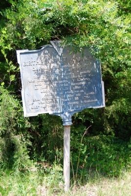
Birthplace of Calhoun Marker
| 1 ► South Carolina, Abbeville County, Abbeville — 1-5 — Birthplace of Calhoun — |
| On Mt. Carmel Road (State Highway 823). | |||
| 2 ► South Carolina, Abbeville County, Abbeville — Fort Pickens — |
| On Cambridge Street at Washington Street (South Carolina Highway 203) on Cambridge Street. | |||
| 3 ► South Carolina, Abbeville County, Due West — 1-13 — Action at Pratt's Mill — |
| On State Highway 184, on the right when traveling north. | |||
| 4 ► South Carolina, Aiken County, North Augusta — Revolutionary War — 1775 — 1783 — |
| On Georgia Avenue near West Clifton Avenue, on the right when traveling south. | |||
| 5 ► South Carolina, Aiken County, North Augusta — 2–11 — Samuel Hammond — |
| On Riverview Park Drive, in the median. | |||
| 6 ► South Carolina, Aiken County, North Augusta — 2-6 — The Martintown Road — |
| On West Martintown Road (South Carolina Route 230) north of Southwood Road, on the left when traveling north. | |||
| 7 ► South Carolina, Aiken County, Perry — 2 58 — Indian Head / The Middle Road — |
| On John Nunn Highway (State Highway 389) 0.5 miles east of Poole Road, on the right when traveling east. | |||
| 8 ► South Carolina, Anderson County, Anderson — Anderson, S.C. — The Electric City — Founded in 1827 — |
| On East Greenville Street (State Highway 81) at Haley Road, on the right when traveling south on East Greenville Street. | |||
| 9 ► South Carolina, Anderson County, Anderson — 4-14 — Old Hopewell Cemetery — |
| On East Greenville Street, on the left when traveling south. | |||
| 10 ► South Carolina, Anderson County, Anderson — The Old Reformer — |
| Near East Greenville Street (State Highway 81), on the left. | |||
| 11 ► South Carolina, Anderson County, Easley — 4-24 — Pickens Cemetery — |
| On Three and Twenty Road (State Highway 485), on the left when traveling south. | |||
| 12 ► South Carolina, Bamberg County, Bamberg — 5-10 — Woodlands — |
| On Heritage Highway (U.S. 78), on the left when traveling west. | |||
| 13 ► South Carolina, Barnwell County, Barnwell — Barnwell County Revolutionary War Monument — |
| On Dunbarton Boulevard, on the right when traveling north. | |||
| 14 ► South Carolina, Barnwell County, Barnwell — 06-05 — Morris Ford Earthworks — 1780 & 1865 — |
| On Old Allendale Road (Route S-6-70) 0.5 miles east of Marlboro Avenue (U.S. 278). | |||
| 15 ► South Carolina, Barnwell County, Barnwell — To Honor the Memory of those Soldiers — |
| On Dunbarton Boulevard (State Highway 70) at Main Street (State Highway 70), on the right when traveling west on Dunbarton Boulevard. | |||
| 16 ► South Carolina, Barnwell County, Boiling Springs — 6-7 — Tarlton Brown (1757 - 1845) — |
| On Boiling Springs Road (State Highway S-6-39), on the left when traveling west. | |||
| 17 ► South Carolina, Barnwell County, Healing Springs — God’s Acre Healing Springs — |
| On State Highway 3 at Healing Springs Road (State Highway S-6-32), on the right when traveling north on State Highway 3. | |||
| 18 ► South Carolina, Barnwell County, Healing Springs — God’s Acre Healing Springs — |
| On Springs Court (State Highway S-6-358), on the right when traveling east. | |||
| 19 ► South Carolina, Beaufort County, Beaufort — Beaufort County, South Carolina — Colonial And Revolutionary Period — 1711-1860 — |
| 20 ► South Carolina, Beaufort County, Beaufort — 7-22 — St. Helena's Church — |
| On Church Street south of King Street when traveling south. | |||
| 21 ► South Carolina, Beaufort County, Beaufort — Thomas Heyward, Jr. — |
| 22 ► South Carolina, Beaufort County, Daufuskie Island — The Martinangeles — |
| Near Prospect Road east of Martinangele Road, on the right when traveling east. | |||
| 23 ► South Carolina, Beaufort County, Grays Hill — 7-5 — Battle of Port Royal Island — |
| On Trask Parkway (U.S. 21) near Parker Drive, on the right when traveling south. | |||
| 24 ► South Carolina, Beaufort County, Hilton Head Island — In Memoriam — Captain John Stoney — 1749 - 1821 — |
| Near Mathews Drive at Folly Field Road and William Hilton Parkway (U.S. 278). | |||
| 25 ► South Carolina, Beaufort County, Hilton Head Island — 7-13 — Revolutionary War Ambush — |
| On Mathews Drive at William Hilton Parkway (U.S. 278), in the median on Mathews Drive. | |||
| 26 ► South Carolina, Beaufort County, Pinckney Island — 07-19 — Charles Cotesworth Pinckney — (1746–1825) — |
| On Pinckney Wildlife Refuge near William Wilton Parkway (U.S. 278), on the right. | |||
| 27 ► South Carolina, Beaufort County, Sheldon — Church of Prince William's Parish — |
| Near Old Sheldon Church Road north of Trask Parkway (U.S. 21), on the right when traveling north. | |||
| 28 ► South Carolina, Beaufort County, Sheldon — 7-4 — Prince William's Parish Church — (Sheldon Church) — |
| On Old Sheldon Church Road near Trask Parkway (U.S. 21), on the right when traveling north. | |||
| 29 ► South Carolina, Beaufort County, Sheldon — 7-4 — Ruins of Old Sheldon |
| On Old Sheldon Church Road north of Bailey Road, on the right when traveling north. Reported permanently removed. | |||
| 30 ► South Carolina, Berkeley County, Cainhoy — 8-12 — Brabant Plantation — |
| On Cainhoy Road (State Highway 8-98), on the right when traveling south. | |||
| 31 ► South Carolina, Berkeley County, Cordesville — 8-25 — Francis Marion — |
| On Dr. Evans Drive (State Road 8-44) near Hard Pinch Road, on the right when traveling south. | |||
| 32 ► South Carolina, Berkeley County, Cross — Barnet's Tavern — |
| On Ranger Road (State Highway 132) at Old Highway 6, on the right when traveling north on Ranger Road. | |||
| 33 ► South Carolina, Berkeley County, Cross — 8-15 — Thomas Sumter's Store — |
| Near Old Number Six Highway (State Highway 6 / 45) near Nicholas Drive, on the right when traveling west. | |||
| 34 ► South Carolina, Berkeley County, Huger — 8-10 — Quenby Bridge — |
| On Cainhoy Road (State Road 8-98), on the right when traveling south. | |||
| 35 ► South Carolina, Berkeley County, Huger — Quinby Bridge & Shubrick’s Plantation: The Disastrous “Raid of the Dog Days” — |
| On Cainhoy Road, on the right when traveling south. | |||
| 36 ► South Carolina, Berkeley County, Jamestown — 8-7 — Battle of Lenud's Ferry — |
| On U.S. 17A at Nelis Place, on the right when traveling north on U.S. 17A. | |||
| 37 ► South Carolina, Berkeley County, Moncks Corner — Berkeley County Museum and Heritage Center: A County's Story — |
| On Stoney Landing Road, 0.8 miles east of Rembert C Dennis Boulevard (Bypass Highway 52), on the right when traveling east. | |||
| 38 ► South Carolina, Berkeley County, Moncks Corner — Colleton House: “Unmanly Practices” or Legitimate Target? — |
| Near Stony Landing Road. | |||
| 39 ► South Carolina, Berkeley County, Moncks Corner — 8-68 — Fairlawn Plantation / Fort Fairlawn — |
| On Rembert C Dennis Blvd. near Edward Drive, on the right when traveling north. | |||
| 40 ► South Carolina, Berkeley County, Moncks Corner — First Site of Moncks Corner — |
| On U.S. 52 north of North Live Oak Drive (U.S. 17A), on the right when traveling north. | |||
| 41 ► South Carolina, Berkeley County, Moncks Corner — Fort Fair Lawn: An Archeaological Treasure — |
| Near Stony Landing Road. | |||
| 42 ► South Carolina, Berkeley County, Moncks Corner — Too Formidable to Take — Fort Fair Lawn Historic Site — The Liberty Trail S.C. — |
| Near Stoney Landing Road, 0.8 miles east of Rembert C Dennis Boulevard (Bypass U.S. 52), on the right when traveling east. | |||
| 43 ► South Carolina, Berkeley County, Moncks Corner — Wadboo Barony: Francis Marion’s Last Headquarters — |
| Near State Highway 402 just north of State Highway S-8-44, on the left when traveling west. | |||
| 44 ► South Carolina, Berkeley County, Nelson Hill — Gen. William Moultrie — 1730-1805 — |
| On Black's Camp Road near lake front, west shore of Lake Moultrie, in the median. | |||
| 45 ► South Carolina, Berkeley County, Pineville — 8-18 — Francis Marion / Francis Marion's Grave — |
| On General Francis Marion Avenue, on the left when traveling north. | |||
| 46 ► South Carolina, Berkeley County, Pineville — Francis Marion’s Grave — |
| Near end of General Francis Marion Avenue, on the right when traveling north. | |||
| 47 ► South Carolina, Berkeley County, Pineville — Maham Plantation — |
| On Colonel Maham Drive at Westfield Drive, on the right when traveling south on Colonel Maham Drive. | |||
| 48 ► South Carolina, Berkeley County, Pineville — The Elusive Francis Marion: Guerrilla Commander — |
| On General Francis Marion Avenue, on the left when traveling north. | |||
| 49 ► South Carolina, Berkeley County, Pineville — The Elusive Francis Marion: The Stuff of Legend — |
| On General Francis Marion Avenue, on the left when traveling north. | |||
| 50 ► South Carolina, Calhoun County, Fort Motte — Site of Rebecca Motte's Home — |
| Near Moye Lane, 0.7 miles west of Wise Road. | |||
| 51 ► South Carolina, Calhoun County, St Matthews — John Adam Treutlen — |
| On Belleville Road (State Highway 9-45) at State Highway 601, on the right when traveling south on Belleville Road. | |||
| 52 ► South Carolina, Calhoun County, St Matthews — Patriots of Calhoun County — 1775 ~ 1781 — |
| Near Railroad Avenue. | |||
| 53 ► South Carolina, Charleston County, Charleston — A Tabby Defense — The Liberty Trail — Charleston Horn Work — |
| Near Meeting Street south of Charlotte Street, on the right when traveling south. | |||
| 54 ► South Carolina, Charleston County, Charleston — At the Center of the Siege — The Liberty Trail — Charleston Horn Work — |
| Near Meeting Street south of Charlotte Street, on the right when traveling south. | |||
| 55 ► South Carolina, Charleston County, Charleston — Charleston’s Horn Work — The Liberty Trail — Charleston Horn Work — |
| Near Meeting Street south of Charlotte Street, on the right when traveling south. | |||
| 56 ► South Carolina, Charleston County, Charleston — David Ramsay House — c. 1740 — |
| On Broad Street, 0.1 miles King Street, on the left when traveling east. | |||
| 57 ► South Carolina, Charleston County, Charleston — Defending Independence — The Liberty Trail — Charleston Horn Work — |
| Near Meeting Street south of Charlotte Street, on the right when traveling south. | |||
| 58 ► South Carolina, Charleston County, Charleston — Marion Square — The Liberty Trail — Charleston Horn Work — |
| Near Meeting Street, 0.1 miles east of Charlotte Street. | |||
| 59 ► South Carolina, Charleston County, Charleston — Reclaiming Charleston’s History — The Liberty Trail — Charleston Horn Work — |
| Near Meeting Street south of Charlotte Street, on the right when traveling south. | |||
| 60 ► South Carolina, Charleston County, Charleston — Royal Judge John Drayton — |
| On 3550 Ashley River Rd, on the right when traveling north. | |||
| 61 ► South Carolina, Charleston County, Charleston — Surrender, then Victory — The Liberty Trail — Charleston Horn Work — |
| Near Meeting Street south of Charlotte, on the right when traveling south. | |||
| 62 ► South Carolina, Charleston County, Charleston — The 1780 Siege of Charleston — The Liberty Trail — Charleston Horn Work — |
| Near Meeting Street, 0.1 miles east of Charlotte Street, on the right when traveling south. | |||
| 63 ► South Carolina, Charleston County, Charleston — The Horn Work on Marion Square — The Liberty Trail — Charleston Horn Work — |
| On Meeting Street, 0.1 miles west of Charlotte Street, on the left when traveling east. | |||
| 64 ► South Carolina, Charleston County, Charleston — The Liberty Trail — Uncover the History Underfoot — Charleston Horn Work — |
| Near Meeting Street south of Charlotte Street, on the right when traveling south. | |||
| 65 ► South Carolina, Charleston County, Charleston, French Quarter — Edward Rutledge — |
| Near Church Street north of Queen Street, on the right when traveling north. | |||
| 66 ► South Carolina, Charleston County, Charleston, French Quarter — Elizabeth Hutchinson Jackson — |
| Near Meeting Street at Broad Street. | |||
| 67 ► South Carolina, Charleston County, Charleston, French Quarter — Francis Salvador — |
| Near Meeting Street at Broad Street. | |||
| 68 ► South Carolina, Charleston County, Charleston, French Quarter — George Washington Statue — |
| Near Meeting Street near Broad Street, on the right. | |||
| 69 ► South Carolina, Charleston County, Charleston, French Quarter — Josiah Flagg — 1763~1816 — |
| On Meeting Street. | |||
| 70 ► South Carolina, Charleston County, Charleston, French Quarter — Revolutionary Artillery — The Cannon Yard — |
| Near Cumberland Street west of Church Street, on the left when traveling west. | |||
| 71 ► South Carolina, Charleston County, Charleston, French Quarter — 10-6 — St. Philip's Church — |
| On Church Street, 0.1 miles north of Queen Street, on the right when traveling north. | |||
| 72 ► South Carolina, Charleston County, Charleston, French Quarter — The Two Cannons — |
| Near Cumberland Street. | |||
| 73 ► South Carolina, Charleston County, Charleston, Harleston Village — Elizabeth Jackson — |
| 74 ► South Carolina, Charleston County, Charleston, Harleston Village — Philip Porcher House — |
| On Archdale Street near Magazine Street, on the right when traveling south. | |||
| 75 ► South Carolina, Charleston County, Charleston, Radcliffeborough — 10-65 — The Siege of Charleston, 1780 — |
| On King Street near Calhoun Street, on the left when traveling south. | |||
| 76 ► South Carolina, Charleston County, Charleston, South of Broad — 36 Meeting Street — Brunet-Hall House — Circa 1743 — |
| On Meeting Street south of Water Street, on the left when traveling south. | |||
| 77 ► South Carolina, Charleston County, Charleston, South of Broad — Charleston Waterfront — |
| Near E Battery near Murray Blvd., on the left when traveling south. | |||
| 78 ► South Carolina, Charleston County, Charleston, South of Broad — Joseph Verree House — 47 Church Street — circa 1767 — |
| On Church Street, on the left when traveling north. | |||
| 79 ► South Carolina, Charleston County, Charleston, South of Broad — Major General Charles Cotesworth Pinckney — |
| 80 ► South Carolina, Charleston County, Charleston, South of Broad — Major Peter Bocquet's House — c.1770 — |
| On Broad Street, 0.1 miles east of King Street, on the right when traveling east. | |||
| 81 ► South Carolina, Charleston County, Charleston, South of Broad — Moultrie — |
| On East Battery Street, on the right when traveling south. | |||
| 82 ► South Carolina, Charleston County, Charleston, South of Broad — Site of the William Burrows House — 71 Broad Street — |
| On Broad Street east of Meeting Street, on the right when traveling east. | |||
| 83 ► South Carolina, Charleston County, Charleston, South of Broad — To the Defenders of Fort Moultrie — |
| On East Battery Street near South Battery Street. | |||
| 84 ► South Carolina, Charleston County, Charleston, Wraggborough — Marion Square — Named in Honor of — General Francis Marion — |
| On King Street (Route 104). | |||
| 85 ► South Carolina, Charleston County, Charleston, Wraggborough — Remnant of Horn Work — |
| On King Street north of Calhoun Street, on the right when traveling north. | |||
| 86 ► South Carolina, Charleston County, Isle of Palms — 10-11 — Lord Cornwallis — |
| On Charleston Blvd., on the right when traveling east. | |||
| 87 ► South Carolina, Charleston County, James Island — 1934 — Site of Fort Johnson — |
| On Fort Johnson Road, on the right when traveling north. | |||
| 88 ► South Carolina, Charleston County, Johns Island — 10-21 — Grave Of Colonel William A. Washington — |
| On Savannah Highway (U.S. 17) near Waldon Road, on the right when traveling south. | |||
| 89 ► South Carolina, Charleston County, Mount Pleasant — Charles Pinckney — 42 Years as a Public Servant — Charles Pinckney National Historical Site — |
| Near Long Point Road, 0.6 miles west of U.S. 17, on the left when traveling west. | |||
| 90 ► South Carolina, Charleston County, Mount Pleasant — Charles Pinckney - Statesman — Snee Farm — Charles Pinckney National Historic Site — |
| Near Long Point Road, 0.6 miles west of U.S. 17 when traveling south. | |||
| 91 ► South Carolina, Charleston County, Mount Pleasant — General William Moultrie / Moultrie Schools — |
| On Coleman Avenue (U.S. 17), on the right when traveling east. | |||
| 92 ► South Carolina, Charleston County, Mount Pleasant — Haddrell's Point — |
| On Haddrell Street at Live Oak Drive, on the right when traveling east on Haddrell Street. | |||
| 93 ► South Carolina, Charleston County, Mount Pleasant — Hibben House — |
| On Hibben Street, on the right when traveling west. | |||
| 94 ► South Carolina, Charleston County, Mount Pleasant — Hibben House / British Occupation — |
| On Hibben Street, on the right when traveling west. | |||
| 95 ► South Carolina, Charleston County, Mount Pleasant — Hobcaw Point Powder Magazine — |
| On Muirhead Road (State Highway 10-503) at Sugar Cane Way, on the right when traveling south on Muirhead Road. | |||
| 96 ► South Carolina, Charleston County, Mount Pleasant — Hobcaw Shipyards — |
| On East Hobcaw Drive (State Highway 10-1515) at Hobcaw Drive (State Highway 10-503), on the right when traveling north on East Hobcaw Drive. | |||
| 97 ► South Carolina, Charleston County, Mount Pleasant — Hog Island — |
| On Patriots Point Road, on the right when traveling east. | |||
| 98 ► South Carolina, Charleston County, Mount Pleasant — Jasper Green/ Sergeant William Jasper — |
| Near Coleman Blvd.. | |||
| 99 ► South Carolina, Charleston County, Sullivans Island — 10-46 — Battle of Fort Sullivan — |
| On Poe Avenue near Palmetto Street, on the right when traveling east. | |||
| 100 ► South Carolina, Charleston County, Sullivans Island — Battle of Sullivan’s Island — |
| On Jasper Boulevard (State Highway 703), on the right when traveling east. | |||
640 entries matched your criteria. The first 100 are listed above. Next 100 ⊳