After filtering for Wyoming, 109 entries match your criteria. The first 100 are listed. ⊳
Native Americans Topic
By Duane Hall
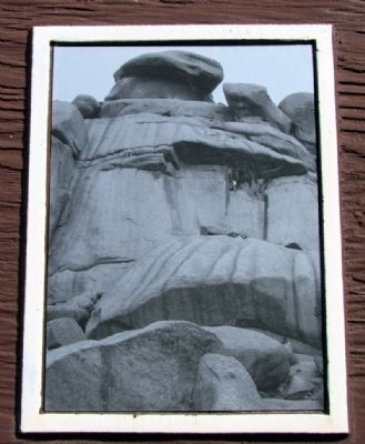
Close-up of Image on Marker
| 1 ► Wyoming, Albany County, Buford — Lonetree on the Laramie Range — |
| Near Interstate 80 at milepost 332, on the left when traveling east. | |||
| 2 ► Wyoming, Albany County, Laramie — Battle of Crowheart Butte — |
| On Grand Avenue near 17th Street, on the right when traveling west. | |||
| 3 ► Wyoming, Albany County, Laramie — Chief Washakie — |
| On Grand Avenue (Business Interstate 80) near 17th Street, on the right when traveling west. | |||
| 4 ► Wyoming, Big Horn County, Hyattville — 10,000 Years of Occupation — |
| On Dry Medicine Lodge Creek, 0.1 miles north of County Road 52, on the left when traveling north. | |||
| 5 ► Wyoming, Big Horn County, Hyattville — Rock Art — |
| On Dry Medicine Lodge Creek, on the left when traveling north. | |||
| 6 ► Wyoming, Big Horn County, Lovell — Five Springs — Crossroads of Culture — |
| Near Forest Road 12 near U.S. 14A, on the left when traveling west. | |||
| 7 ► Wyoming, Big Horn County, Lovell — Medicine Wheel — |
| On U.S. 14A at milepost 79 near Forest Road 130, on the right when traveling west. | |||
| 8 ► Wyoming, Big Horn County, Lovell — Medicine Wheel — Stone Circles — |
| Near Forest Road 12,, 1.7 miles north of U.S. 14A. | |||
| 9 ► Wyoming, Big Horn County, Lovell — Medicine Wheel — The Sacred Circle — |
| Near Forest Road 12,, 1.7 miles north of U.S. 14A. | |||
| 10 ► Wyoming, Big Horn County, Lovell — Mystery Shrouds the Medicine Wheel |
| Near 12 near U.S. 14A. Reported permanently removed. | |||
| 11 ► Wyoming, Big Horn County, Lovell — Welcome to the Medicine Wheel — |
| Near Forest Road 12,, 1.7 miles north of Federal Highway 14A, on the left when traveling north. | |||
| 12 ► Wyoming, Big Horn County, Shell — Bighorn Basin – Its History — |
| On U.S. 14, on the right. | |||
| 13 ► Wyoming, Big Horn County, Shell — Lifeblood of the West — |
| Near U.S. 14, on the right when traveling west. | |||
| 14 ► Wyoming, Carbon County, Elk Mountain — Wagonhound Rest Area — |
| Near Interstate 80 at Elk Mountain Arlington Road. | |||
| 15 ► Wyoming, Carbon County, Elk Mountain — Wagonhound Tipi Rings — |
| Near Interstate 80 at Elk Mountain Arlington Road. | |||
| 16 ► Wyoming, Carbon County, Sinclair — Fort Fred Steele — Historical Overview — |
| Near Old Highway, 0.1 miles east of County Road 347, on the left when traveling east. | |||
| 17 ► Wyoming, Converse County, Glenrock — Site of Brigham Young (BYX) Mail Station — 1859 — |
| On Deer Creek Road (County Highway 19) 1 mile south of I-25 (U.S. I-25), on the left when traveling south. | |||
| 18 ► Wyoming, Crook County, Aladdin — Vore Buffalo Jump — |
| On Old U.S. 14, 2.8 miles east of Wyoming Highway 111. | |||
| 19 ► Wyoming, Crook County, Beulah — A Community Processing Plant — |
| On Old Hwy 14, 3 miles State Highway 86. | |||
| 20 ► Wyoming, Crook County, Beulah — Discovering the Vore Archaeological Site — |
| On Old Hwy 14, 3 miles east of State Highway 86. | |||
| 21 ► Wyoming, Crook County, Beulah — Preparing for Impending Blizzards — |
| On Old U.S. 14 near Wyoming Highway 111, on the right when traveling east. | |||
| 22 ► Wyoming, Crook County, Beulah — The Ideal Hunting Ground — |
| Near Old U.S. 14 near Wyoming Highway 111, on the right when traveling east. | |||
| 23 ► Wyoming, Crook County, Beulah — Trapping Buffalo — |
| On Old Hwy 14, 3 miles east of State Highway 86. | |||
| 24 ► Wyoming, Crook County, Beulah — Understanding Bison Behavior Brought Success — |
| Near Old U.S. 14 near Wyoming Highway 111, on the right when traveling east. | |||
| 25 ► Wyoming, Crook County, Devils Tower — Bountiful Land — |
| Near Devils Tower National Monument Road (State Highway 110) 3.5 miles west of State Highway 24. | |||
| 26 ► Wyoming, Crook County, Devils Tower — Many Meanings for Many People — |
| Near Devils Tower National Monument Road (State Highway 110) 3.5 miles west of State Highway 24. | |||
| 27 ► Wyoming, Crook County, Hulett — Devils Tower — |
| On State Highway 24, 1 mile west of Mona Belle Road, on the right when traveling west. | |||
| 28 ► Wyoming, Crook County, Hulett — People of the Land — Devils Tower National Monument — |
| Near State Highway 110. | |||
| 29 ► Wyoming, Crook County, Moorcroft — Inyan Kara — |
| On Interstate 90 at milepost 171, on the right when traveling west. | |||
| 30 ► Wyoming, Crook County, Sundance — Paha Sapa, Black Hills — Geologic History of the Lakotas' Sacred Hills — |
| On Interstate 90. | |||
| 31 ► Wyoming, Crook County, Sundance — The Custer Trail — Site of Sacred Lands and Historic Battles — |
| On Interstate 90. | |||
| 32 ► Wyoming, Fremont County, Crowheart — Crowheart Butte — |
| On U.S. 287 near Sand Draw Road, on the left. | |||
| 33 ► Wyoming, Fremont County, Fort Washakie — Sacajawea — |
| On U.S. 287 at Ethete Road, on the right when traveling north on U.S. 287. | |||
| 34 ► Wyoming, Fremont County, Fort Washakie — Sacajawea — Baptiste Charbonneau — Bazil — |
| On Cemetery Lane, 0.5 miles north of Trout Creek Road, on the left when traveling north. | |||
| 35 ► Wyoming, Fremont County, Fort Washakie — Sacajawea — |
| Near Cemetery Lane near Trout Creek Road, on the left when traveling north. | |||
| 36 ► Wyoming, Fremont County, Fort Washakie — The Shoshone-Episcopal Mission Boarding School — |
| On Trout Creek Road near Cemetery Lane, on the left when traveling west. | |||
| 37 ► Wyoming, Fremont County, Fort Washakie — Washakie — |
| On North Fork Road near Black Coal Drive, on the right when traveling west. | |||
| 38 ► Wyoming, Fremont County, Jeffrey City — Split Rock — |
| On U.S. 287, 2.5 miles west of California Emigrant Road, on the right when traveling west. | |||
| 39 ► Wyoming, Fremont County, Lander — Beaver Rim and the Wind River Range — |
| Near U.S. 287, 12 miles east of Wyoming Highway 28. | |||
| 40 ► Wyoming, Fremont County, Lander — Killed Here By Indians — |
| On Wyoming 789 (U.S. 287) at Surveyor Road, on the right when traveling north on Wyoming 789. | |||
| 41 ► Wyoming, Fremont County, Shoshoni — Wind River Canyon — |
| On U.S. 20, 0.4 miles north of Brannon Road, on the left when traveling north. | |||
| 42 ► Wyoming, Fremont County, Sweetwater Station — Sweetwater Station — |
| On Wyoming 789 (U.S. 287) at Wyoming Highway 135 on Wyoming 789. | |||
| 43 ► Wyoming, Goshen County, Fort Laramie — A Father’s Grief . . . A Soldier’s Honor — Fort Laramie National Historic Site — |
| Near State Highway 160, on the left when traveling west. | |||
| 44 ► Wyoming, Goshen County, Fort Laramie — Between Two Worlds . . . the American Métis — Fort Laramie National Historic Site — |
| Near State Highway 160, on the left when traveling west. | |||
| 45 ► Wyoming, Goshen County, Fort Laramie — Embassy on the Northern Plains — Fort Laramie National Historic Site — |
| Near 160, on the left when traveling west. | |||
| 46 ► Wyoming, Hot Springs County, Thermopolis — Hot Springs State Park — Wyoming — |
| On U.S. 20, on the left when traveling east. | |||
| 47 ► Wyoming, Hot Springs County, Thermopolis — Washakie's Bath House — |
| On Big Springs Drive near Pasture Road, on the right when traveling north. | |||
| 48 ► Wyoming, Johnson County, Buffalo — Crazy Woman Story — |
| On S. Main Street at E. Fetterman Street, on the right when traveling north on S. Main Street. | |||
| 49 ► Wyoming, Johnson County, Buffalo — The Legend of Crazy Woman — |
| Near Buffalo Sussex Cutoff Road near Irigaray Road, on the right when traveling north. | |||
| 50 ► Wyoming, Johnson County, Kaycee — The Dull Knife Battle — |
| Near Mayoworth Road (State Highway 191) near Interstate 25, on the right when traveling west. | |||
| 51 ► Wyoming, Laramie County, Cheyenne — Cheyenne's Heritage at a Glance — |
| On Carey Avenue at West Lincolnway (U.S. 30), on the right when traveling south on Carey Avenue. | |||
| 52 ► Wyoming, Laramie County, Cheyenne — The Greeting and The Gift — |
| On High Plains Road. | |||
| 53 ► Wyoming, Lincoln County, La Barge — Seeds-Kee-Dee-Agie, Spanish River, Rio Verde, Green River — |
| On U.S. 189, 12.8 miles north of State Highway 372, on the right when traveling north. | |||
| 54 ► Wyoming, Natrona County, Casper — Indians Of Wyoming — |
| Near Fort Caspar Road, 0.1 miles west of Wyoming Route 258, on the right when traveling west. | |||
| 55 ► Wyoming, Park County, Clark — The Nez Perce Conflict of 1877 — |
| On State Highway 120 near State Highway 292, on the left when traveling south. | |||
| 56 ► Wyoming, Park County, Cody — Arland & Corbett — Indian Trading Post — |
| Near W Yellowstone Avenue (U.S. 20), on the right when traveling west. | |||
| 57 ► Wyoming, Park County, Cody — Cedar Mountain — Indian Tree Burials and Frost Cave — |
| Near W Yellowstone Avenue (U.S. 20), on the right when traveling west. | |||
| 58 ► Wyoming, Park County, Cody — Diversion and Escape: The Nez Perce War — |
| On Dead Indian Hill Road (aka Crandall Road) (State Highway 296) near County Highway 103, on the right when traveling west. | |||
| 59 ► Wyoming, Park County, Cody — Indian Names for Land Features — |
| On W Yellowstone Avenue (U.S. 20) 0.1 miles west of Demaris Drive, on the right when traveling west. | |||
| 60 ► Wyoming, Park County, Cody — One Last Mountain: The Nez Perce War — |
| On Dead Indian Hill Road (aka Crandall Road) (State Highway 296) near County Road 103, on the right when traveling west. | |||
| 61 ► Wyoming, Park County, Cody — Stone Circles — Near the River Crossing — |
| Near W Yellowstone Avenue (U.S. 20), on the right when traveling west. | |||
| 62 ► Wyoming, Park County, Cody — The Panoramic View — |
| On W Yellowstone Avenue (U.S. 20) 0.1 miles west of Demaris Drive, on the right when traveling west. | |||
| 63 ► Wyoming, Park County, Wapiti — Home for Ten Thousand Years — |
| On North Fork Highway (U.S. 16), on the left when traveling west. | |||
| 64 ► Wyoming, Park County, Wapiti — Protection Proves Profitable — |
| On U.S. 20, on the right when traveling west. | |||
| 65 ► Wyoming, Park County, Wapiti — Solving the Prehistoric Puzzle — |
| On North Fork Highway west of County Route 414, on the left when traveling west. | |||
| 66 ► Wyoming, Park County, Wapiti — Touch the Past — |
| On North Fork Highway west of County Route 414, on the left when traveling west. | |||
| 67 ► Wyoming, Park County, Yellowstone National Park, Mammoth — Captive Tourists — The Nez Perce Encounter — |
| On Grand Loop Road (U.S. 20) 0.4 miles east of Fountain Flat Drive, on the right when traveling south. | |||
| 68 ► Wyoming, Park County, Yellowstone National Park, Mammoth — Chance Encounter — Nez Perce War — |
| On Lower Grand Loop Road (U.S. 20), on the right when traveling south. | |||
| 69 ► Wyoming, Park County, Yellowstone National Park, Mammoth — Obsidian Cliff — Volcanic Glass — |
| On Grand Loop Road (U.S. 89), on the right when traveling south. | |||
| 70 ► Wyoming, Park County, Yellowstone National Park, Mammoth — Sheepeater Cliff — |
| On Sheepeater Cliff Road, 0.3 miles east of U.S. 89, on the left when traveling east. | |||
| 71 ► Wyoming, Platte County, Guernsey — North Platte River — |
| On U.S. 26,, 1.2 miles east of Wyoming Route 270, on the right when traveling east. | |||
| 72 ► Wyoming, Sheridan County, Banner — As a Cavalryman . . . — |
| Near Piney Creek Road. | |||
| 73 ► Wyoming, Sheridan County, Banner — As a Plains Indian . . . — |
| Near Piney Creek Road. | |||
| 74 ► Wyoming, Sheridan County, Banner — As the Attack Continues… — |
| Near Piney Creek Road. | |||
| 75 ► Wyoming, Sheridan County, Banner — At the Break of Dawn . . . — |
| Near Piney Creek Road. | |||
| 76 ► Wyoming, Sheridan County, Banner — Big Nose . . . — |
| Near Piney Creek Road. | |||
| 77 ► Wyoming, Sheridan County, Banner — Corporal Adolph Metzger . . . — |
| Near Piney Creek Road. | |||
| 78 ► Wyoming, Sheridan County, Banner — Fort Phil Kearny — Registered National Historic Landmark — |
| Near Wagon Box Road, 0.4 miles west of Kearny Lane. | |||
| 79 ► Wyoming, Sheridan County, Banner — In the End . . . — |
| Near Piney Creek Road. | |||
| 80 ► Wyoming, Sheridan County, Banner — Northern Plains Indian Wars — |
| Near Piney Creek Road. | |||
| 81 ► Wyoming, Sheridan County, Banner — The Combatants: Warriors — |
| Near Piney Creek Road. | |||
| 82 ► Wyoming, Sheridan County, Banner — The Discoveries — |
| Near Piney Creek Road. | |||
| 83 ► Wyoming, Sheridan County, Banner — Two Scenarios: Fetterman Fight, December 21, 1866 — |
| Near Piney Creek Road. | |||
| 84 ► Wyoming, Sheridan County, Banner — Weapons of the Fetterman Fight — |
| Near Piney Creek Road. | |||
| 85 ► Wyoming, Sheridan County, Banner — You Pursue . . . — |
| Near Piney Creek Road. | |||
| 86 ► Wyoming, Sheridan County, Ranchester — Connor Battlefield State Historic Site — |
| On Gillette Street. | |||
| 87 ► Wyoming, Sheridan County, Ranchester — Connor Battlefield State Park — |
| On Gillette Street, on the left when traveling south. | |||
| 88 ► Wyoming, Sheridan County, Sheridan — Big Horns — |
| Near E 5th Street (County Route 336), on the left when traveling east. | |||
| 89 ► Wyoming, Sheridan County, Story — A Fight to Survive — |
| Near Wagon Box Road. | |||
| 90 ► Wyoming, Sheridan County, Story — Red Cloud’s Victory — |
| Near Wagon Box Road. | |||
| 91 ► Wyoming, Sheridan County, Story — The Aftermath: Two Versions of Victory — |
| Near Wagon Box Road. | |||
| 92 ► Wyoming, Sheridan County, Story — The Battle, August 2, 1867 — |
| Near Wagon Box Road. | |||
| 93 ► Wyoming, Sheridan County, Story — The Wagon Box Fight: Continuing Controversies — |
| Near Wagon Box Road. | |||
| 94 ► Wyoming, Sheridan County, Story — Valor in Attack — |
| Near Wagon Box Road. | |||
| 95 ► Wyoming, Sheridan County, Story — Wagon Box Monument — |
| Near Wagon Box Road. | |||
| 96 ► Wyoming, Sublette County, Pinedale — Ancient Pronghorn Kill Site — |
| Near East Green River Road near U.S. 191. | |||
| 97 ► Wyoming, Sublette County, Pinedale — Rendezvous on the Green River — |
| Near East Green River Road near U.S. 191. | |||
| 98 ► Wyoming, Sublette County, Pinedale — Upper Green River Rendezvous — |
| Near East Green River Road near U.S. 191. | |||
| 99 ► Wyoming, Sweetwater County, Farson — Emigrant/Indian Relations — |
| Near State Highway 28, 11.5 miles west of U.S. 191, on the left when traveling west. | |||
| 100 ► Wyoming, Teton County, Moose — A Lake Named Jenny — |
| Near Teton Park Road, 8 miles north of U.S. 191. | |||
109 entries matched your criteria. The first 100 are listed above. The final 9 ⊳