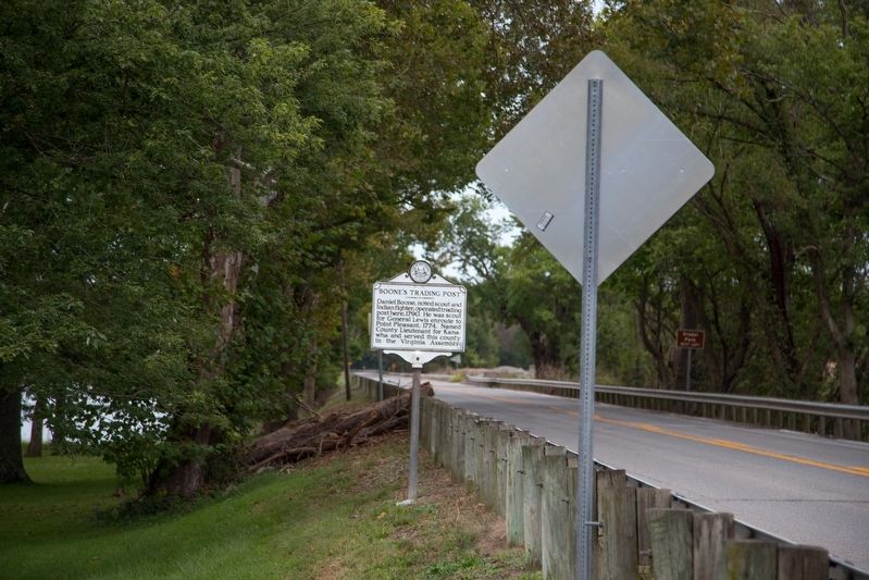
Daniel Boone, noted scout and Indian fighter, operated trading post here, 1790. He was scout for General Lewis enroute to Point Pleasant, 1774. Named County Lieutenant for Kanawha and served in the Virginia General Assembly. — — Map (db m124124) HM
In this monument rests the remains of Keigh-tugh-qua, better known as Cornstalk to the early settlers and frontiersman. Chief Cornstalk was well known and respected by the white settlers and Indian tribes of the Ohio Valley. As chief of the Shawnees . . . — — Map (db m20790) HM
In this monument rests the remains of Keigh-tugh-qua, better known as Cornstalk to the early settlers and frontiersman. Chief Cornstalk was well known and respected by the white settlers and Indian tribes of the Ohio Valley. As chief of . . . — — Map (db m189569) HM
Protecting the Frontier
In 1754, Colonel George Washington ordered the Virginia regiment to construct a line of forts from the Potomac River to North Carolina along the Appalachian Mountains. Settlers hoped these forts would protect them . . . — — Map (db m178694) HM
Original French Version: Lan 1749 du règne de Louis XV Roy de France
nous Céloron commandant d’un détachement
envoie par monsieur le Mis de la Galissoniere
commandant général de la Nouvelle France
pour rétablir la tranquillité dans . . . — — Map (db m42653) HM
Lord Dunmore's War was, in a sense, a focal point in Western history. Here were gathered in either wing of the army the men, who by dint of daring enterprise, had made their way to the frontier and had carried American institutions across the . . . — — Map (db m178628) HM WM
About 1771 was proposed as the capital of a new colony, “Vandalia.” It was visited by early explorers: La Salle, 1669; Celeron, 1749; Gist, 1750; and Washington, 1770. Daniel Boone had a trading post here.
Fort Blair was built . . . — — Map (db m42651) HM
The city of Point Pleasant is located at the confluence of the Ohio and Kanawha Rivers. It is one of the oldest cities along the river. The city was first named by George Washington in 1770. While surveying the area, he named the point of land . . . — — Map (db m178603) HM
Point Pleasant Battle. Here, Oct. 10, 1774, General Andrew Lewis and a thousand Virginia riflemen defeated the federated Indian tribes led by Cornstalk. Known as the "first battle of the Revolution." It was the most important battle between . . . — — Map (db m42652) HM
This was the battle line for the Battle of Point Pleasant, October 10, 1774. Chief Cornstalk's camp was north near Oldtown Creek. General Andrew Lewis' camp was south, at what is now known as Tu-Endie-Wei State Park. — — Map (db m126433) HM
[Front Plaque, Facing East.]
This monument was erected in the year 1909 in commemoration of the Battle of Point Pleasant, fought at the mouth of the Great Kanawha River, now in West Virginia, October 10, 1774. Between twelve hundred and . . . — — Map (db m22553) HM
West Virginia
(Mason County)
"The Mountain State" - western part of the Commonwealth of Virginia until June 20, 1863. Settled by the Germans and Scotch-Irish. It became a line of defense between the English and French during . . . — — Map (db m42650) HM
Here Major (later General) Andrew Lewis camped, February 26, 1756, with Virginia troops on way to attack Indians who had been raiding the settlements. Bitter cold and food shortage brought disaster to the expedition. — — Map (db m200621) HM
West Virginia
(Mercer County)
"The Mountain State"—western
part of the Commonwealth of
Virginia until June 20, 1863.
Settled by the Germans and
Scotch-Irish. It became a line
of defense between the English
and French . . . — — Map (db m90595) HM
Mineral County. Formed from Hampshire in 1866. Named for its great mineral deposits. In Mineral County is Fort Ashby, the only standing unit in the chain of frontier forts which were built in 1755 under Washington’s orders.
State of . . . — — Map (db m156425) HM
Erected in 1755 by Lieut. John Bacon under orders from George Washington and garrisoned with twenty-one men. Lieut. Robert Rutherford, with company of Rangers, was defeated here, August, 1756, by the French and Indians. Fort was named for Col. John . . . — — Map (db m19340) HM
Fort Ashby, one in the chain of Indian forts built by George Washington, 1755. sharp fighting here 1756. in 1794, troops under Gen. Daniel Morgan camped here on their way to suppress Whiskey Rebellion. Fort restored by W.P.A., 1939. — — Map (db m19341) HM
At Reese’s Mill, ruins of the home of Abraham Johnson, who entertained George Washington and surveying party in 1748. Johnson appeared in Patterson Creek Valley between 1735 and 1740 and in 1750 became an official of the Ohio Company. — — Map (db m94023) HM
West Virginia
(Mineral County)
"The Mountain State"—western part of the Commonwealth of Virginia until June 20, 1863. Settled by Germans and Scotch-Irish. It became a line of defense between the English and French during . . . — — Map (db m139061) HM
Near here, William Mayo, Thomas Savage, and party spent the winter of 1736 on their expedition for the British King to determine the head waters of the Potomac River and fix the boundary between Maryland and the lands of Lord Fairfax. — — Map (db m93934) HM
Mineral County. Formed from Hampshire in
1866 and named for its great mineral deposits. In Mineral County is Fort Ashby, the only standing unit in the chain of frontier forts which were built in 1755 under George Washington's order. . . . — — Map (db m179930) HM
On this site in 1750 the Ohio Company of Virginia erected a fortified storehouse known as Fort Ohio or the New Store. It served as protection and the center of commerce for this area, called Wills Creek until 1755, when Fort Cumberland, across the . . . — — Map (db m67205) HM
On land Washington surveyed for Elias Sellers in 1748 stood this fort, important link in system of frontier defenses. It was garrisoned by an officer and thirty men and withstood several attacks by the Indians. — — Map (db m157346) HM
West Virginia
(Mineral County)
"The Mountain State"—western part of the Commonwealth of Virginia until June 20, 1863. Settled by the Germans and Scots-Irish. It became a line of defense between the English and French during the French . . . — — Map (db m134411) HM
Camp of Major (later General) Andrew Lewis in 1756, with Virginia troops, led by Smith, Hogg, Preston, Pearis, Woodson, and others, on way to attack Indians in Ohio. The Tug River and other streams were named by expedition. — — Map (db m136659) HM
Ice's Ferry was settled by Frederick Ice in 1767. His son Adam, born the same year, was the first white child born in Monongahela Valley. Andrew Ice in 1785 started the first authorized ferry in western Virginia. — — Map (db m73337) HM
John Statler built a fort here in 1770. In its vicinity a number of settlers were killed during raids in 1777 with eighteen men losing their lives the next year. Among those massacred was Statler's brother, Jacob. — — Map (db m196803) HM
Fort Martin was built in 1769 by Colonel Charles Martin. Three settlers were killed and seven captured near the fort in 1779. At the Methodist Episcopal Church here Bishop Francis Asbury preached in 1784. — — Map (db m74599) HM
This National Guard unit traces it origins to Capt. Morgan Morgan, who formed the company Feb. 17, 1735. It served with Washington's militia in Braddock's 1755 campaign. At the outset of the Revolution he called upon these fighting men to "drive the . . . — — Map (db m73352) WM
William Stewart settled here in 1771. Northeast was Fort Dinwiddie. Pioneer minister John Corbley, whose wife and three children were killed in 1782 Indian raid on Garard's Fort, founded Forks of Cheat Baptist Church here in 1775. — — Map (db m189510) HM
Branch of Warrior Trail of the Great Catawba Indian War Path located here where Mason and Dixon Survey crossed Dunkard Creek for third time. Guide, Six Nations Indians’ chief, declared he “would not proceed one step further,” because hostile . . . — — Map (db m175212) HM
William Stewart settled here in 1771. Northeast was Fort Dinwiddie. Forks of Cheat Baptist Church was organized here, 1775, by John Corbley, the pioneer minister, whose family was massacred later by the Indians. — — Map (db m74597) HM
Made famous as line between free and slave states before War Between the States. The survey establishing Maryland-Pennsylvania boundary began 1763; halted by Indian wars, 1767; continued to southwest corner, 1782; marked, 1784. — — Map (db m73341) HM
West Virginia (Monongalia County). “The Mountain State”—western part of the Commonwealth of Virginia until June 20, 1863. Settled by the Germans and Scotch-Irish. It became a line of defense between the English and French . . . — — Map (db m73342) HM
William J. Humphreys. Nearby noted meteorological physicist born 2/3/8162; died 11/10/1949. John Hopkins U. Ph.D., 1897; Director Mt. Weather Observatory 1905; famous for 1909 research on stratosphere; retired, Weather Service, 1935. Winds . . . — — Map (db m83986) HM
Home of Isaac Estill
Isaac moved to block house on Indian Creek in 1773 at age 7 with Wallace & Mary Ann Campbell Estill. In 1788 he married Elizabeth, dau. of John Frogg, killed in 1774 at Battle of Pt. Pleasant, & granddau. of John Lewis, . . . — — Map (db m99262) HM WM
West Virginia
(Monroe County)
"The Mountain State"- western part of the Commonwealth of Virginia until June 20, 1863. Settled by the Germans and Scotch-Irish. It became a line of defense between the English and French during . . . — — Map (db m118889) HM
This defense, erected, 1775, by Captin Michael Woods, was of importance during Lord Dunmoore’s War. Troops from here were engaged in the Battle of Point Pleasant next year and later were with George Rogers Clark. — — Map (db m84132) HM
Berkeley Springs
Washington first came here, 1748. Fairfax gave the springs to the public. Established as town, 1776. Virginia treated her sick soldiers here. Gen. Washington, Gen Buchanan, Gen. Gates, Charles Carroll and others bought lots . . . — — Map (db m13016) HM
These healing springs, visited by Washington, 1748, were given to Virginia by Lord Fairfax. Helpful in treating infantile paralysis, rheumatism, diabetes and other diseases. Temperature of water is always 74 degrees. — — Map (db m13114) HM
Today's 4.5-acre Berkeley Springs State Park has always been public ground. Native tribes were known to use the springs but none called it home. Colonial owner Thomas Lord Fairfax allowed its public use. When the town was established in 1776, the . . . — — Map (db m117307) HM
Cacapon Mountain, where you are standing, is the westernmost of the pair of north/south mountains that mark the region as belonging to the ridge and valley section of the Appalachians. Looking out from the overlook, you see its eastern . . . — — Map (db m156764) HM
Sir John's Run was named for Sir John Sinclair, the quartermaster for General Braddock on expedition in 1755 against the French at Fort Duquesne. James Rumsey demonstrated his steamboat here in 1785. — — Map (db m13152) HM
West Virginia (Morgan County). "The Mountain State" - western part of the Commonwealth of Virginia until June 20, 1863. Settled by the Germans and Scotch-Irish. It became a line of defense between the English and French during the French and . . . — — Map (db m159477) HM
The tiny hamlet of Great Cacapon is situated on the western side of Cacapon Mountain on the Potomac River just upstream from its juncture with the Cacapon River. Artifacts of a Native American town circa 1300 AD have been found along the Potomac . . . — — Map (db m148832) HM
Today's View Panorama Overlook marks the north end of Cacapon Mountain's 30-mile march. Composed of Oriskany sandstone, it plunges nearly 1000 feet into the Potomac River, which bends along the base of the Overlook as it heads downstream . . . — — Map (db m167603) HM
Hampshire County
Oldest county: established by the Virginia Assembly, 1754. Formed from Frederick and Augusta. Lord Fairfax, owner, named it for the English shire of the same name. Ice Mountain and Hanging Rocks are among its natural wonders. . . . — — Map (db m148833) HM
Morgan County
Formed, 1820, from Berkeley and Hampshire. Named for Gen. Daniel Morgan of the Revolutionary Army. Many of his renowned "Riflemen" were from the Eastern Panhandle, where he once lived. Famed Berkeley Springs here.
. . . — — Map (db m84797) HM
George Washington described the land here in 1770. The French expedition headed by Capt. Celeron buried leaden plates at the mouth in 1749 and claimed the land for France. De Bonnescamp’s map gives creek name–Kanonouaras. — — Map (db m749) HM
This plaque commemorates the first Mass in what is now West Virginia August 13, 1749, and the establishment of the Catholic Diocese of Wheeling July 19, 1850. — — Map (db m196367) HM
Major Samuel McColloch
daring scout, gallant soldier
while attempting the relief of
Fort Henry at Wheeling
September, 1777
escaped an overwhelming body of Indians
by forcing his horse over this precipice — — Map (db m513) HM
61 rods west stood original
round log church upon 3½
acre plot, deeded Dec.18, 1769,
by John Michael Propst and his
wife, Catherine, “for the congregation of the South Fork of the
Potowmack for five shillings
current money of Virginia.” — — Map (db m123901) HM
West Virginia (Pendleton County)
"The Mountain State" - western part of the Commonwealth of Virginia until June 20, 1863. Settled by the Germans and Scotch-Irish. It became a line of defense between the English and French . . . — — Map (db m34536) HM
Made famous by Brandonville stoves, product of old iron furnaces. Here in 1839 was published one of the early agricultural papers. In the vicinity stood Fort Morris, built before 1774 on the lands of Richard Morris. — — Map (db m74508) HM
Preston County. Formed from Monongalia in 1818 and named for James Preston, 13th governor of Virginia. Here is model Federal homestead project, sponsored by Mrs. Eleanor Roosevelt, the wife of Franklin Delano Roosevelt, 32nd President.
. . . — — Map (db m75147) HM
The nearby highway is part of route
traversing W.Va. from Lewisburg to
Point Pleasant memorialized by the
state to commemorate the march of
the American Colonial army of 1,200
men led by Andrew & Charles Lewis.
After a month's march this . . . — — Map (db m11454) HM
Acquired 7.276 Acres of this land by a grant, dated December 1, 1773 issued to him by
John Murray, Earl of Dunmore, last Royal Governor of Virginia. This tract was surveyed in July, 1773, by William Crawford, upon warrants issued to George . . . — — Map (db m11451) HM
This “Poca River Tract” of
7,276 acres was acquired by
George Washington, and
surveyed by Wm. Crawford, 1773.
It bordered Kanawha River, "12
miles and 227 poles."
Washington’s nephew, Lawrence,
resided at Red House Shoals. — — Map (db m11453) HM
Known as the "War Road", the "Hunter's Road", or simply the "Indian Path" by the time European explorers arrived in the 18th century, Paint Creek had long been a route of travel for Native Americans. Delawares, Mingoes, Ottawas, Senecas, . . . — — Map (db m75165) HM
Oldest public cemetery west of the Allegheny Mountains. Earliest known burials were in 1768. Soldiers of all American wars are buried here. — — Map (db m178484) HM
In 1774 Capt. Benjamin Wilson was made a colonel in Lord Dunmore's army when it invaded the Indian country. He was active in concluding peace with west Indians at the Pickaway Plains in Ohio after the Battle of Point Pleasant. — — Map (db m178470) HM
The nearby highway is part of route
traversing W. Va. from Lewisburg to
Point Pleasant memorialized by the
state to commemorate the march of
the American Colonial army of 1,200
men led by Andrew & Charles Lewis.
After a month's march this . . . — — Map (db m124116) HM
Summers County. Formed, 1871, from Monroe, Fayette, Greenbrier, Mercer.
Named for the distinguished jurist of Kanawha, George W. Summers. Dr. Thomas Walker and companions explored the Greenbrier Valley, 1750, for the Greenbrier . . . — — Map (db m164749) HM
Approximately 820 feet east of here, Camp 70 Road intersects the historic Fairfax Line, the western boundary of about 5,000,000 acres inherited by Thomas Lord Fairfax in 1719. In 1746 a survey party that included Peter Jefferson, father of Thomas . . . — — Map (db m210152) HM
John Crouch, pioneer settler, established "tomahawk rights" here in 1766, but the town was not incorporated until 1893. Here Shavers Fork and Blackwater unite to form the Cheat River. Hu Maxwell, the historian, lived near.
After the battles of . . . — — Map (db m23641) HM
First county seat. Here John Minear and son, Jonathan, after early visits, settled in 1776. Bot of them were killed by Indians, 1780–1781. Captain James Parsons and brother, Thomas, made settlements in the Horseshoe, 1772–1774. — — Map (db m74908) HM
The Thomas National Register Historic District is considered significant under Criterion A for its association with the settlement and development of Thomas and of Tucker County.
Though remote, the area has been of interest to explorers . . . — — Map (db m153055) HM
The Fairfax Stone (½ Mi. E.) marking the Potomac's headwaters, was a corner of Lord Fairfax's vast estate. The line of 1736 was checked in 1746 by a survey on which Peter Jefferson, father of Thomas Jefferson, was engaged. — — Map (db m3945) HM
This monument, at the headspring of the Potomac River, marks one of the historic spots of America. Its name is derived from Thomas Lord Fairfax who owned all the land lying between the Potomac and Rappahannock rivers. The first Fairfax Stone, marked . . . — — Map (db m3946) HM
The Fairfax Stone (½ Mi. E.) marking the Potomac's headwaters, was a corner of Lord Fairfax's vast estate. The line of 1736 was checked in 1746 by a survey on which Peter Jefferson, father of Thomas Jefferson, was engaged. — — Map (db m234616) HM
Buckhannon. Named for chief of Delaware Indians. John Jackson settled near in 1769. John Bush built a fort which was destroyed by Indians, 1782. A settlement which grew up there became the county seat of Harrison. W. Va. Wesleyan College is . . . — — Map (db m14417) HM
Explorations of West Blue Ridge
It is impossible to say when and where the first European settlers set foot on the soil of what is now West Virginia. In all probability no record was ever made of the first visit. It is well known that . . . — — Map (db m179016) HM
Settled by colonists from New England. French Creek Academy was important early school. Asa Brooks started religious services here, 1816, from which grew the Presbyterian Church. Here, 1828, was formed early total abstinence society. — — Map (db m178895) HM
Named during the War between the States. At the junction of the Tug and Big Sandy rivers, in 1789, Charles Vancouver and 10 companions built a log fort and attempted a settlement on land surveyed in 1770 by John Fry for George Washington. — — Map (db m136675) HM
After signing of 1768 treaties, the Stroud family settled on Stroud's Creek near junction with Gauley River. Mrs. Stroud and seven children were killed by Shawnee war party in 1772. Recorded accounts of subsequent attack by settlers on Delaware . . . — — Map (db m178868) HM
Community originally known as Hacker Lick for John Hacker and salt springs he found here in 1772, following a buffalo trail on lands he claimed by "tomahawk mark" in present Webster, Upshur, and Lewis counties. He killed a buffalo cow here. Post . . . — — Map (db m178889) HM
At the Little Kanawha, 1774, George Rogers Clark and 90 companions, largely recruited in what is now West Virginia, assembled on their way into Kentucky. Their plans, halted by Indian Wars, later resulted in conquest of the Northwest. — — Map (db m124219) HM
A tract of 2314 acres was acquired by George Washington three miles west on Dec. 15, 1772, for services in the French and Indian War. It was surveyed by William Crawford in June, 1771. It bordered for five miles on the Ohio River. — — Map (db m124330) HM
183 entries matched your criteria. Entries 101 through 183 are listed above. ⊲ Previous 100