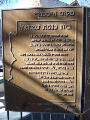
Jewish pioneers, among Arizona's earliest settlers, began arriving in the 1850s and for half a century they worshipped in private homes and rented quarters. In 1904, the Hebrew Ladies Aid Society, now the Sisterhood of Temple Emanu-El, . . . — — Map (db m83237) HM
On September 20, 1906 the first stone was laid in place. Over the next five years, 350,000 cubic feet of block would be cut, shaped, and fashioned into the Roosevelt Dam.
The blocks of stone were carved out of the canyon walls. They were . . . — — Map (db m34106) HM
This entrance marker is constructed of hand-hewn blocks which once made up the façade of Roosevelt Dam. They were given to the Superstition Mountain Historical Society by the United States Bureau of Reclamation. The larger blocks weigh upwards of . . . — — Map (db m34060) HM
Built in 1948, this Contemporary Pueblo Revival building initially housed all town government administration and the Town Council chambers. The Town had a mayor and council-commissioner form of government. With limited staff, each Councilmember was . . . — — Map (db m195851) HM
This Colonial Revival adobe was the home of George Brockway and his wife Esther. Brockway was the town medical doctor, Pinal County Hospital Superintendent and Territorial Prison physician. He owned a drugstore, and in 1908 became the first mayor of . . . — — Map (db m26712) HM
In its' early days as a small, scattered and isolated settlement, Sedona had few emergency services.
In 1948 the Sedona School burned to the ground. This motivated the new Chamber of Commerce to start a "Firefight Fund". Sedona blacksmith and . . . — — Map (db m133032) HM
This building constructed in 1918-19 cost a total of $75,000 including the site, furnishings, and fixtures. Listed on the National Register of Historic Places, it served as the U.S. Post Office for Rogers for over four decades. These 1918 . . . — — Map (db m90744) HM
1.6 acres for the
purpose of establishing
a church & cemetery.
Donated by L.E. Mason
& Ann Mason (wife)
Deeded July 20, 1861.
Trustees;
Thomas Bingham
Samuel H. Johnson
John Mason — — Map (db m224875) HM
The Ozark Arts and Crafts Fair was founded on War Eagle Mills Farm by Lester and Blanche Elliott and friends in October 1954 for the purpose of giving recognition to Ozark artists and craftsmen who work with their hands and hearts to preserve the . . . — — Map (db m52066) HM
This is one of only four free public libraries in Arkansas funded by philanthropist Andrew Carnegie. It was built of native limestone and completed in 1912 on this site which was donated by Eureka Springs resident Richard C. Kerens. The architect . . . — — Map (db m80137) HM
This spring derived its name from early townspeople who declared the water to have a pleasant, sweet taste. The spring was originally located in the deep ravine below the present site. A long wooden stairway led from the spring to the narrow . . . — — Map (db m80115) HM
These two large limestone public buildings anchor this part of downtown Eureka Springs. They span the deep ravine cut by Leatherwood Creek which flows in a tunnel beneath all the buildings on this entire part of Main Street.
[Photo 1.]
This . . . — — Map (db m59964) HM
Eureka Springs claims an estimated fifty-six miles of stone walls. Skilled stonemasons constructed most of the walls between 1885 and 1910. The limestone used was sometimes quarried on site but the majority was transported to the town site by horse . . . — — Map (db m63299) HM
Here, during Reconstruction years, were the offices of the Freedmen's Bureau. The building was, at different times, used as a harness shop, grocery store, barber shop and saloon, and for many years was a residence. — — Map (db m234853) HM
PHS
Dedicated
This landmark is erected on the original site of Peake School built on land donated by Mr. Ed Peake in 1928, and is dedicated to the faculties and staffs who encouraged and prepared us to compete on an equal level with the best . . . — — Map (db m234859) HM
This statue honors Civilian Conservation Corps
Company V-1781. these skilled veterans of World War
One built Arkansas's first state park. — — Map (db m233674) HM WM
Company V-1781 was the
designation of Petit Jean's CCC.
camp. The "V" indicated the
company employed World War I
veterans. The situation was
relatively unique: only 10 percent
of CCC camps around the United
States were veteran camps. . . . — — Map (db m233675) HM
Following the stock market
crash of 1929, the United States
plunged into the depths of the
Great Depression. By 1932, the
unemployment rate was a
staggering 23%. Over 13 million
Americans had lost their jobs.
In a landslide victory, . . . — — Map (db m233673) HM
Front of Obelisk
Born in Boston, Mass., came to Arkansas in 1826 to be printer for the Arkansas Gazette. In 1882 he moved to Hot Springs and in a two room log cabin established a general store, post office and lending library. He served as . . . — — Map (db m116351) HM
Home-site of Dr. Isaac Newton Jones and Elizabeth Littlejohn Jones
Benefactors of James Black, maker of the Bowie knife. Parents of Daniel Webster Jones, Arkansas Governor 1897-1901. — — Map (db m244939) HM
Established in 1855, the Independence County poor farm provided those in need with a place to live, medical care, and the opportunity to grow their own food in the garden patch. These houses were the community’s way of providing care to the poor . . . — — Map (db m226571) HM
Curran Hall, built in 1842, exemplifies the key elements of Greek Revival style: symmetrical form; horizontal emphasis of the rectangular form; classical elements of columns, pilasters, temple-like porch with pediment, transom and sidelights at the . . . — — Map (db m160932) HM
The permanent seat of justice in Sebastian County, created in 1851 was located on a site to which was given the name of Greenwood. In 1861 another court house was erected at Ft. Smith and since then the county has maintained two seats of justice. . . . — — Map (db m92349) HM
In 1884, by an act of Congress, secured by
Congressman John H. Rogers, later United
States Judge of the Western District of
Arkansas, more than 200 acres of the
government reservation was donated to
the Fort Smith school district. — — Map (db m236843) HM
The Campaign for the Twenty-First Century,
considered the most ambitious fund-raising effort
undertaken by an organization in Arkansas, spanned
3/1/1998-6/30/2005. The $500-million campaign's
objective was to raise funds for scholarship . . . — — Map (db m237270) HM
President of University of Arkansas 1939-1941.
U.S. Representative 1943-1944.
U.S. Senator 1945.
Delegate to the United Nations 1954.
Author of Fulbright Resolution for International Cooperation 1943.
Originator of Fulbright . . . — — Map (db m59915) HM
Significant dates in Fayetteville history include: Incorporated town in 1836; Old Wire road from Jefferson City, Mo. to Ft. Smith cut in 1835; Washington County Fair first held on the Square in 1856; first telegraph installed around 1860; . . . — — Map (db m59877) HM
On April 11, 2002, the university received the largest
gift in the history of U.S. public higher education –
a $300 million challenge gift from the Walton Family
Charitable Support Foundation. The gift established
and endowed an undergraduate . . . — — Map (db m224693) HM
Charlie Tillman, born in 1907, has lived in Alameda since 1909. Charlie served as a member of the White House Conference on Aging from 1973 to 1975. He was a member of the California Commission on Aging from 1981 to 1983.
Charlie served on the . . . — — Map (db m219370) HM
Erected 1889 for Mr. & Mrs. George H. Mastick
The Alameda Chapter of the American Red Cross
was founded here in 1898.
Mrs. Mastick was elected first president.
Dedicated 1982 by the
Alameda Chapter American Red Cross
Alameda . . . — — Map (db m157287) HM
James W. Plachek, Architect, 1930
Addition, Ripley/BOORA Architects, 1999
Listed on the National Register of Historic Places
Berkeley’s first free public library system was established in 1895, with branches in west and south Berkeley. The . . . — — Map (db m52364) HM
Originating among working class Englishmen in 1844, the Young Men's Christian Association was brought to North America in 1851 to promote a "full and balanced life" through religious devotion and athletic activity. Berkeley's charter organization . . . — — Map (db m50295) HM
This park honors the memory of
Frances Elizabeth Willard
1839 - 1898
Feminist
Founder of the Women's Christian Temperance Union
Fighter for women's rights and free public education
First woman college president
First Dean of . . . — — Map (db m239025) HM
This property (43327 Mission Blvd.) was developed in 1895 by Daniel Baker for a livery business. The enterprise continued under the ownership of Edward Coffany, William Rose, and then Andrew Kell, at least until 1916. By 1924, the building was . . . — — Map (db m220207) HM
The adobe slowly deteriorated and a large crack developed in an end wall. The roof caved in, exposing the vulnerable adobe bricks which began to disintegrate. Local historian and preservationist, Robert B. Fisher, M.D., raised an alarm, and in . . . — — Map (db m211567) HM
Don Guillermo Castro, founder of the city, preserved the plaza for the enjoyment of the citizens, and in 1856 conveyed to them ownership of the land forever. This library, originally constructed on the plaza in 1951, and enlarged in 1958, was . . . — — Map (db m28774) HM
This land, known as Ukraina, was once the home of Ukrainian expatriate Father Agapius Honcharenko and his wife Albina.
The quotation above, which once greeted visitors here,
expresses the essence of his social reform beliefs. . . . — — Map (db m182185) HM
Marker One:
Founder
Fairview Fire Department
1938
Served as Fire Chief for 27 Years
(1938 – 1965)
Dedicated to the preservation of life and property
He truly loved the Fairview community
Dedicated - October 15, 1988
Board of . . . — — Map (db m207163) HM
On this site once stood the home of Barbara Bunshah (b. 1926 - d. 2007) City Librarian, curator of the Livermore History Center, and creator of the "Bunshah Index" of Livermore newspapers, and who resided here from C. 1958 to 2007. — — Map (db m199128) HM
1890
Buckley's Vineyard
Christopher Augustine Buckley's Winery was built in 1890 and a brandy distillery was added in 1897. The original 100 acre site was one of the larger early vineyards in the Livermore Valley. After its expansion . . . — — Map (db m233018) HM
John "Alex" Alexander spent his entire working life at Naval Supply Center Oakland. Symbolic of the many dedicated civilians who worked on the base, Alex inspired others through his tireless work on behalf of the community at large and promoted . . . — — Map (db m63171) HM
This marker consists of a number of inscribed metal strips embedded in the walkway. 1853 - Map of Oakland is laid out by J. Kellersberg showing seven public squares, including Lafayette Square. Six are symmetrical around Broadway, the . . . — — Map (db m72733) HM
This marker is made up of two markers and two plaques on the same monument.
One Community, Many Locations
Chinese first settled in Oakland in the 18502 during the California Gold Rush. Unlike San Francisco’s Chinatown, Oakland’s . . . — — Map (db m72762) HM
James and Henrietta Latham brought their family to Oakland from Virginia City, Nevada, in the late 1860s. A wealthy stockbroker,
James died at age 42 and left a substantial inheritance to Henrietta
and the children, Edith and Milton. Together, . . . — — Map (db m160460) HM
Joaquin Miller Park was formed in 1917 when the City of Oakland and its citizens – led by The California Writers Club – purchased 68 acres from the estate of Joaquin Miller, the noted 19th century “Poet of the Sierras” and . . . — — Map (db m71737) HM
Dr. Huey P. Newton
February 17, 1942 - August 22, 1989
In 1966, Dr. Huey P. Newton co-founded the Black Panther Party for Self-Defense ("BPP"). Initially, it was a grassroots organization that dispatched legally armed patrols of BPP . . . — — Map (db m185923) HM
On August 1, 1987
This stoplight was
installed as a result of
a community initiative
spearheaded by the
Black Panther Party Side 2
After several students from Santa Fe
Elementary School nearby were killed at
this busy . . . — — Map (db m72395) HM
Originally installed by the Women's Improvement Club in 1932, the Pleasanton Sign has become a familiar landmark and prominent symbol of the community. In 2005, the sign underwent complete restoration, and was rededicated by the City Council on . . . — — Map (db m193940) HM
Chabot Dam, originally called San Leandro Dam, was built by Anthony Chabot who started Contra Coast Water Company in 1868. When artesian wells and Temescal and Sausal Creeks failed to bring Oakland and surrounding cities enough water he decided . . . — — Map (db m71714) HM
Main marker:
California Historic Civil Engineering Landmark.
Alameda Creek Water System, 1888.
San Francisco Section A802, 1975.
Second marker:
Restoration of the Sunol Water Temple.
Started May 27, 1997. . . . — — Map (db m24499) HM
Long before the structure pictured above was built, Ione's most notable civic building was
leveled by fire on June 10, 1923. The original building was constructed in 1893 by the
26th Agricultural District Fair Association and was known as the . . . — — Map (db m193551) HM
This trusty bell served Jackson
faithfully for over 70 years.
Located in tower near courthouse.
Warning of fire or other peril.
Dedicated July 8, 1989 by
Amador County Historical Society
and
Excelsior . . . — — Map (db m19750) HM
This site is named in recognition of the gift by W.D. "Dick" and Marge Cribbs to the city of Sutter Creek on April 6th, 1964. This land was given with the stipulation it be developed for municipal purposes including the construction and . . . — — Map (db m106334) HM
Within the bell
The following is inscribed
"Hung by G. Chisholm, Dan Ramazzotti
Oct. 18, 1907
Director – F. N. Soracco, F. Warner
E. Deacon – Sutter Creek Fire Co.
Cast by A. Fulton’s Son and Company
Pittsburg, PA.
Ordered by . . . — — Map (db m94750) HM
Oroville Carnegie Library, built 1912, has been placed on the National Register of Historic Places by the United States Department of the Interior.
In 1911, Andrew Carnegie, Scottish industrialist, businessman, and major philanthropist, . . . — — Map (db m17229) HM
In deep appreciation of those who had the foresight to plan, design, and construct the Oroville Dam Project and to those who have been operating and maintaining it for the State Water Project and the people of California.
Since its . . . — — Map (db m101447) HM
In 1912 the 62nd United States Congress donated these model 1841 12-Pound Field Howitzers to the Grand Army of the Republic. These guns were cast by N.P. Ames at Springfield Mass and displayed in Burson, Calif. by the Grand Army of the Republic . . . — — Map (db m165023) HM WM
Drainage Area 33,000 Acres
Total Capacity 4,800 Acre Ft.
Water Surface Area 375 Acres
Height of Dam 58 Feet
Length of Dam 1,500 Feet
Volume of Fill 440,000 Cu.Yds.
Built under the Watershed Protection and . . . — — Map (db m198002) HM
This water fountain is dedicated to the memory of Nan Joy & Lawrence “Joe” Wallace
They moved here in 1946. Nan & Joe were instrumental in getting water service to Clayton in 1949, allowing development of our community. The Wallaces were . . . — — Map (db m239621) HM
Originally owned by August Hemme in 1852, just after
California achieved statehood, this land was purchased in 1911
by the San Francisco Protestant Orphanage Asylum.
Camp Swain was built to give foster children a warm summer
away from cold . . . — — Map (db m153113) HM
The large outcrop with the staircase and cables is Sentinel Rock. The Civilian Conservation Corps (CCC) installed the steps and railings on Sentinel Rock sometime berween 1933 and 1942. It is now a popular climbing rock.
One of the responses of . . . — — Map (db m199523) HM
The Orinda Improvement
Association,
inaugurated on May 22,
1923, was the voice of
the citizens in the 1920s
and beyond. It brought
adequate phone service
and fire protection, and
consolidated the local
school districts.
Additional . . . — — Map (db m145030) HM
Established July 7, 1908, for the purpose of improving the quality of life in Point Richmond, the Women's Westside Improvement Club is responsible for the original Indian statue fountain, a reading room that became the Westside Branch Library, this . . . — — Map (db m94711) HM
Born in San Francisco in 1918, Byron Athan joined the Army in 1941, and retired in 1964, as a Lieutenant Colonel. He served during WWII in the Pacific Theater and at the Pentagon. Byron enrolled in law school at the University of San Francisco prior . . . — — Map (db m202056) HM
Costing $3,000 to build, the two-story Central Fire Station was the first and "hub" station in the County's newly formed Central Fire Protection District. The station's pumper engine cost $7,000. The first fire chief was Raymond Spencer, son of . . . — — Map (db m93825) HM
As the community's first service organization,
the Women's Club of Walnut Creek helped meet
many community needs. It established the first
public library in 1916 and the first Walnut Festival
in 1936. The club purchased the land for . . . — — Map (db m159601) HM
The monument you are looking at is dedicated to Billy Boone. But who was Billy Boone? Former newspaper publisher Wally Griffin, remembers him as a "promoter" of Del Norte County, but most people who remember him recall that he was instrumental in . . . — — Map (db m92062) HM
This monument is dedicated to the Georgetown Volunteer Firemen past and present who have served this community for 125 years.
This bell had served as the fire alarm for many years until retired in 1965 when the new station was built. Material . . . — — Map (db m11376) HM
In 1988, Jack Van Sickle (1916 – 2003) donated 542 acres of land to the Nevada Division of State Parks to honor his grandfather, Henry Van Sickle. 20 years later, Van Sickle Bi-State Park was born.
”He was a cowboy. That was one of . . . — — Map (db m223616) HM
In Memory of the victims of September 11, 2001 and in honor of our fallen heroes
America's bravest - New York City Firefighters
Port Authority of NY and NY Police Officers
America's Finest - New York City Police Officers
The Passengers . . . — — Map (db m114526) WM
This is one of the French boxcars of the French Merci Train sent to the United States. in 1949 as a thank you token to the American people for the Freedom Ship of food and clothing sent to France in 1948. The car was filled with many articles of . . . — — Map (db m197216) HM WM
This Water Tower is dedicated to George M. Bowman in recognition for thirty-six years of dedicated service to the City of Fresno and for his accomplishments as a naval officer. He was the city's first chief engineer and became general manager of . . . — — Map (db m41071) HM
Designed by architect George S. Mayer of Chicago, Illinois. It was completed in November 1894, replacing two wooden tanks erected on this site in 1887. The Tower stands 100 feet high with a tank capacity of 250,000 gallons. This facility, modeled . . . — — Map (db m41069) HM
Having water around a sawmill is a good thing. It’s easier to move logs and lumber, and put out fires. The Hume-Bennett Lumber Company found this site near good timber and decided a reservoir would make there operation more efficient. The problem . . . — — Map (db m44303) HM
Built in 1884, this building became home of “Columbia Hose Company Number 4”, chartered April 2, 1894. It is the oldest surviving structure of the 7 volunteer companies organized in Eureka between 1873 and 1908. Original building had 2 . . . — — Map (db m91922) HM
Placed by friends and family in loving memory of a woman of unassuming gernerosity. "Mid" was born in Angels Camp, reared in Los Angeles, educated at Stanford and continued her education though out life.
She purchased this building in the late . . . — — Map (db m231431) HM
Designed and built by Troy Land to raise money for various Ferndale charities, the “Little House” was raffled off December 23rd 1995 to a lady from Watsonville, CA.
In order to preserve a “Main Street Treasure” that had captured the hearts of . . . — — Map (db m231434) HM
Company 1903 Comes to the Prairie In October 1933, CCC Company 1903 moved from Hyampom, in Trinity County, to Prairie Creek. Along with the 113 enrollees were seven soldiers — three officers, three sergeants, and a cook — who would . . . — — Map (db m159100) HM
A native of Plunkett, Saskatchewan, Canada. Graduated from Stanford University with a degree in Civil Engineering, began work with the Division of Highways in 1936. He worked in many positions and locations throughout his career, becoming State . . . — — Map (db m1509) HM
Established and organized in 1908 as the Men Club to promote the city of El Centro, their first goal was for El Centro to reach a population of 10,000 residents. On October 30, 1908 the women took over the club and renamed it the Women's 10,000 . . . — — Map (db m101569) HM
With the discovery of gold and silver in Nevada at Goldfield and Tonopah, the need for electric power for mining operations was fulfilled in September, 1905, by construction of a hydro-electric plant on Bishop Creek, which supplied 1,300 . . . — — Map (db m629) HM
He laid the foundation of the National Park Service, defining and establishing the policies under which its areas shall be developed and conserved unimpaired for future generations. There will never come an end to the good that he has done. — — Map (db m158620) HM
Built in 1913, this building has been the home of the Westwood Fire Department since its beginning. O.L. Lunt was the 1st Chief until 1918. Maurice Hertzig was appointed Chief in 1946 and served for 32 years, he was the last official chief. Once the . . . — — Map (db m56708) HM
Memorial Ceremony honoring Horace Marden Albright (January 6, 1890 - March 28, 1987)
His footprints are on the United States and
the world because all other national park systems
are modeled on the one he built.
April 4, 1987, . . . — — Map (db m236742) HM
Upon arriving at the Beverly Hills trolley station, which was located just to the south of this site across Santa Monica Boulevard, residents and visitors would be greeted by this early Beverly Hills landmark. Originally installed in 1907, the lily . . . — — Map (db m204422) HM
Built in the 1880’s. One of the last remaining examples of Queen Anne-Eastlake architectural style in Glendale. Home of Ed Goode, 1897-1917, outstanding community leader. — — Map (db m143602) HM
In recognition of the leadership of Assistant City
Manager Bob McFall to preserve this heritage oak
during the 2009 Station Fire, the Community Services
& Parks Department has designated this stately tree as
"The McFall Oak." — — Map (db m239335) HM
Established in 1919. Constructed in 1926. Designed by Clarence L. Jay and Lincoln Rogers.
Spanish Colonial Revival architecture.
City of Glendale Historical Landmark. — — Map (db m210004) HM
The Masonic Temple was dedicated on June 11, 1929 and served as a
meeting place for several Masonic Lodges for nearly three decades.
The building, constructed by J.V. McNeil, was designed by architect and
engineer Arthur Lindley who was also . . . — — Map (db m214526) HM
Built in 1925. Exemplary Spanish Colonial Revival home
with elements of Moorish and Pueblo Revival styles. Built for local businessman Robert Jensen.
Named for Mrs. Carmen Issai Ovanesian, noted
local philanthropist for children's causes. — — Map (db m173515) HM
“That beauty might prevail,”
honorable William H.Workman & Mrs.Workman
donated the major portion of Hollenbeck Park
in 1892. This plaque is installed in appreciation for
the many contributions to the City of Los Angeles
which were made by . . . — — Map (db m191551) HM
Time in the Tropics
John Edward Hollenbeck and his wife, Elizabeth
Hatsfeld, were among the most notable and
influential of the early residents of
Boyle Heights. Like many others,
Hollenbeck (an Ohio native)
was drawn to . . . — — Map (db m219231) HM
6845 entries matched your criteria. Entries 101 through 200 are listed above. ⊲ Previous 100 — Next 100 ⊳