Dedicated to the firemen of the Los Angeles Fire Department - past, present and future - who, since 1871, by their courage and faithful devotion to duty have protected the lives and property of the citizens of Los Angeles from the ravages of fire. — — Map (db m51301) HM
Without the determined effort of Christine Sterling and a handful of supporters, the birthplace of the City of Los Angeles would have been lost forever. By 1900 the city center had moved south, leaving the old plaza area to deteriorate. Finally, in . . . — — Map (db m162598) HM
Arguably the most popular player in Kings history, Luc Robitaille was a catalyst for elevating the game of hockey on the West Coast. He had his jersey No. 20 retired on January 20, 2007. In 2009 he was inducted into the Hockey Hall of Fame. The . . . — — Map (db m205078) HM
After a fire in 1971, which left this hilltop scorched and blackened, Amir Dialameh
climbed to the top of this hill, carrying by hand most of the plants and trees we
enjoy in the garden today. Over the years, some of those trees Amir hauled . . . — — Map (db m177491) HM
4218 acres of public park
gifted to the city in 1896 by
Colonel Griffith Jenkins Griffith.
Cultural Heritage Board
Monument No. 942, City of Los Angeles. — — Map (db m223802) HM
At one time the Los Angeles River, which runs just beyond
our garden walls, was a vital resource to the first peoples
of Los Angeles (the Tongva) and for a variety of plant
and animal life. Today it runs through a 51 mile concrete
channel, which . . . — — Map (db m237724) HM
The CCC had two camps in Griffith Park. Camp Griffith Park, originally located just east of this site, was occupied from May 1934 to May 1936. A statue honoring the CCC was sculpted by John Palo-Kangas as a WPA Federal Art Project and placed in that . . . — — Map (db m137298) HM
Westcoast Prairie style, built in 1913.
Sumner P. Hunt and Silas Burns, architects.
1938 addition designed by Sidney Clifton.
Historic-Cultural Monument No. 284,
August 29, 1984.
City of Los Angeles,
Cultural Heritage Commission, Cultural . . . — — Map (db m175867) HM
Hollywood Reservoir
Capacity 2,500,000,000 gallons.
Maximum depth of water 183 feet.
Mulholland Dam
Work started August 1923.
Dam completed December 1924.
172,000 cubic yards of concrete.
Elevation of . . . — — Map (db m167864) HM
In 1995, this building was named in
honor of Johnny
Grant, Hollywood's
long-time honorary
mayor, Walk of
Fame chairman,
and good will ambassador. Built in 1919, it housed
the Meglin Dance Studio and later the Arthur Murray
Dance Studio on . . . — — Map (db m232574) HM
In memory of
Cecil B. DeMille,
his Paradise Ranch
was given by
the Cecil B. DeMille Trust
with the hope that it would be a
Paradise for children. — — Map (db m218483) HM
The half mile long mural on the history of California depicting
prehistory to the 1950's is a work in progress.
The mural is a landmark to the history of America and California and a monument to inter-racial harmony created between the . . . — — Map (db m155522) HM
This plaza is dedicated to the memory of Carl Schaefer Dentzel (1913-1950), Northridge pioneer and Chamber of Commerce president; director of the Southwest Museum for 25 years; and founding member of Los Angeles’ Cultural Heritage Board.
It was . . . — — Map (db m157887) HM
Pacoima means “Rushing Waters”, named by the first occupants of the land: the Gabrielino Native Americans.
Pacoima’s First Elementary School, 1888.
Pacoima’s First Railroad Station, 1888.
Pacoima Flood, 1891. . . . — — Map (db m175733) HM
Charles and Lotte Melhorn
More than fifty-year residents of the Santa Monica Mountains, Charles and Lotte Mel horn fought for the recognition of the natural areas and viewshed along Mulholland Drive as a precious public resource. . . . — — Map (db m164714) HM
The YMCA "Colored Branch"
The 28th Street Young Men's Christian
Association (YMCA) of Los Angeles,
also known as the "Colored Branch or
"Colored Y," opened its new building
in November 1926 at the corner of
East 28th Street and . . . — — Map (db m229206) HM
Black Americans In The Golden State
Africans have had a presence and stake in California since before there was a California. Some 300 Africans accompanied the Spanish conquistador Hernan Cortes to the New World in 1519. And more than two . . . — — Map (db m216966) HM
Offering Light Amid California Sunshine
An amazing variety of people have called
this place home: turn-of-the-century
debutantes, science fiction writer and
Scientology founder L. Ron Hubbard, luckless women - and an evangelist . . . — — Map (db m239657) HM
Exposition Park, originally named Agricultural Park, was developed in 1876 as a showground for agricultural and horticulture fairs. The property became state land in 1880, the same year USC was founded, but during the 1890s, it fell into private . . . — — Map (db m218541) HM
The Board of Trustees of the University of Southern California met for the first time on September 3, 1880, culminating years of efforts by leaders of the Methodist Episcopal Conference of Southern California. The Board accepted the gift of this . . . — — Map (db m129945) HM
In honor of Leon “Ted” Garr, a veteran,
philanthropist and founder of
Garr Enterprises — Construction, motels, senior citizen housing,
child care centers, community college
and Founder's National Bank. — — Map (db m226393) HM
As an institution that has always been
inextricably linked to the region it calls home, the
University of Southern California has long been
a source of formal and informal community service. During its early years, much of that service took
the . . . — — Map (db m130194) HM
A Shrine To Entertainment And Service
When the original Shrine Auditorium opened in 1906, the movies that would make it internationally recognizable were in their infancy; the first dramatic film made entirely in Los Angeles was being . . . — — Map (db m138639) HM
As long as USC has been in existence, there has been music in the air. Musical instruction was listed in the university’s first catalog in 1880, and the first USC band was started in 1881. A student served as band director, and although the group . . . — — Map (db m130533) HM
A native of Illinois, Bernardi toured as a saxophone
player and arranger with Benny Goodman, Tommy
Dorsey and other greats of the Big Band Era before
moving in the 1940s to the San Fernando Valley, where
he became a building contractor. He . . . — — Map (db m227106) HM
Welcome to the Vetter Mountain Fire Lookout Tower in the Angeles National Forest. As you can see from the spectacular vistas, Vetter Mountain is an ideal location for a fire lookout.
The Vetter Mountain Lookout was constructed in 1937 and . . . — — Map (db m201274) HM
This building, built in 1951, was purchased by Ramona Parlor No.109
Native Sons of the Golden West in 1998 and renovated as a meeting
hall and a place to display their early California artifacts in their efforts to preserve the “Spirit of . . . — — Map (db m124459) HM
South Pasadena's
original Carnegie Library,
built in 1907.
In memory of
Mary Helen Wayne (1913 - 2007)
City Librarian 1972 - 1978. — — Map (db m216153) HM
Home of San Anselmo American Legion Post 179. Built by the veterans of World War I, Post Ladies Auxiliary, Boy Scout Troops and dedicated community volunteers.
Construction began April 23, 1933 and was completed and dedicated May 27, 1934. . . . — — Map (db m102721) HM
Angel Island has served many people and their needs for thousands of years. Its secluded harbors and sweeping vistas have provided food, protection, recreation, and even isolation.
Angel Island is alive with history. The island has . . . — — Map (db m203261) HM
In 1969, a visionary named Sam Shapero (who served as Tiburon’s Town Treasurer), decided that Blackie’s Pasture needed to be preserved and protected.
Sam did two things. He bought one-third of the land and donated it to a foundation he created – . . . — — Map (db m204147) HM
”You can save a place, but it’s never really safe. It always takes people caring. It always takes vigilance. It always takes effort to keep those forces at bay that want to crowd in, want to change it, want to over-commercialize it. Once it’s . . . — — Map (db m160410) HM
This building was donated May 29, 1973, by the Independent Insurance Agents Association of Merced County in recognition of Harry P. Schmidt’s 28 years of public service as county supervisor of Merced County.
Merced County Independent Insurance . . . — — Map (db m212243) HM
There is one description of Henry Miller, California's cattle king, that sums up his contributions to this community: Henry Miller - Founding Father of Los Banos.
Born 1827 in Brackenheim, Kingdom of Wurtemberg, Germany, Miller left the family . . . — — Map (db m41164) HM
During the California gold rush, E Clampus Vitus was a fraternal order and benevolence society for miners. It was rumored to be one of the secret societies in the town of Bodie during its heyday.
Today, ECV is dedicated to the preservation of . . . — — Map (db m8493) HM
It began as the county hospital in Bodie in 1879. With the decline of Bodie in the mid 1880’s, the hospital was moved eventually to a site east of this monument and Highway 395 to the rear of the small meadow that you see. At that time it became . . . — — Map (db m11347) HM
East of this site was located West Portal, the largest of 4 'camps' or company towns, built in 1934 by the Los Angeles Department of Water and Power for employees and their families who worked on the Mono Basin Project. At the height of . . . — — Map (db m8173) HM
Named in honor of Davis Ernest Cavagnaro, who served as a director of the Napa Town and Country Fair board for 20 years. A devoted, active circus fan, originator of Napa’s fair parades, civic minded citizen who was lovingly known as Mayor of East . . . — — Map (db m54576) HM
On Oct. 25, 1882, the Veterans Home of California Association purchased 910 Acres in
Yountville for $17,750. On this site the first
building was erected.
Opened April 1, 1884 for Civil and Mexican
War veterans. By July 1, 1889, the Home . . . — — Map (db m144263) HM
Built by the Reverend Thomas J. Dalton and dedicated May 2, 1865 by Bishop Eugene O’Connell as Sacred Heart Convent and Holy Angels Orphanage. Under the Sisters of Mercy it served from 1866 to 1932 as the first orphanage of the Northern Mines. It . . . — — Map (db m12898) HM
This picnic area, sponsored by Wm. Bull Meek-Wm. Morris Steward Chapter Number 10, E Clampus Vitus, is for the enjoyment of all. The redwood lumber for the tables came from Nevada City's Christmas Tree, a Sequoiadendron Giganteum and continues to . . . — — Map (db m857) HM
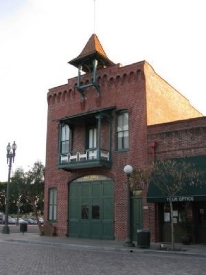
Nevada Hose Co. No. 1 occupied this firehouse from May 30, 1861 to 1938. Hand pulled hose carts, horse drawn engines and motorized pumpers all rolled out of this building to save life and property. — — Map (db m40266) HM
Fire Company formed June 18, 1860 as Eureka Hose No.2 with 34 volunteers. Name changed in August of that year to ‘Pennsylvania Engine’. Construction money raised in 1859 by popular subscription and a grand ball staged by the town’s women. This . . . — — Map (db m10832) HM
History
Today people travel swiftly along I-80 to their destinations in the Sierra, many times not even staying overnight. When they do stay overnight it is most likely in hotels or rental houses.
It was not always that way. Before I-80 . . . — — Map (db m81970) HM
Many of the kids designed water features for their play areas like the ones you
see here. This idea was incorporated into the final play area design through
the use of the dry creek running through the site. This dry creek acts as a way
to catch . . . — — Map (db m230824) HM
In 2012, Mojang, the creators of Minecraft, partnered with the United Nations Human Settlements Programme (UN-Habitat) to launch an initiative called Block by Block, which uses Minecraft to help communities reimagine public spaces.
At the . . . — — Map (db m230829) HM
Since 1920, the American Legion has had an active presence in Brea. Post #181 dedicated a structure on this site on November 8, 1924 followed by a transformation to this Mission Style building in 1931.
It housed the Brea Women's Club during . . . — — Map (db m199553) HM
The residents of Dana Point gratefully recognize Bill Steinriede's many contributions that help improve the quality of our local Dana Point beaches and ocean. Through his concern, dedication and tenacity, Bill was instrumental in energizing Dana . . . — — Map (db m190509) HM
The city council of Huntington Beach has dedicated this park to Ted W. Bartlett who served as Mayor from 1946 to 1948 and as city councilman from 1944-48, 1954-58 and 1966-78--A total of twenty years of service to his city.
A native of North . . . — — Map (db m217545) HM
Designed by artists Marilyn Brame, Misha
Ma'Heo, Aileen May, Dru Maurer, Sophia
Imai, Liz Canales, Greg Nelson, Bob
Knoke, Alisha Mather, students of the
Visual Arts School, Cal State Fullerton art
students, and Mission Viejo children.
. . . — — Map (db m230935) HM
The garden was created in 2002 after the library expansion.
It is located on the site of the "Garden of Knowledge", originally constructed as a place for library patrons to enjoy reading outdoors.
Designed and maintained by the Rose . . . — — Map (db m215645) HM
History
The Oso Creek Trail started in April 1997 as a community collaboration where volunteers gather in late spring to celebrate the Earth and the arts in Mission Viejo. The trail is nestled along the riparian corridor of the Oso Creek . . . — — Map (db m228112) HM
Artist Marilyn Brame designed the Mountain Wall in 2001, as part of the Terra Native/Celebration of the Native Land Earth Day event.
Constructed or concrete with an overlay of mosaic tiles, the Wall educates the community about the . . . — — Map (db m230933) HM
This monument is dedicated in memory of Roger Seitz, FAIA from his friends and colleagues at The Irvine Company.
He was a talented, passionate master architect and urban designer responsible for creating places for all of us to enjoy such as . . . — — Map (db m194161)
Steven Frank Ambriz was elected to the Orange City Council in 2002, becoming one of the youngest members of the Council in our City's history. Born and raised in Orange, Steve was a "Proud Panther" from Orange High School. An important personal . . . — — Map (db m224293) HM
Dedicated to the proud men and women who have put their lives on the line in order to save others. For the past 75 years, over 75,000 swimmers have been aided by these dedicated professionals. The City of San Clemente and its citizen appreciated the . . . — — Map (db m190445) HM
The San Juan Elementary School, established in 1850 in what was then Los Angeles County, is the oldest school site in Orange County. This 2.5 acre plot was originally Mission San Juan Capistrano property, and was gifted by Don Juan Forster who owed . . . — — Map (db m188643) HM
In the spring of 1974, two brothers, Pete and Jim Yyson,
from Newport Beach, California, negotiated a land
lease with the Santa Fe land and improvement company
on this site.
The original depot was built circa 1894-1895, the 1905
freight . . . — — Map (db m232716) HM
Roland Bigonger will always be remembered as one of the founding fathers of Yorba Linda. A resident of the City for 36 years, he was elected to the first City Council in 1967 and served as the City's first Mayor. He went on to serve over eight years . . . — — Map (db m196371) HM
In honor of Henry Gietzen,
Member of the Auburn Volunteer Fire Department since September 12, 1922;
Fire Chief from 1946 to present.
Dedicated in July 1974.
William Chaix, Trustee; Egar E. Ganow, Trustee; Henry Gietzen, Fire Chief; J. A. . . . — — Map (db m687) HM
Erected in 1863 – 1864
By John Ziegenbein as a general store
Sold to Herman Lohse 1879; to George Aldrich 1881;
To A.C. Fleming (& Alex Hemphill) in 1888
Bank of Lincoln, Lincoln’s first bank, here 1902 – 1911
U.S. Post . . . — — Map (db m17784) HM
May 1893: Another block fire raged on Rocklin’s Front Street; 25 businesses were destroyed and chambermaid Alice Irish lost her life. In that same year, the City of Rocklin was incorporated. Foremost on the new city’s agenda was the need for fire . . . — — Map (db m239929) HM
This park was named for and dedicated to the memory of William B. Layton by the North Lake Tahoe Historical Society.
North Lake Tahoe will miss the unselfish way the Bill worked for the community. Past General Manager of the Tahoe City Public . . . — — Map (db m143487) HM
John Vardanega, first owner of Mt. Tomba Inn, (1933-1944) designed and built this cement tank with the help of the CCC on or about 1938 for water supply in the immediate vicinity. — — Map (db m56612) HM
The unique history of this passenger car makes it one of the most important artifacts in the museum's collection. When built by the famous Pullman Company in 1917, this car was named the "Pioneer" and was part of Pullman's executive lease fleet, . . . — — Map (db m163303) HM
This unit, affectionately called a "covered wagon" was purchased to power Western Pacific's California Zephyr less than one year after the train began on March 20, 1949. This cab unit, typically joined by two cabless "B" units, hauled the train . . . — — Map (db m163295) HM
Built in 1915, the Banning Woman's Club Clubhouse is a frame building in the classical revival style with a plain entablature, simple doric columns, and palladian windows, as well as providing a meeting place for the woman's club, the socal and . . . — — Map (db m50710) HM
The first commercially significant hydroelectric plant in California, designed and built by Gustavus Olivio Newman, went into service here in 1888. Utilizing the flow of the Riverside Water Company Canal to produce about 225 kilowatts of power used . . . — — Map (db m50704) HM
Dr. June Robertson McCarroll was born June 30, 1867 in the Adirondacks and began her medical career in Chicago. She left a promising practice for Indio in 1904. Becoming the sole practicing physician for the entire Coachella Valley. She traveled by . . . — — Map (db m78540) HM
Hollywood screen and television star, Charlie Farrell, was Mayor of the City of Palm Springs from 1948-1958. While Mayor, he helped secure the return of the Airport to the City after World War II. He founded the Racquet Club with actor Ralph Bellamy . . . — — Map (db m206193) HM
The American Legion is the nation's largest wartime veterans service organization.
Post #519 was first chartered in May, 1939.
This austere war memorial building features a unique "lamella” roof created by interlocking pre-cut wood pieces . . . — — Map (db m206259) HM
In 1926, philanthropist Thomas O'Donnell (1870-1945) began construction of a private golf course, which he opened to the public in 1932. In 1936 the O'Donnell's commissioned architectural designer William Charles Tanner to design a new home which, . . . — — Map (db m206197) HM
Over a century ago, conservationist Aldo Leopold and forester Robert Marshall prompted the Forest Service to consider wilderness preservation as a worthy goal. They argued that wilderness itself was as important a resource as timber, water, or . . . — — Map (db m210760) HM
After nearly a century of timber production, parts of the San Jacinto Mountains looked like nothing more than a logging camp. Where tall trees once stood, stumps and wood debris littered the landscape. Livestock grazing also took its toll. John Muir . . . — — Map (db m210763) HM
On September 29, 1976, Cesar Chavez spoke at University Theater at UC Riverside. The Latino American civil rights leader and co-founder of the United Farm Workers (UFW) often visited campuses inviting student support of his causes.
When he . . . — — Map (db m202305) HM
Booker Taliaferro Washington visited the Mission Inn as a guest of Frank Miller in 1914. In 2004, the Black Voice News & Foundation, Inc. spearheaded a community drive and commissioned M. Bernard Edmonds to sculpt a bust of him to celebrate the . . . — — Map (db m226098) HM
The Roman Imperial front and vaulted main hall of the courthouse have been widely pictured since completion in 1904. Designed by Chicago trained architect, Franklin Pierce Burnham, it is a close copy of the Petit Palais or Fine Arts Building of the . . . — — Map (db m226069) HM
From its founding in 1870 until 1893, the community of Riverside was a part of San Bernardino County. Riverside citizens, in 1887 and in 1891 indicated their interest in moving the county seat by helping to defeat bond issues for the construction of . . . — — Map (db m226070) HM
This olive tree was planted at the Mission Inn in 1997 in honor of Dr. Donald Verleur and his wife Lois who opened the first Olive Crest Home for Abused Children in 1973. Olive Crest serves more than 10,000 at-risk children and their families in . . . — — Map (db m243330) HM
Patricia H. Birdsall (Pat) was known for her genuine love for Temecula, and for her countless hours of volunteer service for the benefit of the entire Temecula Valley.
Prior to the city's incorporation in 1989, Pat served for many years as a . . . — — Map (db m195086) HM
In 1908 Elk Grove acquired through the efforts of Miss Harriet G. Eddy, then principal of Elk Grove Union High School, the first county free library branch in California. Subsequently, California's county free library branch system has become one of . . . — — Map (db m11868) HM
Folsom Dam and Reservoir are a component of the Central Valley Project, owned and operated by the Bureau of Reclamation, Mid-Pacific Region, Central California Area Office
Construction of Folsom Dam by the Corps began in . . . — — Map (db m17644) HM
The Most Reverend Alfonso Gallegos, O.A.R., D.D. Titular Bishop of Sasabe, Auxiliary Bishop of the Diocese of Sacramento Feb. 20, 1931 – Oct. 6, 1991 “Love one another” May 24, 1958 – Ordained priest for the . . . — — Map (db m137648) HM
The house originally designed in 1857 by Seth Babson and was purchased by Leland Stanford in 1861. It served as the State Executive Office from 1861 to 1867, before the completion of the State Capital. It was later extensively remodeled and . . . — — Map (db m11842) HM
During the Gold Rush Days of 1857, the Sisters of Mercy came to Sacramento to care for the children of the miners and to serve the sick and the homeless.
In those early days, the Sisters purchased land in the heart of the city to build a . . . — — Map (db m14839) HM
This sculpture commemorates the 150th anniversary of the Sisters of Mercy caring for those in need to the greater Sacramento region. Mary Baptist Russell, California Foundress of the Sisters of Mercy, is depicted here as a woman of vision, courage . . . — — Map (db m14840) HM
An African American suffragist, civil rights activist, and poet who highlighted the
experience of African American women who were still enslaved by their inability to
vote. She also found that the white women who had organized a children's home . . . — — Map (db m171505) HM
Many early Sacramento merchants amassed significant wealth. Some moved to nearby San Francisco, others to New York and other eastern states. A number of wealthy merchant families turned to philanthropy later in their lives: Margaret Crocker built . . . — — Map (db m229832) HM
Historic Street Lights
Restored by
SACRAMENTO
MUNICPAL
UTILITY
DISTRICT
Personnel and
Traffic Signals &
Street Lighting Employees
of the
City of Sacramento
Department of Public Works
Installed by
Allen L. Bender, . . . — — Map (db m16521) HM
William Land was Sacramento’s own “Horatio Alger” – a local boy who became financially successful. As a very young boy, Land worked as a baggage handler at the Central Pacific Railroad Passenger Station. He was so efficient at picking up visitors at . . . — — Map (db m229893) HM
Curing the sick and injured was the primary mission of the Catholic Sisters of Mercy Order when they arrived in Sacramento in 1857. Not long after their arrival, the Sisters established the first Catholic School in Sacramento. In 1896, the Sisters . . . — — Map (db m229822) HM
On June 24, 1895 the Sisters of Mercy responded to the healthcare needs of the people of Sacramento by acquiring the Ridge Home, a small private hospital, from two local physicians. In 1896, the Sisters broke ground for the construction of a larger . . . — — Map (db m91585) HM
The donation of her late husband’s art collection to the city in 1885 gave Sacramento the first and finest art gallery west of the Mississippi. Other philanthropic gestures during her lifetime, which included generous support of the Protestant . . . — — Map (db m10769) HM
Plot Size: 67” by 68’
Established 1859
In purchasing this site from the Board of Trustees, Sacramento City Cemetery, July 30, 1859, the Order of Free and Accepted Masons became the first fraternal organization in Sacramento to provide . . . — — Map (db m14075) HM
6860 entries matched your criteria. Entries 201 through 300 are listed above. ⊲ Previous 100 — Next 100 ⊳