After filtering for Georgia, 520 entries match your criteria. Entries 201 through 300 are listed.⊲ Previous 100 — Next 100 ⊳
African Americans Topic
By Beverly Pfingsten, April 7, 2014
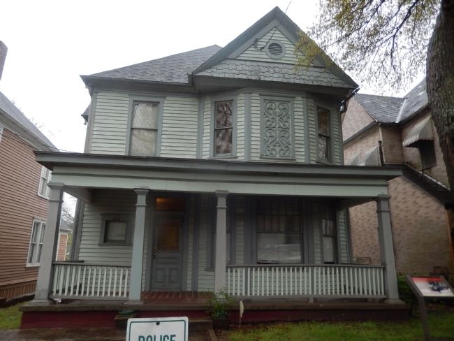
526 Auburn Avenue
| 201 ► Georgia, Fulton County, Atlanta, Old Fourth Ward — A Relaxing Atmosphere — 526 Auburn Avenue — |
| On Auburn Avenue NE. | |||
| 202 ► Georgia, Fulton County, Atlanta, Old Fourth Ward — Apartment House — 509 Auburn Avenue — |
| On Auburn Avenue NE. | |||
| 203 ► Georgia, Fulton County, Atlanta, Old Fourth Ward — Bryant Preparatory Institute — 533 Auburn Avenue — Martin Luther King, Jr., National Historic Site — |
| On Auburn Avenue NE at Howell Street NE, on the right when traveling east on Auburn Avenue NE. | |||
| 204 ► Georgia, Fulton County, Atlanta, Old Fourth Ward — Bryant-Graves House — 522 Auburn Avenue — |
| On Auburn Avenue NE. | |||
| 205 ► Georgia, Fulton County, Atlanta, Old Fourth Ward — Fire Station No. 6 — 37-39 Boulevard, N.E. — |
| Near Boulevard NE at Auburn Avenue NE, on the right when traveling north. | |||
| 206 ► Georgia, Fulton County, Atlanta, Old Fourth Ward — Harper House — 535 Auburn Avenue — Martin Luther King, Jr., National Historic Site — |
| On Auburn Avenue NE at Howell Street NE, on the right when traveling east on Auburn Avenue NE. | |||
| 207 ► Georgia, Fulton County, Atlanta, Old Fourth Ward — Historic Fire Station No. 6 |
| On Boulevard NE at Auburn Avenue NE, on the right when traveling north on Boulevard NE. Reported missing. | |||
| 208 ► Georgia, Fulton County, Atlanta, Old Fourth Ward — Middle-Class Dwelling — 497 Auburn Avenue — Martin Luther King, Jr., National Historic Site — |
| On Auburn Avenue NE east of Boulevard NE, on the right when traveling east. | |||
| 209 ► Georgia, Fulton County, Atlanta, Old Fourth Ward — Neighborhood Pride — 514 Auburn Avenue — |
| On Auburn Avenue NE. | |||
| 210 ► Georgia, Fulton County, Atlanta, Old Fourth Ward — Neighborhood Transformed — Martin Luther King, Jr., National Historic Site — |
| On Auburn Avenue NE at Howell Street NE (south leg), on the right when traveling east on Auburn Avenue NE. | |||
| 211 ► Georgia, Fulton County, Atlanta, Old Fourth Ward — Nowell Family House — 530 Auburn Avenue — Martin Luther King, Jr. National Historical Park — |
| On Auburn Avenue Northeast at Howell Street Northeast, on the right when traveling west on Auburn Avenue Northeast. | |||
| 212 ► Georgia, Fulton County, Atlanta, Old Fourth Ward — 60-10 — Our Lady of Lourdes Catholic Church — Atlanta’s First African-American Catholic Church — |
| On Boulevard NE north of Edgewood Avenue NE, on the right when traveling north. | |||
| 213 ► Georgia, Fulton County, Atlanta, Old Fourth Ward — Shotgun Houses — 472 - 488 Auburn Avenue — |
| On Auburn Avenue NE east of Boulevard NE, on the left when traveling east. | |||
| 214 ► Georgia, Fulton County, Atlanta, Old Fourth Ward — Stepping Up — 510 Auburn Avenue — |
| On Auburn Avenue NE. | |||
| 215 ► Georgia, Fulton County, Atlanta, Old Fourth Ward — The Birthplace — |
| On Auburn Avenue NE east of Bouvelard NE, on the left when traveling east. | |||
| 216 ► Georgia, Fulton County, Atlanta, Old Fourth Ward — The Home — |
| On Auburn Avenue NE. | |||
| 217 ► Georgia, Fulton County, Atlanta, Peachtree Center — 60-4 — First Congregational Church United Church of Christ — |
| On Courtland Street NE at John Wesley Dobbs Avenue NE, on the right when traveling north on Courtland Street NE. | |||
| 218 ► Georgia, Fulton County, Atlanta, Peachtree Center — Lynching in America / 1906 Atlanta Race Massacre — Community Remembrance Project — |
| On Courtland Street Northeast at John Wesley Dobbs Avenue Northeast, on the left when traveling south on Courtland Street Northeast. | |||
| 219 ► Georgia, Fulton County, Atlanta, Perkerson — 060-199 — Gilbert Memorial Cemetery — In Memory of Those Here Laid to Rest — |
| On Cleveland Avenue SW at Interstate 75, on the right when traveling west on Cleveland Avenue SW. | |||
| 220 ► Georgia, Fulton County, Atlanta, Pittsburgh — Lynching in America / The Lynching of Dennis Hubert — Community Remembrance Project — |
| On Roy Street Southwest east of Windsor Street Southwest, on the left when traveling east. | |||
| 221 ► Georgia, Fulton County, Atlanta, South Atlanta — The History of Brownsville / Brownsville and the 1906 Atlanta Race Massacre — Community Remembrance Project — |
| Near Gammon Street Southeast, 0.2 miles west of Lansing Street Southeast, on the left when traveling west. | |||
| 222 ► Georgia, Fulton County, Atlanta, South Downtown — “Expelled Because of Color” — |
| Near Capitol Avenue SW south of M.L.K. Junior Drive SE, on the left when traveling north. | |||
| 223 ► Georgia, Fulton County, Atlanta, South Downtown — Desegregation of Municipal Facilities (1961) — |
| On Mitchell Street SW east of Central Avenue SW, on the right when traveling east. | |||
| 224 ► Georgia, Fulton County, Atlanta, South Downtown — The Campaign for an Open City (1960-1964) — |
| On Forsyth Street SW, on the right when traveling south. | |||
| 225 ► Georgia, Fulton County, Atlanta, Sweet Auburn — 12 — Auburn Avenue Branch — Auburn Avenue — |
| On Auburn Avenue NE at Hilliard Street NE, on the right when traveling east on Auburn Avenue NE. | |||
| 226 ► Georgia, Fulton County, Atlanta, Sweet Auburn — F13 — Auburn Avenue Branch, Carnegie Library |
| On Auburn Avenue NE at Hilliard Street NE, on the right when traveling east on Auburn Avenue NE. Reported missing. | |||
| 227 ► Georgia, Fulton County, Atlanta, Sweet Auburn — Behold — Martin Luther King, Jr., National Historic Site — |
| On Auburn Avenue, on the left when traveling east. | |||
| 228 ► Georgia, Fulton County, Atlanta, Sweet Auburn — 060-116 — Building Together for Youth — |
| On William Holmes Borders Sr. Drive at Gartrell Street, on the left when traveling north on William Holmes Borders Sr. Drive. | |||
| 229 ► Georgia, Fulton County, Atlanta, Sweet Auburn — Cox Brothers Funeral — 380 Auburn Avenue — Martin Luther King, Jr. National Historic Site — |
| On Auburn Avenue NE west of Jackson Street NE, on the right when traveling west. | |||
| 230 ► Georgia, Fulton County, Atlanta, Sweet Auburn — 13 — Dobbs Plaza — Auburn Avenue — |
| On Auburn Avenue NE at Fort Street NE, on the right when traveling east on Auburn Avenue NE. | |||
| 231 ► Georgia, Fulton County, Atlanta, Sweet Auburn — Ebenezer Baptist Church — |
| On Auburn Avenue near Jackson Street. | |||
| 232 ► Georgia, Fulton County, Atlanta, Sweet Auburn — Ebenezer Baptist Church — |
| On Auburn Avenue at Jackson Street, on the right when traveling east on Auburn Avenue. | |||
| 233 ► Georgia, Fulton County, Atlanta, Sweet Auburn — Ebenezer Baptist Church — Martin Luther King, Jr. National Historic Site — |
| On Auburn Avenue NE east of Jackson Street NE, on the right when traveling west. | |||
| 234 ► Georgia, Fulton County, Atlanta, Sweet Auburn — Ebenezer Baptist Church Heritage Sanctuary — 407-413 Auburn Avenue — Martin Luther King, Jr., National Historic Site — |
| On Auburn Avenue NE at Jackson Street NE, on the right when traveling east on Auburn Avenue NE. | |||
| 235 ► Georgia, Fulton County, Atlanta, Sweet Auburn — Haugabrooks Funeral Home — 364 Auburn Avenue — Martin Luther King, Jr., National Historic Site — |
| On Auburn Avenue NE, 0.1 miles west of Jackson Street NE, on the right when traveling west. | |||
| 236 ► Georgia, Fulton County, Atlanta, Sweet Auburn — 10 — Heyday of Auburn Avenue — Auburn Avenue — |
| On Auburn Avenue NE at Jackson Street NE, on the right when traveling west on Auburn Avenue NE. | |||
| 237 ► Georgia, Fulton County, Atlanta, Sweet Auburn — Martin Luther King, Jr. National Historic Site — |
| On Irwin Street NE west of Boulevard NE, on the left when traveling west. | |||
| 238 ► Georgia, Fulton County, Atlanta, Sweet Auburn — Prince Hall Masonic Building — 332-334 Auburn Avenue — Martin Luther King, Jr., National Historic Site — |
| On Auburn Avenue NE at Hilliard Street NE, on the right when traveling west on Auburn Avenue NE. | |||
| 239 ► Georgia, Fulton County, Atlanta, Sweet Auburn — 9 — Religious and Fraternal Institutions — Auburn Avenue — |
| On Auburn Avenue NE at Hilliard Street NE, on the right when traveling west on Auburn Avenue NE. | |||
| 240 ► Georgia, Fulton County, Atlanta, Sweet Auburn — 8 — Soul Food Row — Auburn Avenue — |
| On Auburn Avenue NE at Fort Street NE, on the right when traveling west on Auburn Avenue NE. | |||
| 241 ► Georgia, Fulton County, Atlanta, Sweet Auburn — Sweet Auburn Walk — Martin Luther King, Jr., National Historic Site — |
| On Auburn Avenue at Jackson Street, on the left when traveling east on Auburn Avenue. | |||
| 242 ► Georgia, Fulton County, Atlanta, Sweet Auburn — The Eternal Flame — |
| On Auburn Avenue NE. | |||
| 243 ► Georgia, Fulton County, Atlanta, Sweet Auburn — 11 — The Training Ground — Auburn Avenue — |
| On Auburn Avenue NE at Boulevard NE when traveling east on Auburn Avenue NE. | |||
| 244 ► Georgia, Fulton County, Atlanta, Sweet Auburn — Wheat Street Baptist Church — 365 Auburn Avenue — Martin Luther King, Jr., National Historic Site — |
| On Auburn Avenue NE east of Hilliard Street NE, on the right when traveling east. | |||
| 245 ► Georgia, Fulton County, Atlanta, The Villages of Castleberry Hill — 60-31b — University Homes — |
| On Atlanta Student Movement Boulevard at Elm Street Southwest, on the right when traveling east on Atlanta Student Movement Boulevard. | |||
| 246 ► Georgia, Fulton County, Atlanta, Vine City — The Herndon Home — |
| On University Place NW at Walnut Street NW, on the left when traveling east on University Place NW. | |||
| 247 ► Georgia, Fulton County, Atlanta, Washington Park — Fire Station No. 16 — Erected 1963 — |
| On Joseph E. Boone Boulevard at Flowers Place, on the right when traveling east on Joseph E. Boone Boulevard. | |||
| 248 ► Georgia, Fulton County, Atlanta, Washington Park — Theodore “Tiger” Flowers — (1895-1927) — |
| On Joseph E. Boone Boulevard at Flowers Place, on the right when traveling east on Joseph E. Boone Boulevard. | |||
| 249 ► Georgia, Fulton County, East Point — Lynching in America / The Lynching of Warren Powell — Community Remembrance Project — |
| On Thompson Avenue west of Main Street (U.S. 29), on the left when traveling west. | |||
| 250 ► Georgia, Fulton County, East Point, Conley Hills — Lynching in America / The Lynching of Zeb Long — Community Remembrance Project — |
| On Warren Way south of Headland Drive, on the right when traveling south. | |||
| 251 ► Georgia, Fulton County, Roswell — Lynching in America / Lynching of Mack Henry Brown — Community Remembrance Project — |
| Near Riverside Road, 0.5 miles east of Roswell Road, on the right when traveling east. | |||
| 252 ► Georgia, Fulton County, Roswell — Pleasant Hill Baptist Church — |
| On Pleasant Hill Street at Pleasant Avenue, on the left when traveling south on Pleasant Hill Street. | |||
| 253 ► Georgia, Fulton County, Roswell — Pleasant Hill Cemetery — |
| On Old Roswell Place, 0.1 miles north of Old Roswell Road, on the right when traveling north. | |||
| 254 ► Georgia, Fulton County, Roswell — Zion Missionary Baptist Church — Circa 1871 — |
| On Zion Circle, 0.1 miles Myrtle Street, on the right when traveling north. | |||
| 255 ► Georgia, Glynn County, Brunswick — 63-5 — Colored Memorial School and Risley High School — |
| On Albany Street near H Street, on the right when traveling north. | |||
| 256 ► Georgia, Glynn County, Brunswick — Commissary - Pay Shed — Hofwyl-Broadfield Plantation State Historic Site — |
| Near Ocean Highway (U.S. 17) east of Grants Ferry Road (Georgia Route 99), on the left when traveling south. | |||
| 257 ► Georgia, Glynn County, Brunswick — Enslavement, Resistance, Creativity, and Resilience — Africans and African Americans in Georgia’s Low Country — Hofwyl-Broadfield Plantation Historic Site — |
| Near Ocean Highway (U.S. 17) south of Grants Ferry Road (Georgia Route 99), on the left when traveling south. | |||
| 258 ► Georgia, Glynn County, Brunswick — Hofwyl-Broadfield Plantation State Historic Site — |
| Near Ocean Highway (U.S. 17) south of Grants Ferry Road (Georgia Route 99), on the left when traveling south. | |||
| 259 ► Georgia, Glynn County, Brunswick — House Servants Quarters — Hofwyl-Broadfield Plantation State Historic Site — |
| Near Ocean Highway (U.S. 17) south of Grants Ferry Road (Georgia Route 99), on the left. | |||
| 260 ► Georgia, Glynn County, Brunswick — The Legacy of the Land and the Stewards of Hofwyl-Broadfield — Hofwyl-Broadfield Plantation State Historic Site — |
| Near Ocean Highway (U.S. 17) south of Grants Ferry Road (Georgia Route 99), on the left when traveling south. | |||
| 261 ► Georgia, Glynn County, Brunswick — Twentieth-Century Changes — Smokehouse to Ice House, Laundry and Automobiles — Hofwyl-Broadfield Plantation Historic Site — |
| Near Ocean Highway south of Grants Ferry Road (Georgia Route 99), on the left when traveling south. | |||
| 262 ► Georgia, Glynn County, Brunswick — Union School — Brookman Community — |
| On Gillard Terrace, 0.1 miles west of Galilee Road, on the right when traveling west. | |||
| 263 ► Georgia, Glynn County, Jekyll Island — The Wanderer — Arrival — |
| Near Beach View Drive, 0.1 miles north of South Riverview Drive. | |||
| 264 ► Georgia, Glynn County, Jekyll Island — The Wanderer — Built For Speed — |
| Near Beach View Drive, 0.1 miles north of South Riverview Drive. | |||
| 265 ► Georgia, Glynn County, Jekyll Island — The Wanderer — Cilucangy: Ward Lee — |
| Near Beach View Drive, 0.1 miles north of South Riverview Drive. | |||
| 266 ► Georgia, Glynn County, Jekyll Island — The Wanderer — Timeline — |
| Near Beach View Drive, 0.1 miles north of South Riverview Drive. | |||
| 267 ► Georgia, Glynn County, Jekyll Island — The Wanderer — Timeline: Continued — |
| Near Beach View Drive, 0.1 miles north of South Riverview Drive. | |||
| 268 ► Georgia, Glynn County, Jekyll Island — The Wanderer — What Happened to the Survivors: Their Stories — |
| Near Beach View Drive, 0.1 miles north of South Riverview Drive. | |||
| 269 ► Georgia, Glynn County, Jekyll Island — Wanderer Memory Trail — A Family Learning Experience — |
| Near Beach View Drive at South Riverview Drive. | |||
| 270 ► Georgia, Glynn County, Jekyll Island — A Life of Slavery — Wanderer Memory Trail — |
| Near Beach View Drive, 0.1 miles north of South Riverview Drive. | |||
| 271 ► Georgia, Glynn County, Jekyll Island — A Miserable Voyage — Wanderer Memory Trail — |
| Near Beach View Drive, 0.1 miles north of South Riverview Drive. | |||
| 272 ► Georgia, Glynn County, Jekyll Island — Beach Access — Historic St. Andrews Beach — |
| Near South Beachview Drive, 2.3 miles south of Jekyll Island Causeway (Georgia Route 520), on the left when traveling south. | |||
| 273 ► Georgia, Glynn County, Jekyll Island — Food — Wanderer Memory Trail — |
| Near Beach View Drive, 0.1 miles north of South Riverview Drive. | |||
| 274 ► Georgia, Glynn County, Jekyll Island — Generations — Wanderer Memory Trail — |
| Near Beach View Drive, 0.1 miles north of South Riverview Drive. | |||
| 275 ► Georgia, Glynn County, Jekyll Island — Horton House Harvest — |
| Near Riverview Drive, 0.1 miles south of Clafin Road, on the right when traveling north. | |||
| 276 ► Georgia, Glynn County, Jekyll Island — Horton House Historic Site — Warehouse Ruins — Jekyll Island — |
| On Riverview Drive, on the right when traveling south. | |||
| 277 ► Georgia, Glynn County, Jekyll Island — Horton House Historic Site — From Forest to Plantation — Jekyll Island Museum — |
| Near Riverview Drive, 0.2 miles south of Clafin Road, on the left when traveling north. | |||
| 278 ► Georgia, Glynn County, Jekyll Island — Horton House Historic Site — Age of Exploration — |
| Near Riverview Drive, 0.1 miles south of Chafin Road, on the left when traveling north. | |||
| 279 ► Georgia, Glynn County, Jekyll Island — Marched to the Sea — Wanderer Memory Trail — |
| Near Beach View Drive, 0.1 miles north of South Riverview Drive. | |||
| 280 ► Georgia, Glynn County, Jekyll Island — Memories of Home — Wanderer Memory Trail — |
| Near Beach View Drive, 0.1 miles north of South Riverview Drive. | |||
| 281 ► Georgia, Glynn County, Jekyll Island — Music — Wanderer Memory Trail — |
| Near Beach View Drive, 0.1 miles north of South Riverview Drive. | |||
| 282 ► Georgia, Glynn County, Jekyll Island — Pursuit of Freedom — Wanderer Memory Trail — |
| Near Beach View Drive, 0.1 miles north of South Riverview Drive. | |||
| 283 ► Georgia, Glynn County, Jekyll Island — Separate But Equal? — Historic St. Andrews Beach — |
| On South Beachview Drive, 2.3 miles south of Jekyll Island Causeway (Route 520), on the right when traveling south. | |||
| 284 ► Georgia, Glynn County, Jekyll Island — St. Andrews Beach — Historic St. Andrews Beach — |
| On South Beachview Drive, 2.3 miles south of Jekyll Island Causeway (Georgia Route 520), on the right when traveling south. | |||
| 285 ► Georgia, Glynn County, Jekyll Island — Strange New World — Wanderer Memory Trail — |
| Near Beach View Drive, 0.1 miles north of South Riverview Drive. | |||
| 286 ► Georgia, Glynn County, Jekyll Island — Survivors of the Wanderer — Wanderer Memory Trail — |
| Near Beach View Drive, 0.1 miles north of South Riverview Drive. | |||
| 287 ► Georgia, Glynn County, Jekyll Island — Taken From Africa — Wanderer Memory Trail — |
| Near Beach View Drive, 0.1 miles north of South Riverview Drive. | |||
| 288 ► Georgia, Glynn County, Jekyll Island — Taking Care of Family |
| On Riverview Drive, 0.2 miles south of Stable Road, on the left when traveling south. Reported permanently removed. | |||
| 289 ► Georgia, Glynn County, Jekyll Island — The Beach Pavilion — Historic St. Andrews Beach — |
| Near South Beachview Drive, 2.3 miles Jekyll Island Causeway (Georgia Route 520), on the left when traveling south. | |||
| 290 ► Georgia, Glynn County, Jekyll Island — The Dolphin Club Lounge — Historic St. Andrews Beach — |
| Near South Beachview Drive, 2.3 miles south of Jekyll Island Causeway (Georgia Route 520), on the left when traveling south. | |||
| 291 ► Georgia, Glynn County, Jekyll Island — The Dolphin Motor Hotel — Historic St. Andrews Beach — |
| Near South Beachview Drive, 2.3 miles south of Jekyll Island Causeway (Georgia Route 520), on the left when traveling south. | |||
| 292 ► Georgia, Glynn County, New Hope — 67-1 — Needwood Baptist Church and Needwood School — |
| On U.S. 17, on the right when traveling south. | |||
| 293 ► Georgia, Glynn County, St Simons Island — 63-11 — Ibo Landing: — The Legacy of Resisting Enslavement — |
| On Stable Street north of Sea Island Road, on the right when traveling north. | |||
| 294 ► Georgia, Glynn County, St. Simons Island — A Clash Of Cultures — |
| On Demere Road. | |||
| 295 ► Georgia, Glynn County, St. Simons Island — Cassina Garden Club Houses — |
| On Arthur J. Moore Drive north of Hamilton Road. | |||
| 296 ► Georgia, Glynn County, St. Simons Island — 63-10 — Hampton Plantation — |
| On Lawrence Road. | |||
| 297 ► Georgia, Glynn County, St. Simons Island — 063-7 — Slave Cabin — |
| On Frederica Road at Demere Road, on the right when traveling north on Frederica Road. | |||
| 298 ► Georgia, Glynn County, St. Simons Island — The Defender — Fort Frederica National Monument — |
| Near Mimosa Drive, 0.2 miles west of Frederica Road. | |||
| 299 ► Georgia, Gordon County, Calhoun — 064-34 — Roland Hayes — June 3, 1887 - January 1, 1977 — |
| On Oothcalooga Street at South Fair Street, on the right when traveling east on Oothcalooga Street. | |||
| 300 ► Georgia, Grady County, Cairo — 65-1 — Birthplace of Jackie Robinson — First African American in Major League Baseball — |
| On Hadley Ferry Road (County Route 154) 0.8 miles north of Meridian Road (County Route 322), on the right when traveling south. | |||
520 entries matched your criteria. Entries 201 through 300 are listed above. ⊲ Previous 100 — Next 100 ⊳