After filtering for Tennessee, 761 entries match your criteria. The first 100 are listed. ⊳
African Americans Topic
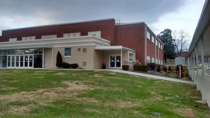
By Tom Bosse, December 30, 2017
Clinton High School Marker
| 1 ► Tennessee, Anderson County, Clinton — 1D 41 — Clinton High School — |
| On North Hicks Street at Leinart Street, on the left when traveling north on North Hicks Street. | |||
| 2 ► Tennessee, Anderson County, Clinton — Clinton Middle School — 1927 — |
| On West Broad Street, on the right when traveling west. | |||
| 3 ► Tennessee, Anderson County, Clinton — Green McAdoo School — 1935 — |
| On West Broad Street at Hillcrest Street, on the right when traveling west on West Broad Street. | |||
| 4 ► Tennessee, Anderson County, Clinton — Prelude: The Green McAdoo School — |
| On Cummings St near West Broad St. | |||
| 5 ► Tennessee, Anderson County, Clinton — ID 49 — The Rev. Paul W. Turner — 1923~1980 — |
| On North Main Street (U.S. 25W) at Cedar Street, on the right when traveling north on North Main Street. | |||
| 6 ► Tennessee, Benton County, Holladay — Fort Johnson — Controlling the Tennessee River — |
| Near Interstate 40 at milepost 130, on the right when traveling east. | |||
| 7 ► Tennessee, Bledsoe County, Pikeville — Pikeville African Methodist Episcopal Zion Church — Southeast Tennessee Religious Heritage Trail — |
| On Upper East Valley Road (Tennessee Route 209), on the right when traveling south. | |||
| 8 ► Tennessee, Blount County, Alcoa — Charles M. Hall School — |
| On East Howe Street, 0.1 miles north of North Hall Road (Tennessee Route 35), on the left when traveling north. | |||
| 9 ► Tennessee, Blount County, Alcoa — 1E 120 — Hunt Field — |
| On East Hunt Road (Tennessee Route 335) east of Russell Road, on the right when traveling east. | |||
| 10 ► Tennessee, Blount County, Alcoa — The Hall Community — |
| On East Howe Street, 0.1 miles north of North Hall Road (Tennessee Route 35), on the left when traveling north. | |||
| 11 ► Tennessee, Blount County, Maryville — Maryville During the Civil War — "A shameful...fire" — |
| Near McCammon Avenue at McGhee Street, on the left when traveling east. | |||
| 12 ► Tennessee, Blount County, Maryville — 1E 109 — William Bennett Scott, Sr. — ca. 1821 - 1885 — |
| On West Broadway Avenue at Gary H. Hensley Drive, on the right when traveling east on West Broadway Avenue. | |||
| 13 ► Tennessee, Bradley County, Cleveland — 2A 101 — College Hill School — 1883-1966 — |
| On Berry Street Northeast just south of Central Avenue Northeast, on the right when traveling north. | |||
| 14 ► Tennessee, Campbell County, LaFollette — Howard "Louie Bluie" Armstrong — 1909-2003 — |
| On East Central Avenue (Tennessee Route 25) at Armstrong Lane, on the right when traveling south on East Central Avenue. | |||
| 15 ► Tennessee, Campbell County, LaFollette — Howard "Louie Bluie" Armstrong — Tennessee Music Pathways — |
| On West Central Avenue at First Street North, on the left when traveling east on West Central Avenue. | |||
| 16 ► Tennessee, Carroll County, McKenzie — 4A 43 — Webb School — |
| On Highland Drive (U.S. 79) 0.1 miles south of Tennessee Route 22, on the left when traveling north. | |||
| 17 ► Tennessee, Carroll County, McLemoresville — 4A 58 — Reedy Creek Missionary Baptist Church — |
| On Adams Street, 0.5 miles west of Tennessee Route 105, on the right when traveling west. | |||
| 18 ► Tennessee, Carter County, Elizabethton — 28 — Betsy Walkway — Elizabethton Walking Tour — |
| On East Elk Avenue east of South Sycamore Street, on the right when traveling east. | |||
| 19 ► Tennessee, Carter County, Elizabethton — 1A 119 — Cedar Grove Cemetery — |
| On Southside Road, on the right when traveling east. | |||
| 20 ► Tennessee, Carter County, Elizabethton — 1A 148 — Elizabethton Blue Grays — 1935-1955 — |
| On Church Street at South Lynn Avenue, on the right when traveling east on Church Street. | |||
| 21 ► Tennessee, Carter County, Elizabethton — The Taylor Family — Sabine Hill State Historic Site — |
| Near West G Street (Tennessee Route 67) 0.1 miles west of Sabine Street, on the left when traveling west. | |||
| 22 ► Tennessee, Carter County, Johnson City — Gandy Dancers — |
| Near Greenlee Road at Cedar Grove Road, on the right when traveling north. | |||
| 23 ► Tennessee, Cheatham County, Ashland City — 3C 76 — Old Neptune School — 1885-1951 — |
| On New Hope Church Road, 0.1 miles west of Powers Drive, on the left when traveling west. | |||
| 24 ► Tennessee, Cheatham County, Kingston Springs — Connection To Johnsonville — U.S. Military Railroad — |
| On North Main Street north of West Kingston Springs Road, on the right when traveling north. | |||
| 25 ► Tennessee, Cheatham County, Kingston Springs — Trail Head — Site CH155 — Kingston Springs City Park — |
| On Kingston Springs, 0.1 miles west of Park Street (County Road 1931), on the right when traveling west. | |||
| 26 ► Tennessee, Clay County, Celina — 2D 31 — Free Hill(s) Community — |
| On Burkesville Highway (SR 53). | |||
| 27 ► Tennessee, Cocke County, Parrottsville — Johnson's Parrottsville Slaves — Origin of Tennessee Emancipation Day — |
| On Tennessee Route 340 at Old Hwy 321, on the right when traveling north on State Route 340. | |||
| 28 ► Tennessee, Coffee County, Tullahoma — Tullahoma Campaign — June 24-July 4, 1863 — From Contraband to United States Colored Troops — |
| On South Jackson Street (U.S. 41A) at West Volney Street, on the right when traveling south on South Jackson Street. | |||
| 29 ► Tennessee, Davidson County, Antioch — 207 — Alfred Z. Kelley — |
| On Blairfield Drive, on the right when traveling east. | |||
| 30 ► Tennessee, Davidson County, Antioch — 209 — Olive Branch Missionary Baptist Church — |
| On Cane Ridge Road, 0.4 miles north of Old Hickory Boulevard, on the right when traveling north. | |||
| 31 ► Tennessee, Davidson County, Brentwood, Antioch — 238 — Racial Terror Lynchings in America / Lynching of Samuel Smith |
| On Old Burkitt Road, 0.1 miles east of Nolensville Pike, on the right when traveling north. Reported missing. | |||
| 32 ► Tennessee, Davidson County, Donelson, Hermitage — Slave Cabins, c. 1858 — [Clover Bottom Farm] — |
| Near Lebanon Pike (U.S. 70) at Rivercrest Pass, on the right when traveling east. | |||
| 33 ► Tennessee, Davidson County, Hermitage — "Have the Negro Houses Placed Where the Old Ones Stands" — |
| On Field Quarter Trail. | |||
| 34 ► Tennessee, Davidson County, Hermitage — A home for Jackson’s Slaves — 1821-1865 — |
| Near Rachel's Lane. | |||
| 35 ► Tennessee, Davidson County, Hermitage — A Landscape Of Inequality — Enslaved Life at The Hermitage — |
| Near Rachels Lane, 0.3 miles east of Hermitage Road. | |||
| 36 ► Tennessee, Davidson County, Hermitage — A Lively Place — Finding Strength in Family and Community — |
| On Field Quarter Trail, on the left when traveling east. | |||
| 37 ► Tennessee, Davidson County, Hermitage — Abandonment and Preservation — Stories Lost, Then Found Again — |
| Near Rachel's Lane. | |||
| 38 ► Tennessee, Davidson County, Hermitage — Alfred’s Cabin — A Life of Toil — |
| Near Rachels Lane, 0.3 miles east of Hermitage Road. | |||
| 39 ► Tennessee, Davidson County, Hermitage — Determined Resistance — Fighting for Freedom — |
| On Field Quarter Trail. | |||
| 40 ► Tennessee, Davidson County, Hermitage — Field Quarter Trail — |
| Near Rachels Lane, 0.3 miles east of Hermitage Road. | |||
| 41 ► Tennessee, Davidson County, Hermitage — Field Quarter Trail — |
| 42 ► Tennessee, Davidson County, Hermitage — Ginning and Pressing "King Cotton" — Wealth Created by Enslaved Hands — |
| On Field Quarter Trail. | |||
| 43 ► Tennessee, Davidson County, Hermitage — Growing Cotton — A Risky Venture — |
| Near Rachel's Lane. | |||
| 44 ► Tennessee, Davidson County, Hermitage — Our Peace: Follow the Drinking Gourd — Memorial to the Enslaved — |
| Near Rachels Lane, 0.7 miles east of Hermitage Road, on the right when traveling east. | |||
| 45 ► Tennessee, Davidson County, Hermitage — Property, Family, Humanity — |
| Near Rachels Lane, 0.3 miles east of Hermitage Road. | |||
| 46 ► Tennessee, Davidson County, Hermitage — Stories Told by Things the Enslaved Left Behind — |
| Near Rachels Lane. | |||
| 47 ► Tennessee, Davidson County, Hermitage — The Field Quarter — Lives of Labor — |
| On Field Quarter Trail, on the left when traveling east. | |||
| 48 ► Tennessee, Davidson County, Hermitage — The Field Quarter Spring — Nourishing Body and Spirit — |
| On Field Quarter Trail, on the right when traveling north. | |||
| 49 ► Tennessee, Davidson County, Hermitage — The First Hermitage — Worlds Apart, Side by Side — |
| Near Rachels Lane, 0.3 miles east of Hermitage Road. | |||
| 50 ► Tennessee, Davidson County, Hermitage — The Hermitage Garden — An Ever Changing Delight — |
| Near Rachels Lane, 0.3 miles east of Hermitage Road. | |||
| 51 ► Tennessee, Davidson County, Hermitage — The Hermitage Landscape — 1804-1821 — |
| Near Rachel's Lane. | |||
| 52 ► Tennessee, Davidson County, Hermitage — The Hermitage Landscape — Frontier Farm to Cotton Plantation to Shrine — |
| Near Rachels Lane, 0.3 miles east of Hermitage Road. | |||
| 53 ► Tennessee, Davidson County, Hermitage — The Hermitage Mansion — Symbol of Democracy? — |
| Near Rachels Lane, 0.3 miles east of Hermitage Road. | |||
| 54 ► Tennessee, Davidson County, Hermitage — The Hermitage Overseer — Between Two Worlds — |
| On Field Quarter Trail. | |||
| 55 ► Tennessee, Davidson County, Hermitage — The Jacksons and Religion — Reflection of the Times — |
| Near Rachels Lane, 0.7 miles Hermitage Road, on the right when traveling east. | |||
| 56 ► Tennessee, Davidson County, Hermitage — The Triplex — Reclaiming the Past — |
| Near Rachels Lane, 0.3 miles east of Hermitage Road. | |||
| 57 ► Tennessee, Davidson County, Hermitage — The Work Yard — The World Behind the Mansion — |
| Near Rachels Lane, 0.3 miles east of Hermitage Road. | |||
| 58 ► Tennessee, Davidson County, Nashville — Coach Ed Temple — Tigerbelles Head Coach 1950-1994 — U.S. Olympic Coach 1960, 1964, 1980 — |
| Near Doctor Walter S Davis Boulevard west of Schrader Lane, on the right when traveling east. | |||
| 59 ► Tennessee, Davidson County, Nashville — In 1865 — [Belle Meade Farm Freedom] — Belle Meade Plantation |
| Reported permanently removed. | |||
| 60 ► Tennessee, Davidson County, Nashville — 3A 156 — Juno Frankie Pierce — |
| On West Heiman Street at Ed Temple Boulevard, on the right when traveling west on West Heiman Street. | |||
| 61 ► Tennessee, Davidson County, Nashville — Kitchen Garden History — |
| Near Hogan Road. | |||
| 62 ► Tennessee, Davidson County, Nashville — 99 — Lake Providence Community — |
| On Nolensville Pike (Alternate U.S. 31) at Winston Avenue West, on the right when traveling south on Nolensville Pike. | |||
| 63 ► Tennessee, Davidson County, Nashville — Slave Burials — Belle Meade Plantation — |
| Near Harding Pike (U.S. 70S) 0.2 miles north of Leake Avenue, on the right when traveling north. | |||
| 64 ► Tennessee, Davidson County, Nashville — Slave Cabin — Belle Meade Plantation — |
| Near Harding Pike (U.S. 70S) 0.1 miles north of Leake Avenue, on the right when traveling north. | |||
| 65 ► Tennessee, Davidson County, Nashville — 3A 124 — Tennessee State University — |
| On Centennial Boulevard/John A Merritt Boulevard, on the left when traveling east. | |||
| 66 ► Tennessee, Davidson County, Nashville — 69 — Tennessee State University — |
| 67 ► Tennessee, Davidson County, Nashville — The Caldwell Years — Tennessee Agricultural Museum — |
| Near Hogan Road. | |||
| 68 ► Tennessee, Davidson County, Nashville — The Natchez Trace — Belle Meade Plantation — |
| Near Harding Pike (U.S. 70S) 0.2 miles north of Leake Avenue, on the right when traveling north. | |||
| 69 ► Tennessee, Davidson County, Nashville, Arts District — 3A 223 — Nashville Sit-Ins — |
| On 5th Avenue North north of Church Street, on the left when traveling north. | |||
| 70 ► Tennessee, Davidson County, Nashville, Arts District — 3A 139 — Sarah Estell — |
| On 5th Avenue North north of Church Street, on the left when traveling north. | |||
| 71 ► Tennessee, Davidson County, Nashville, Belle Meade Links — In 1807 — [Harding Cabin] — Belle Meade Plantation — |
| Near Leake Avenue east of Harding Pike (U.S. 70S). | |||
| 72 ► Tennessee, Davidson County, Nashville, Bordeaux — 3A 267 — The Gold Coast — |
| On Windover Drive at Ashland City Highway (State Highway 12), on the right when traveling west on Windover Drive. | |||
| 73 ► Tennessee, Davidson County, Nashville, Chestnut Hill — 3A 123 — Hubbard House — |
| On 1st Avenue South just south of Mildred Shute Avenue, on the right when traveling south. | |||
| 74 ► Tennessee, Davidson County, Nashville, Chestnut Hill — 3A 184 — Lieutenant Henry Alvin Cameron 1875-1918 / Cameron School — |
| On 1st Avenue South just south of Crenshaw Street, on the right when traveling north. | |||
| 75 ► Tennessee, Davidson County, Nashville, College Heights/Clifton — 3A 177 — Preston Taylor — Minister, Entrepreneur, and Business Leader — 1849-1931 — |
| On Clifton Avenue at 39th Avenue, on the left when traveling east on Clifton Avenue. | |||
| 76 ► Tennessee, Davidson County, Nashville, Crieve Hall — Battle of Nashville / Peach Orchard Hill — |
| Near Farrell Parkway west of Stillwood Drive, on the right when traveling west. | |||
| 77 ► Tennessee, Davidson County, Nashville, Downtown — African Methodist Episcopal Church Sunday School Union — |
| Near 3rd Avenue North north of Union Street, on the right when traveling north. | |||
| 78 ► Tennessee, Davidson County, Nashville, Downtown — 3A 180 — Avon N. Williams, Jr. — 1921-1994 — |
| On Charlotte Avenue just west of YMCA Way, on the left when traveling west. | |||
| 79 ► Tennessee, Davidson County, Nashville, Downtown — 83 — Black Churches of Capitol Hill — |
| On Charlotte Avenue at McLemore Avenue, on the right when traveling west on Charlotte Avenue. | |||
| 80 ► Tennessee, Davidson County, Nashville, Downtown — Jeffrey Lockelier — |
| Near Union Street North at 1st Avenue North, on the right when traveling west. | |||
| 81 ► Tennessee, Davidson County, Nashville, Downtown — 232 — John Robert Lewis — Feb. 21, 1940 - July 17, 2020 — |
| On Commerce Street just west of St. Cloud Alley, on the left when traveling west. | |||
| 82 ► Tennessee, Davidson County, Nashville, Downtown — Lynching in America / The Lynchings of Henry and Ephraim Grizzard — Community Remembrance Project — |
| On 1st Avenue North at Union Street North, on the right when traveling north on 1st Avenue North. | |||
| 83 ► Tennessee, Davidson County, Nashville, Downtown — 87 — Nashville Sit-Ins — |
| On Rosa Parks Blvd at Charlotte Avenue on Rosa Parks Blvd. | |||
| 84 ► Tennessee, Davidson County, Nashville, Downtown — Post-Emancipation Violence in America / Lynching and the Subversion of Legal Rights — Community Remembrance Project — |
| On 1st Avenue North north of Bank Street, on the right when traveling north. | |||
| 85 ► Tennessee, Davidson County, Nashville, Downtown — 210 — Rev. Nelson G. Merry — "Nashville's First Ordained African American Minister" — 1824-1884 — |
| On Nelson Merry Street at 10th Avenue North, on the right when traveling east on Nelson Merry Street. | |||
| 86 ► Tennessee, Davidson County, Nashville, Downtown — Robert "Black Bob" Renfro — |
| Near 3rd Avenue North north of Union Street, on the right when traveling north. | |||
| 87 ► Tennessee, Davidson County, Nashville, Downtown — Welcome to Frankie Pierce Park — |
| On LifeWay Plaza at 10th Avenue North, on the left when traveling west on LifeWay Plaza. | |||
| 88 ► Tennessee, Davidson County, Nashville, Downtown — Welcome to Frankie Pierce Park — |
| On Nelson Merry Street, on the right when traveling west. | |||
| 89 ► Tennessee, Davidson County, Nashville, Downtown — Witness Walls — Walter Hood — 2017 — |
| On James Robertson Parkway, on the right when traveling east. | |||
| 90 ► Tennessee, Davidson County, Nashville, East Nashville — 124 — First Baptist Church — East Nashville — |
| On Main Street just east of North 6th Street, on the left when traveling east. | |||
| 91 ► Tennessee, Davidson County, Nashville, East Nashville — 3A 188 — Meigs School — The First African American High School in Nashville — |
| On Ramsey Street just west of North 8th Street, on the right when traveling west. | |||
| 92 ► Tennessee, Davidson County, Nashville, East Nashville — 180 — Rock City — |
| On Ann Street at Rock City Street, on the right when traveling west on Ann Street. | |||
| 93 ► Tennessee, Davidson County, Nashville, Edgehill — 3A 138 — DeFord Bailey — 1899-1982 — |
| On Edgehill Avenue at 12 Avenue South on Edgehill Avenue. | |||
| 94 ► Tennessee, Davidson County, Nashville, Edgehill — 68 — Edmondson Home Site — |
| On 14th Avenue South north of Wade Avenue, on the right. | |||
| 95 ► Tennessee, Davidson County, Nashville, Edgehill — 227 — History of Edgehill — |
| On Edgehill Avenue, 0.1 miles west of Hillside Avenue, on the right when traveling west. | |||
| 96 ► Tennessee, Davidson County, Nashville, Edgehill — 3A 245 — William Edmondson Studio and Home Site — |
| On 14th Avenue South at Wade Avenue, on the right when traveling north on 14th Avenue South. | |||
| 97 ► Tennessee, Davidson County, Nashville, Fang — 3A 122 — Academic Building At Fisk University — |
| 98 ► Tennessee, Davidson County, Nashville, FANG — 3A 136 — Carl Van Vechten Art Gallery — |
| On Jackson St., on the right when traveling west. | |||
| 99 ► Tennessee, Davidson County, Nashville, FANG — 213 — Clark Memorial United Methodist Church — |
| On 14th Avenue North at Phillips Street, on the right when traveling north on 14th Avenue North. | |||
| 100 ► Tennessee, Davidson County, Nashville, FANG — 3A 154 — Cravath Hall — |
| Near 17th Avenue North. | |||
761 entries matched your criteria. The first 100 are listed above. Next 100 ⊳