On N. Yandes St south of E. Adams St, on the right when traveling south.
As Indiana's 42nd governor 1965-1969, championed equal opportunity in education and housing. Earned degrees from Franklin College and Harvard University. Deputy prosecutor of Johnson and Brown counties 1926-1929. Practiced law in Franklin, . . . — — Map (db m66820) HM
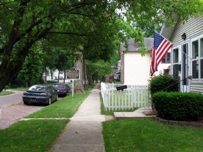
Near West South Street at Ninevah Street, on the right when traveling west.
Founder and proprietor of Franklin,
IN. Leader in the establishment of
Johnson County, 1822. Founder of
the First Presbyterian Church, Postmaster, Justice of the Peace and
benefactor of Franklin College as
donor of its original site and . . . — — Map (db m221851) HM
Near West South Street at Ninevah Street, on the right when traveling west.
born in Cannonsburg, PA, came to Indiana in 1819; elected Clerk of the Indiana House of Representatives in 1820; chosen first Judge of the New Purchase in 1822; first Judge to hold court in Indianapolis; held first court in Johnson County at John . . . — — Map (db m221852) HM
On North 2nd Street north of Busseron Street, on the right when traveling north.
Abner Turner Ellis, a Borough President, Probate
Judge, and State Senator, promoted the Charter of
Ohio & Miss. R. R. (later a part of B & O) and was
its first president. His stately home was built by John Moore about 1838.
Abraham Lincoln . . . — — Map (db m23286) HM
On Park Street east of East Scott Street, on the right when traveling east.
On July 4, 1800, the western part of the
Northwest Territory became the Indiana Territory.
It covered land that would eventually be included
in the present states of Indiana, Illinois, Michigan,
Wisconsin, and Minnesota.
Vincennes, on the . . . — — Map (db m23266) HM
On North 4th Street at Buntin Street, on the right when traveling west on North 4th Street.
Site of first Courthouse in Indiana Territory -
1813 to about 1834. Was starting point in 1821
for survey of Indiana - Illinois boundary.
Present structure, probably built in 1850's,
became home of Hon. Wm. E. Niblack, Congressman,
Indiana . . . — — Map (db m23278) HM
On Park Street south of Harrison Street, on the left when traveling south.
Two blocks South of this marker
on March 6, 1814, was born
Sarah Knox Taylor
Daughter of
Capt. And Mrs. Zachary Taylor
Miss Taylor married Lieut. Jefferson Davis
at Louisville, Kentucky on June 17, 1835
and died in West Feliciana . . . — — Map (db m23263) HM
On North 2nd Street north of Hart Street, on the right when traveling north.
Built about 1830 by Samuel Judah, distinguished
pioneer lawyer who won the famous land grant case
for Vincennes University in the U. S. Supreme Court.
Occupied from 1848 to 1865 by Dr. John Isidore Baty,
builder of the three story addition. . . . — — Map (db m23306) HM
On Park Street west of Harrison Street, on the right when traveling west.
Harrison became Governor of Indiana Territory 1800; he administered government of District of Louisiana 1804-1805. In Vincennes, he served as a contact during the expedition; surviving records document his support and his involvement in decisions . . . — — Map (db m23251) HM
Near North Old Fort Knox Road, 0.1 miles south of Lower Fort Knox Road, on the left when traveling south.
The governor of Indiana Territory and commander in-chief of the militia, being charged by the President of the United States with a military expedition, takes command of the troops assigned, that is: The detachment of regular troops . . . — — Map (db m226424) HM
On South High Street at East Center Street, on the left when traveling north on South High Street.
This third county jail, including a sheriff’s residence, was built in 1870 by Richard Epperson. Chicago architect, George O. Garnsey designed it in Neo-Gothic Style. Rusticated stonework and turrets create the appearance of a small castle to provide . . . — — Map (db m1625) HM
On West Center Street west of South Buffalo Street, on the right when traveling east.
A sculpture created by Indiana artist
John Mishler
tribute to
Mary Ellen Rudisel-Jordan
1951-2013
Architect and designer of Warsaw City Hall
Made possible by those inspired by Mary Ellen's ability to "lift us up" through her work and . . . — — Map (db m240947) HM
The Old Courthouse has been, since its erection in 1878, a landmark in Lake County, Indiana. Construction of the central portion, including the clock tower, began with 500,000 hand-kilned bricks from the Henry Wise Brickyard in Crown Point, . . . — — Map (db m27806) HM
On Madison Street north of Madison Lane, on the right when traveling north.
U.S. Representative Katie Hall, standing second from left, witnesses along with other national dignitaries as Ronald Reagan, 40th President of the United States of America, signs federal legislation establishing a national holiday honoring the . . . — — Map (db m241793) HM
On Massachusetts Street, on the right when traveling north.
Gary City Hall - Gary Tillery's Mayor Richard G. Hatcher Statue
This statue honors Mayor Hatcher, one of the first two black mayors to be elected in major cities in the U.S. The bronze statue celebrates this . . . — — Map (db m241908) HM
On East Michigan Boulevard (U.S. 12) at Pine Street on East Michigan Boulevard.
Assassinated President Abraham Lincoln’s funeral was April 19, 1865 at the White House. The funeral train left for Springfield, Illinois April 21 directed by military; stops en route allowed the public to pay homage. From Indianapolis, train . . . — — Map (db m60670) HM
Near North Illinois Street at West Railroad Street, on the left when traveling north.
At approximately 7:30 A.M. on the morning of May 1, 1865, the train that bore the body of Abraham Lincoln passed through Wanatah on its way from Washington to Springfield, Illinois. The train did not stop here, but slowed down to 5 miles per hour . . . — — Map (db m207793) HM
On Indiana's Historic Pathways - North Spur (U.S. 50) 0.4 miles east of Connerly Cemetery Road, on the left when traveling west.
This marker is on the northern boundary of the Vincennes Tract, the first Indian cession obtained by Governor William Henry Harrison in the Indiana Territory.
The treaty was signed by chiefs of the Miami, Delaware, Shawnee, Potawatomi, Eel . . . — — Map (db m243588) HM
Republican Presidential candidate delivered his acceptance speech at Callaway Park, August 17, 1940.
Willkie’s Democrat opponent, Franklin D. Roosevelt, won the 1940 election and later appointed Willkie to Britain as a liaison during World . . . — — Map (db m243329) HM
Here in Callaway Park August 17, 1940, Willkie accepted Republican party presidential nomination after a nationwide grassroots campaign. An estimated crowd of 250,000 was in the park and along adjacent streets. Established campaign headquarters in . . . — — Map (db m1186) HM
Combines two nineteenth-century architectural styles. Built 1850s-1860 in Italianate Style. Later additions in Second Empire Style. Owners included Hervey Bates, Sr., first Marion County sheriff, Thomas A. Hendricks, U.S. vice president, and John . . . — — Map (db m1827) HM
Lawyer and Publicist. Col. 70th Reg. Ind. Vol. War 1861-1866. Brevetted Brigadier General 1866. U.S. Senator, 1881-1887. President 1889-1893. Statesman, yet friend to truth, of soul sincere, action faithful and in honor clear. — — Map (db m93165) WM
Near Nortn Blackford Street north of Indianapolis Cultural Trail, on the right when traveling north.
In the early 1900s, people from around the nation and world traveled through Boone County's rich farmland to view the courthouse in Lebanon. Built with 38-foot high columns, each carved from a single block of limestone, the courthouse is situated on . . . — — Map (db m238761) HM
On West Walnut Street east of North Capital Avenue, in the median.
Franklin Delano Roosevelt (FDR) and Anna Eleanor Roosevelt (AER) were one of the first power couples in American politics. FDR's sweeping vision helped rescue the United States from the worst economic depression in its history and led the country . . . — — Map (db m132850) HM
Near North Blackford Street north of Indianapolis Cultural Trail, on the right when traveling north.
Nestled in Harrison County's wooded hills and pastures, Corydon holds significant importance in Indiana's history. The city served as capital of the Indiana Territory and then as the first Indiana state capital. In 1863, John Hunt Morgan's . . . — — Map (db m238855) HM
On East Saint Clair Street east of North Meridian Street, on the right when traveling west.
President of the
Continental Congress which framed
the Ordnance of 1787
Governor of the
Territory Northwest of the River Ohio
1788 - 1802
Under his control were laid the
broad foundations of the future Commonwealths of
Ohio · . . . — — Map (db m132853) HM WM
On N. Blackford Street near W. New York Street, on the right when traveling north.
Born 1786 in New Jersey; admitted to the bar 1810. Residing in Vincennes, Indiana Territory in 1815; later elected Speaker of the first state House of Representatives. In September 1817, Governor Jennings appointed Blackford to Indiana Supreme . . . — — Map (db m60668) HM
On North Blackford Street at West Michigan Street, on the right when traveling south on North Blackford Street.
Jones Tabernacle African Methodist Episcopal Zion Church, the fourth oldest African American church in Indianapolis, ministered to this neighborhood for almost a century. Organized in 1872, the church was named in honor of the Right Reverend . . . — — Map (db m132757) HM
Near North Blackford Street north of Indianapolis Cultural Trail, on the right when traveling north.
The Capital Commission, meeting near what would become the junction of the National Road and White River, identified the location as the site for the new state capital in 1822. Alexander Ralston and Elias P. Fordham, influenced by Pierre Charles . . . — — Map (db m238989) HM
On Hine Street east of Limestone Street, on the right when traveling east.
John W. McCormick (1791-1825) was one of the first European-American pioneers of Indianapolis, settling near the eastern end of the former Washington Street Bridge in 1820. He built one of the first taverns in the area. In June of 1820, the tavern . . . — — Map (db m132743) HM
On Alabama Street just north of East North Street, on the right when traveling north.
Social reformer Roberta West Nicholson moved to Indianapolis ca. 1925. She co-founded the Indiana Birth Control League in 1932, renamed Planned Parenthood. As state representative, Nicholson sponsored a 1935 “Heart Balm Bill” that outlawed suing . . . — — Map (db m210951) HM
On Lockerbie Street east of East Street, on the left when traveling east.
“Hoosier Poet” James Whitcomb Riley (1849-1916) gained widespread fame performing across the U.S. from 1881-1903 and for poems written in rustic Hoosier dialect, such as “Little Orphant Annie.” He lived in this house, owned . . . — — Map (db m127999) HM
Prominent lawyer of Indianapolis; Keynote convention speaker, 1896; United States Senator, 1897-1905; Vice-President of the United States, 1905-1909; and Vice-Presidential candidate in 1916. — — Map (db m1849) HM
Near South Capitol Avenue at West Washington Street, on the right when traveling south.
The son of a Kentucky farm couple, Abraham Lincoln was a self-educated man. During his childhood, his family moved to Indiana and later to Illinois. Lincoln's unusual height (6 feet 4 inches) and strength gave him an advantage at many physical . . . — — Map (db m187304) HM
On West Washington Street west of North Capitol Avenue, on the right when traveling west.
First in War
First in Peace
First in the Hearts of His Countrymen
"Observe good faith and justice toward all nations. Cultivate peace and harmony with all. Religion and morality enjoin this conduct."
George Washington . . . — — Map (db m232884) HM
On West Washington Street west of North Capitol Avenue, on the right when traveling west.
Two times Governor of Indiana planted this Bald Cypress on the State House ground on April 29, 1949
Olive Inez Downing originator of "Each Governor Plant A Tree" — — Map (db m233068) HM
On West Washington Street at North Capitol Avenue, on the right when traveling west on West Washington Street.
Trailblazing African American lawyer and Indianapolis native Harriette Bailey Conn graduated from Crispus Attucks High School in 1937. After graduating from Indiana University’s Law School in 1955, she became a Deputy Attorney General for the . . . — — Map (db m210960) HM
On West Washington Street (U.S. 40) at South Missouri Street, on the right when traveling west on West Washington Street.
“…it is your business…if the Union of these States, and the liberties of this people, shall be lost.... It is your business to rise up and preserve the Union....”
From speech by President-elect Abraham Lincoln at intersection of . . . — — Map (db m564) HM
On West Washington Street west of North Capitol Avenue, on the right when traveling west.
Planted and dedicated on April 26, 1946 in honor of Governor Ralph E. Gates
Attended by Miss Olive Inez Downing originator of "Each Governor Plant A Tree Program" — — Map (db m233082) HM
Near North Senate Avenue south of West Ohio Street, on the right when traveling south.
State Senator, 1969-1972
Lieutenant Governor, 1973-1980
45th Governor of Indiana, 1981-1989
United States Ambassador to Singapore, 1989-1992
Appointed by President George H.W. Bush
Robert Dunkerson Orr was born in Ann Arbor, . . . — — Map (db m232659) HM
On North Capital Avenue near West Market Street, on the right when traveling south.
State capital was moved to Indianapolis, 1825, from Corydon. The capital built on this site in 1835 was razed in 1878 to make way for this State House, completed in 1888. — — Map (db m63953) HM
On West Washington Street at North Capitol Street on West Washington Street.
Vice President of the United States
with Democrat President Grover Cleveland, 1885
Born September 7, 1819, near Zanesville, Ohio
Died November 25, 1885, Indianapolis, buried at Crown Hill Cemetery
Represented Shelby County: . . . — — Map (db m100033) HM
On North Delaware Street at East Alley 1200 North, on the left when traveling north on North Delaware Street.
Benjamin Harrison-citizen soldier, lawyer, U.S. Senator, and 23rd President of the United States-was a unifying force at a time of deep division, a statesman of character whose abiding love for the nation he led can still be felt in the tradition . . . — — Map (db m238642) HM
On North Delaware Street north of East 11th Street, on the left when traveling north.
Entered the Union Army as 2nd Lt. of the 70th Indiana Regiment. He insisted on turning raw recruits into disciplined soldiers. He later was United States Senator from Indiana and the twenty-third President of the United States. — — Map (db m565) HM
On North Delaware Street south of East 13th Street, on the left when traveling north.
Home
of
Benjamin Harrison
23rd President of the
United States
Born August 20, 1833
Died March 13, 1901
Indiana's Own Citizen
In command of the
70th . . . — — Map (db m132870) HM
On North Meridian Street at West Fall Creek Parkway South Drive and East 25th, on the right when traveling north on North Meridian Street.
Built in 1917, this Neo-Classical, reinforced concrete arch bridge was designed by nationally prominent landscape architect, George Kessler. In 1991 the bridge was named in honor of State Representative Joseph Summers, who served with distinction as . . . — — Map (db m1854) HM
On North Delaware Street just north of East 15th Street, on the left when traveling north.
Hoosier author Meredith Nicholson gained prominence in the Golden Age of Indiana Literature (c. 1880-1920) for best-selling novels, starting with The Main Chance (1903). He wrote The House of a Thousand Candles (1905) in this house, . . . — — Map (db m169256) HM
Here on the evening of April 4, 1968, Kennedy came to address a large crowd of mostly African Americans in his bid for Democratic Party nomination for president of U.S. Instead, visibly shaken, he gave an impromptu speech about the assassination of . . . — — Map (db m236) HM
On North Delaware Street at East Alley 1200 North, on the left when traveling north on North Delaware Street.
The Benjamin Harrison Presidential Site is a treasured national historic landmark. It is recognized as one of Indiana's premier cultural attractions, serving tens of thousands of students and visitors each year. The nationally significant . . . — — Map (db m238643) HM
On West Georgia Street west of South Meridian Street, in the median.
The son of Indiana's sixth governor, Lew Wallace was a man of boundless ambition and restless spirit. Born April 10, 1827, in Brookville, Ind., Wallace was a lawyer, soldier, politician and author. A Mexican War veteran, he led the 11th Indiana . . . — — Map (db m187302) HM
On East Georgia Street east of South Meridian Street, in the median.
The 16th President of the United States was born February 12, 1809, near Hodgenville, Ky. In the harsh Kentucky wilderness that the young Abraham Lincoln and his family called home, settlers struggled to eke out a living on hardscrabble farms. . . . — — Map (db m132821) HM
On West Georgia Street west of South Capitol Avenue, in the median.
The grandson of President William Henry Harrison, Benjamin Harrison was born Aug. 20, 1833, in North Bend, Ohio. The 23rd President of the United States graduated Miami University (Ohio) before opening a law office in Indianapolis in 1854. . . . — — Map (db m132831) HM
In memory of Chief Menominee and his band of 859 Pottawatomie Indians removed from this Reservation Sept. 4, 1838 by a company of soldiers under command of General John Tipton, authorized by Governor David . . . — — Map (db m36122) HM
On East Main Street (Business U.S. 24) at North Huntington Street, on the right when traveling west on East Main Street.
Founding member of the National League of Women Voters
Time capsule buried 2022
To be opened in 2072
"I believe women will bring to our body politic an independence of action and clarity of thought unhampered by precedents, . . . — — Map (db m240733) HM
On East Wabash Avenue near South Water Street, on the right when traveling west.
(front)
Lane (1811-1881) began political career as a state legislator, 1837. Served in U.S. Congress, 1840-43 and 1861-67. In 1860, as a part of a Republican Party Strategy to win state offices, Lane was elected governor and served two days . . . — — Map (db m199965) HM
On East Washington Street just east of North Graham Street, on the left when traveling east.
A reform-minded Republican lawmaker, Emmett Forest Branch (1874-1932) served Indiana as a legislator, lieutenant governor, and governor. He served in the Spanish-American War and WWI. Branch spent three terms in the Indiana House of . . . — — Map (db m210975) HM
Near State Road 16, 0.3 miles east of South 335 East when traveling east.
Republican presidential candidate William Taft toured the country by train in 1908, a change in strategy from earlier “front porch” campaigns. The tour began with a September 23 stop at the “Hazelden” estate of journalist and playwright George Ade, . . . — — Map (db m231147) HM
On West 1500 South, 0.1 miles east of First Street, on the right when traveling east.
McCray worked in banking and grain dealing and later bred Hereford cattle at his Orchard Lake Stock Farm in Newton County. He served on state charitable and agricultural boards, before entering state politics in 1915 as a Republican gubernatorial . . . — — Map (db m231146) HM
On Main Street at North Orange Street, on the right when traveling west on Main Street.
Albion - Noble County Seat
The Center - later named Albion was chosen the Seat of Noble County Indiana by the vote of its citizens in August 1846.
Since that time three courthouses have been located on this square.
The first which . . . — — Map (db m53950) HM
Near North Front Street at Fourth Street, on the left when traveling south.
Obtained several thousand acres near Rising Sun in 1803 then left in 1804 for Cincinnati to practice law. Brown became Ohio's 7th governor in 1818, retired to Rising Sun in 1836, then was an Indiana State Representative from 1841-43 — — Map (db m222372) HM
Near South Front Street south of Main Street, on the left when traveling south.
The great-grandfather of U.S. Senator Bob Dole. Talbott purchased a mill on the Rising Sun riverfront in 1847 built by Moses Turner in 1827. The mill burnt in 1889. Senator Dole visited the site of the former mill in 1998. — — Map (db m222438) HM
Near South Front Street south of Main Street, on the left when traveling south.
Born near Rising Sun in 1847 and served in the Civil War at age 16. In 1879, Works served one term in the Indiana Legislature. He later became a California Supreme Court Justice and, in 1911, a U.S. Senator. — — Map (db m222417) HM
Near South Front Street south of Main Street, on the left when traveling south.
Moved to Rising Sun from Ohio in 1844. Downey was elected to the Indiana State Senate in 1862 and the Indiana State Supreme Court in 1870. He also was a Brigadier-General in the Indiana Legion. — — Map (db m222413) HM
Near South Front Street north of 1st Street, on the right when traveling north.
Key civic leaders and Rising Sun First, a community action group, worked in concert to pas the November 1993 Riverboat Gaming Referendum and successfully lobbied the Indiana Gaming Commission to approve a casino gaming development on June 30, 1995. — — Map (db m222689) HM
Near South Front Street north of 1st Street, on the right when traveling north.
In July 1996, the City of Rising Sun implemented a revenue sharing plan where other local municipalities and counties benefited quarterly from gaming revenue received. The plan, a first of its kind in Indiana, is used as a model throughout the . . . — — Map (db m222694) HM
On South Maple Street south of West Jefferson Street, on the right when traveling south.
Side A:
Orleans was platted March 11, 1815. This town square, called Congress Square, was part of the plat. Orleans Academy was built here 1866, in operation by 1867. In 1870s, the Academy was purchased, and its building was made part . . . — — Map (db m22064) HM
Near Old 36 Road (County Road 168) west of Neysville Road, on the right when traveling west.
Gov. Jos. A. Wright
1810 — 1867
Atty. In Rockville 1829 – 1849
Gov. Of Indiana 1949 – 1857
Minister of U.S.A. to Prussia
Parke Co. Historical Society — — Map (db m59830) HM
On West Ohio Street (U.S. 36) west of South Jefferson Street, on the right when traveling east.
In February, 1824, this site was chosen as the permanent seat of justice for Parke County. Eight men christened the town-to-be in honor of the ancient boulders found here. — — Map (db m8927) HM
On County Road S325W north of County Road S550W, on the right when traveling north.
The first business in Parke County was a grist mill built near here by Chauncey Rose and associates in 1819.
This was the first flatboat landing in the county; territorial court was held here and this was a stop for stagecoaches. — — Map (db m164853) HM
On Ohio River Scenic Byway (Indiana Route 66) 0.2 miles east of Girl Scout Road, on the right when traveling west.
Dedicated to Abraham Lincoln and the Lincoln ideals and to the old Perry County of his boyhood years (1816-1830) Lincoln-Humble-Homely-Lonely-Gifted-Great — — Map (db m243582)
On U.S. 40 east of County Road S900W, on the right when traveling west.
Runs northwest-southeast through this point. On September 30, 1809, Indiana Territorial Governor, William Henry Harrison, obtained for the United States almost three million acres from the Potawatomi, Delaware and Miami tribes. — — Map (db m18880) HM
On Indiana Route 32, on the right when traveling west.
Born in Randolph Co. circa 1828 to Quaker family, Way was advocate for women’s rights and temperance. Founding member of Indiana Woman’s Rights Association, 1851; participant in “Whisky Riot” here, 1854; and nurse in Civil War. She . . . — — Map (db m120249) HM
On West Franklin Street west of South Main Street, on the right when traveling west.
Governor Isaac Gray (b. 1828) moved to Union City in 1855 where he became a merchant, Colonel, banker, lawyer and politician. He became Lt. Gov. in 1876 and then the 18th Gov. of Indiana (1880-81) In 1884 Gray was elected the 20th Gov. of Indiana . . . — — Map (db m222272) HM
On West Franklin Street at South Main Street, on the right when traveling west on West Franklin Street.
He was a lawyer, businessman, and descendant of the Goodrich family that settled in Randolph County in 1832. He served as Governor from 1917 to 1921, during which time he established many of the State's departments such as banking, highways and . . . — — Map (db m222247) HM
On West Washington Street (a.k.a. St. Rd. 32) at South Main Street, on the right when traveling east on West Washington Street (a.k.a. St. Rd. 32).
Established in 1818 and was split off the north end of Wayne County with Winchester made the County Seat. 1820 - 1825 the County included all Territory North to the Michigan Line. Until 1836, included Territory North to Allen County. The 1875 . . . — — Map (db m31376) HM
Near West Franklin Street at South Main Street, on the right when traveling west.
In addition to being the home of Indiana governors Isaac P. Gray (1828-1895) and James P. Goodrich (1864-1940), Randolph County has been the launching point for many other important state and national political and governmental leaders and jurists. . . . — — Map (db m222259) HM
On North Main Street, on the left when traveling north.
When Ripley County was formed in 1818, its name was inspired by the popular War of 1812 hero Eleazer Wheelock Ripley.
He was born April 15, 1782, in Hanover, New Hampshire. Ripley graduated from Dartmouth College (founded by his namesake . . . — — Map (db m100055) HM
On East Tyson Street at North Washington Street, on the left when traveling east on East Tyson Street.
Side One
Born 1808 Ontario County, New York. Moved with family to Ripley County, 1820. Prominent abolitionist and orator, delivering powerful anti-slavery speeches throughout the area, often against public sentiment. Was active in . . . — — Map (db m45873) HM
On State Road 44 west of Airport Road, on the left when traveling west.
Lawyer and business leader - Republican presidential nominee, 1940 - the only native Hoosier to be nominated for the Presidency by a major political party - author of One World - grave and memorial in East Hill Cemetery, Rushville. — — Map (db m66844) HM
On North Main Street (State Road 3) at N. Park Blvd, on the right when traveling south on North Main Street. Reported missing.
Lawyer and business leader – Republican presidential nominee, 1940 – the only native Hoosier to be nominated for the Presidency by a major political party – author of One World – grave and memorial in East Hill Cemetery, Rushville. — — Map (db m228129) HM
On North Main St (State Road 3) at East 2nd St, on the right when traveling north on North Main St. Reported permanently removed.
Lawyer and business leader – Republican presidential nominee, 1940 – the only native Hoosier to be nominated for the Presidency by a major political party – author of One World – grave and memorial in East Hill Cemetery, Rushville. — — Map (db m222134) HM
On East 2nd Street east of Main Street (State Road 3), on the right when traveling east.
Lawyer and business leader - Republican presidential nominee, 1940 - the only native Hoosier to be nominated for the Presidency by a major political party - author of One World - grave and memorial in East Hill Cemetery, Rushville. — — Map (db m232129) HM
On North Park Boulevard west of North Main Street (Indiana Route 3), on the right when traveling south.
In Memory of
Thomas H. Barnes
In deepest appreciation for his service to his country, his community and his fellow Veterans, we dedicate Veterans Memorial Bridge in his honor.
ET1(SS), USS Narwhal SSN 671 (1964-1972)
Rush County . . . — — Map (db m223505) HM WM
On East McClain Avenue at South Main Street, on the right when traveling east on East McClain Avenue.
Side A:
County formed by Indiana General Assembly 1820. First county seat located at Lexington; first courthouse built 1821. Several attempts made 1822-1870 to move county seat to more central location, creating animosity among . . . — — Map (db m22063) HM
On N. Harrison St at E. Mechanic St, on the right when traveling north on N. Harrison St.
Outstanding lawyer; member Indiana legislature; delegate, Second Constitutional Convention, 1850-1851; Indiana Congressman, 1851-1855; United States Senator, 1863-1869; Governor of Indiana, 1873-1877; and Vice-President of the United States, 1885. — — Map (db m63820) HM
On County Route 300E, 0.3 miles south of Lewis Street, on the right when traveling north.
Now he belongs to the ages
- Edwin M. Stanton, Lincoln's Secretary of War, 1865
Explore the life of Abraham Lincoln, the man called the Great Liberator, through five National Park Service sites and memorials. . . . — — Map (db m178223) HM
Near South 5th Street, 0.1 miles south of Seminary Street, on the left when traveling south.
The following is a selection from a biography of Daniel Grass by his great granddaughter, Miss Laura Wright. Written for Southwestern Indiana Historical Society, date unknown.
Daniel Grass was two and a half years old when his father was . . . — — Map (db m207214) HM
On Main Street at South 3rd Street, on the right when traveling east on Main Street.
General James C. Veatch was born in Harrison County, Indiana, December 19, 1819, and died December 21, 1895 at Rockport. His great-grandfather was a soldier in the Revolutionary War.
In 1838, after teaching one term of school in Luce Township, he . . . — — Map (db m207161) HM