On Greenwood Avenue (Connecticut Route 302) at Library Place, on the right when traveling west on Greenwood Avenue.
“I was born and reared in an atmosphere of merriment my natural bias was developed and strengthened by the associations of my youth; and I feel myself entitled to record the sayings and doings of the wags and eccentricities of Bethel because . . . — — Map (db m69926) HM
Near Noble Avenue north of Crown Street, on the left when traveling north.
Status: Threatened
Formerly an endangered species due to poaching, their population has increased thanks to environmental awareness programs at zoos like Connecticut's Beardsley Zoo.
Near Noble Avenue north of Crown Street, on the left when traveling north.
Size: up to 12.5 feet in length[;] up to 6.5 feet at the shoulders
Weight: up to 2,500 lbs[;] males larger than females
Lifespan: 15-20 years in the wild[;] up to 40 years in captivity
Habitat: grasslands . . . — — Map (db m230894) HM
Near Noble Avenue north of Crown Street, on the left when traveling north.
It is estimated that between 1970 - 1983, the Amur leopard lost 80% of its former territory. Indiscriminate logging, forest fires and land conversion for farming are the main causes. There is still hope. Large tracts of forest, which are ideal . . . — — Map (db m230916) HM
Near Noble Avenue north of Crown Street, on the left when traveling north.
AZA Tiger Conservation Campaign
Connecticut's Beardsley Zoo supports the Amur Tiger Conservation projects sponsored by the AZA Tiger Species Survival Plan. The first survey of Amur tigers in the 1930's estimated that only 20 - 30 remained . . . — — Map (db m230926) HM
Near Noble Avenue north of Crown Street, on the left when traveling north.
The eagle's drastic decline in the mid-20th century has been attributed to the widespread use of the pesticide DDT. In a process called biological magnification (brought brought forth to the general public by Rachel Carson in her book Silent . . . — — Map (db m230922) HM
Near Noble Avenue north of Crown Street, on the left when traveling north.
Size: 34-43 inches in length
Weight: males 8-9 lbs, females 10-14 lbs
Wingspan: 6-7.5 feet
Lifespan: 25 to 30 in the wild[;] up to 60 years in captivity
Habitat: lakes, rivers and seacoasts
Diet: fish, . . . — — Map (db m230923) HM
Near Noble Avenue north of Crown Street, on the left when traveling north.
Size: 1.5-2.5 feet at shoulder
Weight: 66-88 pounds
Lifespan: Up to 9 years
Habitat: Dry thorn forests, plains and marshes of South America
Diet: Cacti, tubers, fruits, flowers
Near Noble Avenue north of Crown Street, on the left when traveling north.
Height at shoulder: 21 - 24 inches
Weight: 150 to 300 lbs
Habitat: Farms across Europe, Africa and the United States
Diet: Shrubs, weeds, bird eggs, mice grasshoppers, roots, tubers, even manure
Status: This . . . — — Map (db m230939) HM
Near Noble Avenue north of Crown Street, on the left when traveling north.
Size: no taller than 34 inches, measured at the top of the shoulders
Weight: between 150 and 350 pounds
Lifespan: from 25 to 35 years
Found in many nations, particularly in Europe and the Americas
Near Noble Avenue north of Crown Street, on the left when traveling north.
Wolves have been brought to near extinction, mainly due to conflicts with humans.
1630 - Present
Bounty Hunting for Wolves
In 1630, Massachusetts colonists passed the first wolf bounty law in America. They sought to eliminate wolves . . . — — Map (db m230845) HM
Near Noble Avenue north of Crown Street, on the left when traveling north.
White tigers are not a separate species. All white tigers in North America are the descendants of a single tiger captured in 1951. Generations of inbreeding have increased the frequency of the white coat. Because of this inbreeding and the . . . — — Map (db m230928) HM
On Broad Street at State Street, on the right when traveling south on Broad Street.
Bridgeport
"The Park City"
The area that is now Bridgeport was settled in the mid-17th century by farmers from the older towns of Stratford and Fairfield. Centers of settlement were Stratfield, present North Avenue; Pembroke, now Old Mill Green; . . . — — Map (db m91834) HM
On Golden Hill Street at Lafayette Square, on the right when traveling south on Golden Hill Street.
In memory of the construction workers who died at L'Ambiance Plaza April 23, 1987
Michael Addona • Augustus Allman • Glenn Canning • Mario Colello • Francesco D’Adonna • William Daddona • Donald Emanuel • Vincent Figliomeni • Herbert Goeldner, . . . — — Map (db m91977) HM
On Broad Street at State Street, on the right when traveling south on Broad Street.
Lewis Howard Latimer
September 4, 1848 – December 11, 1928
Considered one of the 10 most important black inventors in US history. Lewis Latimer was renowned for his work with the Edison Pioneers. Of his many inventions and patents, his most . . . — — Map (db m91836) HM
On Waldemere Avenue at Park Avenue, on the left when traveling west on Waldemere Avenue.
[Inscription on the street (east) side]
This Memorial Arch was erected
AD MCMXVIII to the memory of
William Hunt Perry
of Bridgeport Conn by his wife
Harriet Adelaide Perry
[Inscription on the park side]
This Memorial . . . — — Map (db m27166) HM
On Main Street at Wooster Street, on the left when traveling north on Main Street.
Eight families came from Norwalk in 1685 to settle this area which the Indians called Pahquioque. They built their first homes a half mile south of here and made this green their common. The General Court in October 1687 decreed the . . . — — Map (db m22836) HM
On Main Street at West Street, on the right when traveling north on Main Street.
Although local folklore credits a man by the name of Zadoc Benedict with the start of hatting in Danbury after the Revolutionary War, hatters are thought to have been at work in the Danbury community before that time.
After the . . . — — Map (db m71237) HM
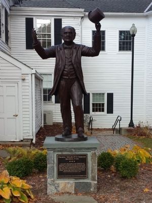
On Main Street (Connecticut Route 53) just south of West Street, on the right when traveling north.
Entertainment in Danbury has taken many forms. Buffalo Bill's Wild West Show and traveling circuses that passed through town competed with church-related activities and civic events.
The Taylor Opera House, built in 1870 provided first . . . — — Map (db m230137) HM
On West Street at Foster Street, on the right when traveling west on West Street.
• First recorded census taken in 1756, Danbury’s population: 1,527.
• Danbury’s first mayor, elected in 1888, was Lewis LeGrand Hopkins.
• The first train arrived on the tracks of the Danbury & Norwalk Railroad on March 1, 1851.
• . . . — — Map (db m152995) HM
On West Street at Foster Street, on the right when traveling west on West Street.
Throughout its history, countless women have contributed to Danbury and the lives of its citizens. Here are just a few that have left their mark on our community.
Mary Bull (1812-1882) dedicated her life to attending the poor and needy of . . . — — Map (db m71247) HM
On Wooster Street near Grand Street, on the right when traveling east.
The artificers, who produced and distributed goods for the army during the American Revolution, may have fueled the start of Danbury’s early manufacturing activities. During the years following the war, Danbury began its transition from a . . . — — Map (db m71474) HM
On Deer Hill Avenue near Wooster Street, on the right when traveling north.
Over 300 patents were issued to residents of Danbury between 1800 and 1890, one of the earliest was issued to D. Hoyt in 1838 for a door hinge.
Many inventions can be attributed to progress and practical conveniences including an oven, a . . . — — Map (db m71350) HM
On Main Street at Chapel Place, on the right when traveling south on Main Street.
An important aspect of Danbury’s growth as a regional center was the proliferation of banks.
The Savings Bank of Danbury began conducting business in 1849 when George W. Ives set up shop in the Ives homestead on Main Street. As noted by . . . — — Map (db m71138) HM
On Main Street near Elm Street, on the right when traveling south.
The first newspaper printed in Danbury was called The Farmer’s Journal and the year was 1790.
By 1837, The Danbury Times was churning out a weekly paper on a small wooden press that printed one side of a page at a time. During the . . . — — Map (db m71135) HM
On Kennedy Avenue at Main Street, on the left when traveling east on Kennedy Avenue.
The intersection of Main Street with White and Elm Streets, known as Wooster Square became an increasingly important section of town with the completion of the Danbury and Norwalk Railroad depot on Main Street in 1851.
As the main route . . . — — Map (db m72855) HM
On Brookside Road north of Stephen Mather Road, on the left when traveling north.
A Historic Home
The Mather Homestead was built in 1778 by Deacon Joseph Mather, son of Reverend Moses Mather, a fiery patriot and the Minister of Middlesex Parish (now the First Congregational Church in Darien), for 62 years. He lived in . . . — — Map (db m226764) HM
On Meeting House Lane, 0.1 miles west of Hillside Road, on the left when traveling east.
At the Sign of The Black Horse here Rufus Putnam, Tallyrand, Don Juadenes, Rufus King, Joel Barlow and Tapping Reeve were guests — — Map (db m27563) HM
Near Old Post Road at Beach Road, on the right when traveling north.
Fairfield's prominence brought many important visitors to town, including President George Washington, who recorded his October 16, 1789 visit in his journal. The newly inaugurated president of the United States likely spent the night at Samuel . . . — — Map (db m203404) HM
Near Old Post Road at Beach Road, on the right when traveling north.
This tidal marsh was once part of a network of wetlands that covered hundreds of acres and extended south to Long Island Sound, east to Ash Creek and west to Pine Creek. For centuries the area's native inhabitants, the Unquowa, fished and . . . — — Map (db m204276) HM
On Main Street (Connecticut Route 25) 0.1 miles north of Knollwood Street, on the right when traveling north.
Stepney
1801
Bridgeport / Newtown Turnpike
The forerunner of CT Route 25. Five toll stations were located along this road. Travelers would be stopped by a pole or “pike” across the road attached to a base. Upon paying a few . . . — — Map (db m25342) HM
On Main Street (Connecticut Route 25) at Easton Road (Connecticut Route 59), on the right when traveling south on Main Street.
Stepney
ca 1855
Site of the Burr Hawley &
Burritt General Store
At this site farmers assembled horse teams & wagons to bring milk to the milk station & to buy feed, hay and grain; residents purchased sewing supplies, groceries & . . . — — Map (db m25338) HM
On Oenoke Ridge (Connecticut Route 124) at Pinney Road and Lukes Wood Road, on the right when traveling north on Oenoke Ridge.
Site of the Home of Henry A. Pinney (1836-1905). The shoe factory owned by Mr. Pinney was located on land opposite his home on slightly over three acres of land at the corner of Lukes Wood and Oenoke. The factory, built in 1870, produced women’s . . . — — Map (db m26136) HM
On Seaview Avenue at East Avenue, on the left when traveling south on Seaview Avenue.
The Mill Pond was created, probably in the 1700s, by diking a natural coastal inlet, save for a narrow channel that would power a mill wheel. Seaview Avenue and Veterans Park were later built on more landfill. Other businesses, most notably hat . . . — — Map (db m53482) HM
On Calf Pasture Beach Road, on the left when traveling east.
Year-round at Calf Pasture, you’ll see people reaping the bounty that Long Island Sound provides. You can participate too, but be sure to first obtain the required permits and then obey all applicable requirements and restrictions. These measures . . . — — Map (db m53470) HM
On Bailey Avenue at Main Street (Connecticut Route 35), on the left when traveling east on Bailey Avenue. Reported missing.
Louis Bailey (1819-1899), a prominent member of the community, created Bailey Avenue for the purpose of building stores and residences, and for access to the train depot on Prospect St. He was an incorporator of the Ridgefield Savings Bank, a . . . — — Map (db m31998) HM
On Main Street (Connecticut Route 35) at King Lane, on the right when traveling north on Main Street.
On September 23, 1780, on his way through American lines to New York City, Major John Andre of the British Army was captured, taken prisoner and brought to American headquarters in South Salem, N.Y. Andre had plotted with General Benedict . . . — — Map (db m32002) HM
On Governor Street at Main Street (Connecticut Route 35), on the right when traveling west on Governor Street.
Hiram K. Scott set up the town's first variety and drug store in 1853. Scott was an influential businessman, serving as postmaster, town clerk, probate judge and a druggist for 50 years. He sold his store to Harvey Bissell in the summer of . . . — — Map (db m31587) HM
On Grove Street at Prospect Street, on the right when traveling south on Grove Street.
The Home of George G. Scott, located on Prospect Street, was razed in 1964 to make way for Ridgefield Arms, the first apartment complex to be built in Ridgefield. Scott, a descendant of the original Scott family was Judge of Probate . . . — — Map (db m230133) HM
On Ethan Allen Highway (U.S. 7) at Branchville Road (Connecticut Route 102), on the right when traveling north on Ethan Allen Highway.
A Small Village began to emerge in the area in 1852 with the opening of the Danbury-and-Norwalk Railroad line. Stores, a hotel, a post office, a school and small industries in the area were establishes. The building that housed the Branchville . . . — — Map (db m31967) HM
On Main Street, on the right when traveling north.
Built as a farmhouse in 1713 on Lot#2 by David Hoyt, it was sold to his grandson Timothy Keeler, who converted it into an inn/tavern in 1772. The Keeler Tavern, which also served as a post office, was inherited by Anna Keeler, Timothy’s . . . — — Map (db m23411) HM
On Catoonah Street at Main Street (Connecticut Route 35), on the right when traveling east on Catoonah Street.
The Fire District in Ridgefield was organized in 1896 following the devastating fire of 1895. Ex-Governor Phineas Lounsbury was an early benefactor of the Department and the new engine company took his name. The firehouse is also the site of . . . — — Map (db m32050) HM
On Ethan Allen Highway (U.S. 7) at Branchville Road (Connecticut Route 102), on the right when traveling north on Ethan Allen Highway.
The Bridgeport Wood Refinishing Company and Silex Mills had a plant on the eastern side of Route 7, north of the Branchville train station, and a much larger one at the intersection of Branchville Road and Route 7 along the newly built branch . . . — — Map (db m31966) HM
On Main Street (Connecticut Route 35) at Bailey Avenue, on the right when traveling north on Main Street.
The East Side of Main Street as it appeared the day after the devastating fire of 1895. (See Panel #17 for a description of the fire.)
Barhite & Valden General Store and the Western Union telegraph office next door were located just . . . — — Map (db m31585) HM
On Catoonah Street at Main Street (Connecticut Route 35), on the left when traveling east on Catoonah Street.
Whitlock's Livery, later the Sperry Livery stable, was across the street from the firehouse. Whitlock ran a stage to the Branchville station before the branch line was built in 1870. The livery stable also boarded horses, including those used . . . — — Map (db m32051) HM
On Prospect Street at Bailey Avenue, on the right when traveling west on Prospect Street.
In 1870, A Branch Line from the Branchville train station was built to offer service to the wealthy New Yorkers who began arriving to spend their summers in Ridgefield. Many of these "summer people" had their own private railroad cars. . . . — — Map (db m31591) HM
On Bailey Avenue at Main Street (Connecticut Route 35), on the right when traveling east on Bailey Avenue.
The small, white octagonal building on the corner was originally built as a boathouse on the estate of F.E. Lewis. It was moved behind the high school on East Ridge during World War II, and used as a warming hut for volunteers looking for . . . — — Map (db m31590) HM
On Main Street (Connecticut Route 35) at Catoonah Street, on the right when traveling south on Main Street.
Henry Mead and His Wife are seen standing on the stoop of their grocery store in the early part of the 20th century. The building was moved when Ridgefield Hardware built their new store in 1948. Today Ridgefield Hardware is one of the oldest . . . — — Map (db m31937) HM
On Main Street (Connecticut Route 35) at Bailey Avenue, on the right when traveling south on Main Street.
The International Order Of Odd Fellows, Pilgrim Lodge No. 45 was established in Ridgefield in 1847, meeting in the Masonic Hall until 1895 when the structure was destroyed in the Great Fire. The Odd Fellows built their own building in 1928 and . . . — — Map (db m31970) HM
On N Salem Road (Connecticut Route 116) at New Street, on the right when traveling south on N Salem Road.
Mills first appeared along the Titicus River in the early part of the 18th century. Sawmills, the first to come, permitted the proprietors to build frame houses instead of rough log cabins. Titicus also boasted the largest tannery in town, which . . . — — Map (db m23609) HM
Near Canal Street East, 0.1 miles Bridge Street when traveling north.
The Shelton locks from Housatonic River to the canal system were built in 1867, allowing canal boats to be raised through 3 sets of locks by water entering each lock, one at a time, raising the boat approximately 10 feet. It was then brought forward . . . — — Map (db m27118) HM
On Atlantic Street at Main Street, on the right when traveling north on Atlantic Street.
The Stamford Lincoln
Dedicated
July 11, 1995 to Honor
Frank D. Rich, Sr.
(1894 – 1990)
Citizen
Patriot Veteran
City Builder
----------
Si monumentum requiris
circumspice
If you would see his monument
look around . . . — — Map (db m38608) HM
Near Church Hill Road (Connecticut Route 127) near Main Street (Connecticut Route 111), on the left when traveling north.
A Salute to Women – Veterans Day 1999
Our community honors mothers, wives, daughters and sisters
who during times of war joined their uniformed men in service
as well as “kept the home fires burning”
unselfishly entering . . . — — Map (db m26086) HM
On Elm Street, 0.1 miles east of Main Street, on the right when traveling east.
On this site stood an African-American neighborhood hidden behind Main Street and Elm Street. Buildings here were given "½" numbers as street addresses. The residents made up the majority of Westport's African-American population, many of whom . . . — — Map (db m226766) HM
On Jesup Road at Taylor Place, on the right when traveling east on Jesup Road.
Jennings Trail
Jesup Green
Here stood the William H. Jessup House
Later owned by William Taylor.
On the river the Jessups built wharves
and warehouses in the late 18th
century where grain was stored awaiting
export by sail. The . . . — — Map (db m30645) HM
Near Myrtle Avenue, 0.1 miles north of Avery Place, on the right when traveling north.
Indigenous people frequented this area for thousands of years before the arrival of Europeans in the 17th century. In 1637, native Paugussets were driven away after the Great Swamp Fight between the larger Pequot tribe and European colonizers. In . . . — — Map (db m226768) HM
On Crescent Drive, on the right when traveling south.
For many years an icehouse stood on the southern shore of Birge Pond at the site of the present-day parking lot. In the days before refrigeration, ice was an important commodity and Birge Pond was the largest supplier of ice to the City of . . . — — Map (db m93046) HM
On Jacob Street at Tulip Street, on the right when traveling west on Jacob Street.
Albert F. Rockwell
1862 – 1925
Inventor, manufacturer, public-
spirited citizen. He gave to the
city this park and contributed
liberally to its development.
His initiave and counsel were
of great value in the civic
and . . . — — Map (db m34281) HM
On River Road (Connecticut Route 179), on the left when traveling north.
Canoe Club, circa 1910- The club house was near the present-day nursery.
Note: The house in back was lost in the flood of 1955
Ice on the river, Circa 1900
View of the river from the tracks, Circa 1910
Station, circa 1911, . . . — — Map (db m92462) HM
On Torrington Avenue (Connecticut Route 179) at Bridge Street, on the right when traveling north on Torrington Avenue.
This powerhouse was built in 1935 to house a low-head, Francis-type turbine and a General Electric remote controlled generator. The turbine and generator were purchased by The Collins Company from a municipality in Lenoir, North Carolina and . . . — — Map (db m92548) HM
On Front Street at Main Street, on the right when traveling south on Front Street.
This building was built in 1865. Here, plows were assembled, painted, labeled and stored. By 1870, the Collins Company was producing 100 plows a day.
The introduction of the tractor and gasoline powered farm equipment eventually made hand . . . — — Map (db m93373) HM
Located at the west end of Farmington, the village of Unionville was first recognized as
such by the U.S. Postal Service in 1834. Earlier it was called Langdon’s Quarter and
then Union District. Residents took full advantage of the Farmington . . . — — Map (db m134927) HM
Unionville has used Farmington River water power since the late 1700s. The first dam (item D1 on map 1 and Photograph P1), built circa 1780, was just 200 yards upstream from the Route 4 bridge. The canal from this dam was on the west side of . . . — — Map (db m95986) HM
On Main Street south of Mahl Avenue, on the right when traveling south.
Reed moved to Hartford in 1916, where she would attend Hartford High School and Hartford Federal College.
She joined WPA's Negro Theatre Project in Hartford in her mid-twenties, and would appear in plays such as "Trilogy in Black," "Porgy," . . . — — Map (db m230471) HM
On Main Street north of Seyms Street, on the right when traveling south.
Johnson came to Hartford in 1916. She and her husband co-owned the only Black-owned funeral services company in the state of Connecticut at the time.
She co-founded the Colored Women's League in 1917 and was its president. Her organization . . . — — Map (db m230466) HM
Near Columbus Boulevard at State Street, on the right when traveling north.
This plaza is dedicated in honor of William "Bill" Mortensen – whose life is an inspiration to a new generation of Hartford residents. Born in Hartford, Bill Mortensen graduated from Hartford High School, and became one of the city's leading . . . — — Map (db m52618) HM
On Central Row near 800 Main Street, on the right when traveling west.
In recognition of the lasting
contribution toward a better life for the
People of Connecticut – especially for
those of greater Hartford by
William H. Putnam
With Ability – Courage – Devotion and
vision he served his . . . — — Map (db m52784) HM
On Main Street north of St. Monica's Avenue, on the right when traveling south.
Born in St. Andrew, Jamaica, he immigrated to Connecticut in 1951, where he opened a real estate and insurance company.
Elected to Hartford's city council in 1965, he battled to assist low-income families in purchasing homes for eight years. . . . — — Map (db m230481) HM
On Main Street at Tower Avenue, on the right when traveling north on Main Street.
Born in Georgia, Hales moved to Hartford in the 1950s and opened a coin-operated laundry and electronics business on Albany Avenue. — — Map (db m230478) HM
On Wethersfield Avenue at Stonington Street, on the right when traveling north on Wethersfield Avenue.
On the grounds which his taste beautified by the home he loved this memorial stands to speak of his genius his enterprise and his success and of his great and loyal heart
His wife in faithful affection
dedicates this memorial . . . — — Map (db m52335) HM
On Hilliard Street at Adams Street, on the right when traveling west on Hilliard Street.
Hilliard Mills
One of the early woolen mills in the country was established here by Aaron Buckland in 1794. In 1832 he sold it to Samuel Pitkin who made Elisha Hilliard a partner in 1832, later in 1871 Hilliard became sole owner. Blankets were made . . . — — Map (db m98747) HM
Near West Main Street at Cedar Street, on the left when traveling west.
Cornelius B. Erwin 1811 – 1885
Cornelius Erwin was one of New Britain's greatest benefactors and an original shareholder in the Walnut Hill Park Company. He built several successful businesses including Russell & Erwin Manufacturing Company, . . . — — Map (db m41763) HM
Near West Main Street at Cedar Street, on the left when traveling west.
Frederick H. North
1824 – 1907
Frederick North was born in New Britain on August 10, 1824. After graduating from Yale University in 1846, he entered the manufacturing business with his father and later joined with Oliver Stanley and John B. . . . — — Map (db m41765) HM
Near West Main Street at Cedar Street, on the left when traveling west.
Frederick T. Stanley 1802 – 1883
Frederick Trenck Stanley was an early civic leader and a successful industrialist. The development of Walnut Hill Park arose from one of Stanley's visionary projects, the development of a water works. Stanley . . . — — Map (db m41767) HM
Near West Main Street at Cedar Street, on the left when traveling west.
George M. Landers 1813 – 1895
George Landers, another member of the Walnut Hill Park Company, was a giant among nineteenth century industrialists. Born in Lenox, Massachusetts, he came to New Britain at the age of sixteen and learned the . . . — — Map (db m41764) HM
Near West Main Street at Cedar Street, on the left when traveling west.
Henry E. Russell 1816 – 1893
A member of the Walnut Hill Park Company, Henry Russell was one of New Britain's leading industrialists of the nineteenth century. He is primarily remembered for his partnership in the Russell and Erwin . . . — — Map (db m41766) HM
On Bank Street at Columbus Boulevard, on the left when traveling east on Bank Street.
Leo A. Milewski Park
This park in the heart of our city symbolizes our deep and
abiding spirit of renewal. It is gratefully dedicated to
Leo A. Milewski, 1910 – 1969
Whose faith and courage while serving as Chairman of the . . . — — Map (db m41474) HM
Near West Main Street at Cedar Street, on the left when traveling west.
William B. Stanley
William Stanley was one of New Britain's earliest and most progressive manufacturers. Stanley, in partnership with his brother, Frederick Stanley, began the manufacture of door locks in New Britain in 1831 – the first . . . — — Map (db m41755) HM
On Church Street at Old Main Street, on the right when traveling north on Church Street.
The first farmers in this area were the Indigenous people who lived along the Connecticut River. Artifacts from this first farming community were uncovered at the Morgan Trench archaeological dig in the rock Hill Great Meadows. Surface finds, . . . — — Map (db m230804) HM
On Old Main Street at Center Street, on the right when traveling south on Old Main Street.
The history of Rocky Hill is entwined with the Connecticut River. Flowing past our 4 mile shoreline, on its 410 mile trip from northern New Hampshire to Long Island Sound, the river has been a major factor in our town's growth and development as . . . — — Map (db m230797) HM
On Meadow Road (Connecticut Route 160) at Ferry Lane, on the right when traveling north on Meadow Road.
Nation's oldest continuously operating ferry. Since 1655, public transportation across the Connecticut River has been provided at this site, connecting the towns of Rocky Hill and Glastonbury, both formerly parts of Wethersfield. Motive power has . . . — — Map (db m45766) HM
On Hopmeadow Street (U.S. 202) 0.1 miles south of West Street (Connecticut Route 167), on the right when traveling north.
Now known as Ensign-Bickford Industries, Inc., the company traces its origins to 1836, when Simsbury’s Richard Bacon formed a partnership with an English firm to manufacture a product called a safety fuse.
Invented by Englishman William . . . — — Map (db m140672) HM
On Main Street at Sullivan Avenue, on the left when traveling north on Main Street.
Post Office & Store
From this building dry goods and groceries were offered to the public for over 200 years. The Store, operated in 1727 by Nathan Day, was discontinued in 1962. One of the oldest, this Post Office, the only one known to be in an . . . — — Map (db m114006) HM
On Palisado Ave at Bissell's Ferry Road on Palisado Ave.
This marks the road to Bissell’s Ferry, established by the General Court of Connecticut in 1641. Operated by the Bissell family for nearly one hundred years. Later leased to various townsmen and continuously operated until 1917. The original . . . — — Map (db m65727) HM
The Warham Mill was established by Mr. John Warham, first minister to the Windsor Church, in 1640. The Mill has been in continuous use as a grist mill to the present day. Tradition says it was the first grist mill in Connecticut. — — Map (db m219574) HM
Near East River Road, 1.7 miles south of Connecticut Route 20.
Charcoal production was an important industry in northwestern Connecticut in the nineteenth century.
Before Pennsylvania coal became readily available, the iron forges in Litchfield County were reliant upon locally produced charcoal as . . . — — Map (db m112226) HM
Careful inspection of the ground behind this sign reveals a raised circular mound about 30 feet in diameter, surrounded by a narrow, circular depression. The unnatural shape and bits of charcoal under the leaf layer are the telltale signs of an old . . . — — Map (db m141061) HM
On Riverton Road (Connecticut Route 20) at Robertsville Road, on the right when traveling south on Riverton Road.
In Honor of Lambert Hitchcock, (1795 – 1852), this village was once known as Hitchcocks-ville. Here he originated his chairs & cabinet furniture with Sheraton influence and in 1826 built his water powered mill employing a hundred persons. In 1866 . . . — — Map (db m29887) HM
282 entries matched your criteria. The first 100 are listed above. Next 100 ⊳