By Cajun Scrambler, July 8, 2017
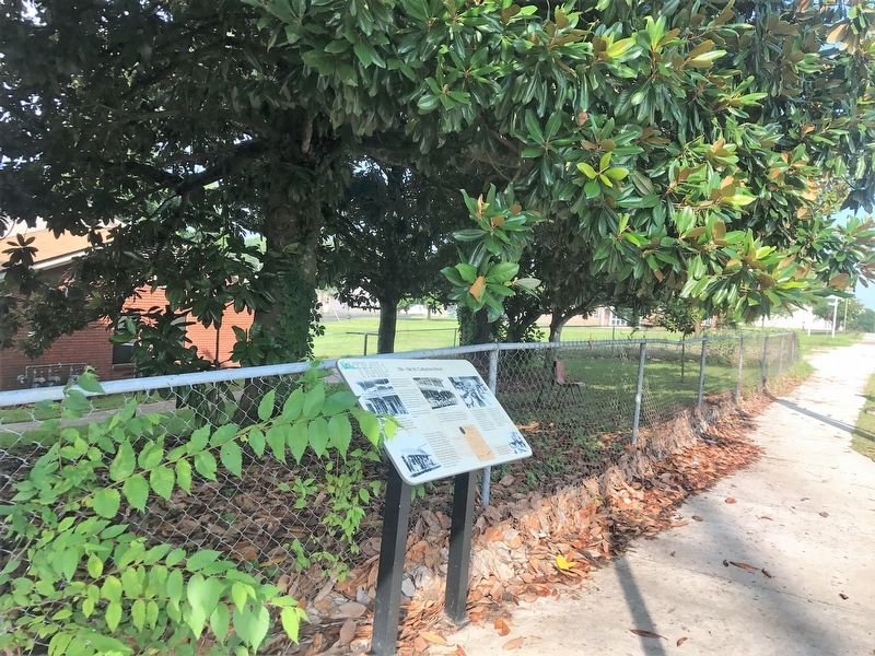
156-166 St. Catherine Street Marker
| On St. Catherine Street, 0.2 miles west of McCabe Street, on the left when traveling west. |
| On Martin Luther King Street at St. Catherine Street & Jefferson Street, on the left when traveling north on Martin Luther King Street. |
| On St. Catherine Street east of Junkin Street, on the right when traveling west. |
| On Franklin Street at North Wall Street, on the left when traveling east on Franklin Street. |
| Near N. Broadway Street north of Main Street, on the right when traveling south. |
| On Main Street at South Canal Street, on the left when traveling west on Main Street. |
| Near John R Junkin Drive (Business U.S. 61) 0.5 miles south of Lower Woodville Road, on the right when traveling south. |
| On Liberty Road south of St. Catherine St. (U.S. 61), on the right when traveling north. |
| On High Street at North Rankin Street, on the right when traveling east on High Street. |
| On North Pearl Street at Jefferson Street, on the right when traveling north on North Pearl Street. |
| On North Rankin Street at Jefferson Street, on the right when traveling south on North Rankin Street. |
| On Jefferson Street near North Union, on the right when traveling west. |
| On Main Street at Canal Street, on the left when traveling north on Main Street. |
| On Main Street at South Wall Street, on the left when traveling west on Main Street. |
| On Franklin Street at North Pearl Street, on the left when traveling east on Franklin Street. |
| On South BroadwayStreet near Washington Street, on the right when traveling south. |
| On Jefferson Street west of North Rankin Street, on the right when traveling west. |
| On S. Broadway St at Bontura Street, on the right when traveling south on S. Broadway St. |
| On Franklin Street east of North Pearl Street, on the right when traveling east. |
| On Silver Street east of South Broadway Street, on the right when traveling east. |
| On Main Street west of South Pearl Street, on the left when traveling west. |
| On St. Catherine Street west of Auburn Street, on the left when traveling west. |
| On St. Catherine Street near Old D'Evereux Street, on the left when traveling east. |
| Near State Street east of South Canal Street, on the right when traveling east. |
| On Saint Catherine Street at Orange Avenue, on the left when traveling west on Saint Catherine Street. |
| On State Street, 0 miles east of So. Canal Street (Business U.S. 61), on the right when traveling west. |
| Near Natchez Trace Parkway (at milepost 8.7), 0.5 miles U.S. 61, on the right when traveling north. Reported missing. |
| On Natchez Trace Parkway (at milepost 8.7), 0.5 miles north of U.S. 61, on the right when traveling north. |
| On U.S. 61 at Assembly Street, on the right when traveling south on U.S. 61. |
| On Natchez Trace Parkway (at milepost 8.7), 0.5 miles north of Blues Highway (U.S. 61), on the right when traveling north. |
| On East Waldron Street at Polk Street, on the right when traveling west on East Waldron Street. |
| On State Highway 33 north of Church Street, on the left when traveling north. |
| On East Washington Street at North Huntington Street, on the right when traveling west on East Washington Street. |
| On South West Main Street at Green Street, on the right when traveling south on South West Main Street. |
| On Edwards Avenue at Roosevelt Street, on the right when traveling south on Edwards Avenue. |
| On Edwards Avenue at Roosevelt Street, on the right when traveling south on Edwards Avenue. |
| On Natchez Trace Parkway (at milepost 180.7), 0.1 miles south of Mississippi Highway 413, on the right when traveling north. |
| On Natchez Trace Parkway (at milepost 203.5), 0.6 miles south of U.S. 82, on the right when traveling north. |
| Near Grand Gulf Road at River Road. |
| On Carrol Street east of Main Street, on the right when traveling east. |
| On Market Street south of Fair Street, on the left when traveling south. |
| On Orange Street at Market Street, on the right when traveling west on Orange Street. |
| On Main /Market Street north of Orange Street, on the right when traveling north. |
| On Market Street south of Walnut Street, on the right when traveling south. |
| On Orange Street at Market Street, on the right when traveling west on Orange Street. |
| On Gunn Drive (U.S. 11) at Old Mill Creek Road, on the right when traveling north on Gunn Drive. |
| On Sunflower Avenue, 0.2 miles south of Martin Luther King Boulevard, on the right when traveling south. |
| On Martin Luther King Boulevard at Harrison Avenue, on the right when traveling east on Martin Luther King Boulevard. |
| On Moon Lake Road north of Moon Road, on the right when traveling north. |
| On U.S. 51 north of Main Street, on the left when traveling north. |
| On East Railroad Avenue at Hotel Street, on the left when traveling north on East Railroad Avenue. |
| On Bonhomie Road, 0.2 miles south of W.S.F. Tatum Boulevard, on the left when traveling south. |
| On Mobile Street north of Fifth Street, on the right when traveling north. |
| On Macedonia Road at Morriston Road, on the right when traveling north on Macedonia Road. |
| On Oak Street at Summer Street, on the right when traveling east on Oak Street. |
| On Old Avera Road, 0.1 miles south of Kate James Road, on the right when traveling north. |
| On North Beach Road at North 2nd Street, on the left when traveling west on North Beach Road. |
| On South Beach Boulevard at Main Street, on the right when traveling south on South Beach Boulevard. |
| On Discovery Circle, 0.5 miles west of State Highway 607, on the right when traveling west. |
| On Logtown/Possum Walk Trail, 1.5 miles west of State Highway 604, on the right when traveling west. |
| On U.S. 90, 0.1 miles east of Baltic Street, on the right when traveling east. |
| On North Beach Boulevard, 0.2 miles south of Whispering Pines Drive, on the right when traveling south. |
| On Bayview Avenue at Porter Avenue, on the left when traveling east on Bayview Avenue. |
| On Keller Avenue at Jenkins Lane, on the right when traveling north on Keller Avenue. |
| On Cadet Street at East 1st Street on Cadet Street. |
| On Beach Boulevard (U.S. 90) at Bellman Street, on the right when traveling west on Beach Boulevard. |
| On Howard Avenue east of Reynoir Street, on the left when traveling east. |
| On Main Street. at Beach Boulevard (U.S. 90), on the right when traveling south on Main Street.. |
| On East First Street at Myrtle Street on East First Street. |
| Near Beach Boulevard (U.S. 90) at Porter Avenue. |
| On Woolmarket Road at Old Highway 67 (Old Mississippi Highway 67), on the right when traveling east on Woolmarket Road. |
| On Bay Shore Drive at Boney Avenue, on the left when traveling west on Bay Shore Drive. |
| On Santa Cruz Avenue at Bay Shore Drive, on the right when traveling south on Santa Cruz Avenue. |
| On 7th Avenue north of Moran Street, on the right when traveling south. |
| On Central Avenue at West Race Track Road, on the right when traveling south on Central Avenue. |
| On East Pass Road at Monet Street, on the right when traveling east on East Pass Road. Reported damaged. |
| On 13th Street at 25th Avenue (U.S. 49), in the median on 13th Street. |
| On Jeff Davis Avenue at East 2nd Street, on the right when traveling south on Jeff Davis Avenue. |
| On Klondyke Road at North Cleveland Avenue, on the right when traveling north on Klondyke Road. |
| On Jefferson Street north of Main Street, on the right when traveling north. |
| On Commerce Street, 0.1 miles north of Tombigbee Street, on the right when traveling north. |
| On West Northside Drive, 0.5 miles east of Medgar Evers Boulevard, on the right when traveling east. |
| Near Natchez Trace Parkway (at milepost 93.1), 0.5 miles north of Medgar Evers Boulevard (U.S. 49), on the left when traveling north. |
| On North Gallatin Street at West Capitol Street, on the right when traveling north on North Gallatin Street. |
| On North Street at East Amite Street, on the right when traveling south on North Street. |
| Near Lakeland Drive (State Highway 25) 0.2 miles east of Interstate 55, on the left when traveling east. |
| On Fairview Street, 0.1 miles east of North State Street (U.S. 51), on the left when traveling east. |
| Near East Fortification Street at North Jefferson Street. |
| On John R. Lynch Street at Valley Street, on the right when traveling east on John R. Lynch Street. |
| On West Capitol Street, 0.1 miles west of South Roach Street, on the left when traveling west. |
| On Natchez Trace Parkway (at milepost 61), 1.7 miles north of Fisher Ferry Road, on the left when traveling north. |
| On Court Square at Wall Street (State Route 17), on the left when traveling east on Court Square. |
| On South Hayden Street at East Jackson Street, on the right when traveling north on South Hayden Street. |
| On East Main Street, 0.1 miles east of South Rose Street, on the right when traveling east. |
| On West Wiygul Street at South Gaither Street, on the left when traveling west on West Wiygul Street. |
| On State Highway 23 close to Patton Flat Oakland Road. |
| On Graveline Road at Old Spanish Trail, on the right when traveling north on Graveline Road. |
| On Graveline Road at De la Pointe Drive, on the right when traveling north on Graveline Road. |
| On Oak Street, 0.1 miles north of De La Pointe Drive, on the right when traveling north. |
| Near Fort Street at Spanish Avenue. |
239 entries matched your criteria. The first 100 are listed above.
Next 100 ⊳