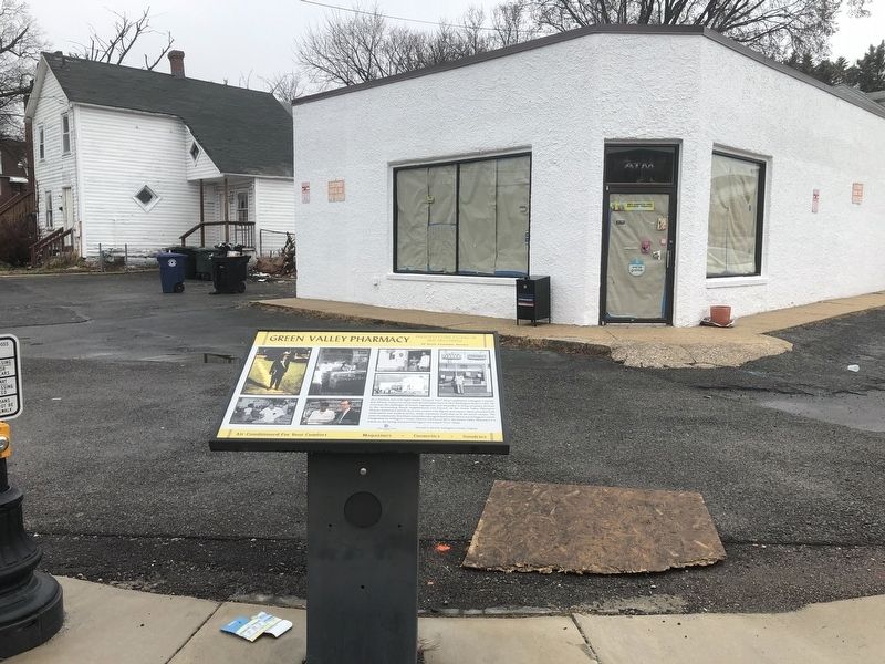
By Devry Becker Jones (CC0), March 10, 2019
Green Valley Pharmacy Marker
GEOGRAPHIC SORT Title Sort Marker Number Sort Marker Number Sort N Marker Number Sort T Publication Order Sort Publication Order Sort A Erected Year Sort Most Viewed Sort Most Recent-Interest Sort Most Recently Changed Sort SEE FAQ #33 FOR DESCRIPTIONS
On Shirlington Road at 24th Road South, on the right when traveling north on Shirlington Road.
Near Long Bridge Drive east of 6th Street South, on the right when traveling east.
Near Long Bridge Drive east of 6th Street South, on the right when traveling east.
On North Old Glebe Road south of North Randolph Court, on the right when traveling north.
On Overlook Trail at Marcey Road, on the right when traveling east on Overlook Trail.
On North Little Falls Road at North Florida Sreet, on the right when traveling west on North Little Falls Road.
On Little Falls Court north of North Little Falls Road, on the right when traveling north.
On Iron Works Road (County Route 809) at Virginia Route 42, on the right on Iron Works Road.
On North River Road (County Route 730) just east of Stokesville Road and Old C&W Railroad Road (County Route 718/763), on the left when traveling east.
On Steeles Lane (Virginia Route 937) 0.6 miles east of Raphine Road (Virginia Route 606), on the right when traveling east.
On Mill Place Parkway (County Route 1943) south of Laurel Hill Road (County Route 612).
Near Three Notched Mountain Highway (U.S. 250) 0.8 miles north of Interstate 64, on the left when traveling north.
On County Route 687 at Post Office Drive, on the right when traveling west on County Route 687.
On Sam Snead Highway (U.S. 220) south of Main Street (County Route 615), on the left when traveling north.
Paid Advertisement
On Old Mill Road (Virginia Route 645) south of Old Germantown Road (Virginia Route 692), on the left when traveling south.
Near Old Mill Road (Virginia Route 645) just south of Old Germantown Road (Virginia Route 692), on the right when traveling north.
On Old Mill Road (Virginia Route 645) just south of Old Germantown Road (Virginia Route 692), on the left when traveling south.
Near Overlord Circle, 0.4 miles west of Burks Hill Road.
Near Overlord Circle, 0.4 miles west of Burks Hill Road.
Near Overlord Circle, 0.4 miles west of Burks Hill Road.
Near Blue Ridge Parkway (at milepost 86), 0.6 miles Peaks Road (Virginia Route 43).
Near Overlord Circle, 0.4 miles west of Burks Hill Road.
Near Overlord Circle, 0.4 miles west of Burks Hill Road.
On Overlord Circle, 0.8 miles west of Burks Hill Road (Virginia Route 122).
Near Overlord Circle, 0.4 miles west of Burks Hill Road.
On Main Street (U.S. 11) south of Washington Street, on the right when traveling south.
Near Lowe Street (County Road T-1305) west of Main Street (U.S. 11), on the right when traveling west.
On Lee Hwy (U.S. 11), on the right when traveling north. Reported missing.
On Lee Highway (U.S. 11) north of Updike Lane, on the right when traveling north.
On Breckinridge Mill Road (County Route 600) 1 mile south of Grove Hill Road (Route 606), on the left when traveling south.
Paid Advertisement
On Martin Luther King Jr. Boulevard (Virginia Route 113) north of State Street, on the right when traveling north.
Near Railroad Street, 0.5 miles east of High Street when traveling east.
On Tobacco Heritage Trail, 1.3 miles east of Railroad Street, on the left when traveling east.
On North Madison Road (U.S. 15) at Gold Mine Street (Alternate County Route 1010), on the right when traveling south on North Madison Road.
On Magnolia Avenue (Business U.S. 501) just north of East 21st Street, on the right when traveling north.
Near Washington Street at Broad Street, on the left when traveling east.
On Richmond Highway (U.S. 460) 0.1 miles east of Oxford Furnace Road (County Route 662), on the right when traveling west.
On Village Highway (Route 501) near Rails End Lane (County Route 838), on the right when traveling south.
On Jefferson Davis Highway (U.S. 1) 0.7 miles south of C C C Road (County Route 683), on the right when traveling north.
On Water Street at Main Street (U.S. 301), on the left when traveling west on Water Street.
On King Street, 0.1 miles north of Water Street, on the right when traveling north.
On Byllesby Road (County Route 602) at Buck Dam Road, on the left when traveling east on Byllesby Road.
On Carrolton Pike (U.S. 58) near Coulson Church Road (County Route 620), on the right when traveling west.
On Sturgeon Point Road at The Glebe Lane, on the right when traveling south on Sturgeon Point Road.
On John Tyler Memorial Highway (Virginia Route 5) 0.3 miles west of Kimages Road (Virginia Route 658), on the right when traveling east.
On John Tyler Memorial Highway (Virginia Route 5) at Kimages Road, on the right when traveling east on John Tyler Memorial Highway.
Paid Advertisement
On John Tyler Memorial Highway (Virginia Route 5) 0.2 miles east of Sturgeon Point Road (Virginia Route 614), on the right when traveling west.
On John Tyler Memorial Highway (Virginia Route 5) 0.2 miles east of Sturgeon Point Road (Virginia Route 614), on the right when traveling west.
On Courthouse Road (Virginia Route 155) at Watermelon Fields Road on Courthouse Road.
On John Tyler Memorial Highway (Virginia Route 5) at Wayside Road (County Route 607), on the right when traveling east on John Tyler Memorial Highway.
On Red House Road (Virginia Route 727) at Lawyers Road, on the right when traveling south on Red House Road.
On East Main Street at 1st Street South, in the median on East Main Street. Reported permanently removed.
On East Market Street west of 5th Street NE, on the right when traveling east.
On Main Street near 5th Street SE, in the median.
On 2nd Street Southwest at West Main Street, on the right when traveling south on 2nd Street Southwest.
On Jefferson Park Avenue west of Brandon Avenue, on the right when traveling east.
Near Court Square at Park Street, on the right when traveling east.
On East Jefferson Street at Park Street, on the right when traveling east on East Jefferson Street.
On Park Street just south of East Jefferson Street.
On McIntire Road at Perry Drive, on the right when traveling north on McIntire Road.
On Park Street just south of East High Street (Business U.S. 250), on the right when traveling north.
On West Main Street (Business U.S. 250) just east of 4th Street Northwest, on the right when traveling west.
Paid Advertisement
On Preston Avenue just south of 10th Street NW, on the left when traveling north.
On Preston Avenue just south of Rosser Avenue, on the right when traveling south.
Near Preston Avenue just south of Rosser Avenue, on the right when traveling south.
On East Market Street just west of Riverside Avenue, on the left when traveling east.
On Riverside Avenue, 0.2 miles north of Chesapeake STreet, on the right when traveling north.
Near Locks Road, 0.6 miles west of North Battlefield Boulevard (Virginia Route 168), on the left when traveling west.
Near North Battlefield Boulevard (Business Virginia Route 168) at Locks Road, on the right when traveling south.
Near Dismal Swamp Canal Trail, 2.1 miles south of George Washington Highway South (Business U.S. 17), on the right when traveling south.
Near Dismal Swamp Canal Trail, 3.6 miles south of George Washington Highway South (Business U.S. 17), on the right when traveling south.
Near Dismal Swamp Canal Trail, 4.1 miles south of George Washington Highway South (Business U.S. 17), on the right when traveling south.
Near Glencoe Street, 0.2 miles west of George Washington Highway South (U.S. 17), on the left when traveling west.
Near Elizabeth River Way at Poindexter Street.
Near Elizabeth River Way at Truxton Street, on the right when traveling south.
On Jefferson Davis Highway (U.S. 1) north of Marina Drive, on the right when traveling north.
On East Hundred Road (Virginia Route 10) 0.1 miles west of Allied Road, on the right when traveling west.
Near Henricus Park Road, 1.3 miles east of Coxendale Road.
Paid Advertisement
Near Henricus Park Road, 1.3 miles east of Coxendale Road.
On Winterpock Road (Route 621) at Beach Road (Virginia Route 655), on the right when traveling south on Winterpock Road.
On Iron Bridge Road (Virginia Route 10) at Krause Road, on the right when traveling east on Iron Bridge Road.
On Henricus Park Road, 1.3 miles east of Coxendale Road, on the right when traveling east.
On Henricus Park Road, 1.3 miles east of Coxendale Road, on the right when traveling east.
On Fleet Street (State Highway 36) at Chesterfield Avenue (State Highway 36), on the right when traveling north on Fleet Street.
On Chesterfield Avenue (Virginia Route 36), on the right when traveling west.
On Chesterfield Avenue (Virginia Route 36), on the right when traveling west.
On Chesterfield Avenue (Virginia Route 36), on the right when traveling west.
On Chesterfield Avenue (Virginia Route 36), on the right when traveling west.
On Chesterfield Avenue (Virginia Route 36), on the right when traveling west.
On Chesterfield Avenue (Virginia Route 36), on the right when traveling west.
On Pickett Avenue (Virginia Route 600) at Ferndale Avenue, on the right when traveling south on Pickett Avenue.
On Midlothian Turnpike (U.S. 60) at Robious Road, on the right when traveling west on Midlothian Turnpike. Reported missing.
On Midlothian Turnpike (U.S. 60) 0.2 miles west of Hugenot Road, on the right when traveling west.
On Midlothian Turnpike (U.S. 60) at Robious Road, on the right when traveling west on Midlothian Turnpike. Reported missing.
Paid Advertisement
Near North Woolridge Road, 0.1 miles north of Scotter Hills Lane, on the left when traveling north.
On Midlothian Turnpike (U.S. 60) just west of Huguenot Springs Road, on the right when traveling west.
Near North Woolridge Road, 0.2 miles north of Scotter Hills Lane, on the left when traveling north.
On Midlothian Turnpike (U.S. 60) 0.2 miles east of Coalfield Road, on the right when traveling east.
Near North Woolridge Road, 0.3 miles south of Walton Park Road.
1545 entries matched your criteria. Entries 201 through 300 are listed above.
⊲ Previous 100 —
Next 100 ⊳