On North Carson Street (Lincoln Highway) (Business U.S. 395) north of West Robinson Street, on the left when traveling north.
”Pony” Bob Haslam, considered to be the greatest of all Pony Express riders, rode for the Express from the beginning to the end. His route was through Carson City, one of the relay stations.
Erected by the Nevada Pony Express Centennial . . . — — Map (db m128553) HM
Abraham Curry, the “Father of Carson City”, accomplished more in his 15 year residence than most men hope to in a lifetime. Not only did he purchase the land in 1858 which is now Carson City, but laid out the townsite and built many of . . . — — Map (db m20874) HM
On Spooner Drive near Windridge Drive, on the right when traveling west.
In 1902 Marion Jefferson Blackwell purchased 360 acres from the State of Nevada, 556 acres of adjoining land from Sweeney’s Hot Springs and a lot with a house. He raised carp and catfish to sell commercially also hay and horses. Neighbors used the . . . — — Map (db m116178) HM
On South Carson Street (Business U.S. 395), on the right when traveling south.
[Front of Marker:]
Dedicated April 12, 1996
Carson City
Original Station
Apr. 3, 1860 - Nov. 20, 1861
by
Byron L. & Peggy Clark & Family
Bob & Tina McFadden
Mae & Jim Thorpe
The Bike Smith
Betty Young & Erica . . . — — Map (db m23038) HM
Near South Carson Street (U.S. 395/50) near East Musser Street.
Nevada's State Capital, one of the state’s oldest communities, was established in 1851 as Eagle Station, a trading post and ranch on the Carson Branch of the California Immigrant Trail, by Frank and Warren L. Hall, George Follansbee, Joe and . . . — — Map (db m20911) HM
On North Stewart Street, on the left when traveling south.
This is the site of the house and observatory of Nevada’s first weatherman, astronomer, and seismologist, Charles William Friend. Born in Prussia in 1835, Friend immigrated by way of South America to California during the 1849 Gold Rush. In 1867, he . . . — — Map (db m162166) HM
On East 3rd Street just east of South Stewart Street, on the right when traveling west.
This site was part of Carson City's Chinatown, which at one time was one of Nevada's largest Chinese Communities. In the 1880 Census Manuscript of Carson City, of the 789 Chinese, 706 were men and of these, 267 were married, 18 were widowed, 391 . . . — — Map (db m146930) HM
At 4:00 Am September 28, 1926, Fire Broke Out At The Jack Smith Ranch, At The Base Of Clear Creek Canyon.winds, Reversed Itself And Came Down Ings Canyon. It Reversed Itself Again And Raced Up Kings Canyon Once More, Trapping 5 Firefighters Near The . . . — — Map (db m100249) HM
On East Musser Street at North Pratt Avenue, on the right when traveling east on East Musser Street.
On March 17, 1897, at an arena located on this site, Carson City played host to Nevada's first world championship prizefight, a fourteen-round thriller in which the reigning heavyweight titlist, James J. "Gentleman Jim" Corbett, was dethroned by . . . — — Map (db m69690) HM
“Myriads of Stars shine over the graves of our ancestors.” Dat-So-La-Lee had seen some 96 winters, mostly in Carson Valley, when death came in 1925.
She was the last of those Washoe weavers whose ancient art had been practiced by countless . . . — — Map (db m20801) HM
Near North Carson Street (Lincoln Highway) (Business U.S. 395) at East Caroline Street, on the left when traveling north.
This reproduction of the Liberty Bell was presented to the people of Nevada by direction of The Honorable John W. Snyder Secretary of the Treasury
As the inspirational symbol of the United States Savings Bonds Independence . . . — — Map (db m128551) HM
On West Appion Way at Snyder Avenue, on the right when traveling west on West Appion Way.
Centrally located between the first Nevada settlement at Genoa and the precious metal deposits of the Comstock Lode, Eagle Valley, site of present Carson City, was a vital link in land communications.
One of the key California emigrant routes, . . . — — Map (db m20802) HM
On U.S. 50 at Akron Way, on the right when traveling east on U.S. 50.
When the Comstock Lode was discovered in 1859, the problem of reducing the ore from the fabulously rich Virginia City mines had to be solved. Mills were built in Gold Canyon and Six Mile Canyon. In Washoe Valley, at Dayton, and on the Carson River . . . — — Map (db m55083) HM
Empire City was a milling town that was established in 1855. As you read this storyboard you are facing east toward Brunswick Canyon. The City of Empire was located to your right about 1/4 - 1/2 mile. At one time Empire City stretched for 3/4 of a . . . — — Map (db m89601) HM
On North Carson Street at East Telegraph Street, on the right when traveling north on North Carson Street.
This imposing public structure, the former United States Post Office and Courthouse, represents the first federal office building constructed in the State of Nevada.
Construction began in late 1888 and was completed in 1891 at a cost of $138, . . . — — Map (db m101827) HM
On South Carson Street (U.S. 395/50), on the right when traveling south.
On this site in the period from 1870 until 1918 stood the ornate two-story home of Mathew Culbertson Gardner, rancher and lumberman. The residence was headquarters for Gardner’s 300 acre ranch in Meadows to the Southward.
Here was located, 1870 . . . — — Map (db m20926) HM
Approximately one-half mile south of this point and west of the present highway lay the immense lumberyard of the Carson-Tahoe Lumber and Fluming Company, the greatest of the Comstock lumbering combines operating in the Lake Tahoe Basin during . . . — — Map (db m20804) HM
On East Musser Street at North Plaza Street on East Musser Street.
This block at the historic core of Carson City was the site of many business enterprises since the city's founding in 1858. The longest standing structure was the Odd Fellows Hall. Here for some 95 years the following lodges met at one time or . . . — — Map (db m89475) HM
On Kings Canyon Road, 0.1 miles south of Cooper Springs Court, on the right when traveling south.
Originally a Washoe Indian trail, Kings Canyon served as a gateway to Lake Tahoe following the gold rush to California. Eagle Station was established in 1851 near the mouth of the canyon, Dr. Benjamin King built his ranch the next year, and others . . . — — Map (db m163164) HM
Near Seely Loop near North Saliman Road, on the left.
In March 1868 William Sharon of the Bank of California contracted with Isaac Evan James to construct a railroad from the mines of the Comstock Lode to the stamp mills located on the Carson River. Survey work got underway in December and grading . . . — — Map (db m21338) HM
"Continue descending but passing over sandy hills on the south of the road [south of Hwy 50]... Good grass and water 2 miles [to Clear Creek]" - James H. Compton, Sep 20, 1853 — — Map (db m228421) HM
Unveiled June 10, 1989
Artist: Buckeye Blake
It was the winter of 1843-44 when Kit Carson along with the John C. Fremont expedition worked his way south from Pyramid Lake looking for an easy route across the Sierra Nevada. Carson, depicted . . . — — Map (db m20897) HM
On U.S. 395 Alterate (Alternate U.S. 395) at Hobart Road, on the right when traveling south on U.S. 395 Alterate.
As early as 1863, two hotels with appurtenant stables were located here. In 1872, one hotel became a station on the newly-completed Virginia and Truckee Railroad between Carson City and Reno.
Crossing under the highway are three inverted . . . — — Map (db m244508) HM
On North Carson Street (Lincoln Highway) (Business U.S. 395) at West Robinson Street, on the left when traveling north on North Carson Street (Lincoln Highway).
Now:
U.S. 50 • San Francisco to Salt Lake City
U.S. 30 • Salt Lake City to Philadelphia
U.S. 1 • Philadelphia to New York City — — Map (db m128552) HM
Near South Carson Street (Business U.S. 395) at Fairview Drive, on the right when traveling south.
Logging wagon built in 1870 at Bassett Station, Yuba Pass. Used to haul lumber to the Sierra Buttes mines with teams of oxen. Presented to Nevada Day committee in 1950 by Ceasar P. Lombardi. — — Map (db m163897) HM
Dedicated in 1867, this church serves a congregation that was organized in 1859 and is often referred to as the “Cradle of Nevada Methodism”. Like many other buildings in Carson City, the stone used in its construction was quarried at . . . — — Map (db m21240) HM
On North Roop Street, 0.2 miles south of East William Street.
On April 15th, 1951 this 52-acre tract, known as Foley's Woods to Carsonites of an earlier day, was presented to the City of Carson by the Mills family, of San Francisco, for use as a city park. The 52-acre tract embraces the eastern extremity of . . . — — Map (db m221712) HM
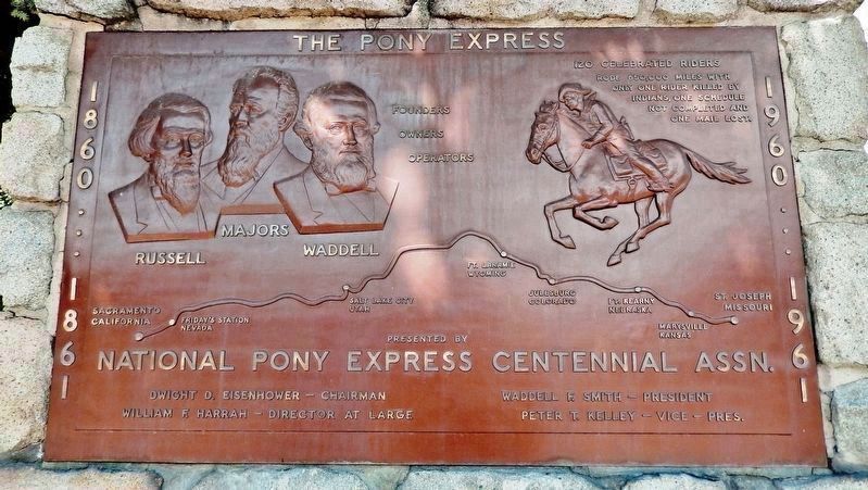
On North Carson Street (Lincoln Highway) (Business U.S. 395) north of West Robinson Street, on the left when traveling north.
Honour to the Nevada men who were riders in the July 19 to 28, 1960 Centennial Reenactment of the Pony Express
Monument Erected by the
Pony Express Club of Nevada
National Pony Express Centennial Association
Dwight D. . . . — — Map (db m128554) HM
On South Stewart Street at East 7th Street, on the right when traveling south on South Stewart Street.
The Nevada Orphan’s Asylum, a privately funded institution, was opened in Virginia City May 1867 by Sister Frederica McGrath and two other nuns of the Sisters of Charity. By 1870, most of its functions were taken over by the Nevada Orphans’ Home . . . — — Map (db m20806) HM
Near Seely Loop near North Saliman Road, on the left.
In memory of our Brothers who Never Returned From
Republic of VietNam 1954 – 1975
POW – MIA
[Column 1:]
Perry Richard Clark – LDCR – Navy – Carlin – 31 Aug. 1967 • Whittemore Frederick H. . . . — — Map (db m21348) WM
Near South Carson Street (U.S. 395/50) near East Musser Street.
Completed in 1871, Nevada’s splendid Victorian Capitol was built of sandstone from the quarry of the town’s founder, Abe Curry. The octagon annex was added in 1907, the north and south wings in 1915. Notable features are its Alaskan marble walls, . . . — — Map (db m20812) HM
On West King Street at Nevada Street, on the right when traveling west on West King Street.
Olcovich-Meyers House
Has been placed on the
National Register
of Historic Places
By the United States
Department of the Interior
1874 — — Map (db m21395) HM
On North Curry Street, on the right when traveling north.
Opened in 1875 on Carson Street by Andrew and Henry Robert, French Canadian brothers. The saloon was closed by prohibition in 1918. In 1951 Bob Golightly, Andrew’s grandson asked Virgil Bucchianeri to reopen the Old Globe.
In 1971 the saloon was . . . — — Map (db m174112) HM
On North Carson Street at West Second Street when traveling north on North Carson Street.
Carson Citys first hotel site bought by Major William Ormsby in 1859 from M. Stebbins, completed after his death in the 1860 Indian War. The hotel was the first polling place in Carson City also meeting place of early lawmakers. It was lighted by . . . — — Map (db m174114) HM
On West Fifth Street at Terrace Street, on the right when traveling west on West Fifth Street.
In May, 1860 Major William Ormsby was killed in an ambush by Paiutes at Pyramid Lake. In June, 1860 William Allen, a scout, was the last of some 40 white men killed in the ensuing war. Both were interred here, but Ormsby was later reburied in N.Y.. . . . — — Map (db m175808) HM
On North Carson Street at East Telegraph Street, on the right when traveling north on North Carson Street.
Carson City, Nevada, was one of the stations along the historic but hazardous 1966 mile Pony Express route between Sacramento Cal. and St. Joseph, Mo.
This monument is dedicated July 20, 1960 in memory of the Pony Express, during the epic . . . — — Map (db m101828) HM
On North Curry Street near West King Street, on the right when traveling south.
Completed in 1876, this palatial residence represents one of the finest and best preserved examples of High Victorian Italianate architecture remaining in the American West.
Charles H. Jones, a French-schooled designer, constructed the residence . . . — — Map (db m21246) HM
On West 3rd Street at Carson Street (Business U.S. 395), on the right when traveling west on West 3rd Street.
One of the oldest continuously operating hotels in the state. It is composed of two hotels. The three story St. Charles and the two story Muller House next door south. Construction of both buildings took place in 1862 with completion in August of . . . — — Map (db m23039) HM
On North Division Street near West Telegraph Street, on the right when traveling south.
Construction of this graceful reminder of the churches of old New England began in October 1867. Work was completed in July 1868 at a cost of $5,500.
The church was first occupied by its congregation on Sunday, August 9, 1868, with the . . . — — Map (db m21211) HM
Near East 2nd Street just west of South Stewart Street, on the right when traveling west.
Completed in 1886, the State Printing Building is the second oldest structure built by the State within the Capitol Complex. Architects Morrill J. Curtis and Seymore Pixley, designed the Italianate structure to compliment the older State Capitol . . . — — Map (db m160701) HM
On Snyder Avenue near Clear Creek Drive, on the right when traveling south.
Originally known as the Carson Indian Training School. Stewart Indian School, operated by the U.S. Bureau of Indian Affairs, provided vocational training and academic education for American Indian students from throughout the west for nearly a . . . — — Map (db m20796) HM
On North Minnesota Street at West King Street, on the right when traveling south on North Minnesota Street.
This house was built about 1860 of local sandstone for William Morris Stewart who lived here until 1862. He sold it to the Territorial Governor of Nevada, James W. Nye. The two men served as Nevada's first United States Senators after the . . . — — Map (db m162593) HM
On North Carson Street (Business U.S. 395) just south of Corbett Street, on the right when traveling north.
The Foreman-Roberts House Museum Built in 1864, Washoe City, Nev. Moved to this site November 1874 Carson City Historical Society — — Map (db m146954) HM
On Mountain Street at West Robinson Street, on the left when traveling north on Mountain Street.
Reno architect George A. Ferris designed this neo-classical mansion, which cost $22,700. It is the only home ever built for Nevada's highest elected official. In July, 1909, acting Governor Denver Dickerson and his wife Una became the first . . . — — Map (db m89516) HM
On North Carson Street (U.S. 395), on the right when traveling south.
The original Carson City building is a formal balanced, sandstone block edifice, two stories high with a centrally located, cupola. The sandstone blocks were quarried at the Nevada State prison. On March 3, 1862, Congress passed a bill establishing . . . — — Map (db m89543) HM
On West Robinson Street near North Carson Street, on the right when traveling west.
The original Carson City building is a formal balanced, sandstone block edifice, two stories high with a centrally located, cupola. The sandstone blocks were quarried at the Nevada State prison. On March 3, 1862, Congress passed a bill . . . — — Map (db m89438) HM
On North Plaza Street at East Washington Street on North Plaza Street.
For hundreds of years prior to the
White Man the Washoe and Paiute
Indians used this site as a recreation area and played a type of
ball game here. Later, in the year
1872, the area became the freight
vards of the historic Virginia &
Truckee . . . — — Map (db m136166) HM
Near South Carson Street (Business U.S. 395) at West 2nd Street, on the right when traveling north.
Adolph Sutro engineered and constructed the Sutro Tunnel. Approximately four miles long, the Tunnel runs in a westerly direction intersecting the Comstock Lode some 1600 feet under Virginia City. The portal is near Dayton, Nevada. The Tunnel . . . — — Map (db m146900) HM
Near East Musser Street near North Fall Street when traveling south.
The Channel Marker directly across the Channel marks the location of Nevada Point, where the USS NEVADA, the only battleship to get underway on 7 December, 1941, ended her attempted sortie. Believed to be sinking, and thus in danger of blocking the . . . — — Map (db m160703) HM WM
On Carson Street at Washington Street, on the right when traveling north on Carson Street.
This building was headquarters for the fabled Virginia & Truckee Railroad. From Carson City rails extended in three directions: To Virginia City in 1870, to Reno in 1872, and to Minden in 1906. The line to Virginia City was abandoned in 1939; The . . . — — Map (db m89559) HM
On North Carson Street, on the right when traveling north.
The quarried sandstone you are looking at came from
the Virginia and Truckee Railroad's machine shop and engine
house also referred to as "the Stone Fort” or
the Carson City/Virginia and Truckee Roundhouse.
The Stone was quarried at the . . . — — Map (db m157591) HM
Near East Musser Street at North Fall Street when traveling south.
— Washington — first took command of the American Army under the grandparent of this elm at Cambridge, Mass, July 3, 1775. Raised an given by Maryland D.A.R. Marked by Nevada D.A.R. This tree is planted as part of the two hundredth . . . — — Map (db m160564) HM
On U.S. 50, 23 miles north of Nevada Route 722, on the right when traveling north.
Replacement Marker
Abundant grass and brush found near springs and intermittent streams in Edwards Creek Valley were important ecological areas for Native Americans. Shoshone Indians wandered seasonally to gather wild seeds and small . . . — — Map (db m67146) HM
Near U.S. 50, 22 miles west of Nevada Route 722, on the right when traveling west.
In 1861, the rocks composing the walls of this stage station and freighter stop were in neat rows and roofed with bundles of willow. It was one part of "Stagecoach King" John Butterfield's Overland Mail & Stage Company Road Systems, which at the . . . — — Map (db m67145) HM
Near U.S. 50 at milepost 30.7, on the left when traveling east.
On the mountain slopes in the distance, you can see a series of horizontal lines or terraces etched into the side of the range. These beach lines are left by waves of ancient Lake Lahontan. Over 12,000 years ago, the lake reached a maximum depth of . . . — — Map (db m165833) HM
On Pioneer Way, 0.5 miles south of U.S. 50, on the right when traveling south.
"We continued on following the river. The main road leaving the river for 12 miles. Over a strip of desert without grass or water the road along the river being a pack route and impracticable for wagons" - Calvin Taylor, Sep 17, 1850 — — Map (db m159073) HM
On Lincoln Highway (U.S. 50) 0.1 miles west of Trento Lane, on the right when traveling east.
"Ragtown...is a collection of tents and canvass shanties, where a tolerable meal can be had at one dollar a head. Whiskey is sold, cards are played, gambling pretty extensively carried on and hay sold" - Henry Sheldon Anable, Sep 1, 1852 — — Map (db m159072) HM
"Passing out of the canyon we went up [Edwards Creek] Valley between two ranges of mountains ... to Cold Springs where we ... prepared for crossing the sixty mile desert by cutting grass and fillings our kegs with water" - Lumin A. Scott, Aug 29, . . . — — Map (db m159358) HM
On West Williams Avenue at Lincoln Highway (U.S. 50), on the right when traveling west on West Williams Avenue.
Churchill County was created by the Territorial Legislature in 1861 but attached to Lyon County for judicial and revenue purposes. Churchill County was organized in 1864 and La Plata served as county seat. In 1868, it was moved to Stillwater, . . . — — Map (db m69686) HM
On West Williams Avenue near Lincoln Highway (U.S. 50).
In 1903, Senator Warren Williams introduced a bill allowing the county seat to be moved from Stillwater to Fallon. The courthouse was constructed at its present location that same year. The wooden-framed structure of Neo-Classical design was . . . — — Map (db m70512) HM
Near U.S. 50 at milepost 30.7, on the left when traveling east.
According to anthropologists, many hunter-gatherer societies, such as those who lived here, had a spiritual leader called a shaman. During the hunt, the shaman was called on to perform rituals to ensure success. One theory is that some of the . . . — — Map (db m165835) HM
On U.S. 50, 5 miles east of Nevada Route 839, on the right when traveling east.
Fairview was part of the renewed interest in mining. Triggered by the strikes in Tonopah and Goldfield. Discoveries in 1905 of a rich silver float led to a boom that lasted through 1906 and 1907. A substantial town that boasted 27 saloons, hotels, . . . — — Map (db m67147) HM
On Earthquake Fault Road, 0.3 miles south of U.S. 50, on the right when traveling south.
When the energy from pressure built up underneath the Earth's thin crust is suddenly released, an earthquake occurs. At first the crust may just bend. But if the stress is great enough, the rocks will break and "snap" to a new position. This usually . . . — — Map (db m62121) HM
On U.S. 50 at milepost 30.7, on the right when traveling west.
Grimes Point, one of the largest and most accessible petroglyph sites in northern Nevada, contains about 150 basalt boulders covered with petroglyphs. Nevada petroglyphs were of magico-religious significance in insuring the success of large game . . . — — Map (db m127115) HM
Near U.S. 50 at milepost 30.7, on the left when traveling east.
[side 1] The Cattail-Eater People (Toidikadi) Stillwater Marsh is located in the basin northwest of Grimes Point. When the first non-native explorers entered the area, it was the home of the Northern Paiute people, known as the . . . — — Map (db m165830) HM
On Old Carson Highway north of Nevada Route 50, on the left when traveling north.
On this site, while participating in a training exercise, five U.S. Navy men from Helantisubron Four N.A.S. North Island, California were killed when their SH-3 Sea King helicopter crashed at 1245 on 22 March 1978
HS-4 Black Knights LT C.O. . . . — — Map (db m192607) HM
Lahontan Dam, completed in 1915, is the key feature of the Newlands Irrigation Project which has turned Lahontan Valley into one of Nevada's most productive farming and ranching areas. With completion of the dam's powerhouse, the electrical energy . . . — — Map (db m89515) HM
Near U.S. 50 at milepost 30.7, on the left when traveling east.
The crater-like depressions and elongated grooves, seen on the boulder before you, possibly date back 7,000 years or more. This "Pit and Groove" petroglyph style is believed to be the oldest at Grimes Point. Depressions were made by striking the . . . — — Map (db m165831) HM
Near Unnamed Road, 0.6 miles west of Earthquake Fault Road.
Scientists measure the force of an earthquake in several ways. The Richter Scale and the Modified Mercalli Scale are the two methods most often used to gauge an earthquake's strength and magnitude.
The Richter Scale provides an . . . — — Map (db m62122) HM
On East Park Street, on the right when traveling north.
The Oats Park School was designed in 1914 by Frederick J. DeLongchamps, Nevada's pre-eminent architect of the period. He was also responsible for the 1921 north and south wing additions. This building is one of his earliest, and perhaps, first, . . . — — Map (db m69683) HM
On North Maine Street (U.S. 95) just south of East A Street, on the right when traveling north.
In 1929, this building was deemed a magnificent improvement to the city. Built to U.S. Postal Service standards, this brick structure features massive single doors on either end of a vestibule that protects the inside from the elements. Carved . . . — — Map (db m142625) HM
One hundred and fifty years ago, the Pony Express was founded by W. H. Russell, Alexander Majors and William B. Waddell, operators of the Overland Stage Line of Leavenworth, Kansas. During a visit to Washington, Mr. Russell was urged by California . . . — — Map (db m69681) HM
On Reno Highway (U.S. 50) near Pioneer Way, on the right when traveling east.
Ragtown was never a town, but the name of a most welcome oasis and hamlet. This mecca on the banks of nearby Carson River received its name from the appearance of pioneer laundry spread on every handy bush around.
The Forty-Mile Desert, . . . — — Map (db m180202) HM
Near U.S. 50 at milepost 30.7, on the left when traveling east.
Rock art in the Great Basin has often been linked to prehistoric game trails. While this seems strange for this barren scene, consider what this area was like thousands of years ago. Grimes Point would have been a peninsula surrounded by water, and . . . — — Map (db m165834) HM
On U.S. 50, 11 miles north of Nevada Route 722, on the left when traveling north.
Replacement Marker
Rock Creek was an important stagecoach stop on the Overland Mail Stage Company's historic line along the Simpson route between Salt Lake City and Genoa, Nevada, which was operated by John Butterfield (1861-1866) and . . . — — Map (db m67144) HM
On U.S. 50 at milepost 46.5, on the right when traveling west.
Sand Mountain, dominating the Salt Wells Basin, is a prominent landmark in Nevada's early history. The Northern Piute know it as Kwazi, the name of the snake that inhabits the dune, its backbone forming the crest of the mountain. Captain James . . . — — Map (db m69653) HM
Two small rooms at the southwest end of the station were originally one large room and shared a common wood floor. The wall which now separates the two rooms was built on top of the floor some time later. The center room was probably used for . . . — — Map (db m127117) HM
Near U.S. 50 at milepost 30.7, on the left when traveling east.
While petroglyphs were etched or scratched into the rock surface, pictographs were painted, using natural materials as pigments. One of the oldest petroglyph styles can be seen as circular and wavy lines and may be almost 3000 years old. The . . . — — Map (db m165832) HM
Near Lincoln Avenue (U.S. 50) 25 miles east of Maine Street (U.S. 95), on the left when traveling east.
"The Mail Must Go Through"
From April 3, 1860 to November 21, 1861, mail was delivered by the Pony Express between St. Joseph, Missouri and Sacramento, California. It was a relay system between 190 stations along the route. A fresh horse was . . . — — Map (db m142572) HM
On Lincoln Highway (U.S. 50) near Wildes Road (County Route 118), on the left when traveling east.
Want it known that in the State of Nevada....
This site is dedicated not for it’s historical significance, but for the significance of the genuine gold diggers of Western history... the working girls who made a man forget the back breaking work . . . — — Map (db m90814) HM
Near U.S. 50, 11 miles north of Nevada Route 722, on the right when traveling north.
Competing with time, distance, harsh climate, and hostile Indians, the Pony Express carried important communications from the East and the West across 2,000 miles in only 10 days.
The "Pony," as it was called, is an outstanding . . . — — Map (db m67142) HM
On U.S. 95, 0.9 miles south of Interstate 80, on the left when traveling south.
"Long before sunrise our teams were on the trail marching forward on the desert. Very little to note save the dust & brightness of the glittering sand. Now & then a grave, little donage & dead stock." - John Clark of Virginia, Aug 21, 1852 — — Map (db m149414) HM
On Nevada Route 722 at milepost 4.7, on the right when traveling north.
The ten foot wide flat at the base of the cliff is the site of Wagon Jack Shelter. The name comes from the Shoshone Indian, Wagon Jack, who camped here about 1900, while working on an Eastgate Ranch. He was a leader of Indian rabbit drives in Smith . . . — — Map (db m69650) HM
Near Lincoln Avenue (U.S. 50) 25 miles east of Maine Street (U.S. 95), on the left when traveling east.
Sand Springs Deserved its Name The rocks you see in front of you were once Sand Springs Pony Express Station. The Pony Express ended in November 1861, but this Station was used as a stopover for freight wagons until the late 1800s. It laid . . . — — Map (db m142573) HM
Little known at the time, except as a stage stop, Williams Station was destined to be remembered in Nevada history as the incident that ignited the Pyramid Lake War of 1860.
Williams Station was named for three brothers, James O., Oscar, and . . . — — Map (db m168508) HM
On U.S. 50 at milepost 61.5, on the right when traveling west. Reported missing.
text from: Nevada State Historic Preservation Office
Located 13 miles to the north is the camp of Wonder, a major mining center in the early years of the twentieth century. Thomas J. Stroud and several others made the first locations in . . . — — Map (db m69651) HM
On U.S. 50 at California Road, on the right when traveling west on U.S. 50.
Hazen was named for William Babcock Hazen, who served under General Sherman in his "March to the Sea." The town, established in 1903 to house laborers working on the Newlands Irrigation Project south of here, included hotels, saloons, brothels, . . . — — Map (db m42328) HM
Near U.S. 95 at Interstate 80, on the right when traveling south.
Stretching before you are two vast sinks, terminal areas of the Humboldt and Carson River drainage systems. The marshey remnant of Lake Lahontan, between you and the distant Humboldt Range, served as a life sustaining resource of wildlife for . . . — — Map (db m67352) HM
Near U.S. 95 at Interstate 80, on the right when traveling south.
Whichever direction your travels take you, you're going to have a similar experience to what the California-bound emigrants had. You're going to see the same country, except for the towns and the ranch meadows. The big difference, though, is that . . . — — Map (db m67359) HM
Near U.S. 95 at Interstate 80, on the right when traveling south.
The 40 Mile Desert, beginning here, is a barren stretch of waterless alkali wasteland. It was the most dreaded section of the California Emigrant Trail. If possible, it was traveled by night because of the great heat.
The route was first . . . — — Map (db m67348) HM
Near U.S. 95 at Interstate 80, on the right when traveling south.
Look at the barren country south of here just beyond this Rest Stop. This is the Forty-Mile Desert--a barren stretch of waterless alkali wasteland. It was the single-most dreaded section of the entire California Trail from the banks of the Missouri . . . — — Map (db m67357) HM
On Nevada Route 50 west of Route 361, on the right when traveling west.
"We left camp at 6 this morning passed through Middle and West Gate This kanyon that these passes or gates are in is the most beautiful one we passed through yet we have not traveled only 15 miles to day." - Elizabeth Duncan Oct 4, 1867 . . . — — Map (db m155193) HM
Near Nevada Route 361 south of Lincoln Highway (U.S. 50), on the right when traveling south.
Middlegate was named in 1850 by James Simson as he mapped the route for the Overland Stage Company. In his journal he writes that he thought the cuts in the mountains looked like 'gates' so he named each cut Westgate, Middlegate, and Eastgate to . . . — — Map (db m89452) HM
On Pahrump Valley Highway (Nevada Route 160 at milepost 17), on the left when traveling west.
This portion of the Old Spanish Trail was discovered in January, 1830, by Antonio Armijo during his first trip from Santa Fe to Los Angeles. The spring just north of this marker provided excellent water and fed meadows of luxuriant grass for draft . . . — — Map (db m213760) HM
James B. Wilson, a gold miner and veteran of the Civil war, arrived in southern Nevada in 1869. He first started a ranch near the original Las Vegas Rancho, but sold that property. In 1876 he homesteaded the Sandstone Ranch on this location with . . . — — Map (db m205214) HM
On Village Boulevard at Diamond Street, on the left when traveling east on Village Boulevard.
Stretching for 130 miles across Clark County, this historic horse trail became Nevada's first route of commerce in 1829 when trade was initiated between Santa Fe and Los Angles. The trail was later used by the wagons of the "49ers" and Mormon . . . — — Map (db m29218) HM
On Canyon Road, 0.6 miles north of Industrial Road, on the right when traveling north.
Originally a Native American trail, Bootleg Canyon – also called the Hooch Highway was a well-known backdoor into Boulder City and the Hoover Dam construction site during prohibition. Bootleggers brewed illegal alcohol in stills hidden in . . . — — Map (db m29324) HM
One of the finest examples of how civil engineering ingenuity shaped the development of society's quality of life in the 20th century. — — Map (db m31900) HM
Born in 1858, Dr. Elwood Mead became a world-renowned water and irrigation engineer. He wrote Wyoming's first water code, the basis for codes throughout the United States, Australia, Canada, South Africa and New Zealand. He wrote the Carey Act, led . . . — — Map (db m31902) HM
965 entries matched your criteria. The first 100 are listed above. Next 100 ⊳