2017 entries match your criteria. Entries 101 through 200 are listed.⊲ Previous 100 — Next 100 ⊳
Non-US Wars Topic
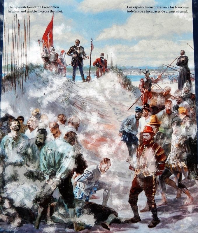
By Stanley Meltzoff / National Geographic Creative
Marker detail: The Spanish found the Frenchmen helpless and unable to cross the inlet
101 ► Florida, St. Johns County, Crescent Beach — Old World Showdown / Reyes y fe — Fort Matanzas National Monument —  |
| Near A1A Scenic and Historic Coastal Byway (State Highway A1A) 4 miles south of State Highway 206, on the right when traveling south. | |||
| 102 ► Florida, St. Lucie County, Fort Pierce — Navy Seal Ty Woods — National Navy UDT-SEAL Museum — |
| Near Florida Route A1A 0.3 miles Jackson Way, on the right when traveling north. | |||
| 103 ► Georgia, Bibb County, Macon — Trading with the British 1690-1715 — Ocmulgee National Monument — |
| Near Park path north of Ocmulgee National Park Road, in the median. | |||
| 104 ► Georgia, Glynn County, Jekyll Island — 63-18 — Le Sieur Christophe Anne Poulain du Bignon — (1739- 1825) — |
| On Riverview Dr. near Major Horton Dr., on the right when traveling south. | |||
| 105 ► Georgia, Glynn County, St. Simons Island — Fort St. Simons — |
| Near Beachview Drive. | |||
| 106 ► Georgia, Richmond County, Augusta — Eve — 1806 - 1877 — |
| On Telfair Street near 6th Street, on the left when traveling west. | |||
| 107 ► Georgia, Taliaferro County, Crawfordville — 131-7 — Old Tavern Site — |
| On Broad Street NE (U.S. 278) at Askin Street SE, on the right when traveling east on Broad Street NE. | |||
| 108 ► Georgia, Taliaferro County, Sharon — 131-5 — The Church of the Purification — Locust Grove Academy — |
| On Washington Road (Georgia Route 47) 0.1 miles Raytown Road (County Route 21), on the right when traveling north. | |||
| 109 ► Georgia, Walker County, LaFayette — 146-1 — Fort Cumming — |
| On W. Indiana Avenue near Part Street, on the right when traveling west. | |||
| 110 ► Hawaii, Hawaii County, Kapaau — Kamehameha I — |
| On Hawi-Niulii Road east of Kapaau Road. | |||
| 111 ► Hawaii, Hawaii County, Keauhou — The Kamehameha Dynasty — |
| On Kaleiopapa Street near Ehukai Street, on the right when traveling north. | |||
| 112 ► Hawaii, Maui County, Wailuku — Battle of Kepaniwai - Uniting the Islands — |
| Near Iao Needle Lookout Trail and Ethnobotanical Loop west of Iao Valley Road, on the left. | |||
| 113 ► Hawaii, Maui County, Wailuku — Kūka‘emoku — [ʻĪao Valley] — |
| Near Iao Valley Road (Hawaii Route 32) when traveling west. | |||
| 114 ► Hawaii, Maui County, Wailuku — Kūka'emoku - 'Īao Needle — |
| Near 'Iao Needle Lookout Trail and Ethnobotanical Loop west of Iao Valley Road. | |||
| 115 ► Hawaii, Maui County, Wailuku — Sun of Maui — |
| Near Iao Valley Road west of Aulii Drive, on the left when traveling west. | |||
| 116 ► Idaho, Teton County, Driggs — 38 — John Colter — Erected Sept. 1938 — Teton County Company |
| On Scenic State Highway 33 at East Wallace Avenue, on the right when traveling north on State Highway 33Scenic . Reported missing. | |||
| 117 ► Illinois, Cook County, Chicago, Garfield Ridge — Solidarity Monument — Dignity • Freedom — |
| On Archer Avenue near 55th Street, on the right when traveling east. | |||
| 118 ► Illinois, Cook County, Chicago, Lower West Side — Cuauhtemoc — (1495 - 1525) — |
| Near West 21st Street at South Blue Island Avenue, on the right when traveling east. | |||
| 119 ► Illinois, Cook County, Chicago, Lower West Side — Emiliano Zapata — (1879 - 1919) — |
| Near South Ashland Avenue south of West 21st Street, on the right when traveling north. | |||
| 120 ► Illinois, Cook County, Chicago, Lower West Side — Ignacio Zaragoza — (1829 - 1862) — |
| Near South Laflin Street south of West 21st Street, on the right when traveling south. | |||
| 121 ► Illinois, Cook County, Chicago, Lower West Side — Jose Maria Morelos Y Pavon — (1765 - 1815) — |
| Near South Ashland Avenue south of West 21st Street, on the right when traveling north. | |||
| 122 ► Illinois, Cook County, Chicago, Lower West Side — Miguel Hidalgo Y Costillá — (1753 - 1811) — |
| Near South Ashland Avenue south of West 21st Street, on the right when traveling north. | |||
| 123 ► Illinois, Cook County, Chicago, Lower West Side — Venustiano Carranza — (1859 - 1920) — |
| Near South Ashland Avenue south of West 21st Street, on the right when traveling north. | |||
| 124 ► Illinois, Cook County, Chicago, Lower West Side — Vicente Guerrero — (1782 - 1831) — |
| Near South Laflin Street south of West 21st Street, on the right when traveling south. | |||
| 125 ► Illinois, Cook County, Chicago, Morgan Park — Irish Nationalist Monument — |
| Near West 111th Street east of South Sacaramento Avenue, on the right when traveling east. | |||
| 126 ► Illinois, Cook County, Chicago, Ukrainian Village — Ukraine War and Flight MH17 Memorial — June 2014/Липень 2014 — |
| On North Oakley Boulevard north of West Superior Street, on the right. | |||
| 127 ► Illinois, Cook County, Chicago, West Loop — James Connolly — |
| On Ashland Avenue near Warren Boulevard, on the right when traveling north. | |||
| 128 ► Illinois, Cook County, Cicero — Lithuanian Independence — |
| On 15th Street east of 50th Avenue, on the right when traveling east. | |||
| 129 ► Illinois, Cook County, Willow Springs — Płk Antoni Skarbek-Szacki / Colonel Antoni Skarbek-Szacki — |
| On Hilton Street south of Archer Avenue (Illinois Route 171), on the right when traveling north. | |||
| 130 ► Illinois, DuPage County, Addison — Heaven's Brigade Memorial — |
| On Army Trail Road (County Route 11) 0.2 miles east of Glen Ellyn Road, on the right when traveling east. | |||
| 131 ► Illinois, DuPage County, Lisle — Ryan Daniel Burris — |
| On Center Avenue at School Street, on the right when traveling east on Center Avenue. | |||
| 132 ► Illinois, Jo Daviess County, Elizabeth, Woodbine Township — Building the Apple River Fort — |
| On Old Fort Road 0.2 miles east of Illinois Street, on the left when traveling east. | |||
| 133 ► Illinois, Kendall County, Oswego — Vietnam Conflict — (1959-1975) — |
| Near Main Street near Jefferson Street. | |||
| 134 ► Illinois, St. Clair County, Belleville — Deidesheimer's Dry Goods Store — |
| On East Main Street west of High Street, on the right when traveling east. | |||
| 135 ► Illinois, St. Clair County, Cahokia Heights — Jarrot Mansion — |
| On East 1st Street just east of Falling Springs Road, on the right when traveling east. | |||
| 136 ► Indiana, Floyd County, New Albany — Floyd County World Peace Honor Roll — |
| On East Market Street east of East 10th Street, on the left when traveling east. | |||
| 137 ► Indiana, Knox County, Vincennes — Douglas A4D Skyhawk — Buno number 144906 — |
| Near South 6th Street Road west of Willow Street (Business U.S. 41). | |||
| 138 ► Indiana, Marion County, Indianapolis, Downtown — Tippecanoe County — Organized in 1826 — Named for the Tippecanoe River — |
| Near North Blackford Street north of Indianapolis Cultural Trail, on the right when traveling north. | |||
| 139 ► Iowa, Kossuth County, Algona — Lajos (Louis) Kossuth — 1802-1894 — |
| On West State Street just east of North Hall Street, on the right when traveling west. | |||
| 140 ► Kansas, Bourbon County, Fort Scott — "I'm not leaving" — Carl Wilkens (1957-present) — Lowell Milken Center for Unsung Heroes — |
| Near South Main Street south of East Wall Street. | |||
| 141 ► Kentucky, Bath County, Owingsville — 940 — Bath County — |
| Near West Main Street (U.S. 60). | |||
| 142 ► Kentucky, Franklin County, Frankfort — "Fight as Kentuckians" — A Brief History of the Kentucky Guard — 1912-1940 — |
| Near Minuteman Parkway at West Frankfort Connector. | |||
| 143 ► Kentucky, Hardin County, Fort Knox — M24 Chaffee — Light Tank, M24 — |
| On Bullion Boulevard 0.5 miles north of North Dixie Road (Kentucky Route 31), in the median. | |||
| 144 ► Kentucky, Henderson County, Henderson — Husband Edward Kimmel — |
| On North Water Street north of 2nd Street, on the left when traveling north. | |||
| 145 ► Kentucky, Lincoln County, Stanford — Fortitude with Courage — Lt. Col. Anthony Gale USMC — |
| On Lancaster Street. | |||
| 146 ► Kentucky, Oldham County, La Grange — Colonel William Oldham — |
| On West Main Street west of South 1st Avenue, on the right when traveling east. | |||
| 147 ► Louisiana, Ascension Parish, Darrow — Bocage Plantation — |
| On River Road (State Highway 942) at St. Elmo Street (Parish Route 1435), on the right when traveling south on River Road. | |||
| 148 ► Louisiana, East Baton Rouge Parish, Baton Rouge, Downtown — Site of Spanish Fort — |
| On State Capitol Drive near North 3rd Street. | |||
| 149 ► Maine, Androscoggin County, Auburn — A10 — Wabanaki History / Les Wabanaquis — Auburn, Maine — The Museum in the Streets — |
| On Auburn Riverwalk just east of Main Street (Maine Route 136), in the median. | |||
| 150 ► Maine, Aroostook County, Fort Kent — The Aroostook War — |
| On Blockhouse Road at Island Road, on the right when traveling west on Blockhouse Road. | |||
| 151 ► Maine, Cumberland County, Portland, East Bayside — Armenian Genocide Memorial — |
| On Cumberland Avenue just south of Boyd Street, on the right when traveling south. | |||
| 152 ► Maryland, Anne Arundel County, Annapolis — Battle of the Severn — |
| On Ritchie Highway (Maryland Route 450) at Chase Road, on the left when traveling south on Ritchie Highway. | |||
| 153 ► Maryland, Anne Arundel County, Annapolis — History of Our Maryland Flag — |
| On Maryland Avenue south of Prince George Street, on the right when traveling north. | |||
| 154 ► Maryland, Baltimore, Druid Hill Park — Saving Okapi — |
| Near Silver Spring Drive east of African Journey, on the left when traveling north. | |||
| 155 ► Maryland, Baltimore, Druid Hill Park — William Wallace — |
| On Swann Drive, on the right when traveling north. | |||
| 156 ► Maryland, Baltimore, Inner Harbor — The National Katyń Memorial — Bóg, Honor, Ojczyzna — God, Honor, Country — |
| On President Street at Aliceanna Street, in the median on President Street. | |||
| 157 ► Maryland, Montgomery County, Sandy Spring — Kwame Nkrumah — 09/21/1909 - 04/27/1972 — [Sandy Spring Slave Museum & African Art Gallery] — |
| Near Brooke Road 0.1 miles west of Chandlee Mill Road, on the right when traveling west. | |||
| 158 ► Maryland, Montgomery County, Silver Spring, Colesville — Khmer Rouge Genocide Memorial — |
| Near New Hampshire Avenue (Maryland Route 650) at Orchard Way, on the left when traveling north. | |||
| 159 ► Maryland, Montgomery County, Silver Spring, Downtown Silver Spring — The Global Refugee Mural — by Joel Beringer ©2009 — creative director Tom Block |
| On Pershing Drive at Bonifant Street, on the left when traveling west on Pershing Drive. Reported damaged. | |||
| 160 ► Maryland, St. Mary's County, St. Mary's City — A Time of Troubles — Struggling — |
| On Middle Street Path just north of Aldermanbury Street Footpath, on the left when traveling north. | |||
| 161 ► Maryland, St. Mary's County, St. Mary's City — In 1648 Margaret Brent Asks for “Vote…And Voyce” — |
| Near Old State House Road at Point Lookout Road ( Route 5). | |||
| 162 ► Maryland, Worcester County, Ocean City — Smaller Conflicts After WWII — |
| On 24th Street just east of Philadelphia Avenue ( Route 528), on the right when traveling east. | |||
| 163 ► Massachusetts, Middlesex County, Cambridge, Harvard Square — Richard T. Greener — Educator, Lawyer, and Diplomat — 1844 - 1922 — |
| On Massachusetts Avenue (Massachusetts Route 2A) south of Church Street, on the right when traveling south. | |||
| 164 ► Michigan, Cass County, Marcellus — M-60 Main Battle Tank (1960-1991) — (Received from U.S.Government-1990) — |
| On Centre Street (Michigan Route 40) 0.2 miles south of East Elm Street, on the right when traveling south. | |||
| 165 ► Minnesota, Brown County, New Ulm — Hermann Monument — (Hermann Denkmal) — |
| Near Monument Street north of Center Street, on the right when traveling north. | |||
| 166 ► Minnesota, Crow Wing County, Crow Wing, Crow Wing State Park — Old Crow Wing — |
| On the road to the campground north of State Park Road (County Road 27), on the left when traveling north. | |||
| 167 ► Minnesota, Crow Wing County, Crow Wing, Crow Wing State Park — Sioux Camp Prior to 1768 Ambush — |
| Near Crow Wing State Park Road. | |||
| 168 ► Minnesota, Crow Wing County, Crow Wing, Crow Wing State Park — The Battle of Crow Wing — Chippewa Lookout — |
| Near State Park Road (County Road 27). | |||
| 169 ► Minnesota, Crow Wing County, Crow Wing, Crow Wing State Park — The Meeting Place — Main Street, Crow Wing — Self-Guiding Trail — |
| Near Crow Wing State Park Road. | |||
| 170 ► Minnesota, Crow Wing County, Crow Wing, Crow Wing State Park — The Meeting Place — |
| Near the road to the campground north of State Park Road (County Road 27), on the left when traveling north. | |||
| 171 ► Minnesota, Mille Lacs County, Onamia, Mille Lacs Kathio State Park — Dakota Village — Kathio Landmark Trail — National Historic Landmark District — |
| Near the road to Ogechie Campground. | |||
| 172 ► Minnesota, Wadena County, Staples — "A Cloud of Barbed Arrows" — |
| Near Old Wadena Circle. | |||
| 173 ► Minnesota, Washington County, Stillwater — Indian Battleground — |
| Near St. Crois Trail North (State Highway 95) 0.1 miles north of Laurel Street East, on the left when traveling north. | |||
| 174 ► Mississippi, Forrest County, Camp Shelby — 33 — BMP1 Mechanized Infantry Combat Vehicle — |
| On Forrest Ave W at Museum Street, on the left when traveling north on Forrest Ave W. | |||
| 175 ► Mississippi, Forrest County, Camp Shelby — 31 — ZSU 23-4 Shilka Self-Propelled Anti-Aircraft Gun — |
| On Forrest Ave W at Museum Street, on the left when traveling north on Forrest Ave W. | |||
| 176 ► Missouri, St. Louis, Forest Park — Threats and Solutions — Going, going, gone? |
| Near Wells Drive 0.1 miles west of Concourse Drive, on the right when traveling west. Reported missing. | |||
| 177 ► Missouri, St. Louis, Missouri Botanical Garden — The Symbol of a King — History & Heritage — |
| Near Shaw Boulevard west of Tower Grove Avenue, on the left when traveling west. | |||
| 178 ► Missouri, St. Louis County, Florissant — St. Ferdinand III of Castile — b. 1199 d. 5-30-1252 — |
| On Rue Saint Francois at Saint Ferdinand Street, on the right when traveling west on Rue Saint Francois. | |||
| 179 ► Missouri, St. Louis County, Kirkwood, National Museum of Transportation — St. Louis - San Francisco #1621 — Eagle Picher — 1918 — |
| Near Barrett Station Road east of Old Dougherty Ferry Road, on the right when traveling east. | |||
| 180 ► Montana, Blaine County, Chinook — We will stand our ground! — Roaring Eagle: tipiyeléhne?iléseniń (George Comedown) — |
| Near Cleveland Road (County Road 240) near S-B Road. | |||
| 181 ► Montana, Chouteau County, Fort Benton — Bloodiest Block in the West — |
| On Front Street near 15th Street, on the right when traveling north. | |||
| 182 ► Montana, Chouteau County, Fort Benton — Drowning of the Governor — |
| On Front Street near 17th Street, on the right when traveling north. | |||
| 183 ► Montana, Missoula County, Lolo — Fort Fizzle — |
| Near U.S. 12, on the left when traveling west. | |||
| 184 ► Montana, Missoula County, Missoula — Rankin Hall — |
| On Campus Drive. | |||
| 185 ► Montana, Powder River County, Broadus — Southeastern Montana — |
| On U.S. 212 south of Big Powder River East, on the left when traveling north. | |||
| 186 ► New Jersey, Burlington County, Bordentown — Point Breeze — Estate of Joseph Bonaparte (1768-1844) — Delaware River Heritage Trail — |
| On West Park Street 0.1 miles west of Prince Street, on the left when traveling west. | |||
| 187 ► New Jersey, Cape May County, Middle Township, Cape May Court House — American Bison — Bison bison — |
| Near County Park Road 0.3 miles west of North Main Street (U.S. 9), on the left when traveling west. | |||
| 188 ► New Jersey, Cumberland County, Vineland — Sgt. Dominick Pilla — |
| On Cambridge Street at North 6th Street, on the left when traveling east on Cambridge Street. | |||
| 189 ► New Jersey, Essex County, Newark, Central Ward — Jose G. Artigas — 1764 - 1850 — |
| On Broad Street. | |||
| 190 ► New Jersey, Hudson County, Jersey City, The Village — Jose Protacio Rizal — (1861–1896) — |
| On Christopher Columbus Drive at Brunswick Street, on the right when traveling west on Christopher Columbus Drive. | |||
| 191 ► New Jersey, Mercer County, Trenton, South Trenton — 1655 — |
| On Lamberton Street north of New Jersey Route 29, on the left when traveling north. | |||
| 192 ► New Jersey, Mercer County, Trenton, South Trenton — 1664 — |
| On Lamberton Street north of New Jersey Route 29, on the left when traveling north. | |||
| 193 ► New Jersey, Mercer County, Trenton, South Trenton — 1673 — |
| On Lamberton Street north of New Jersey Route 29, on the left when traveling north. | |||
| 194 ► New Jersey, Mercer County, Trenton, South Trenton — 1817 — |
| On Lamberton Street north of New Jersey Route 29, on the left when traveling north. | |||
| 195 ► New Jersey, Passaic County, Totowa — John P. Holland — "Father of the Modern Submarine" — |
| Near Union Boulevard. | |||
| 196 ► New Jersey, Union County, Elizabeth — Gen. Jose Artigas — |
| On Winfield Scott Plaza south of East Jersey Street, on the left when traveling south. | |||
| 197 ► New Jersey, Union County, Elizabeth — José Martí — |
| On Winfield Scott Plaza north of Dickinson Street, on the left when traveling south. | |||
| 198 ► New Mexico, Cibola County, Laguna, New Laguna — Pueblo of Laguna — |
| On Historic Route 66 (Interstate 40 at milepost 113.5), on the right when traveling west. | |||
| 199 ► New Mexico, Luna County, Columbus — Columbus — |
| On State Road 11 at milepost 2.5, on the right when traveling north. | |||
| 200 ► New Mexico, Luna County, Columbus — Pancho Villa State Park — |
| Near South Pancho Villa Loop. | |||
2017 entries matched your criteria. Entries 101 through 200 are listed above. ⊲ Previous 100 — Next 100 ⊳