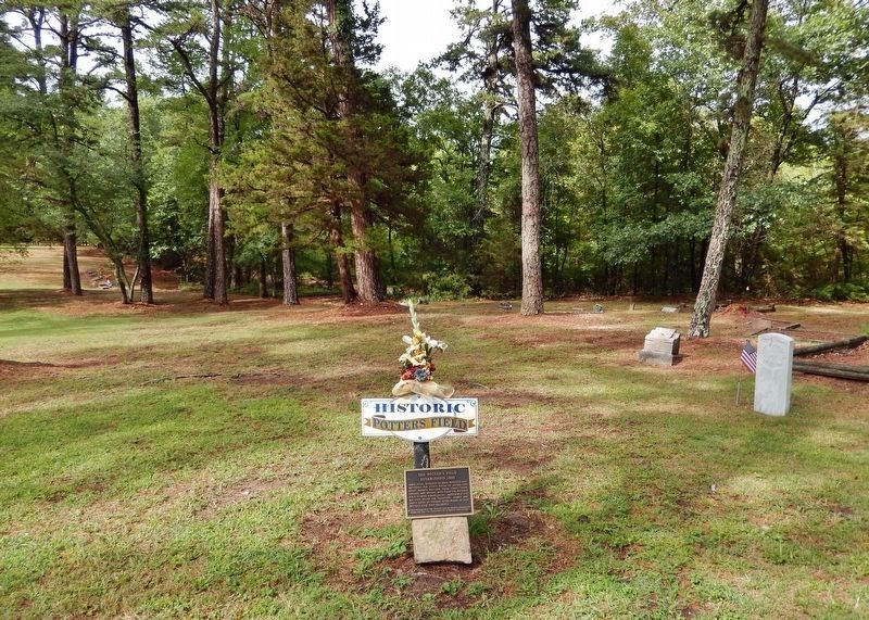
When Judas, betrayer of Jesus, repented and returned the thirty pieces of silver, the chief priests refused them, then “took counsel and bought with them the Potter’s Field to bury strangers in”. Matthew 27:3-10 KJB thus began the tradition. Names . . . — — Map (db m229498) HM
The Eureka Springs Railroad opened in February, 1883. As the first trains arrived at the original station house, a finely crafted wooden structure, passengers were met by horse drawn carriages and hacks which quickly carried them to the best . . . — — Map (db m80173) HM
The Round House stands on land first claimed by timber entrepreneur William Evans. By 1884, this land was subdivided into building lots as the new city of Eureka Springs boomed. William and Mahala Evans and their partners David and Precious Bays . . . — — Map (db m225161) HM
The Southern was built in the year 1880 adjacent to Basin Spring and some 25 feet above it on the hillside. L.M. Rainey of Missouri, its original owner, sold the hotel to W. E. Beatty in 1886, at which time it was acclaimed to be one of the city's . . . — — Map (db m59970) HM
"It is sometimes called The Basin Springs, and is invariably the first resort for visitors. If there is any one in the city you desire to find, if no other way, go to the Basin Springs, seat yourself comfortable, and await his coming."
Prof. . . . — — Map (db m63300) HM
“… After his cure was an established fact, the news soon spread, passing from tongue to tongue, and other afflicted mortals, hearing this good news in the wilderness, at once turned their eyes and footsteps in the direction of the . . . — — Map (db m225170) HM
Eureka Springs claims an estimated fifty-six miles of stone walls. Skilled stonemasons constructed most of the walls between 1885 and 1910. The limestone used was sometimes quarried on site but the majority was transported to the town site by horse . . . — — Map (db m63299) HM
The original Flat-Iron Building was constructed within sight of Basin Springs in the year 1880. It housed the town's first banking establishment and was the first structure made of brick among hundreds of wood buildings. The unusual three-sided, . . . — — Map (db m63302) HM
First by horseback, wagons or on foot, invalids from all over this region flocked to Eureka Springs in 1879 to seek cures from the miraculous healing springs. But soon there were easier ways to arrive - stagecoaches, then trains. This laid a base . . . — — Map (db m80211) HM
Eureka Springs was incorporated on Valentine's Day in 1880. At that time, the only courthouse was in the county seat of Berryville, some 12 miles to the east. This was a great distance at the time, the roads were bad, and the King's River had to be . . . — — Map (db m59962) HM
Elements of three companies of the First Arkansas Cavalry (U.S.) were dispatched to Yocum Creek at Duncan Springs on November 15, 1862, to evacuate Unionist families to safety at Elkhorn Tavern, including some related to soldiers in the First. While . . . — — Map (db m198709) HM
The first railroad through this area was the Mississippi, Ouachita and Red River, begun in 1854 and extending westward from the Mississippi River. In 1875 it became the Little Rock, Mississippi and Texas railroad. In 1887 the north-south main line . . . — — Map (db m229488) HM
From the close of
the Civil War to
the beginning of the twentieth century, Cariola
Landing at Grand Lake was one of the largest
shipping points on the Mississippi River south
of Helena, Arkansas. Cotton from a large area
west and south of . . . — — Map (db m159402) HM
Site of the Eudora settlement's first business district. After a ferry across Bayou Macon was established in 1846, Cariola Landing was accessible to Arkansas Communities to the west and Louisiana towns to the south. Merchants built stores along the . . . — — Map (db m158053) HM
Site of Mount Carmel, the first organized community in the Eudora area. John Booth donated land for a Presbyterian Church and a seminary for girls. Rev. Benjamin Shaw was director and pastor. Booth and Shaw are buried in Mount Carmel Cemetery. The . . . — — Map (db m158466) HM
The county seat of Chicot County was located at Columbia in 1823, where it remained until 1855. The county took its name from Point Chicot, on the Mississippi. — — Map (db m89773) HM
Front (West side)
"To the Confederate
soldiers of Chicot
County, the record
of whose sublime
self sacrifice and
undying devotion is
the proud heritage
of a loyal posterity."
Rear (East side)
We care not . . . — — Map (db m90255) WM
In April 1923 Lindbergh, then an unknown 21-year-old mail pilot, experienced engine trouble and landed his airplane on the now-abandoned golf course behind this site of the old Lake Village County Club. He remained in Lake Village overnight. During . . . — — Map (db m89779) HM
The town of Columbia was located on the Mississippi River about two miles east of this point. In 1833 the Chicot County seat was moved to Columbia from Villemont due to river bank erosion. Columbia became a thriving port and the location of a . . . — — Map (db m167545) HM
In Memoriam Hyner Cemetery established in 1898 marks the site of those devout, courageous Italian immigrants who came to America in 1895 settling and working at Sunnyside Plantation and throughout the Delta area. They established schools, . . . — — Map (db m168476) HM
In 1895 Austin Corbin, a New York banker and land developer, working with immigration officials brought 100 families from north central Italy to grow cotton at Sunnyside, a plantation located between the Mississippi River and Lake Chicot. These . . . — — Map (db m89774) HM
When Arkansas went to war in 1861, Lycurgus and Lydia Johnson and their family stayed with their home at Lakeport. By 1862, U.S. gunboats were common on the Mississippi River, and on Sept. 6, 1862, Confederate troops burned 158 bales of cotton at . . . — — Map (db m89797) HM
Side 1
The Lakeport Plantation house was constructed circa 1859 for Lycurgus and Lydia Taylor Johnson. The skilled craftsmanship and lasting character are testaments to those who built the house. It is preserved in remembrance of all who . . . — — Map (db m90491) HM
Jim Kelley, a slave, organized this church in 1860. His owner allowed the use of this plot of this plot of ground on which to build a church. On May 15, 1873, Mr. and Mrs. William B. Street deeded the property to the trustees of the church. New Hope . . . — — Map (db m89777) HM
This home was built about the year 1848 for John H. Saunders and his wife Martha A. Pettit Saunders. During the Civil War engagement at Ditch Bayou in 1864 the house was used as a hospital for soldiers of both armies. A number of military dead were . . . — — Map (db m107737) HM
It is the morning of June 6, 1864. Rain has created a muddy mess. To your left are four cannon. To your right are 600 cavalrymen and two more cannon. These men served under Confederate Colonel Colten Greene. To your front is Ditch Bayou, and 700 . . . — — Map (db m90432) HM
The battle at Ditch Bayou was a Federal effort to drive Confederates away from the Mississippi River, where the Confederates had been harassing Union shipping. Even though the Confederates were outnumbered here, they were able to inflict heavy . . . — — Map (db m90418) HM
This site
When the Clark County seat was
moved from Greenville to Arkadelphia
in 1842, until completion of a permanent
structure in 1844, a log building
which stood here served as court
house.
In 1860 a handsome two-story
brick . . . — — Map (db m234844) HM
Clark County was created by the legislature of Missouri Territory on Dec. 15, 1818 and named for the territorial governor, William Clark. It comprised, roughly, all of the present Clark, Hot Spring, Garland, Pike and Dallas counties. Early county . . . — — Map (db m121379) HM
East face
When the last trumpet
is sounded, may each one
answer the roll call
of the heavenly army.
South face
"The principles for
which they fought live
eternally." erected by
the Harris Flanagin Chapter, . . . — — Map (db m121961) WM
Indians in primeval times, DeSoto in 1541, and pioneers in the 1800s and Confederates during the Civil War obtained salt from the creek and old well here. John Hemphill in 1812 opened one of the first manufactories in Arkansas, a salt refinery. — — Map (db m200778) HM
John S.T. Callaway owned forty
acres, including this site, after
receiving a United States land patent
for it in 1836. Then, in 1842, Benjamin S.
Duncan purchased the land at a
sheriff's auction and platted
Duncan's Addition in 1858.
Today, . . . — — Map (db m234829) HM
At this site the first public or “free” school in Arkadelphia was opened in 1870. Early teachers included R.D. Hearn, Elizabeth Webb, Harriet Crow, John Gordon & Dutie Casey. — — Map (db m234848) HM
Here, during Reconstruction years, were the offices of the Freedmen's Bureau. The building was, at different times, used as a harness shop, grocery store, barber shop and saloon, and for many years was a residence. — — Map (db m234853) HM
As settlers began arriving in this area around 1812, the need for religious services became a top priority among the residents. Brush arbor meetings were held every summer. Soon a log structure was built along the creek that marked the beginning of . . . — — Map (db m184576) HM
PHS
Dedicated
This landmark is erected on the original site of Peake School built on land donated by Mr. Ed Peake in 1928, and is dedicated to the faculties and staffs who encouraged and prepared us to compete on an equal level with the best . . . — — Map (db m234859) HM
Used in the production of salt
from the water of the Saline
Bayou one mile east of Arkadelphia
by John Hemphill pioneer salt
maker of Arkansas territory, circa
1814. Given to the Henderson
State Teachers College museum
by the family of Capt. . . . — — Map (db m201033) HM
Near this site on April 1, 1864 Confederate General Joseph O. Shelby caught up with and attacked the rear guard of Union General Frederick Steeles army. Union General Samuel A. Rice, in charge of the supply, pontoon and brigade trains, rushed to . . . — — Map (db m121180) HM
Near this site was the original public school building for black students in the Arkadelphia public school system. Noted principals: Ms. P.A. Holmes 1872-1873, John Ed Peake 1877-1881, 1897-1898, 1904-1906 & Sam Hildreth 1907-1914, 1916-1939. The . . . — — Map (db m234864) HM
East & South of this point was
The Blakely Graveyard
in this first public burying
place of the community, the
early settlers were interred.
It remained in use until 1869
when it was closed to future
burials by the city council. . . . — — Map (db m200782) HM
Confederate Manufacturing
Arkadelphia was a manufacturing center for Confederate Arkansas early in the Civil War. Gen. Thomas Hindman established a powder works and an arsenal in 1862, producing guns, cannon, bullets, shells, wagons and . . . — — Map (db m96557) HM
In the Hotel Hall which formerly stood on the site of this building was organized on January 21st 1892 the Concatenated Order of the Hoo-Hoo a society composed of lumbermen and those in allied industries and having for its object the promotion . . . — — Map (db m234904) HM
Skirmishes at Okolona
Gen. Frederick Steele’s Union army left Little Rock on March 23, 1864, for a planned invasion of Texas, but it was April 2 before they faced organized Confederate attacks. Gen. Joseph Shelby attacked the Union wagon train . . . — — Map (db m200735) HM
Named for the white clay which resembles chalk, this magnificent bluff is one of the most important historical landmarks in Arkansas. At this point the St. Francis River cuts through Crowley's Ridge from west to east and forms the boundary between . . . — — Map (db m18136) HM
Since Crowley's Ridge provided the only natural route for north-south travel across the lowlands of northeastern Arkansas, an Indian trail and later a military road crossed the river here. About 1840 Abraham Seitz established a ferry which was later . . . — — Map (db m4912) HM
On March 10, 1863 Union cavalry captured the ferry after a three-hour fight. They burned buildings and stores of corn in Chalk Bluff and destroyed a large uncompleted ferry boat. Two weeks later on March 24 Union cavalry returned to Chalk Bluff and . . . — — Map (db m4906) HM
In April 1863 a Confederate army of 5000 men commanded by General John S. Marmaduke advanced into Missouri. Forced to retreat before superior Union forces, the Confederates on May 1-2 fought a successful delaying action here while their army crossed . . . — — Map (db m4911) HM
Chalk Bluff occupied a strategic position during the Civil War. Its cliffs commanded a vital river crossing on the only major road from Missouri into the Crowley's Ridge country. Provisions were collected here and shipped downstream to Confederate . . . — — Map (db m18186) HM
Until its removal to Heber Springs, the county seat of Cleburne County, the youngest of the 75 counties in Arkansas, was established at Sugar Loaf in 1883, the year the county was formed, and named for General Pat. Cleburne. — — Map (db m141602) HM
In Honor of Those
Who Gave the Ultimate Sacrifice
from Cleburne County
Iraq
Parker, Tommy Lynn "TJ" Jr.
Woodham, Anthony Lynn
World War I
Denwoody, Frank • Stark, George B.
Estes, Charles D. • Thompson, Perry J. . . . — — Map (db m143762) WM
The Civil War in Cleburne County
Cleburne County was infested with bands of bushwhackers who would prey on both military and civilian targets. Union troops operating in the area also seized food from civilians. Guerrillas ambushed 35 men . . . — — Map (db m141586) HM
The man known to the world as Johnny Cash was
born near here, in the home of his grandparents,
John Lewis and Rosanna Hurst Rivers, on
February 26, 1932. The family doctor was not
able to arrive in time for his birth, so a midwife,
Mrs. Grace . . . — — Map (db m170307) HM
Johnny Cash moved with his parents and siblings
from Kingsland to Dyess, Arkansas in 1935 when he
was three years old. Johnny would often return to
the Kingsland area to visit or stay the night with
his Cash and Rivers relatives during his youth . . . — — Map (db m170310) HM
Battle of Marks' Mills
On April 23, 1864, a Union force with 240 wagons left Camden to get supplies from Pine Bluff for Gen. Frederick Steele's army. Gen. James Fagan's Confederate cavalrymen ambushed them at Marks' Mills on April 25. . . . — — Map (db m121150) HM
The Battle of Mark's Mill, fought here on April 25, 1864, was a complete Confederate victory. General James F. Fagan's Confederate cavalry having surprised and captured a Union army of 2,000 men and 240 wagon loads of supplies. General Powell . . . — — Map (db m121283) HM
The New Edinburg Commercial Historic District,
located along the north and south sides of Highway 8,
was added to the National Register of Historic Places
on September 4, 2001 as a representative collection
of Craftsman style architecture . . . — — Map (db m170749) HM
Approaching Marks Mills from the south General Joe Shelby's Missouri Division was ordered to move to the right in order to block the Marks Mills to Mt Elba Road preventing The Union forces from escaping across the Saline River.
Guided by . . . — — Map (db m121660) HM
Early on the morning of April 25, the Confederates blocked the Pine Bluff Road near the Marks family home and mills. The first Union wagons arrived around 9:30 a.m. The Confederates shot the horses and driver of the lead Union wagon and launched the . . . — — Map (db m121327) HM
Facts
After getting in the neighborhood of the supply train Gen. Shelby was ordered on the road leading to Mount Elba to intercept the train and attack the front. Cabell's Brigade moved up to the road leading direct to Marks' Mills. As they . . . — — Map (db m121658) HM
Front
Fought here on April 25, 1864
was a complete Confederate victory
General James F. Fagan's Division of Confederate
cavalry surprised and captured a Union supply
train of 2000 men and 240 wagonloads of supplies.
General . . . — — Map (db m121310) HM WM
In March of 1864, the Union Army began the Red River Campaign, a plan to subdue Arkansas and Louisiana and capture Texas cotton for northern mills. By mid-April, the Arkansas arm of the campaign was stalled in Camden. A Union foraging party and . . . — — Map (db m121311) HM
So many horses and soldiers were killed that Salty Branch ran red with blood.
In 1864, Camden was a large town on the Ouachita River, as was Pine Bluff on the Arkansas River. Moro Bay, to the south, was the largest cotton shipping point . . . — — Map (db m121330) HM
Cash Family Reunions
Johnny Cash often returned to Rison with his siblings
and father, Ray Cash, to attend annual family reunions
held at the old American Legion Hut, which formerly
stood across from the courthouse on Sycamore Street.
At . . . — — Map (db m185709) HM
Johnny Cash Day in Arkansas
On March 20, 1976, Johnny Cash Day in Arkansas
was declared by proclamation issued by then-
Governor David Pryor. The festivities started in
Kingsland where Johnny and his family boarded a
special train, the . . . — — Map (db m170305) HM
One of the very oldest settlements of this county. Here in 1840–1850 settled the Bakers, Barnetts, Booths, Couches, Deeses, Dixons, Garretts, McDonalds, McWilliams, and other pioneer families Near this point Harvey Crowley Couch, Arkansas . . . — — Map (db m121240) HM
One of the oldest settlements in Columbia County. Here Colonel John Dockery had his plantation and home. Here T.P. Dockery, who became a general in the War Between the States, was born and reared. The Caddo Indian Trail from Camden on the Ouachita . . . — — Map (db m121136) HM
Third courthouse on this site. Bid for construction of a new courthouse was let in 1905 for $58,631. Designed by W.S. Hull and built of blond brick with stone detailing, it is considered an example of second renaissance revival architecture. . . . — — Map (db m121341) HM
John P. McCown was born Aug. 19, 1815, in Sevierville, Tenn. An 1840 graduate of West Point, he served in the Mexican and Seminole wars before resigning from the U.S. Army on May 17, 1861. McCown joined the Confederate army, rising to the rank of . . . — — Map (db m121139) HM
Dr. Thomas William Hardison was a resident of Petit Jean
Mountain for nearly half a century: Struck by the beauty and
natural wonders of the land, he was among the first to
imagine creating a park here to preserve its pristine grandeur
for . . . — — Map (db m233669) HM
The seat of justice for Conway County was first established in 1825, at the old town of Cadron, which had been the first county seat of Pulaski County. The County of Conway was named for Congressmen Henry Warton Conway. — — Map (db m237025) HM
Freedom is Not Free
The General William Lewis Chapter DAR
honors
All Veterans of
the Korean War
1950 – 1953
Marker placed December 31, 2002 — — Map (db m237021) WM
In honor of the men and
women of Conway County
who served in the armed
forces and sacrificed
unselfishly for the
freedom of the United
States of America — — Map (db m237019) WM
Vietnam Era
August 5, 1964 May 7, 1975
This plaque is in remembrance and honor of the Vietnam War veterans from Conway County, Arkansas and commemorates the courageous service and dedication these veterans gave for their
country. Special . . . — — Map (db m237005) WM
Erected in 2007 by Chapter 13 Disabled American Veterans
In memory and honor of all who served in World War I.
Doughboys
World War I, The War to End All Wars
The yanks are coming, the yanks are coming
and we won't be back till it's . . . — — Map (db m237004) WM
Erected in 2003 by Chapter 13 Disabled American Veterans
In memory and honor of all who served in World War II
Disabled American Veterans Chapter 13 Officers
Commander Pat Calhoun • Adjutant Rafel Brents • Service Officer Herb . . . — — Map (db m237029) WM
During the Civil War, first Confederate units and later Union units occupied and fought at and near Lewisburg. Confederate units included the Co. A of the 17th Arkansas Infantry, which was enlisted at Lewisburg in Oct. 1861, and the 18th Arkansas . . . — — Map (db m237032) HM
While a Confederate unit, the Conway Mounted Rifles, formed at Lewisburg in May 1861, the town was a Union base for much of the war. A garrison was established Sept. 28, 1863, and Col. Abraham H. Ryan recruited the 3rd Arkansas Cavalry (U.S.) there. . . . — — Map (db m170456) HM
These stones memorialize Old Lewisburg .
First trading post of Conway County .
Established 1825 by Stephen D. Lewis .
Made county seat 1831 to 1850
again 1873 to 1884 .
Incorporated 1844 . — — Map (db m170957) HM
This cabin was built in 1845 by John Walker, the second white settler on Petit Jean Mt. In 1854 it became the home of Owen & Jane West, a young couple who reared a family of 9 children, 5 of whom were born in this cabin without medical aid. . . . — — Map (db m233677) HM
Lewisburg A trading post and steamboat landing was founded near here in 1825 by Major William Lewis, his son Stephen D. Lewis and Dr. Nimrod Manifee. The location gave them land and river access. A town grew up around the trading post and . . . — — Map (db m237068) HM
Side 1
Conway County in the Civil War
Conway County men served in both the Union and Confederate armies in the Civil War. Co. I, 1st Arkansas Mounted Rifles, Co. B, Carroll’s Cavalry, Co. I, 36th Arkansas Infantry, . . . — — Map (db m96451) HM
The Arkansas River below you has a long history and continues to flow through time.
Bernard de La Harpe, the first European known
to explore the Arkansas River, arrived here in
1722. His expedition was commissioned by France
to establish . . . — — Map (db m233664) HM
Stout's Point provides a dramatic overlook of the Arkansas River, the water route
of the Congressionally-designated Trail of Tears National Historic Trail.
What is the Trail of Tears?
After passage of the Indian Removal Act of 1830, . . . — — Map (db m233662) HM
During the "roaring twenties" and the following decade of the Great Depression, this location on Petit Jean Mountain,
known as Stout's Point, saw changes that would influence the history of Petit Jean State Park.
In 1920, the Morrilton Chamber . . . — — Map (db m233668) HM
William Cummings Stout
(1824-1886)
In 1849, William Cummings Stout
was the first Arkansan ordained as
a priest of the Episcopal Church.
In 1855, he and his wife purchased
5000 acres spanning both sides of
the Arkansas River beginning . . . — — Map (db m233667) HM
One of the most captivating legends in Arkansas folklore
is the romantic tale of the mountain's namesake.
According to local legend, during the 18th century, a French
nobleman named Chavet was granted an expedition to explore.
uncharted . . . — — Map (db m233666) HM
You are standing in a place that inspired establishment of
Petit Jean State Park and the entire Arkansas State Parks system.
A Lasting Legacy
Dr. T. W. Hardison is considered the father of
Arkansas State Parks. A long time resident . . . — — Map (db m233680) HM
When the Civilian Conservation Corps worked at Petit Jean in the 1930s, Dionicio Rodríguez, a
Mexican-born artist, sculpted this small bridge above a goldfish pond in a flower garden. He also
sculpted a flower basket that is in rubble on the north . . . — — Map (db m233676) HM
This statue honors Civilian Conservation Corps
Company V-1781. these skilled veterans of World War
One built Arkansas's first state park. — — Map (db m233674) HM WM
1716 entries matched your criteria. Entries 301 through 400 are listed above. ⊲ Previous 100 — Next 100 ⊳