Meadowville, on the site of an Indian fort built in 1784, is a few miles north. New Jersey colonists settled there before 1800, and tavern, mills, and stores made it a trading center of the Tygarts Valley for a hundred years. — — Map (db m34448) HM
Two miles west is the site of the first house in present West Virginia. It was built by Col. Morgan Morgan who came from Delaware in 1726. It was destroyed and the one now there was built in 1800 by another Morgan. — — Map (db m57717) HM
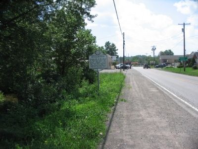
Originally built 1731-34 as second home of Morgan Morgan-first white settler in West Virginia. Rebuilt with some of original logs in 1976 as a State and County Bicentennial project. It was here during the Revolution that James Morgan, the grandson . . . — — Map (db m12798) HM
At Bunker Hill in 1726, Colonel Morgan Morgan founded the first permanent settlement of record in what is now West Virginia. In commemoration of this event, the state of West Virginia has erected a monument in Bunker Hill State Park, and has . . . — — Map (db m134056) HM
Morgan Morgan, a native of Wales, established his home at Bunker Hill before 1732, and was leader in Eastern Panhandle’s early development. His sons gave name to Morgantown, and fought in Indian and Revolutionary Wars. — — Map (db m1176) HM
Named for Gen. William Darke, veteran of the Revolution and the Indian wars. He saved the remnants of St. Clair’s army from massacre in 1791 when badly defeated by the Miami Indians. His son, Capt. Joseph Darke, lost his life. — — Map (db m167181) HM
West Virginia
(Berkeley County)
"The Mountain State"—western part of the Commonwealth of Virginia until June 20, 1863. Settled by the Germans and Scotch-Irish. It became a line of defense between the English and French during . . . — — Map (db m131797) HM
Built by John Hays, 1743. Became home of Reverend David Gerard, who founded Gerrardstown in 1787. His father was Reverend John Gerard, the first Baptist Minister west of the Blue Ridge Mountains. — — Map (db m12793) HM
Established as a town, 1787. Named for John Gerrard, first pastor of Mill Creek Baptist Church, which was organized by early settlers about 1743. The congregation reorganized after Indian hostilities during the French and Indian War. — — Map (db m12791) HM
This property
has been placed on the
National Register
of Historic Places
by the United States
Department of the Interior
Zaquill Morgan House
1761
[Lower plaque:]
A
Berkeley
County
Historic
Landmark . . . — — Map (db m148875) HM
National Register [of Historic Places] Structure
by
U. S. Dept. of Interior
Hedgesville Historic District
Est. 1978
[Lower plaque:]
circa
1842 — — Map (db m148850) HM
Site of stockade fort built during the early Indian wars. Mt. Zion Episcopal Church was built soon after. A mile west is the tavern, built, 1740–1750, by Robert Snodgrass on land patented in 1732 by William Snodgrass, pioneer settler. — — Map (db m990) HM
During the French and Indian War (c. 1750) Virginia Militia Col. George Washington supervised the construction of Fort Hedges, a stockade fort built along the Warm Spring Road at the heavily-traveled Skinner's gap atop North Mountain (740 feet . . . — — Map (db m117316) HM
Adam Stephen (1720-1791) had a close acquaintance with George Washington through their association with Lord Fairfax and from their military involvements from the French & Indian War through the American Revolution. Stephen was present with . . . — — Map (db m167507) HM
The colonial village of Martinsburg was established by law enacted by the General Assemply of the Commonwealth of Virginia on October 21, 1778. Martinsburg’s founder was General Adam Stephen, a noted soldier of the American Revolutionary War. . . . — — Map (db m167514) HM
One of the earliest brick buildings constructed in Martinsburg. Home of Rear Admiral Charles Boarman, who served in the War of 1812 and the Civil War. — — Map (db m132397) HM
Built, 1812, by Elisha Boyd, general in the War of 1812, on land bought from Gen. Adam Stephen. Mansion noted for its fine workmanship. Home of his son-in-law, Charles J. Faulkner, Minister to France, and his grandson, U.S. Senator Faulkner. — — Map (db m983) HM
During the French and Indian War, Fort Neally was captured and its garrison massacred, Sept. 17, 1756. Many settlers in the vicinity also were killed. Among captives was Isabella Stockton, later wife of William McCleery, Morgantown. — — Map (db m12790) HM
Here was home of General Adam Stephen, founder of Martinsburg and county's first sheriff. Was famous as fighter in French and Indian Wars, and as major general in the American Revolutionary War. — — Map (db m12786) HM
Founder of Martinsburg, First Sheriff of Berkeley County, Statesman, Soldier, Surgeon National Register of Historic Places Oct. 15, 1970 — — Map (db m12788) HM
He was commander of a division in the Revolution. Voted for the adoption of the federal constitution while a member of the Virginia Assembly. Granted 130 acres of land for the site of Martinsburg and was the first sheriff of Berkeley County. — — Map (db m132409) HM
Founded, 1778, by Gen. Adam Stephen. Named for Thomas Martin, nephew of Lord Fairfax. Home of Admirals Charles Boarman and C.K. Stribling. Locomotives seized here, 1861, in Jackson’s raid were drawn by horses to Winchester, Va. — — Map (db m1973) HM
Martinsburg. Established, 1778, by Gen. Adam Stephen. Named for Col. Thomas Martin, nephew of Lord Fairfax. Home of Admiral C.K. Stribling and Admiral Charles Boarman. In Jackson’s raid, 1861, captured B&O locomotives were drawn by horses to . . . — — Map (db m1976) HM
The Founder
Born around 1720 in Scotland, Stephen received a surgeon's degree from the University of Edinburgh in 1746. He came to America in 1748, settling in Fredericksburg, Va., where he practiced as a doctor. In 1754 he joined the Virginia . . . — — Map (db m167510) HM
West Virginia (Berkeley County). "The Mountain State—western part of the Commonwealth of Virginia until June 20, 1863. Settled by the Germans and Scotch-Irish. It became a line of defense between the English and French during . . . — — Map (db m167182) HM
Named for William Madison Peyton,
father of navigation on Coal River,
who promoted and actively engaged in
coal mining. As chief engineer for the
Coal River Navigation Company, he
locked and dammed Coal River in the
1840’s and made it . . . — — Map (db m137511) HM
Area first settled in 1798; Payton Byrnes came in 1830. First known as Lumberport in 1866, when Capt. John Burns established first saw mill in area. Incorporated by county in 1902 and named for Burns. — — Map (db m50025) HM
Bethany
Here Scots-Irish Alexander Campbell founded a religious movement which he called the Disciples of Christ. In this place Amos Dolbear perfected parts of the telephone, and longtime Speaker of the House "Champ" Clark, Supreme Court . . . — — Map (db m79899) HM
Bethany
Bethany College, established here in 1840, oldest school of college rank in State. The home and the study of Alexander Campbell, founder, are here. Prof. A. E. Dolbear here perfected parts of the telephone, which Bell used.
. . . — — Map (db m79900) HM
Born in County Down, Ireland, Feb. 1, 1763, and died at the residence of his son Alexander, Jan. 4, 1851, aged 91 years, 11 mthns, five days. Many years a minister of the Secession Presbyterian Church in Ireland and Scotland. In the United States . . . — — Map (db m20835) HM
Constructed by Alexander Wells at
65 Washington St., Buffaloe, Virginia
(present day Third St.,
Wellsburg, West Virginia)
The Wells Log House was, and is, in the
“National Register of Historic Places”
District of . . . — — Map (db m21634) HM
First highway tunnels constructed west of Alleghenies. They were built in 1831 by Richard Waugh at personal expense to ease transportation to his flour mills. The tunnels, a mile apart, were removed by the State in 1957. — — Map (db m21614) HM
The first glass house in Western Virginia was built at Charlestown, now Wellsburg, in 1813, by Isaac Taylor Duvall and Company. It was located on the southeast corner of Fifth and Yankee Streets. Cobalt blue, green and clear flint glass wares were . . . — — Map (db m39642) HM
Built by John Henderson prior to 1798 in Federal style, the building was leased by William Miller and operated as a tavern for 50 years. Since 1974 building has housed the Brooke County Museum. — — Map (db m21628) HM
Sergeant on the Lewis and Clark
Expedition, he published the first
account of that exploration in 1807
Veteran of the War of 1812, he
fought in the Battle of Lundy's Lane
and at Fort Erie
Citizen of Wellsburg for more than . . . — — Map (db m21629) HM
Born 12 June 1771, Gass served as carpenter for Lewis and Clark. The expedition explored and studied the land, waterways, animal life, natural features and resources of the West. Gass's journal of trip was published in 1807. Soldier in the War of . . . — — Map (db m39731) HM
The Corps of Discovery, under the command of Meriwether Lewis and William Clark, was the first official expedition through the interior of the North American Continent sponsored by the United States.
Captain Meriwether Lewis passed Charles . . . — — Map (db m21639) HM
Methodism in Wellsburg dates back to 1787 with the establishment of the “Ohio Circuit.” Early services were held in “The Academy” on High Street. Bishop Asbury preached at the courthouse on September 6, 1803.
On April . . . — — Map (db m21635) HM
Established in 1791. Brooke Academy, started, 1778, incorporated in 1799. Here lived Joseph Doddridge, the author of "Frontier Notes," and Patrick Gass, member of the Lewis and Clark Expedition and author of its "Journal." — — Map (db m39699) HM
In the 1790's, flatboats left here with their cargoes for southern markets. To accommodate and store products, warehouses and wharfs were built along our river banks. This wharf, which was established in the 1800's, extended twenty feet out in the . . . — — Map (db m21637) HM
This giant Sycamore tree stands at the top of the Wellsburg Wharf it was planted in the early years of the 19th century by Dr. Albert Wheeler who practiced medicine in Wellsburg until his death in 1864.
It was under this tree that militiamen . . . — — Map (db m21641) HM
Established, 1813. County seat moved here from Guyandotte and remained until taken to Huntington in 1887. Before the Guyandotte courthouse was chosen,court met at the home of William Merritt, 1809-1810, on Mud River near here. — — Map (db m227463) HM
This Tablet Erected to Commemorate the
150th Anniversary of the Founding of Cabell County
Formed from Kanawha County in 1809. Included Wayne, Mingo and parts of Logan, Boone, Putnam and Lincoln. Named in honor of Governor William H. Cabell of . . . — — Map (db m126799) HM
This tablet marks the square where the First Cabell County Court House was erected in 1809. Dedicated in loving memory to my father and mother Mr. & Mrs. James Lewis Caldwell by Ouida Caldwell Watts, Ex-Regent Buford Chapter D.A.R., September 17, . . . — — Map (db m125942) HM
Indian name. Founded in 1810. Site chosen as county seat, 1809, and court first met here, October, 1810. Important point in river traffic, connecting with the James River and Kanawha Turnpike. Burned during the War between the States. — — Map (db m73705) HM
George Washington was made
president in 1785 of the
James River Company. His
plan of communication to
the West eventually resulted
in the construction of the
Midland Trail, U.S. 60, and the
Chesapeake and Ohio Railroad. — — Map (db m126041) HM
Authorized by an act of 1786 was extended in December 1787 from Richmond Va. past this point to the mouth of the Big Sandy River entering the city over Norway Avenue. By 1832 this road became the James River and Kanawha Turnpike opening west to . . . — — Map (db m73741) HM
Survey of Milton began here in 1872 and post office was established in 1873. Founder, David Harshbarger, later lived on this lot. Named for Milton Reece, first postmaster and large landholder in vicinity. Town incorporated in 1876 with Captain J.R. . . . — — Map (db m73674) HM
First White settlers came here from Giles County, Virginia, in pursuit of an Indian raiding party that had taken their horses. Permanent settlement established by 1800. McComas and Hatfield families were among first settlers. Thomas Ward produced . . . — — Map (db m178251) HM
Site of first Calhoun Co. Court which met at home of Joseph Burson, April 14, 1856. Justices were Wm. Brannon, Dan. Duskey, H.R. Ferrell, Geo. Lynch, Joshua Knight, Absalom Knotts and Hiram Ferrell. — — Map (db m73462) HM
One mile west in the low gap are the graves of Mike Fink and an Indian, slain in 1780, and buried where they fell. While hunting, Fink and Adam O’Brien were fired on by two Indians; Fink shot one and was killed by the other. — — Map (db m137950) HM
Solomon Osborne was born circa 1814 on a Cherokee reservation in North Carolina. Served as guard on the “Trail of Tears,” and fell in love with Seaberry (Martha Arms), daughter of Chief Running Bear (Robert Arms). They escaped and were married in . . . — — Map (db m137986) HM
Both county and county seat are named for Henry Clay. The Golden Delicious apple, once called "Mullins' Yellow Seedling," was developed on Porters Creek. The State also produced the Grimes Golden, the other great yellow apple. — — Map (db m64096) HM
Here lived Joseph H. Diss Debar, artist, designer of the State seal and coat of arms. He lived here many years and helped establish Saint Clara Colony nearby, about 1845. Author of first "Handbook of West Virginia". — — Map (db m142421) HM
West Union, incorporated in 1881, was formerly called Lewisport in honor of Lewis Maxwell. It is the county seat of Doddridge, named for Philip Doddridge. In it lived J. H. Diss Debar and Sen. and Gov. M. M. Neely. — — Map (db m42429) HM
Nearby is grave of Seaberry Osborne
(circa, 1815-66), daughter of Chief
Running Bear. She married Solomon
Osborne in Cherokee, N.C. and in
1838 fled to escape “Trail of Tears.”
The Native American pioneers found
sanctuary in the mountains and . . . — — Map (db m138009) HM
Plaque One
Abraham Vandal
1758-1848
* Born in Dutchess, NY
* Soldier in the American Revolutionary War 1776-1781
* Married Mary Dillon 1780
* Father of Eight Children
* Early Fayetteville Settler
* In 1812 Abraham . . . — — Map (db m55816) HM
The town of Glen Jean-and a small empire-began as a wedding gift. In 1870, Thomas McKell of Ohio received about 12,500 acres of
West Virginia land from his father-in-law. After geologists confirmed the presence of coal, McKell purchased another . . . — — Map (db m165216) HM
Welcome to Kaymoor Bottom! The structures around you are all that remain of Kaymoor One's coal processing plant (metal remains) and power station (stone/brick walls). The coke ovens and former town are upstream to the right of the boardwalk, running . . . — — Map (db m242504) HM
Kaymoor was one of the largest coal mine complexes in the New River Gorge. You are two miles from Kaymoor One. Here workers mined over 16 million tons of coal and processed one million tons of coke between 1899 and 1962.
Kaymoor was a company . . . — — Map (db m242426) HM
Settled before the Revolution by Levi Morris, whose father, William Morris, made the first permanent settlement in the Great Kanawha Valley. Named Coal Valley in 1879. Renamed when incorporated in 1891 for James C. Montgomery. — — Map (db m138010) HM
Settled before the Revolution by Levi Morris, whose father, William Morris, made the first permanent settlement in the Great Kanawha Valley. Named Coal Valley in 1879. Renamed when incorporated in 1891 for James C. Montgomery. — — Map (db m138013) HM
With railroads came thousands of workers looking to make a new life in the coalfields. In the late 1800’s and well into the mid-1900’s, many Appalachian miners lived in company towns called “Coal Camps”.
Mine operators built . . . — — Map (db m34443) HM
Secondary to only the mines themselves, the railroads were the most significant driver of development in the Dunloup Creek watershed at the outset of the 20th century. A fiercely competitive business, access to the railroad determined the success . . . — — Map (db m242619) HM
Fayette County. Formed, 1831, from Nicholas, Greenbrier, Kanawha, Logan. Named for General Lafayette. On New River, 1671, Batts and Fallam officially claimed Mississippi Valley for Great Britain in opposition to the claim of France. . . . — — Map (db m228751) HM
Native Americans used the area of Sugar. Dunloup, and Mill Creeks for hunting until Virginia's Governor purchased land south of the Kanawha River in 1770. Raids continued until General Anthony Waynes won a decisive victory in Ohio in 1794 securing . . . — — Map (db m161340) HM
Located within the New River coalfield, Mt. Hope was an important service center for the oldest of southern West Virginia's three "smokeless" coalfields. Unlike the Pocahontas field, where town- building followed railroad and coal development, . . . — — Map (db m242624) HM
The arrival of the coal industry in the 1890s dramatically transformed the landscape of the New River coalfield. Guided by managers of the newly-founded companies, company towns emerged almost overnight along the coal seam, introducing . . . — — Map (db m242618) HM
Occupying an area of land in a bend on the west side of the New River, much of what became the New River coalfields was once known simply as "the Loop" to early-19th century Virginians on the frontier. Bound by the river, the area was fed by two . . . — — Map (db m228745) HM
Located on the edge of Mount Hope, a mining operation was first established at Kilsyth in 1893 by the McKell Coal and Coke Company. Operating until the 1940s under the New River Coal Company, the mine's production peaked in 1911. The mine was . . . — — Map (db m228747) HM
You are at the site of the coal-mining town of Nuttallburg. Mine owner John Nuttall arrived here in 1870 and quickly opened two mines. He built Nuttallburg to serve the mines and his workers.
Nuttallburg evolved with the mining industry, Mine . . . — — Map (db m242436) HM
This trail, the former Keeney Creek Branch Railroad, leads to the site of Nuttallburg, a coal mining town that existed from 1870 until 1958. Today you can visit the site and learn about life in a New River Gorge mining town. Several structures and . . . — — Map (db m242427) HM
The scene around you recently changed-again. The landscape here has undergone several transitions in the past 150 years. Native Americans and settlers in the early 1800s saw solid forest, but in the late 1800s mining companies cut much of the . . . — — Map (db m242435) HM
You are at the site of the coal-mining town of Nuttallburg. Mine owner John Nuttall arrived here in 1870 and quickly opened two mines. He built Nuttallburg to serve the mines and his workers.
Nuttallburg evolved with the mining industry, Mine . . . — — Map (db m242428) HM
It was the belief of [my grandfather] that the safest and most profitable investment that a man could make was the purchase of wild lands which had natural resources on or under them. Such lands should increase in value... [and] no trusted . . . — — Map (db m242462) HM
Sounds frightening doesn't it? It sounds like if you take this trail you might not be seen again. Fear not. Seldom Seen was the name of a community that once existed about 4 mile from here. Visiting the site of Seldom Seen takes about 30 minutes. It . . . — — Map (db m242465) HM
Thurmond ran from the river's edge up the hill. Homes dotted the hillside. Large businesses (like Hotel Thurmond and Armour Meat Company) along with small shops
(a jeweler, shoemaker, barber, and others) served the needs of residents and . . . — — Map (db m165248) HM
The area across the river was known as Southside Junction. During the industrial boom of the early 1900s, it helped draw many people to the Thurmond area for both business and pleasure.
Southside Junction boasted the famous Dunglen Hotel, as . . . — — Map (db m242506) HM
Ribbons of steel were, and still are, the main street of Thurmond. For over 80 years, trains were the primary method of travel, linking over 50 New River communities to each other and connecting the gorge to the rest of the US. Thurmond was a . . . — — Map (db m165243) HM
Built this home in 1837 on a 1000-acre tract, and laid out the town of Glenville in 1845. As a member of the Virginia Assembly, he urged the building of the Parkersburg-Staunton Turnpike. As a Congressman, in 1842, Hays appointed Thomas Jonathan . . . — — Map (db m17557) HM
Stalnaker Plantation. Major William Stalnaker moved here
with his family from Randolph County
in 1817 to claim a land grant for
services rendered in the War of 1812.
Tobacco was among the crops grown
on the plantation. A post office . . . — — Map (db m174395) HM
Nearby was located cabin of Vincent Williams, an early settler and noted Indian fighter of the South Branch, who lived on Patterson’s Creek near Fort Pleasant. During a July 16, 1756 attack on his home, Williams killed five Native Americans before . . . — — Map (db m94034) HM
The proclamation of George III, King of England, in 1763 ordered settlement west of these mountains to stop. The early treaties between the English and the Six Nations accepted this range as the dividing line between them. — — Map (db m75184) HM
576 entries matched your criteria. The first 100 are listed above. Next 100 ⊳