Here was the southwestern boundary of the six million acre estate of Lord Fairfax. This vast tract, lying south of the Potomac and known as the Northern Neck, included the Eastern Panhandle and most of the South Branch. — — Map (db m155451) HM
Grant County. Formed in 1866 from Hardy. Named for General Grant, later President. At the northwestern corner is the Fairfax Stone, which established the limits of the lands of Lord Fairfax. The county has many mountain peaks and beautiful . . . — — Map (db m162737) HM
Settled in 1777 by “Elder” John Alderson, the frontier missionary. He organized the first Baptist church in the Greenbrier Valley. In 1763, the Muddy Creek settlements were destroyed by Shawnee Indians under Cornstalk. — — Map (db m76515) HM
Fort Donnally. Built by Andrew Donnally a few miles north about 1771. Attack on this fort by 200 Indians in 1778 was second most important frontier engagement in the State. The fort was relieved by force under Col. John Stuart.
Border . . . — — Map (db m238233) HM
Caldwell on Scribner's Magazine Cover
Caldwell, located two and a half miles east of Lewisburg, gets its name from James R. Caldwell, whose family owned and occupied the stately brick house, "Elmhurst," on the bank of the Greenbrier River. . . . — — Map (db m238237) HM
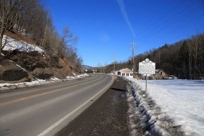
Col. John Stuart, who came here in 1769 with McClanahan, the Renicks, and companions, bought out earlier claims of William Hamilton. "The Cliffs" to the east offer one of the celebrated beauty spots of Greenbrier Valley. — — Map (db m50389) HM
Side A Site of Fort Savannah, built in 1755. Here at Camp Union Gen. Andrew Lewis mustered troops which participated in the Battle of Point Pleasant 1774. Lewisburg was incorporated in October, 1782, by the Virginia Assembly. Side B . . . — — Map (db m21747) HM
Pontiac's WarMassacre of white families of Muddy Creek and of the Clendenins near here by a band of Shawnee Indians led by Chief Cornstalk, in 1763, completed the destruction of the early settlements in the Greenbrier Valley.
Welsh . . . — — Map (db m50395) HM
"Leave me but a banner to plant upon the mountains of Augusta and I will rally around me the men who will lift our bleeding country from the dust, and set her free."
....Washington . . . — — Map (db m75200) HM
From the French word meaning “Greenbrier”. Thomas Edgar settled in Greenbrier County before 1780. His son built first grist mill on Greenbrier River. Three successive mills were destroyed but the fourth plant operates today. — — Map (db m76513) HM
A post office was established here in 1889 and the village was incorporated in 1945. Named for Dr. Cyrus A. Rupert (1812-1891), a prominent local physician. The first settler here was William McClung (1738-1833) who came in 1766. A soldier in the . . . — — Map (db m50390) HM
Named for Kate Carpenter, whose husband, Nathan, was killed by the Indians. Fine scenic view. Home of Kate's Mountain Clover and other rare plants, such as the Box Huckleberry, 6000 years old - the oldest living thing. — — Map (db m19363) HM
Early European settlers in this Allegheny Mountain valley learned from Shawnee Indian hunters about this sulphur water spring. Health-seekers soon started arriving to bathe in the waters to relieve the aches of rheumatism. By the 1830's the resort . . . — — Map (db m75422) HM
This structure replicates the original fortress stockade, erected nearby in late 1755 by early Cacapehon Valley settler, Joseph Edwards. On his homestead, the fortress encompassed Edwards's house, barn, outbuildings, and a spring. The original . . . — — Map (db m167033) HM
War Comes to the Frontier
It took over one hundred years from the time that European settlers first began to build Jamestown until Governor Spotswood and his Knights of the Golden Horseshoe stood on the Blue Ridge Mountains and gazed . . . — — Map (db m150674) HM
In 1784, Washington proposed the Northwestern Turnpike as an all-Virginia route to the Ohio. Authorized in 1827 and started in 1831, it remains a monument to the skill of its engineers, Charles Shaw and Colonel Claudius Crozet. — — Map (db m4623) HM
Hampshire County
Oldest county; established by the Virginia Assembly, 1754. Formed from Frederick and Augusta. Lord Fairfax, owner, named it for the English shire of the same name. Ice Mountain and Hanging Rocks are among its natural . . . — — Map (db m159337) HM
“Fort Pearsall was on or in view of this site.”
Job Pearsall built a fort as protection against the indians in 1754 on Lot 16, granted by Fairfax in 1749 containing 323 acres, including part of Indian Mound Cemetary.
On May . . . — — Map (db m2101) HM
Romney. Incorporated as a town, 1762. Owned and laid off as a town by Lord Fairfax. Named for one of the five English Channel ports. Not far away was Fort Pearsall, built, 1756, as Indian defense. Town changed military control 56 times, . . . — — Map (db m159299) HM
Francis Taggart (also spelled Tygart) A Quaker, was responsible for the construction of this Clapboard "Half" House on one of the one hundred lots which Lord Fairfax had surveyed to encourage settlement of the western countries. According to his . . . — — Map (db m150639) HM
Site of Nesselroad's powder mill which operated from 1795 to 1801. To the south on King's Creek stood Hartford's grist mill which served local settlers in early 1800's. In 1823, Swearingen's grist mill and Eaton's saw mill were built near the same . . . — — Map (db m39654) HM
Near New Cumberland, George Chapman settled, about 1783, and built an Indian fort. Here are graves of the Chapmans, Gregorys, Graftons, and other pioneer families. Pughtown, settled about 1810, was the first county seat. — — Map (db m39685) HM
Near New Cumberland, George Chapman settled, about 1783, and built an Indian fort. Here are graves of the Chapmans, Gregorys, Graftons, and other pioneer families. Pughtown, settled about 1810, was the first county seat. — — Map (db m44130) HM
In 1839 John Cuppy laid out 42 lots on his farm between Ohio River and hill; added 50 lots in 1850. Named Vernon but called Cuppy Town. In 1840 John Chapman built the first house. Industry based on rich clay deposits, brick plants and river . . . — — Map (db m39743) HM
In 1839 John Cuppy laid out 42 lots on his farm between Ohio River and hill; added 50 lots in 1850. Named Vernon but called Cuppy Town. In 1840 John Chapman built the first house. Industry based on rich clay deposits, brick plants and river . . . — — Map (db m44135) HM
In Memory Of
Ernest T. Weir
Founder of
City of Weirton and Weirton Steel
and to the honor of all who have contributed to the growth and progress of the city and its industry
Dedicated in America's Bicentennial Year . . . — — Map (db m155988) HM
Hancock County
Formed in 1848 from Brooke. Named for John Hancock, first signer of the Declaration of Independence. Iron furnaces established in this county as early as 1794 made the cannon balls that Commodore Perry used in Battle of Lake . . . — — Map (db m80381) HM
Hardy County. Formed from Hampshire in 1786. Named for distinguished Virginian, Samuel Hardy. In 1725, John Van Meter of New York visited the South Branch Valley. He praised it highly, so his sons acquired land and settled at Old Fields. . . . — — Map (db m237976) HM
Howard's Lick
Howard's Lick, or Lee White Sulphur Springs, was once owned by Gen. Henry "Light Horse Harry" Lee of Revolutionary War fame. It was owned later by Charles Carter Lee, brother of the beloved Gen. Robert E. Lee.
Jackson Home . . . — — Map (db m50470) HM
Chartered, 1777, and named for Conrad Moore, early settler. During Indian wars, Town Fort, north, and Fort Buttermilk, south, gave protection. Here, 1794, Gen. Biggs brought part of the troops recruited to suppress Whisky Rebellion. — — Map (db m9233) HM
Built on lands of Issac Van Meter who took up claim near Old Fields, 1735, and settled there, 1744. In chain of forts which Washington established. For a time it was garrisoned by British regulars. Near it was Battle of the Trough, 1756. — — Map (db m155454) HM
Who made the first settlement on Lower Simpson Creek in April 1772. He obtained a patent on 400 acres of land and built his cabin near this site. Later in the same year he returned to the South Branch and married Sarah Allen. They reared a family of . . . — — Map (db m229645) HM
On Simpson Creek is the site of fort built by John Powers, 1771. Nearby is grave of Col. Benjamin Wilson, soldier and settler. Here lived Joseph Johnson, only Virginia governor from west of Alleghenies; first elected by popular vote. — — Map (db m4545) HM
(side 1)
Established 1785. Named for Gen. George Rogers Clark. John Simpson camped here in 1764. Early permanent settlements were made by the Davissons, Cottrills, Sotha Hickman, Nicholas Carpenter, and others.
(side 2) . . . — — Map (db m73413) HM
Born along Devils Crk. in the Millstone Valley of New Jersey. Married
Prudence Izzard of Phil. in 1772. Came to Harrison Co. Va. in 1773 with wife
father, Obadiah, uncles John, Andrew, Amaziah and families. His survey
listed 400 acres in 1773 . . . — — Map (db m184966) HM
In 1764, John Simpson, hunter and trapper, established a camp here on the bank of the West Fork River opposite the mouth of Elk Creek. He was the first white man in the area. Simpson Creek and the town of Simpson are named for him. — — Map (db m174580) HM
"...So build your community that quickened conscience, larger vision, deeper devotion and equality of rights for all will resolve itself into an enthusiastic zeal for personal service in the community. All who give service are torch bearers." . . . — — Map (db m73414) HM
Nearby is the Mclntire blockhouse, built in 1773, another of the outposts established as protection against the Indians. Here are the graves of many
early settlers, including those of John McIntire and wife, both victims of the Indians. — — Map (db m176882) HM
Chartered, 1794, and settled by colony of families from New Jersey. Site of blockhouse where troops were stationed during Indian wars to guard the trail from the Ohio to the West Fork settlements. It is the seat of Salem College. — — Map (db m170909) HM
Salem developed as a result of the oil boom around the turn of the twentieth century. A major fire devastated the downtown in 1902 destroying the majority of the wood-framed buildings along Main Street. Subsequently, much of Main Street was . . . — — Map (db m173878) HM
Built, 1778, by Levi Shinn who came from New Jersey, 1773, and claimed tomahawk rights. Returned with family and brothers, Clement and Jonathan and settled. Sold part of land to Jonathan whose son, Levi, deeded it for site of Shinnston. — — Map (db m125817) HM
Inherited by Levi's oldest son Clement. After Clement's death, house sold to David Morris in 1840's. Morris heirs sold it with surrounding land in 1959 to Richardson Lumber & Construction Company. In 1972, its owners, Bob and Shirla (Bice) . . . — — Map (db m177089) HM
Village so named because of well drilled here in 1835 by Abraham and Peter Righter. The well reached a depth of 745 feet releasing natural gas. Often attributed to be first deep well drilled in United States. Water from such wells was reputed to . . . — — Map (db m177528) HM
Spelter Community Company town built for immigrant, primarily Spanish, zinc plant workers, 1910-11: housed 1,500 residents in 175 homes, renting for $11 per month by 1915. First known as Ziesing, for a company official; named Spelter for post . . . — — Map (db m125821) HM
Michael Coleman, member of a hunting party from frontier fort at Belleville, was killed and scalped by the Indians at this point about 1793. Near by at Mill Creek Falls, Benjamin Wright build an early power flour mill. — — Map (db m124884) HM
Post Office established here July 1, 1880, with Grandville P. Morrison as first postmaster. Named in honor of John Edward Kenna (1848-1893), member of the U.S. House of Representatives (1879-1883), and later elected to the U.S. Senate (1883-93). . . . — — Map (db m73672) HM
This tablet marks the military grant of land 2448 acres made by King George II of England in the year 1772 to George Washington for his services in the French and Indian War. General Washington bequeathed 1425 acres of this tract to his niece . . . — — Map (db m228080) HM
Westward lies the Millwood Tract of 4,395 acres patented by George Washington on December 15, 1772, based on a survey made in June 1771. It bordered on the Ohio River above the Great Bend for “file miles and 700 poles.” — — Map (db m124517) HM
Established in 1832 on land which was settled by William John and Lewis Rogers in 1768 and later acquired by Jacob and Ann (Staats) Starcher. Near here lived Capt. William Parsons who was active in the early life of Jackson County. — — Map (db m73650) HM
Built in 1887 over Tug Fork of Mill Creek and named for Enoch Statts' mill. Jackson Co. Court paid local builder H.T. Hartley $904 to erect "Long" truss wooden superstructure. Total cost of original 97 ft. bridge with stone abutments and approaches . . . — — Map (db m73652) HM
Enjoy over 3,000 acres of rivers, trails, and battlefields in historic Harpers Ferry
Near the Visitor Center: Battlefields and Trails
Experience Harpers Ferry's tumultuous past. Pick up park trail maps and guides at the visitor . . . — — Map (db m143936) HM
"I will pledge myself that there is not a spot in the United States which combines more or greater requisites...."
George Washington May 5, 1798 Harpers Ferry's history and geography have influenced each other for . . . — — Map (db m12065) HM
Bushrod Corbin Washington, grandnephew of General George Washington, built this home in 1820. It was destroyed by fire, 1838, and rebuilt. Later it was the home of Frank R. Stockton, novelist, who here wrote his last book. (2 Mi. SW) — — Map (db m12636) HM
A half mile southwest is the mansion built by John B. and Lucy Washington Packette in 1840. The center of conflict between Generals Early and Sheridan on August 21, 1864. Marks of the cannonading and musketry fire are yet visible. — — Map (db m157729) HM
On February 17, 1787, Charles Washington, founder of Charles Town, executed a deed granting a lot to the Board of Trustees of the Charles Town Presbyterian Church. Washington was paid 20 pounds "current money of Virginia" for the lot which was in . . . — — Map (db m170356) HM
Founded in 1786 by Charles Washington, brother of the President. Here John Brown was tried and convicted of treason. Home of W. L. Wilson, Postmaster General, 1896, who here started the first rural free delivery in America. — — Map (db m1650) HM
You now stand in the center of a town that is almost as old as the United States, laid out on 80 acres of Washington lands in 1786 - four years before the First President took office.
Charles Washington, youngest of the five brothers of the . . . — — Map (db m12600) HM
Exitus Acta Probat. 1738–1799. In Memory of Colonel Charles Washington, brother of General George Washington and founder of Charles Town, Virginia (now West Virginia) in 1786. The four corner lots at Washington and George Streets were . . . — — Map (db m2029) HM
In 1799, prominent Charles Town resident Samuel Washington sold the two lots that house this building to James Duke, a freed indentured servant. Eventually, physician Charles Taylor Richardson took ownership of the land and property. Dr. Richardson . . . — — Map (db m103606) HM
Now called Mordington, home of Colonel Charles Washington, founder of Charles Town, Virginia (now West Virginia). His brother General George Washington often visited him here. Colonel Washington died in September 1799. He and his wife Mildred are . . . — — Map (db m12070) HM
Erected in 1771. The home of Colonel Samuel Washington, County Lieutenant. His brother General George Washington visited here and General Lafayette and Luis Phillipe of France were entertained here. In this house James Madison and Dolly Payne Todd . . . — — Map (db m1914) HM
John Blessing was born in Germany and came to the United States and made his home in Baltimore, Maryland. He moved to Charles Town 1853 and purchased a large brick building on the corner of Charles and Washington Streets (Now known as the Shugart . . . — — Map (db m132445) HM
Lock Graveyard relocated by
W.V.D.O.H. from the Flynn Farm
on the north side of Harper's
Ferry Pike, east of Charles
Town, W.V.
February 27, 1989 — — Map (db m103493) HM
From this one-room office Charles Washington, brother of George Washington, sold lots in the City of Charles Town which he founded in 1786. — — Map (db m132451) HM
This chapel was built by devout people of (then) Frederick Parish. Frederick County, Virginia joined Col. Robert Worthington in completing it in 1769. It was first called the English Church, then Berkeley Church, then Norborne Chapel, as the parish . . . — — Map (db m2026) HM
Harpers Ferry owed its existence principally to the United States armory, which began producing small arms here in 1801. At its height, this factory produced more than 10,000 weapons a year and employed 400 workers. The armory affected the everyday . . . — — Map (db m18793) HM
Expanding armory operations in the opening decades of the 19th century resulted in overcrowded and unhealthy living conditions for workers. Families shared inadequate, unventilated housing, while single men slept in the workshops. To alleviate the . . . — — Map (db m18797) HM
You are in the Camp Hill area of Harpers Ferry. Explore Camp Hill's history with exhibits in front of the Morrell, Brackett, and Lockwood houses and Mather Training Center. Side trails in Harper Cemetery and in front of Mather Training Center . . . — — Map (db m103584) HM
From this vantage point, a succession of early residents watched Harpers Ferry grow from a tiny village into a thriving industrial community. In 1775, town founder Robert Harper chose this hillside for his family home because it lay safely . . . — — Map (db m18753) HM
From this vantage point, early residents watched Harpers Ferry grow from a tiny village into a thriving industrial community.
In 1775, town founder Robert Harper chose this hillside for his home. The home was completed in 1782. . . . — — Map (db m148945) HM
Harpers Ferry, Virginia - Charter from Virginia Legislature 1851
Jeremiah Fuss - 1851-1852
John C. Umseld - 1852-1853
Solomon V. Yantis - 1853-1855, 1879-1880, 1882-1885
George Mauzy - 1855-1857
Isaac Fouke - 1858-1859
Fontaine . . . — — Map (db m143935) HM
Along this path lie the remains of revolutions. Six acres of the U.S. Armory at Harpers Ferry have been reduced to rubble. Buildings that buzzed with activity and innovation now lie covered with dirt. Train tracks that pushed to the edge of a new . . . — — Map (db m20475) HM
In this cemetery are buried George Adam Moler (1714–1783) and his wife Eve. George Adam Moler came to American on Aug. 29, 1730 with his father Ludwig Mohler, settling first in Lancaster, Penn. He moved to this area around 1758. He received a land . . . — — Map (db m1962) HM
Home of General Charles Lee, built on land bought in 1774. Lee, colonel in British army, resigned his commission and joined the colonists after Battle of Lexington. On this estate, the U.S. Government maintains a fish hatchery. — — Map (db m12069) HM
Home of Gen. Horatio Gates, built on land bought, 1763. Gates, once a British officer, joined the Revolutionary Army, and was the leader of the Continentals in decisive victory over Gen. Burgoyne at Saratoga. (1/2 Mi. S. W.) — — Map (db m12068) HM
Three miles west, on Opequon Creek, lived General Adam Stephen, 1754–1772. Original tract, with hunting lodge, was bought in 1750. The present mansion was built by Adam Stephen Dandridge, his grandson, in 1805. — — Map (db m1746) HM
1½ mi. S is 1825 home of John T. A. Washington, a great nephew of the 1st president. Land part of "Harewood" plot of Sam’l Washington, a brother of George. Original site of 1780 home "Berry Hill." — — Map (db m159500) HM
Founded by free African Americans, George W. & Betty Johnson, in 1848 on 12 acres, it was the first free black community in the state. Johnsons and other families built number of homes and a log, one-room graded school, which also served as a . . . — — Map (db m238231) HM
Traveller's Rest
Traveller's Rest is the site of a pre-Revolutionary War, 1½-story limestone dwelling and several log, wood frame, and masonry outbuildings. The property is listed in the National Register of Historic Places and . . . — — Map (db m150614) HM
On the east side of WV 9 is one of the oldest standing frame (post and beam) buildings in West Virginia. It was constructed in three sections, with the oldest, 1½-story eastern section dating between 1751 and 1755. The voids between the studs . . . — — Map (db m207032) HM
Built in 1751 by Peter Burr, cousin of Aaron Burr, on a grant of 480 acres from Lord Fairfax. The house is one of the state's oldest frame structures. It is a fine example of a mid-18th century Virginia family homestead which traces its origins to . . . — — Map (db m12644) HM
Middleway, founded in the late 1700s, flourished as a trading center for most of the 1800s. About 1820 the Lutherans and German Reformed congregations joined together to build this church. Some years elapsed before the building was erected and . . . — — Map (db m157726) HM
Tackley Farm, originally known as Valley View, was established in 1777 when Michael Blue leased a portion of the property from original grantee, Colonel Richard Blackburn, who migrated from England and acquired over 2,000 acres in 1754. Both . . . — — Map (db m150420) HM
Built by Col. Joseph Van Swearingen
American Revolutionary Soldier
Visited by Lafayette, George Washington, Henry Clay and Wm. J. Bryan
Home of Henry Shepherd V. Descendant of Shepherdtown's founder — — Map (db m70863) HM
Jefferson County. Formed in 1801 from Berkeley. Named for Thomas Jefferson. Home of Generals Gates, Darke, and Charles Lee. Here four companies of Washington's men organized. Shepherdstown was strongly urged as the seat of the National . . . — — Map (db m167398) HM
Early settlers crossed the Potomac here. “Stonewall” Jackson and A.P. Hill used this ford on the way to Battle of Antietam. Here Lee’s army crossed after the battle, with the Corn Exchange Regiment, other Federals in pursuit. — — Map (db m62778) HM
To commemorate their organization February 22, 1916 and preserve the original name of the town and river crossing of colonial days — — Map (db m103698) HM
Established in 1872 as a branch of the State normal school system. It was an outgrowth of the old Shepherd College. This is the site of early settlement made by Thomas Shepherd who built a fort here during Indian days. — — Map (db m1938) HM
James Rumsey, inventor of the steamboat, lived here, 1785 to 1788, and in 1787 demonstrated his boat on the Potomac at this point. Here was born Colonel James Strode Swearingen, who commanded the men who founded the City of Chicago in 1803. — — Map (db m60704) HM
Shepherdstown, the oldest town in what is now West Virginia was incorporated as Mecklenburg in 1762, but was renamed Shepherd's Town in 1798 in honor of its founder Thomas Shepherd. From the French and Indian War to the Civil War the town has been . . . — — Map (db m143927) HM
Such an admirable site for mills, tanneries, and other industries, was not to be found every day.... And so they began, with the industry of beavers, to erect their mills, dwellings, forges, tanneries, shops, schools and meeting houses; . . . — — Map (db m103738) HM
The "Bullskin" or Rock Hall Tract, the first land owned by George Washington in West Virginia, was surveyed by him Nov. 24, 1750. Bought from Captain Rutherford, it became a part of Washington's 2,233-acre tract in this area. — — Map (db m12633) HM
Home of General Washington's grandnephew, John Augustine Washington, who later became the owner of Mount Vernon. "Blakeley", built about 1820, was partially burned a few years later and then rebuilt in it present form. (1½ Mi. W.) — — Map (db m12640) HM
In 1881, the community of Rome
was established at the forks of
the Coal River. Named for local
landowner Rome Pickens. Renamed
Alum Creek after nearby stream
on December 7, 1910. The stream
was named for alum found along
its banks. New post . . . — — Map (db m137394) HM
House built circa 1810 by Samuel Shrewsbury (1763-1855) on a 704 acre tract of land received from Colonel John Dickinson. Sandstone and hewn hardwood logs used in construction were obtained locally from the land. Shrewsbury, a revolutionary . . . — — Map (db m76882) HM
Walter Kelly settled here about 1773 but was killed by Indians. William Morris came here in 1774 and made first permanent settlement in this valley. He built a fort, had a "boat yard," and started a church and school. — — Map (db m50406) HM
Founder and defender of Fort Morris, the first fort built on the Great Kanawha River in 1774, near this site. He also built the first church and school house and made the first permanent white settlement in the Great Kanawha Valley.
And of . . . — — Map (db m164712) HM
1716 Gov. Spotswood's Shenandoah Expedition
1730's Shenandoah Valley settlements
1750-1760's Carolina's-Georgia back country settled
1745-49 Ohio Valley land rivalries
1754-63 French and Indian War
1775-83 . . . — — Map (db m233308) HM
576 entries matched your criteria. Entries 101 through 200 are listed above. ⊲ Previous 100 — Next 100 ⊳