After filtering for Georgia, 388 entries match your criteria. Entries 101 through 200 are listed.⊲ Previous 100 — Next 100 ⊳
Cemeteries & Burial Sites Topic
By David Seibert, August 14, 2011
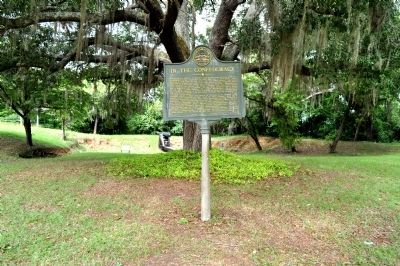
In the Confederacy Marker
| 101 ► Georgia, Clay County, Fort Gaines — 030-5 — In the Confederacy — |
| On Bluff Street, 0 miles south of Commerce Street, on the right when traveling south. | |||
| 102 ► Georgia, Clay County, Fort Gaines — Mt. Gilead Baptist Church — Fort Gaines, Georgia — |
| On Cotton Hill Road (County Route 43) 0.5 miles east of County Route 50, on the right when traveling east. | |||
| 103 ► Georgia, Clay County, Fort Gaines — Old Pioneer Cemetery — |
| On Carroll Street, 0.1 miles west of North Hancock Street, on the left when traveling west. | |||
| 104 ► Georgia, Clay County, Georgetown — New Lowell United Methodist Church / New Lowell School — |
| On New Hope Church Road (County Route 129) 2.6 miles west of Georgia Route 39, on the right when traveling west. | |||
| 105 ► Georgia, Clayton County, College Park — 031-34 — Site: Shoal Cr. Church — |
| On West Fayetteville Road (Georgia Route 314) at East Fayetteville Road, on the right when traveling south on West Fayetteville Road. | |||
| 106 ► Georgia, Clayton County, Jonesboro — 39 — Patrick Cleburne Confederate Cemetery — Battle of Jonesborough - the Second Day — Atlanta Campaign Heritage Trail — |
| On Johnson Street at North McDonough Street, on the right when traveling west on Johnson Street. | |||
| 107 ► Georgia, Clayton County, Jonesboro — 03-11 — Two Days of Battle at Jonesboro — |
| On Johnson Street at North McDonough Street, on the left when traveling east on Johnson Street. | |||
| 108 ► Georgia, Clayton County, Jonesboro — Unknown Confederate Soldiers Memorial — Battle of Jonesboro — |
| Near North McDonough Street at Johnson Street, on the right when traveling north. | |||
| 109 ► Georgia, Clinch County, Homerville — 89 B-12 — Guest Mill Pond — |
| On Guest Mill Pond Road (Private), 0.1 miles west of Pearson Highway (Route 441), on the left when traveling west. | |||
| 110 ► Georgia, Clinch County, Sirmans — 032-4 — Bethany Baptist Church — |
| On Arabia Church Road, 0.1 miles north of Georgia Route 122, on the right when traveling north. | |||
| 111 ► Georgia, Cobb County, Mableton — Cemetery — Mable House — |
| Near Floyd Road Southwest, 0.1 miles north of Maran Lane Southwest, on the right when traveling north. | |||
| 112 ► Georgia, Cobb County, Mableton — Mable Plantation African American Cemetery — |
| Near Floyd Road Southwest, 0.1 miles north of Maran Lane Southwest, on the right when traveling north. | |||
| 113 ► Georgia, Cobb County, Marietta — A National Cemetery System — |
| Near Washington Avenue NE at Cole Street NE, on the right when traveling east. | |||
| 114 ► Georgia, Cobb County, Marietta — Address by President Lincoln — At the Dedication of The Gettysburg National Cemetery — November 19, 1863 — |
| Near Washington Avenue at Cole Street. | |||
| 115 ► Georgia, Cobb County, Marietta — 033-106 — Confederate Cemetery — |
| Near West Atlanta Street SE, 0.1 miles north of Cemetery Street SE. | |||
| 116 ► Georgia, Cobb County, Marietta — 033-107 — Confederate Cemetery — >>>------> — |
| On Powder Springs Road (Georgia Route 360) at South Marietta Parkway (Georgia Route 120), on the right when traveling north on Powder Springs Road. | |||
| 117 ► Georgia, Cobb County, Marietta — Founder's Lot William Harris — |
| Near West Atlanta Street SE, 0.2 miles north of Cemetery Street SE. | |||
| 118 ► Georgia, Cobb County, Marietta — Lady in Black — |
| On West Atlanta Street SE, 0.1 miles north of Cemetery Street SE. | |||
| 119 ► Georgia, Cobb County, Marietta — 22 — Marietta Confederate Cemetery — "Garden of Heroes" — Atlanta Campaign Heritage Trail — |
| Near West Atlanta Street SE north of Confederate Avenue, on the left when traveling north. | |||
| 120 ► Georgia, Cobb County, Marietta — Marietta National Cemetery — |
| Near Washington Avenue NE at Cole Street NE. | |||
| 121 ► Georgia, Cobb County, Marietta — Marietta National Military Cemetery — Henry Greene Cole — |
| Near Washington Avenue at Cole Street. | |||
| 122 ► Georgia, Cobb County, Marietta — Mary Phagan — |
| Near West Atlanta Street SE just north of Cemetery Street SE. | |||
| 123 ► Georgia, Cobb County, Marietta — McLeod Vault — |
| On Powder Springs Road SE (Georgia Route 360) at Cemetery Street SE, on the right when traveling north on Powder Springs Road SE. | |||
| 124 ► Georgia, Cobb County, Marietta — Rest well, Miss Mattie — |
| Near Powder Springs Road (Georgia Route 360). | |||
| 125 ► Georgia, Cobb County, Marietta — Rev. Thomas Milton Allen — |
| On West Atlanta Road SE, 0.2 miles north of Cemetery Street SE, on the left when traveling north. | |||
| 126 ► Georgia, Cobb County, Marietta — Slave Lot — |
| Near West Atlanta Street SE at Cemetery Street SE. | |||
| 127 ► Georgia, Cobb County, Marietta — U.D.C. Confederate Soldiers Monument — Marietta Confederate Cemetery — |
| Near West Atlanta Street SE, 0.3 miles north of Cemetery Street, on the left when traveling west. | |||
| 128 ► Georgia, Cobb County, Marietta — William Root — |
| On West Atlanta Road, 0 miles Cemetery Street SE, on the right when traveling north. | |||
| 129 ► Georgia, Cobb County, Marietta — Wisconsin Soldiers Memorial — |
| Near Washington Avenue NE at Cole Street NE. | |||
| 130 ► Georgia, Cobb County, Smyrna — Collins Springs Primitive Baptist Church — c. 1866 — |
| On North Church Lane at Collins Springs Drive, on the right when traveling east on North Church Lane. | |||
| 131 ► Georgia, Cobb County, Smyrna — First Marked Burial — Elijah H. Fleming — Sept. 25, 1802 - April 8, 1848 — |
| On Memorial Place, 0 miles south of Atlanta Road SE (Georgia Route 3), on the right when traveling south. | |||
| 132 ► Georgia, Cobb County, Smyrna — Mazie Whitfield Nelson — Jan. 1, 1890 - Feb. 2, 1977 — |
| On Memorial Place, 0 miles south of Atlanta Road SE (Georgia Route 3), on the right when traveling south. | |||
| 133 ► Georgia, Cobb County, Smyrna — Smyrna Memorial Cemetery — |
| On Memorial Place, 0 miles south of Atlanta Road SE (Georgia Route 3), on the right when traveling south. | |||
| 134 ► Georgia, Cobb County, Smyrna — Smyrna’s First Mayor — John C. Moore — Aug. 16, 1830 - May 10, 1897 — |
| On Memorial Place, 0 miles south of Atlanta Road SE (Georgia Route 3), on the right when traveling south. | |||
| 135 ► Georgia, Colquitt County, Moultrie — Murphy Settlement — |
| On U.S. 319 at Mack Dekle Road, on the right when traveling north on U.S. 319. | |||
| 136 ► Georgia, Colquitt County, Moultrie — Olde Greenfield Church and Historic Cemetery — In Memory of Rev. T.C. Gregory — |
| On Greenfield Church Road at Kilgore Road, on the left when traveling east on Greenfield Church Road. | |||
| 137 ► Georgia, Coweta County, Grantville — 38-1 — Gravesite of Lt. (jg) Thomas E. Zellars- Namesake of USS Zellars DD 777 — |
| On Griffin Street west of Grantville Brown School Drive, on the right when traveling south. | |||
| 138 ► Georgia, Coweta County, Newnan — 038-5 — Confederate Dead — |
| On Herring Street, 0.1 miles north of Jefferson Street (Georgia Route 34), on the left when traveling north. | |||
| 139 ► Georgia, Dade County, Trenton — Cole Plantation and Bethlehem Cemetery — Historic Dade County — |
| On Slygo Road (County Route 143) 0.3 miles south of Hales Gap Road (County Route 200), on the right when traveling south. | |||
| 140 ► Georgia, Decatur County, Attapulgus — Attapulgus Cemetery Inc. — Hatcher Annex — |
| On Williams Street at Clay Street, on the left when traveling west on Williams Street. | |||
| 141 ► Georgia, Decatur County, Attapulgus — Attapulgus Presbyterian Cemetery — |
| On Main Street (Georgia Route 241) at Church Street, on the left when traveling south on Main Street. | |||
| 142 ► Georgia, Decatur County, Faceville — Ira Sanborn — |
| On Faceville Highway (Georgia Route 97) at Florida Street, on the right when traveling west on Faceville Highway. | |||
| 143 ► Georgia, Decatur County, Recovery — Camp Recovery Monument — |
| Near Booster Club Road at Recovery Road, on the right when traveling east. | |||
| 144 ► Georgia, DeKalb County, Decatur, Druid Hills — 27 — The Hardman Family Cemetery — Early DeKalb County Landmark — Atlanta Campaign Heritage Trail — |
| On Starvine Way, 0.3 miles west of Clairmont Road (U.S. 23), on the right when traveling west. | |||
| 145 ► Georgia, DeKalb County, Decatur, Glennwood Estates — Historic Decatur Cemetery — |
| On Commerce Drive (Georgia Route 155) 0.5 miles north of East Ponce De Leon Avenue, on the right when traveling north. | |||
| 146 ► Georgia, DeKalb County, Stone Mountain — L1 — Stone Mountain Cemetery — Forever Comrades — March to the Sea Heritage Trail — |
| On Cemetery Circle north of East Ponce de Leon Avenue, on the right when traveling north. | |||
| 147 ► Georgia, Dodge County, Eastman — 45-2 — Orphans Cemetery — |
| Near Firetower Road at Orphans Cemetery Road at Firetower Road. | |||
| 148 ► Georgia, Dougherty County, Albany — 47-4 — Edward Vason Jones — |
| Near Dawson Road west of Greenwood Drive, on the right when traveling west. | |||
| 149 ► Georgia, Dougherty County, Albany — Royal Air Force — |
| Near Dawson Road, 0.5 miles north of West 3rd Avenue, on the right when traveling north. | |||
| 150 ► Georgia, Dougherty County, Albany — Spec 4 James Earl Worthy — Albany Veterans Park — |
| Near South Front Street at West Oglethorpe Boulevard, on the left when traveling south. | |||
| 151 ► Georgia, Early County, Blakely — 049-10 — Kolomoki Mounds Archaeological Area — |
| On Indian Mounds Road, 0.2 miles east of Georgia Route 1940, on the left when traveling east. | |||
| 152 ► Georgia, Effingham County, Ebenezer — The Salzburgers — |
| On Ebenezer Road (Georgia Route 275), on the left when traveling east. | |||
| 153 ► Georgia, Effingham County, Guyton — 051-20 — Guyton Confederate General Hospital — |
| On Central Boulevard (State Highway 17) at Springfield Avenue (State Highway 119), on the left when traveling north on Central Boulevard. | |||
| 154 ► Georgia, Effingham County, Rincon — Jerusalem Church Cemetery — |
| On Ebenezer Road (County Route 275) 0.1 miles east of Old Augusta Road (County Route 284), on the left when traveling east. | |||
| 155 ► Georgia, Effingham County, Rincon — 051-4 — The Rev. John Martin Bolzius / The Rev. Israel Christian Gronau — |
| On Ga 275, on the left when traveling east. | |||
| 156 ► Georgia, Elbert County, Elberton — 052-5 — Gov. Heard’s Grave |
| On Heardmont Road at Johnsontown Drive, on the right on Heardmont Road. Reported missing. | |||
| 157 ► Georgia, Elbert County, Elberton — Samuel Elbert — |
| On Deadwyler Street at North Oliver Street (Georgia Highway 77), on the left when traveling east on Deadwyler Street. | |||
| 158 ► Georgia, Fayette County, Fayetteville — 56-3 — Governor Hugh M. Dorsey — (1871-1948) — |
| On Glynn Street (Georgia Route 85) at Fisher Avenue, on the left when traveling south on Glynn Street. | |||
| 159 ► Georgia, Fayette County, Tyrone — Palmer Family Cemetery — |
| On Senoia Road (Old Georgia Route 74) 0 miles north of Carriage Oaks Drive, on the right when traveling north. | |||
| 160 ► Georgia, Floyd County, Coosa — Sardis Presbyterian Church & Cemetery — |
| On Georgia Route 20, on the right when traveling west. | |||
| 161 ► Georgia, Floyd County, Rome — 57-2 — General Thomas Edwin Greenfield Ransom — 1834-1864 — |
| On Alabama Highway (State Highway 20) at Woods Road NW, on the left when traveling west on Alabama Highway. | |||
| 162 ► Georgia, Floyd County, Rome — Myrtle Hill Cemetery — |
| Near South Broad Street near Myrtle Street Southwest. | |||
| 163 ► Georgia, Floyd County, Rome — The Woman Who Saved Football in Georgia — |
| Near Broad Street at East 4th Avenue, on the right when traveling east. | |||
| 164 ► Georgia, Forsyth County, Cumming — Cumming Historic Cemetery — |
| On Resthaven Street west of Atlanta Highway (Georgia Route 9), on the left when traveling east. | |||
| 165 ► Georgia, Fulton County, Atlanta, Bolton — 060-190 — Montgomery Cemetery — |
| On Marietta Boulevard NW, 0.2 miles south of Bolton Road NW, on the right when traveling south. | |||
| 166 ► Georgia, Fulton County, Atlanta, Buckhead — 060-119 — Sardis Methodist Church — |
| On Powers Ferry Road NW, 0.1 miles north of Roswell Road, on the right when traveling north. | |||
| 167 ► Georgia, Fulton County, Atlanta, Grant Park — "Out in the Rain" — (1913) — |
| 168 ► Georgia, Fulton County, Atlanta, Grant Park — Alfred Iverson, Jr. — Brigadier General — Confederate States Army — |
| 169 ► Georgia, Fulton County, Atlanta, Grant Park — Burial Ground of Congregation Ahavath Achim — |
| On Martin Luther King Jr. Ave SE, 0.1 miles east of Oakland Avenue, on the right when traveling east. | |||
| 170 ► Georgia, Fulton County, Atlanta, Grant Park — Clement Anselm Evans — 1833 - 1911 — |
| 171 ► Georgia, Fulton County, Atlanta, Grant Park — Colonel Joseph F. Burke — November 2, 1845 - April 24, 1927 — |
| Near Oakland Avenue SE at Martin Luther King, Jr. Drive SE. | |||
| 172 ► Georgia, Fulton County, Atlanta, Grant Park — Confederate Memorial Grounds — |
| Near Oakland Avenue SE at Martin Luther King, Jr. Drive SE. | |||
| 173 ► Georgia, Fulton County, Atlanta, Grant Park — Confederate Obelisk — |
| Near Oakland Avenue SE at Martin Luther King, Jr. Drive SE. | |||
| 174 ► Georgia, Fulton County, Atlanta, Grant Park — Confederate Soldiers Plot — "Lest We Forget" — |
| 175 ► Georgia, Fulton County, Atlanta, Grant Park — Dr. Charles d'Alvigny — |
| 176 ► Georgia, Fulton County, Atlanta, Grant Park — Dr. Daniel Cornelius O'Keefe — Oct. 1828, Aug. 1871 — |
| 177 ► Georgia, Fulton County, Atlanta, Grant Park — Dr. Noel d'Alvigny — |
| 178 ► Georgia, Fulton County, Atlanta, Grant Park — Hibernian Benevolent Society of Atlanta, Ga. — Founded 1858 — |
| 179 ► Georgia, Fulton County, Atlanta, Grant Park — Historic Oakland Cemetery — |
| Near Oakland Avenue SE at Martin Luther King, Jr. Drive SE. | |||
| 180 ► Georgia, Fulton County, Atlanta, Grant Park — John Brown Gordon — 1832 - 1904 — |
| 181 ► Georgia, Fulton County, Atlanta, Grant Park — Julia Carlisle Withers — Born Aug. 17, 1842 • Died Oct. 29, 1919 — |
| 182 ► Georgia, Fulton County, Atlanta, Grant Park — Martha Lumpkin Compton — |
| 183 ► Georgia, Fulton County, Atlanta, Grant Park — Moses W. Formwalt — |
| 184 ► Georgia, Fulton County, Atlanta, Grant Park — 60-7 — Oakland Cemetery — |
| On Oakland Avenue at Martin Luther King Drive, on the right when traveling north on Oakland Avenue. | |||
| 185 ► Georgia, Fulton County, Atlanta, Grant Park — Our Confederate Dead — |
| 186 ► Georgia, Fulton County, Atlanta, Grant Park — Rev. Dr. Henry Carr Hornady — |
| 187 ► Georgia, Fulton County, Atlanta, Grant Park — Slave Square — |
| 188 ► Georgia, Fulton County, Atlanta, Grant Park — The African American Burial Grounds — |
| Near Oakland Avenue SE at Martin Luther King, Jr. Drive SE. | |||
| 189 ► Georgia, Fulton County, Atlanta, Grant Park — The Bobby Jones Story — |
| Near Oakland Avenue SE at Martin Luther King, Jr. Drive SE. | |||
| 190 ► Georgia, Fulton County, Atlanta, Grant Park — The Geography of Race — |
| Near Oakland Avenue SE at Martin Luther King, Jr. Drive SE. | |||
| 191 ► Georgia, Fulton County, Atlanta, Grant Park — The Hanging of Andrews' Raiders — |
| On Memorial Drive S.E. at Park Avenue S.E. on Memorial Drive S.E.. | |||
| 192 ► Georgia, Fulton County, Atlanta, Grant Park — The Legacy of Bobby Jones — |
| Near Oakland Avenue SE at Martin Luther King, Jr. Drive SE. | |||
| 193 ► Georgia, Fulton County, Atlanta, Grant Park — 060-109 — Where Hood Watched the Battle of Atlanta — |
| On Oakland Avenue at Martin Luther King Jr. Drive, on the right when traveling east on Oakland Avenue. | |||
| 194 ► Georgia, Fulton County, Atlanta, Grant Park — William Allen Fuller — Born April 15, 1836 • Died Dec. 28, 1905 — Captain, Independent State Troops of Ga. C.S.A. — |
| 195 ► Georgia, Fulton County, Atlanta, Grant Park — Women's Comfort Station — |
| Near Oakland Avenue SE at Martin Luther King, Jr. Drive SE. | |||
| 196 ► Georgia, Fulton County, Atlanta, Hammond Park — 060-123 — Mt. Zion Methodist Church — |
| On Metropolitan Parkway SW (U.S. 41) at Old Jonesboro Road, on the left when traveling south on Metropolitan Parkway SW. | |||
| 197 ► Georgia, Fulton County, Atlanta, Lakewood Heights — 60-17 — South-View Cemetery — |
| On Helena Road SE west of Jonesboro Road SE (Georgia Route 54), on the left when traveling east. | |||
| 198 ► Georgia, Fulton County, Atlanta, Paces — Paces Ferry United Methodist Church — Established 1877 — |
| On Paces Ferry Road at Mount Paran Road, on the right when traveling east on Paces Ferry Road. | |||
| 199 ► Georgia, Fulton County, Atlanta, Perkerson — 060-199 — Gilbert Memorial Cemetery — In Memory of Those Here Laid to Rest — |
| On Cleveland Avenue SW at Interstate 75, on the right when traveling west on Cleveland Avenue SW. | |||
| 200 ► Georgia, Fulton County, Atlanta, Venetian Hills — 060-192 — Historic Utoy Church — |
| On Cahaba Drive at Bayberry Drive, on the left when traveling north on Cahaba Drive. | |||
388 entries matched your criteria. Entries 101 through 200 are listed above. ⊲ Previous 100 — Next 100 ⊳