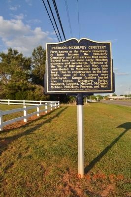
First known as the Peerson Cemetery, it later became the McKelvey Cemetery and still carries that name. Buried here are some early Moulton pioneers and merchants, Veterans of the War of 1812 and Civil War, each contributed to Moulton's early . . . — — Map (db m84312) HM
Ca. 1875-1947. Faith healer. Fortune teller and finder of lost things. His yard filled every Sunday with seekers from near and far. Buried here. — — Map (db m239806) HM
Copena Indians built this mound with baskets of dirt some 2000 years ago. The Copena name was derived from their use of copper and galena (lead ore) found in their burials along with gorgets and celts. The mounds were a burial site with the dead . . . — — Map (db m84315) HM
(Side 1)
Auburn's first separate black community cemetery offers a rich source of the city’s black heritage. Much of the history is oral but it is known that a white man gave most of the land in the early 1870’s. The four acre cemetery . . . — — Map (db m74453) HM
(Side 1)
Pine Hill was established in 1837 and is the oldest cemetery in Auburn. Judge John J. Harper, Auburn's founder, donated almost six acres to the new town to be used as a community burying ground for white settlers and their . . . — — Map (db m74474) HM
Beulah No. 1 Missionary Baptist Church, formerly
Second Baptist Church of Notasulga, founded in 1865,
owns and cares for this sacred ground. Here rest
known and unknown souls whose faith and sacrifice
laid the foundation for generations to . . . — — Map (db m304055) HM
Side 1
On February 9, 1876, the City of Opelika paid D.B. Preston $80 for two acres of land to establish an African-American section of Rosemere Cemetery. This rectangular area of the cemetery contains 176 blocks, with 16 being partial . . . — — Map (db m75139) HM
Side 1
The City of Opelika purchased 19.6 acres of land to expand Rosemere Cemetery. This rectangular area is the newest portion. There are 193 blocks with varying numbers of sections and spaces in each. 467 grave markers have death dates . . . — — Map (db m75140) HM
Side 1
On July 23, 1869, the City of Opelika purchased ten acres of land for a cemetery from Dr. A.B. Bennett for $100 an acre. On November 23, 1869, he accepted his choice of a lot in exchange for the debt. The earliest marked grave is . . . — — Map (db m85335) HM
Union Grove Baptist Church was founded on
August 25, 1856, as Friendship Meeting House.
Henry S. Oliver and Nancy F. Oliver gave the
land to the church. The earliest marked grave
is April 10, 1869, for Nancy Oliver. General
Rousseau's Raid on . . . — — Map (db m304112) HM
Hopwood Cemetery,
established by 1850,
has been placed in the
Alabama Historic
Cemetery Register by
the Alabama Historical
Commission,
March 19, 2013. — — Map (db m281995) HM
North Side This marks the site of Cambridge, a small town established in the earliest years of Limestone County. In 1818, it consisted of several business houses, shops, and a mill. It was one of three locations considered for the county . . . — — Map (db m60177) HM
Wealthy and influential Virginia family settled here in 1820's. Daniel Coleman (1801-1857) built his stately home a block west about 1826. During the Civil War, home was occupied by Yankee troops who took Elizabeth Coleman's teeth for their gold . . . — — Map (db m85389) HM
The Confederate Circle in Athens City Cemetery contains graves of over 50 soldiers killed in or around Athens during the WBTS, 8 unknown. Around 1898 ladies of the local UDC were working in the cemetery when bones, believed to be soldiers, were . . . — — Map (db m94159) HM
This burial mound is one of hundreds constructed during the Middle Woodland period between 100 BC and AD 500 by native people who shared burial practices with other similar cultural groups extending from the Gulf and Atlantic coasts to Canada. . . . — — Map (db m154232) HM
Lentzville Cemetery began as the family cemetery for the family of John Henry Lentz (7 Feb 1753-18 Jul 1835) and his wife Savilla. John Henry was a veteran of the American Revolution and pioneer settler of Limestone County, entering his land in . . . — — Map (db m114306) HM
This is the earliest known cemetery in the town of Athens, and the final resting place for many of its first citizens. The earliest burials date from the 1820’s and continue through the mid-1800’s, with an occasional burial past 1900. Through the . . . — — Map (db m71525) HM
(Side A)
Old New Garden Cemetery
This cemetery is one of the oldest in Limestone County and is listed on the Alabama Historic Cemetery Register. Many of the areas earliest settlers are buried here including Patsy Elmore, widow of a . . . — — Map (db m73836) HM
VA native John Nelson Spotswood Jones, son of Rev. War Capt. Lewellen Jones, cousin of Martha Washington, and descendant of Rev. Rowland Jones of Williamsburg's Bruton Parish, built Druid's Grove near this site before 1820 and established the . . . — — Map (db m70235) HM
Approximately 200 yards east of this site are the unmarked graves of Abner Alloway Strange, Sr., and other family members. (The markers were moved to Salem Methodist Cemetery in 1977.) A Sergeant in the Virginia Militia, Strange was at Yorktown . . . — — Map (db m32561) HM
The first known burial here is Charles Cunningham who died September 28, 1852. Many unmarked fieldstones are present that could mark older graves. The cemetery contains 82 identifiable burials with headstones. Six Confederate soldiers, WWI, and WWII . . . — — Map (db m98753) HM
The first known burial here is Nancy Vinson Christopher who died May 16, 1852. Many unmarked fieldstones are present that could mark older graves. The cemetery contains 52 identifiable burials with headstones. Five Confederate soldiers and one WWII . . . — — Map (db m71991) HM
Side A
Build abt. 1858 by Schuyler Harris on land once owned by Henry Augustine Washington, a distant relative of the first president. Through purchases, marriages, and inheritance between the Washington, Harris and Pryor families, all . . . — — Map (db m85458) HM
Frances Lewis II (1768-1837), a planter, was the first soul to
be interred in this family cemetery. Lewis was born a British
subject in the Colony of Virginia and migrated to Alabama in
the 1820s. The fathers of both Frances Lewis II and his . . . — — Map (db m245991) HM
In Honor of
Our Confederate Soldiers
1861 1865
Jno Alexander • Wm. Alexander • Wm. H. Alexander • Ed Alexander • Capt. M.F. Bonham • Maj. Bright • Capt. T.B. Brown • Alberta Caffee • Irvin Crocheron • J.P. Caffee • Jim Crocheron • Jno. . . . — — Map (db m85472) WM
Creek Stand's earliest African-American pioneers and their descendants are buried here. Oral history indicates that many slaves were buried here generations before the original church was constructed in 1895. These ancestors came to Macon County . . . — — Map (db m227725) HM
Creek Stand Methodist Church
and Historic Cemetery
dating back to about 1850
The original church was dismantled and reconstructed with same material in smaller size during the year 1951 — — Map (db m188777) HM
Elizabeth Missionary Baptist Church is one of the oldest Black Missionary Baptist Churches in Macon County. The church was organized in 1860 under the leadership of Rev. M. Eley and the Tuskegee Baptist Association. Between 1860 and 1876, Elizabeth . . . — — Map (db m205266) HM
The camp on this site served as a military hospital, a camp of conscription and instruction, a supply depot, and a cemetery during the War Between the States. At one time, there were hundreds of headstones and rocks marking the final resting place . . . — — Map (db m73529) HM
Oldest Identified Grave Site: 1881.
Grave sites include participants of the
U.S. Public Health Study of Syphilis in
Untreated Black Males, 1930-1972.
Designated State of Alabama Historic Site: 2006 — — Map (db m151227) HM
Francis Marion Whatley He was born on September 21, 1839 and died on April 22, 1903. He married Matilda Thompson (1842-1877) who died at 35 years of age. He later married Emma E. Radney (1861-1941) he had 14 children with 4 dying as infants. . . . — — Map (db m261580) HM
This cemetery was founded in 1900 when Francis Marion Whatley and Emma Whatley buried their daughter, Ophelia. A son of Simeon Whatley, Francis was a Confederate prisoner of war veteran. He was a prominent landowner, farmer, and cotton gin and . . . — — Map (db m204230) HM
More than 8,000 people, White and Colored, rich and poor, from the lowliest farm and the richest Fifth Avenue mansion crowded in and around the school chapel to pay homage [to Booker T. Washington].
—Baltimore . . . — — Map (db m99943) HM
Gurley Cemetery sits nestled in the hills and forest
of John Gurley's 1830s farm. Originally a private
cemetery, the earliest known gravesite dates to 1831.
The cemetery appeared in the original plat map of
the Town of Gurley, and was approved . . . — — Map (db m289255) HM
This unmarked cemetery site was discovered during the relocation of a section of Meridianville Bottom Road in July 2012. Though no marked graves are present, this might be a family graveyard associated with the early settlers of Madison County. . . . — — Map (db m154283) HM
Glenwood Cemetery. Glenwood Cemetery replaced the original slave cemetery, known as "Georgia,” which had been established in 1818 and located north of the present Huntsville Hospital. Glenwood Cemetery was established in 1870 by the City of . . . — — Map (db m154245) HM
Harris Hill Cemetery is located Sec. 17, T3, and R1E, on the south side of Highway 72 East at the intersection of Moores Mill Road and Highway 72 East in a large clump of trees on a small rise. This is the old home place and family graveyard of . . . — — Map (db m43878) HM
Born in Virginia; graduate of Princeton; lawyer, planter, and politician. President of the Alabama Constitutional Convention held July 5-Aug 2, 1819 in what is now Huntsville; 1 of 8 signers from Madison County; and 1 of 44 delegates from 22 . . . — — Map (db m235545) HM
(side 1)
Established 1818
by the City of Huntsville
Maple Hill Cemetery
has become the final resting place of many citizens of this community. Here lie brave men who served in the major wars of our nation, many public servants, . . . — — Map (db m28791) HM
On September 3, 1818, the Huntsville City Commissioners purchased two acres of land from LeRoy Pope for a "burying ground" for slaves. This cemetery was located within the NE quarter of Section 1, Township 4, Range 1 West of the Base Meridian. It . . . — — Map (db m35214) HM
This cemetery site was used as a burial ground for slaves who lived on both the Peter Blow and Job Key plantations from 1811 to 1865. Dred Scott's first wife and their two children are believed to have been buried here. The cemetery continued to be . . . — — Map (db m31562) HM
Established in 1889, this cemetery is the
final resting place of several generations
of the Arnett family, a prominent African
American family in the Springhill area of
Madison County. Among those buried here
are Samuel Arnett and Louisa Ward . . . — — Map (db m299724) HM
Born in Virginia; attorney, judge, and planter. Chair of Committee of Fifteen that drafted the 1st Alabama Constitution during Convention held July 5-Aug 2, 1819 in what is now Huntsville; 1 of 8 signers from Madison County; and 1 of 44 delegates . . . — — Map (db m235535) HM
Born in Virginia; prominent in business, finance, and politics. 1 of 3 signers from Limestone County at 1st Alabama Constitutional Convention held July 5- Aug. 2, 1819 in what is now Huntsville; 1 of 44 delegates from 22 counties. The Alabama . . . — — Map (db m235540) HM
(Succeeded His Brother William Wyatt Bibb, H.D., as Governor
Delegate, Alabama, Constitution Convention 1819
Representative, Alabama State Legislature
President, First Alabama State Senate
— — Map (db m235541) HM
Listed on the Alabama Historic Cemetery Register in 2015 by the Alabama Historical Commission. This plot of ground has been the resting place of many of Madison's pioneer families since the early 1800s. This marker is erected to remember and honor . . . — — Map (db m191687) HM
(front)
On October 11, 1823, Bethel Church joined the MUD Creek Association of Primitive Baptist Churches. Frank P. and Nannie Butler Ivy deeded Bethel Cemetery to Bethel Church on May 25, 1891. On June 5, 1982 the Bethe Cemetery Perpetual . . . — — Map (db m126816) HM
On August 19, 1887, Tranquilla J. Haden gave to
the Poplar Ridge community 1.5 acres at this
site for a cemetery later to be called Hayden.
The site had been used as a cemetery since
as early as 1858. The cemetery expanded to 5.1
acres through . . . — — Map (db m191685) HM
New Hope Cemetery By 1813-14, white settlers were coming in 1arge numbers following Andrew Jackson's Fort Deposit Road. Most were squatters on the Cherokee Indian Reservation. When the land began to be sold by the government in 1830, Robert . . . — — Map (db m191686) HM
John Whitaker, born 1761 in Pitt County, NC, was a Revolutionary War Soldier and established this cemetery. He and his second wife Winnie sold their land in Pitt County in 1801 and migrated to Rowan County where Winnie died, then to Mulberry, TN . . . — — Map (db m71341) HM
For 53 years Madison County operated an establishment one-half mile to the south where the indigent, lame, and unfortunate were housed in a series of log buildings. Each year a superintendent and a physician were appointed to care for their needs. . . . — — Map (db m154290) HM
"A holy place: symbol of eternity. strength, and stability within the wilderness."
One of the earliest known Cumberland Presbyterian campgrounds in Madison County, Mount Paran Cemetery is the resting place for many of the county's pioneer . . . — — Map (db m154293) HM
John C. Grayson, a Virginia-trained surveyor, came to the Big Cove area before it opened for U.S. settlement. In 1807, he assisted U.S. Surveyor Col. Thomas Freeman with a survey to avoid a dispute among the Cherokee and Chickasaw Nations and the . . . — — Map (db m191681) HM
This African American Cemetery was located on the plantation of William K. Paulling (est. 1836). Oral histories given by the surrounding African American community indicate that Paulling Place Cemetery has been in continuous use since the days of . . . — — Map (db m203661) HM
Interred in the north section of this cemetery were many slaves who had labored on Faunsdale Plantation since its founding in 1843. The earliest identified burial in the black section of the cemetery is that of Barbary (Harrison), a house servant on . . . — — Map (db m72965) HM
1844 - Dr. Thomas & Louisa Harrison gave acre of their Faunsdale Plantation for a log church designated Union Parish.
1852 - name changed to St. Michael’s Parish.
1855 - slave artisans Peter Lee and Joe Glasgow built Gothic Revival-style . . . — — Map (db m72964) HM
established as
Mt. Pleasant Baptist
by Elder James Yarbrough in 1820
with 27 charter members.
By 1834 it had 150 members.
Church among the oldest in Demopolis area.
Buried in church cemetery are John Gilmore, Reuben Hildreth and . . . — — Map (db m72974) HM
Constituted June 6, 1821 from the fruits of labor of the venerable Solomon Perkins, For four years after their constitution they enjoyed almost a continual revival. Home of Miss Willie Kelly, a missionary to China from 1894 to 1936. This church was . . . — — Map (db m72968) HM
Following the Civil War and emancipation, newly freed African Americans, who had worshiped in the Bethel Church in McKinley while enslaved, established their own Bethel Church in a wooden house at the rear of the current church site. In the . . . — — Map (db m72969) HM
The original building was located about three miles east of the present site near the village of Shiloh. It was used as a union church until it became a Baptist Church in 1842. A new building was erected at the present site and the first bodies were . . . — — Map (db m72970) HM
Holt Cemetery has been a part
of this community since the
1870s and in the Phillips Family
for five generations. It is a
lovely resting place rich in family
history and memories. Placed
on the Alabama Historic
Cemetery Register by . . . — — Map (db m307244) HM
On June 18, 1906, the town of Thomaston purchased
two acres of land from John W. and Julia M. Buck
for a town cemetery. The land contained a few
existing graves with the oldest being Lilian Ibera
Lowry Clancy, who died on June 17, 1902. . . . — — Map (db m288222) HM
Since the early 1800s, members of the
Friendship/Cody Mountain community have
chosen Friendship Cemetery as their final
resting place. In 1852, for nine dollars,
Edmund B. Cody, Sr., deeded six and a half
acres to the Friendship congregation, . . . — — Map (db m284144) HM
Side 1
Pikeville, designated as the first permanent county seat for Marion County, lies along General Andrew Jackson's Military Road. Earlier temporary county seats were mostly along the Tombigbee River in what was Mississippi when the . . . — — Map (db m96485) HM
The Buttahatchee Cemetery has been placed
on the Alabama Historic Cemetery Register
by the Alabama Historical Commission.
The Alabama Territorial Legislature Act of
December 16, 1819, designated the
Buttahatchee community as the temporary
seat . . . — — Map (db m284146) HM
Shottsville and the adjacent area was Chickasaw Indian land
until ceded to the U.S. Government by treaty and acts of
Congress. The U.S. Land Office in Pontotoc, Mississippi then
sold the land to white settlers. On Oct. 6, 1836, John . . . — — Map (db m282658) HM
This land was originally part of Land Grant claim of Capt. Joseph Burleson • War 1812/Creek War under Andrew Jackson. By 1820 the Forks of the Buttahatcha Primitive Baptist Church was founded on the ridge to the NW of this site. . . . — — Map (db m309074) HM
This land was originally part of a land grant claim by Captain Joseph Burleson, a Tennessee Militia Soldier during the War of 1812 and Creek War under Andrew Jackson. By 1820 the Forks of the Buttahatchee Primitive Baptist Church was . . . — — Map (db m309075) HM
The City of Albertville is named for Thomas Albert, buried here with his wife Sarah Sappington Albert and daughter Sarah. They had three other daughters -- Martha, who married James C. Miller,the city's first postmaster, Elizabeth, and Mary. Albert . . . — — Map (db m143214) HM
The West Main Street Cemetery was established in the late 1850’s by the Jones Chapel Methodist Episcopal Church, South, which was located nearby. Among notable persons buried here are: Thomas A. Albert (1796-1876), for whom Albertville is named; W. . . . — — Map (db m225620) HM
A congregation of the Methodist Episcopal Church North erected a log church, possibly named Pleasant Hill Methodist Church, adjacent to this cemetery in 1883. The church served as Arab's first school. The earliest marked grave is 1883, though older . . . — — Map (db m42594) HM
Brashier's Chapel community was named for Hiram Brashier who emigrated from South Carolina in 1885 and settled near the present day Brashier's Chapel Cemetery. The oldest grave dates to 1866 and is for Mary Tuttle, the maternal grandmother of . . . — — Map (db m83810) HM
Located on the hilltop 500 feet southwest of here. Fry Cemetery typifies rural valley-and-ridge community cemeteries of the 1800s. The Fry family emigrated from Virginia to this area when it was still part of the Mississippi Territory. Revolutionary . . . — — Map (db m261863) HM
The church was founded on March 14, 1886 by charter members R.J. Riddle, Julie Riddle, W.J. Wright, A. M. Preston, W.B. Scott and F.E. Scott. It is named after Shoal Creek, which rises up less than a mile from the church grounds and empties into the . . . — — Map (db m68785) HM
Organized by 1847 as one of the first churches on Sand Mountain. First meeting house erected 1855; buildings at present site constructed about 1885 and 1927. Preachers included Samuel Tyler, Levi Isbell, Jacob K. Dowdy, James R. Isbell, James R. . . . — — Map (db m85853) HM
Bodine Cemetery is located 100 yards south of here in an area of Brown’s Valley set aside in the Indian Treaty of 1816. James and Catherine Butler Bodine moved to these rich farm lands from Sevier County, Tennessee where their French ancestors . . . — — Map (db m210724) HM
Many of Guntersville's earliest citizens are buried in this historic cemetery. Judge Louis Wyeth (1812-1889) and his wife deeded the property to be used as a cemetery in 1881, but a few burials had occurred as early as the 1870s. Many military . . . — — Map (db m290805) HM
This park and bird refuge dates from the Mississippian Period (AD 1100 to 1550). Native Americans, who roasted oysters and fished in adjacent Dauphin Island Bay, visited the shell mounds for centuries. From excavations carried out in 1990, . . . — — Map (db m122350) HM
Civil War Dead
An estimated 700,000 Union and Confederate soldiers died in the Civil War between April 1861 and April 1865. As the death toll rose, the U.S. government struggled with the urgent but unplanned need to bury fallen Union troops. . . . — — Map (db m162406) HM
Catholic Cemetery, established in 1848 by Michael Portier, Bishop of Mobile, with purchase of five acres on Stone St., now Martin Luther King, Jr. Blvd. Significant for its circular pattern original section has three concentric rings of graves . . . — — Map (db m112224) HM
In 1862, while Alabama was a State among the Confederate States of America suffering invasion by Union forces, the City of Mobile designed this Square 13 of Magnolia Cemetery as "Soldier's Rest" for Confederate Patriots who were casualties of the . . . — — Map (db m87210) HM WM
This memorial is dedicated to the gallant crew of the CSS Horace L Hunley and their commander 1st Lt George E Dixon
Co A 21st Ala Inf CSA who
perished on the attack on
the USS Housatonic Feb 17 1864 — — Map (db m86251) WM
Jewish Rest, also known as the Old Hebrew Burial Ground, is the oldest Jewish cemetery in Alabama. The land was purchased on June 22, 1841 by the congregation of Sha'arai Shomayim Umaskil el Dol of the Needy), Alabama's first and longest . . . — — Map (db m212911) HM