1647 entries match your criteria. The first 100 are listed. ⊳
Landmarks Topic
By Mark Hilton, April 6, 2019
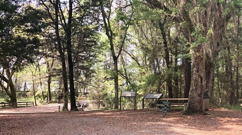
The Bottle Creek Site Marker on right.
| 1 ► Alabama, Baldwin County, Blakeley — The Bottle Creek Site — Alabama Indigenous Mound Trail — |
| On Franklin Street, 0.4 miles north of Washington Avenue, on the right when traveling west. | |||
| 2 ► Alabama, Barbour County, Eufaula — Eufaula-Montgomery Roadway — |
| On Springhill Road north of U.S. 82, on the right when traveling north. | |||
| 3 ► Alabama, Butler County, Greenville — Coleman-Crenshaw House — |
| On Ridge Road (County Road 54) at Crenshaw Road, on the right when traveling north on Ridge Road. | |||
| 4 ► Alabama, Choctaw County, Silas — Silas Elementary School — Choctaw County — |
| On Indian Way (County Road 5) at State Route 17, on the right when traveling east on Indian Way. | |||
| 5 ► Alabama, Colbert County, Sheffield — Furnace Hill — |
| On W. 20th Street at W. 15th Street on W. 20th Street. | |||
| 6 ► Alabama, Conecuh County, Evergreen — Alice's — |
| On West Front Street (U.S. 84) at Cooper Street (State Route 83), on the left when traveling east on West Front Street. | |||
| 7 ► Alabama, Conecuh County, Evergreen — The Bank of Evergreen — |
| On West Front Street (U.S. 84) 0.1 miles east of Cooper Street (State Route 83), on the left when traveling east. | |||
| 8 ► Alabama, Covington County, Andalusia — Bank of Andalusia National Historic Place — |
| On South Court Square, on the right when traveling east. | |||
| 9 ► Alabama, Covington County, Andalusia — First National Bank Building — National Historic Place — |
| On South Cotton Street at Coffee Street, on the right when traveling north on South Cotton Street. | |||
| 10 ► Alabama, Dallas County, Cahaba — Cahaba First State Capital — 1818-1826 — |
| On Capitol Avenue near Vine Street, in the median. | |||
| 11 ► Alabama, Dallas County, Selma — Edmund Pettus Bridge — National Historic Landmark — |
| On Broad Street (Business U.S. 80) at Water Avenue, on the right when traveling south on Broad Street. | |||
| 12 ► Alabama, Elmore County, Wetumpka — Here Stood Fort Toulouse — |
| Near West Fort Toulouse Road, 0.3 miles west of Jackson Park Road, on the right when traveling west. | |||
| 13 ► Alabama, Escambia County, Atmore — Escambia County Training School — |
| On Martin Luther King Avenue north of McGlasker Street, on the right when traveling north. | |||
| 14 ► Alabama, Escambia County, Brewton — The Leigh Place — |
| On Belleville Avenue at Court Street, on the right when traveling south on Belleville Avenue. | |||
| 15 ► Alabama, Etowah County, Gadsden — Dwight Mill Village — |
| On Marston Ave at Coolidge Circle, on the right on Marston Ave. | |||
| 16 ► Alabama, Franklin County, Phil Campbell — Dismals — Registered National Landmark — |
| Near County Road 8 west of State Route 43, on the left when traveling west. | |||
| 17 ► Alabama, Houston County, Dothan — Dothan Municipal Light and Water Plant — |
| On Museum Avenue north of East Main Street (U.S. 84), on the right when traveling north. | |||
| 18 ► Alabama, Houston County, Dothan — Shelley General Store — |
| Near Landmark Drive at Reeves Street (U.S. 431). | |||
| 19 ► Alabama, Jefferson County, Birmingham — Jefferson County Courthouse Site — |
| On Richard Arrington, Jr. Blvd North north of 3rd Avenue North. | |||
| 20 ► Alabama, Jefferson County, Birmingham — Sloss Blast Furnaces — National Historic Landmark — |
| Near 32nd Street South. | |||
| 21 ► Alabama, Jefferson County, Birmingham — Sloss Furnaces — |
| Near 1st Avenue North (U.S. 11) near 32nd Street North. | |||
| 22 ► Alabama, Jefferson County, Vestavia Hills — A History Of Vestavia Hills — |
| On Montgomery Highway (US Highway 31), 0 miles north of Shades Crest Road, on the right. | |||
| 23 ► Alabama, Jefferson County, Vestavia Hills — Sibyl Temple — |
| On Montgomery Highway (U.S. 31) at Shades Crest Road, on the right when traveling south on Montgomery Highway. | |||
| 24 ► Alabama, Lauderdale County, Florence — Florence's Early Water Tower 1890 — |
| On Seymore Avenue. | |||
| 25 ► Alabama, Lee County, Auburn — General James Henry Lane House — Woman's Club of Auburn — |
| On Sanders Street. | |||
| 26 ► Alabama, Lee County, Opelika — Bean's Mill — |
| On West Point Parkway (U.S. 29 at milepost 197), 0.6 miles south of County Road 390, on the right when traveling south. | |||
| 27 ► Alabama, Macon County, Tuskegee — The Tuskegee Veterans Administration Hospital |
| On Hospital Road, 1.4 miles north of East Water Street (Route 81), on the right when traveling north. Reported missing. | |||
| 28 ► Alabama, Madison County, Hazel Green — Initial Survey Point — |
| On Huntsville Highway (U.S. 231/431) at Hunter Road, on the right when traveling south on Huntsville Highway. | |||
| 29 ► Alabama, Madison County, Huntsville — Bessie — "The Meadow Gold Cow" |
| Reported missing. | |||
| 30 ► Alabama, Madison County, Huntsville — Hotel Monte Sano — “Monte Sano” – Spanish for “Mountain of Health” — |
| On Old Chimney Road Southeast, on the right when traveling south. | |||
| 31 ► Alabama, Montgomery County, Montgomery — Alabama State Capitol — |
| Near North Bainbridge Street at Dexter Avenue, on the right when traveling north. | |||
| 32 ► Alabama, Montgomery County, Montgomery — Bertha Pleasant Williams Library — Rosa L. Parks Avenue Branch — |
| On Early Street at Rosa L Parks Avenue, on the right when traveling west on Early Street. | |||
| 33 ► Alabama, Montgomery County, Montgomery — Charlie and Lucille Times — Civic Leaders and Civil Rights Activists — |
| On South Holt Street, 0.1 miles north of Central Street, on the right when traveling north. | |||
| 34 ► Alabama, Montgomery County, Montgomery — Train Shed 1897 — National Historic Landmark — |
| Near Water Street. | |||
| 35 ► Alabama, Russell County, Holy Trinity — Spanish Fort, 1689-1691 — |
| On Alabama Route 165 at Terminal Road (Route 54), on the right when traveling north on State Route 165. | |||
| 36 ► Alabama, Tallapoosa County, Daviston — Jackson Trace — |
| Near Battlefield Park Tour Road. | |||
| 37 ► Alabama, Tuscaloosa County, Tuscaloosa — Alabama Central Female College — |
| Near 6th Street at 28th Avenue. | |||
| 38 ► Alabama, Tuscaloosa County, Tuscaloosa — Denny Chimes — |
| Near University Boulevard west of 6th Avenue, on the right when traveling west. | |||
| 39 ► Alaska, Sitka Borough, Sitka — American Flag Raising Site — |
| 40 ► American Samoa, Vaifanua County, Vatia — Vai'ava Strait — |
| Near American Samoa Route 006. | |||
| 41 ► Arizona, Gila County, Young — The Pleasant Valley War a.k.a. The Graham-Tewksbury Feud — Circa 1882 - 1892 — |
| On Desert to Tall Pines Highway / Young Highway Road (State Highway 288). | |||
| 42 ► Arizona, Mohave County, Kingman — Santa Fe Locomotive No. 3759 — |
| On Andy Devine Avenue (Business Interstate 40), on the right when traveling west. | |||
| 43 ► Arizona, Mohave County, Lake Havasu City — London Bridge — |
| On Arizona Route 95 south of McCulloch Blvd. N when traveling south. | |||
| 44 ► Arizona, Navajo County, Winslow — Barringer Meteor Crater — |
| Near Meteor Crater Road south of Interstate 40, on the right when traveling east. | |||
| 45 ► Arizona, Pima County, Green Valley — Titan II Intercontinental Ballistic Missile Museum — |
| Near West Duval Mine Road. | |||
| 46 ► Arizona, Pima County, Tucson, Colonia Solana — El Conquistador Water Tower — |
| On East Broadway Boulevard, on the right when traveling east. | |||
| 47 ► Arizona, Yavapai County, Jerome — Jerome, Arizona — Too Strong to Die — |
| On Main Street (Arizona Route 89A), on the right when traveling east. | |||
| 48 ► Arizona, Yavapai County, Prescott — Plaza Bandstand — |
| Near West Gurley Street, on the right when traveling east. | |||
| 49 ► Arizona, Yavapai County, Prescott — Santa Fe Depot — |
| On Sheldon Street (Arizona Route 89) at Cortez Street, on the right when traveling south on Sheldon Street. | |||
| 50 ► Arizona, Yavapai County, Prescott — The Historic Yavapai County Courthouse Plaza Fountain — |
| Near South Cortez street at West Hurley street. | |||
| 51 ► Arkansas, Cleveland County, New Edinburg — The Union Wagon Train Leaves Camden — |
| On Arkansas Route 97 at Arkansas Route 8, on the left when traveling north on State Route 97. | |||
| 52 ► Arkansas, Crawford County, Van Buren — Courthouse — |
| On South 4th Street south of East Main Street, on the right when traveling south. | |||
| 53 ► Arkansas, Faulkner County, Conway — 82 — Cadron in the Civil War — |
| Near State Highway 319 at Cadron Settlement Lane, on the right. | |||
| 54 ► Arkansas, Monroe County, Holly Grove — Initial Point of the Louisiana Purchase Survey — |
| On Baseline Road (State Highway 362) 1.8 miles east of U.S. 49. | |||
| 55 ► Arkansas, Pope County, Pottsville — Bois D'Arc Tree / In 1790 When This Tree Began Growing: — |
| On East Ash Street west of 2nd Street, on the right when traveling east. | |||
| 56 ► Arkansas, Saline County, Bryant — The Geographical Center of Arkansas — |
| On Old Stage Coach Road (State Highway 5) 0.2 miles west of Hilldale Road, on the right when traveling west. | |||
| 57 ► California, Alameda County, Alameda — 440 — Alameda Terminus of the 1st Transcontinental Railroad — |
| On West Mall Square, on the right when traveling north. | |||
| 58 ► California, Alameda County, Berkeley, Downtown Berkeley — Berkeley High School Industrial Arts and Science (G and H Buildings) — Henry H. Gutterson and William Corlett, Sr., Architects — Jacques Schnier and Robert Howard, Sculptors — |
| On Martin Luther King Jr Way at Allston Way on Martin Luther King Jr Way. | |||
| 59 ► California, Alameda County, Livermore — 641 — Concannon Vineyard — |
| Near Tesla Road. | |||
| 60 ► California, Alameda County, Livermore — 586 — Cresta Blanca Winery — |
| Near Arroyo Road. | |||
| 61 ► California, Alameda County, Livermore — Mills Square Flag Pole — Raised September 9, 1905 — |
| Near South J Street near 3rd Street. | |||
| 62 ► California, Alameda County, Livermore — 957 — Wente Bros. Winery — |
| Near Tesla Road. | |||
| 63 ► California, Alameda County, Niles — Completion of the Transcontinental Railroad — Niles, California — |
| Near Niles Boulevard near J Street. | |||
| 64 ► California, Alameda County, San Leandro, Mulford Gardens — 824 — San Leandro Oyster Beds |
| On North Pike Road near Neptune Road. Reported missing. | |||
| 65 ► California, Alpine County, Kirkwood — Caples Lake — |
| On Carson Pass Highway (State Highway 88), on the right when traveling east. | |||
| 66 ► California, Alpine County, Markleeville — Hermit Valley — Historical Landmark — |
| On Ebbetts Pass (State Highway 4), on the right when traveling east. | |||
| 67 ► California, Amador County, Drytown — 31 — Drytown — |
| On Hanford Street (State Highway 49), on the right when traveling south. | |||
| 68 ► California, Amador County, Ione — Buena Vista Store — |
| On Buena Vista Road at Jackson Valley Road on Buena Vista Road. | |||
| 69 ► California, Amador County, Jackson — Kennedy Mining and Milling Company — 1860 - 1942 — |
| Near Kennedy Mine Road. | |||
| 70 ► California, Amador County, Jackson — Original site of Mel and Faye’s Diner — Established 1956 — |
| On Golden Chain Highway (Route 49), on the right when traveling south. | |||
| 71 ► California, Amador County, Jackson — 34 — Pioneer Hall — |
| On Main Street near Court Street, on the right when traveling south. | |||
| 72 ► California, Amador County, Sutter Creek — 1007 — Knight Foundry — |
| On Eureka Street, on the left when traveling east. | |||
| 73 ► California, Amador County, Sutter Creek — William Tucker's Fire Bell — |
| On Hanford Street (Old State Highway 49), on the right. | |||
| 74 ► California, Amador County, Volcano — The Thomas Starr King Bell — |
| On Emigrant Trail at Consolation Street on Emigrant Trail. | |||
| 75 ► California, Amador County, Volcano — Volcano — |
| On Main Street at Consolation Street, on the left when traveling north on Main Street. | |||
| 76 ► California, Amador County, Volcano — 29 — Volcano — |
| On Main Street at Consolation Street, on the right when traveling north on Main Street. | |||
| 77 ► California, Butte County, Chico — 840-2 — Chico Forestry Station and Nursery — |
| Near South Park Drive. | |||
| 78 ► California, Butte County, Chico — 329 — Rancho Del Arroyo Chico — |
| Near Esplanade near Memorial Way. | |||
| 79 ► California, Calaveras County, Altaville — 499 — Altaville Grammar School — |
| Near Main Street (State Highway 49). | |||
| 80 ► California, Calaveras County, Altaville — 735 — Prince-Garibardi Building — |
| On South Main Street (State Highway 49) near Demarest Street, on the right when traveling south. | |||
| 81 ► California, Calaveras County, Campo Seco — 257 — Campo Seco — |
| On Campo Seco Road, on the left when traveling east. | |||
| 82 ► California, Calaveras County, Copperopolis — 296 — Copperopolis — State Registered Landmark No.296 — |
| On Main Street, on the left when traveling south. | |||
| 83 ► California, Calaveras County, Jenny Lind — 266 — Jenny Lind — |
| On Milton Road, on the right when traveling east. | |||
| 84 ► California, Calaveras County, Mokelumne Hill — 265 — Chili Gulch — |
| On State Highway 49, on the right when traveling north. | |||
| 85 ► California, Calaveras County, Murphys — 272 — Douglas Flat |
| On Main Street (State Highway 4 at milepost 27.5), at Monge Ranch Road on Main Street. Reported missing. | |||
| 86 ► California, Calaveras County, Murphys — 466 — Peter L. Traver Building — |
| On Main Street. | |||
| 87 ► California, Calaveras County, Murphys — 465 — Site of Brownsville — |
| On Pennsyvania Gulch Road, on the right when traveling south. | |||
| 88 ► California, Calaveras County, San Andreas — 258 — Fourth Crossing — |
| On State Highway 49, on the right when traveling south. | |||
| 89 ► California, Calaveras County, Valley Springs — 295 — Paloma (Fosteria) — |
| On Paloma Road at Edster Street, on the right when traveling south on Paloma Road. | |||
| 90 ► California, Calaveras County, Valley Springs — 251 — Valley Spring — |
| On State Highway 12, on the right when traveling east. | |||
| 91 ► California, Calaveras County, West Point — 268 — West Point — |
| On State Highway 26 (State Highway 26) at Main Street, on the left when traveling east on State Highway 26. | |||
| 92 ► California, Colusa County, Colusa — 890 — Colusa County Courthouse — |
| Near Market Street. | |||
| 93 ► California, Contra Costa County, Walnut Creek — Mount Diablo State Park — |
| On Summit Road at Blackhawk Road, on the right when traveling north on Summit Road. | |||
| 94 ► California, Contra Costa County, Walnut Creek — Mt Diablo State Park — What's In A Name? — |
| On Summit Road, on the left when traveling east. | |||
| 95 ► California, El Dorado County, Coloma — Coloma — |
| On Bridge Street at Back Street, on the right when traveling west on Bridge Street. | |||
| 96 ► California, El Dorado County, Coloma — 143 — James W. Marshall — 1810 - 1885 — |
| Near Marshall Park Way (State Highway 153). | |||
| 97 ► California, El Dorado County, Coloma — 748 — The Coloma Road — |
| Near State Highway 49. | |||
| 98 ► California, El Dorado County, El Dorado — 486 — El Dorado — |
| On Main Street (Pleasant Valley Road) at Church Street, on the right when traveling west on Main Street (Pleasant Valley Road). | |||
| 99 ► California, El Dorado County, El Dorado Hills — 699 — Mormon Tavern — Overland Pony Express Route - California — |
| On PG&E-Clarksville Sub-Station Road, on the right when traveling west. | |||
| 100 ► California, El Dorado County, Georgetown — 521 — Greenwood — |
| On Greenwood Road near Georgetown Road (California Highway 193), on the right when traveling east. | |||
1647 entries matched your criteria. The first 100 are listed above. Next 100 ⊳