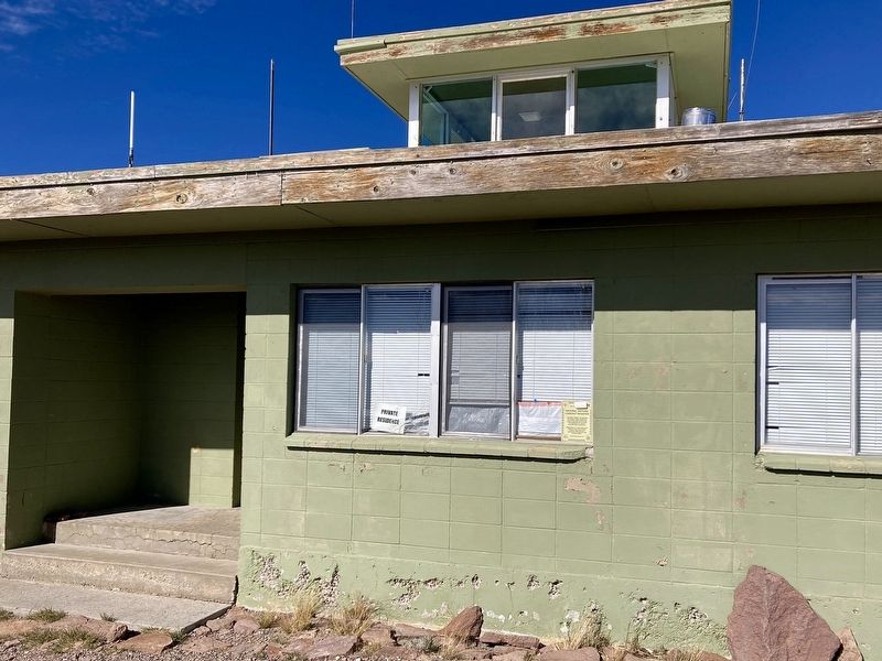
Near Bald Mountain Road 12 miles east of U.S. 395.
This site listed on the
National Historic Lookout Register, a national register recognizing
fire lookout sites, structures
and towers with historic and
cultural significance to forest
fire detection in order to
promote their protection.
. . . — — Map (db m287675) HM
Near White Mountain Road 13 miles north of Ancient Bristlecone Pine Forest Visitor Center, on the right when traveling north.
Al Noren retired in 1954 as White Mt. District
Ranger after 35 years with the U.S. Forest
Service. He discovered The Patriarch in 1948
and in 1951 it was added to the American Forestry
Assn's List of Big Trees as the Largest . . . — — Map (db m304459) HM
Near Cabrillo Highway (State Highway 1 at milepost 37).
Limekiln
In the 1870s and 1880s, locally quarried limestone was kilned (smelted) in four huge wood-fired kilns. The powdered lime was then packed in barrels and cabled from the canyon down to the beach and out to ocean-going schooners . . . — — Map (db m196815) HM
On 17 Mile Drive west of California Highway 1, on the right when traveling south. Reported missing.
Even though Monterey cypress trees prefer this area's rugged bare granite headlands, the Lone Cypress is a testament to the hardiness of these trees. It has withstood Pacific storms and winds for roughly 250 years. Fences and cables now offer added . . . — — Map (db m8476) HM
On 17 Mile Drive west of Madre Lane, on the right when traveling west.
Crocker Grove is home to the largest and oldest Monterey Cypress trees in existence. It is named after Charles Crocker, one of the railroad barons responsible for building the luxurious Hotel Del Monte in Monterey and the original 17-Mile Drive . . . — — Map (db m296761) HM
On 17 Mile Drive west of Madre Lane, on the right when traveling west.
In this grove are the oldest Monterey cypress trees - some nearly 300 years old. These trees occur naturally only here and at Pt. Lobos south of Carmel; all others have been planted. The grove, named after a founding family of this area, became a . . . — — Map (db m296764) HM
Welcome to the Casa del Oro Garden
The name of this garden means "House of Gold" and reflects the history of Old Monterey. The Joseph Boston Store, which anchors the garden, served as a storehouse for gold brought back by miners during the . . . — — Map (db m296410) HM
Near Olivier Street south of Scott Street, on the right when traveling south.
This bell was salvaged from the ruins of the 1906 Earthquake in San Francisco and hung at the McMenamin’s Mission Inn.
Robert C. Littlefield acquired it in 1961 and placed it in his garden home.
His widow Patricia donated it to the . . . — — Map (db m63222) HM
Near Pacific Street, on the right when traveling south.
This "Moon Tree" is a Coast Redwood grown from a seed that in January 1971 was carried to the moon and brought back to earth by Major Stuart Roosa, Command Module Pilot for Apollo 14.
The seed was planted and nurtured into a seedling at the . . . — — Map (db m63500) HM
Like all backyards in Alta California, the rear of the Cooper family house was devoted to practicality. Penned animals, a vegetable garden and outbuildings were a likely sight. However, horticulture books on growing stone fruits can be found in . . . — — Map (db m296238) HM
On Sunset Point, on the left when traveling south.
In 1542, the explorer Cabrillo called this point of land Cabo de Nieve - Cape Snow- to describe the white landscapes before him. No one's sure what he saw. In 1774, Tomás de la Peña, a missionary, gave this western-most point on the Monterey . . . — — Map (db m83330) HM
In the 1860’s there were four saw mills in this area. This display, in honor of his founding fathers, is from the Tom Rowe Saw Mill, and displays how the mill works. The foreman stood in the cage and called out the beam size (8x8, 12x12, etc.) then . . . — — Map (db m39895) HM
Near this spot stood the tree which marked what was believed to be the campsite of the family of George Donner in the winter of 1846. The tree stood for 150 years (missing) the Donner families camped in Alder Creek before it succumbed to Mother . . . — — Map (db m129928) HM
On West River Road just west of Brockway Road, on the left when traveling west.
One of Truckee’s earliest settlers. Schaffer in 1866 built the first lumber mill in the town. He freighted the locomotive San Mateo to Truckee in a winter crossing of the Sierra prior to the laying of Central Pacific tracks. This building “The . . . — — Map (db m60580) HM
On State Highway 20, on the right when traveling east.
The Native People
The cultural history of people inhabiting the western slope of the Sierras spans a period of at least 3,500 years. It is known that the Nisenan, a Native California tribe, occupied the geographic region between the Sierra . . . — — Map (db m44642) HM
The Cactus Garden was conceived by Rudolph "Rudy" Boysen, Superintendent
of Anaheim City Parks from 1928 to 1949. Mr. Boysen, a noted botanist and
creator of the "boysenberry," placed a variety of cactus in this garden, including
several rare . . . — — Map (db m193789) HM
Near East Sycamore Street at East Sycamore Street, on the right when traveling east.
This grove of dawn redwood trees was planted by the Orange County Cemetery District as a memorial to the People of Chinese Heritage interred in the Anaheim Cemetery. This species of tree was thought to be extinct until they were rediscovered growing . . . — — Map (db m197717)
This section weighs five tons and measures 7½ feet in diameter. The original tree, estimated to have been 200 feet tall, was part of a sub-tropical forest 55 to 70 million years ago in what is now Colorado. Scientists believe it to be of the Redwood . . . — — Map (db m155279) HM
How the Dolbeer Donkey steam engine got its name is one of the real mysteries of the West. Some folks say it was called a "donkey" because loggers thought it was too puny to merit a horsepower rating. Invented by John Dolbeer, this portable steam . . . — — Map (db m155280) HM
On Ball Road east of Lewis Street, on the right when traveling east.
This nine foot band saw is among the largest log saws ever used in the sawmill industry. It weighs over 38,000 pounds and has a blade that stre[t]ches over fifty-six feet in length. This saw was used to cut Douglass Fir logs up to ten feet in . . . — — Map (db m199505) HM
Transplanted from one of Anaheim's parks in the
late 1960's to its present location, the exact age
of this Ficus macrophylla, (commonly known as the Moreton Bay Fig), tree is unknown. It is estimated to have first been planted as early as . . . — — Map (db m257484) HM
"Redwoods are...ambassadors from another time."
-John Steinbeck
Travels with Charley (c. John Steinbeck 1962)
Every tree has a tale to tell, and the tree's rings tell us its story. A California redwood grows by . . . — — Map (db m267809) HM
In 2022, Artemis I launched into space from the Kennedy Space Center carrying tree seeds that would journey 270,000 miles from Earth during its 25-day mission. Traveling in the Orion spacecraft, the seeds flew farther than any spacecraft designed . . . — — Map (db m291151) HM
The Sienna Botanica is the riverine system that you see here. It is a man made natural biofiltration system that handles urban run-off throughout the community of Ladera Ranch. The Sienna Botanica uses plants and soilto filtrate the run-off and uses . . . — — Map (db m276459) HM
On Los Alamitos Boulevard at Catalina Street, on the right when traveling south on Los Alamitos Boulevard.
This nine-foot band saw is among the largest log saws ever used in the sawmill industry. It weighs over 38,000 pounds and has a blade that stretches over 56 feet in length. This saw was used to cut Douglas Fir and Ponderosa Pine logs up to ten feet . . . — — Map (db m66262) HM
On Macadamia Lane, on the right when traveling west.
These Australian nut-producing trees are the oldest Macadamia tetraphylla in California. They were planted prior to 1890 by a local spiritualist health colony, the Societas Fraternia. Members experimented with many varieties of fruits and nuts to . . . — — Map (db m50018) HM
Following their dream after being interned in Manzanar, Atsuo James and Hiroko Ito came to San Juan Capistrano in 1959. Jimmy, as he was known and Hiroko met and married in Manzanar during WWII. Their eldest son Braven was born there. Douglas, . . . — — Map (db m307666) HM
Eugene Oyharzabal and her daughter Carmelita (Carmen) are greatly respected for their vision and generosity in the Los Rios District and San Juan Capistrano.
In 1878, Domingo was the first Oyharzabal to arrive in San Juan Capistrano. Having . . . — — Map (db m276437) HM
Water from the Santa Ana River was largely responsible for the transformation of this arid valley into productive agricultural land. Irrigation companies in Orange County were in operation as early as the 1860s. The two largest were the Santa Ana . . . — — Map (db m59529) HM
Near North Lake Boulevard (State Highway 28) west of Grove Street, on the right when traveling east.
For over 125 years a grand pine tree known as the “Big Tree” stood in the centerline of Highway 28 in the heart of Tahoe City.
In 1940 the Federated Women’s Club literally joined hands around the tree when the California Division of Highways’ . . . — — Map (db m34524) HM
They were fallers, buckers, swampers, barkers, skidders, snipers, doggers, greasers, bull punchers, skinners, hook tenders, choker setters, rigging slingers, high climbers, donkey men, whistle punks, river pigs, and more. Once they were lumberjacks, . . . — — Map (db m56737) HM
Near Fairgrounds Road south of Lee Road, on the right when traveling south.
Donated by: Plumas Nat. Forest
Built by: Company 989 C.C.C, 1935
Dismantled & Rebuilt by Reserve Navy Mobile Construction Battalion – 2 “Sea Bees” — — Map (db m56501) HM
On West Foothill Parkway 0.1 miles east of Highgrove Street, on the right when traveling east.
Established in 1911 by S.B. Hampton, this was the center of 2,000 acres of groves, the largest single lemon ranch in California. The remaining headquarters and surrounding buildings were converted to Corona Heritage Park & Museum Dec. 7, 2000 by a . . . — — Map (db m105188) HM
A common question asked by visitors entering Joshua Tree National Park through the southern entrance is “Where are the Joshua trees?” Sometime the Mojave yucca, a close relative is mistaken, for a Joshua tree. The reality is that Joshua . . . — — Map (db m92514) HM
Logging was one of the most significant
impacts on the natural landscape on the
western side of the San Jacinto Mountains.
Beginning in 1875 and lasting through the early 1900s,
a number of logging camps and mills were established
in the . . . — — Map (db m232790) HM
On Arlington Avenue at Magnolia Avenue, on the right when traveling east on Arlington Avenue.
To Commemorate the introduction of the first Marsh Grapefruit Trees into California, brought to Riverside from Lakeland, Florida in 1890 by Twogood and Cutter, pioneer nurserymen, and to honor J.E. Cutter who planted here one of those first . . . — — Map (db m82144) HM
On Citrus Drive, on the right when traveling north.
Developed at U.C.R. and patented in 1980, is one of a series of citrus varieties to emerge from research in the University of California system. It is planted on this 14th day of February, 1982, as a tribute to the Citrus Experiment Station in . . . — — Map (db m199539) HM
On Orange Street north of 1st Street, on the right when traveling north.
Designed in the Eastlake Victorian style, this house was built for John and Martha Hewitt. The Hewitts had moved to Riverside from Illinois after reading of its healthful climate. Mr. Hewitt was a pioneer in Riverside's early Citrus Horticulture, . . . — — Map (db m304627) HM
On Lemon Street near Tenth Street, on the right when traveling north.
No individual has contributed more to Riverside County agriculture than Robert M. Howie. From 1954 until 1982, Mr Howie served as agricultural commissioner of Riverside County.
During his tenure, crop values rose by 650%, citrus acreage doubled . . . — — Map (db m304115) HM
On Magnolia Avenue at Arlington Avenue, on the right when traveling south on Magnolia Avenue.
Planted February 24, 1914 by members of that famous ball team.
Tablet presented to City of Riverside by Charles A. Comiskey, owner of the Chicago White Sox. — — Map (db m302533) HM
On Victoria Avenue east of Jane Street, on the right when traveling west.
The Loraine Small Rose Garden is located in the Victoria Avenue median within walking distance of the Helen Hays Yeager Memorial Grove. In addition to operating a landscape nursery in Riverside for many years, Lorraine Small wrote a gardening column . . . — — Map (db m273880) HM
On Victoria Avenue at Myrtle Avenue, in the median on Victoria Avenue.
Roosevelt Palm, originally Queen Victoria Palm planted by
President Theodore Roosevelt, May 8, 1903.
Marked March 27, 1965 by Jurupa Parlor No. 296
Native Daughters of the Golden West, Riverside, California. — — Map (db m308675) HM
On Victoria Avenue at Jane Street, on the right when traveling west on Victoria Avenue.
President Theodore Roosevelt visited Riverside in May 1903 along with Governor George Pardee, at the invitation of Mission Inn owner Frank Miller. During his visit President Roosevelt toured Hawarden Drive and Victoria Avenue. At the head of . . . — — Map (db m273854) HM
On Victoria Avenue east of Jane Street, on the right when traveling west.
From its very inception, ordinary citizens have been involved in the preservation and beautification of Victoria Avenue. In 1990 several large Eucalyptus trees were slated for removal along Victoria Avenue. A group of concerned citizens including . . . — — Map (db m273882) HM
Near Rainbow Oaks Drive 3.8 miles south of Temecula Parkway (Interstate 15).
This is the place of the Great Oak or Wi’ia$ha (We-awsh-ah). The great oak is a member of the wi’ia$al or Coast Live Oak Family (Quercus Agrifolia). Estimates range anywhere from 500 to 2000 years old. The Great Oak continues to attract people to . . . — — Map (db m36210) HM
Near 13th Street south of L Street, on the left when traveling north.
Planted September 29, 1921 by the California American War Mothers commerating the fall of the first California boy in the World War — — Map (db m266240) HM WM
HISTORY
When Spanish governors ruled the California territory, its capitol was moved from town to town between San Diego and Monterey.
San Jose had already been designated the capitol by the time California was granted statehood in 1850. . . . — — Map (db m15017) HM
A STUMP IS ALL THAT REMAINS of a Silver Maple transplanted from the Battlefield of Chattanooga. In 1897 the sapling was planted here as part of a Memorial Grove dedicated to Union soldiers who fought in the Civil War. The first war memorial to . . . — — Map (db m14984) HM
Near L Street at 10th Street, on the right when traveling east.
Dedicated on April 14, 1983 by Governor George Deukmejian celebration of the 50th anniversary of the Civilian Conservation Corps — — Map (db m90265) HM
Near H Street west of 33rd Street, on the left when traveling west.
McKinley Rose Garden Park History McKinley Park, as we know it today, was opened in 1871 as the privately owned East Park, a name given to it for its location in the undeveloped area, just east of city limits. As a ploy to increase street-car . . . — — Map (db m137486) HM
Near Rim of the World Highway (California Route 18) 0.3 miles west of Highway 138, on the right when traveling west.
In the spring of 1852, over one hundred Mormon men donated a full thousand man-days of arduous labor, to construct a road up Waterman Canyon, past this spot, and into the prime timber, where some of their enterprising bethren established six . . . — — Map (db m154361) HM
On Rim of the World Highway (California Route 18).
"I never thought I would outlive the trees"
A century old herself in 2005, and seeing many of her beloved trees bow to beetle and flame, Pauliena Lafuze had done just that. She has been a Lake Arrowhead Woman's Club member since the . . . — — Map (db m30409) HM
On Inland Empire Boulevard 0.7 miles east of Haven Avenue, on the left when traveling east.
Ontario's history has been shaped by pioneers who built a new community by combining their own knowledge and skills with the energy and determination generated by the promise of
this extraordinary landscape. George Chaffey, Ontario's founder, . . . — — Map (db m149487) HM
On Euclid Avenue (California Route 83) near Holt Boulevard, in the median.
This is one of nine young pepper trees purchased and planted on Euclid Avenue by the students of Ontario's nine public elementary schools in observance of Arbor Day, March 8, 1954.
The young trees were planted as replacements for mature trees . . . — — Map (db m124287) HM
On South Center Street at West Cypress Avenue, on the left when traveling north on South Center Street.
These twin Deodar Cedar trees mark the intersection designated as the town center by its founders, Edward Judson and Frank Brown, when they laid out the town plan in 1881. Over the years, in honor of their vision for the city of Redlands, the . . . — — Map (db m269846) HM
On California Route 18 at Hunsaker Drive, on the right when traveling east on California Route 18.
The two-wheel logger placed
at this location was used in the
last part of the 19th century by
Brookings Lumber Company to
harvest timber from this location.
Pulled by oxen, the wheels which
stand seven feet tall straddled
the large pine logs, . . . — — Map (db m197747) HM
On Indian Cove Nature Trail west of Indian Cove Road West, on the right when traveling north.
This desert adapted tree is not a true willow,
but it has similar long, slender leaves. Narrow
leaves reduce surface area through which water is lost
by a process called evapotranspiration.
Since they need more moisture than other desert . . . — — Map (db m292596) HM
On Utah Trail at National Park Drive, on the right when traveling south on Utah Trail.
Her tireless efforts to establish Joshua Tree National Monument contributed to a heightened appreciation, not only of the Joshua Tree, but of the total desert environment. — — Map (db m116863) HM
On Indian Cove Nature Trail west of Indian Cove Road West, on the right when traveling north.
Young pencil cholla joints are edible after being boiled. The fruits of this cactus are light brown when ripe and taste a bit like sour apples. The buds are also edible. They can be boiled or fried. The taste is similar to asparagus or . . . — — Map (db m292630) HM
Early in 1908, F.P. Hosp & Partners planted 40,000 eucalyptus seedlings creating this grove. They hoped to satisfy Santa Fe Railroad's needed for wood for railroad ties. Following a citizen vote in 1987, 53 acres of the grove were acquired by . . . — — Map (db m255900) HM
Here stands the world's first electrically-lighted outdoor Christmas tree, unveiled at the Hotel del Coronado on December 24, 1904 — — Map (db m70553) HM
On Orange Avenue near Isabella, on the right when traveling south.
In May, 1936, the Rotary Club planted this starpine for the citizens of Coronado. This tree given by Emily T. Thompson in memory of her husband Charles. — — Map (db m117524) HM
Native to the Canary Islands this unusual tree was planted at The Del prior to the turn of the century where it thrives in our temperate southern California coastal climate.
The Dragon Tree was used as a backdrop in the Marilyn Monroe movie . . . — — Map (db m70552) HM
The oldest pepper tree in California
was planted by Fr. Antonio Peyri
in the middle of the Mission
garden. The seeds were
brought to San Juis Rey
in 1830 by a sailor from Peru
and the tree still stands today.
The California Pepper . . . — — Map (db m295218) HM
Originally designed in formal Spanish style, this sheltered retreat was created as Montezuma Garden for the 1915 Panama-California Exposition. Seclusion was enhanced by a leafy eucalyptus forest beyond the south walls. A step into this enclosed . . . — — Map (db m280998) HM
From Earth's far distant reaches
he brought the beasts of the soil
the birds of the air and the life
of the sea that all might learn
the wonders of created life.
Dedicated to Dr. Harry M. Wegeforth,
founder and president of the . . . — — Map (db m271050) HM
The Botanical Building is widely acclaimed as the most photo- graphed spot in San Diego. Alfred D. Robinson, a founder and President of the San Diego Floral Society, suggested the construction of a lath house for the 1915 Panama California . . . — — Map (db m209497) HM
On Pan American Rd E, on the right when traveling north.
1915 - 1955
In Balboa Park the year 1915, San Diego opened its Panama-California Exposition. Designed to call attention to San Diego and bolster the economy, the Exposition highlighted archaeological and anthropological displays as well as . . . — — Map (db m209206) HM
Designed by architect Richard Requa (1883-1941), this sunken garden and stone amphitheater were built by government-funded work relief employees during the Great Depression of the 1930s. The area is used for events and plays and has been . . . — — Map (db m209486) HM
On Front Street at W Upas Street, on the left when traveling north on Front Street.
In 1924, San Diego socialites and patrons of the arts, Miss Alice Lee and her partner, Miss Katherine Teats, commissioned renowned architect Louis Gill to build this historic home. Gill's design for a distinctive “Canyon House” features interior . . . — — Map (db m312270) HM
Near North Harbor Drive north of Ash Street, on the left when traveling north.
This huge timber was once a bowsprit aboard Forester, a four-masted schooner built in 1900 to carry lumber from the Pacific Northwest to growing coastal ports like San Diego. After many years of service, Forester was eventually . . . — — Map (db m229834) HM
On K Street at Fifth Avenue, on the right when traveling west on K Street.
The Pioneer Truck Company was the first occupant of this building owned by Roscoe Hazard and Elwyn Gould. It was used as a furniture and van storage warehouse. In order to avoid extra handling the San Diego & Arizona Santa Fe Railroad spur tracks . . . — — Map (db m191981) HM
Near Convention Way at Marina Park Way, on the right when traveling west.
San Diego’s Cultural Oasis
Located just minutes away from downtown San Diego, Balboa Park provides an enriching experience for more than 14 million visitors from near and far each year. Referred to as “the Smithsonian of the . . . — — Map (db m73907) HM
The garden became a formal part of the Mission after the rebuilding of the church in 1931. Represented in this garden are various plants such as palm trees, bougainvillea, allow vera roses. Within the garden are crosses made from original mission . . . — — Map (db m254645) HM
On Garnet Avenue at Pico Street, on the right when traveling west on Garnet Avenue.
This plaque commemorates the life and influence of a woman who envisioned San Diego beautiful. On this site she operated a nursery and gained world renown as a horticulturist. She was the first woman to receive the International Meyer Medal in . . . — — Map (db m51098) HM
Moreton Bay Fig
(Ficus Macrophylla native to Australia)
In 1904 the House of Representative legislated protection of this tree. Requested by President Theodore Roosevelt after a visit of the area.
This tree is now over 200 years old. — — Map (db m70319) HM
From the 1920s through the 1960s, island slopes
gistened every summer with the vibrant pink
blossoms of an iceplant (Drosanthemum
floribundum) known by the residents as "Persian
carpet.” The iceplant solved two problems
it reduced . . . — — Map (db m194674) HM
On Columbus Avenue at Kearny Street, on the right when traveling south on Columbus Avenue.
In 1880, Finnish sea captain Gustave Niebaum acquired the Inglenook Estate and began building the stone chateau for his winery. His wines became world renowned and contributed to the growing fame of the Napa Valley.
Francis and Eleanor Coppola . . . — — Map (db m236038) HM
On Stow Lake Drive at John F. Kennedy Drive, on the right when traveling east on Stow Lake Drive.
Trees from historic spots
in the thirteen
original states of the Union
Planted by Sequoia Chapter
Daughters of the American Revolution
October 19, 1896.
Boulder placed April 19, 1920.
— — Map (db m285031) HM
Near Hagiwara Tea Garden Drive north of Martin Luther King Jr. Drive, on the left when traveling south.
In the winter of 1894 the California Midwinter Exposition arrived in Golden Gate Park. Some of the most popular attractions at the fair were exhibits of people from around the world; Native Americans, Egyptians, Aleutians, Hawaiians, Turks, South . . . — — Map (db m132112) HM
Near Martin Luther King Jr. Drive near Lincoln Way, on the right when traveling east. Reported missing.
In the 1860's, San Francisco was a booming city fueled by the Gold Rush and the first transcontinental railroad. Civic leaders envisioned a large park and arboretum similar to those in European cities and the eastern United States. Skeptics . . . — — Map (db m106635) HM
Near John F. Kennedy Drive, on the left when traveling east.
California’s first municipal greenhouse was completed in 1879. It was patterned after the Conservatory, Kew Gardens, England. A distinguished example of late Victorian style using early techniques of mass production and assembly of simple glass . . . — — Map (db m143442) HM
Huntington Park
On this site in 1872, General David D. Colton, a railroad attorney, built one of the most elaborate residences ever seen in San Francisco. The classic white wooden mansion featured an entry flight of marble steps leading to a . . . — — Map (db m63532) HM
Near The Embarcadero south of Bay Street, on the right when traveling north.
The Alcatraz Gardens
Alcatraz would be a barren rock were it not for human presence. Despite the lack of soil and water, people have planted and maintained gardens on The Rock for 150 years. In the nineteenth century, the army imported soil to . . . — — Map (db m228554) HM
On Letterman Drive at Presidio Boulevard, on the left when traveling west on Letterman Drive.
The main idea is, to crown the ridges, border the boundary fences, and cover the areas of sand and marsh waste with a forest. … In order to make the contrast from the city seem as great as possible, and indirectly accentuate the idea of the power . . . — — Map (db m176592) HM
Meet a Zoo Original
The swamp gum eucalyptus tree standing before you was one of the original lake-shore plantings at the Zoo, planted sometime around 1925. There are only about 20 of these trees known to exist in California, and this is . . . — — Map (db m230441) HM
Golden Gate National Recreation Area
Lands End
Carpet bed designs were created with flowers and carefully trimmed grasses, hedges, and moss. They were a standard feature in Victorian gardens. The elaborate plantings at Sutro Heights were mostly . . . — — Map (db m210714) HM
This site was the location of Sutro’s glass conservatory, built to shelter exotic plants from the local coastal fog and harsh winds. Flowers from around the world thrived inside the greenhouse along with infant shrubs and mosses used to create the . . . — — Map (db m210876) HM
On Center Street at Hesperian Lane, on the left when traveling west on Center Street.
The Creekside Reserve Native Plant Gardens
(first planted in 2022)
These gardens showcase how California Native Plants can be used to create beautiful, water-conserving landscapes while promoting California's extraordinary plant . . . — — Map (db m298143) HM
This Jonathan Apple is the first tree to be replanted in the Price Orchard
In memory of
Mrs. Charis Lee Straw
For her dedicated service to The Friends of Price House and the City of Pismo Beach
Planted on Arbor Day, April 28, 2000 . . . — — Map (db m313126) HM
On Broadway near Warrington Avenue, on the right when traveling east.
Redwood City was an important center for early aviation and Stanford Redwood City is located on what was once an airfield. Silas Christofferson, a visionary young pilot and engineer, bought Michael Lynch’s flower field in early 1916 and built . . . — — Map (db m206589) HM
Nurseryman Michael Lynch bought the property that is now the Stanford Redwood City campus in 1898. Lynch was best known for growing violets and sweet peas for sale as cut flowers and in seed packets. In 1901, he was hired by Jane Stanford to . . . — — Map (db m206591) HM
On Skyline Boulevard (California Route 35 at milepost 14), on the right when traveling north.
Age Estimated - 1,860 Years
Height:
Before Top Broke - 225 Ft
In 1954 - 137 Ft
Diameter at Base - 14 Ft
Access courtesy of California Water Service — — Map (db m202567) HM
The site of the Central Park is possibly the sole surviving example of the late nineteenth century estates once so numerous on the Peninsula.
Charles B. Polhemus, Director of the San Francisco & San Jose Railroad and founder of Central San . . . — — Map (db m28712) HM
On De Sabla Road near Belford Way, on the right when traveling south.
This authentic historic oriental garden and tea house was first developed in the 1880's by Peninsula pioneer Henry Bowie. The property later became part of the Eugene de Sabla estate. Joan and Achille Paladini, current owners have restored the . . . — — Map (db m93312) HM
5049 entries matched your criteria. Entries 301 through 400 are listed above. ⊲ Previous 100 — Next 100 ⊳