1901 entries match your criteria. The first 100 are listed. ⊳
Natural Resources Topic
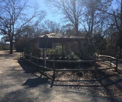
By Mark Hilton, December 17, 2013
Doster Road Artesian Well House
1 ► Alabama, Autauga County, Prattville — Doster Road Artesian Well House —  |
| On Doster Road at Mobile Drive, on the right when traveling south on Doster Road. | |||
| 2 ► Alabama, Bibb County, West Blocton — The Railway System — |
| Near Blocton Bypass (County Road 24) west of Griffin Town Road, on the right when traveling west. | |||
| 3 ► Alabama, Bibb County, West Blocton — Welcome to West Blocton Coke Ovens Park — |
| Near Blocton Bypass (County Road 24) west of Griffin Town Road, on the right when traveling west. | |||
| 4 ► Alabama, Bibb County, West Blocton — What Are Coke Ovens? — |
| Near Blocton Bypass (County Road 24) west of Griffin Town Road, on the right when traveling west. | |||
| 5 ► Alabama, Blount County, Blount Springs — Blount Springs — |
| On U.S. 31 at County Road 7, on the right when traveling north on U.S. 31. | |||
| 6 ► Alabama, Calhoun County, Oxford — Charcoal Production at Caver-Christian-Davis Farm — AD 1865 to AD 2000 — Choccolocco Park Interpretive Trail — |
| Near Leon Smith Parkway. | |||
| 7 ► Alabama, Choctaw County, Gilbertown — First Oil Well In Alabama — |
| On Paragon Road (County Road 16) 2 miles west of State Route 17, on the left when traveling west. | |||
| 8 ► Alabama, Colbert County, Tuscumbia — Petrified Conifer Tree / Petrified Lycopod Tree Stump — |
| On S. Main Street. | |||
| 9 ► Alabama, Jefferson County, Birmingham, Forest Park — King's Spring — |
| Near 5th Avenue South at 41st Street South. | |||
| 10 ► Alabama, Jefferson County, Birmingham, Redmont Park — Lane Park — |
| On Cahaba Road at Park Lane, on the right when traveling north on Cahaba Road. | |||
| 11 ► Alabama, Jefferson County, Clay — The Cahaba Heart River of Alabama — |
| On Old Springville Road / County Road 30, on the left when traveling north. | |||
| 12 ► Alabama, Jefferson County, Hoover — Shades Crest Road Historical District — |
| On Shades Crest Road (County Road 97) at Park Avenue, on the right when traveling north on Shades Crest Road. | |||
| 13 ► Alabama, Jefferson County, Hoover — Shades Crest Road Historical District — |
| On Shades Crest Road east of Mimosa Lane, on the right when traveling east. | |||
| 14 ► Alabama, Lauderdale County, Florence, East Florence — Dr. Augustine Uzo Mokwunye — Inducted 2021 — City of Florence Walk of Honor — |
| On Hightower Place. | |||
| 15 ► Alabama, Lauderdale County, St. Florian — Shoals Creek Preserve Tract — |
| On County Road 61. | |||
| 16 ► Alabama, Mobile County, Dauphin Island — Energy from the Sands of Time — |
| On Bienville Boulevard 0.1 miles east of Albatross Street, on the left when traveling east. | |||
| 17 ► Alabama, Mobile County, Mobile — Caldwell Field — |
| On Marmotte Street north of Dr Martin Luther King Jr Avenue, on the right when traveling north. | |||
| 18 ► Alabama, Morgan County, Lacey's Spring — Lacey's Spring — |
| On U.S. 231 0.2 miles north of State Route 36, on the right when traveling north. | |||
| 19 ► Alabama, Shelby County, Montevallo, Aldrich — Alabama Coal Mining — |
| On County Road 203 north of Aldrich Road, on the left when traveling north. | |||
| 20 ► Alabama, Talladega County, Sylacauga — Sylacauga Marble — |
| On South Norton Avenue south of West Fort Williams Street, on the right when traveling north. | |||
| 21 ► Alabama, Tuscaloosa County, McCalla — Roupes Valley Iron Company — The Tannehill Furnaces (1859-1865) — Hillman's Bloomery Forge (1830) — |
| Near Confederate Parkway at Tannehill Park. | |||
| 22 ► Alabama, Tuscaloosa County, McCalla — Tannehill Ironworks — (1829-1865) — |
| On Tannehill Park 0.3 miles east of Eastern Valley Road, on the right when traveling east. | |||
| 23 ► Alabama, Tuscaloosa County, Tuscaloosa — Burns’ Shoals — |
| Near Greensboro Avenue north of 2nd Street (Jack Warner Parkway). | |||
| 24 ► Alabama, Tuscaloosa County, Tuscaloosa — Masons Marks — |
| Near 6th Street at 28th Avenue. | |||
| 25 ► Alabama, Tuscaloosa County, Tuscaloosa — The Black Warrior River — |
| Near Greensboro Avenue north of 2nd Street (Jack Warner Parkway). | |||
| 26 ► Alaska, Fairbanks North Star Borough, Fairbanks, Downtown — 30 — The Trans Alaska Pipeline: An Epic Construction Effort — Vignettes in History — Proud to be Alaskan — |
| On 1st Avenue east of Cushman Street, on the left when traveling east. | |||
| 27 ► Alaska, Fairbanks North Star Borough, Goldstream — Pipeline Facts — |
| On Steese Highway (State Highway 2), on the right when traveling north. | |||
| 28 ► Alaska, Fairbanks North Star Borough, Goldstream — Pipeline History — |
| Near Steese Highway (at milepost 8.4), on the right when traveling north. | |||
| 29 ► Alaska, Fairbanks North Star Borough, Harding-Birch Lakes — Alaska's Gold Rush Era — |
| On Richardson Highway (Alaska Route 2), on the right when traveling south. | |||
| 30 ► Alaska, Fairbanks North Star Borough, Harding-Birch Lakes — Tanana Valley Gold — |
| On Richardson Highway (Alaska Route 2), on the right when traveling south. | |||
| 31 ► Alaska, Juneau Borough, Juneau, Downtown Juneau — 3 — Alaska Juneau Mill — |
| Near South Franklin Street 0.5 miles north of Mr. Roberts Street. | |||
| 32 ► Alaska, Juneau Borough, Juneau, Downtown Juneau — Hard Rock Miners — |
| Near Marine Way near South Franklin Street, on the left when traveling west. | |||
| 33 ► Alaska, Kenai Peninsula Borough, Moose Pass — Gold Discoveries Trigger Stampede — |
| On Seward Highway (Alaska Route 1 at milepost 56.6). | |||
| 34 ► Alaska, North Slope Borough, Utqiagvik — Paġlagivsi! — Welcome to the Ancient Village of Ukpiaġvik — “The Place Where We Hunt Snowy Owls” — |
| On Apayauk Street. | |||
| 35 ► Arizona, Apache County, Adamana — Jasper Forest |
| Near Jasper Forest Road, on the left when traveling west. Reported permanently removed. | |||
| 36 ► Arizona, Apache County, Lupton — Arizona's Most Abundant Resources — |
| On Grant Road south of Interstate 40, on the right when traveling south. | |||
| 37 ► Arizona, Cochise County, Bisbee — The Lavender Pit — |
| On Arizona Route 80 at milepost 343, on the right when traveling east. | |||
| 38 ► Arizona, Cochise County, Cochise — Sulphur Springs — |
| On Birch Road 3.1 miles east of U.S. 191, on the right when traveling east. | |||
| 39 ► Arizona, Cochise County, Elfrida — Soldiers Hole — |
| On West Gleeson Road 2.5 miles west of Highway 191, on the right when traveling west. | |||
| 40 ► Arizona, Cochise County, Tombstone — 37a — The Mines of Tombstone — |
| On East Toughnut Street at South 5th Street, on the left when traveling west on East Toughnut Street. | |||
| 41 ► Arizona, Coconino County, Flagstaff — Julius Aubineau — 1852-1903 — In Memory Of — |
| On North Fort Valley Road. | |||
| 42 ► Arizona, La Paz County, Cibola — 104 — Cibola Arizona |
| Near Cibola Road at Baseline Road. Reported missing. | |||
| 43 ► Arizona, La Paz County, Quartzsite — Tyson's Well — |
| On West Main Street (U.S. 95) 0.3 miles west of Route 95, on the right when traveling west. | |||
| 44 ► Arizona, La Paz County, Quartzsite — 060-019 — Tyson's Well — Old Stage Station — |
| On West Main Street (Arizona Route 95), on the right when traveling east. | |||
| 45 ► Arizona, La Paz County, Salome — Harrisburg — |
| On Salome Road 5 miles south of U.S. 60, on the right when traveling south. | |||
| 46 ► Arizona, Maricopa County, Apache Junction — Apache Lake — |
| On Arizona Route 88 at milepost 229, on the left when traveling east. | |||
| 47 ► Arizona, Maricopa County, Fort McDowell — Canyon Lake — |
| On Apache Trail (Arizona Route 88 at milepost 208), on the right when traveling east. | |||
| 48 ► Arizona, Maricopa County, Gilbert — Pump House — Heritage District — |
| On West Page Avenue, on the right when traveling east. | |||
| 49 ► Arizona, Maricopa County, Glendale — Sine Brothers Hardware Building — 6329 North 58th Drive — Built 1912 — |
| On North 58th Drive south of West Glendale Avenue, on the right when traveling north. | |||
| 50 ► Arizona, Maricopa County, Wickenburg, Whispering Ranch — Vulture Gold Mine — |
| Near Vulture Mine Road 12 miles south of Grand Avenue (Route 60). | |||
| 51 ► Arizona, Mohave County, Bullhead City — Hardyville Site |
| On Arizona Route 95 near Colina Drive, on the right when traveling south. Reported missing. | |||
| 52 ► Arizona, Mohave County, Chloride — Chloride — "Oldest Silver Mining Town in Arizona" — |
| On 2nd Street, on the left when traveling south. | |||
| 53 ► Arizona, Mohave County, Kingman — Camp Beale Springs Arizona — |
| On Fort Beale Road at Wagon Trail Road, on the left when traveling north on Fort Beale Road. | |||
| 54 ► Arizona, Mohave County, Kingman — Cerbat — |
| On U.S. 93 at Golden Valley Drive, on the right when traveling north on U.S. 93. | |||
| 55 ► Arizona, Mohave County, Kingman — 31805 — Chloride — |
| On U.S. 93 at County Road 125, on the right when traveling north on U.S. 93. | |||
| 56 ► Arizona, Mohave County, Kingman — Mineral Park — |
| On U.S. 93 at County Road 255, on the right when traveling north on U.S. 93. | |||
| 57 ► Arizona, Mohave County, Kingman — White Hills — |
| On County Route 145 at U.S. 93, on the right when traveling east on County Route 145. | |||
| 58 ► Arizona, Mohave County, Mohave Valley — Oatman — |
| On County Route 153 at Route 95, on the right when traveling east on County Route 153. | |||
| 59 ► Arizona, Mohave County, Oatman — Gold Road Mine — |
| On Oatman -Topock Highway (Historic Route 66) (County Road 10). | |||
| 60 ► Arizona, Mohave County, Oatman — Oatman — Gold Mining Town — |
| On Oatman-Topock Highway at Rock Hound Road, on the left when traveling north on Oatman-Topock Highway. | |||
| 61 ► Arizona, Mohave County, Oatman — 80 — Oatman Arizona and its Burros — |
| On Oatman -Topock Highway / Main Street (Old Route 66 at Rock Hound Road, on the left when traveling north on Oatman -Topock Highway / Main Street (Old Route 66. | |||
| 62 ► Arizona, Mohave County, Peach Springs — Guano Point — |
| Near Diamond Bar Road (County Route 7) near Eagle Point Service Road. | |||
| 63 ► Arizona, Navajo County, Holbrook — From Wood to Stone — |
| On Petrified Forest Road, on the right when traveling north. | |||
| 64 ► Arizona, Navajo County, Holbrook — Triassic Landscape |
| Near Petrified Forest Road, on the right when traveling north. Reported permanently removed. | |||
| 65 ► Arizona, Pima County, Ajo — The Ajo Mining District — |
| On La Mina Avenue, on the right when traveling north. | |||
| 66 ► Arizona, Pima County, Ajo — The City of Ajo — |
| On La Mina Avenue, on the right when traveling north. | |||
| 67 ► Arizona, Pima County, Ajo — 10 — The Mine Manager's House — Ajo, Arizona — |
| Near West Greenway Drive. | |||
| 68 ► Arizona, Pima County, Lukeville — Kris Eggle — |
| On Puerto Blanco Drive, on the left when traveling south. | |||
| 69 ► Arizona, Pima County, Tucson, Agua Caliente Regional Park — Agua Caliente Ranch and Hot Springs — |
| Near East Roger Road. | |||
| 70 ► Arizona, Pima County, Tucson, Colonia Solana — El Conquistador Water Tower — |
| On East Broadway Boulevard, on the right when traveling east. | |||
| 71 ► Arizona, Pinal County, Apache Junction — Dons's Camp — |
| On East Peralta Road 5.6 miles east of Superstition Freeway (U.S. 60). | |||
| 72 ► Arizona, Pinal County, Apache Junction — Goldfield Mining District — Arizona — |
| On East Apache Trail (Arizona Route 88 at milepost 199) east of North Mountain View Road, on the right when traveling east. | |||
| 73 ► Arizona, Pinal County, Apache Junction — Goldfield Mining District — |
| Near North Apache Trail (Arizona Route 88) north of North Farside Lane, on the right when traveling north. | |||
| 74 ► Arizona, Pinal County, Kearny — Sonora, Arizona — |
| Near Victoria Circle at Greenwich Street. | |||
| 75 ► Arizona, Pinal County, Oracle — American Flag — |
| On Mount Lemmon Road 1 mile south of Webb Road, on the right when traveling south. | |||
| 76 ► Arizona, Yavapai County, Bagdad — Bagdad Copper Mine — |
| On Main Street (State Highway 96E) 4.5 miles north of State Highway 97N, on the right when traveling north. | |||
| 77 ► Arizona, Yavapai County, Camp Verde — Pecan Lane Rural Historic Landscape — |
| On North Montezuma Castle Highway 2 miles north of West Highway 260 & South Main Street, on the right when traveling north. | |||
| 78 ► Arizona, Yavapai County, Clarkdale — United Verde Copper Company Smelter — |
| On 1st N Street at North 9th Street, on the right when traveling west on 1st N Street. | |||
| 79 ► Arizona, Yavapai County, Congress — CY 6028 — The Song of the “Peavine” — |
| On South Santa Fe Road. | |||
| 80 ► Arizona, Yavapai County, Jerome — Historic Audrey Shaft Headframe — Little Daisy Mine — |
| On State Park Road, on the left when traveling east. | |||
| 81 ► Arizona, Yavapai County, Jerome — Jerome Blast Furnace — |
| On Main Street, on the right when traveling east. | |||
| 82 ► Arizona, Yavapai County, Jerome — Jerome, Arizona — Too Strong to Die — |
| On Main Street (Arizona Route 89A), on the right when traveling east. | |||
| 83 ► Arizona, Yavapai County, Jerome — Rocket Shovel and Dragline — |
| On Hampshire Avenue (Arizona Route A89). | |||
| 84 ► Arizona, Yavapai County, Jerome — The Audrey Shaft and UVX Operations — |
| On State Park Road, on the left when traveling east. | |||
| 85 ► Arizona, Yavapai County, Jerome — The Childs-Irving Project - Construction Challenges — |
| On Douglas Road (AKA State Parks Road, on the left when traveling west. | |||
| 86 ► Arizona, Yavapai County, Prescott — Granite Creek — |
| On West Gurley Street. | |||
| 87 ► Arizona, Yuma County, Yuma — Castle Dome Mining District — 1864 - 1979 — |
| Near Castle Dome Mine Road 10 miles east of U.S. 95. | |||
| 88 ► Arkansas, Benton County, Bella Vista — Bella Vista Water Tank — |
| On Cedar Crest Drive at Cunningham Drive, on the right when traveling west on Cedar Crest Drive. | |||
| 89 ► Arkansas, Clark County, Arkadelphia — Salt Kettle — |
| On Court Street south of Clay Street, on the right when traveling south. | |||
| 90 ► Arkansas, Franklin County, Ozark — Trail of Tears Memorial — |
| On East River Street east of South 1st Street, on the right when traveling east. | |||
| 91 ► Arkansas, Garland County, Hot Springs — Hot Springs — |
| On Central Avenue (State Highway 7) just south of Fountain Street, on the right. | |||
| 92 ► Arkansas, Johnson County, Clarksville — C-23 — Johnson County First Anthracite Coal — |
| On West Main Street (U.S. 64) at South Fulton Street, on the right when traveling east on West Main Street. | |||
| 93 ► Arkansas, Marion County, Rush — Rush Mining District — Buffalo National River — National Park Service, U.S. Department of the Interior — |
| On County Road 6035 0.2 miles east of County Road 637, on the right when traveling east. | |||
| 94 ► Arkansas, Marion County, Rush — Rush, The Town That Zinc Built — |
| On County Road 6035 0.3 miles east of County Road 637, on the right when traveling east. | |||
| 95 ► Arkansas, Newton County, Dogpatch, Harrison — Arkansas Marble in Washington’s Monument — |
| On State Highway 7 0.1 miles south of Highway 125, on the right when traveling south. | |||
| 96 ► Arkansas, Pike County, Murfreesboro — Amarillo Starlight — |
| On State Park Road. | |||
| 97 ► Arkansas, Pike County, Murfreesboro — Dazzling Diamonds From the Crater — |
| On State Park Road. | |||
| 98 ► Arkansas, Pike County, Murfreesboro — Esperanza Diamond — |
| Near State Park Road. | |||
| 99 ► Arkansas, Pike County, Murfreesboro — First Diamonds — |
| On State Park Road. | |||
| 100 ► Arkansas, Pike County, Murfreesboro — James "Diamond Jim" Archer — Feb. 23, 1925 - Jan. 8, 2003 — |
| On State Park Road. | |||
1901 entries matched your criteria. The first 100 are listed above. Next 100 ⊳