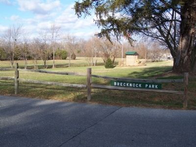
In 1680 Alexander Humphreys received a warrant from the county court for 600 acres of land which he called Brecknock. The tract is believed to have been named for a shire of Wales. A milling operation was established here in the 1740’s. For nearly . . . — — Map (db m39507) HM
Caesar Rodney-Born on October 7, 1728 on a farm east of Dover, Caesar Rodney was one of Delaware's most distinguished statesmen. Entering public life at an early age, Rodney held numerous local offices. He was a member of the Colonial State . . . — — Map (db m141257) HM
A local society of Methodists was organized circa 1778. On May 16, 1781, they obtained land here on which to build a permanent house of worship. A large frame church was then constructed and named Blackiston's Chapel, to honor the family that . . . — — Map (db m40190) HM
Richard Allen founded and became the first Bishop of the African Methodist Episcopal Church in 1816. Born into slavery in Philadelphia, Pennsylvania, on February 14, 1760, Allen and his family were sold to a family near Dover in 1772. While there, . . . — — Map (db m39093) HM
Statesman, Soldier and Patriot. Member of Stamp Act Congress and of First and Second Continental Congresses. Signer of Declaration of Independence. Member and Speaker of Colonial Assembly of “Three Lower Counties on Delaware.” Member of . . . — — Map (db m39067) HM
In memory of
1734 Charles Inglis 1816
1759 Rector of this parish 1765
1787 Bishop of Nova Scotia 1816
First Colonial Bishop in the British Empire
His wife Mary Vining and their two infant children rest in the churchyard. — — Map (db m42757) HM
Presbyterian minister, later practiced medicine, Member of Colonial Assembly, Member of Council of Safety, 1775. Commanded First Delaware Militia Regiment. This regiment, reviewed in Dover, later joined Washington’s army and fought in Battles of . . . — — Map (db m4716) HM
These two words say a great deal about Dover. It is a modern and growing city entering the 21st century on a foundation of achievement built over more than 300 years of American history.
And a rich history it is. Founded by William Penn in . . . — — Map (db m142501) HM
County seat since 1680. William Penn, in 1683, ordered townsite laid out and named Dover. Plotted in 1717. Temporary capital in 1777 and permanent capital since 1779. Federal Constitution ratified here in 1787 making Delaware First State in Union. . . . — — Map (db m51115) HM
The Light Infantry Company of Dover, a part of the 1st Battalion of Kent County, mustered in on 2 April
1776. Each militia volunteer was uniformly armed,
equipped, and wore a standard military coat of green
faced with red lapels, cuffs, and . . . — — Map (db m39576) HM
In 1680, a large tract of land called "Brothers Portion" was warranted to John and Richard Walker. In 1695, 200 acres of the parcel were purchased to create the town of Dover. When the town plot was completed in 1718, John Mifflin purchased 69 acres . . . — — Map (db m94380) HM
In 1723 Nicholas Loockerman purchased 600 acres of land known as “The Range.” Following his death in 1771, the property passed to his grandson Vincent Loockerman Jr. Evidence suggests that he built the Georgian-style mansion known today . . . — — Map (db m39053) HM
In this churchyard lie the remains of Nicholas Ridgely, Statesman and Jurist. Born in Dover, 1762, eldest son of Dr. Charles Greenbury Ridgely and Mary Wynkoop Ridgely. Member of State Convention which ratified the Federal Constitution, December 7, . . . — — Map (db m39066) HM
Founded as mission by the Society for the Propagation of the Gospel in response to a petition from twenty-two inhabitants of Dover in 1703. The present church was erected in 1734. Among early missionaries here was the Rev. Charles Inglis, later . . . — — Map (db m3803) HM
Born in 1740 in Dover, Kent Co., DE
Died Feb, 15, 1791 in Dover, Kent Co., DE
Justice of the Peace
Member of Joint Committee of Accounts, Committee of Correspondence, Council of Safety, and General Assembly. — — Map (db m42754) HM
A Presbyterian Society, present in Kent from c1694, was organized and worshipped in a log church on this site from c1708 until 1791. The Presbytery of Philadelphia recognized its congregation in 1714. The present church was built in 1791 and served . . . — — Map (db m5166) HM
Part of a tract of 3,000 acres granted to John Hillyard by William Penn, March 7, 1683. His great-grandson, Charles Hillyard, built this mansion and resided here with his wife, Mary, daughter of William Killen, first Chancellor of Delaware. . . . — — Map (db m42761) HM
Near this site stood the boyhood home of Caesar Rodney, signer of the Declaration of Independence, Brigadier General of the State's militia (1775-1778), and President (Governor) of Delaware (1778-1781). Byfield was originally settled in the early . . . — — Map (db m75835) HM
"The Penman of the Revolution." Member of Delaware colonial and state assemblies. Member of Continental Congress, Annapolis Convention, and Philadelphia Federal Constitutional Convention. Signer for Delaware of Articles of Confederation and Federal . . . — — Map (db m39583) HM
This part of what is now Kent County, Delaware was one of the state's earliest sites of English colonization. Beginning in the 1660's plantations were established along the St. Jones River. The Dickinson family of Talbot County, Maryland was among . . . — — Map (db m245466) HM
The St. Jones River, a major Delaware navigable waterway, is situated south of the John Dickinson Plantation. The river connects the Delaware Bay to the inland city of Dover. Between 1760 and 1808, John Dickinson owned six farms that bordered the . . . — — Map (db m79168) HM
Quakers were gathering for worship in this area by 1712, when members of the Religious Society of Friends met "at the widow Needham's at Murderkill Creek." Established as Motherkiln Preparative Meeting (under the care of Duck Creek Meeting), the . . . — — Map (db m39459) HM
A native of Virginia's Eastern Shore, Mifflin came to Delaware as a young man. Born into a slaveholding Quaker family, he manumitted his own slaves in 1774-75 and later became one of America's foremost abolitionists of the 18th century. As an elder . . . — — Map (db m39456) HM
Responsible for marking the boundaries of Maryland and Pennsylvania (including the "Three Lower Counties" of Delaware), Mason and Dixon began their survey of the North-South or Tangent Line at the southwestern corner of present-day Delaware in June . . . — — Map (db m168146) HM
Christ Church Mispillion was the second parish in Delaware established by the Society for the Propagation of the Gospel in Foreign Parts. The Rev. Thomas Crawford first held services of the Church of England in lower Kent County in 1704. The . . . — — Map (db m69033) HM
This American Liberty Elm was named after “The Liberty Tree", our country’s first symbol of freedom. On the morning of August 14, 1765, the people of Boston awakened to discover their stamp collector hung in effigy suspended from a giant elm. A few . . . — — Map (db m227857) HM
In 1706 John Allee, of a Huguenot family, bought a
600-acre tract, "Woodstock Bower," of which this land
is a part. One of his sons, Abraham, was prominent in
Kent County affairs until his death in 1776: Member
of the General Assembly 1726, . . . — — Map (db m39589) HM
In 1733 a charter was granted to “a dissenting congregation” of Scots and Irish Presbyterians who had settled in this area. A Meeting House was subsequently erected at this location. The Reverend Thomas Evans conducted the first service . . . — — Map (db m39032) HM
In 1764, Thomas Green sold a one-quarter acre lot at this location to his grandson, Charles Green. Some time thereafter, Charles established a facility for the manufacturing of redware pottery on this site. The business is known to have been in . . . — — Map (db m39678) HM
The first religious organization to hold services in Duck Creek Hundred - 1705. Property transferred to Duck Creek Historical Society - 1962. Michael Desmond, Jr's Eagle Scout Restoration Project - 2002. — — Map (db m39711) HM
Lums Pond State Park
The pond has existed since 1735 when St. Georges Creek was dammed to power a sawmill. when the Lum family acquired the mill after 1809, they lent their name to the pond. Some twenty years later, Lums Pond provided water . . . — — Map (db m238407) HM
Once the summer home of a prosperous Wilmington businessman and his family, the Cauffiel House has changed little since it was built in the late 1920s. The colonial style brick house still looks down to the Delaware River over land that was . . . — — Map (db m227941) HM
This was one of the first trees sent back to Europe from the New World. Tea made from the roots was given to women during childbirth and was also made into cough medicine. — — Map (db m240846) HM
Known in its early days as the "Presbyterian Church at Christiana Bridge," this congregation was organized in the 1730s. A church structure was built on this site soon after and a graveyard was established by the mid-18th century. Rev. Charles . . . — — Map (db m145161) HM
The origin of this congregation may be traced to the earliest days of Methodism in America. In March, 1771, Joseph Pilmore, one of the first Methodist missionaries from England, preached outdoors at Christiana. Upon returning in 1773, Pilmore noted . . . — — Map (db m145164) HM
Colonel George Talbot , cousin of Lord Baltimore, in defiance of William Penn's claim to Delaware, erected a fort nearby, 1684, on land of the Widow Ogle. Talbot dispossessed settlers between here and Iron Hill who refused to acknowledge Baltimore . . . — — Map (db m145052) HM
Colonial River Port and Crossroads
A National Historic District
1684
[reverse side]
Named for Queen Christina of Sweden
Home of Col. John Read
Landing of Marquis de Lafayette and 1500 Troops. March 1781
Major colonial . . . — — Map (db m145361)
John Grubb, one of the original English settlers in Delaware, acquired a one-third interest in a 600 acre tract of land at this location in 1680. Several generations passed and the Grubb family greatly increased their land holdings in the area and . . . — — Map (db m146375) HM
The oldest portion of this structure is believed to have been built circa 1730. In the 1740s the house and surrounding property were sold to Philadelphia merchant Thomas Robinson. Other holdings included a milling operation and landing on nearby . . . — — Map (db m14704) HM
These brick were brought from England in the 17th Century and used in the construction of Lord Fairfax Mansion at Belvoir, Virginia, 1736. — — Map (db m174452) HM
In the years prior to the Revolutionary War, John Aiken commenced the operation of a tavern and storehouse at this location near the intersection of two of the major roadways of the Delmarva Peninsula. Aided by their proximity to this important . . . — — Map (db m153860) HM
Welsh Tract Church
William Penn granted a 30,000 acre tract of land to three Welshmen, (David Evans, William Davis, and William Willis) in 1701. They and their followers had left southern Wales in search of religious freedom. In encouraging . . . — — Map (db m140189) HM
Welsh Tract Church
William Penn granted a 30,000 acre tract of land to three Welshmen, (David Evans, William Davis, and William Willis) in 1701. They and their followers had left southern Wales in search of religious freedom. In encouraging . . . — — Map (db m238425) HM
From Pencader Hundred shipping was possible by either the Delaware River of the Chesapeake Bay.
One third of the population of the United States now lives within a day's drive of Pencader Hundred.
The shortest distance overland between . . . — — Map (db m238426) HM
Delaware boundaries are made up of three distinct lines.
* The 12-mile radius, surveyed 1701.
** The Transpeninsular Line, surveyed 1751.
*** The Mason-Dixon Line, surveyed 1763.
All the lines were completed even before Delaware became a . . . — — Map (db m153857) HM
On October 15, 1701, William Penn granted 30,000 acres of land to William Davies, David Evans, and William Willis "in behalf of themselves and Company of new Welsh Purchasers." Known as the Welsh Tract, this expansive holding attracted large . . . — — Map (db m153859) HM
In 1726, William and Catherine Cox built a Flemish bond brick house named "Ocasson" on 350 acres of land acquired from Letitia Penn. William Phillips and his heirs owned the farm from 1766-1830 and added a bank barn by 1770. From 1830-1856 Quaker . . . — — Map (db m157190) HM
The Hockessin Friends Meeting has operated with an active membership and regular services, known as Meetings for Worship, since its founding. The Meeting is part of the larger Philadelphia Yearly Meeting faith community.
The expansion of the . . . — — Map (db m92144) HM
This home was once the residence of Joshua Clayton (1744-1798), an eminent physician and distinguished government leader in post-Revolutionary Delaware. After attending the University of Pennsylvania he established a successful local practice and . . . — — Map (db m160786) HM
Here lie the remains of the family of James McDonough, an Irish immigrant who purchased land at this location in 1748. Seven children were raised here by James and his wife Lydia. Their eldest, Thomas McDonough, was a prominent local physician. In . . . — — Map (db m92152) HM
Beginning in the 1690s, settler Adam Peterson and his family acquired several tracts of land here. One tract, surveyed in 1733, was given the name "Middletown." The origin of the name is believed to derive from the area's location at the middle . . . — — Map (db m155566) HM
Robert Ashton and his brother-in-law Isaac DeCou
arrived in Delaware in 1686 and settled on a 300
acre tract of land they purchased called Chelsey
Georges Creek. Ashton purchased DeCou's portion
upon his death in 1686. Through later . . . — — Map (db m190341) HM
1682 - 1932
This tree was living when
William Penn
came to Pennsylvania
1682
White Oak, Quercus Alba
Girth Breast High, 1932, 14ft. 4 ins. — — Map (db m73845) HM
Three Welsh members of the St. George's Anglican Church were reinterred here on Jun 20, 1937, the 232nd anniversary of St. Anne's Parish. Their remains were removed from the church cemetery when the C & D Canal was widened in 1937. — — Map (db m73846) HM
Chartered on June 24, 1765 by the Grand Lodge of Pennsylvania A.Y.M., Lodge No. 5 at Cantwell's Bridge (later known as Odessa) became the first Masonic lodge established in Delaware. The lodge was admitted to membership under the Grand Lodge of . . . — — Map (db m155836) HM
Approximate southern boundary of tract of thirty thousand acres granted by William Penn to the Welsh in 1701. It included what is now Pencader Hundred, Delaware, and a part of Cecil County, Maryland. — — Map (db m157102) HM
David Witherspoon, born in Ireland, built this tavern in 1761 as a midpoint between waterways to the east and west. While traveling to the Continental Congress, Thomas Jefferson lodged here on June 20, 1775. George Washington also dined at the . . . — — Map (db m155564) HM
The original landing was started during the 17th century of stone filled wood cribs, being enlarged several times. The city acquired ownership from the New Castle Frenchtown Railroad Co. in 1914, and rebuilt the wharf with a concrete face on new . . . — — Map (db m57133) HM
Built in 1732 as the statehouse for Pennsylvania's "Three Lower Counties on the Delaware," the New Castle Court House was the scene of a dramatic vote on June 15, 1776 when the colonial assembly declared independence from both Great Britain and . . . — — Map (db m102546) HM
Fort Casimir was built by the Dutch in 1651 and recaptured by them from the Swedes, 1655. Site now lies beneath the Delaware 250 feet E.N.E. from this stone which is erected by the Delaware Society of the Colonial Dames of America, 1905, to . . . — — Map (db m57130) HM
In the mid-1600s this site was the focal point of a three-nation struggle for control of the Delaware River. Dutch military leaders recognized the strategic importance of this place in controlling river traffic in 1651 and established a fort here. . . . — — Map (db m130462) HM
Built about 1760. Home of Gunning Bedford, eleventh governor of Delaware, born 1742. Lieut-Col. in Haslet's Delaware Regiment. Wounded in Battle of White Plains 1776. Presidential Elector 1788. Also home of Caleb P. Bennett, twenty-ninth governor of . . . — — Map (db m25558) HM
Rear of house built in seventeenth century. Main building built after 1738 by Dr. John Finney. Home of Nicholas Van Dyke, seventh Governor of Delaware. The marriage of Ann Van Dyke to Kensey Johns, Sr. took place here April 24, 1784. George . . . — — Map (db m152614) HM
Site of home of George Read. Born September 18, 1733. Died September 21, 1798. Member of The Congress of the Revolution. The convention that framed The Constitution of The United States, and of the first senate under it. Judge of Admiralty, . . . — — Map (db m25560) HM
Near here October 27, 1682, William Penn first stepped on American soil. He proceeded to the fort and performed Livery of Seisin. “He took the key, thereof,…we did deliver unto him 1 turf with a twig upon it, a porringer with river water and . . . — — Map (db m156292) HM
This land is part of a tract of one thousand acres set apart by William Penn in 1701 for the inhabitants of the town of New Castle. Trustees were appointed and incorporated by Penn’s heirs in 1764, whose successors still hold and manage the land. — — Map (db m3212) HM
New Castle Historic District
has been designated a
Registered National
Historic Landmark
under the provisions of the
Historic Sites Act of August 21, 1935
This site possesses exception value
in commemorating or illustrating
the . . . — — Map (db m64763) HM
One hundred feet to the East of this point is the site of Fort Casimir. Erected by Dutch in 1651. Taken by Swedes 1654, called Fort Trafaldigheets or Trinity, retaken by Dutch under Petrus Stuyvesant in person September 11, 1655. — — Map (db m130334) HM
Portion of the early cart road laid out by Augustine Herrman, Lord of Bohemia Manor to connect his Maryland estate with Appoquinimink Creek and the Town of New Castle. Known as the “The Old Man’s Road”, this was one of the earliest links . . . — — Map (db m152613) HM
On the 26th Day of October 1682, William Penn the great proprietor on his first landing in America here proclaimed his government, and received from the commissioners of the Duke of York the key of the fort and turf twig and water as symbols of his . . . — — Map (db m191494) HM
Built in 1667, Crane Hook Church was located one mile east of here on what is now Pigeon Point Road. The Church took its name from the land located between here and the Delaware River. Under Dutch leadership, this area was colonized by the Swedes . . . — — Map (db m67354) HM
Since the mid-18th century an establishment for public hospitality has existed here. The first building, of wood construction, was known as St. Patrick's Inn. Famous visitors included surveyors Mason and Dixon. The property was purchased by James S. . . . — — Map (db m154817) HM
Son of a weaver in Northern Ireland, Dr. Francis Alison (1705-1779) was educated at Scotland's leading universities. He migrated to America, where he became the father of higher education in the middle colonies. In 1743 Alison founded the Academy . . . — — Map (db m154832) HM
The first Presbyterian services in this area were conducted by Rev. John Wilson in 1706. Then pastor of New Castle Presbyterian Church, Rev. Wilson came every other Sunday to minister to the many residents of this area who had immigrated from . . . — — Map (db m9979) HM
[caption:] Iron ore like this was mined from Iron Hill and Chestnut Hill
What is iron ore?
Iron is a silvery-white, solid metal, though when found in Pencader Hundred, it commonly appears as a brown, and sometimes nearly black . . . — — Map (db m157343) HM
Delaware boundaries are made up of three distinct lines.
* The 12-mile radius, surveyed 1701.
** The Transpeninsular Line, surveyed 1751.
*** The Mason-Dixon Line, surveyed 1763.
All the lines were completed even before Delaware became a . . . — — Map (db m156796) HM
The University of Delaware has a proud legacy of being a teaching University and accordingly, acknowledges faculty who are distinguished by their contributions of teaching excellence and mentorship of students. The first member of the University's . . . — — Map (db m154180) HM
What is Milling?
Milling is a process of taking whole bulbs, tubers, nuts, seeds, grains or other foods from its original size to a smaller size by pounding, grinding or rolling it until it is the consistency of a meal, flour or powder. . . . — — Map (db m156797) HM
Founded at New London, Pennsylvania, in 1741 by Rev. Dr. Francis Alison, removed in 1752 to Cecil County, Md., and in 1767 to Newark. Chartered by Thomas and Richard Penn 1769. Closed from 1777 to 1780 on account of Revolutionary War. Merged with . . . — — Map (db m9781) HM
White Clay Creek Church existed prior to 1718, meeting in a small log cabin at this site. The area became known as Meeting House Hill. In 1721, White Clay Meeting formally became the White Clay Creek Congregation. Rev. Thomas Craighead purchased 402 . . . — — Map (db m200791) HM
Francis Alison came to America from Ireland in 1735 and served as a Presbyterian minister in New London, Pennsylvania, from 1736-52. In 1743, he started a free school there to which the University of Delaware traces its origin. His first class, . . . — — Map (db m153982) HM
What is a Hundred?
A hundred is an old English subdivision of a county. Although the origin is somewhat shrouded in mystery [,] basically it was a tract of land large enough to provide a hundred men to serve in the king’s wars. In American . . . — — Map (db m156916) HM
After decades of dispute over property boundaries, the proprietors of the provinces of Maryland and Pennsylvania hired English astronomers and surveyors Charles Mason and Jeremiah Dixon to "run out, settle, and define" the boundaries between the . . . — — Map (db m243667) HM
Welsh Tract Church
William Penn granted a 30,000 acre tract of land to three Welshmen, (David Evans, William Davis, and William Willis) in 1701. They and their followers had left southern Wales in search of religious . . . — — Map (db m156971) HM
[Left Column]
[caption at upper left]
A 250 million year old fossilized sea shell found in the Pencader Area
Delaware is the second smallest state in the country. However, we played an important role in the formation of the . . . — — Map (db m158222) HM
Welsh Tract Church
William Penn granted a 30,000 acre tract of land to three Welshmen, (David Evans, William Davis, and William Willis) in 1701. They and their followers had left southern Wales in search of religious freedom. In encouraging . . . — — Map (db m238421) HM
[caption:] Iron ore like this was mined from Iron Hill and Chestnut Hill
What is iron ore?
Iron is a silvery-white, solid metal, though when found in Pencader Hundred, it commonly appears as a brown, and sometimes nearly black . . . — — Map (db m158219) HM
Historic Roads of Newark, Delaware
1. Old Baltimore Pike
The Old Baltimore Pike was built before 1720 and connected Elkton, Maryland to Christiana. It followed the path of an east-west Indian trail over the south side of Iron Hill. . . . — — Map (db m214020) HM
From Pencader Hundred shipping was possible by either the Delaware River of the Chesapeake Bay.
One third of the population of the United States now lives within a day's drive of Pencader Hundred.
The shortest distance overland between . . . — — Map (db m238420) HM
219 entries matched your criteria. The first 100 are listed above. Next 100 ⊳