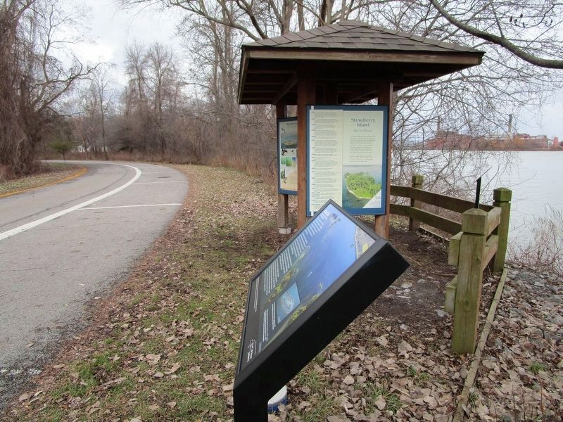
Strawberry Island formed near the end of the Wisconsin Ice Age about 12,000 years ago. When meltwaters broke through gracial till and created the present course of the Niagara River, gravel and sand carried downstream by river currents settled out . . . — — Map (db m101061) HM
You are standing on the bed of the Erie Canal, a 363 mile long, 40 ft. wide, 7 ft. deep "ditich" built from 1817 to 1825 that connected Lake Erie waters with the Hudson River and ultimately the Atlantic Ocean. It unleashed a flood of products, . . . — — Map (db m98540) HM
In 1884, the Tonawanda Gas Light Company was incorporated to supply gas to both Tonawanda and North Tonawanda for street and house lighting. The "gas works" was located on property once owned by Mary Long. Between the Canandaigua and Erie . . . — — Map (db m166212) HM
During the 1800s, many Americans and newly arrived immigrants were eager to move west, but this undertaking proved difficult because of the Appalachian Mountains. A natural barrier running from Alabama through Pennsylvania, New York and on into . . . — — Map (db m77385) HM
An Overview
In the spring of 1823, work on the Erie Canal at this end of the state began with the building of a dam. Its purpose was to raise the water level of Tonawanda Creek 4 to 4 1/2 feet so that its ten-mile stretch between Pendleton . . . — — Map (db m77499) HM
The westernmost leg of the Erie Canal completed in 1825 followed a route paralleling the Niagara River between Tonawanda and Buffalo. From where you are standing, the Canal travelled some ten miles through the mostly unsettled Township of Tonawanda . . . — — Map (db m98556) HM
Dedicated on February 14, 1980 during the XIII Olympic Winter Games to the memory of Norway’s greatest figure skater Sonja Henie (1912-1969). Holder of 10 World Championships, 3 Olympic Gold Medals, the second awarded in Lake Placid at the 1932 . . . — — Map (db m100520) HM
The aerial photograph of Port Henry taken about 1925 leaves no question as to the nature of this place: a busy port shipping the products of its furnaces by water and by rail. Two new furnaces, begun in 1922, represented the latest technology. An . . . — — Map (db m109054) HM
The aerial photograph of Port Henry taken about 1925 leaves no question as to the nature of this place: a busy port shipping the products of its furnaces by water and by rail. Two new furnaces, begun in 1922, represented the latest technology. An . . . — — Map (db m109055) HM
Iron processing changed the shoreline of Port Henry. When the New York and Canada Railroad was built in 1874, the tracks hugged the lake. That same year, a modern blast furnace was built at Cedar Point, just beyond the train station. Eight blast . . . — — Map (db m109053) HM
The Civil War's monstrous appetite for iron - for horse shoes, artillery, cannon balls, rifles, and armor plate - exposed the greatest obstacle to iron production in Moriah: getting ore from the mines to the lake shore. Even 100 teams of horses . . . — — Map (db m109033) HM
This caboose was built in 1946 at Fisher Hill Shop, Mineville N.Y. It is constructed from an iron ore car and weighs 16 tons.
The Lake Champlain and Moriah Railroad used this caboose on the main line from Mineville to Port Henry to haul iron . . . — — Map (db m109056) HM
Powerhouse Park still serves as a staging area for ice fishing shanties during the winter and remains of the old Port Henry Powerhouse form its boundary along Mill Creek.
A mixture of six parts mine tailings to one park concrete was used to . . . — — Map (db m108982) HM
As the idea for a Railroad and Mining Heritage Park took shape in the early 1990s, a few people shared a great dream. Most evidence of Moriah's proud mining heritage had been demolished, but railroad equipment could help people visualize a part of . . . — — Map (db m109040) HM
The first of Port Henry's many iron furnaces was erected just west of here in 1822. Throughout the 19th century new furnaces, crushers, concentrating plants, and casting houses were added to increase production.
The key to the success of Port . . . — — Map (db m108995) HM
Charles M. Spofford, an engineer of the Boston firm Fay, Spofford & Thorndike, designed the 1929 Lake Champlain Bridge. It was the first American highway bridge to employ a continuous truss design to create a curving transition between the deck . . . — — Map (db m109074) HM
Inspired by the 18th-century military gardens Sarah G. T. Pell established the first ornamental garden on this site as the fort was being reconstructed. In 1912 Alfred Bossom, who designed the reconstruction, enclosed the flower garden with a . . . — — Map (db m126315) HM
Inspired by the 18th-century military gardens Sarah G. T. Pell established the first ornamental garden on this site as the fort was being reconstructed. In 1912 Alfred Bossom, who designed the reconstruction, enclosed the flower garden with a . . . — — Map (db m126327) HM
In 1913, Sarah Pell went to Europe looking for artifacts to furnish the King’s Garden and Fort grounds. At a shop in London specializing in historic architectural fragments and antique garden ornaments, she found a set of “leaf work gates of . . . — — Map (db m126312) HM
The grindstones lining this street were used by the early mills operating in the 1800’s.
The mills were located in the entire area of the falls on the La Chute River.
They were salvaged by Vincent Strebe and erected in 1978.
. . . — — Map (db m125100) HM
New York
World War Veterans Memorial Highway
Surveyed 1928 • Completed 1937
During the Administrations of Governors
Alfred E. Smith Franklin D. Roosevelt Herbert H. Lehman
* * * * *
Whiteface Mountain Highway Commission
William . . . — — Map (db m46148) HM
This Side of Street Leveled
On January 21st. Sixteen
Businesses Were Destroyed.
It was an Economic Tragedy,
With No Loss of Life.
Broadalbin Historical Society — — Map (db m75110) HM
Trail Station Park
[Text on the Back]
This Monument Erected 1996 Marks the Site of the Gloversville Passenger Station and Main Offices of the Fonda, Johnstown and Gloversville Railroad It is Dedicated to those who Migrated . . . — — Map (db m68346) HM
New York State purchased Johnson Hall in 1906. At that time, after almost 150 years of changing ownership, only 20 acres remained intact of the original 700+ acre property.
The Johnstown Historical Society, trustee of Johnson Hall in the early . . . — — Map (db m58844) HM
This small dam was built in
1930 to hold back water and
create a permanent lake as
part of the newly created
Sacandaga Reservoir. — — Map (db m190520) HM
Many people in Northville and around Northville know about the return of the Chimney Swifts, but not many people know about Mr. Ray Hubbell. Each year the Chimney Swifts would return to their home in the chimney that was on the corner of 2nd Street . . . — — Map (db m137132) HM
Here the natural water power potential of Old Buttermilk Falls determined not only the village site, but in 1803, the erection of Stoddard and Platt's Pioneer Grist Mill. In 1822 Herman Le Roy, for whom the town was named, replaced this with a much . . . — — Map (db m142118) HM
Zadock Pratt
October 30, 1790 to April 6, 1871
Born in Stephentown, Rensselaer County, New York
Buried in Prattsville, New York Cemetery
Tanner, Farmer, Builder, Banker
U.S. Congressman (1837-1839; 1843-1845)
Wives:
Beda . . . — — Map (db m137374) HM
1885 - 1935
Fire Tower.
The second forest fire
tower in the Adirondacks.
Erected 1909. One of 58 now
maintained by the State in
Adirondacks and Catskills.
New York State Education and
Conservation Departments, . . . — — Map (db m44649) HM
Lake Durant
Named in Honor Of
William West Durant
1850 - 1934
Who Devoted Much of his Life To
Developing the Adirondacks And
Making Known their Beauties
— — Map (db m46723) HM
In Memoriam
U.S.S. Maine
Destroyed in Havana Harbor
February 15, 1898
This tablet is cast from metal
recovered from the U.S.S. Maine — — Map (db m126379) HM WM
1st Battalion, 32nd Infantry
2nd Battalion, 87th Infantry
3rd Squadron, 71st Cavalry
4th Battalion [sic], 25th Field Artillery
710th Brigade Support Battalion
3rd Brigade Special Troops Battalion
"... nothing good in life comes
but at . . . — — Map (db m111748) WM
Soldiers of the 10th Mountain Division (LI)
stand to honor and grieve a fallen comrade
symbolized by the traditional helmet, boots,
and rifle. Two other soldiers in battle gear
move out for the next challenge, at the same
time extending . . . — — Map (db m111745) WM
The Citizens of Jefferson, Lewis and St. Lawrence Counties extend heartfelt welcome to the United States Army and to the men and women of Fort Drum. This standard, which flies our nation's flag, and the time capsule beneath this marker are . . . — — Map (db m110392) WM
In 1895 George Boldt acquired Heart Island for the reputed sum of $20,000.00 and work on the Island began shortly thereafter. The first three projects undertaken were the design and construction of Alster Tower, the construction of a boat lagoon . . . — — Map (db m126692) HM
It is believed that this structure was the first built by the Boldts while they were remodeling the original frame "cottage" on the Island in 1894. The stone tower was topped with a wooden structure designed for use as a dove house. It is said . . . — — Map (db m126654) HM
The most desirable orientation on the island has always been toward the main channel on the Southwest side and the Village of Alexandria Bay on the United States mainland. Taking their cue from the layout of the original Hart cottage, the Boldts . . . — — Map (db m126693) HM
Not many years ago the Thousand Islands, like the Adirondacks, were not considered of much value, except as a great hunting and fishing ground. In 1822 a boundary line and division of the Island Region was agreed upon between United States and . . . — — Map (db m126646) HM
The mighty St. Lawrence River was first explored by Jacques Cartier in 1535. As early as 1680 settlers were talking about building canals on the St. Lawrence River to aid navigation. It was 150 years later that the first navigational work began. . . . — — Map (db m126660) HM
Across the water on Wellesley Island is located the Boldt Yacht House. Mr. Boldt had several projects going on simultaneously with the construction of the castle, the Yacht House being the largest. Construction commenced in November of 1899 at a . . . — — Map (db m126645) HM
Early Mormon meeting home built from native limestone circa 1820. Land bought from William Henderson in 1824. Possible Underground RR site.
Home of T. O. Whitney — — Map (db m143149) HM
This Statue of Liberty was placed here in remembrance of 9/11 to honor all firefighters, policemen and rescue teams that put their lives at risk to help the innocent Americans on that unprecedented September day.
We also want to thank every man . . . — — Map (db m110163) HM WM
In grateful memory of the
Soldiers and Sailors of
Jefferson County
who fought or fell in defense of
the Union and the freedom of man.
This monument to witness
that these dead have not
died in vain and that
through them,
under God, . . . — — Map (db m110124) WM
Original 8 Towns [and] 1805 Town Supervisors
Town of Adams • Nicholas Salisbury
Town of Brownville • John Collins
Town of Champion • Noadiah Hubbard
Town of Ellisburgh • Lyman Ellis
Town of Harrison (Rodman) • Thomas White
Town of . . . — — Map (db m110082) HM
The founder of the
F. W. Woolworth Co.
began his retailing career
at this location in 1873.
After the experience with
the 5¢ counter here,
Frank W. Woolworth
established the first
5¢ and 10¢ stores.
This was the beginning of . . . — — Map (db m110127) HM
Born August 7 · 1835 · Died May 12, 1899
Representative in the Forty Seventh
and in the Fifty First Congress
Governor of the State of New York
MDCCCXCII - MDCCCXCIV
Erected in affectionate and
grateful remembrance of his
noble . . . — — Map (db m110161) HM
Built 1856-57 by the Genesee Valley RR to span the Conesus Outlet. The 200 ft. long x 12 ft. wide limestone bridge was part of the Rochester-Avon-Geneseo-Mt. Morris Line. Avon became a RR hub connecting Buffalo-Rochester-Corning-Hornell. The line . . . — — Map (db m58050) HM
Working Before Its Time On November 25, 1950 storm clouds covered the sky and heavy rains fell causing the water to rise in the upper Genesee River. Severe flooding inundated upstream towns and villages. Many families were rescued from their . . . — — Map (db m143300) HM
Dedicated to the men and women employed by the Mount Morris Dam Builders and U.S. Army Corps of Engineers, Buffalo District 1948-1952
Under the Flood Control Act of 1944, the United States Congress authorized the construction of a dam . . . — — Map (db m143298) HM
In reaction to the severe flooding that occurred almost every seven years in the Genesee Valley since the 1800s, Congress authorized the Mount Morris Dam project under the Flood Control Act of 1944. Completed in 1952 by the United States Army Corps . . . — — Map (db m143296) HM
(left panel) Looking Left – Upstream A Dry Dam… A Protected River Why is there no reservoir upstream of the dam? The Genesee River Basin provides beautiful scenic, natural, recreational, cultural, geological and ecological . . . — — Map (db m143299) HM
Mount Morris Dam was built to provide flood protection to the farm lands, residential areas, and commercial and industrial development in the Genesee River Valley from the dam site north through Metropolitan Rochester to Lake Ontario. Prior to its . . . — — Map (db m143297) HM
Genesee Valley Canal Rochester to Olean 1836-1878 ————————— This section of the Genesee Valley Canal opened as far as Mt. Morris on September 1, 1840. The canal provided a practical means of . . . — — Map (db m116989) HM
Towns sprouted along the length of the Erie Canal. Canal Street was Canastota's business district. Travelers stopped here for food and supplies or a bed for the night at a hotel or boarding house. Local farmers, merchants, and manufacturers shipped . . . — — Map (db m139500) HM
Its immediate success on opening from Albany to Buffalo in 1825 soon led to calls to enlarge the canal. From 1836 to 1862 the canal was deepened from 4 feet to 7 feet, with bigger locks and aqueducts, and canal boats grew threefold in capacity from . . . — — Map (db m139502) HM
Canal and street traffic came into conflict where Peterboro Street crossed the Erie Canal in Canastota's busy commercial district. Engineers fixed the problem with a hydraulic lift bridge. Raised, it let boats through and still carried foot traffic. . . . — — Map (db m139501) HM
Construction of the Erie Canal was hailed as the greatest engineering accomplishment to that time. Under the leadership of Governor De Witt Clinton, construction began July 4, 1817. With little technical knowledge, thousands of workers surveyed, . . . — — Map (db m65012) HM
When a canal boat needed repairs, the captain went to the nearest dry dock. A dry dock was a basin or bay that could be flooded to get a boat in, and then drained so that the boat could be repaired. Along the canal, at least 44 different dry docks . . . — — Map (db m144329) HM
The high ground from Syracuse to Rome, known as the Rome Summit Level, was the first completed section of the canal. Water does not naturally fill this section because of its elevation, but the canal needed to be full to be open. Construction of . . . — — Map (db m144328) HM
This bell was salvaged during the dismantling of the Union Meeting House (Presbyterian Church) in 1883.
It was mounted at the Union Hall on December 11, 1884 and used as a fire bell until the Union Hall was destroyed by fire on December 31, . . . — — Map (db m116797) HM
The opening of the Brockport to Buffalo section in October 1825 marked the completion of the 348 mile Erie Canal. By linking the Hudson River with the Great Lakes, the Canal provided the first economical means of transportation from the eastern . . . — — Map (db m75943) HM
1. Luther Gordon epitomized Brockport's involvement in canal commerce during its heyday. He owned a sawmill and 7,000 acres of timberland in Michigan and transported logs via the Great Lakes and the canal to his Brockport sawmill and planing . . . — — Map (db m75934) HM
1. Daniel Holmes (1828-1917) practiced law in offices on Main Street from 1852 until his death. He was Village Clerk for twenty years, Justice of the Peace for thirty years, Vestryman at St. Luke's Episcopal Church for fifty years, and member . . . — — Map (db m75804) HM
has been placed on the
National Register
of Historic Places
by the United States
Department of the Interior
Built 1854
———————
This structure has
been designated an
Historic . . . — — Map (db m75783) HM
This neighborhood of poured concrete houses was developed by Kate Gleason in the 1920s. These European-like structures were built to last 100 years. — — Map (db m65111) HM
Established in 1935 on this site, wells using the pre-glacial channel of the old Genesee River provided the Village of East Rochester with water until 1992. — — Map (db m56266) HM
Site of tunnel which took workers under the RR tracks to the car shops. Established in 1897 the Merchant Despatch Transportation Co. was largely responsible for the early growth of the village. — — Map (db m70706) HM
Erected in 1935 replacing a smaller tank on Lincoln Road and Filbert Place. It provided was to village for many years, ending in 1992. — — Map (db m70708) HM
Erected at Fullamtown 1822 by Elisha Fullan. Housed 1st Perinton Post Office. Moved here 1850. Site if the 1st Fairport Library. — — Map (db m57769) HM
The Erie Canal was the most important of America’s inland waterways. It facilitated the opening of the American frontier and provided a route west for tens of thousands of settlers and immigrants. Villages, towns, and cities were born along its . . . — — Map (db m65107) HM
The Great American Canal The Erie Canal was the most important of America’s inland waterways. It facilitated the opening of the American frontier and provided a route west for tens of thousands of settlers and immigrants. Villages, town, and . . . — — Map (db m110008) HM
The Great American Canal The Erie Canal was the most important of America’s inland waterways. It facilitated the opening of the American frontier and provided a route west for tens of thousands of settlers and immigrants. Villages, town, and . . . — — Map (db m110017) HM
These stones from the first aqueduct and the locks were set October 30, 1926 at the eastern widewaters to commemorate the first centenary of the Erie Canal presented to the City of Rochester — — Map (db m57403) HM
Beginning in the twentieth century, this historic neighborhood, now known as Grove Place, was home to some of the leading families of Rochester, including George Selden, an eminent Rochester patent attorney and inventor of the automobile gasoline . . . — — Map (db m62098) HM
Diagonally across Franklin Street stands a fine example of the work of esteemed Rochester architect J. Foster Warner. This traditional banking house was built in 20th century Byzantine Style in 1928 for the Rochester Savings Bank. It features . . . — — Map (db m56296) HM
From Seneca fording place to aqueduct and bridge — a perpetual crossing place
Erie Canal Rerouted South of the City and out of Downtown
The last canal boat passed through the Erie Canal in downtown Rochester in 1919. The city had . . . — — Map (db m65116) HM
Historic Marker
Pont de Rennes
Pedestrian Bridge
(Formerly Platt Street Bridge)
Originally Built - 1891
Rochester Bridge and Iron Works
Converted to Pedestrian Mall - 1980 — — Map (db m55773) HM
Rochester's first park, offered in 1883 by Ellwanger & Barry Nursery; Accepted Jan. 13, 1888. Park Commission formed May 1, 1888. — — Map (db m56107) HM
This plaque is dedicated to the original founders
of the Rochester Water Works, and the hundreds
of succeeding Water Bureau employees who have
carried on the design, construction, operation,
and maintenance of the City's water supply . . . — — Map (db m137308) HM
Canals provide an inexpensive way to move people and goods
1825 The Erie Canal
The Erie Canal connects the Hudson River and Lake Erie. The 363 miles of navigable waterway provided a cost-efficient way to transport goods to and from the . . . — — Map (db m61901) HM
Limestone was used to build locks, aqueducts, and other features throughout New York State's canal system both because of its availability and its durability. This limestone block was a capstone from the Schoharie Aqueduct. Local limestone formed . . . — — Map (db m64591) HM
The stone structure extending about halfway across Schoharie Creek in front of you is what remains of the Schoharie Aqueduct. Built between 1839 and 1841 as part of the Enlarged Erie Canal, the Schoharie Aqueduct was perhaps the single greatest . . . — — Map (db m142208) HM
Has Been Placed on The
National Register of
Historic Places in 2002
By the United States
Department of the Interior
William G. Pomeroy Foundation 2013
— — Map (db m76606) HM
3554 entries matched your criteria. Entries 301 through 400 are listed above. ⊲ Previous 100 — Next 100 ⊳