When the Sandy Hook Lighthouse was built in 1764, ships entered New York Harbor through a natural channel that ran close to the Sandy Hook shore. Sandbars were a constant danger and the merchants of New York built the Lighthouse to protect their . . . — — Map (db m22756) HM
When the Sandy Hook Lighthouse was built in 1764, ships entered New York Harbor through a natural channel that ran close to the Sandy Hook shore. Sandbars were a constant danger and the merchants of New York built the Lighthouse to protect their . . . — — Map (db m208214) HM
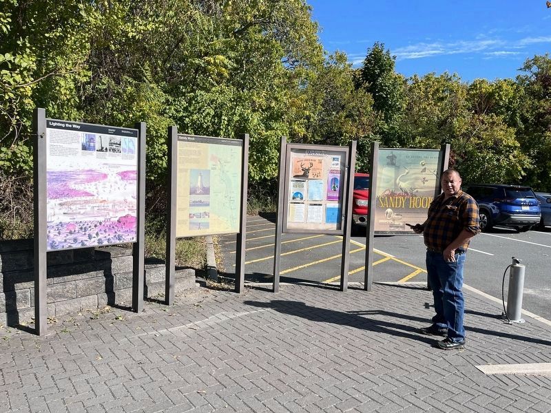
Stretching off the northern tip of the New Jersey Shore, the 1,650 acre peninsula preserves six miles of ocean beaches enjoyed by more than two million visitors a year. But there’s much more.
Beyond its well-known beaches, sand dunes and . . . — — Map (db m208215) HM
Stretching off the northern tip of the New Jersey Shore, the 1,650 acre peninsula preserves six miles of ocean beaches enjoyed by more than two million visitors a year. But there’s much more.
Beyond its well-known beaches, sand dunes and . . . — — Map (db m208219) HM
Upper Marker:
This light was completed in 1764 and is the oldest continuously operating lighthouse in the United States. New York merchants petitioned their assembly to raise money for the light by lotteries and tonnage taxes on ships . . . — — Map (db m5092) HM
The Mansion House was considered to be the finest hotel of its day. On August 22, 1861, the wife of Abraham Lincoln visited Long Branch and stayed at the Mansion House. A thrilling demonstration of an ocean rescue by the Life-Saving Service, which . . . — — Map (db m46931) HM
• Seabeach amaranth had not been seen on Monmouth County beaches since 1899 or elsewhere in New Jersey since 1913, but now the plant is back! It was rediscovered in July 2000 in Sea Bright, Monmouth Beach, and Sandy Hook. Biologists are not . . . — — Map (db m208285) HM
First known as Strawberry Hill, Home of Thomas Whitlock, the first permanent settler of record in New Jersey under British Rule, who scouted the land in 1663. Shoal Harbor was an early sailing port and center for fishing and agriculture. — — Map (db m5788) HM
On this spot were buried the remains of the Honorable Hamilton Douglas Halyburton, 1st Lieutenant, Royal Navy, son of the Earl of Morton, and James Champion, Lieutenant of Marines.
Together with twelve members of the crew of H.M.S. . . . — — Map (db m5658) HM
From the first federally funded lifesaving stations built in 1849 to today’s busy bases, the history of the United States Coast Guard can be traced along New Jersey’s coast.
In 1915, the Life-Saving Marine Service were combined to form the . . . — — Map (db m22665) HM
The first wharf built here was used to bring in granite blocks for the Fort at Sandy Hook. Later, cannon to be tested at the Sandy Hook Proving Ground were received here. In the 1890s barges arrived carrying the materials to build Fort . . . — — Map (db m54505) HM
Find a prickly pear cactus. 🌵 Bike or walk a park trail. Search for an egret as you explore the salt marsh. Count the butterflies. 🦋 Go birdwatching. 🐦 Look for holly in our coastal forests.
See how America's oldest . . . — — Map (db m208209) HM
Find a prickly pear cactus. 🌵 Bike or walk a park trail. Search for an egret as you explore the salt marsh. Count the butterflies. 🦋 Go birdwatching. 🐦 Look for holly in our coastal forests.
See how America's oldest . . . — — Map (db m208223) HM
The broad expanse of New York Harbor is misleading. Shoals and sandbars pose underwater threats to navigation and ships must stay in channels for safe passage. Until the Ambrose Channel was created, all ships entered the harbor through a natural . . . — — Map (db m22693) HM
Established in 1943, to store and supply ammunition for the Atlantic fleet, the Earle Naval Weapons Station plays a key role in protecting American coastal cities and ports. Its deep-water pier is 2.9 miles long and can service several naval vessels . . . — — Map (db m22664) HM
Stretching off the northern tip of the New Jersey Shore, the 1,650 acre peninsula preserves six miles of ocean beaches enjoyed by more than two million visitors a year. But there’s much more.
Beyond its well-known beaches, sand dunes and . . . — — Map (db m22754) HM
Stretching off the northern tip of the New Jersey Shore, the 1,650 acre peninsula preserves six miles of ocean beaches enjoyed by more than two million visitors a year. But there’s much more.
Beyond its well-known beaches, sand dunes and . . . — — Map (db m208178) HM
Stretching off the northern tip of the New Jersey Shore, the 1,650 acre peninsula preserves six miles of ocean beaches enjoyed by more than two million visitors a year. But there’s much more.
Beyond its well-known beaches, sand dunes and . . . — — Map (db m208182) HM
Stretching off the northern tip of the New Jersey Shore, the 1,650 acre peninsula preserves six miles of ocean beaches enjoyed by more than two million visitors a year. But there’s much more.
Beyond its well-known beaches, sand dunes and . . . — — Map (db m208211) HM
Stretching off the northern tip of the New Jersey Shore, the 1,650 acre peninsula preserves six miles of ocean beaches enjoyed by more than two million visitors a year. But there’s much more.
Beyond its well-known beaches, sand dunes and . . . — — Map (db m208222) HM
Sandbars, shallow waters, and winter storms off the New Jersey Shore were a constant danger to early sailing vessels. In a storm, wind and waves could destroy a helpless grounded ship, its cargo, and crew and passengers. Commerce in and out of New . . . — — Map (db m22613) HM
U.S. Life-Saving Station
The Spermaceti Cove Life-Saving Station was one of the first Life-Saving Stations constructed by the federal government in the 19th century. Life-Saving Stations along the New Jersey Shore played a key role in the . . . — — Map (db m208183) HM
Site of the Brinley Grist Mill. Built about 1725 the mill on Whalepond Brook was the first business in the area. The settlers brought their grain here until the early 1900's. — — Map (db m24425) HM
This area is designated Greely Field in honor of Major General Adolphus Washington Greely, Chief Signal Officer of the U.S. Army from 3 March 1887 to 6 February 1906.
From the time he entered the Army as a private during the Civil War, . . . — — Map (db m209083) HM
Welcome to Gateway National Recreation Area. Sandy Hook is a barrier beach peninsula at the northern end of the New Jersey Shore. Its location at the entrance to New York Harbor assured Sandy Hook's importance for coastal and harbor defense. For . . . — — Map (db m208237) HM
A Limited Resource Water covers almost three quarters of the earth’s surface, but only three percent of it is fresh water, and less than one third of that is usable. The remaining fresh water is locked up as snow and ice at the polar regions. . . . — — Map (db m53179) HM
Near this location, over 100 years ago, canal boats heavily laden with Pennsylvania coal were approaching the summit of Morris Canal Plane 7 East.
Much like a canal “lock”, an inclined plane is a simple machine which allows boats . . . — — Map (db m88949) HM
Morris Canal
1824-1924
National Register Landmark
Information
Lock Nos. 9 & 10-East
Stone abutment supported mule bridge. Boats were pulled across river in slack water behind dam.
Morris County — — Map (db m88953) HM
Pre-revolutionary farm pond, on an 800 acre tract owned by the Noe family, provided water and ice for the Noe farm, dairy and greenhouses. Converted in 1955 to a private family swim and recreation club by Jack & Ruth Noe and Taz & Baily Brower Jr., . . . — — Map (db m38135) HM
19th Century store on Morris Canal, lock 8 east. Catered to canal boatmen and their families. Property purchased by Samuel Peer in 1852. E.C. Peer served as lock tender 1862-1915. — — Map (db m91610) HM
From the mid-1800's to the 1920's, this site named for the prominent King family is where canal boats docked while waiting to transit two inclined planes or a nearby lock. The boatmen bought goods and supplies from local stores, which helped fuel . . . — — Map (db m161747) HM
Pre-Revolutionary salt box dwelling least altered on the Suckasunny Plains. Built by Captain Silas Riggs, who operated three boats on nearby Morris Canal. Moved to present site 1962 — — Map (db m91420) HM
George MacCulloch, “Father of the Morris Canal,” and wife Louisa built this 1810-1819 Georgian Mansion. They established Saint Peter’s Episcopal Church. Louisa was first directress of family services of Morris County. The first recorded . . . — — Map (db m91150) HM
Created in 1846 as the Morris Canal’s Stanhope Reservoir. This lake supplied water that filled the canal and powered local industries. Mules treading an earthen causeway across the lake pulled boats loaded with coal, iron ore, or freight along a . . . — — Map (db m37927) HM
Completed in 1926 under the administration of a. Harry Moore, Governor, by the Morris Canal and Banking Company, Trustee for the State of New Jersey.
Board of Directors
Albert W. Drake, Pres. •
William E. Florance •
John L. Kuser • . . . — — Map (db m231648) HM
The Morris Canal was built in 1825 completed 1831, cost $2,000,000. Enlargement 1840-5 including this reservoir increased cost to $3,400,000, and further improvements, 1846 - 1860, to $5,100,000. there were 28 locks and 23 inclined planes. In . . . — — Map (db m231647) HM
The Morris Canal and Banking Co. built this circa 1826 culvert to allow the passage over Fox's Brook of canal boats hauling anthracite coal, iron ore and manufactured goods between Pennsylvania and New York. The site remains among the . . . — — Map (db m157531) HM
The Morris Canal was an engineering marvel of its time. A system of 23 lift locks and 23 inclined planes enabled the canal to overcome more elevation change than any other transportation canal ever built. Large changes in elevation were . . . — — Map (db m33270) HM
Constructed of native stone by the Lackawanna Railroad, the station was a key link for resort visitors and residents from 1911 into the 1950s. Lackawanna Trains, The Morris Canal, Lake Steamboats, and Morris County Traction Company Trolleys . . . — — Map (db m149142) HM
Industrial transportation route
extending from Phillipsburg to
Jersey City. The canal, an engineering feat of locks and inclined
planes, revitalized the iron
industry in Morris County.
New Jersey Register of Historic Places
National . . . — — Map (db m41900) HM
Located across the street and known by the Native Americans for its healing properties, the spring flowed from above the exposed rock outcropping and was a popular 19th century destination attracting visitors to the nearby grand hotels. — — Map (db m228476) HM
Settlement, established as port on Morris Canal and Depot on Morris and Essex Railroad. Fostered development of Wharton Furnace. Borough name changed to Wharton in 1902. — — Map (db m91510) HM
Primary seacoast lights were located to warn mariners of their proximity to land, the presence of navigational dangers, and to help set their course. By 1852, however, lighthouses and lightships often looked so much alike that it was difficult to . . . — — Map (db m209195) HM
Built 1857-58 by the Federal Lighthouse Board. First Lighted January 1, 1859.
The present lighthouse replaced an earlier lighthouse built in 1834. The height of the light above sea level is 165 feet. Barnegat Lighthouse was built as a 1st . . . — — Map (db m34624) HM
Built 1857 - 1858 by the Federal Lighthouse Board
First lighted January 1, 1859
Relit January 1, 2009 by Friends of Barnegat Lighthouse State Park
The present lighthouse replaced an earlier lighthouse built in 1835.
The . . . — — Map (db m209194) HM
What am I looking at? The shelter in front of you and the equipment attached to the jetty behind you are components of a gauging station. The gauge is equipped to measure the amount of water flowing into and out of Barnegat Bay through . . . — — Map (db m88568) HM
After a long journey across the Atlantic, mariners bound for New York Harbor welcomed the sight of the Barnegat Lighthouse lighting the way. It was constructed in 1834 as a navigational aid to guard Barnegat Inlet. Twenty years later, it was . . . — — Map (db m34625) HM
In the 1850's, Archelaus R. Pharo, founder of Beach Haven and a Tuckerton business man became acquainted with a group of wealthy sportsman from Philadelphia who duck hunted at Bond's Hotel on the southern end of LBI. These men would become the . . . — — Map (db m219727) HM
To hunt whales the Soper and Inman families settled here in 1690 followed by the Cranmer, Rutter, Mullins and Stevens families.
This area known as "Great Swamp" had a tall forest of white cedar and fresh water.
The "Mansion of Health" . . . — — Map (db m209202) HM
Lost WWII US Warship Found
On October 21, 1943, while waiting to perform anti-submarine escort duty for a convoy heading out of New York Harbor, the USS Murphy was struck by the tanker SS Bulkoil, cutting the destroyer in half. Two hundred . . . — — Map (db m209196) HM WM
The 28' "E" Scow replaced the 20' Sandbagger Sneakbox as the fastest sailboat class on the Bay in the late 1920's. Originally built on the Great Lakes and accepted on Barnegat Bay in 1924. This Scow was probably built by Melges in before 1970 on . . . — — Map (db m209179) HM
Served with distinction during Kamikazi attacks in the Pacific Theatre during World War II. It later joined fleets in the Atlantic and Mediterranean and played a part in America’s early space program. Returned John Glenn, the first American to orbit . . . — — Map (db m92451) WM
This 16' canoe (circa 1915) was the property of William Ambrose Cox (1900-1939), a resident of Barnegat, NJ. He attended Westtown Friends School. He owned and operated a lumber yard and Cox's Dairy.
His father, William Cox, was an area real . . . — — Map (db m209171) HM
East Water Street extends from its intersection with Main Street (Route 166) to Dock Street, one half mile east. It is also called "Captain's Row" for the many sea captains who built their homes here in the 1800s so they would be near their . . . — — Map (db m209109) HM
This 17 1/2 ft. sailboat is a single sail Charles D. Mower design built in 1924 by the Morton Johnson Boat Yard of Bay Head. It is marconi rigged and was sailed to first place in the "Classic Boat" division of the 1989 Wooden Boat Festival . . . — — Map (db m209180) HM
Designed by C. Mower built by Morton Johnson, Bay Head New Jersey.
Length 18 feet 9 inches, length at the water line 14 feet, beam 6 feet 7 inches, draft hull 7 feet. Mast 24 feet, sail area main 147 sq. feet jib 57 sq. feet. . . . — — Map (db m209177) HM
The 19 foot "Gussie Feathers" with hull number 579 was built in 1943 in Skaneateles NY. The "Lightning" class came to Barnegat Bay in 1939 & was a one design sail class in the Barnegat Bay Yacht Racing Association for several years. It came . . . — — Map (db m209176) HM
Water Street is named for the parallel waterway that flows of 40 miles from its inland source to Barnegat Bay. Since the early 1700s, the waterway and the tiny village that thrived near it were called Tom's River. Historians believe that they . . . — — Map (db m209111) HM
Downtown Toms River, also called the "village," includes both residential and commercial properties. None of these properties are as old as the town itself when it was separated from Shrewsbury Township, Monmouth County in 1767 and was . . . — — Map (db m208342) HM
Built on the Penobscot River in Old Town, Maine, this 15' canoe has serial number 96876. The canoe was used for many years by the Vogel family on the Toms River and on the streams feeding the Toms River. It is light and easy for portaging and . . . — — Map (db m209169) HM
Built by J.H Perrine in Barnegat, NJ in 1902 and rebuilt in 1983 by Vince Heckel & Son of Toms River, NJ. Rebuilt mast rings and original brass software.
This 15 foot model was the forerunner of today,s Barnegat Bay Yacht Racing . . . — — Map (db m209170) HM
Local mariners or “baymen,” found that they could support themselves almost entirely from the rich harvest of waterfowl, crabs, flounder, clams, oysters, and other native resources of the back bays. To navigate the shallow depths of . . . — — Map (db m26364) HM
Designed by Charles S. (Buck) Snyder and built by Buck and his brother Bob in 1937, the Sea Biscuit was originally an open sea skiff painted black. She was built primarily for off shore fishing and could make the "ridge" easily and quickly. Built . . . — — Map (db m209182) HM
Stoutenburgh-Minturn House (c. 1868) [86 E. Water St.] NR
In 1866, the first trains began to run along the new railroad tracks that had been laid between New York City and Toms River. Soon, train cars brought wealthy visitors . . . — — Map (db m209166) HM
Bishop Memorial Library (c. 1941)
101 Washington Street
Writer and traveler Nathaniel Holmes Bishop (1837-1902), born in Medford, Massachusetts, moved to Toms River when he was about 27 years old. His adventurous spirit and . . . — — Map (db m208297) HM
Toms River residents Joseph and Mary Lawrence owned a large strip of undeveloped land located south of Washington Street that extended to the river's edge. They deeded one acre of this land to the trustees of the Toms River Meeting House. It . . . — — Map (db m208340) HM
For over 150 years, Barnegat Bay has been at the heart of a rich culture that relied on the bay for its livelihood. Early settlers who tried their hand at farming found they could supplement their diet and income with clams, fish, and waterfowl . . . — — Map (db m209283) HM
In 1609 - 1616, Dutch Captains Hudson, May and Hendricksen explored the coast and called this area "Eyre Haven" (Egg Harbor) reflecting the prolific bird population.
The English took control of "New Netherland" from the Dutch in 1664 and, in . . . — — Map (db m209291) HM
This sneakbox, a one-person hunting boat, is indigenous to the Barnegat Bay. Sneakboxes have been made in our area since 1836. Easily navigable and able to operate in shallow water, the sneakbox gets its name from its ability to sneak up on . . . — — Map (db m209292) HM
The Hunting Shanty, the original building that began the Barnegat Bay Decoy & Baymen's Museum was originally located across Route 9 at Tip Seaman County Park. It opened in 1993 and soon became too small. The founders purchased 40 acres on this . . . — — Map (db m209296) HM
This waterway, conceived in the 1820's, linked Pennsylvania's coal fields, New Jersey's iron industry and New York's commercial markets. For 100 years it flowed between the Delaware and Hudson Rivers.
Gloria J. Kolodziej, Mayor, City of Clifton . . . — — Map (db m64208) HM
Alexander Hamilton, with great vision, prompted the incorporation of the "society for establishing usefull [sic] manufactures" in 1791 to start America's economic and industrial independence. Pierre Charles L'Enfant, engineer and planner of the . . . — — Map (db m64189) HM
was launched in 1878, a one man craft with engine which after a series of trials was sunk in the Passaic River at this spot where she lay buried until raised in 1927 by a group of Paterson youths who presented her to the City of Paterson October . . . — — Map (db m49864) HM
Born Liscannor, Ireland 1841
Died New Jersey, USA 1914
Designer of the U.S. Navy's first submarine
USS Holand (SS 1)
Dedicated Oct. 10, 1976 — — Map (db m145902) HM
Property of the U.S. Fish and Wildlife Service. Guided ships through the upper Delaware Bay from April 2, 1877 to March 22, 1950. Through the efforts of private citizens coordinated by the "Save the Lighthouse Committee," the 115-foot iron tower was . . . — — Map (db m65259) HM
Originally named "Bridge Street" for the northern Fenwick Creek crossing and first town entrance, most buildings date from the late 18th and early 19th centuries representing an American town from over 200 years ago.
National Register of . . . — — Map (db m153701) HM
This tablet dedicated December 6, 1941, to commemorate the erection of this bridge and the following county bridges which were destroyed by the flood of September 1st and 2nd, 1940:
Dubois Bridge No. 493 near Harrisonville,
Deep . . . — — Map (db m153945) HM
Historic Blackwells Mills Canal House circa 1835. Home to generations of Bridge Tenders who opened and closed the swinging bridge for canal traffic. — — Map (db m94091) HM
The D&R Canal was built between the years 1830 and 1834. The waterway connected the Delaware and Raritan Rivers and, after its completion, served to expedite the flow of commerce between Philadelphia and New York City. Coal was the primary commodity . . . — — Map (db m33195) HM
The potential of the Raritan River to provide waterpower for industry was recognized early. In 1840, the success of similar projects along the Passaic and Delaware Rivers prompted the Somerville Water Power Company to begin building a power canal . . . — — Map (db m165260) HM
Historical Significance Dug by hand, mostly be Irish immigrants, the 66 mile D & R Canal was completed in 1834. 75 feet wide and 8 feet deep, the canal originally had 14 locks to raise and lower boat traffic. The D & R Canal operated as an . . . — — Map (db m15661) HM
A natural waterway follows the contours of the land over which it flows, the depth of water varies, depending on the quantity and velocity of flow. To maintain the constant depth of water required for transportation, a canal is engineered as a . . . — — Map (db m15663) HM