1704 House
Has been designated a
Registered National Historic Landmark
Under the provisions of the Historic Sites Act of August 21, 1935 this site possesses exceptional value in commemorating or illustrating the History of the United . . . — — Map (db m187163) HM
The Franklin House Hotel was erected c. 1853 and was first known as the Philadelphia House, after the Philadelphia & Erie Railroad which passed nearby. Managed early on by George W. Boyer, it quickly became a favorite lodging and meeting facility . . . — — Map (db m152012) HM
When the first settlers arrived here in the early 1840s, they found a heavily forested, rugged wilderness. In pre-mechanized north-central Pennsylvania, clearing the land was no simple task, and the first homes built by the pioneers were likely of . . . — — Map (db m175989) HM
One of the oldest houses in Erie, built in 1823 for prominent civic leader and politician Alexander Brewster, rear addition and Italianate changes to Federal period design made in 1850's. Deeded by Brewster family in 1898 to Erie Bureau of Charities . . . — — Map (db m116419) HM
This steel Flagpole was first installed in 1938 at the SE corner of E. 6th & French Sts. by Erie Insurance Co-Founder and President H. O. Hirt when Erie moved its Home Office to the historic C. F. Adams Building (now Erie Insurance Heritage . . . — — Map (db m116397) HM
Erected in 1840, the last of three Federal style houses built at 5th & Holland by prominent brickmaker David Kennedy. It is typical of double houses occupied by workers of the period rear wings added in 1860's. Listed on National Register of . . . — — Map (db m116417) HM
This Richardsonian-Romanesque style mansion & carriage house on "Millionaire's Row", built entirely of Medina Sandstone, was designed by prominent Buffalo architects, Green & Wicks for roofing paper maker & inventor, Harrison F. Watson . . . — — Map (db m226782) HM
Stull Interpretive Center
In the 1920s, a small rustic building known as the Police Barracks, served as the "State Park Police" headquarters. In 1935, the building was moved to the sawmill area and a new wooden structure was built here in . . . — — Map (db m132283) HM
In the early 19th Century the Great Lakes provided the single most important transportation system in the country. Throughout the lakes, mariners depended heavily on lighthouses to warn of hazards to navigation and to mark major land features.
A . . . — — Map (db m129989) HM
John A. Brashear, astronomer, educator, was born here 1840. His grandfather kept the Brashear House, a leading tavern. In 1825 Lafayette spoke from its doorway to the people of Brownsville. — — Map (db m746) HM
This Property Has Been Placed On The National Register of Historic Places By the United States Department of the Interior Placed by the Connellsville Area Historical Society — — Map (db m195499) HM
This Property Has Been Placed On The National Register of Historic Places By the United States Department of the Interior Placed by: C. J. Franklin Ellis Postmaster 1951 to 1972 — — Map (db m195496) HM
This Finial was the uppermost element of the building known as Number One, Poultry, in the heart of the City of London. The building was constructed in 1870 to a design by the Victorian architect John Belcher Jr., in the Venetian-Gothic style. A . . . — — Map (db m62144) HM
Designed by Frank Lloyd Wright (1867-1959), this house was built in 1936 as a family retreat for Pittsburgh businessman Edgar J. Kaufmann. Widely admired for its design, it is dramatically cantilevered over a waterfall; it exemplifies Wright's . . . — — Map (db m41785) HM
Fallingwater, as part of the 20th-Century Architecture of Frank Lloyd Wright, has been inscribed on the World Heritage List.
Inscription confirms that this property deserves protection for the benefit of all humanity because of its outstanding . . . — — Map (db m138206) HM
Friendship Hill has changed greatly since Albert Gallatin sold the property in 1832. To Gallatin, the property reflected his dream of agricultural pursuits and establishment of the industry. With the passage of time and ownership, Friendship Hill . . . — — Map (db m195695) HM
Founded 1734; main part of present church built 1803. One of the Presbyterian churches marking the first great settlement of Scotch-Irish pioneers west of the Susquehanna. — — Map (db m8062) HM
This church, the third building, stands on the site of a log church built in 1780 by the Lutheran and Reformed and used jointly by the congregations till 1808. The land was granted by Benjamin Chambers. — — Map (db m8121) HM
Built 1823-1824. Oldest Pennsylvania building erected solely for Masonic use and now used exclusively for that purpose. Spared when Confederates burned town on July 30, 1864. — — Map (db m8057) HM
Of Georgian design, this jail was built in 1818 and was in continuous use for 152 years. The third oldest building in the borough, it survived the burning of Chambersburg by Confederate forces during the Civil War. — — Map (db m8059) HM
On this site stood the John Jack Tavern. Operated by the family of James Jack, courier of the Mecklenburg Declaration of Independence. The Tavern was used from 1784 until 1794 as a courthouse and jail for Franklin County. — — Map (db m8098) HM
This station served the town of Quincy, Pennsylvania on the Mont Alto Railroad, later the Cumberland Valley and Pennsylvania Railroads. The building was acquired by Guilford Township from James Fouchard in 2008, moved to Norlo Park and restored to . . . — — Map (db m152346) HM
John Wolfe, 1795 Jacob Shaffer, 1815 Thomas Reynolds Robert McCoy D.M.B. Shannon, 1856 Dr. John Kuhn, 1905 Dr. William Grove, 1950 James W. & Carol W. Smith, 1972 — — Map (db m58691) HM
James McMurdie, hatmaker, owned this house in 1791. Other owners include Charles Gillespie, copper and tinsmith, 1835; Gillespie's daughter Betsy Lowe, 1841; Joseph A. Kreps, carriage maker, 1862; his son Jacob R., Carpenter, 1864; Hannah and Felix . . . — — Map (db m192269) HM
Erected by John McDowell before 1754. It was used as a base of supplies and as a magazine until the erection of Fort Loudon in 1756. The military road from Pennsylvania, connecting with the Braddock Road at Turkey Foot, was built from this point in . . . — — Map (db m8045) HM
Originally built circa 1814 by the Bittinger family at the current location of the Alexander Hamilton Library in Waynesboro. Disassembled and relocated to Renfrew in 2014. Rebuilt in 2015 with a grant from Franklin County Commissioners. This . . . — — Map (db m192338) HM
This pioneer grist mill was built in 1812 by William Hunter. It has been in use continuously since that date. It is powered by a water wheel and uses much of the old-style machinery in its present operation. — — Map (db m27268) HM
This property has been placed on the National Register of Historic Places by the United States Department of the Interior-Circa 1850 — — Map (db m90787) HM
This property has been placed on the National Register of Historic Places by the United States Department of the Interior-Circa 1909 — — Map (db m90785) HM
David McMurtrie built this house in 1817. A pioneer family; leaders in local political and business affairs. Now houses the Historical Society and the Library of Huntingdon County. — — Map (db m52390) HM
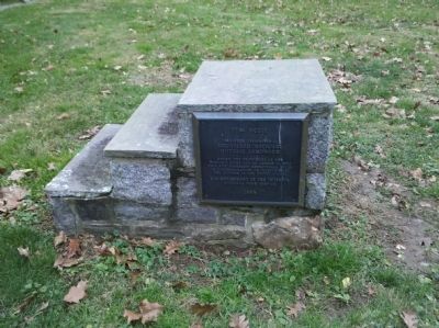
East Broad Top Railroad
Has Been Designated A
Registered National
Historic Landmark
Under the Provisions of The
Historic Sites Act of August 21, 1935
This Site Possesses Exceptional Value
In Commemorating and Illustrating . . . — — Map (db m32389) HM
While the exact date of construction of this building is uncertain, it dated from at least 1870 and was one of the most important commercial buildings in Smicksburg. While M. A. Stear is listed as the owner in 1871, the building served a succession . . . — — Map (db m163534) HM
The store located on this corner was built by John A. Campbell in 1910. By the 1930's the store was owned by George and Sara Riethmiller. Like many other small town stores, it sold a little bit of everything from ice cream and fabric to gasoline. . . . — — Map (db m79986) HM
Brookville's early growth can be attributed to its strategic location along the Susquehanna and Waterford Turnpike, a toll road which was completed in 1822 from the Susquehanna River in Clearfield County northwest to Waterford in Erie County. This . . . — — Map (db m176972) HM
[Left text and photo]
Sandt's Auto Service Station
Walter J. Sandt, brother of local aviation pioneer Earle Sandt (aka "Brookville's Bird Man"), established the Walter J. Sandt Company when he installed an underground gasoline tank in front . . . — — Map (db m176846) HM
Constructed of structural tile produced by Brookville's Humphrey Brick & Tile Co., this is the town's oldest remaining structure built [and] designed expressly for the automobile industry. Originally built for the Baker Buick Company, it later . . . — — Map (db m176683) HM
The YMCA was established in Brookville in 1905. This building was erected by contractor Raymond H. Richards from designs by DuBois architect Harrington & Howard, using the Colonial Revival style with terra cotta trim on the exterior. The "Y" has . . . — — Map (db m177785) HM
This late Victorian home was constructed by master builder Daniel Baumgardner for Griswold Buell Carrier (1831-1900), a Jefferson County farmer and lumberman. Carrier was also a director of the Jefferson County Agricultural Society and Driving . . . — — Map (db m176620) HM
Griswold B. Carrier built this small store and owned it for just three years before selling it to grocer William Shields who lived in the house immediately to the left. The two buildings were connected by a passageway which has been closed. During . . . — — Map (db m176616) HM
Located on this site was the 1832 Franklin House, the first brick hotel erected in Jefferson County. Richard Arthurs (1811-1892) erected the Central Hotel, which originally had a lavish 3-story balcony on the facade. In 1894, two large windows . . . — — Map (db m177222) HM
One of Main Street's finest domestic buildings, this Renaissance Revival residence features an exterior of rusticated wood blocks fashioned to simulate stone. Built as the home of lumberman E.H. Darrah (1826-1890) who was active in timbering both . . . — — Map (db m177832) HM
Queen Anne style residential building constructed as the private home of druggist and Associate Judge E.B. Henderson. Octagonal corner tower and Palladian window on facade. Present porch ornament installed in 1909, in a Neo-Classical mode. First . . . — — Map (db m176621) HM
Built as the home of Daniel English, a local architect-builder who was responsible for the construction of the Jefferson and Clarion County Court Houses. After 1897 it was home to William Shields (1859-1935), a Brookville grocer active in . . . — — Map (db m176618) HM
Greek Revival style commercial building which was the only building on this block to survive the Fire of 1876. Built as the tinware and stove shop of Judge Joseph Henderson (1814-1896). His residence still stands immediately to the left of the . . . — — Map (db m176684) HM
J.T. Carroll (1829-1895) was a Brookville cobbler who was also associated with James K. Hamilton in the manufacture of harnesses. Described as a "veteran shoemaker," in an 1888 county history, Carroll built this Italianate style residence and . . . — — Map (db m177788) HM
Handsome facade of granite and terra cotta, constructed by Brookville builder John H. Carr & Son from designs by Brooklyn architect A. Stanley Miller. The bank was first organized in 1878 by Thomas K. Litch, Paul Darling, and J.B. Henderson. . . . — — Map (db m176705) HM
Designed in the Queen Anne style with a variety of materials and using a typically irregular floor plan. Especially notable is the handsome oriel window on the right side. Hon. Henry Truman (1836-1930) was a native of England who came to Sigel, . . . — — Map (db m177827) HM
Built by merchant William Kelso as a furniture store. In 1909 the western portion was erected by Kelso's son-in-law, Rufus G. Reitz, for use as Brookville's Post Office. Now owned by the Galbraith Family, this structure has been used as a . . . — — Map (db m176623) HM
J.E. Long and George A. Pearsall erected this Italianate building in 1874 for their hardware business. It also housed the printing office of the Brookville Jeffersonian, the Knights of Pythias, and the American Legion. The first floor was used as . . . — — Map (db m176696) HM
Silas J. Marlin returned home to Brookville after the Civil War. Using his fortune made in the lumber industry, he began building the Marlin Opera House Block in the spring of 1883. Today the building includes retail spaces and offices, but it . . . — — Map (db m176987) HM
Col. Silas J. Marlin's imposing business block is especially notable for its lavish wood cornice, described when new as "the neatest and handsomest in town." The two storefronts on the left side are the only 19th-century shop fronts left in the . . . — — Map (db m176847) HM
After many years of hard work in Eldred Township, farmer John McCracken retired to Brookville in 1864 at the age of 60 and assumed control of the Union Hotel (southwest corner of Main and White). In 1868, McCracken began construction of a . . . — — Map (db m176811) HM
Distinctive for its belvedere at the peak of the hip roof, this structure was built by hotelier John McCracken (1813-1891), whose Union Hotel remains across White Street to the West. The earliest surviving public performance hall in Brookville, . . . — — Map (db m176614) HM
Italianate commercial building constructed for pharmacist (later State Senator) W.J. McKnight. McKnight's Drug Store operated from this building for more than a century. Third floor originally contained a fraternal lodge hall. Brookville's first . . . — — Map (db m176716) HM
1828
Originally known as the Globe Hotel this early Brookville hotel had a succession of owners in its first few decades of operation. In 1857, the owner of the building at the time, C. N. Kretz, renamed the structure the Jefferson . . . — — Map (db m177835) HM
Hotelier John R. McCall engaged master builder Thomas M. Barr to build this hotel in response to the busy trade along the Susquehanna and Waterford Pike. It operated under a number of proprietors through the years, including Robert R. Means, John . . . — — Map (db m176609) HM
Built by entrepreneur Richard Arthurs (1850-1910), this building originally contained three separate storerooms. The first tenant in the easternmost room was G.W. Stewart & Co., a shoe factory which in 1886 was projected to employ 125. Later . . . — — Map (db m177781) HM
Dr. Mark Rodgers was a local merchant-physician who built this Italianate commercial building to house his business, which in 1878 was described in the newspaper as "the finest store, with the best light and ventilation in town." From 1902-1929, the . . . — — Map (db m176699) HM
Pioneer merchant Uriah Matson constructed this as a hotel, but it never saw this use, instead it housed a variety of businesses including the dry goods stores of Sol Kaufman and G. Loebman, L.A. Leathers' grocery, the Brookville Hardware Co., and . . . — — Map (db m176703) HM
Built by lumberman Bernard Verstine for his son-in-law George Sandt, Brookville's first graduate pharmacist. Verstine's Hall, a small performance facility, was on the second floor and hosted local talent as well as travelling shows. The Sandt Drug . . . — — Map (db m177776) HM
In the days before national banking laws, private banks were found in many communities. William F. Clark established a banking house in 1869 and built this building as its home three years later. Clark's bank closed in 1879; in 1881 Ira Fuller . . . — — Map (db m176656) HM
Brookville's YMCA organized sometime before 1905 and operated from Mechanic's Hall. In June, 1915, this wooden building burned down. Citizens quickly responded, raising $41,158 in only a week. This fundraising campaign helped contribute to the . . . — — Map (db m177772) HM
A National Register Building, Erected 1892-1894-City of Carbondale Government Offices-Carbondale Historical Society-D&H Transportation Museum — — Map (db m89296) HM
This structure has been
recorded by the
Historic American
Buildings Survey
of the United States Department
of the Interior for its Archives
at the Library of Congress — — Map (db m152229) HM
Founder of the
Waverly Community House
——————————————
This House Builded for the
People of this Community
in Memory of Henry Belin Jr.
——————————————
This property is part of the
Waverly Historic District
Listed in the . . . — — Map (db m218894) HM
Kagerise
Store and House
built 1827
has been placed on the
National Register
of Historic Places
by the United States
Department of the Interior
[Additional plaque below:]
1776-1976
Cocalico Area . . . — — Map (db m136648) HM
Chartered in 1864, The First National Bank of Columbia played a key role in the growth and development of Columbia. Marvelous details from the bank's working years survive, such as the walnut paying-and-receiving teller cages, the furnishings of . . . — — Map (db m244048) HM
Chartered in 1864, The First National Bank of Columbia played a key role in the growth and development of Columbia. Marvelous details from the bank's working years survive, such as the walnut paying-and-receiving teller cages, the furnishings of . . . — — Map (db m244049) HM
B.F. Good / P. Lorillard
Tobacco Warehouse
built in 1899
has been placed on the
National Register
of Historic Places
by the United States
Department of the Interior — — Map (db m136616) HM
This house, of true Georgian style, was built about 1750. The ground was purchased by Thomas Poultney, merchant, in 1749, John Passmore, first mayor of Lancaster, occupied the house at one time. — — Map (db m5226) HM
This one and a half story house is typical of the architecture during the period of early settlement of Lancaster, dating from 1730. Most of the local houses in 1800 were of this style. — — Map (db m5168) HM
Congregation traces its origin to 1742. The first regular pastor was Rev. John D. Woodhull, Revolutionary patriot. First building completed here in 1770; present edifice dedicated 1851. James Buchanan, 15th President of the U.S., was a member. — — Map (db m122389) HM
This long building was used as military stables during the Revolution. On opposite side of street, stood the Barracks where British and Hessians were imprisoned during that period. — — Map (db m5122) HM
The New Era Building
circa 1890
has been placed on the
National Register of Historic Places
by the United States Department of the Interior — — Map (db m136501) HM
The Plow Tavern
formerly occupied this site.
built 1745 * * * demolished April 1, 1924.
Tradition says that on its register were the
names of General George Washington and General
Lafayette.
When General Lafayette made his memorable . . . — — Map (db m177512) HM
This plaza joins two buildings erected during the presidency of John Summers Stahr, class of 1867, the Gymnasium (1891) and the Science Building (1900-02). Dr. Stahr served his alma mater as professor of Natural Sciences for more than 50 years . . . — — Map (db m178060) HM
Built in 1828, the privy is one of the three original buildings left on the estate. Privies were in use here until the late 1800’s, when an interior bathroom was added to the mansion. Interesting to note the symmetrical arrangement with the . . . — — Map (db m54395) HM
This property has been placed on the National Register of Historic Places by the United States Department of the Interior. This structure has been recorded by the Historic American Buildings Survey by the United States Department of the Interior . . . — — Map (db m180362) HM
One of the three buildings constructed in 1828, this west dependency appears to have been a combination smokehouse / icehouse when it was originally built. Located a convenient distance from the basement kitchen, it is built of brick, wood, . . . — — Map (db m54399) HM
David M. Mayer (1836-1891) began construction of his original home in 1867. In 1870, David purchased the 203 acres where the house sits from his father, Martin Mayer. He married Katherine F. Hunsucker in 1868 and had two children. David dies in . . . — — Map (db m136612) HM
The home of James Buchanan, statesman, diplomat and the fifteenth President of the United States (1857-61), is located on Marietta Avenue, seven blocks south. Buchanan maintained Wheatland as his home from 1848 until he died there on June 1, 1868. — — Map (db m157225) HM
General Johann Agust Sutter Home
built in 1871
has been placed on the
National Register
of Historic Places
by the United States
Department of the Interior — — Map (db m136388) HM
Built in 1746 by the Moravians as Church, Parsonage, and School. It stood 125 yards to the north on the elevation on this side of Carter's Run. — — Map (db m5266) HM
Built c. 1740 by Peter Grubb, pioneer ironmaster at nearby Cornwall Furnace, and named for the Upper and Lower Hopewell Forges located on Hammer Creek near the house. Remnants of the forge dams may still be seen in the creek. — — Map (db m30272) HM
620 entries matched your criteria. Entries 201 through 300 are listed above. ⊲ Previous 100 — Next 100 ⊳