4153 entries match your criteria. Entries 101 through 200 are listed.⊲ Previous 100 — Next 100 ⊳
Notable Places Topic
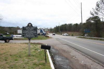
By Tim & Renda Carr, March 13, 2010
Tannehill Furnace And Foundry Marker West View
| 101 ► Alabama, Tuscaloosa County, McCalla — Tannehill Furnace And Foundry — (1829-1865) — |
| On Bucksville Road (Alabama Route 216) east of Interstate 59/20, on the right when traveling east. | |||
| 102 ► Alabama, Tuscaloosa County, Tuscaloosa — Alabama Central Female College — |
| Near 6th Street at 28th Avenue. | |||
| 103 ► Alabama, Tuscaloosa County, Tuscaloosa — Site of Queen City Park Softball Field — 1936-1967 — |
| On Jack Warner Parkway, on the right when traveling north. | |||
| 104 ► Alabama, Tuscaloosa County, Tuscaloosa — Tuscaloosa — Second State Capital — 1826-1846 — |
| On 6th Street at 28th Avenue, on the right when traveling west on 6th Street. | |||
| 105 ► Alabama, Tuscaloosa County, Tuscaloosa — Where Are We? — City of Tuscaloosa — |
| On 6th Street west of 21st Avenue, on the left when traveling west. | |||
| 106 ► Alaska, Fairbanks North Star Borough, Fairbanks — Welcome to Coldfoot Camp — |
| On Coldfoot Road. | |||
| 107 ► Alaska, Fairbanks North Star Borough, North Pole — "The North Pole" — |
| On East 5th Avenue, 0.1 miles east of Davis Boulevard, on the left when traveling east. | |||
| 108 ► Alaska, Sitka Borough, Sitka — 250th Anniversary of the Bering- Chirikov Expedition — 1741-1991 — |
| 109 ► Alaska, Sitka Borough, Sitka — History of Castle Hill (1867-) — |
| 110 ► Alaska, Sitka Borough, Sitka — Men of the Hill — |
| 111 ► Alaska, Sitka Borough, Sitka — Story of a Hill — |
| Near Harbor Drive, 0.1 miles west of O'Connell Bridge (Route F-99), on the right when traveling west. | |||
| 112 ► Alaska, Skagway — Skagway and White Pass — |
| Near 2nd Street. | |||
| 113 ► Alaska, Southeast Fairbanks Census Area, Tok — Taylor Highway — |
| On Taylor Highway (Alaska Route 6) at Alaska Highway (Alaska Highway 2) on Taylor Highway. | |||
| 114 ► Arizona, Apache County, Eagar — 8 — 26 Bar Hereford Ranch — |
| On School Bus Road at West Central Avenue (Arizona Route 260), on the right when traveling south on School Bus Road. | |||
| 115 ► Arizona, Apache County, Eagar — 7 — Colter Ranch — |
| On School Bus Road at West Central Avenue (Arizona Route 260), on the left when traveling south on School Bus Road. | |||
| 116 ► Arizona, Apache County, Springerville — 1 — Escudilla Mountain — |
| On U.S. 60 at milepost 392, on the right when traveling east. | |||
| 117 ► Arizona, Apache County, Springerville — 3 — White Mountain Historical Park — |
| On East Mohave Street at South Zuni Street, on the left when traveling west on East Mohave Street. | |||
| 118 ► Arizona, Apache County, Teec Nos Pos — Arizona — (Four Corners) — |
| Near 4 Corners Road, 0.5 miles west of U.S. 160. | |||
| 119 ► Arizona, Cochise County, Benson — Mormon Battalion — LDS Church — |
| On 4th Street (Business U.S. 10) near Ocotillo Avenue, on the right when traveling west. | |||
| 120 ► Arizona, Cochise County, Bisbee — Brewery Gulch — |
| On Review Alley at Howell Avenue, on the left when traveling north on Review Alley. | |||
| 121 ► Arizona, Cochise County, Douglas — Douglas International Airport — |
| On West Airport Road near 10th Street, on the right when traveling north. | |||
| 122 ► Arizona, Cochise County, Douglas — Mormon Battalion — LDS Church — |
| On Arizona Route 80 at milepost 356, on the right when traveling east. | |||
| 123 ► Arizona, Cochise County, Douglas — San Bernardino Ranch — |
| Near East San Bernardino Road at Slaughter Ranch Road, on the right. | |||
| 124 ► Arizona, Cochise County, Elfrida — Soldiers Hole — |
| On West Gleeson Road, 2.5 miles west of Arizona Highway 191, on the right when traveling west. | |||
| 125 ► Arizona, Cochise County, Sierra Vista — Fort Huachuca — |
| On Grierson Avenue at Boyd Avenue, on the right when traveling south on Grierson Avenue. | |||
| 126 ► Arizona, Cochise County, Sierra Vista — Mormon Battalion — LDS Church — |
| On East Charleston Road, on the right when traveling east. | |||
| 127 ► Arizona, Cochise County, Sierra Vista — Mormon Battalion Campsite — |
| On Arizona Route 90 at milepost 329, on the left when traveling east. | |||
| 128 ► Arizona, Cochise County, St. David — Mormon Battalion — LDS Church — |
| On West Patton Street (Arizona Route 80 at milepost 301) at South Church Street, on the right when traveling east on West Patton Street. | |||
| 129 ► Arizona, Cochise County, Willcox — Faraway Ranch — |
| Near Faraway Trail north of East Bonita Canyon Road. | |||
| 130 ► Arizona, Coconino County, Cameron — Cameron — Originally Tanner's Crossing — |
| Near U.S. 89, on the left when traveling north. | |||
| 131 ► Arizona, Coconino County, Flagstaff — Buffalo Park — |
| Near North Gemini Drive. | |||
| 132 ► Arizona, Coconino County, Flagstaff — Flagstaff — |
| On Route 66 at South Beaver Street, on the right when traveling east on Route 66. | |||
| 133 ► Arizona, Coconino County, Flagstaff — Flagstaff Flag - Raising — |
| On North Thorpe Road, on the left when traveling west. | |||
| 134 ► Arizona, Coconino County, Grand Canyon Village — Grand Canyon Village — |
| Near Bright Angel Trail. | |||
| 135 ► Arizona, Coconino County, Grand Canyon Village — Rest House — |
| On Hermits Road, on the right when traveling south. | |||
| 136 ► Arizona, Coconino County, Sedona — Indian Gardens — Homesite of the First Settler in Oak Creek Canyon — |
| On Arizona Route 89A at milepost 378 south of Old Indian Road, on the right when traveling north. | |||
| 137 ► Arizona, Gila County, Globe — City of Globe — |
| On North Broad Street, on the right when traveling north. | |||
| 138 ► Arizona, Gila County, Payson — William H. Goettl Memorial — |
| On South Green Valley Parkway. | |||
| 139 ► Arizona, La Paz County, Bouse — Camp Bouse — |
| On Broadway Avenue (Arizona Route 72 at milepost 27) south of Main Street, on the right when traveling west. | |||
| 140 ► Arizona, La Paz County, Cibola — 104 — Cibola Arizona |
| Near Cibola Road at Baseline Road. Reported missing. | |||
| 141 ► Arizona, La Paz County, Cibola — 103 — Colorado River Ferries — |
| Near Cibola Road at Baseline Road. | |||
| 142 ► Arizona, La Paz County, Ehrenberg — Pioneer Cemetery — |
| On Ehrenberg Poston Highway, on the right when traveling north. | |||
| 143 ► Arizona, La Paz County, Salome — Harrisburg — |
| On Salome Road, 5 miles south of U.S. 60, on the right when traveling south. | |||
| 144 ► Arizona, Maricopa County, Glendale — 59th Avenue Residential Historic District — |
| On North 59th Avenue at West Orangewood Avenue, on the left when traveling north on North 59th Avenue. | |||
| 145 ► Arizona, Maricopa County, Glendale — Glendale Business District — Developed 1896 – 1921 — |
| On West Glenn Drive at North 58th Avenue, on the right when traveling east on West Glenn Drive. | |||
| 146 ► Arizona, Maricopa County, Glendale — Glendale's Towering Flagstaff — |
| Near West Glendale Avenue. | |||
| 147 ► Arizona, Maricopa County, Glendale, Catlin Court Historic District — Catlin Court Historic District — National Register of Historic Places — Listed June 9, 1992 — |
| On North 58th Drive at West Palmaire Avenue, on the left when traveling north on North 58th Drive. | |||
| 148 ► Arizona, Maricopa County, Glendale, Catlin Court Historic District — Glendale Townsite — Catlin Court Historic District — |
| On North 58th Avenue at West Palmaire Avenue, on the left when traveling north on North 58th Avenue. | |||
| 149 ► Arizona, Maricopa County, Glendale, Floralcroft Historic District — Floralcroft Historic District — Platted 1928 — |
| On West Northview Avenue at North 59th Avenue, on the right when traveling east on West Northview Avenue. | |||
| 150 ► Arizona, Maricopa County, Glendale, Manistee Ranch HOA — Manistee Ranch — |
| Near North 51st Avenue. | |||
| 151 ► Arizona, Maricopa County, Mesa — 169 — Mesa — |
| Near East Main Street. | |||
| 152 ► Arizona, Maricopa County, Phoenix, Central City — F.Q. Story Addition — |
| On North 15th Avenue at West Culver Street, on the right when traveling south on North 15th Avenue. | |||
| 153 ► Arizona, Maricopa County, Phoenix, Central City — First Latter-day Saint Chapel in Phoenix — |
| Near North 6th Street near East Monroe Street. | |||
| 154 ► Arizona, Maricopa County, Tortilla Flats — The Dutchman’s Inn — |
| On Apache Trail (Arizona Route 88), on the right when traveling west. | |||
| 155 ► Arizona, Mohave County, Bullhead City — Arizona Veterans Memorial — |
| 156 ► Arizona, Mohave County, Bullhead City — Commercial Steamship Transportation and Bullhead Community Park — |
| On Arizona Route 95 at milepost 247 north of Silver Creek Road, on the right when traveling south. | |||
| 157 ► Arizona, Mohave County, Bullhead City — Hardyville Pioneer Cemetery — |
| On Dorado Drive south of Verano Drive, on the right when traveling south. | |||
| 158 ► Arizona, Mohave County, Bullhead City — Hardyville Site |
| On Arizona Route 95 near Colina Drive, on the right when traveling south. Reported missing. | |||
| 159 ► Arizona, Mohave County, Bullhead City — Old Fort Mohave — |
| Near State Highway 68. | |||
| 160 ► Arizona, Mohave County, Chloride — Chloride — "Oldest Silver Mining Town in Arizona" — |
| On 2nd Street, on the left when traveling south. | |||
| 161 ► Arizona, Mohave County, Kingman — Camp Beale Springs Arizona — |
| On Fort Beale Road at Wagon Trail Road, on the left when traveling north on Fort Beale Road. | |||
| 162 ► Arizona, Mohave County, Kingman — Ha' Qa' Muwe: — (Ancestral Home of the Hualapai) — |
| On Fort Beale Road at Wagon Trail Road, on the left when traveling north on Fort Beale Road. | |||
| 163 ► Arizona, Mohave County, Kingman — United States Army — |
| Near Andy Devine Road (Business Interstate 40) near Grandview Avenue. | |||
| 164 ► Arizona, Mohave County, Kingman — White Hills — |
| On County Route 145 at U.S. 93, on the right when traveling east on County Route 145. | |||
| 165 ► Arizona, Mohave County, Lake Havasu City — British – American Friendship — |
| On McCulloch Boulevard, 0.1 miles south of Arizona Route 95, on the right when traveling south. | |||
| 166 ► Arizona, Mohave County, Mohave Valley — Oatman — |
| On County Route 153 at Arizona Route 95, on the right when traveling east on County Route 153. | |||
| 167 ► Arizona, Mohave County, Oatman — Oatman — Gold Mining Town — |
| On Oatman-Topock Highway at Rock Hound Road, on the left when traveling north on Oatman-Topock Highway. | |||
| 168 ► Arizona, Mohave County, Oatman — 80 — Oatman Arizona and its Burros — |
| On Oatman -Topock Highway / Main Street (Old Route 66 at Rock Hound Road, on the left when traveling north on Oatman -Topock Highway / Main Street (Old Route 66. | |||
| 169 ► Arizona, Navajo County, Holbrook — A Canvas for Ideas — |
| Near Petrified Forest Road, on the right when traveling north. | |||
| 170 ► Arizona, Navajo County, Holbrook — A Gap in the Geologic Record — |
| On Petrified Forest Road, on the left when traveling east. | |||
| 171 ► Arizona, Navajo County, Holbrook — Desert Vistas — |
| Near Petrified Forest Road, on the left when traveling east. | |||
| 172 ► Arizona, Navajo County, Holbrook — Early Explorers — |
| Near Petrified Forest Road, on the left when traveling east. | |||
| 173 ► Arizona, Navajo County, Holbrook — From Wood to Stone — |
| On Petrified Forest Road, on the right when traveling north. | |||
| 174 ► Arizona, Navajo County, Holbrook — Life in the Village — |
| Near Petrified Forest Road, on the right when traveling north. | |||
| 175 ► Arizona, Navajo County, Holbrook — Summer Solstice Marker — |
| Near Petrified Forest Road, on the right when traveling north. | |||
| 176 ► Arizona, Navajo County, Holbrook — The Painted Desert — |
| Near Petrified Forest Road, on the left when traveling north. | |||
| 177 ► Arizona, Navajo County, Holbrook — Triassic Landscape — |
| Near Petrified Forest Road, on the right when traveling north. | |||
| 178 ► Arizona, Navajo County, Holbrook — Village on the Rio Puerco — |
| Near Petrified Forest Road, on the right when traveling north. | |||
| 179 ► Arizona, Pima County, Ajo — Old Clarkston Cemetery — |
| On Arizona Route 85 at milepost 44, on the right when traveling north. | |||
| 180 ► Arizona, Pima County, Ajo — The Ajo Mining District — |
| On La Mina Avenue, on the right when traveling north. | |||
| 181 ► Arizona, Pima County, Ajo — The City of Ajo — |
| On La Mina Avenue, on the right when traveling north. | |||
| 182 ► Arizona, Pima County, Green Valley — Titan II Intercontinental Ballistic Missile Museum — |
| Near West Duval Mine Road. | |||
| 183 ► Arizona, Pima County, Sikul Himatk — Quijotoa — |
| On Tucson Ajo Highway (State Highway 86) near Indian Route 32, on the right when traveling east. | |||
| 184 ► Arizona, Pima County, Tucson, Downtown — Plaza de las Armas — |
| 185 ► Arizona, Pima County, Tucson, El Presidio — N. W. Corner Adobe Wall of Spanish Presidio of Tucson — |
| On North Main Avenue at West Washington Street, on the right when traveling north on North Main Avenue. | |||
| 186 ► Arizona, Pima County, Tucson, El Presidio — Plaza Militar — |
| On West Alameda Street, on the right when traveling west. | |||
| 187 ► Arizona, Pima County, Tucson, El Presidio — Presidio Wall — |
| On North Main Avenue at West Washington Street, on the right when traveling north on North Main Avenue. | |||
| 188 ► Arizona, Pima County, Tucson, Fairgrounds — First Municipal Airport in the United States — Arizona Historic Site — |
| On South 6th Avenue at West Oklahoma Street, on the right when traveling north on South 6th Avenue. | |||
| 189 ► Arizona, Pima County, Tucson, Historic Fourth Avenue — Historic Fourth Avenue Underpass — Constructed 1916 – Demolished in 2008 — |
| On North Fourth Avenue at East 9th Street, on the right when traveling south on North Fourth Avenue. | |||
| 190 ► Arizona, Pima County, Tucson, Menlo Park — Sentinel Peak — |
| On Sentinel Peak Road South, on the left when traveling north. | |||
| 191 ► Arizona, Pima County, Tucson, Mission Valley — Mission San Xavier del Bac — |
| Near San Xavier Road. | |||
| 192 ► Arizona, Pima County, Vail — Colossal Cave Mountain Park — |
| Near East Old Spanish Trail. | |||
| 193 ► Arizona, Pinal County, Apache Junction — Bluebird Mine and Gift Shop — |
| Near North Apache Trail (Arizona Route 88) north of North Farside Lane, on the right when traveling north. | |||
| 194 ► Arizona, Pinal County, Apache Junction — Dons's Camp — |
| On East Peralta Road, 5.6 miles east of Superstition Freeway (U.S. 60). | |||
| 195 ► Arizona, Pinal County, Apache Junction — Ghost Town of Goldfield — Historical Marker Since 1947 — |
| Near North Apache Trail (Arizona Route 88) north of North Farside Lane, on the right. | |||
| 196 ► Arizona, Pinal County, Coolidge — Those Who Are Gone — |
| On Arizona Route 87 at Arizona Route 287, on the right when traveling north on State Route 87. | |||
| 197 ► Arizona, Pinal County, Florence — Camp Florence — |
| On North Illinois Street at Arizona Boulevard, on the left when traveling north on North Illinois Street. | |||
| 198 ► Arizona, Pinal county, Gila River — Gadsden Purchase — |
| Near Interstate 10 at milepost 181. | |||
| 199 ► Arizona, Pinal county, Gila River — Gila River Indian Reservation — (Established 1859) — |
| Near Interstate 10 at milepost 183. | |||
| 200 ► Arizona, Pinal County, Gila River — Gila River Indian Reservation — (Established 1859) — |
| Near Interstate 10 at milepost 181. | |||
4153 entries matched your criteria. Entries 101 through 200 are listed above. ⊲ Previous 100 — Next 100 ⊳