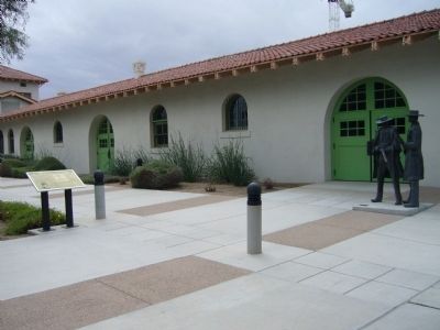
Near North Toole Avenue near East Pennington Street.
Wyatt Earp joined his four brothers in the silver-boom town of Tombstone in 1879 where brother Virgil was deputy U.S. marshal. Wyatt was a sometimes-lawman himself, and hoped to become sheriff of the newly formed Cochise County in 1881. . . . — — Map (db m28929) HM
Near East Hunt Highway 2 miles west of Arizona Highway 79, on the right when traveling west.
"The Father of Arizona"
Born April 20, 1825 — Died June 24, 1902
Native of Kentucky
Elected as first Arizona Delegate
To Congress in 1864
This Monument erected by the
State of Arizona in Conjunction with
Maricopa Chapter . . . — — Map (db m26662) HM
On South Main Street, on the right when traveling south.
This 1881 Sonoran/Early Transitional adobe was home to the Elmer Coker family in 1907. A prominent cattleman and lawyer specializing in land and water rights. Coker was a delegate to the Arizona Constitutional Convention and is considered the father . . . — — Map (db m26626) HM
On North Main Street north of 12th Street, on the left when traveling north.
Built in 1948, this Contemporary Pueblo Revival building initially housed all town government administration and the Town Council chambers. The Town had a mayor and council-commissioner form of government. With limited staff, each Councilmember was . . . — — Map (db m195851) HM
Near East Adamsville Road 1.2 miles west of South Main Street.
March 12 1825 - Jan 11 1891
Judge- District court of New Mexico
Delegate to Confederate Congress
Arizona Mounted Volunteers CSA
Territorial legislature
US Congress
Pioneer- Soldier- Statesman — — Map (db m32394) HM
On North Granite Street, on the left when traveling north.
Built in 1878 for John P. Clum, Indian agent, editor of Florence's first newspaper, the "Arizona Citizen" and founder of the "Tombstone Epitaph."
Typical of transitional architecture, the home is a Sonoran adobe with an Anglo-influenced roof. . . . — — Map (db m26744) HM
On West Ruggles Avenue, on the right when traveling west.
Civil War veteran Levi Ruggles came to Arizona Territory in 1866 as a U.S. Indian Agent. Recognizing the agricultural potential of this valley, he found an easily fordable crossing on the Gila River and surveyed a townsite here. He called the . . . — — Map (db m26709) HM
On North Pinal Parkway (State Highway 79) 0.1 miles south of East Hunt Highway, on the left when traveling north.
Charles Debrille Poston, 1825-1902, often referred to as the "Father of Arizona", promoted territorial status for Arizona during President Lincoln's administration. Poston, motivated by silver mining interests lobbied for federal legislation to . . . — — Map (db m26661) HM
On East Ruggles Street at Church Street, on the right when traveling east on East Ruggles Street.
Originally a Sonoran adobe row house built C. 1877 for John D. Walker friend, agent, and physician to the Pima Indians at Sacaton. This building was used as courtroom and county offices during his terms as justice of the peace, county surveyor and . . . — — Map (db m68386) HM
Born in Rutledge, Tennessee, he became a self-taught construction engineer and builder of railroads. In 1909, he settled in the mining town of Superior, site of the Magma Copper Company. He opened his first drug store in Superior in 1913, later . . . — — Map (db m34104) HM
On Arizona Route 89 at milepost 333, on the right when traveling north.
Site of original Camp Whipple established December 1863
From January 22 to May 18, 1864 the offices of the Territorial Government of Arizona were operated from tents and log cabins here, before being moved to Prescott the first permanent . . . — — Map (db m33444) HM
Founded 1864 on Granite Creek, early source of placer gold. Former territorial capital of Arizona. Now a center for ranching, mining, health, especially asthma relief. Located here on site of old Ft. Whipple is Whipple Veterans Hospital. Seat of . . . — — Map (db m20298) HM
On East Gurley Street (Arizona Route 89) at South Cortez Street, on the left when traveling west on East Gurley Street.
The courthouse you see today, constructed in 1916 and listed in the National Register of Historic Places, is not the original one on this site. The first courthouse constructed on the Plaza, one of two city blocks set aside in 1864 for government . . . — — Map (db m18132) HM
In 1859, steamboat entrepreneur George Alonzo Johnson built a riverside home for his bride, Estefana Alvarado. Now known as the Commanding Officer's Quarters, the home is believed to be Arizona's oldest Anglo-built adobe building. In the . . . — — Map (db m28999) HM
On Harold C. Giss Parkway at South 3rd Avenue, on the right when traveling east on Harold C. Giss Parkway.
Senator Giss was born February, 1906, in Minneapolis, Minn. and moved to Arizona in 1937. Being a concerned individual for Arizona's future, Senator Giss entered politics. He served as a member of the Arizona House of Representatives for two years . . . — — Map (db m28986) HM
On West 1st Street west of North Second Avenue, on the right when traveling west.
Built in classic Spanish Colonial Revival style on high ground overlooking the Colorado River, it has served as the traditional seat of municipal government.
Dedicated December 1999, by the City of Yuma for the preservation of our heritage. . . . — — Map (db m28985) HM
Our Constitution names the President of the United States the Commander in Chief of all the Armed Forces. Presidents who have served in our military are displayed on the following plaques. Each has served either on Active Duty, in the National Guard . . . — — Map (db m92382) HM WM
[Written on the initial marker, provided for context]
Our Constitution names the President of the United States the Commander in Chief of all the Armed Forces. Presidents who have served in our military are displayed on the following . . . — — Map (db m92384) HM WM
[Written on the initial marker, provided for context]
Our Constitution names the President of the United States the Commander in Chief of all the Armed Forces. Presidents who have served in our military are displayed on the following plaques. . . . — — Map (db m92389) HM WM
[Written on the initial marker, provided for context]
Our Constitution names the President of the United States the Commander in Chief of all the Armed Forces. Presidents who have served in our military are displayed on the following plaques. . . . — — Map (db m92400) HM WM
[Written on the initial marker, provided for context]
Our Constitution names the President of the United States the Commander in Chief of all the Armed Forces. Presidents who have served in our military are displayed on the following plaques. . . . — — Map (db m92421) HM WM
[Written on the initial marker, provided for context]
Our Constitution names the President of the United States the Commander in Chief of all the Armed Forces. Presidents who have served in our military are displayed on the following . . . — — Map (db m92423) HM WM
[Written on the initial marker, provided for context]
Our Constitution names the President of the United States the Commander in Chief of all the Armed Forces. Presidents who have served in our military are displayed on the following . . . — — Map (db m92424) HM WM
On A Street at NE Second Street, on the right when traveling north on A Street.
The first court house in Benton County, built of hewed logs was erected on this site (at Bentonville) in 1837, the year after the county was created. It was named for Thomas H Benton. — — Map (db m19880) HM
On South Walton Boulevard (U.S. 71B) 0.2 miles south of W Central Avenue, on the right when traveling south.
The Oaks
Home of Congressman Samuel W. Peel
In 1875, Samuel Peel built a two-story home on the outskirts of Bentonville that he named “The Oaks.” The house is an excellent example of the Italianate style that was popular in the South . . . — — Map (db m276707) HM
On Jackson Street south of McClure Avenue (County Road 923), on the left when traveling south.
The earliest postal area was at Cross Hollows. Records show the Bloomington Post Office was changed to Lowell, March 9, 1881 with Paul F. Lewis, Postmaster. Insets show a 1900 Post Office building on North Jackson Street. The one next door to . . . — — Map (db m93274) HM
On East Rush Avenue at North Main Street (Business U.S. 65), on the left when traveling east on East Rush Avenue.
It was completed in 1903 and served as the Post Office from 1906 - 1965. The three story (plus basement) building was constructed at an original cost of $78,000 with a floor space in excess of 20,000 sq ft. It was constructed of hard-burned, dark . . . — — Map (db m141866) HM
On East Cedar Street at North Main Street (Business U.S. 63), on the right when traveling west on East Cedar Street.
The first temporary court house in Bradley County was erected on this site in 1842, two years after the creation of the county, and continued in use until 1858, when a court house built of brick was erected. — — Map (db m121054) HM
On Spring Street north of Hillside Avenue, on the right when traveling north.
Crescent Cottage
on the National Register of Historic Places
Built in 1881
Home of Powell Clayton,
the first governor of Arkansas
after the state was readmitted
to the Union following
the War Between the States
Owners
Ray & . . . — — Map (db m80139) HM
On Spring Street 0.1 miles north of Main Street (Arkansas Highway 23), on the left when traveling north.
Festus Orestes Butt was born in 1875 in Illinois just before his family moved to Carroll County, Arkansas. He became a licensed attorney before he was of legal age. The Arkansas General Assembly set aside his "disability of minority", and he set . . . — — Map (db m79735) HM
On Main Street (State Highway 23) north of Benton Street, on the left when traveling south.
These two large limestone public buildings anchor this part of downtown Eureka Springs. They span the deep ravine cut by Leatherwood Creek which flows in a tunnel beneath all the buildings on this entire part of Main Street.
[Photo 1.]
This . . . — — Map (db m59964) HM
On Main Street (State Highway 23) north of Benton Street, on the left when traveling south.
Eureka Springs was incorporated on Valentine's Day in 1880. At that time, the only courthouse was in the county seat of Berryville, some 12 miles to the east. This was a great distance at the time, the roads were bad, and the King's River had to be . . . — — Map (db m59962) HM
On West Main Street at North Third Street on West Main Street.
Thomas Marion Holifield, County Judge 1874-1878
William G. Akers · County Sheriff 1873-1874 William Liddell · County Treasurer, 1873-1874 T. M. Martin County & Circuit Court Clerk · 1873-1874
E.N. Royall · County Tax Assessor 1873-1874
W.C. . . . — — Map (db m289143) HM
On West Main Street (Arkansas Route 25) west of South 3rd Street, on the left when traveling west.
Until its removal to Heber Springs, the county seat of Cleburne County, the youngest of the 75 counties in Arkansas, was established at Sugar Loaf in 1883, the year the county was formed, and named for General Pat. Cleburne. — — Map (db m141602) HM
On Arkansas 35 at 116, on the right when traveling east on Arkansas 35.
The county seat of Cleveland County "first called Dorsey County" was established at Toledo in 1878, where it remained until it was removed to Rison in 1889. — — Map (db m305265) HM
On South Court Square at South Jefferson Street, on the left when traveling east on South Court Square.
Third courthouse on this site. Bid for construction of a new courthouse was let in 1905 for $58,631. Designed by W.S. Hull and built of blond brick with stone detailing, it is considered an example of second renaissance revival architecture. . . . — — Map (db m121341) HM
On Sardis Road (County Road 61) at Puddin Drive, on the right when traveling west on Sardis Road.
Conway County in the Civil War
Conway County men served in both the Union and Confederate armies in the Civil War. Co. I, 1st Arkansas Mounted Rifles, Co. B, Carroll’s Cavalry, Co. I, 36th Arkansas Infantry, and several companies of the 10th . . . — — Map (db m96451) HM
On South Main Street at West Washington Avenue, on the right when traveling south on South Main Street.
The site of Jonesboro was laid off as the county seat of Craighead County in 1859, and there was erected soon afterwards the first court house in the county. — — Map (db m116609) HM
On West Washington Avenue at S. Main Street, on the right when traveling west on West Washington Avenue.
February 1, 1878 - December 22, 1950
Tennessee Native -Arkansas Daughter
A good southern wife in the traditional sense.
First:
Elected woman U. S. Senator
Woman to preside over the Senate
Woman chairman of a Senate committee . . . — — Map (db m227550) HM
On Aggie Road west of University Loop, on the right when traveling west.
Hattle Caraway made history in 1932 as the first woman elected to the United States Senate. A Tennessee native, she married fellow Dickson College student Thaddeus Caraway in 1902 and settled in Jonesboro, where he practiced law and entered . . . — — Map (db m299209) HM
On South 4th Street south of East Main Street, on the right when traveling south.
The companies of soldiers that came out
of Van Buren were formed at this historic
landmark. It is also the site where some
infantry and Calvary units camped and
drilled. There were nine different
companies that were formed in . . . — — Map (db m96864) HM
Near North 3rd Street 0.1 miles south of Knox Street, on the right when traveling south.
From the front of his home, John Drennen could overlook the bustling port town of Van Buren, including the wharf originally known as Phillips Landing.
Until after the Civil War, the Arkansas River and the steamboats that plied its . . . — — Map (db m120427) HM
On South Falls Boulevard (State Highway 1) at East Union Avenue, on the right when traveling north on South Falls Boulevard.
The county was named for Col. David C. Cross. First seat of justice, Cleburne 1865. Moved to Wittsburg 1865 where it remained until 1884 when it was removed to Vanndale and later in 1903 the county seat was established at Wynne, where it has since . . . — — Map (db m158125) HM
On West 3rd Street, on the right when traveling west.
Named for Samuel W. Fordyce, a leader in the building of the first
railroad through this area in 1882. Post office established June 25,
1883. Incorporated April 8, plat filed July 5, 1884. Second major
railroad reached town in 1905.
Became . . . — — Map (db m305250) HM
First town in Dallas County,
established
January 1, 1845, and known as Dallaston until November 1845
when name was
changed to
Princeton. Plat filed October 26, 1846,
incorporated March 4, 1849.
Site of first post
office in county established . . . — — Map (db m305046) HM
On Arkansas Route 1 at Front Street, on the right when traveling east on Arkansas Route 1.
Watson became the county seat of Desha County after Napoleon was abandoned to the Mississippi River. Lewis W. Watson donated the land and built the courthouse near this site. The county seat was moved to Arkansas City in 1880. Watson remained the . . . — — Map (db m107757) HM
On West Commercial Street (Highway 64) at South 2nd Street, on the right when traveling east on West Commercial Street.
Ozark was designated as the county seat of Franklin County in 1837, and the first court house in the county was erected on this site in 1838. — — Map (db m120001) HM
Near Central Avenue (Arkansas Route 7) north of Court Street, on the right when traveling south.
In 1928 Senator Joe T. Robinson was
the Democratic party's candidate
for vice-president. He was
formerly (sic) notified at the
Arlington Hotel that he had been
chosen as Al Smith's running mate.
A huge crowd assembled downtown
to hear . . . — — Map (db m211196) HM
Near Central Avenue (Arkansas Route 7), on the right when traveling south.
From 1832 to 1877, the Hot
Springs Reservation was under
federal ownership, but there was
no local supervision of the land
or the thermal waters. During
that period, several private
citizens attempted to gain title
to the springs, including . . . — — Map (db m211136) HM
On Central Avenue (State Highway 7) at Spring Street, on the right when traveling north on Central Avenue.
Magna Cum Laude graduate of Ouachita University • Lt. Governor 1993-1996 • 44th Governor of Arkansas 1996-2007 • Host of Fox News television show Huckabee and nationally syndicated radio programs The Mike Huckabee Show and The Huckabee Report • New . . . — — Map (db m264399) HM
On Central Avenue (State Highway 7) at Spring Street, on the right when traveling north on Central Avenue.
First woman elected to the U.S. Senate in 1932 over 7 men serving until 1944 • Beat John McClellan in 1938 when his slogan was “Arkansas needs another man in the Senate” • Co-sponsored a proposed Equal Rights Amendment in 1940 • Staunch supporter . . . — — Map (db m264493) HM
On Central Avenue (State Highway 7) at Prospect Avenue, on the left when traveling north on Central Avenue.
Was one of the Spa’s most memorable personalities. The boss of city and county politics for two decades, McLaughlin also had a flair for showmanship, riding daily along Central Avenue in a sulky pulled by his horses named Scotch and Soda. — — Map (db m264197) HM
Near Central Avenue, on the right when traveling south.
In 1832 Congress passed a bill reserving four sections of land with the springs in the middle for future use by the United States government. This act supposedly eliminated the possibility of private ownership of land within a mile of the springs. — — Map (db m211046) HM
The first Lamar opened in 1888, the final year that Georgia-born Lucius Quintus Cincinnatus Lamar (1825-1891) — a former Confederate officer, overseas ambassador for the Confederacy, and U.S. Representative and Senator for Mississippi — served as . . . — — Map (db m211200) HM
On Central Avenue (State Highway 7) at Spring Street, on the right when traveling north on Central Avenue.
Elected 42nd President of United States in 1992, re-elected 1996 • Six term Governor of Arkansas • Arkansas Attorney General • Rhodes Scholar Hope & Hot Springs, Arkansas • Inducted 1996 — — Map (db m264495) HM
On Central Avenue (State Highway 7) 0.1 miles north of Mountain Street, on the right when traveling north.
Site of
The State Capitol of Arkansas
July 2-14-1862
When Federal troops
advanced on Little Rock,
Governor Henry Massie Rector
moved his staff and records here.
Erected by the Garland County Association
of the
Arkansas . . . — — Map (db m122573) HM
Near Central Avenue (Arkansas Route 7), on the right when traveling south.
Early in 1862 Governor Henry
Rector feared that Federal
troops were planning an attempt
to seize Little Rock and decided
to move the capitol of the state
to Hot Springs. The movement of
the government to Hot Springs
was the highlight of the . . . — — Map (db m211077) HM
Near Central Avenue (Arkansas Route 7), on the right when traveling south.
The temporary state capitol was set up in 1862 in a two-story home on the site of the park opposite the Arlington Hotel. Some state records were stored in a log kitchen which was separate from the house. The kitchen was later moved and sat adjacent . . . — — Map (db m211072) HM
On East Division Street at South Main Street, on the left when traveling east on East Division Street.
March 12, 1999. On this day two Hope natives
visited the Hope Visitor Center and museum.
President William Jefferson Clinton, in town to
dedicate his restored birthplace house, was
escorted through the center by life-long friend
Thomas Franklin . . . — — Map (db m161917) HM
Archer Shepperson was born into enslavement in Arkansas on February 7, 1850. Freedom came in 1865, and the 1870 census recorded him as literate and laboring for a Black farmer near Washington. The following year, Shepperson was a deputy sheriff and . . . — — Map (db m315177) HM
On North Main Street near Isaac C. Perkins Bypass (U.S. 278 W).
Howard County was created on
April 17, 1873, from parts of
Hempstead, Pike, Polk, and
Sevier counties. The first
county seat was Centre Point.
After the completion of a
railroad to Nashville in
1885, the city grew rapidly.
In 1905 after a . . . — — Map (db m274166) HM
On River Street at South Broad, on the left when traveling south on River Street.
• Pay off the national debt • Repeal laws that
favors capital • Prevent aliens from owning land
• Abolish national banks • Government operations
on a cash basis • End agricultural futures
trading • Establish a graduate income tax •
Prohibit . . . — — Map (db m221190) HM
Near Sidney Street south of Virginia Drive, on the left when traveling south.
Col. Magness, 1796-1871, legendary wealthiest man of Independence County before the Civil War, emigrated from Tennessee with his father, Johnathan Magness, a North Carolinian, when Arkansas was a part of Missouri Territory. Col. Magness, a prominent . . . — — Map (db m221205) HM
Near Sidney Street south of Virginia Drive, on the left when traveling south.
Elisha Baxter (1827-1899), 10th Governor of Arkansas, was born in Rutherford County, North Carolina. He came to Batesville in 1852, opened a mercantile business and was elected mayor in 1853. Baxter served two terms as state representative . . . — — Map (db m221210) HM
The town of Batesville was selected as the county seat and the first county court house built in 1821, a year after the county was organized. — — Map (db m66720) HM
On East Main Street (Arkansas Route 394) north of General Street ( Route 233), on the right when traveling north.
Near this spot stood the homes of
three governors
of the State of Arkansas
Thomas S. Drew (1844-1849)
Elisha Baxter (1873-1874)
William R. Miller (1877-1881) — — Map (db m221079) HM
On 3rd Street at Main Street, on the right when traveling west on 3rd Street.
The first court house in Jackson County, created in 1832, was located at Litchfield, where it remained until 1839, when it was moved to Elizabeth. In 1852 Augusta (now Woodruff County) was made the county seat and two years later it was moved to . . . — — Map (db m116624) HM
In 1912, Secretary of State Earle Hodges (1911-1917) and the Pine Bluff chapter of the Daughters of the American Revolution sponsored a competition to produce a design for Arkansas’s first state flag. Since 1819, Arkansans had lived, fought, played . . . — — Map (db m168987) HM
On East 3rd Street at Spruce Street, on the left when traveling east on East 3rd Street.
The first court house in Lafayette County erected in 1828, was built of logs on Chickaninny Prairie. In 1840 a new town site for the county seat was laid off at the place to which was given the name of Lewisville. — — Map (db m178710) HM
Near McKamie Road (Arkansas Route 53) 0.3 miles south of Magnolia Street, on the right when traveling south. Reported missing.
Three African American men represented Lafayette County in the state legislature after the Civil War. Monroe Hawkins, born a slave in North Carolina around 1832, was a minister and laborer. He was a delegate in the 1868 Constitutional Convention and . . . — — Map (db m121211) HM
Near State Highway 25, on the right when traveling east.
You are facing the Powhatan Jail
Designed by John D. Edwards, this is a rare example
of a stone military blockhouse.
Lawrence County, is known as the "Mother of Counties". In 1815,
Lawrence County formed this northern region of . . . — — Map (db m242636) HM
On County Road 133 at State Route 234, on the right when traveling west on County Road 133.
Little River County was formed 1867 out of lands taken from Hempstead and Sevier Counties by Act 104 of the Arkansas Legislature approved March 7, 1867. The Act fixed the temporary county seat at the home of William M. Freeman, which was ½ mile . . . — — Map (db m121273) HM
On North 2nd Street north of West Main Street (State Route 32), on the right when traveling north.
Rocky Comfort, made the County Seat of Little River County in 1868, continued as such until 1880, when it was moved to Richmond and from there the Seat of Justice was moved to Ashdown. — — Map (db m121243) HM
On Arkansas Route 108 south of Route 108 Spur, on the right when traveling south.
The Arkansas Constitutional Convention of 1868 located the permanent county seat at Rocky Comfort, where it remained until 1880. The first term of court was held there August 4, 1868. A frame court house was erected with offices on the first floor . . . — — Map (db m121277) HM
On North Center Street (State Highway 31) north of 2nd Street, on the right when traveling north.
Joseph Taylor Robinson Home - 204 NE Front St. Practiced law in Lonoke - 1893-1912 U.S. Congressman - 1902-1913. Governor of Arkansas - January - March 1913. U.S. Senator - 1913-1937. Lonoke was named for lone oak tree, surveyor's landmark for . . . — — Map (db m65710) HM
On North Center Street (State Highway 31) north of 2nd Street, on the right when traveling north.
Senator Joseph Taylor Robinson, Arkansas' outstanding statesman was born six miles northwest of this place in 1872. He lived in Lonoke and practiced law; was elected to Congress and served ten years; moved to Little Rock in 1912; served as Governor . . . — — Map (db m65713) HM
On West War Eagle Avenue at West Main Street (U.S. 412), on the right when traveling west on West War Eagle Avenue.
Front
Isaac Murphy was born Oct. 16, 1799, in Pennsylvania. A teacher and lawyer, he moved to Fayetteville in 1834 and became involved in politics. Murphy took part in the 1849 Gold Rush, but lost his farm to creditors. He, his wife and . . . — — Map (db m141518) HM
On West Main Street (Business U.S. 412) at West War Eagle Avenue, on the right when traveling east on West Main Street.
A county government was organized in Madison County in 1836, in the barn of Evan S. Polk, a short distance northwest of the present town of Huntsville which was laid out as a town and made the permanent seat, of government in 1839. The county was . . . — — Map (db m141599) HM
On State Highway 198, on the left when traveling west.
Mark Twain referred to Osceola as "the famous and formidable Plum Point" in his book, Life on the Mississippi, as well as other writings. First established in 1837 as Plum Point, Osceola was incorporated in 1853. From this vantage point, one could . . . — — Map (db m36301) HM
On West Hale Avenue at North Walnut Street (U.S. 61), on the right when traveling west on West Hale Avenue.
The county seat of Mississippi County, created in 1833, was located at Osceola in 1836. Since about 1900 the county has maintained another court house at Blytheville for the northern district. The county was named for the great river which flows . . . — — Map (db m36489) HM
On West Hale Avenue, on the right when traveling west on West Hale Avenue.
This Neoclassical Courthouse was built in 1912 on land donated by Judge W.J. Driver. Constructed of unusual brick, the building features a flat roof supporting a copper dome with large concrete terra cotta decorations and round polished inserts on . . . — — Map (db m36434) HM
On West Hale Avenue, on the right when traveling east.
Constructed in 1915, this building served as the post office on the Cotton Highway until 1936. County Judge S.L. Gladish made sure that the Post Office contained European tiles like those used in the then-new courthouse. The building later housed a . . . — — Map (db m36454) HM
On North Walnut Street (U.S. 61) at West Hale Avenue, on the right when traveling north on North Walnut Street.
In memory of the honorable William J. Driver.Former Circuit Judge and Congressman, a lifelong citizen of Osceola, Arkansas. Born March 2, 1873. Died October 1, 1948. As a member of the Rivers and Harbors and Flood Control Committees of the Congress . . . — — Map (db m36532) HM
The first court house in Monroe County, created in 1829, was erected about 1830 on a site on Joseph Jacob's farm, to which was given the name of Lawrenceville. There it remained until 1856, when the county seat was moved to Clarendon. — — Map (db m153390) HM
On Walnut Street near Perry Street, on the right when traveling south.
Jacob Trieber served as United States District Judge for the Eastern
District of Arkansas from 1901 to 1927. He was the first Jewish judge
ever to serve on the federal bench. Trieber was born in Prussia in
1853, immigrated with his parents to St. . . . — — Map (db m107824) HM
On Cherry Street at Perry Street on Cherry Street.
The First County Seat of Phillips county was ordered in the Act of 1820 which created the county, to be located in the Town of Monticello, which place has since been identified as the original name of the present Town of Helena. — — Map (db m51918) HM
African Americans Exercise Their Rights
In the decades following the Civil War, former slaves in
Arkansas saw African Americans elected to local, state and
national offices. Henderson B. Robinson was elected . . . — — Map (db m107892) HM
On Courthouse Square at North Washington Avenue (State Route 26), on the left when traveling west on Courthouse Square.
The first court house in Pike County, built of logs, was erected on the site of the town of Murfreesboro, which was laid out as a site for the county seat in 1833. — — Map (db m121284) HM
10605 entries matched your criteria. Entries 301 through 400 are listed above. ⊲ Previous 100 — Next 100 ⊳