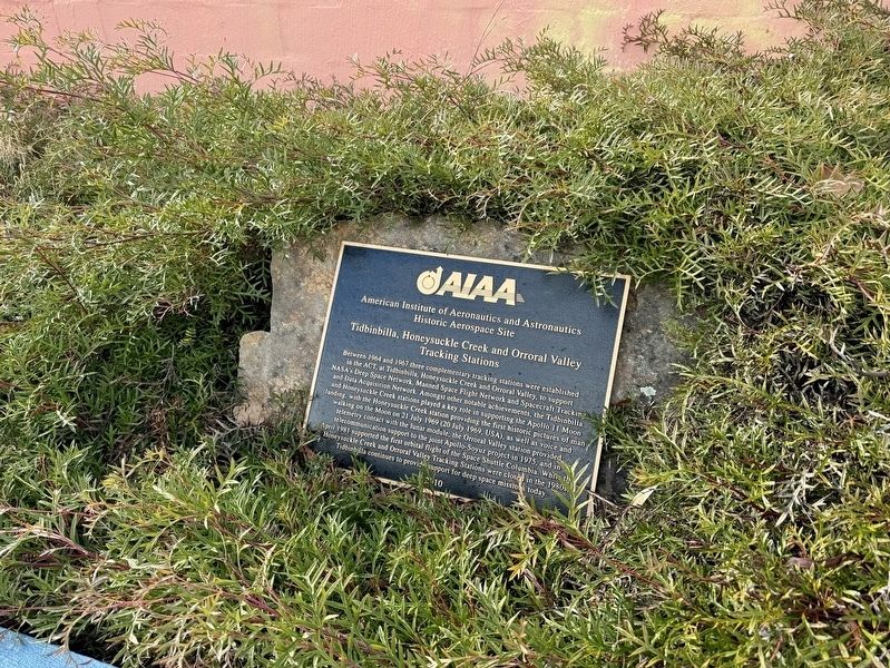
Near Discovery Drive 6.8 kilometers east of Paddys River Road.
Between 1964 and 1967 three complementary tracking stations were established in the ACT, at Tidbinbilla, Honeysuckle Creek and Orroral Valley, to support NASA's Deep Space Network, Manned Space Flight Network and Spacecraft Tracking and Data . . . — — Map (db m296080) HM
On The Escort Way (Highway 81) at Orange Road (Highway 90), on the right when traveling west on The Escort Way.
From this vicinity Sir Thomas Mitchell's second expedition proceeded on April 7, 1835 to the Darling River, his third expedition on March 19, 1836 to Australia Felix (Western Victoria), and his fourth expedition on December 15, 1845 to Tropical . . . — — Map (db m38374) HM
On Virgil Street, on the right when traveling south.
The old town of Gungafai was built on the flats where these bridges now cross. The town was first gazetted and surveyed in 1838. The town flooded about 1 metre in 1844 and 1851.
On the 25th June 1852 the old town was destroyed by a flood 4 to . . . — — Map (db m71067) HM
Near Mrs Macquaries Road, on the left when traveling north.
Don't miss this notable landmark — Mrs Macquaries Chair is just around the corner to your right. It is actually a carved rock ledge seat where Elizabeth Macquarie, the Governor's wife, liked to sit and admire the view of the harbour. Her husband had . . . — — Map (db m185648) HM
This plaque commemorates the 200th anniversary of the birth of
Captain Matthew Flinders R.N. at Donington, England. On 16th March, 1774
Captain Flinders was the first person to circumnavigate this continent and
was largely responsible for the use . . . — — Map (db m245311) HM
On Argyle Street west of Harrington Street, on the right when traveling west.
Captain Stanley Savige formed Legacy in 1923, as an offshoot of the Remembrance Club founded by Major General Sir John Gellibrand to help former servicemen struggling to re-establish themselves after World War I.
The Legacy Club changed its . . . — — Map (db m126551) HM
Whales (generally humpback or southern-right) can provide a magnificent spectacle off this coastline during their annual migration south, from September to November.
Many long-time residents of Tuross Head can recall the arrival of a whale on . . . — — Map (db m38375) HM
Near Church Street, on the right when traveling south.
Isaac Nathan (1792–1864)
Anglo-Jewish Émigré Australian
Father of Australian Music
Singing Master · Composer · Scholar · Ethnomusicologist · Reformer · Secret Agent
“He laid the foundations of creative music, professional . . . — — Map (db m310649) HM
Near Chifley Road 0.1 kilometers east of Petra Avenue.
A railway zig zag is a series of reversing ramps used to avoid very steep grades. John Whitton, Engineer in Chief NSW Government Railways 1856-90, chose this as the economical method for the descent from Clarence to Lithgow. Built during 1866-69 by . . . — — Map (db m59808) HM
On Swan Street at Berkeley Street, on the right when traveling west on Swan Street.
This historic Bakehouse was built by Richard Chapman during 1851. Chapman was a property owner, butcher and businessman of Morpeth whose residency extended from at least 1850 to his death in 1867. The building has technical value as a rare, . . . — — Map (db m70687) HM
Near Marine Parade, on the left when traveling south.
From this lookout, formally attired spectors (sic) watch a surf carnival against a sweeping panorama of thriving pines. Today high-rise buildings dwarf the trees, which were damaged by airborne pollution from North Head sewage works. Since the . . . — — Map (db m70686) HM
This marker is made up of two panels placed back to back.
Cooma 1890
During the 1880s Cooma was expanding rapidly and Sharp Street had become the town’s main thoroughfare, although settlement was still quite scattered. Some very . . . — — Map (db m70674) HM
On Lambie Street (New South Wales Route B72) at Sharp Street, on the right when traveling east on Lambie Street.
This marker consists of two plaques placed back to back.
In the 1850s Cooma was developing in two areas, one around Lambie and Mulach Street, the other over the hill where Centennial Park and Sharp Street are now. Nevertheless for the . . . — — Map (db m70675) HM
On Old Tumbarumba Road at Old Tumbarumba Road, on the right when traveling south on Old Tumbarumba Road.
The White Gate was a well-known landmark last century. By 1910 it was old and lying beside the posts which were still standing. The original White Gate was erected at the junction of the Batlow-Tumbarumba and Old Tumbarumba roads, marking the . . . — — Map (db m95910) HM
On Peel Street just north of Darling Street, on the right when traveling south.
Tamworth N.S.W. was the first town in Australia to introduce electric street lighting by means of two 18kw steam driven Crompton dynamos. Electricity was supplied to 52 street lights using 140 Swan incandescent lamps and 7 Crompton carbon arc lamps. . . . — — Map (db m70695) HM
On B95 close to Brisbane Street, on the right when traveling south.
For Australia
1962 – 1973
Their bodies are buried in peace and their names liveth for evermore
Killed in Action
From
Tamworth Region
213780 Pte Wilson M.A.F.
1 RAR 8 Jan 66
2781465 2 Lt Sharp G.C.
6 RAR 18 Aug 66 . . . — — Map (db m71048) WM
Stannum House
Built in 1888 “Stannum” Latin for tin, hence the owner, Mr. John Holmes Reid made the first of his fortune in tin mining.
Stannum is a Victorian-Italiante villa, triple brick, double airflow system with granite . . . — — Map (db m70697) HM
On Parker Walk just south of Esplanade, on the right when traveling south.
On Feb. 15, 1942, the P-40E Kittyhawk fighter of 2nd Lt. Buel was one of only two planes that were available for the defense of Northern Australia. On this date, both aircraft were sent to defend an allied convoy under Japanese attack, but only Buel . . . — — Map (db m257460) HM WM
On Parker Walk 0.2 kilometers south of Esplanade, on the right when traveling south.
Darwin Harbour is the resting place for the U.S. destroyer Peary sunk on 19th February 1942 by Japan's Pearl Harbour veterans.
This 4 inch gun was salvaged from the Peary in the 1950's by diver Carl Atkinson (dec.). It was . . . — — Map (db m257513) HM
On Reg Leydin Place 0.2 kilometers south of Esplanade, on the right when traveling east.
Upper Marker
Naturalist and explorer and party of path finders from Brisbane reached Port Essington 17th December 1845. The party comprised John Gilbert, (mortally speared 28-6-45) John Roper, James S. Calvert, John Murphy, William . . . — — Map (db m257526) HM
On Reg Leydin Place 0.2 kilometers south of Esplanade, on the right when traveling east.
The Darwin Garden Club has been a high achiever in promoting ideas for beautiful gardens over the years since its formation in the then embryo city of 1958. Over the years the club won many honours in the Darwin. Show and prizes in the Bougainvillea . . . — — Map (db m257575) HM
On Mitchell Street at McLachlan Street, on the right when traveling south on Mitchell Street.
Kuninku artists James Iyuna and his wife Melba Gunjarrwanga have created for the Darwin Entertainment Centre a unique ceiling structure reminiscent in style and technique of a giant fish net fence. James Iyuna is the son of Anchor Kalunba who was a . . . — — Map (db m257578) HM
On Parker Walk 0.2 kilometers south of Esplanade, on the right when traveling south.
The shimmering surface of Darwin Harbour hides the remains of ships sunk during the Japanese air raids on Darwin on 19 February 1942, during World War Two. These wrecks are memorials to the bravery of those who died, and the courage of those who . . . — — Map (db m257581) HM
On Parker Walk 0.2 kilometers south of Esplanade, on the right when traveling south.
In rememberance of these men who lost their lives February 19, 1942, during the bombing of Darwin, Australia by Japanese aircraft.
John S. Andrews •
Robert Armstrong •
Delmer E. Baker •
William E. Bancroft •
Murren A. Barbee •
George E. . . . — — Map (db m257523) WM
On Doctors Gully Road just south of Daly Street, on the right when traveling south.
Uncle Roque Gullawun Lee and Trent Bundirrik Lee. 2023
Aluminium, concrete, stainless steel.
Created by two Larrakia men, this artwork shares cultural and historical stories of the Darwin Esplanade.
Many years ago, their Ancestors . . . — — Map (db m257648) HM
On Wickham Terrace at Bartley Street on Wickham Terrace.
The oldest surviving building in Queensland, the Windmill, was constructed by convicts in 1828 to grind flour and maize meal as food for the Moreton Bay Penal Settlement. A stone and brick building, it contained two pair of mill stones - one pair . . . — — Map (db m100365) HM
The Man from Snowy River written by A. B. "Banjo" Paterson is Australia’s most epic ballad and first appeared in print on 26 April 1890.
Recounting the legendary exploit of an heroic mountain-man’s daring ride against impossible odds, it . . . — — Map (db m237077) HM
To honour the achievement of surveyor Francis Edward Roberts who in 1863-1866 surveyed the Queensland-New South Wales border over rugged and mountainous country for a distance of 215 miles from Point Danger.
This plaque was erected 1st. December . . . — — Map (db m245546) HM
This memorial
erected to commemorate the Centenary
of the landing at this spot of
Lieut Bowen, RN
on 13th September 1803,
was unveiled by His Excellency the Governor
Sir A. E. Havelock, G.C.S.I.,
G.C.M.G., G.C.I.E.
22nd February . . . — — Map (db m81891) HM
In memory of those who served
Boer War 1899-1902
World War I 1914-1918
World War II 1939-1945
Korea 1950-1953
Vietnam 1963-1972
Conflicts in Malaya, Borneo,
East Timor, Afghanistan, Iraq,
and all peacekeeping forces. . . . — — Map (db m135758) WM
The Lucas Platypus Experience is housed in a classified building on the register of the National Trust Estate. In 1858 George Atkinson built a licensed hotel “The Royal Charter Inn” on the present site. At the time he imported from Liverpool UK a . . . — — Map (db m70668) HM
Near Boland Street close to Willis Street, on the left when traveling west.
Lighting up Launceston
First established in 1858, the Launceston Gasworks charts the growth of the gas industry in Tasmania and the development of the city of Launceston itself.
The site was purchased in 1858 by the Launceston Gas . . . — — Map (db m70667) HM
On Greenwood Drive 0.1 kilometers east of Lea Crescent, on the left when traveling west.
This reserve was formerly known as Mental Health Reserve, a name commemorating the open space that surrounded the former Mont Park psychiatric institutions established in the area in 1910 after the State Government bought 1,000 acres of land in . . . — — Map (db m309825) HM
Near Greenwood Drive 0.1 kilometers south of Lea Crescent.
A Human Connection
Gresswell Nature Conservation Reserves are made up of Gresswell Forest, Gresswell Hill and the Gresswell Habitat Link, totalling approximately 70 hectares. These precious reserves are home to diverse and significant flora . . . — — Map (db m309826) HM
On Main Street (Victoria Route 48) 0.1 kilometers north of Para Road, on the left when traveling north.
Samuel and Rose Quirk ran a tailoring business and tea rooms in Main Street for a number of years and were involved in many community activities particularly with the Methodist Church. Their son Roy, who was a member of the church choir, had fine . . . — — Map (db m309827) HM
On Main Street 0.1 kilometers south of St Helena Road, on the left when traveling north. Reported damaged.
Built in conjunction with Heidelberg Council (referred to in the Argus as the city of swimming pools) to assist those out of work during the depression years the pool contributed greatly to the social well being and health of Greensborough . . . — — Map (db m309828) HM
On Morwell Avenue 0.1 kilometers north of Grace Street, on the left when traveling east.
The 25 pounder was the standard field gun of the British and Commonwealth Forces during World War II and was used by the Australian Forces in the UK, Middle East, Greece, New Guinea and the islands.
The gun also saw action during the Korean War . . . — — Map (db m309824) WM
On Morwell Avenue 0.1 kilometers north of Grace Street, on the left when traveling west.
In the early 1930's the 40mm gun was developed for defence against low flying aircraft by the Swedish Armament Manufacture 'Bofors'. The 40mm Bofors was an extremely versatile gun. Apart from its primary role it was used as an anti-tank weapon, . . . — — Map (db m309822) WM
Near Beach Road (Victoria Route 33) 0.3 kilometers north of Reserve Road.
For thousands of years, Boon wurrung women and children congregated in this area during special periods in spring and summer. The area was rich in seafood and had fresh water wells dotted around it. Among the Banksia trees that provided shelter, . . . — — Map (db m312292) HM
Near Beach Road (Victoria Route 33) at Reserve Road.
The name Ricketts Point is thought to have been derived from the Ricketts family that owned a fishing or beach shack on the foreshore. David Charles Ricketts with his brother Thomas Johnson, and sister Elizabeth, acquired six acres of land from . . . — — Map (db m312154) HM
Near Beach Road (Victoria Route 33) 0.2 kilometers north of Reserve Road.
This work is thought to be one of the first landscape paintings featuring nudes produced by an Australian artist.
The young men in the picture are thoroughly at home in their environment, taking shade under the banksias and stretching either . . . — — Map (db m312152) HM
On Old Calder Highway at Hunter Street, on the left when traveling east on Old Calder Highway.
Keilor Hotel, established in 1849 by James Mitchell, was known then as the Galway Arms Tavern. In 1854, after selling it to an Englishman, James Smith, the name changed to the Red Lion. Mathew Goudie purchased the hotel in 1862 for the sum of £1000 . . . — — Map (db m312146) HM
On Old Calder Highway at Bonfield Street, on the left when traveling east on Old Calder Highway.
To cross the meandering Saltwater River, which is now known as the Maribyrnong River, many wooden bridges were constructed. A punt was used to transfer livestock at this crossing. Provision for the roadway system throughout the District was made by . . . — — Map (db m312149) HM
On Overnewton Close 0.1 kilometers south of Overnewton Road, on the right when traveling south.
Overnewton was the residence of William Taylor, (1818 -1903). He was born in Glasgow, Scotland and arrived in Australia in 1840. Soon after his arrival he purchased a sheep station on the Moorabool River 20 miles from Geelong and subsequently . . . — — Map (db m312011) HM
On Cemetery Road 0.1 kilometers south of Ely Court, on the left when traveling south.
In October 1857 a notice in the Victorian Government Gazette advised of the appointment of trustees for the ground set apart at Keilor as a site for a general cemetery. The first burial, however, had taken place in April 1856 when Ellen Blanche, the . . . — — Map (db m312150) HM
On Harrick Road 0.3 kilometers west of Keilor Park Drive ( Route 39), on the left when traveling east.
In 1854 Father Matthew Downing, an Irish Augustinian priest of Eureka Stockade fame, was appointed as the first pastor to the newly formed Keilor Parish. He quickly set about building a school, later relocated to this site, a presbytery and a . . . — — Map (db m312151) HM
On Dog Netting Road, on the right when traveling north.
This plaque was erected by the Whycheproof Shire Council to commemorate the construction in 1885, of a fence from Tyntynder to the South Australian border, a distance of 204 miles, to prevent wild dogs and other vermin from entering farm lands to . . . — — Map (db m218783) HM
On Little Hopwood Street close to Murray Esplanade.
The house consists of 3 small rooms on each floor, the upper rooms being reached by a staircase leading into a sheltered lane running off Little Hopwood street, making it possible for even the most respectable citizen to visit the scarlet ladies . . . — — Map (db m70630) HM
Near Pound Road 0.2 kilometers north of K M Reedy Reserve Access Road.
Ken Reedy's parents came to Hampton Park in 1918 to take up a soldier settlement farm, part of which is now known as the Huntington Park Estate. He was born in 1929 and all his life played a vital part in establishing Hampton Park as a community. . . . — — Map (db m308856) HM
Near High Street 0.1 kilometers north of Spring Street.
The Spirit of Legacy is Service
The care of dependants of those who served their country; namely, veterans who gave their lives or health on operational service or subsequently, and Australian Defence Force members who die in service or as . . . — — Map (db m310546) WM
Near High Street 0.1 kilometers north of Spring Street.
In commemoration of the citizens of Frankston and surrounding district, who valiantly volunteered to serve this nation during the great war of 1914-18
A Frankston RSL initiative funded under the Commonwealth Government's Assistance Centenary . . . — — Map (db m310617) WM
Near High Street 0.1 kilometers north of Spring Street.
In Honoured Memory
of the
Men and Women
from the
Australian
Armed
Forces
Lest We Forget
South Africa Boer War Sudan Gallipoli Dardenelles
France Palestine United Kingdom Egypt Libya . . . — — Map (db m310547) WM
The rust-like stains on the memorial are symbolic, representing the bloodshed and sacrifices made during times of war.
These marks serve as a visual metaphor, reminding us of the countless lives lost and the enduring impact of their sacrifices, . . . — — Map (db m310616) WM
On Esplanade at High Street, on the left when traveling north on Esplanade.
Thompson's Folly, known simply as 'The Folly', refers to the 200 metre stretch of road that connects the Esplanade to the Nepean Highway. It was named after its creator, John Arthur Thompson, a Welshman born in 1827 who came to Melbourne by boat in . . . — — Map (db m310702) HM
On Kambrook Road 0.2 kilometers east of Booran Road ( Route 22).
Welcome to the Caulfield Racecourse Reserve - A Place for Everyone.
Located 10km south-east of Melbourne CBD, the Reserve features approximately 42 hectares of open space that is referred to as the Caulfield Commons. This area includes two . . . — — Map (db m309736) HM
Near Green Street 0.1 kilometers north of Bulla Road ( Route C743).
It is not possible to separate Allister's love of Roses from his other passions in life: One can trace Alister's personal interests and solial connections through the people, places and horses after whom he named many of his roses.
The . . . — — Map (db m311612) HM
Near Green Street 0.1 kilometers north of Bulla Road ( Route C743).
Born in Scotland in 1903, Amy Johnson was a famous English pilot, being the first woman to fly solo from England to Australia in 1930. Alister. Clark named his rose after Amy to commemorate her landing in Australia.
At a civic reception, Amy . . . — — Map (db m311569) HM
On Bulla Road (Victoria Route C743) at Green Street, on the left when traveling east on Bulla Road.
Erected by the Residents of Bulla
In honour of the men who fought for the Empire in the Great War 1914-1919
Deceased Soldiers
Grant M.A. ∙ Hill S. ∙ Johnson J.W.L. ∙ Lang A.E. ∙ Tate E.J. ∙ Lyon W.J. . . . — — Map (db m311566) WM
Near Green Street 0.1 kilometers north of Bulla Road ( Route C743).
Born at Hopetoun in 1895, Cicley grew up in Geelong. She was a keen golfer, an Associate Member (Lady) of the Royal Melbourne Golf Club from 1915, and went onto represent Australia, and Captain teams in many interstate and overseas golf . . . — — Map (db m311609) HM
Near Green Street 0.1 kilometers north of Bulla Road ( Route C743).
Lady Helen Rous, 3rd Countess of Stradbroke, was born in Scotland and married the 3rd Earl of Stradbroke, whose family seat was Henham Estate in England. Her husband was Governor of Victoria from 1920-1926.
The Countess visited Glenara in 1926, . . . — — Map (db m311974) HM
Near Green Street 0.1 kilometers north of Bulla Road ( Route C743).
Allister experimented in Daffodil breeding long before he bred roses.
The Bulb Syndicate
Alister was part of an Australian syndicate that purchased bulbs from the Shakespearean actor George Titheradge. These bulbs were bred by the . . . — — Map (db m312006) HM
Near Green Street 0.1 kilometers north of Bulla Road ( Route C743).
Thomas Adams 'T.A.' Stewart was a great friend of Alister Clark. He and his wife Mabel shared a great love of roses and both held offices in the National Rose Society of Victoria.
T.A. Stewart dedicated over 30 years of his life to editing and . . . — — Map (db m311972) HM
On Green Street at Bulla Road ( Route C743), on the left when traveling north on Green Street.
The former Bulla Shire Hall is a reminder of the time when Bulla was the centre of the local area for settlers.
Robert Hoddle planned the village reserves for the township in 1840, when Europeans began moving into the area. Bulla . . . — — Map (db m311565) HM
Near Green Street 0.1 kilometers north of Bulla Road (Route C743).
Glenara was the Clark family property in Bulla. Glenara (pronounced Glenaira), was built by Alister Clark's father, Walter Clark in 1857.
The property was originally named Deep Creek after the creek that flows below it. It was probably the . . . — — Map (db m311614) HM
Near Green Street 0.1 kilometers north of Bulla Road ( Route C743).
Gwendoline Alice Nash born 1893, was the daughter of Alister Clark's great friends Albert and Maud Nash who lived at Bullarto, near Cranbourne.
She spent a lot 'of time at Glenara, often accompanied by her cousin Nora Cunningham. She was a . . . — — Map (db m311606) HM
On Oaklands Road 0.2 kilometers north of Cemetery Lane, on the left when traveling south.
Dec. 1924
Erected
by the Residents
of the District
in Memory of
the Explorers
Hume and Hovell
who camped
near this site
on the 14th and 20th of
December 1824 — — Map (db m312010) HM
Near Green Street 0.1 kilometers north of Bulla Road ( Route C743).
Jessie Clark was the 3rd Glenara and 1st R. gigantea seedling to be released, and was named after Alister's niece (daughter of brother Walter and Mary Johnston of Craiglee Winery in Sunbury).
Alister had no children, but was very close to his . . . — — Map (db m311607) HM
On Trap Street 0.2 kilometers north of School Lane, on the left when traveling east.
Imagine you are travelling through Bulla prior to 1843. Crossing the creek would be a challenge. The first bridge was built by 'Tulip Wright' and the original road cutting on this side of the creek is still visible. The present bridge, acclaimed for . . . — — Map (db m311507) HM
Near Green Street 0.1 kilometers north of Bulla Road ( Route C743).
Catherine Noel 'Kitty" Kininmonth was born in 1893 at her family's property Mount Hesse near Winchelsea. Her parents were good friends of Alister Clark.
During World War One Kitty drove military ambulances in France. She later trained as a . . . — — Map (db m311610) HM
Near Green Street 0.1 kilometers north of Bulla Road ( Route C743).
Lady Mann was born Adeline Mary Raleigh in Melbourne 1884. She married barrister Frederick Wollaston Mann in 1911. Frederick Mann became a Chief Justice of the Victorian Supreme Court in 1935 and Lieutenant-Governor General of Victoria (Acting) for . . . — — Map (db m311745) HM
Near Green Street 0.1 kilometers north of Bulla Road ( Route C743).
Lady Medallist was the first of Alister Clark's roses to be released, and its naming demonstrates Alister's great love of horses and racing.
Lady Medallist was the racehorse that won the 1911 Caulfield Cup.
She won the race by 6 lengths, . . . — — Map (db m311748) HM
Near Green Street 0.1 kilometers north of Bulla Road (Route C743).
Lorraine Lee was a distant relative of Alister Clark. Born in Melbourne, she moved to England with her family when she was a child, and lived there for the rest of her life.
Lorraine's family had a strong gardening tradition- her Great, Great . . . — — Map (db m311750) HM
Near Green Street 0.1 kilometers north of Bulla Road ( Route C743).
Although once the height of fashion, Allister Clark Roses fell out of favour and became all but unknown.
Lost Roses
Although Alister Clark roses were very fashionable in Australia during the 1920s and 1930s, they lost popularity after . . . — — Map (db m312007) HM
Near Green Street 0.1 kilometers north of Bulla Road ( Route C743).
Marjory Palmer (nee Staughton) was born in 1881, and was brought up on Eynesbury Station, near Melton. She married Claude Palmer (fifteen years her senior) when she was 21.
Marjory and Claude lived at Dalvui, at Mount Noorat near Terang. The . . . — — Map (db m311747) HM
On Green Street 0.1 kilometers north of Bulla Road ( Route C743).
Mary Guthrie was born in 1915 at her parent's property Marongo, near Geelong. Mary's family were all great friends of the Clarks - her mother and two aunts were also rose namesakes.
In 1932, at the age of 18, Mary was presented at Court to King . . . — — Map (db m311611) HM
Near Green Street 0.1 kilometers north of Bulla Road (Route C743).
Born Dorothy Twiston Williams, she married Fred Danks in 1923. Mr and Mrs Fred Danks were gardening and plant breeding friends of Alister Clark.
Dorothy was a keen gardener and was skilled in garden design and flower arranging. Fred was a plant . . . — — Map (db m312004) HM
Near Green Street 0.1 kilometers Bulla Road ( Route C743).
Mrs Harold Alston was born Elizabeth Stewart in Scotland in 1886, and came to Melbourne as a child.
In 1910 she married Harold Alston, a horticultural writer who was regularly published in the Australian Rose Annual and a number of leading . . . — — Map (db m311574) HM
Near Green Street 0.1 kilometers north of Bulla Road ( Route C743).
Dorothy Clare Brookes (nee Bird) was the daughter of the first Lecturer in Surgery at the University of Melbourne. Her family was very friendly with William Guilfoyle, the Director of the Royal Botanic Gardens in Melbourne, and they spent a lot of . . . — — Map (db m311961) HM
Near Green Street 0.1 kilometers north of Bulla Road ( Route C743).
Gladys Dettman (nee Watkins) was born in Werribee, Victoria, in 1901 and moved to Kyneton with her family at the age of 4.
She married Hugh Dettman in 1929, and the couple lived in Kyneton where they ran the Watkins Bakery in Piper Street. . . . — — Map (db m311749) HM
Near Green Street 0.1 kilometers north of Bulla Road ( Route C743).
Maud Alston moved from Western Australia to nearby Oaklands Junction following her marriage. As a 'new bride' to the Bulla area, the Clarks took her under their wing and they became great friends
They shared a love of gardening, and so Alister . . . — — Map (db m311964) HM
Near Green Street 0.1 kilometers north of Bulla Road ( Route C743).
Nancy Hayward was born Agnes Somerville Wanliss Irvine in Eltham in 1903. A good friend of Alister Clark's, her father Sir William Hill Irvine resigned as Premier of Victoria in 1904 to become HM for Flinders in the new Federal Parliament. . . . — — Map (db m311962) HM
Near Green Street 0.1 kilometers north of Bulla Road ( Route C743).
Rhona Mary 'Peggy' Bell was born in 1908 at her family property, The Towers, in Lilydale. Her parents Joseph and Beatrice Bell, were great friends of Alister Clark.
Peggy was 21 when Alister named this rose after her. At the age of 23 she . . . — — Map (db m312005) HM
Near Green Street 0.1 kilometers north of Bulla Road ( Route C743).
'Lorraine Lee', 'Jessie Clark' and 'Black Boy' are roses that many Australians have planted or grown up with. These are just a few of the roses bred by Australia's most prolific and famous Rosarian - Allister Clark.
A Mission
Alister . . . — — Map (db m311965) HM
On Green Street 0.1 kilometers north of Cahill Street, on the left when traveling north.
How does a Steam Train Work?
Steam trains have a firebox, which is filled with wood or coal and set alight. The fire heats the water in the boiler part of the engine (a large metal tank). As the water heats up it turns to steam and the steam . . . — — Map (db m312008) HM
Near Green Street 0.1 kilometers north of Bulla Road ( Route C743).
Alister Clark was raised and lived at Glenara, Bulla. Alister was a rose and daffodil breeder of international repute, and although he died in 1949, he is still considered to be Australia's most prolific rose breeder. He was also an important social . . . — — Map (db m311572) HM
Near Green Street 0.1 kilometers north of Bulla Road ( Route C743).
Zara Hore-Ruthven (nee Pollok) was born in Ireland in 1879. She was also known as Lady Gowrie. Her husband, Lord Gowrie was Governor General of Australia from 1936 to 1945.
Both Lord and Lady Gowrie were enthusiastic gardeners, and it was . . . — — Map (db m311746) HM
On Homestead Track 0.3 kilometers east of Woodlands Drive, on the left when traveling east.
Restoration of the 1840's Landscape
The main aim of park management here at Woodlands Historic Park is to restore the landscape, flora and fauna of the 1840s, when European settlement began.
The photo shows Woodlands Homestead with . . . — — Map (db m312009) HM
Near Osborne Avenue 0.1 kilometers south of Brandon Way.
Flying Saucer Sighting
An average Autumn day on the 6th April 1966 became unforgettable for hundreds of pupils and staff of the Westall High School and Westall State School.
It was late morning just before first recess, and all . . . — — Map (db m296843) HM
Near Osborne Avenue 0.2 kilometers south of Brandon Way.
The Grange
Precious remnant of Melbourne's original bushland and suburban refuge for native animals and plants
(Excerpt)
A Brief History
In the 1850' , the McLeod family built a homestead on 23 acres of prime dairy land. . . . — — Map (db m296844) HM
On Como Parade West 0.1 kilometers south of Balcombe Road ( Route 10), on the left when traveling south.
This horse drinking trough was presented by the Purple Cross Society to the Mentone community in 1935.
It is a memorial to Violet and Bill Murrell who, on 24th March 1934, in a vain attempt to save two horses, ran into burning stables in . . . — — Map (db m314965) HM
On Como Parade West 0.1 kilometers south of Balcombe Road ( Route 10), on the left when traveling south.
Celebrating Mentone's rich history and enduring village character.
Mentone emerged during the prosperous land boom of the 1880s.
Developer, Sir Matthew Davies, envisaged the town as a stylish new Riviera. Embracing Mediterranean . . . — — Map (db m314898) HM
On Como Parade West near Balcombe Road ( Route 10), on the left when traveling south.
Mentone Railway Station and Gardens
is registered by the
Heritage Council of Victoria
Mentone Railway Station and Gardens is an outstanding example of a metropolitan Edwardian timber railway station and gardens, important for its . . . — — Map (db m314899) HM
On Como Parade West 0.1 kilometers south of Balcombe Road.
Erected by
The Purple Cross Society of Victoria
to the memory of
Mr & Mrs W. Murrell
who in March 1934 lost their lives
attempting to rescue two dearly
loved horses from a burning stable — — Map (db m314966) HM
On Stewart Street 0.3 kilometers east of Dorset Road ( Route 5), on the left when traveling east.
This reserve has been bequeathed to Knox City Council by Ramon Leslie Cowling. 1931 to 2016.
Ramon lived on this property from 1972 until 2016. He was an active member of community groups including Knox Environment Society, Friends of Old Joes . . . — — Map (db m310017) HM
On Station Street at Alpine Street, on the left when traveling south on Station Street.
The radial growth of the Historic Pine Tree is dated to around 1920 although it is estimated that it could have been growing as a sapling for up to 15 years.
During this period in Ferntree Gully:
∙ Manual telephone service set up in . . . — — Map (db m314893) HM
A majestic Araucaria bidwillil tree (Bunya Bunya Pine) once stood at this site, entwined from its roots to the tips of its branches, by a towering Ficus rubiginosa tree (Port Jackson Fig).
The Bunya Bunya Pine is found naturally in south- . . . — — Map (db m295945) HM
The cool store retains the original tiled floor, timber-lined ceiling and window joinery. The original function of this room is highly likely to have been a cool store or dairy as it is close to the kitchen and includes tiled benches around the . . . — — Map (db m295947) HM
On Emmeline Row 0.1 kilometers east of Gulinya Cres, on the right when traveling west.
Stamford Park Homestead is one of the last remaining substantial 19th century homes in Knox. It is a magnificent example of 19th century architecture featuring gothic gables, fretted barge boards, intricate wrought iron and five metre high ceilings. . . . — — Map (db m295943) HM
517 entries matched your criteria. The first 100 are listed above. Next 100 ⊳