517 entries match your criteria. The first 100 are listed. ⊳
Historical Markers and War Memorials in Australia
By courtesy NASA
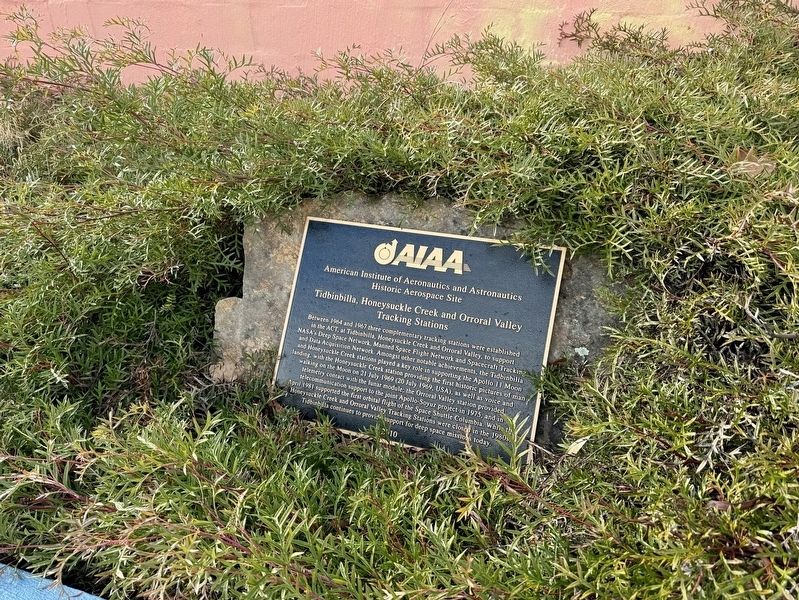
Tracking Stations Marker
1 ► Australia, Australian Capital Territory, Kambah, Paddys River — Tidbinbilla, Honeysuckle Creek and Orroral Valley Tracking Stations — AIAA Historic Aerospace Site —  |
| Near Discovery Drive 6.8 kilometers east of Paddys River Road. | |||
| 2 ► Australia, New South Wales, Cabonne Shire Council, Boree — Sir Thomas Mitchell — |
| On The Escort Way (Highway 81) at Orange Road (Highway 90), on the right when traveling west on The Escort Way. | |||
| 3 ► Australia, New South Wales, Cootamundra-Gundagai Regional Council, Gundagai — Prince Alfred Bridge Viaduct — Gundagai Town of Historic Bridges — |
| On Virgil Street, on the right when traveling south. | |||
| 4 ► Australia, New South Wales, Council of the Sydney, Sydney — Mrs Macquaries Chair — |
| Near Mrs Macquaries Road, on the left when traveling north. | |||
| 5 ► Australia, New South Wales, Council of the Sydney, Sydney, The Rocks — Captain Matthew Flinders R.N. — 1774 - 1814 — |
| On Sydney Orbital Network. | |||
| 6 ► Australia, New South Wales, Council of the Sydney, The Rocks — Legacy — |
| On Argyle Street west of Harrington Street, on the right when traveling west. | |||
| 7 ► Australia, New South Wales, Eurobodalla Shire Council, Tuross Head — McWilliam Park Whale Burial Site — |
| On Tuross Boulevard just south of Bridges Avenue. | |||
| 8 ► Australia, New South Wales, Inner West Council, Newtown, Camperdown Cemetery Newtown — Isaac Nathan (1792-1864) — |
| Near Church Street, on the right when traveling south. | |||
| 9 ► Australia, New South Wales, Lithgow Council, Clarence — The Great Zig Zag — Lithgow — |
| Near Chifley Road 0.1 kilometers east of Petra Avenue. | |||
| 10 ► Australia, New South Wales, Maitland Council, Morpeth — Historic Arnott Bakehouse — circa 1851 — |
| On Swan Street at Berkeley Street, on the right when traveling west on Swan Street. | |||
| 11 ► Australia, New South Wales, Northern Beaches Council, Manly — Marine Parade — 1920s — |
| Near Marine Parade, on the left when traveling south. | |||
| 12 ► Australia, New South Wales, Snowy Monaro Regional Council, Cooma — Cooma 1890 / Cooma 1925 — |
| On Sharp Street at Vale Street on Sharp Street. | |||
| 13 ► Australia, New South Wales, Snowy Monaro Regional Council, Cooma — Lambie Street — |
| On Lambie Street (New South Wales Route B72) at Sharp Street, on the right when traveling east on Lambie Street. | |||
| 14 ► Australia, New South Wales, Snowy Valleys Council, Kunama — The White Gate — |
| On Old Tumbarumba Road at Old Tumbarumba Road, on the right when traveling south on Old Tumbarumba Road. | |||
| 15 ► Australia, New South Wales, Tamworth Regional Council, Tamworth — Electric Street Lighting — |
| On Peel Street just north of Darling Street, on the right when traveling south. | |||
| 16 ► Australia, New South Wales, Tamworth Regional Council, Tamworth — Vietnam War Memorial — Lest We Forget — |
| On B95 close to Brisbane Street, on the right when traveling south. | |||
| 17 ► Australia, New South Wales, Tenterfield Shire Council, Tenterfield — Historic Stannum House — circa 1888 — |
| On Rouse Street close to Clive Street. | |||
| 18 ► Australia, Northern Territory, Darwin Municipality, Darwin City — 2nd Lt. Robert J. Buel, USAAF — WWII Fighter Pilot, 21st Pursuit Sq., 35th Pursuit Grp. — Shot Down Feb. 15, 1942 — |
| On Parker Walk just south of Esplanade, on the right when traveling south. | |||
| 19 ► Australia, Northern Territory, Darwin Municipality, Darwin City — A Story of Sacrifice — |
| On Parker Walk 0.2 kilometers south of Esplanade, on the right when traveling south. | |||
| 20 ► Australia, Northern Territory, Darwin Municipality, Darwin City — Friedrich Wilhelm Ludwig Leichhardt — |
| On Reg Leydin Place 0.2 kilometers south of Esplanade, on the right when traveling east. | |||
| 21 ► Australia, Northern Territory, Darwin Municipality, Darwin City — Friendship through Gardens — Darwin Garden Club 1958-1998 — |
| On Reg Leydin Place 0.2 kilometers south of Esplanade, on the right when traveling east. | |||
| 22 ► Australia, Northern Territory, Darwin Municipality, Darwin City — Mandjabu Fish Trap — |
| On Mitchell Street at McLachlan Street, on the right when traveling south on Mitchell Street. | |||
| 23 ► Australia, Northern Territory, Darwin Municipality, Darwin City — Ocean Views Hide History — Our War Heritage — |
| On Parker Walk 0.2 kilometers south of Esplanade, on the right when traveling south. | |||
| 24 ► Australia, Northern Territory, Darwin Municipality, Darwin City — USS Peary DD 226 — |
| On Parker Walk 0.2 kilometers south of Esplanade, on the right when traveling south. | |||
| 25 ► Australia, Northern Territory, Darwin Municipality, Larrakeyah — mirragma gunugurr-wa — (bamboo raft) — |
| On Doctors Gully Road just south of Daly Street, on the right when traveling south. | |||
| 26 ► Australia, Queensland, Brisbane, Brisbane City — The Old Windmill and Reservoirs — |
| On Wickham Terrace at Bartley Street on Wickham Terrace. | |||
| 27 ► Australia, Queensland, Gold Coast, Broadbeach — The Man From Snowy River — Plaza — |
| Near Victoria Avenue. | |||
| 28 ► Australia, Queensland, Gold Coast, Coolangatta — Surveyor Francis Edward Roberts — |
| On Boundary Street. | |||
| 29 ► Australia, Tasmania, Clarence Council, Risdon — Risdon Landing Centenary — |
| Near East Derwent Highway. | |||
| 30 ► Australia, Tasmania, Dorset Council, Scottsdale — Scottsdale Cenotaph — |
| Near Alfred Street. | |||
| 31 ► Australia, Tasmania, Latrobe Council, Latrobe — Edwin Maw — 1858 — |
| On Victor Street close to Gilbert Street. | |||
| 32 ► Australia, Tasmania, Launceston Council, Launceston — Launceston Gasworks — |
| Near Boland Street close to Willis Street, on the left when traveling west. | |||
| 33 ► Australia, Victoria, Banyule, Bundoora — Greenwood Reserve — |
| On Greenwood Drive 0.1 kilometers east of Lea Crescent, on the left when traveling west. | |||
| 34 ► Australia, Victoria, Banyule, Bundoora — Gresswell Forest Nature Conservation Reserves — |
| Near Greenwood Drive 0.1 kilometers south of Lea Crescent. | |||
| 35 ► Australia, Victoria, Banyule, Greensborough — 12 — Quirk's the Tailor and Mrs Quirk's Tea Rooms — Greensborough Historical Society Trail — |
| On Main Street (Victoria Route 48) 0.1 kilometers north of Para Road, on the left when traveling north. | |||
| 36 ► Australia, Victoria, Banyule, Greensborough — 13 — Swimming Pool on the Plenty River — Greensborough Historical Society Trail |
| On Main Street 0.1 kilometers south of St Helena Road, on the left when traveling north. Reported damaged. | |||
| 37 ► Australia, Victoria, Banyule, Watsonia — 25 Pounder Mark 2 on Carriage 25 Pounder Mark I/L — |
| On Morwell Avenue 0.1 kilometers north of Grace Street, on the left when traveling east. | |||
| 38 ► Australia, Victoria, Banyule, Watsonia — 40mm Bofurs No 12 (Bristol) Anti Aircraft Gun — |
| On Morwell Avenue 0.1 kilometers north of Grace Street, on the left when traveling west. | |||
| 39 ► Australia, Victoria, Banyule, Watsonia — Citizens of Diamond Valley and Watsonia R.S.L. War Memorial — |
| On Morwell Avenue 0.1 kilometers north of Grace Street, on the left when traveling east. | |||
| 40 ► Australia, Victoria, Bayside, Beaumaris — 15 — Boon Wurrung Blossom — Sculpture by Ellen Jose 2008 — Bayside Indigenous Trail — |
| Near Beach Road (Victoria Route 33) 0.3 kilometers north of Reserve Road. | |||
| 41 ► Australia, Victoria, Bayside, Beaumaris — 14 — Ricketts Point — Beaumaris — Bayside History Trail — |
| Near Beach Road (Victoria Route 33) at Reserve Road. | |||
| 42 ► Australia, Victoria, Bayside, Beaumaris — 34 — Tom Roberts — The Sunny South c.1887 — Bayside Art Trail — |
| Near Beach Road (Victoria Route 33) 0.2 kilometers north of Reserve Road. | |||
| 43 ► Australia, Victoria, Boroondara, Hawthorn — 4 Glan Avon Road — |
| On Glan Avon Road 0.1 kilometers south of Yarra Grove, on the left when traveling north. | |||
| 44 ► Australia, Victoria, Brimbank, Keilor — 6 — Keilor Hotel — 1849 — Keilor Heritage Walk — |
| On Old Calder Highway at Hunter Street, on the left when traveling east on Old Calder Highway. | |||
| 45 ► Australia, Victoria, Brimbank, Keilor — 4 — Old Iron Bridge — 1868 — Keilor Heritage Walk — |
| On Old Calder Highway at Bonfield Street, on the left when traveling east on Old Calder Highway. | |||
| 46 ► Australia, Victoria, Brimbank, Keilor — 15 — Overnewton — 1849 — Keilor Heritage Walk — |
| On Overnewton Close 0.1 kilometers south of Overnewton Road, on the right when traveling south. | |||
| 47 ► Australia, Victoria, Brimbank, Keilor East — 2 — Keilor Cemetery — Keilor Heritage Walk — |
| On Cemetery Road 0.1 kilometers south of Ely Court, on the left when traveling south. | |||
| 48 ► Australia, Victoria, Brimbank, Keilor Park — 3 — St Augustine’s — 1863 — Keilor Heritage Walk — |
| On Harrick Road 0.3 kilometers west of Keilor Park Drive ( Route 39), on the left when traveling east. | |||
| 49 ► Australia, Victoria, Buloke Shire, Warne — Dog Netting Fence — |
| On Dog Netting Road, on the right when traveling north. | |||
| 50 ► Australia, Victoria, Campaspe Shire, Echuca — This Establishment Built About 1878 Is The Only Classified Brothel in Victoria — |
| On Little Hopwood Street close to Murray Esplanade. | |||
| 51 ► Australia, Victoria, Casey, Hampton Park — K. M. Reedy — |
| Near Pound Road 0.2 kilometers north of K M Reedy Reserve Access Road. | |||
| 52 ► Australia, Victoria, Frankston — 100th Anniversary of Legacy — |
| Near High Street 0.1 kilometers north of Spring Street. | |||
| 53 ► Australia, Victoria, Frankston — Centenary of Armistice Day — Remembrance Day — 11th November 2018 — |
| Near High Street 0.1 kilometers north of Spring Street. | |||
| 54 ► Australia, Victoria, Frankston — Frankston War Memorial — |
| Near High Street 0.1 kilometers north of Spring Street. | |||
| 55 ► Australia, Victoria, Frankston — Frankston War Memorial - Rust Stains — |
| Near High Street 0.1 kilometers Spring Street. | |||
| 56 ► Australia, Victoria, Frankston — Thompson's Folly — |
| On Esplanade at High Street, on the left when traveling north on Esplanade. | |||
| 57 ► Australia, Victoria, Glen Eira, Caulfield East — Caulfield Commons — |
| On Kambrook Road 0.2 kilometers east of Booran Road ( Route 22). | |||
| 58 ► Australia, Victoria, Hume, Bulla — Alister Clark — Alister Clark Memorial Rose Garden — |
| Near Green Street 0.1 kilometers north of Bulla Road ( Route C743). | |||
| 59 ► Australia, Victoria, Hume, Bulla — Amy Johnson — 1931 Soft Pink Tall Shrub Rose — Alister Clark Memorial Rose Garden — |
| Near Green Street 0.1 kilometers north of Bulla Road ( Route C743). | |||
| 60 ► Australia, Victoria, Hume, Bulla — Bulla War Memorial — |
| On Bulla Road (Victoria Route C743) at Green Street, on the left when traveling east on Bulla Road. | |||
| 61 ► Australia, Victoria, Hume, Bulla — Cicely Lascelles — 1937 Pink Shaded Salmon HT Pillar / Climbing Rose — Alister Clark Memorial Rose Garden — |
| Near Green Street 0.1 kilometers north of Bulla Road ( Route C743). | |||
| 62 ► Australia, Victoria, Hume, Bulla — Countess of Stradbroke — 1928 Large, Crimson Red Climbing Rose — Alister Clark Memorial Rose Garden — |
| Near Green Street 0.1 kilometers north of Bulla Road ( Route C743). | |||
| 63 ► Australia, Victoria, Hume, Bulla — Daffodils — Alister Clark Memorial Rose Garden — |
| Near Green Street 0.1 kilometers north of Bulla Road ( Route C743). | |||
| 64 ► Australia, Victoria, Hume, Bulla — Editor Stewart — 1939 Crimson Red Pillar Rose — Alister Clark Memorial Rose Garden — |
| Near Green Street 0.1 kilometers north of Bulla Road ( Route C743). | |||
| 65 ► Australia, Victoria, Hume, Bulla — Former Bulla Shire Hall — |
| On Green Street at Bulla Road ( Route C743), on the left when traveling north on Green Street. | |||
| 66 ► Australia, Victoria, Hume, Bulla — Glenara — 1951 Deep Pink Tall HT Shrub Rose — Alister Clark Memorial Rose Garden — |
| Near Green Street 0.1 kilometers north of Bulla Road (Route C743). | |||
| 67 ► Australia, Victoria, Hume, Bulla — Gwen Nash — 1920 Glowing Pink to Apricot, Small, Single Climbing Rose — Alister Clark Memorial Rose Garden — |
| Near Green Street 0.1 kilometers north of Bulla Road ( Route C743). | |||
| 68 ► Australia, Victoria, Hume, Bulla — Hume and Hovell - 100 Year Memorial Marker — |
| On Oaklands Road 0.2 kilometers north of Cemetery Lane, on the left when traveling south. | |||
| 69 ► Australia, Victoria, Hume, Bulla — Jessie Clark — 1915 Clear Pink Single Climbing R. Gigantea Hybrid — Alister Clark Memorial Rose Garden — |
| Near Green Street 0.1 kilometers north of Bulla Road ( Route C743). | |||
| 70 ► Australia, Victoria, Hume, Bulla — Just Passing Through — Bulla Bluestone Bridge — |
| On Trap Street 0.2 kilometers north of School Lane, on the left when traveling east. | |||
| 71 ► Australia, Victoria, Hume, Bulla — Kitty Kininmonth — Alister Clark Memorial Rose Garden — |
| Near Green Street 0.1 kilometers north of Bulla Road ( Route C743). | |||
| 72 ► Australia, Victoria, Hume, Bulla — Lady Mann — 1940 Rosy Pink Tall HT Shrub Rose — Alister Clark Memorial Rose Garden — |
| Near Green Street 0.1 kilometers north of Bulla Road ( Route C743). | |||
| 73 ► Australia, Victoria, Hume, Bulla — Lady Medallist — 1912 Light Pink Double Climbing Rose — Alister Clark Memorial Rose Garden — |
| Near Green Street 0.1 kilometers north of Bulla Road ( Route C743). | |||
| 74 ► Australia, Victoria, Hume, Bulla — Lorraine Lee — 1924 Rosy Pink, Ever Blooming Tea Rose — Alister Clark Memorial Rose Garden — |
| Near Green Street 0.1 kilometers north of Bulla Road (Route C743). | |||
| 75 ► Australia, Victoria, Hume, Bulla — Lost and Unconfirmed Roses — Alister Clark Memorial Rose Garden — |
| Near Green Street 0.1 kilometers north of Bulla Road ( Route C743). | |||
| 76 ► Australia, Victoria, Hume, Bulla — Marjory Palmer — 1936 Rich Pink Small Bush Bedding Rose — Alister Clark Memorial Rose Garden — |
| Near Green Street 0.1 kilometers north of Bulla Road ( Route C743). | |||
| 77 ► Australia, Victoria, Hume, Bulla — Mary Guthrie — 1929 Rich Single Pink Small Shrub Rose — Alister Clark Memorial Rose Garden — |
| On Green Street 0.1 kilometers north of Bulla Road ( Route C743). | |||
| 78 ► Australia, Victoria, Hume, Bulla — Mrs Fred Danks — 1951 Lilac Pink HT Pillar Rose — Alister Clark Memorial Rose Garden — |
| Near Green Street 0.1 kilometers north of Bulla Road (Route C743). | |||
| 79 ► Australia, Victoria, Hume, Bulla — Mrs Harold Alston — 1940 Pale Pink Tall HT Shrub Rose — Alister Clark Memorial Rose Garden — |
| Near Green Street 0.1 kilometers Bulla Road ( Route C743). | |||
| 80 ► Australia, Victoria, Hume, Bulla — Mrs Harold Brookes — 1931 Bright Red HT Shrub Rose — Alister Clark Memorial Rose Garden — |
| Near Green Street 0.1 kilometers north of Bulla Road ( Route C743). | |||
| 81 ► Australia, Victoria, Hume, Bulla — Mrs Hugh Dettman — 1930 Apricot Yellow HT Pillar Climbing Rose — Alister Clark Memorial Rose Garden — |
| Near Green Street 0.1 kilometers north of Bulla Road ( Route C743). | |||
| 82 ► Australia, Victoria, Hume, Bulla — Mrs Maud Alston — Alister Clark Memorial Rose Garden — |
| Near Green Street 0.1 kilometers north of Bulla Road ( Route C743). | |||
| 83 ► Australia, Victoria, Hume, Bulla — Nancy Hayward — 1937 Single, Vivid Cerise Pink R. Gigantea Climber — Alister Clark Memorial Rose Garden — |
| Near Green Street 0.1 kilometers north of Bulla Road ( Route C743). | |||
| 84 ► Australia, Victoria, Hume, Bulla — Peggy Bell — 1929 Ever Blooming Apricot Pink HT Shrub Rose — Alister Clark Memorial Rose Garden — |
| Near Green Street 0.1 kilometers north of Bulla Road ( Route C743). | |||
| 85 ► Australia, Victoria, Hume, Bulla — Roses — Alister Clark Memorial Rose Garden — |
| Near Green Street 0.1 kilometers north of Bulla Road ( Route C743). | |||
| 86 ► Australia, Victoria, Hume, Bulla — The Power of Steam — |
| On Green Street 0.1 kilometers north of Cahill Street, on the left when traveling north. | |||
| 87 ► Australia, Victoria, Hume, Bulla — Welcome to the Alister Clark Memorial Rose Garden — Alister Clark Memorial Rose Garden — |
| Near Green Street 0.1 kilometers north of Bulla Road ( Route C743). | |||
| 88 ► Australia, Victoria, Hume, Bulla — Zara Hore-Ruthven — 1932 Rich Clear Pink HT Rose Shrub — Alister Clark Memorial Rose Garden — |
| Near Green Street 0.1 kilometers north of Bulla Road ( Route C743). | |||
| 89 ► Australia, Victoria, Hume, Greenvale — Woodlands Historic Park — |
| On Homestead Track 0.3 kilometers east of Woodlands Drive, on the left when traveling east. | |||
| 90 ► Australia, Victoria, Kingston, Clayton South — Flying Saucer Sighting — |
| Near Osborne Avenue 0.1 kilometers south of Brandon Way. | |||
| 91 ► Australia, Victoria, Kingston, Clayton South — The Grange — |
| Near Osborne Avenue 0.2 kilometers south of Brandon Way. | |||
| 92 ► Australia, Victoria, Kingston, Mentone — Garryowen — Horse Drinking Trough — |
| On Como Parade West 0.1 kilometers south of Balcombe Road ( Route 10), on the left when traveling south. | |||
| 93 ► Australia, Victoria, Kingston, Mentone — 1 — Mentone Railway Station — Mentone Historical Walking Trail — |
| On Como Parade West 0.1 kilometers south of Balcombe Road ( Route 10), on the left when traveling south. | |||
| 94 ► Australia, Victoria, Kingston, Mentone — Mentone Railway Station and Gardens — |
| On Como Parade West near Balcombe Road ( Route 10), on the left when traveling south. | |||
| 95 ► Australia, Victoria, Kingston, Mentone — Murrell Memorial Horse Trough — |
| On Como Parade West 0.1 kilometers south of Balcombe Road. | |||
| 96 ► Australia, Victoria, Knox, Boronia — Ramon Cowling Bushland Reserve — |
| On Stewart Street 0.3 kilometers east of Dorset Road ( Route 5), on the left when traveling east. | |||
| 97 ► Australia, Victoria, Knox, Ferntree Gully — City of Knox History — Radial Growth of Historic Pine — |
| On Station Street at Alpine Street, on the left when traveling south on Station Street. | |||
| 98 ► Australia, Victoria, Knox, Rowville — An Entwined History — Stamford Park Homestead — |
| Near Emmeline Row. | |||
| 99 ► Australia, Victoria, Knox, Rowville — Cool Store - Dairy — Stamford Park Homestead — |
| Near Emmeline Row just west of Enterprise Drive. | |||
| 100 ► Australia, Victoria, Knox, Rowville — Homestead — Stamford Park Homestead — |
| On Emmeline Row 0.1 kilometers east of Gulinya Cres, on the right when traveling west. | |||
517 entries matched your criteria. The first 100 are listed above. Next 100 ⊳