“By the Treaty of Saginaw, made at Saginaw [Saquina] September 24, 1819, by General Lewis Cass, Governor of the Northwest Territory, on the part of the United States, and the Chippewa Nations, Thunder Bay River became a part of the boundary of the . . . — — Map (db m182328) HM
U.S.S. Maine, destroyed in Havana harbor February 15th 1898. This tablet cast from metal recovered from the U.S.S. Maine.
(on the shield) ☆ Patriotism ☆ Devotion ☆
— — Map (db m233608) WM
Shipping on the Great Lakes has always been seasonal. The poor visibility, heavy seas and ice that came each year with the gales of November prompted ship owners and captains in the 1800s to "lay up" their ships. Every winter ice choked docks and . . . — — Map (db m121892) HM
Portland cement, so-called because
it resembles in color stone from
the Isle of Portland, in the British
Isles, was first produced in the
United States in 1871, in Michigan
in 1896. Because of Alpena’s location
in the midst of immense . . . — — Map (db m233611) HM
Launched in 1891, the steel-hulled Grecian was built during an era of unprecedented
industrial growth and dramatic change in shipbuilding technology. Good steel flexes
but doesn’t break upon impact. However in June 1908, when the . . . — — Map (db m236369) HM
Built for speed, the 236-foot steam package freighter Montana
initially carried all types of freight. A typical trip found the
Montana carrying a diverse cargo of 6,000 barrels of flour, 40
tons of copper, 250,000 shingles, 100 . . . — — Map (db m236026) HM
On Saturday night, November 19, 1966, the Nordmeer was traveling to
Chicago from Hamburg, Germany, with a cargo of 990 coils of steel
destined for Milwaukee. It was the ocean-going vessel’s first freshwater
voyage. The night was clear. . . . — — Map (db m236019) HM
My name is Abby O’Bryan, I am a Girl Scout with Troop 1033 in Alpena.
I proposed the original idea of a dog park to a member of the City Council and
began the planning process. During the initial stages, I met many others with
common interests . . . — — Map (db m236519) HM
Thomas Stafford was born in Wexford, Ireland in 1842. After originally immigrating to Canada,
Stafford moved to Alpena where he married Elizabeth McDougall. The couple raised nine children
in Alpena, with many descendants still living in the area . . . — — Map (db m236518) HM
Shipwreck Alley.
For more than 12,000 years, people have traveled on the Great Lakes. From Native American dugout canoes to wooden sailing craft and steel freighters, thousands of ships have made millions of voyages on the Inland Seas. The . . . — — Map (db m236835) HM
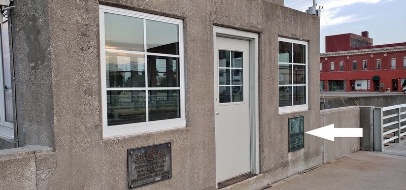
What is this
NOAA
building?
This building houses
equipment that records Lake
Huron water levels, wind
speed and direction, air and
water temperature,
barometric pressure, and
relative humidity. It was
installed in 2006.
NOAA’s . . . — — Map (db m235924) HM
Since Alpena’s inception, the Thunder Bay River has bisected the city. Initially, a wooden
scow, pulled back and forth across the river with a rope, served as a ferry and connected
Second Avenue on the south side with Dock Street on the north. In . . . — — Map (db m235868) HM
Located across the river from where you are standing is an area
known historically as Alpena’s Third Ward. The first dwellings
were erected in 1858 or ’59 at the river’s edge, while the majority
of the land remained woods and swampland. In 1867, . . . — — Map (db m235736) HM
Shipping on the Great Lakes has always been seasonal. Poor
visibility, heavy seas and ice that arrive each year with the gales
of November prompted 19th-century ship owners and captains
to “lay up” their ships and take them out of active service . . . — — Map (db m235671) HM
E. P. Austin • Vincent Agius, Jr. • Philip B Emerson • Jack R. Sanborn • David K. Bruning • Ned A. Heath • Rodney Chapman • Gene P. Fussey • Phillip A. Elliott • Bruce E. Hahn • Thomas P. Smith • Donald J. Woloszyk • Frederick J. Wozniak • Luther A. . . . — — Map (db m235658) WM
This sculpture series represents the history of industry in Alpena and the surrounding region of Northeast Michigan. It is dedicated to
the people who made livelihoods for themselves, their families and their communities throughout time.
While . . . — — Map (db m235657) HM
In the summer of 1879
five Norwegian families
settled what became the
village of Leer. They and
those who followed came
to Michigan seeking to
own their own land. Many
of the men worked in area
lumber camps and Alpena’s
mills until they . . . — — Map (db m233696) HM
In Memory Of
Bruce E Hahn
Sgt E5 U.S. Army
Vietnam
July 13th 1948 - May 6th 1970
In Memory Of
Roger P. Briunski
Sgt E5 U.S. Army
Persian Gulf
April 30th 1966 - Feb. 27th 1991 — — Map (db m165334) WM
This Memorial is Dedicated
to the Men and Women
Who Served Their Country,
State, and Community
With Courage, Dedication,
and Sacrifice
in War and in Peace.
They Will Not Be Forgotten. — — Map (db m190677) WM
In 1891-92 the Chicago and West Michigan Railway, precursor to the
Pere Marquette Railroad, extended the line between Traverse City and
Petoskey through Spencer Creek. William Alden Smith, the railway's
general counsel, advocated building the . . . — — Map (db m190676) HM
The first pioneers of Antrim County
settled along Grand Traverse Bay
near Elk Rapids in the 1850s. Later
settlers moved inland, and urged
that the county seat be transferred
from the bay shore closer to the
geographical center of the . . . — — Map (db m234153) HM
Before America was discovered, indigenous people hunted and fished the Grand Traverse region for thousands of years. As far back as 8,000 B.C., the waters of Grand Traverse Bay, Elk River and the 14 lakes of Antrim County's Chain of Lakes had been . . . — — Map (db m98175) HM
In this photo you are standing on the other side of the Elk River and to the left side of the photograph. This picture of Elk Rapids is from the 1890s and the view is from the top of the Elk Rapids Iron Company's Furnace. What is left of this . . . — — Map (db m98173) HM
In 1856 Dexter and Noble Company began building an empire with their sawmill and mercantile business. In 1872 they built an iron smelting plant, one of the largest charcoal furnaces in the country. At each step of their building that empire, . . . — — Map (db m98125) HM
Elk Rapids thrived in the late
nineteenth century due to the
lumber industry boom and local
iron and chemical manufacturing
plants. When the economy declined,
people left to find work. Between
1910 and 1920. the town lost two-thirds of its . . . — — Map (db m234256) HM
As shown in the above photograph taken in c1910, the Elk River and Chain of Lakes provided a means of transporting logs to the Dexter & Noble sawmill and a shoreline site where cord wood was made into charcoal fuel for the iron furnace. This . . . — — Map (db m98151) HM
In the late 1850s traveling pastors
began to conduct Methodist services in
Elk Rapids and nearby communities.
First Methodist Episcopal Church was
organized in the early 1870s. Services
were held in a former school and then a
former . . . — — Map (db m234753) HM
Native Americans have hunted and fished the Grand Traverse region for thousands of years, perhaps as many as 10,000 years before white settlers appeared. The waters of the Bay, Elk River and the 14 lakes of Antrim County's Chain of Lakes had been . . . — — Map (db m98128) HM
US 31 in its present location was built in 1953. In the 1960s, the Rotary Club of Elk Rapids began to develop the land between the highway and Elk River. With the help of other local organizations, the area became a park, named Rotary Park in . . . — — Map (db m98118) HM
Look carefully westward to see what remains of the Elk Rapids City Dock. This dock was one of
three docks situated within the village limits. It served the community of Elk Rapids from 1905
to 1911. The pier extended 1,440 feet out into East Grand . . . — — Map (db m247432) HM
Edwin S. Noble (1838-1922) designed
and built this house for his family in
1865. Noble, an expert accountant,
was associated with the Dexter Noble
Company, first as secretary-treasurer
and later as a full partner. The company
was involved in . . . — — Map (db m234603) HM
Memorial to those who gave their lives in the service of their country.
World War II. John Bachi • Robert Barnes • Donald Banninger • Byron Hassett • Lynn Hansen • Willard Banninger • Ralph Hirt • Mark Mamagona • Wayne Martinek • William . . . — — Map (db m247405) WM
Designed by Charles H.Peale
and built in 1883 near the
site where the earliest
white settler, Abram Wadsworth had lived, the Elk
Rapids Township Hall has
served as a social and
political center
center for over
ninety years. Largely due
to . . . — — Map (db m234752) HM
It has often been asked, "Why the stumps in the river?"
In a way, the stumps tell the story of Elk Rapids. In the beginning the trees grew there while the land was still dry. As one can see in the photograph of the blast furnace, which was . . . — — Map (db m98135) HM
At the beginning of 1901, a
reporter visiting Essex noted thirty to forty houses, a
large sawmill. a stave factory, a shingle mill, one store,
a telephone office, a blacksmith shop, a livery stable
and a post office. A 1902
Central Lake Torch . . . — — Map (db m234152) HM
On November 10, 1881, the Antrim County Herald ran an advertisement about the village of Wetzell that read: "New Town, New Store; Everything New!" Earlier that year the Wetzell brothers had platted the village and opened a sawmill. As the . . . — — Map (db m215768) HM
n 1885 Bohemian immigrants founded Saint John
Nepomucene Catholic Church,
named for the patron saint of
Czechoslovakia. The settlers,
most of whom emigrated from
Prague, named their community Praga. This Gothic
Revival church was built as
a . . . — — Map (db m234149) HM
This churchlike white frame structure with its graceful cupola was built in 1890 as the second Arenac County Courthouse. The first courthouse on this site burned the previous year. Omer had been a part of Bay
County until Arenac was organized in . . . — — Map (db m70969) HM
This region's history is long and rich. Father Ménard, the Jesuit missionary, wintered near what is now L'Anse in 1660-1661. Near here Father Baraga set up his mission in 1843. He and the head of the neighboring Methodist mission, the Rev. J. . . . — — Map (db m76282) HM
Gettysburg
Wilderness
The Union
One and Inseparable.
Mission Ridge
To
Our Nation's Defenders
1861-1865
Vicksburg
Dedicated to those who
offered up their lives
that the government of
the people by the people . . . — — Map (db m216395) WM
Dedicated to those who served from Barry County during World War I 1917-1918
Dedicated to those who served from Barry County during World War II 1941-1946 Dedicated to those who served from Barry County during the Korean War 1950-1953 . . . — — Map (db m216397) WM
Dedicated to those who served from Barry County during the Revolutionary War 1775 - 1783
War of 1812 1812-1815
Mexican War 1846 - 1848
and all others from Barry County who served in the military in any other conflicts
Dedicated to . . . — — Map (db m216400) WM
Central School Hastings built the first school on this site in 1852. It burned in 1871, and the second school was constructed. Hailed as a "landmark of progress," the new building served until 1930 when it was razed. Bucks from that structure . . . — — Map (db m216612) HM
Barry County, organized in 1839, was named after U.S. Postmaster General William Barry. Hastings, the county seat, was platted in 1836 and chartered as a village in 1855. The present courthouse was completed in 1892. A newspaper was published here . . . — — Map (db m150276) HM
Oakland County physician
George W. Lowry (1850-1922)
purchased this lot and a
medical practice from Dr.
William A. Upjohn in 1887.
In 1892-1894 he built one of
Hasting's finest residences,
which also housed his medical office. The . . . — — Map (db m216360) HM
Kim Sigler (1894-1953), a native of Schuyler, Nebraska, received his law degree from the University of Detroit in 1918. While attending law school, Sigler worked at Henry Ford’s Highland Park plant. He first practiced law in Detroit, where he . . . — — Map (db m150275) HM
Hastings City Bank began its corporate existence on October 26, 1886, when
state bank charter number eleven was granted by the State of Michigan. The
bank's first quarters were above a hardware store on State Street. In 1890, a
new bank building . . . — — Map (db m216358) HM
Hastings City Bank began its corporate existence on October 26, 1886, when
state bank charter number eleven was granted by the State of Michigan. The
bank's first quarters were above a hardware store on State Street. In 1890, a
new bank . . . — — Map (db m216609) HM
Center Panel:
To honor the Hastings High School boys who made the supreme sacrifice in the World War
Left Panel:
Laurence J. Bauer '13
1894-1918
1st Lieut. 11th Squadron Air Service
fell at Bar Le Doc France
Right Panel:
Reuben . . . — — Map (db m216614) WM
On April 5, 1885, the Michigan Mutual Tornado, Cyclone, and Windstorm Insurance Company became the first mutual windstorm company incorporated by the state of Michigan. Starting in a one-room office above Grant's store, the company occupied and . . . — — Map (db m33250) HM
From 1872 to 1963 Hope Township children attended school in this building, known as the Hinds School because of its location at the crossroads community of Hinds Corners. The school had stood vacant for almost twenty years when Robert Casey, a Hinds . . . — — Map (db m191509) HM
In the early nineteenth century the Thornapple band of Ottawa Indians established a village a short distance from Thornapple Lake. It was served in the 1840s by a Methodist mission and school conducted by the Reverend Mannaseh Hickey. Trails leading . . . — — Map (db m191511) HM
This steel Pratt through truss bridge was erected for Hastings Township in 1903. The township contracted with the Massillon Bridge Company of Massillon, Ohio, for $2,090, to fabricate and erect the steel bridge. In operation from 1869 to the 1930s, . . . — — Map (db m191510) HM
The first Methodist Episcopal Society, the oldest congregation in Hastings, erected this Greek Revival structure in 1860. In 1911 the Methodists built a new church on the northwest corner of Green and Church Streets. The following year it sold the . . . — — Map (db m199125) HM
Hastings was first linked
with Jackson and Grand
Rapids by the Grand River
Valley Railroad in 1870.
The Michigan Central Railroad leased the line that
same year. At first located
elsewhere, a passenger
station was built on this
site in . . . — — Map (db m216359) HM
Built in the 1880s by Daniel Striker, this Queen Anne-style building was once considered the "handsomest residence in Hastings." Born in New York State in 1835, Striker moved as a child with his family to Michigan. He was elected to several . . . — — Map (db m216572) HM
We proudly stand for our family,
That served and have now died.
Memories are all we have,
A tear in all our eyes.
They knew what they signed on to do.
They answered duty's call.
The honor of the uniform,
They fought for one and all. . . . — — Map (db m216398) WM
This block of brick paving
is the only extant portion
of Hastings' first major
street improvement project
completed in 1907 as the
result of the initiative of
Dr. George W. Lowery, elected
mayor in 1906. The fine
condition of this . . . — — Map (db m216361) HM
In 1850 George Thomas operated a sawmill here, and in the next decade as settlers began to arrive he built a gristmill. The new village, also known as Gull Lake, was a few miles south of the Reverend Leonard Slater’s Baptist Indian mission. Thomas . . . — — Map (db m191508) HM
In 1878 twelve persons organized the Parmelee Methodist Church. The small congregation met at various locations until 1884, when this church was built on land given to the Methodist Trustee Board by Oliver and Bernice Carpenter. On September 15, . . . — — Map (db m215391) HM
Calvin G. (Squire) Hill, founder of the village of Middleville, came from New York state to Michigan in the autumn of 1834. He purchased four hundred acres on both banks of the Thornapple River where the village now stands. In 1854 he donated this . . . — — Map (db m216913) HM
In 1867 Ionia County native John Carveth (1841-1910) settled in Middleville to read law. In 1868, after the completion of his studies, he was admitted to the bar and established a practice in Middleville. Carveth served one term as state senator . . . — — Map (db m216346) HM
WWI
Arthur Finkbeiner, Pvt. Army Oct 29 1918
WWII
Robert Corson, RT3, USN Nov 13 1942
Melbourne Donovan, PFC, Army Dec 21 1944
Bernard Fighter, CPL, Army Jan 1 1943
Steve Hula, SSGT, Army Jan 10 1945
Patrick Reynolds, CPL, . . . — — Map (db m216910) HM
Settlement began here in the mid-1830s, and in 1850 a post office known as Gun Lake was established. The village, never over 100 population, contained a sawmill, general store, blacksmith shop, and several other businesses. E. H. Bowen constructed . . . — — Map (db m216624) HM
Emory Parady was born in New York in 1844. On April 24, 1865, he was one of twenty-seven men from the 16th New York Cavalry Regiment who rode with the two detectives tracking John Wilkes Booth after the assassination of President Abraham Lincoln. On . . . — — Map (db m191499) HM
Built in 1884/85, this red-bricked Italianate structure was the home of Charles W. and Agnes Putnam. Mr. Putnam was a hardware merchant and banker; Mrs. Putnam taught music and was the first public school teacher in Nashville. Around the turn of the . . . — — Map (db m191514) HM
This plaque is issued by the Historical Society of Michigan in recognition of
Village of Nashville
Founded in 1869
For more than 150 years of continuous operation in service to the people of Michigan and for contributing to the growth and . . . — — Map (db m191542) HM
This village was settled in the mid-nineteenth century, and in 1857 a post office was opened. By 1860 a town of several blocks was established, and the businesses included a gristmill, hotel, and sash factory. The gristmill, run by Melatiah J. . . . — — Map (db m216525) HM
Near here once stood one of the most famous inns west of Detroit. It was run by “Yankee Bill” Lewis, a New Yorker who came here in 1836. His establishment, located on the main road from Grand Rapids to Battle Creek and Kalamazoo, was an unimposing . . . — — Map (db m216617) HM
The area now known as Woodland Township was first settled in 1837 by Charles Galloway and Jonathan and Samuel Haight. In 1842, the state legislature set aside the township, which by then had several hundred residents. The area’s level surface and . . . — — Map (db m216646) HM
In 1868 the Williams Township Board of Health authorized a township burial ground and voted to purchase land for that purpose. In 1871 the board purchased five acres previously designated for school purposes from the state of Michigan for twenty . . . — — Map (db m163589) HM
When Bay City's sawmills opened in 1885, mill owners notified workers that wages would be 12 to 25 percent lower than in 1884. On July 6, 1885, Bay City millhands began to walk off the job. Their slogan, "Ten Hours or No Sawdust," represented . . . — — Map (db m162453) HM
Abraham Lincoln Dedicated to the Grand Army of the Republic and The Women Who Served Daughters of Union Veterans of Civil War 1861-1865
Lincoln’s Address Delivered at the dedication of the cemetery at Gettysburg, November 19, 1863.
. . . — — Map (db m131778) HM WM
After being housed in various buildings since 1869, the east-side branch library found a permanent home thanks to the Carnegie Corporation, local leaders William Clements, James E. Davidson, and Charles R. Wells, and the government and citizens of . . . — — Map (db m198353) HM
One of the first attempts in America to produce beet sugar was made in Michigan at White Pigeon late in the 1830's. The venture did not succeed though the future governor John Barry went to Europe seeking to learn its production methods. In 1888 Dr. . . . — — Map (db m180634) HM
Center Avenue presents one of the most spectacular displays of late nineteenth and early twentieth century residential architecture in Michigan. Between 1870 and 1940 Bay City's prominent citizens favored Center Avenue as "the" place to live. Early . . . — — Map (db m33961) HM
Center Avenue presents one of the most spectacular displays of late nineteenth and early twentieth century residential architecture in Michigan. Between 1870 and 1940 Bay City´s prominent citizens favored Center Avenue as "the" place to live. Early . . . — — Map (db m161001) HM
Charles came to Bay City in 1864 from Ithaca, NY, to work for sawmill owners Henry Sage and John McGraw, eventually buying the Bay City Dredging Co. His home's architecture is Shavian Manorial, a Queen Anne/Tudor Revival style named after the . . . — — Map (db m33909) HM
Before the advent of the World Wide Web, indeed even before the advent of telephones and automobiles, it was the railroad that kept us connected. Communities to communities. Businesses to customers. People to one another. Americans to their . . . — — Map (db m131789) HM
Side 1
In 1848, James G. Birney and his wife led Bay City's earliest Presbyterian services in a schoolhouse. Birney, an elder in the church, twice ran unsuccessfully for president on the antislavery ticket. The Reverend Lucius Root organized . . . — — Map (db m33696) HM
The introduction of chicory into Bay County, at the beginning of the twentieth century brought a ___ industry into the area and provided the farmers with a profitable cash crop. Chicory was a popular beverage in Europe at the time. The chicory root, . . . — — Map (db m180656) HM
Frankenlust
One of four colonies in Michigan settled by people from Franconia, Germany, Frankenlust was founded by Pastor Ferdinand Sievers and fourteen immigrants who established Saint Paul Evangelical Lutheran Church in June 1848. On July . . . — — Map (db m138097) HM
George began as a laborer in his father James' lumber business, eventually managing what became Shearer Brothers when his brother James B. joined the firm. The lumber, real estate and insurance company operated out of the Shearer Brothers Block at . . . — — Map (db m131779) HM
This 9-inch Dahlgren Cannon is a true replica of those in place at Battery Park from the early 1900s to 1942. The originals were part of the arsenal aboard the USS Hartford, the flagship of Rear Admiral David G. Farragut. During the Civil . . . — — Map (db m182351) HM
(Side 1)
In 1926 the Bay City Chamber of Commerce recognized the economic benefits that could be derived from a local airport. That year the chamber decided to build one and dedicate it to Bay City men killed during World War I. The . . . — — Map (db m180636) HM
5174 entries matched your criteria. Entries 101 through 200 are listed above. ⊲ Previous 100 — Next 100 ⊳