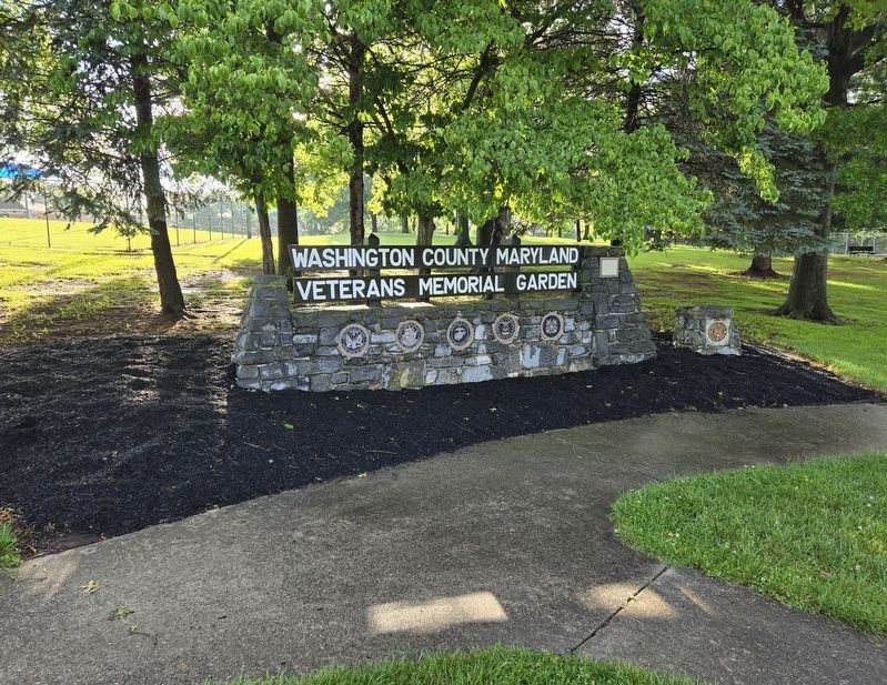
On West Potomac Street (U.S. 11) at North Conococheague Street (Maryland Route 63), on the right when traveling east on West Potomac Street.
The town of Williamsport, like many of Maryland's small towns, furnished scores of its citizens for the war effort. The boys of Williamsport served with distinction in many of the states finest units like the 1st MD Cavalry, companies of the . . . — — Map (db m170612) HM
On Lappans Road (Maryland Route 68) just north of Printz Road, on the right when traveling north.
Devil's Backbone Dam appears to be one of the few remaining original dams from the height of Washington County's flour production days of the early 19th century and a representative example of masonry dams that predate the Civil War. According to . . . — — Map (db m145989) HM
On East Potomac Street (U.S. 11) west of North Artizan Street.
On the afternoon of July 5, 1863, Williamsport was inundated with the arrival of 7,000
wounded Confederate soldiers retreating from the Battle of Gettysburg. The ambulance
train, under the command of Brigadier General John Imboden, arrived to . . . — — Map (db m170560) HM
On South Potomac Street (State Highway 65), on the right when traveling north.
On July 29, 1864, elements of Cole's Maryland Cavalry (Union) battled Brigadier General John C. Vaughn's cavalry brigade of Early's command for three hours in the streets of Hagerstown. By late afternoon, the Marylanders retreated north to . . . — — Map (db m20856) HM
On Potomac Street (Maryland Route 65) 0.1 miles south of Memorial Boulevard, on the left when traveling south.
The Maryland Constitution in 1818 maintained religious test requirements that effectively prohibited Jews from being elected to state office. Kennedy, a Scottish Presbyterian immigrant, was elected to the House of Delegates in 1817 from Washington . . . — — Map (db m134330) HM
On Roxbury Road, on the right when traveling south.
This bridge was built in 1824, in close proximity to Roxbury Mills, an early sawmill and later a large distillery complex which operated into the 20th century. A three-arch bridge over the Antietam, it was one of a series of bridges built for the . . . — — Map (db m5036) HM
On Poffenberger Road, on the left when traveling west.
Although it vaults only a millrace deflected from Antietam Creek proper, this small but well-designed one-arch bridge is typical of many others that have not survived at mill sites in the county. It is not certain that John Weaver built this 53' . . . — — Map (db m5669) HM
On Poffenberger Road, on the left when traveling west.
This three-arch bridge over Antietam Creek was completed by John Weaver in 1840 for $2,800. It was near the mill operated for generations by the Claggett family. The house, barn, and outbuildings of the Claggett estate, "Valentia," stand nearby. . . . — — Map (db m5031) HM
On West Baltimore Street / Oak Ridge Drive, on the right when traveling west.
This bridge over Antietam Creek at Funkstown was built in 1833 by George Weaver for $1,800. At this site was Shafer’s Mill where flour was ground. The most notable feature of this bridge is the graduated size of its three arches, growing larger . . . — — Map (db m2009) HM
On Garis Shop Road, on the right when traveling west.
This handsome three-arch bridge over Antietam Creek was constructed by John Weaver in 1839 and was specially adapted to the grain mill which was built at the same time. The westernmost of the three arches was designed to accommodate the millrace . . . — — Map (db m4930) HM
Volunteer villagers of nearby Boonesboro celebrated their Independence Day July 4, 1827, by building and dedicating this first monument to the memory of George Washington.
Repaired and altered many times over a hundred years by patriotic . . . — — Map (db m1908) HM
On West Washington Street (U.S. 40), on the right when traveling east.
The Lyceum, a public debating hall constructed circa 1848, stood on this site during the Civil War. Heated debates took place here prior to the Civil War on the state of the Union. Following the Battles of Antietam and Gettysburg, the Lyceum was . . . — — Map (db m20847) HM
On North Potomac Street (State Highway 65) at Franklin Street (U.S. 40), on the right when traveling south on North Potomac Street. Reported missing.
The Independent Junior Fire Company was formed in 1842. Their firehouse was constructed in 1852 and altered in 1881. During the Civil War, the Juniors' firehouse was used by the U.S. Army for various purposes and served as a field hospital to treat . . . — — Map (db m20768) HM
On North Potomac Street (State Highway 65) at East Franklin Street (U.S. 40), on the right when traveling north on North Potomac Street.
The existing City Hall was constructed in 1939, replacing the 1818 City Hall on this location. Town Treasurer and City Councilman Matthew Barber negotiated with Confederate General John McCausland regarding the ransom of Hagerstown in 1864. Retreat . . . — — Map (db m20767) HM
On West Washington Street, on the right when traveling east.
The Hagerstown Bank stood at this site until it was demolished in the mid-1930s. The current Hagerstown Trust Bank is a direct descendant of the Hagerstown Bank. The bank's Board of Directors, led by President James Dixon Rodman, took the lead in . . . — — Map (db m20837) HM
On West Washington Street (U.S. 40) at South Prospect Street, on the left when traveling east on West Washington Street.
The Rochester House stood on this site until its demolition in the mid-1950s. During the Civil War, it was the home of Mrs. Frances Howell Kennedy, widow of Dr. Howard Kennedy. From the beginning of the War, Mrs. Kennedy provided food and comfort to . . . — — Map (db m20853) HM
On North Potomac Street (State Highway 65), on the right when traveling south.
Local Physician,Dr. Norman Bruce Scott, attended to Confederate and Federal wounded in the Franklin Hotel, which stood at this site during the Civil War. After the Battles of Antietam and Gettysburg, the military treated the wounded in private . . . — — Map (db m20773) HM
Near Halfway Boulevard at Oak Valley Drive, on the left when traveling north.
In memory of
Seaman Craig Wibberley
and
Fireman Patrick Roy
Who gave the ultimate sacrifice while serving aboard the U.S.S. Cole -DDG-67 on October 12, 2000 — — Map (db m247769) WM
On Baltimore National Pike (U.S. 40) at Stone Bridge Drive, on the right when traveling west on Baltimore National Pike.
Built in 1819, this five-arch structure, named for nearby village, was first stone bridge in Washington County. Erected by Silas Harry at cost of $12,000, it was a major improvement to road system between Baltimore and Cumberland, providing . . . — — Map (db m697) HM
Near West Memorial Boulevard at South Potomac Street.
Jacob Wheaton was born in Middletown, Maryland and moved to Hagerstown in the 1850s. he is believed to be the first African-American to vote in Maryland after the civil war for casting h1s vote in the Hagerstown Mayoral Election of 1868. In 1897, he . . . — — Map (db m107266) HM
On Potomac Avenue near Mealey Parkway, on the right when traveling south.
Honoring the men and women of Washington County Maryland who by their service in the United States armed forces aided in stemming the tide of Communist aggression throughout the world — — Map (db m151202) WM
First governor of Kentucky
1792-1796
Fifth governor of Kentucky
1812-1816
One of Shelby’s first acts as Governor was to call for and help design the Great Seal of the Commonwealth of Kentucky. The figures of a pioneer and statesman in this . . . — — Map (db m121734) HM
On South Potomac Street (Maryland Route 65), on the right.
The State of Maryland has provided this cemetery, and erected this monument, to perpetuate the memory of the Confederate dead, who fell in the Battles of Antietam and South Mountain. The State of Virginia, has contributed toward the burial of her . . . — — Map (db m12203) HM WM
On North Mulberry Street north of North Cannon Avenue, on the left when traveling south.
The Agricultural and Mechanical Association of Washington County was chartered in 1856 and began holding annual fairs in "Heyser's Woods" (now City Park) in the years before the Civil War. The fairs were suspended due to the War, but when peace . . . — — Map (db m131810) HM
Fort Cumberland was garrisoned from 1754 to 1765. During this period, there was bickering between Maryland and Virginia as to how the fort should be maintained and whose control it was under.
In early 1756, Colonel Washington favored a small . . . — — Map (db m17708) HM
On Key Street near Museum Drive ( Highland Avenue). Reported permanently removed.
Mt. Aetna Furnace, at which this cannon was cast in 1776, was located one mile west along Mt. Aetna Road from its
predecessor Antietam furnace which was along Mt. Lena Road. Numerous records from the Revolutionary period describe
the . . . — — Map (db m45455) HM
On North Avenue at Potomac Street ( Route 60), on the right when traveling east on North Avenue.
In memory of the the men from Washington County Maryland who served in the Armed Forces of the United States of America during the war with Spain, the China Relief Expedition and the Philippine Insurrection. — — Map (db m8139) HM
On South Potomac Avenue (Maryland Route 65), on the right when traveling north.
Raised in Middletown in Frederick County, Wheaton had a prominent role in the post-civil war civic involvement of African Americans in the state. Contemporary accounts credit Wheaton as the first African American in Maryland to vote when he . . . — — Map (db m107361) HM
On Jonathan Street, on the left when traveling north.
An African American Heritage Report prepared by the Heritage Resources Group for the City of Hagerstown in 2002 identified the following historical incidents which suggest that the Washington County Jail was a significant site of activity along . . . — — Map (db m5676) HM
Maryland's Appalachian Region Offers Visitors Natural Splendor And Outdoor Adventure, Plus Countless Opportunities To Explore The Region's Rich Heritage—all Just A Few Miles Off Interstate 70.
Maryland Byways, like the Historic National . . . — — Map (db m196240) HM
Near Dwight D. Eisenhower Highway (Interstate 70) south of Baltimore National Pike (U.S. 40), on the right when traveling east.
Maryland's Appalachian Region Offers Visitors Natural Splendor And Outdoor Adventure, Plus Countless Opportunities To Explore The Region's Rich Heritage—all Just A Few Miles Off Interstate 70.
Maryland Byways, like the Historic National . . . — — Map (db m116525) HM
On North Main Street / Old National Road (Alternate U.S. 40), on the right when traveling south.
During the Antietam Campaign, the U.S. Signal Corps used the stone structure in front of you and to your left as a signal station. On July 4, 1827, citizens of the town of Boonsboro paraded to the top of the mountain here and began building this . . . — — Map (db m1161) HM
On Key Street north of Highland Avenue when traveling north.
The iron industry of the Western Maryland region was a "prodigious industrial achievement and an immense contribution to the war effort, unmatched by any other furnace establishment in any other North American colony."
- . . . — — Map (db m291587) HM
Robert Patterson owned a 25-acre tract on the west side of a Catoctin peak. This peak is known today as Bob's Hill. Robert was a free African American collier and pig farmer, one of 22 “mulattos”* listed in the 1870 United States Census for the . . . — — Map (db m260974) HM
Sitting near the junction of the Potomac River and the Great Seneca Creek, the Seneca Mill had a long tradition at this pivotal location.
By 1725, a grist mill functioned here as a commercial staple for the small village. Early proprietors . . . — — Map (db m96104) HM
Near Fort Frederick Road south of Big Pool Road ( Route 56), on the right when traveling south.
During the American War for Independence Fort Frederick was revitalized for military purposes. The Continental Congress turned the fort into a prison camp to house captured British soldiers. As a result the fort became extremely overcrowded, and . . . — — Map (db m96137) HM
Near Fort Frederick Road south of Big Pool Road ( Route 56), on the right when traveling south.
During the American War for Independence Fort Frederick was revitalized for military purposes. The Continental Congress turned the fort into a prison camp to house captured British soldiers. As a result the fort became extremely overcrowded, and . . . — — Map (db m96138) HM
On Mapleville Rd at Fahrney Church Rd., on the right when traveling north on Mapleville Rd.
Founder of the Fahrney family in Maryland. Born May 8, 1767, in Lancaster County Pennsylvania. Died April 9, 1837. Son of Doctor Jacob Fahrney who was born at Frankfort, Germany, studied medicine, and in the year 1756 came to American and settled in . . . — — Map (db m229241) HM
On East Baltimore Street west of South Locust Street, on the right when traveling west.
It will comfort us to think that we have done at least one good act in our lives... - Thomas Kennedy
Who was Thomas Kennedy?
Born in 1776 in Paisley, Scotland, Thomas Kennedy immigrated to Maryland in 1797 and settled in the . . . — — Map (db m195592) HM
On South Potomac Street (Maryland Route 65) near Memorial Blvd West.
The school campus was the location of Willow Lane Park in the early 20th Century. It was here that a stadium was constructed to serve as a home to Hagerstown's "Class D" minor league baseball teams. The teams were part of the "Blue Ridge . . . — — Map (db m46024) HM
Frederick County. Named for Frederick 5th and last Lord Baltimore. Erected out of Prince George’s County in 1748. It then included Montgomery County and all of Maryland west to the West Virginia boundary.
Washington County. The first . . . — — Map (db m41770) HM
On Key Street at Highland Avenue, on the right when traveling south on Key Street. Reported permanently removed.
When German immigrant and founder of Hagerstown, Jonathan Hager, arrived in this country in 1736, western Maryland area was frontier. Maryland’s colonial governor was offering cheap land to those willing to settle here. In 1739, Hager obtained . . . — — Map (db m1160) HM
Near West Memorial Boulevard at South Potomac Street.
Titcomb began her career in library science in Concord, Massachusetts. in 1901, she became the first director of the newly-created Washington county free library on Summit Avenue. She served for over 30 years. Titcomb was an innovator in county-wide . . . — — Map (db m107092) HM
On West Washington Street (U.S. 40), on the right when traveling east.
This is Washington County's third courthouse. When the county was established in 1776, the first courthouse, a combination building that served also as a market house, was built in the middle of the town square, one block east of here. It proved too . . . — — Map (db m6094) HM
Near Canal Street at South Pennsylvania Avenue, on the left when traveling west. Reported permanently removed.
Situated on the Potomac River at the narrowest point in the state of Maryland the town of Hancock is rich in history. The town is named for Joseph Hancock, Jr., who ferried travelers, traders, and commerce across the Potomac.
In 1818, the . . . — — Map (db m96126) HM
On Johnstown Road/Main Street (U.S. 62) 0 miles east of Ohio Route 605, on the right when traveling east.
Side A:
A tavern and inn, for which Noble Landon (1783-1866) obtained a liquor license in 1835, formerly occupied the southeast corner of High and Main streets. In 1837 Landon and William Yantis laid out the town of New Albany in 50-by-100-foot . . . — — Map (db m14452) HM
On 2nd Street Extension at Grant Avenue, on the right when traveling west on 2nd Street Extension.
Jacob Rabe came from Maryland in 1770 to Western Pennsylvania while this area was claimed by Virginia. In 1774 he received a Virginia Certificate for 412 acres. Boundary dispute between Virginia and Pennsylvania was settled in 1781, with the . . . — — Map (db m69762) HM
On Warren Street east of South Mercer Street, on the right when traveling east.
Capt. John Swann of Washington County, Maryland. By 1798, Capt. Swann owned Lots #12, #13, #34 and #35.
Lot #12: Conveyed by the Trustees of the Town of Bath to Capt. John Swann, 1777. — — Map (db m117410) HM
On Brooke Road 0.1 miles west of Chandlee Mill Road, on the right when traveling west.
Sadie Matthews Budd and Family
Kate Matthews of Sandy Spring was the mother of Sadie Matthews, who was married to Norman Budd. In 1888, Norman Edward Budd was born in Montgomery County, Maryland, to Samuel Waters and Emma Budd. . . . — — Map (db m188346) HM
On Washington Monument Road 0.3 miles north of Zittlestown Road, on the right when traveling north.
Background Overshadowed by the Battle of Antietam (near Sharpsburg), which took place three days later and resulted in a loss of 23,000 men, the Battle of South Mountain nevertheless played a crucial role in determining the outcome of . . . — — Map (db m129047) HM
On Baltimore Street (Alternate U.S. 40), on the left when traveling west.
Civil War Hospital Site Angela Kirkham Davis House Was used as a hospital during The Maryland Campaign 1862 Private Property courtesy of S.H.A.F. — — Map (db m2008) HM
On Mansfield Avenue, on the left when traveling east.
At a farmhouse and barn not far from here, Clara Barton labored without sleep for three days, comforting the wounded of the Battle of Antietam with water, food, and medical supplies. Clara Barton, founder of the American Red Cross, began her . . . — — Map (db m5902) HM
Early History
Williamsport was along the heavily traveled "Indian Trail" and occupied by the Iroquois, Delaware, Catawba, Algonquin and Massawomenkes tribes. The settlement was known as Conococheague, an Indian name meaning either "a long . . . — — Map (db m95939) HM
On Wilson Bridge Park Lane west of Baltimore National Pike (U.S. 40), on the left when traveling west.
“Keep these bridges in proper repair and they will last as long as any. They have stood many hard knocks for a long time.” —Elmer E. Piper, Washington County Surveyor, 1920s.
On West Memorial Boulevard 0.1 miles west of South Potomac Street ( Route 56), on the right when traveling west.
1912
Thomas Pangborn moves his sand-blast manufacturing business to Hagerstown.
1915
The Maryland Theatre is constructed. The Hagerstown Municipal Band plays its first concert that July in this theater.
1915
The . . . — — Map (db m146065) HM
On West Memorial Boulevard 0.1 miles west of South Potomac Street ( Route 56), on the right when traveling west.
1930
Municipal Stadium is constructed and the first home game is played by Hagerstown Hubs on May 8. Willie Mays plays his first professional baseball game here in 1950.
1931
Fairchild Aircraft moves to Hagerstown from New York and . . . — — Map (db m146064) HM
Near West Memorial Boulevard at South Potomac Street.
Jonathan Hager was the founder of the City of Hagerstown. He was born in Germany and immigrated to Pennsylvania in 1736. In 1739, he purchased 200 acres of land in what is now the western part of Hagerstown and engaged in numerous business ventures. . . . — — Map (db m107144) HM
On South Mulberry Street south of East Antietam Street, on the right when traveling south.
Site of 2nd church erected in Washington County.
Consecrated by Rt. Rev. Thomas John Claggett. First Bishop of Maryland.
1786 • 1809 — — Map (db m194836) HM
On South Conococheague Street (Maryland Route 68) north of West Potomac Parkway, on the right when traveling south.
[Left plaque:]
Honoring all veterans of Washington County Maryland
who fought to retain the freedom of the United States of America, and saved the world from tyrrany.
The great armies of World War II were made up of . . . — — Map (db m131802) WM
On Big Pool Road (Maryland Route 56) at McCoys Ferry Road, on the right when traveling east on Big Pool Road.
A French Hugenot who in partnership with Thomas Johnson in 1768 built "Green Spring Furnace." He and Johnson dissolved partnership in 1776 when Johnson became first governor of Maryland. Jacques' house built about 1766. — — Map (db m47120) HM
On Shepherdstown Pike (Maryland Route 34) 0.5 miles east of Richardson Avenue, on the left when traveling east.
Explore an historic landscape marked by war and resilience
The Civil War (1861 - 1865) and its legacy changed America forever. Here, during the Battle of Antietam, the forces of the Union and Confederacy clashed and the seeds of the . . . — — Map (db m269310) HM
On Southgate Parkway (Ohio Route 209) at Turner Avenue, on the right when traveling north on Southgate Parkway.
In memory of
The Founders Of Cambridge
June Second 1806
and of the pioneers of this region.
Northwest Territory 1787 •
Washington County 1788 •
Survey of Military Lands 1796 •
This 4000 acre tract patented 1801 •
State of . . . — — Map (db m209849) HM
On Lakeview Parkway near Shoosmith Road, on the left when traveling north.
During the first 18 months of the Civil War, President Abraham Lincoln chose not to act upon recommendations of Frederick Douglass, and others, to enlist Black men in the Union Army in the fight against the Confederacy. After the much-needed Union . . . — — Map (db m314862) HM
On South Potomac Street (Maryland Route 56) just north of West Memorial Boulevard, on the left when traveling north.
1970
Hagerstown's first network-affiliated television station, WHAG, begins broadcasting on January 3. It was affiliated with the National Broadcasting Company (NBC).
1971
In June, a regional history magazine begins publishing . . . — — Map (db m146062) HM
On Jonathan Street, on the left when traveling north.
The first building used as the Washington Country Jail was a log house at 26-28 E. Franklin Street in Hagerstown. In 1818, the state legislature authorized the county to spend $12,000 to build a new jail. The new jail was built on this site on . . . — — Map (db m5677) HM
Near Lieutenant Billy Webb Avenue 0.1 miles north of Cook Street.
The Star-Spangled Banner, the national anthem of the United States, was written by Francis Scott Key during the War of 1812, and set to the music of To Anacreon in Heaven, an old English tune. In the summer of 1813, Major George . . . — — Map (db m210253) HM
On Wisconsin Avenue Northwest north of Harrison Street Northwest, on the right when traveling south.
Have you ever wondered?
In a city with nearly equal numbers of Black and white residents, why is Ward 3's population 70% white and 8% Black?
Since at least the 1700's, Black people have lived and thrived in the area, . . . — — Map (db m259716) HM
On East Fountain Street (State Highway 1/78) at North Benton Street, on the right when traveling east on East Fountain Street.
[north side] George Washington United States Flag Washington County [west side] Timothy Brown & Samuel Lewis [Revolutionary War] [south side] President Theodore Roosevelt cartoon . . . — — Map (db m292300) HM
On South Washington Street (West Virginia Route 522) at Fairfax Street, on the right when traveling north on South Washington Street.
William Herbert
Lot #62
William Herbert of Alexandria, Va. Herbert, who was born in Ireland, became President of the Alexandria Bank established in 1798 and served as Mayor of Alexandria from 1808 to 1810. He was an honorary pallbearer for . . . — — Map (db m117407) HM
On New Hampshire Avenue Northwest at 17th Street Northwest, on the right when traveling south on New Hampshire Avenue Northwest.
Who was William Dorsey Swann?
William Dorsey Swann, born in 1860, was a trailblazer in Black and LGBTQ+ history. Known as the "Queen" of queer D.C., Swann led one of the earliest Black queer organizations and is recognized as the first . . . — — Map (db m294490) HM
Near South College Street (U.S. 127) at West Lexington Street, on the right when traveling south.
The marriage of Thomas Lincoln and Nancy Hanks took place on the Beechland property of Nancy’s uncle, Richard Berry Sr., in Washington County, about twenty-five miles southwest of here, on June 12, 1806. The ceremony was presided over by the . . . — — Map (db m46317) HM
On The Hagerstown Cultural Trail at West Baltimore Street (Alternate U.S. 40), on the left when traveling north on The Hagerstown Cultural Trail.
David Gibney (DeGibnio)
American, born 1952
Möller's Sustained Wind, 2020
Organ pipes, Steel, Bricks
City of Hagerstown Cultural Trail, Hagerstown, MD
An original artwork commissioned by and in the public art . . . — — Map (db m291603) HM
On South Potomac Street at West Memorial Boulevard, on the right when traveling south on South Potomac Street.
1774
On July 2, 800 citizens meet in Elizabeth Town and pledge to boycott British goods, especially tea. This is done to support the citizens of Boston because their port had been closed by Parliament.
1775
In August, a colonial . . . — — Map (db m146011) HM
On West Memorial Boulevard 0.1 miles west of South Potomac Street (Maryland Route 65), on the right when traveling west.
1853
The Hagerstown Female Seminary is constructed on Cannon Hill. Later, the name of this school is changed to Kee Mar College. In 1912, the college is converted for use as the Washington County Hospital.
1854
The Washington . . . — — Map (db m145997) HM
On West Memorial Boulevard 0.1 miles west of South Potomac Street (Maryland Route 65), on the right when traveling east.
1896
The Hagerstown Railway trolley system begins operation. Service is expanded in 1904 to Frederick and into Pennsylvania, becoming the first inter-urban rural rail system in the country. The last car runs in 1947.
1898
America . . . — — Map (db m145993) HM
Near South Potomac Street (Maryland Route 65) just north of West Memorial Boulevard, on the left when traveling north.
1991
Robinwood Medical Center opens for business. It is enlarged in 1996 and 2001.
1997
Fiber optic telecommunications arrive in downtown Hagerstown.
1997-99
The city obtains the former Washington County Fairgrounds, . . . — — Map (db m146042) HM
On South Mulberry Street south of East Antietam Street, on the right when traveling south.
This property is one of the earliest developed sites in Hagerstown. St. John's Episcopal Church stood here from the 1780s until around 1830, when a new church was constructed on South Jonathan Street (Summit Avenue). When that church burned in . . . — — Map (db m195378) HM
On outh Potomac Street (Maryland Route 65), on the right when traveling north.
Immediately after the Civil War, Union casualties in the Frederick-Washington County areas were re-interred at a new National Cemetery at Sharpsburg. Yet no provisions were made to provide decent burial for thousands of hastily-buried . . . — — Map (db m153412) HM
Near Springfield Lane south of Maplehurst Avenue, on the right when traveling south.
In 1987 the Town of Williamsport purchased the heart of what was once the large and successful farming operation at Springfield Farm. Springfield Barn is one of the largest barns in the state of Maryland. This enormous eight-bay frame barn is 56 . . . — — Map (db m131805) HM
Thin black lines indicate changes in relevance. Between each pair of lines entries are ordered geographically but all have the same relevance.
* Inflectional forms of words are their plurals, singulars, and possessives as well as gramatical tenses and similar variations.