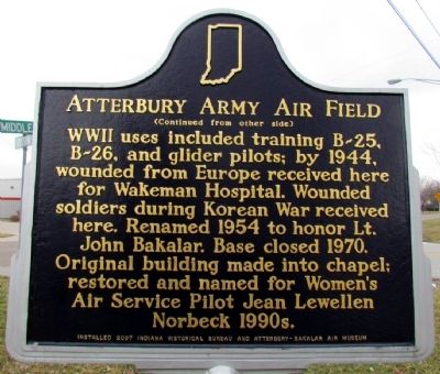
On Middle Rd at Grissom Ave, on the left when traveling north on Middle Rd.
(Front Side)
Construction begun summer 1942 under Captain Stratton O. Hammon, who used broad authority over laborers, suppliers, and railroad; base in use February 1943. More than 1,000 workers employed during construction. Base was over . . . — — Map (db m63819) HM
On Washington Street south of 3rd Street, on the right when traveling south.
County formed by Indiana General Assembly 1821. Thirty acres of land were purchased, and John Tipton donated thirty acres, for county seat. State commissioners named county seat Tiptona — after Tipton; local elected commissioners renamed it . . . — — Map (db m48105) HM
On Jackson Street south of 3rd Street (State Road 46), on the left when traveling south.
Revolutionary War Soldiers
buried in Bartholomew County
1776 ——— 1976
(Row One) - - William Campbell • John Carney • Joseph Carter • Arthur Chenoweth, Jr. • Thomas Cook • Richard H. Crittenden • Benjamin Ensley • . . . — — Map (db m48339) HM
On Washington Street south of 3rd Street (State Road 46), on the right when traveling south.
The Bartholomew County Memorial for veterans is a tribute to those living and dead who answered the Nations Call in the conflicts of the twentieth century.
Sherman Rhude 1897-1918 • Gordon Haggard 1908-1944 • John Arrington 1948-1967 • . . . — — Map (db m313317) WM
On Jackson Street south of 3rd Street (State Road 46), on the left when traveling south.
( Left Side )
- -( Seals )- - Branches of the United States Military
( Right Side )
They shall grow not old
as we that are left grow old
Age will not worry them
nor time condemn
But at the going down of the sun . . . — — Map (db m48337) WM
On Jackson Street south of 3rd Street (State Road 46), on the left when traveling south.
In Honor
of those who served
their Country in the World War
1917 — (Seal) — 1918
(American War Mothers)
Erected 1929
Bartholomew County War Mothers — — Map (db m48341) HM
On Jackson Street just south of 7th Street, on the right when traveling south.
In late 1800’s railroads and new technology opened national markets to Midwest producers, including Indiana, a leader in corn products. Joseph Gent patented operations and devices to mass-produce flaked corn. Gaff, Gent, & Thomas Co. Began making . . . — — Map (db m238476) HM
On 5th Street at Lafayette Avenue, on the left when traveling west on 5th Street.
has been designated a
National Historic Landmark
This building is an important work associated
with Modernism in architecture and possesses
national significance in commemorating the
history of the United States of America.
2001 . . . — — Map (db m251092) HM
On County Road 325W at Lowell Rd, on the right when traveling north on County Road 325W.
From 1830 to 1880 the community of Lowell Mills thrived here along Driftwood River. There were two grist mills, a cooperage, a shoemaker's shop, a distillery, a saw mill, a woolen mill, an inn and general store. When the mills closed, the town was . . . — — Map (db m63794) HM
On 17th St at Orinoco Ave, on the right when traveling west on 17th St.
(Front Side)
Incorporated and its factory built here 1890. Reorganized 1891; William H. Lincoln then led the company to great success, stressing quality and artistic merit in fine, high-grade furniture. By 1895, production included . . . — — Map (db m63818) HM
On 3rd Street (Indiana Route 46) west of Lafayette Avenue, on the right when traveling west.
Our Pioneer Heritage
Here, from the days of the frontier, the covered wagon, the Indian Wars, come reflections which make us feel humbly grateful for the vision, courage and sacrifice of our pioneer forebears which made possible the community . . . — — Map (db m242295) HM
Congregation was formed in 1879; reorganization in 1882 by the Reverend John R. Miller and a core of determined members. The present building, formerly a theater, was acquired in 1913. This African-American church, like many others, has served its . . . — — Map (db m248582) HM
On Lindsey Street, on the right when traveling south.
To the memory of
Gen. John Tipton
1786-1839
Founder of Columbus, Indiana
Gen. Joseph Bartholomew
1766-1840
Our county bears his name
Both heroes at Tippecanoe — — Map (db m242302) HM WM
On 10th Street at Reed Street, on the right when traveling east on 10th Street.
Second Baptist members Lizzie
Hubbard & Fannie Davis first
women registered to vote in
Bartholomew County after
partial suffrage act of 1917 — — Map (db m289212) HM
On 3rd Street at Jackson Street, on the left when traveling west on 3rd Street.
((The ‘greatest care’ has been given to get each person’s name correct. If any mistakes are found, please contact me so correction can be made. - - Al Wolf.))
Honor Roll
———
Bartholomew County . . . — — Map (db m48551) WM
On 2nd Street at Railroad Rd, in the median on 2nd Street.
Mandated by Indiana's 1836 Internal Improvement Act, construction began in Madison 1836. Completed along this site 1843; Elizabethtown platted 1845 as a result of the railroad. Completed to Indianapolis in 1847. Linked Ohio River and interior of . . . — — Map (db m63798) HM
Near E. Harrison St (State Road 46) at N. Jackson St.
Founded 1847 A.D.
by
Citizens of Hartsville. It was taken over by the Church of the United Brethren in Christ in 1849 - Opened as a college in 1850 - Burned January 30, 1898 - It was one of the first co-educational colleges in America.
. . . — — Map (db m63807) HM
On E. Harrison St (State Road 46) at N. Jackson St, on the right when traveling west on E. Harrison St.
Original site of coeducational United Brethren school founded 1850 as Hartsville Academy by public act of Indiana General Assembly. Campus moved four blocks south, circa 1865; destroyed by fire, January 1898. Many graduates became distinguished . . . — — Map (db m63805) HM
On E. Harrison St (State Road 46) at N. Washington St, on the right when traveling west on E. Harrison St.
Mitchell, Co. F, 27th Indiana Volunteers, is buried in
Hartsville Baptist Cemetery. He found Confederate General
Lee's "Lost" Special Orders No. 191 near Frederick, MD, September 13, 1862. Union General McClellan then engaged Lee at the Battle . . . — — Map (db m63806) HM
On Indiana Route 9 at North County Road 300, on the right when traveling south on Indiana Route 9.
Served throughout the entire Revolutionary War, including five years as a member of the most prestigious corps of the American Revolution –
General George Washington’s Life Guard. He now sleeps in peace in Sharon Cemetery. — — Map (db m167019) HM
On Indiana Route 135 north of Route 45, on the right when traveling north.
The Brown County Jamboree began
informally in Bean Blossom as a free
outdoor show featuring local musicians.
Gradually commercialized and
professionally promoted, the Jamboree
drew large crowds by 1941, including
attendees from other . . . — — Map (db m206706) HM
On State Road 46 at T C Steele Road, on the right when traveling east on State Road 46. Reported missing.
Theodore Clement Steele (1847-1926) lived and painted south of here, 1907-1926. Member of Hoosier Group of American impressionists, his landscape paintings captured picturesque panoramas characteristic of area. Property is State Historic Site; . . . — — Map (db m242256) HM
On East Main Street east of State Road 135, on the left when traveling east.
( West - Plaque )
Lest We Forget
From its inception in 1836, Brown County has given freely its sons and daughters to serve in the quest for World Peace. Its sacrifices began in 1846 with the Mexican War, and continued through the . . . — — Map (db m63223) WM
On South Van Buren Street (Indiana Route 135) south of East Main Street, on the left when traveling south.
Photographer, artist, and newspaper columnist Frank Hohenberger moved to Nashville in 1917. Through his black and white, large format photographs, he documented the residents, artists, daily life, traditions, and natural beauty of Brown County. . . . — — Map (db m184584) HM
On South Van Buren Street (Indiana Route 135) just south of West Main Street, on the right when traveling south.
Frank P. Taggart Building / Miller’s Drug Store, circa 1873, has been entered in the National Register of Historic Places by the United States Department of Interior. — — Map (db m206745) HM
On South Van Buren Street at West Main Street, on the right when traveling south on South Van Buren Street.
As a rising tide lifts all boats, so a sudden wind fills all sails. These soaring fall leaves, driven skyward by a sudden wind, are not only an iconic symbol of Brown County, but also represent Arts Village Brown County and Elder Heart rising . . . — — Map (db m312520) WM
On Jefferson Street North at West Main Street, on the right when traveling west on Jefferson Street North.
Attracted by the area’s natural beauty and its residents’ rustic lifestyles, a group of professional artists began working in Brown County by 1908. The Brown County Art Colony gained renown as its members exhibited regularly, first in the . . . — — Map (db m206708) HM
On East Main Street at South Van Buren Street ( Route 135) on East Main Street.
Ever since the year 1867, a public hostelry of one form or another has occupied this corner. It served the logging industry for many years & later became a gathering place for artists. In recent years it has become the cornerstone of the tourist . . . — — Map (db m206747) HM
On West Main Street at South Jefferson Street, on the left when traveling west on West Main Street.
The pump and pump house were reconstructed in 2017 courtesy of the Rotary Club of Brown County.
Prior to 1949, several pumps were in use around Nashville to provide water for families who were without a well on their property, and . . . — — Map (db m206742) HM
The work of a DNR land surveyor is connected to the work of the first surveyors who walked the property in the 1800s, but uses today's technology
Land surveyors locate the elevation and position of property points. Distances and angles . . . — — Map (db m249830) HM
Near Abe Martin Lodge Road east of Brown County State Park Road, on the right when traveling east.
Cartoonist and journalist Frank McKinney "Kin" Hubbard 1868-1930) was born in Ohio. He worked for the Indianapolis News by 1891, mainly as a political caricaturist. He created Abe Martin, his popular folksy and witty cartoon character, in 1904. . . . — — Map (db m244858) HM
Near Abe Martin Lodge Road 2 miles south of Road 46, on the right when traveling north.
The name of the lodge and its cabins comes from a time when the rugged hills of Brown County were the backdrop for homespun humor.
Rustic cabins provided the first lodging at Brown County State Park. Visitors bought their groceries at a . . . — — Map (db m244859) HM
On West Street north of Summit Street, on the right when traveling north.
Coeducational school founded 1884 by William W. Borden primarily to serve children of southern Indiana farmers. Low-cost, progressive program included teacher preparation and laboratory-based scientific studies. School closed 1906. Borden also . . . — — Map (db m74115) HM
Near Market Street at E. Main Street, on the left when traveling north.
Old Borden Tavern
Here William W. Borden’s mother kept a tavern 1824 to 1851. As a memorial to his parents, the Old Tavern, which was built in 1819, was incorporated into the buildings of the Borden Museum.
Borden Museum
Erected . . . — — Map (db m74116) HM
On Trail #7 east of State Park Drive, on the right when traveling north.
Steamboats brought crowds to Rose Island.
Most visitors traveled to Rose Island by steamboat. The steamer Idlewild made the 90-120 minute trip from Louisville every day of the season. Steamers like the Liberty and the Sunshine shuttled . . . — — Map (db m304151) HM
The Dinner Crowd
The Rose Island Restaurant could seat 500 guests at one time. An equal number could be accommodated in the outdoor dining room and in the dance hall, bringing the total seating to more than 1,600.
[Caption]: The outdoor . . . — — Map (db m304127) HM
On Trail #7 east of State Park Drive, in the median.
Creating a Tourist Mecca
David B.G. Rose (below left) bought the acreage in 1923 and renamed it Rose Island. Rose developed the peaceful picnic grounds into Rose Island Amusement Park – a major tourist destination for residents of the river . . . — — Map (db m303868) HM
On Jersey Avenue east of Ohio River Scenic Byway ( Road 62), on the left when traveling east.
Nearby is site of former popular Ohio River regional recreation area known from 1880s as Fern Grove. David Rose expanded facilities in 1923 – including an amusement park and a swimming pool – and named it Rose Island. Major access was by car to . . . — — Map (db m206818) HM
On Main Street east of Main Cross Street, on the right when traveling east.
Historic Charlestown was the seat of the Grand Lodge of Indiana its first year, 1818. In this frontier village Alexander Buckner, first Grand Master of Masons and later U.S. Senator from Missouri, practiced law. — — Map (db m206895) HM
On Trail #7 east of State Park Drive, on the right when traveling south.
Tickets Please
A wooden ticket booth (left) stood near the suspension bridge. Visitors arriving to Rose Island paid their entry fees here, then set off for a day of adventure at the park.
Watch Your Step
Look closely at the . . . — — Map (db m303890) HM
On Trail #7 east of State Park Drive, on the right when traveling south.
An Adventure to Begin the Day
To get to Rose Island, visitors drove a steep and winding road from Highway 62 to the west side of Fourteen Mile Creek. After parking their cars on the creek’s banks, visitors crossed the creek on a wooden . . . — — Map (db m303889) HM
On Market Street (State Road 3) 0.2 miles south of Clark Road, on the right when traveling south.
Indiana Territorial Delegate to
Congress, 1809-1816.
President of Indiana Constitutional
Convention, June, 1816.
First Governor of Indiana, 1816-1822.
Member of Congress, 1822-1830. — — Map (db m206887) HM
On Trail #7 east of State Park Drive, on the right when traveling north.
70% of Louisville was under water
Following weeks of heavy rains, the Ohio River swelled over its banks in the Great Flood of 1937. Ranging from Pittsburgh to Cairo, Ill., the flood is considered one of the most powerful of the 20th . . . — — Map (db m304153) HM
On Trail #7 east of State Park Road, on the right when traveling east.
Did You Know?
In the late 1800's there was no television and radio was in an experimental stage. The motion picture industry was still in its infancy. There were no computers, Internet or airplanes. Telephones did exist, but very few people . . . — — Map (db m304124) HM
Near Jersey Avenue 1 mile south of Ohio River Scenic Byway ( Road 62), on the right when traveling south.
… our parks and preserves are not mere picnicking places. They are rich storehouses of memories and reveries. They are a solace to the aged and an inspiration to the young. – Richard Lieber, Founder, Indiana State . . . — — Map (db m206872) HM
On Tunnel Mill Road, on the right when traveling south.
John Work, born 1760 in Pennsylvania, came with family to Clark County, Indiana Territory circa 1804. He purchased land along Fourteen Mile Creek in 1805 and later acquired extensive property in the county. Federal-style brick home here built circa . . . — — Map (db m206815) HM
On Main Street at Short Street, on the left when traveling east on Main Street.
Women’s rights activist and political strategist Mary Garrett Hay was born in Charlestown. She worked with the WCTU here and in Indianapolis in the late 1800s, honing her leadership and speaking skills and advancing women’s suffrage. Susan B. . . . — — Map (db m206885) HM
On Trail #7 east of State Park Drive, on the right when traveling north.
Catching a Steamer to Rose Island
Families eager to escape the heat in the city looked forward to a trip to Rose Island. They woke early, packed a picnic, and headed to the riverfront to catch a steamer. Jammed with people, the steamboat . . . — — Map (db m304131) HM
Near Patrol Road 0.7 miles north of Collector Wells Road, on the right when traveling north.
Since the beginning of history, people have been drawn to the river for water, food and transportation.
1. The Earliest People Several archaeological sites at Charlestown reveal stories of temporary camps. Mounds in this region date from the . . . — — Map (db m206831) HM
On Trail #7 east of State Park Drive, in the median.
All that remains
Building foundations, stone walkways, and the concrete swimming pool are all that remain of Rose Island Amusement Park. The natural succession from resort to field and forest, as well as the forces of the mighty Ohio River, . . . — — Map (db m303866) HM
Near an unnamed road 0.5 miles east of Jersey Avenue.
From the 1880s until the 1930s, a trip to either Fern Grove or Rose Island would not be complete without either a ride on a steamboat or a walk across a suspension bridge, along with a basket of fried chicken and a dance in the dance hall. . . . — — Map (db m206833) HM
On Trail #7 east of State Park Drive, on the right when traveling north.
From a Child’s Point of View
A day trip to Rose Island Amusement Park was easily the high point of the summer for many children. Decades later, every detail of the adventure is vividly recalled.
Recollection of Louis Deca, Jefferson . . . — — Map (db m304148) HM
On Trail #7 east of State Park Drive, on the right when traveling north.
A Charming Summer Home
With porches overlooking the Ohio River, 20 quaint cottages were available for rent as summer homes. Set just 100 feet from the river, the four-room bungalows were charming and comfortable, with a fantastic view. . . . — — Map (db m304129) HM
Perfect Ending to a Perfect Day
For guests at the Rose Island resort, an evening in the Dance Hall was the perfect end to a summer day. While live music played, couples waltzed and tangoed across the dance floor. By the late 1920s and early . . . — — Map (db m303893) HM
On State Park Drive 0.1 miles east of Jersey Avenue, on the right when traveling east.
From the 1880s until the 1930s, the Fern Grove and Rose Island resorts provided good fun and lively entertainment for generations. This trail will lead you down to the form site of these two parks, and take you back to the laughter and noise of a . . . — — Map (db m303860) HM
On Water Street at Harrison Street, on the right when traveling west on Water Street.
Built in 1812 by James Bigger
Scene of inaugural ball
held in 1816 for Jonathan Jennings
Indiana's first governor
and scene of infare for his marriage
with Clarissa Barbee in 1826 — — Map (db m206889) HM
Breezy river views
Perched at the base of the cliff but well above the high water mark, a quaint hotel offered grand views from its location just north of the Ohio River Gateway. Guests enjoyed cool river breezes from the hotel’s verandas and . . . — — Map (db m304157) HM
On Trail #7 east of State Park Drive, on the right when traveling east.
Making a Splash!
At a time when homes had no air conditioning, a dip in Rose Island’s swimming pool was the ultimate way to cool off on a hot summer day. Simmers could climb onto a round platform in the pool’s center and spin round and . . . — — Map (db m304122) HM
On Trail #7 east of State Park Drive, on the right when traveling west.
Animals all around
Zoos and exotic animals were popular amusements in the early 20th century, and Rose Island was part of the trend. Monkeys, raccoons, wolves, a groundhog, and alligators were among the menagerie. The best known resident of . . . — — Map (db m304149) HM
On Trail #7 east of State Park Drive, on the right when traveling east.
Trace the history of Rose Island through time. As time marches on, so does the history of this former resort. As you explore the park, find the reclamation logo and look around to see how nature is slowly reclaiming the land.
1700
Indian . . . — — Map (db m303869) HM
On Trail #7 north of Jersey Avenue, on the right when traveling north.
A Link to the Past
As you tour historic Rose Island, imagine crowds of visitors enjoying this bustling summer playground in the 1920s and 30s. Discover how people traveled to the park, and visit the places where they at, slept, and played. . . . — — Map (db m303863) HM
On Trail #7 north of Jersey Avenue, in the median.
Steamboats brought the visitors on day trips
Between 1923 and 1937, most visitors came to Rose Island by steamboat for day trips. Others rented cottages or stayed in the grand hotel. Rose Island was the most popular destination for miles . . . — — Map (db m304121) HM
On West Harrison Avenue, on the right when traveling south.
First American settlement in the Northwest Territory. 150,000 acres granted to George Rogers Clark and his troops by Virginia in 1781 for war services. Town named and tracts occupied by 1784. — — Map (db m292055) HM
On West Washington Street east of North Taggart Avenue, on the right when traveling east.
In commemoration of her visit to Clarksville High School, on June 16, 1958. Eleanor Roosevelt entered these doors to speak inside the Clarksville High School Gymnasium.
A crowd of nearly 1000 people, including Supreme Court Justice Sherman . . . — — Map (db m206964) HM
Near West Riverside Drive north of West Winbourne Avenue, on the left when traveling north.
Falls of the Ohio Fossil Beds
has been designated a
National Natural Landmark
This site possesses exceptional value as an illustration of the nation's natural heritage and contributes to a better understanding of the . . . — — Map (db m291783) HM
On Ohio River Scenic Byway 0.4 miles west of Main Street, on the left when traveling west.
By the Way: Lewis and Clark began their famous expedition from this area on October 26, 1803.
Almost 400 million years ago, during the Devonian age, future states Indiana and Kentucky were asleep beneath a warm tropical sea, located about . . . — — Map (db m206956) HM
Near Harrison Avenue west of Bailey Avenue, on the right when traveling east.
Near this site stood the home
of General George Rogers Clark
Pioneer - Soldier - Patriot
Conqueror of the Northwest Territory
who with dauntless heroism during the Revolutionary War invaded the enemy territory, captured the posts of . . . — — Map (db m245088) HM WM
On W. Winbourne Avenue at W Riverside Drive, on the right when traveling south on W. Winbourne Avenue.
History’s Great Explorers
Lewis & Clark
Acclaimed National Heroes
The Eastern Legacy
October 14, 1803
Meriwether Lewis came from Washington, D.C. and
met William Clark at the Falls of the Ohio
“When they shook hands, the Lewis . . . — — Map (db m103856) HM
Near West Riverside Drive north of West Winbourne Avenue, on the left when traveling north.
…our parks and preserves are not mere picnicking places. They are rich storehouses of memories and reveries. They are a solace to the aged and an inspiration to the young.
Richard Lieber, Founder
Indiana State . . . — — Map (db m290849) HM
Near West Riverside Drive north of West Winbourne Avenue, on the left when traveling north.
US Life Saving Station #10
The station was installed by the United States Life Saving Service on the banks of the Ohio River in 1881. Life Saving Station #10 was the only inland Life Saving Station in the U.S. It was located at the most . . . — — Map (db m290959) HM
Near Harrison Avenue west of Bailey Avenue, on the left when traveling west.
Near this site on October 26, 1803, Meriwether Lewis and William Clark with the nucleus of the Corps of Discovery together set off down the Ohio River on their epic journey to explore the Louisiana Purchase and Pacific Northwest. — — Map (db m206962) HM
Near West Riverside Drive north of West Winbourne Avenue, on the left when traveling north.
Before you is the McAlpine Dam, one of a coordinated system of 20 locks and dams on the Ohio River operated by the U.S. Army Corps of Engineers.
The Dam: Maintaining River Depth
Prior to construction of locks and dams, the river . . . — — Map (db m291787) HM
On W. Winbourne Avenue at W Riverside Drive, on the right when traveling south on W. Winbourne Avenue. Reported missing.
The Dam - The huge concrete wall that you see is the McAlpine Dam. Its main function is to control water levels for navigation, but its unusual shape, an elongated Z, also provides water for the hydroelectric station while keeping the fossil . . . — — Map (db m290988) HM
Near Ohio River Scenic Byway 0.1 miles west of Main Street, on the left when traveling west.
The Ohio River between Clark County, Indiana and Louisville, Kentucky, provides a treasure of historic bridges. The first bridge to your left is the George Rogers Clark Memorial Bridge, completed in Art-Deco style in 1929. Its original name was the . . . — — Map (db m198392) HM
On Zollman Road 0.4 miles east of Sunday Drive, on the left when traveling east.
Born and raised here on his family farm, entrepreneur Harland Sanders entered the restaurant business in the 1930s, serving food at his Corbin, Kentucky service station. By 1952, Sanders developed his patented method of cooking chicken and . . . — — Map (db m312060) HM
On State Road 160 east of Interstate 65, on the right when traveling east. Reported missing.
Founder of Kentucky Fried Chicken
Erected 1987 by these Local Franchisees:
Mr. & Mrs. Robert Bagshaw
Mr. & Mrs. William Bridges
Mr. & Mrs. William Bright
Mr. & Mrs. Roy Burchel
Mr. & Mrs. Lee Cummings
Mr. & Mrs. Ralph . . . — — Map (db m245085) HM
On Winding Road 0.1 miles west of U.S. 31, on the left when traveling west.
Indiana's oldest state forest, established 1903. Portions of Clark's Grant (1781) included in original 2.000 acres. Experimental plantings and reforestation began 1904; became national models in scientific forestry. Multiple land uses include timber . . . — — Map (db m244937) HM
Near Mulberry Street south of West Maple Street, on the left when traveling south.
Construction on the $4.7 million George Rogers Clark Memorial Bridge started in June 28 and took just over a year to complete with the opening being held October 31, 1929.
President Herbert Hoover attended the dedication of the bridge which . . . — — Map (db m186830) HM
On Patrol Road south of Trey Street, on the right when traveling south.
Charlestown Indiana in the summer of 1940 was a quiet town with a population of 900. By December of that same year the population had grown to over 13,400. Of this number over 10,000 residents worked at a single plant. The “boom” in Charlestown . . . — — Map (db m206901) HM
On Spring Street, on the right when traveling south.
Many "cafes" in the 1930's were a front for what was really happening within. The gambling in Clark County goes as far back as 1809 when Major John Harrison developed the Jeffersonville Springs. It was about a mile and a half north of Jeffersonville . . . — — Map (db m241649) HM
Near Mulberry Street south of West Maple Street, on the left when traveling south.
In 1887, the Louisville and Jeffersonville Bridge Company formed to serve as a recelevership in the creation of the Big Four Bridge, which was built to carry the Cleveland, Cincinnati, Chicago and St Louis Railway.
On December 15, 1893, . . . — — Map (db m186834) HM
Near Mulberry Street south of West Maple Street, on the left when traveling south.
Big Four Railroad Bridge was converted into a pedestrian/bicycle path in 2013. The bridge was originally built in 1895 to provide rail access for freight and passengers between Jeffersonville and Louisville. It was closed in 1969.
The distance . . . — — Map (db m186839) HM
On West Market Street at Mulberry Street, on the right when traveling east on West Market Street.
Forty-two workers perished during construction of this bridge, which was built between 1888 and 1895. Through the years, the bridge has been hailed as a monument to those who lost their lives.
In 1929, a new bridge was built inside the old . . . — — Map (db m186837) HM
On East Park Place east of Crestview Court, on the right when traveling east.
Site of Jefferson General Hospital, the third largest hospital in the United States during the Civil War. Under Dr. Middleton Goldsmith's command it served over 16, 000 patients. — — Map (db m46647) HM
On Mulberry Street south of West Chestnut Street, on the right when traveling south.
( Top Section )
Civil War Cemetery
On this site, 1861 - 1865, are buried several hundred Union and Confederate Soldiers. Killed in the Western Campaign. Lack of interest from distant families allowed deterioration of the wood grave . . . — — Map (db m46670) WM
Near Mulberry Street south of West Maple Street, on the left when traveling south.
The flood of 1937 was the largest flood known in the modern era in the Louisville area.
The Ohio River stretched to be 10 miles wide, with 70% of Louisville submerged and 90% of Jeffersonville. Estimated damage was $250 million which translates . . . — — Map (db m186840) HM
1432 entries matched your criteria. The first 100 are listed above. Next 100 ⊳