Dale
Barrows
Sept. 25, 1920
Mar. 19, 1945
Leo
Dittrich
Apr. 21, 1887
Nov. 5, 1918
Ronald
Noldner
June 25, 1947
Aug. 8, 1968
All
Gave
Some
Some
Gave
All
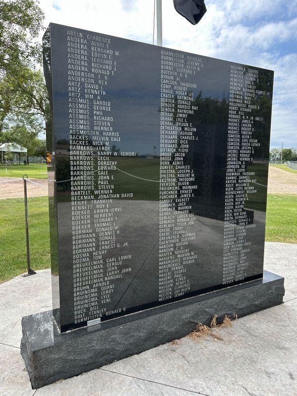
Abeln, Clarence ·
Andera, Alvin E. · . . . — — Map (db m137488) WM
On Commercial Avenue (U.S. 14) south of Cardinal Street, on the left when traveling south.
Wolsey: A Crossroad of the Heartland
Wolsey has been a crossroad of the heartland of South Dakota from its beginnings. In 1880 the Dakota Central Railway, a subsidiary of the Chicago & North Western, laid track following a wagon trail called . . . — — Map (db m123906) HM
On U.S. 14 at 391st Avenue, on the right when traveling west on U.S. 14.
Prairie Plants: More Than Meets the Eye
What appears at first glance to be an endless sea of grass is actually a wildly diverse community of plants. More than 100 different species of plants may be found in fewer than 5 acres of native . . . — — Map (db m279390) HM
On U.S. 14 at 391st Avenue, on the right when traveling west on U.S. 14.
Duck Factory of North America
Receding glaciers sculpted the shallow
wetlands of the Prairie Pothole Region,
making the region a magnet for waterfowl.
Ten thousand years ago, melting glaciers created millions of shallow depressions . . . — — Map (db m279360) HM
Near U.S. 14 at 391st Avenue, on the right when traveling west.
National Wildlife Refuge System
Centennial Time Capsule for the
Huron Wetland Management District
Committed on March 14, 2003
To be opened on March 14, 2103 — — Map (db m279359) HM
On Cemetery Road 0.2 miles west of Main Street, on the left when traveling west.
The church was built in 1893 by Bohemian pioneers. Relocated to Kimball and restored in 1982. Contains Bohemian artwork and artifacts of more than 100-year vintage. Intricate altars make a striking setting for weddings and is enjoyed by tour groups. . . . — — Map (db m271836) HM
On Main Street at 6th Street, on the right when traveling south on Main Street.
In honor and memory of those who served in the Armed Forces of the United States of America.
They made the supreme sacrifice
They died for liberty
They died for us
They are at rest
We the Kimball veterans wish to honor our . . . — — Map (db m271840) WM
On State Highway 47 just north of Lower Road, on the left when traveling north.
In memory of the Dakota whose lives were taken at Fort Thompson in 1863, these were the innocent exiled from Minnesota, who suffered hardship and sickness at this camp.
The stone that stands here, reminds us of the land from which you came. . . . — — Map (db m185463) HM WM
On State Highway 47 north of Lower Road, on the right when traveling south.
A Crow Creek Sioux dancer at a powwow.
Courtesy of South Dakota Public Broadcasting
The Crow Creek Reservation began in a tragic story of hardship. The Uprising, or the U.S. – Dakota War, started in 1862 when starving Dakota . . . — — Map (db m242476) HM
On State Highway 47 north of Lower Road, on the right when traveling south.
Dancers at a Lower Brule Sioux powwow.
Courtesy of Central Dakota Times, Debi Ruiz
For thousands of years, ancestors of the Kul Wicasa Oyate, members of the Lakota band known as the Sicangu (burnt or scorched thigh), . . . — — Map (db m242478) HM
On State Highway 47 north of Lower Road, on the right when traveling south.
Indigenous peoples throughout the West have used medicine wheels of many forms. For thousands of years, Native peoples have used this wheel pattern for health and healing.
The Spirit of the Circle Monument honors and remembers . . . — — Map (db m242477) HM
The statistical center of population for South Dakota in 2000,
according to the Census Bureau and the National Geodetic Survey,
lies at the point 3.2 miles northwesterly from this monument.
The center is at Latitude 44 degrees 02 . . . — — Map (db m125779) HM
On 401st Avenue north of 295th Street, on the right when traveling north.
I, the Lord, was there at the beginning, and I, the Lord God, will be there at the end. Isaiah 41:4
Bohemian Protestant homesteaders organized in 1895 with services in member homes
Incorportated in 1902 as Bohemian-Moravian . . . — — Map (db m313509) HM
On 390th Avenue 0.2 miles north of County Road 2, on the right when traveling north.
This monument commemorates the Yankton Sioux Treaty of 1858.
As increasing numbers of settlers came upriver, the Yankton Sioux had to decide whether to join other Sioux tribes in armed resistance or to co-exist with the immigrants. They . . . — — Map (db m217461) HM
On 390th Avenue 0.2 miles north of County Road 2, on the right when traveling north.
In memory of the Yankton Chiefs, who made the Treaty of 1858.
Struck by the Ree ·
Black Bear ·
Medicine Cow ·
White Swan ·
Pretty Boy ·
Feather in the Ear ·
Crazy Bull ·
Frank Deloria
Sioux
Delegates who signed the . . . — — Map (db m217464) HM
On Front Avenue Southeast at 1st Street Southeast, on the right when traveling south on Front Avenue Southeast.
Army Navy Air Force Marine Corps Coast Guard Merchant Marine
Duty · Honor · Country · Freedom
In honor of the brave men and women of the Armed Forces of the United States of America who served for our great country so each . . . — — Map (db m217530) WM
On 297th Street (State Highway 46) 0.2 miles east of Front Avenue Southeast, on the right when traveling west.
of the men and women of Company A
153rd En Bn who served in support of
Operation Iraqi Freedom II.
07 December 2003 to 01 March 2005
A Company Roster
Commander - CPT Gregory R. Darlow
First Sergeant - 1SG John L. Noyes . . . — — Map (db m217633) WM
On Wagner Lake Road 0.2 miles north of 297th Street (South Dakota Highway 46), on the right when traveling north.
Lewis and Clark
The Lewis and Clark Expedition, officially the Corps of Discovery, was in what is now South Dakota from August 21 to October 14, 1804 and from August 21 to September 4, 1806.
While here they would make numerous . . . — — Map (db m313461) HM
Dedicated 1996
To Those Who
Served Our Country
All Gave Some
Some Gave All
These Gave All
Marion B. Develder, Henry Hoekman, Alan A. Buckles, Leon D. Biesheuvel
Frank W. Everson, Joseph Tegethoff, Roy E.G. Mullen, John . . . — — Map (db m137489) WM
On 276th Street (U.S. 281) 0.4 miles west of 392nd Avenue, on the right when traveling west.
A great town while it lasted, Grand View became Douglas County's third county seat when it won out over Huston, the second and Douglas City by 11 votes in 1882. Brownsdale the first, a phantom city, had been a brief but expensive luxury. Grand View . . . — — Map (db m180686) HM
On 269th Street 0.2 miles east of 383rd Avenue, on the right when traveling west.
1900—1947
1948—1979
Organized August 21, 1887 by Scandinavian settlers
First pastor Rev. George Norbeck
First structure destroyed by lightning 1947
"Heaven and earth will pass away, but my words will not pass away." Matt. . . . — — Map (db m313361) HM
On East Main Street east of North Broadway Street, on the right when traveling west.
In Memory
John Kurtz, Sept. 18, 1918.
Michael Laib, Oct. 12, 1918.
Jos. H. Breitbach, Oct. 14, 1918.
Earl E. Berry, Oct. 15, 1918,
August Bremer, Oct. 15, 1918.
Howard T. Huey, Nov. 1, 1918.
In Memory
Reinhold Albrecht and . . . — — Map (db m237275) WM
On West Main Street west of Wilson Street, on the right when traveling west.
← Onion House
Built in 1902 and listed on the Nat'l Historic Register. Named for the onion shaped metallic dome.
Bluebird Locker →
Business began in 1944 and known regionally for its "Delmont Sausage". Business uses . . . — — Map (db m234939) HM
On Mellette Street south of 2nd Avenue, on the right when traveling south.
In memory of past – present – future
Army Marine Navy Air Force Merchant Marine
National Guard Coast Guard
Left wall:
Civil War
Franklin Bennett ·
Matthew Biggins ·
Joe Chastain ·
Perry Ellis ·
John . . . — — Map (db m237286) WM
On Mellette Street north of 1st Avenue, on the left when traveling north.
Bonesteel
South Dakota
Quasquicentennial
1892 - 2017
Pride in the Past Faith in the Future
One of the iron posts used to mark the corner of the Fort Randall Military Reservation was originally located approximately two miles east and . . . — — Map (db m234936) HM
On Mellette Street north of 1st Avenue, on the left when traveling north.
Bonesteel
South Dakota
Quasquicentennial
1892 - 2017
Pride in the Past Faith in the Future
Legacy Park was built in observance of the State Centennial in 1989 and the City of Bonesteel Centennial in 1992. In 2017, Bonesteel celebrated . . . — — Map (db m235029) HM
On Mellette Street north of 1st Avenue, on the left when traveling north.
Bonesteel
South Dakota
Quasquicentennial
1892 - 2017
Pride in the Past Faith in the Future
In 1893, fifty-seven numbered quartzite markers were placed on the South Dakota-Nebraska border beginning at the Keya Paha River and proceeding . . . — — Map (db m234935) HM
The town was named for H.E. Bonesteel, early day freighter. Its first postmaster was Francis M. Safeser, 1 August 1892. By 1905 it had 754 people and had made the Big Time Headlines. It came about his way. In 1902 the railroad reached Bonesteel . . . — — Map (db m234830) HM
On East 3rd Street (198th Street) at Carney Avenue, on the right when traveling east on East 3rd Street (198th Street).
Ree Heights Roadside Park
The railroad beat the settlers into this area where farms are giving way to cattle ranches, now as it was then. Ree Heights first postmaster was Wm. H. Love 8 June 1882. Three miles South are the Ree Heights, . . . — — Map (db m185461) HM
On South Dakota Route 25 at 244th Street, on the right when traveling north on South Dakota Route 25.
The town of Epiphany came into being between the years 1889-1892 and was named by Bishop Martin Marty. In 1893 Father William Kroeger a Catholic priest and medical doctor established the town of “Kroeger”. He built his own laboratory where he made . . . — — Map (db m179876) HM
On East Main Street at Othella St, on the right when traveling east on East Main Street.
All Gave Some
Some Gave All
This Memorial is Dedicated
To all Veterans Who have
Served our Country
To Preserve Democracy,
Liberty, and Freedom — — Map (db m119553) WM
Improved By
City of Parkston
and
Works Progress Administration
Project Number 2974
1938
City Officials
Mayor - W.A. Koehn
Councilmen
M. Hohenthaner
Fred Ceidel
H.K. Meisenhoelder
Edward E. . . . — — Map (db m119555) HM
On Dunham Street 0.2 miles south of Main Street East, on the left when traveling south.
This glacial granite boulder will far outlast all memory of man, I humbly ask of it to be the keeper of my message:
"Thanks for the miracle of life"
I dedicate this in memory of my grandparents, Jefferson and Mary Jane Hand . . . — — Map (db m180806) HM
Notice the top wire of fence is made of an unusual old wire type. There was a great demand for barbed wire because the west was being rapidly settled and this was a way to control cattle and identify private property. In order to circumvent the . . . — — Map (db m263127) HM
The large tree in the draw started growing in 1717 according to a sample taken by a State Forester, which makes it over 289 years old. The United States didn't become a country until 1776. There is one oak tree in the park that is nearly 400 years . . . — — Map (db m263126) HM
On West Main Street east of Dakota Avenue, on the right when traveling east.
The Wessington Springs Carnegie Library, built in 1917 at a cost of $7,000 is the last of 25 South Dakota public libraries financed by steel magnate Andrew Carnegie through the Carnegie Library Building Program. Since its formal opening on February . . . — — Map (db m180762) HM
Indians were drawn to this area for protection, abundant water and wildlife. The park area was once known as a neutral ground where different tribes and fur traders could come in peace to trade their goods. The city's name came from the Natural . . . — — Map (db m263135) HM
Near Dunham Street west of Cemetery Road, on the right when traveling south.
Cleveland T. Hall is credited by records of historical societies and of the U.S. Department of the Army with carrying the message which saved our nation's capital at the only time it has been seriously threatened by an invasion of enemy forces. . . . — — Map (db m180766) HM
Near State Highway 34 0.3 miles west of Dakota Avenue South, on the right when traveling west.
Wessington Springs is home to our state's 7th Governor who served from 1909-1913. He came to Jerauld County as one of the early pioneers, starting in the sheep business before entering banking and real estate. Robert & Florence Vessey built their . . . — — Map (db m180809) HM
Near State Highway 34 0.3 miles west of Dakota Avenue South, on the right when traveling west.
Up here out of the draw the wind blows harder and the sun is hotter. This makes it drier. These climatic factors produce a grassland instead of a forest. The predominant grass in this area is smooth brome. Native Americans often used wild plants for . . . — — Map (db m263132) HM
Near State Highway 34 0.3 miles west of Dakota Avenue South, on the right when traveling west.
Remnants of this historic trail can be seen just south of Hwy 34 along the ridge. In 1857 Nobles Trail was built by Col. W.H. Nobles, from Mendota (the mouth of the Minnesota) via Fort Ridgley to the Missouri River. It was to be a wagon road from . . . — — Map (db m180810) HM
Anton Reindl, a stone mason who immigrated to Jerauld County with his wife from Austria, was hired to construct a bridge across the creek. The bridge is an arch supported by its own weight & was completed in 1895, over 111 years ago. The old willow . . . — — Map (db m263128) HM
Man has many effects on the environment. Some are detrimental. The grass in this area is smooth brome. Brome was introduced from Europe in the early days of settlement. Brome has spread and replaced native species of herbs and grasses. A solid stand . . . — — Map (db m263121) HM
On Dakota Avenue South at 1st Street SW, on the right when traveling north on Dakota Avenue South.
This courthouse was built in 1930 at a cost of $120,000. It had an unusual design for a courthouse at that time, being Modern American instead of Classical. The exterior is brick, trimmed with Bedford Stone. The interior has terrazzo floors, . . . — — Map (db m124590) HM
Near Alene Avenue South south of 1st Street Southwest.
In the year 1934, this hill was designated as Legion Hill to honor the veterans of World War I. In this year of 2007, this plaque is being placed on Legion Hill to honor these veterans and all men and women from all branches of service, including . . . — — Map (db m180756) HM WM
On 1st Street Southwest 0.1 miles south of West Main Street, on the left when traveling west.
In 1934 this hill was designated as Legion Hill to honor the veterans of World War I with a stone monument still in its original location at the top of the hill. In 2007 a plaque was placed on the monument to honor these WWI veterans and all men and . . . — — Map (db m180807) HM
On 2nd Street Southwest 0.1 miles east of Dakota Avenue South, on the right when traveling west.
The Field House was built by the W.P.A. in 1936. The government formed the W.P.A. (Works Progress Administration) to create jobs during the Great Depression. Native stone was hauled from local fields to keep the costs down. The building features a . . . — — Map (db m180706) HM
On 2nd Street Southwest 0.1 miles west of Dakota Avenue, on the right when traveling west.
The area within about a 5 mile radius of this site was considered a neutral area by all Indians. French traders set up a trading post every fall near the big spring. There was no fighting; competing tribes camped side-by-side. However, it is fairly . . . — — Map (db m180747) HM
On 2nd Street Southwest 0.1 miles west of Dakota Avenue, on the right when traveling west.
This marks a camp-site of Dakota's first highway 1857, known as Noble's Trail, from Ft. Ridgley, Minn., to the Missouri River.
Also marks the site of Levi Hain's log cabin, erected 1876. — — Map (db m180749) HM
As you make your way up the trail, imagine yourself as one of the early settlers in the late 1870's following the original wagon route. The Old Grade served as the main road to and from Wessington Springs for many years until the present Highway 34 . . . — — Map (db m263124) HM
Near State Highway 34 0.3 miles west of Dakota Avenue South, on the right when traveling west.
Native Americans utilized the many plants along the Old Grade for food and medicine. Early white inhabitants also took advantage of the many fruits and plants that grow here including gooseberries, chokecherries, plums, wild grapes, wild . . . — — Map (db m263129) HM
On South Dakota Route 34 0.3 miles west of Dakota Avenue South.
Robert S. Vessey was born near Oshkosh, Wisconsin, May 16, 1858. His father was a minister-farmer with a family of 15 children. He attended common school, but dropped out at an early age to work and assist in the support of his father’s family. He . . . — — Map (db m180805) HM
On 228th Street (South Dakota Route 34) 0.3 miles west of Dakota Avenue South.
A.J. Gebhart designed and built the ski lift assisted by Lloyd Marken. The electric powered apparatus was installed in February of 1956 and kept a 1,200 foot circle of rope rotating to safely pull sled, ski, toboggan, or scoop shovel users back to . . . — — Map (db m113045) HM
On 6th St N 0.1 miles north of 4th St. NW, on the left when traveling north.
Shakespeare Garden
Modeled after Shakespeare Garden near Stratford-upon-Avon, England over 150 varieties of flowers, trees and shrubs. Only garden of its kind in South Dakota.
Ann Hathaway Cottage
This home was styled . . . — — Map (db m113051) HM
On Dakota Avenue South at 1st Street Southwest, on the right when traveling south on Dakota Avenue South.
Paul Pawlowski
Played for the "OWLS" in 1948
As a "pick up" player in the State Tournament
Played amateur baseball from 1934 to 1952
Competed in 6 amateur baseball State Tournaments
Inducted in the SD Hall of Fame in 2002
Lyle . . . — — Map (db m263203) HM
In 1916 Foster Stratton erected a two-story brick building on this site. It held a garage and machine shop on the lower level, with a photography studio and living quarters on the second floor. When the building was razed in 1989, the Stratton . . . — — Map (db m113050) HM
Near Dakota Avenue South at 4th Street Southeast, on the right when traveling south.
Smooth Sumac shrubs are very prominent here near the ski area and in the hills and gulches nearby. Their great numbers help to stabilize the soil preventing erosion and landslides. As a forest moves up the hillside, one of the first plants you see . . . — — Map (db m263134) HM
The Shakespeare Garden, founded 1927, was planned and developed by Clark W. and Emma Freeland Shay and is maintained as a memorial to them. Together they served the Wessington Springs College as instructors and advisors for a total of 83 . . . — — Map (db m113052) HM
Near College Avenue South south of 1st Street Southwest, on the left when traveling south.
This indention in the ground is the site of the first home in Jerauld County. Levi Hain and his wife, Maribee began with a sod house in 1876 and soon after built a log cabin. They sold their home and land to Rev. A.B. Smart in 1880 and the cabin . . . — — Map (db m180704) HM
Near 228th Street (South Dakota Route 34) 0.3 miles west of Dakota Avenue South.
Wood and water were essential to pioneer road builders and in 1857, when the Fort Ridgely & South Pass Wagon Road was built by Col. W.H. Nobles, the springs at Wessington Hills was a natural on the Reconnaissance to the Missouri River. On the . . . — — Map (db m180808) HM
On College Avenue South 0.2 miles south of West Main Street, on the right when traveling south.
Springs that flow into the park along with an old legend about a trapper named Wessington is how Wessington Springs got its name. Legend has it that Wessington was burned by the Indians while tied to a tree in what is now the city park. Our First . . . — — Map (db m180753) HM
On Burrett St SE at Wallace Ave S on Burrett St SE.
(Main Memorial)
This memorial is dedicated to those men and women who served our country in times of war and peace and especially to those who gave their lives in that service.
(World War I Stone)
In Commemoration of the Patriotism of our . . . — — Map (db m113054) WM
On 481st Avenue south of 296th Street, on the right when traveling south.
This is the site of the founding of the Nathanael Lutheran Church 16th day of May 1885.
A band of Swedish immigrants joined together to build a church on the prairies of Lincoln County, S.D. From this small beginning the prayers of these . . . — — Map (db m293368) HM
On Fourth Street at Hubbard Street, on the right when traveling south on Fourth Street.
I pledge allegiance to the Flag of the United States of America and to the Republic for which it stands one Nation under God, indivisible, with liberty and justice for all
* Killed in ActionVeteran's Prayer
Father of us . . . — — Map (db m293366) WM
On 233rd Street (State Highway 34) west of 421st Avenue, on the right when traveling east. Reported missing.
Around 1895 the first Fedora village school was the Root School located in section 9 later moved to section 10. In 1905 a new two story wood school was built and used for grades one through ten located two blocks south of this marker on the west . . . — — Map (db m124601) HM
On 233rd Street (State Highway 34) west of 421st Avenue, on the right when traveling east.
(side 1)
On June 13, 1943, three B-17 bombers of the 393rd Bomb Group — the “Flying Sioux” — left the Sioux City, Iowa, airbase on a routine training mission. The pilots of flights 446, 750 and 790 flew rigorously . . . — — Map (db m124600) HM WM
On 233rd Street (State Highway 34) west of South Maple Street, on the right when traveling west.
The Howard Public Library was the first public library chartered in Dakota Territory. Charter No. 1 was issued to the Ladies Library Association of Howard on January 8, 1886, by M.L. McCormick, Territorial Secretary. In 1889, the City of Howard . . . — — Map (db m124599) HM
On 233rd Street (State Highway 34) east of South Main Street, on the right when traveling west.
Dedicated to those who answered our nations call in the pursuit of freedom
Army Air Force Marine Corps
Navy Coast Guard Merchant Marines — — Map (db m238322) WM
On 228th Street east of 437th Avenue, on the right when traveling east.
This 2-part structure is what survived from the mini-community of Nansen. The name, probably given by the adjacent creamery operator, A A Henden, came from a revered then-famous Norwegian Fridtjof Nansen. Another store or two may have operated . . . — — Map (db m253796) HM
On 433rd Avenue (State Highway 25) 0.1 miles south of 229th Street, on the left when traveling south.
In 1886, the town of St. Marys was platted by Dr. Louis Gotthelf and named for his daughter Mary. According to a notice of his death in 1905, Dr. Gotthelf was born in Berlin, Prussia, in 1821, graduated from medical college in 1843, and was . . . — — Map (db m267182) HM
Near 229th Street 0.3 miles west of 433rd Avenue ( Highway 25), on the right when traveling west.
The town of St. Marys was platted by Dr. Louis Gotthelf in 1886. A post-WWI land boom spurred the establishment of new businesses in 1919, with the town becoming a trade center on a Chicago and North Western Railroad line. The name of the town was . . . — — Map (db m267184) HM
On 255th Street 0.2 miles west of 255th Street, on the right when traveling west.
In 1908 the Western Bridge and Construction Co. of Omaha, Nebraska, built this Pratt-Through Truss Bridge. Workers fastened beams together with diagonal bracing to create a strong rigid framework. Each beam of a truss bridge shares a portion of the . . . — — Map (db m184708) HM
Near 252nd Street east of 481st Avenue, on the right when traveling west.
Within short distance of this hill of peace eleven original pioneer families came in 1873 to claim the land and to give us birth
Johannes E. Berdahl ·
Mrs. Lars Brandvold ·
C. O. Henjum ·
Synneve Henjum ·
Thor Hermanson ·
Olaus . . . — — Map (db m208421) HM
Side 1 The Reconstruction Finance Corporation (RFC) granted a $410,000 relief loan to South Dakota in 1932, the third year of the Great Depression, Garretson became one of five towns in the county allotted funds.
Its City Council then . . . — — Map (db m188833) HM
On 5th Street (Local Route 5th) 0.2 miles west of Main Street, on the right when traveling west.
Two events in the 1870s in eastern Minnehaha County, Dakota Territory, provided the stimulus leading to the beginning of the town of Garretson. The first was the founding of the now-vanished village of Palisade, often referred to as Garretson’s . . . — — Map (db m69089) HM
Near 252nd Street east of 481st Avenue, on the right when traveling east.
Norway Lutheran Church was established by Norwegian-American pioneers on March 23, 1874 in Minnehaha County, Dakota Territory. They met in sod houses, schools and a lean-to until the building was completed. Land, where the church could be seen and . . . — — Map (db m208420) HM
Near 252nd Street east of 481st Avenue, on the right when traveling east.
This bell that called the people to worship is placed here to the memory of the men and women who endured the dangers and hardships of pioneer life, and still found time and money to build churches for themselves and for those who should follow . . . — — Map (db m208422) HM
Palisades State Park
Palisades State Park began with an initial gift of 20 acres from Mrs. Winona Axtell Lyon in 1947. During the next twenty years, smaller tracts were added to the park as money to purchase them became available. In 1969, . . . — — Map (db m208240) HM
On 252nd Street east of 479th Avenue, on the right when traveling east.
One of the deepest desires of Norwegian immigrants who settled in this area of the Slip-Up Creek was to have a church where they and their children might hear the saving gospel. On December 17, 1873, O. O. Sando, a circuit-riding preacher who served . . . — — Map (db m208419) HM
On Devil's Gulch Park Road 0.5 miles north of 5th Street, on the left when traveling north.
Imagine a fall day in 1876. A man approaches, galloping on his horse as fast as they can go. They are trying to escape a posse after robbing a bank in Northfield, Minnesota. The man has already divided ways with his brother to help evade the lawmen, . . . — — Map (db m187036) HM
Settlers homesteaded in this area beginning in 1865. A feed and flour mill was built in the early 1870's, with power from a large wooden dam across Split Rock Creek east of this marker. A town, complete with three stores, livery barn, blacksmith . . . — — Map (db m208239) HM
On Picotte Street at East 4th Street, on the right when traveling north on Picotte Street.
Born at Ft. Tecumseh (Pierre), the son of Honore Picotte, an American Fur Co. factor and Eagle Woman, he was educated at St. Louis. Marrying a Yancton woman, he became a leader in that Band and was influential in the Treaty of 1858 ceding land and . . . — — Map (db m177658) HM
On West 6th Street at Douglas Avenue, on the right when traveling east on West 6th Street.
Founded in 1861
by
The Rev. Melancthon Hoyt, D.D., LL. D.
First Missionary to Settle in
Dakota Territory
This Building is the Third
Church Home of
The Yankton Episcopal Parish. — — Map (db m177979) HM
On West Third Street at Broadway Avenue (U.S. 81), on the right when traveling east on West Third Street.
The Yankton County Courthouse stood at this site from 1905 to 2003. The handsome three-story building was dedicated Nov. 1, 1905. Speakers at that event estimated it would have "a long life of 25 years." The building far exceeded those expectations . . . — — Map (db m742) HM
This Property has been
Placed on the
NATIONAL REGISTER
OF HISTORIC PLACES
By the United States
Department of the Interior
Built 1886
— — Map (db m135988) HM
Near Meridian Bridge 0.4 miles south of West 4th Street (State Highway 50).
The Missouri River creates a crossroads of cultures and creativity. The river has been an artery to the upper plains for thousands of years. The Missouri River was first explored in earnest by the Lewis and Clark Expedition in the early 19th . . . — — Map (db m177903) HM
On Cedar Street south of West 4th Street ( Highway 50), on the right when traveling south.
In September 1862 - after a skirmish with Hostile Indians near James River, it was determined to finish stockade at once, north wall being of sod with ditch in front already finished, and East wall of posts with boards on either side with earth . . . — — Map (db m211589) HM
On East 3rd Street at Mulberry Street on East 3rd Street.
C. J. Holman, for a Sioux City group, rivals of Frost, Todd & Co.'s Upper Missouri Land Company came in March 1858, was run off by threatening Indians but returned in May and built cabin, after fracas with F. T. & Co. employees and lived there till . . . — — Map (db m177606) HM
On Cedar Street 0.1 miles south of West 4th Street, on the right when traveling south.
Dakota Territories first bank was that of Mark M. Parmer started at Yankton in September, 1869 which became the private banking partnership of Parmer and Moses K. Armstrong in 1872. On December 27, 1872, the First National Bank of Yankton, a . . . — — Map (db m177711) HM
On East 4th Street (South Dakota Route 50) at Capital Street, on the right when traveling west on East 4th Street.
Dakota Territory, extending N to Canada and W to the summit of the Rockies, a fourth larger than Texas, was created March 2, 1861. Lincoln appointed William Jayne Governor and he arrived at Yankton June 8th. Dakota had 2,326 white citizens; the . . . — — Map (db m177859) HM
Near Meridian Bridge 0.4 miles south of West 4th Street (State Route 50).
Originally named Strahmsburg after Saby Strahm who platted the town in 1872, Green Island grew to an estimated population of 150 by 1881. The village had two churches, a school, post office, general store, hotel, and a blacksmith's shop. In spite . . . — — Map (db m177901) HM
On 31st Street (South Dakota Route 50) at Fox Run Parkway, on the right when traveling west on 31st Street.
"Wild Bill" Hickok, famous gunman, was shot in the back of the head at Deadwood on August 2, 1876 by Jack McCall, who was tried for murder at Yankton on 4-5-6 December, found guilty, sentenced by Judge Peter C. Shannon on January 3, 1877. The . . . — — Map (db m177713) HM
On West 4th Street (State Highway 50) at Walnut Street, on the right when traveling east on West 4th Street.
100 ft. South is office of Dakota's oldest newspaper. Weekly Dakotian, June 6, 1861. Yankton Press, Aug. 10, 1870. Weekly Press & Dakotian November 20, 1873. Daily Press & Dakotan April 26, 1875. — — Map (db m211683) HM
On West Riverside Drive 0.3 miles south of West 4th Street (State Highway 50).
The Meridian Bridge has been an icon of Yankton and the Missouri River for many years. With its completion in 1924, the permanent structure spanning the river replaced unreliable ferries and seasonal pontoons. It derives its name from the Meridian . . . — — Map (db m177900) HM
117 entries matched your criteria. The first 100 are listed above. The final 17 ⊳