By Jason Voigt, June 10, 2026
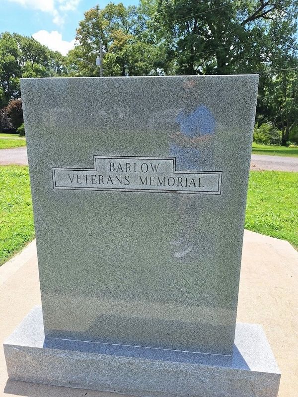
Barlow Veterans Memorial
| On Broadway Street (U.S. 60) at Bryant Drive, on the right when traveling east on Broadway Street. |
| On Blandville Road (State Road 1837) at Perry Drive, in the median on Blandville Road. |
| On Paducah Road (U.S. 60) 0.4 miles east of Stafford Road, on the right when traveling east. |
| On Blandville Road (Kentucky Route 1837) at Pepper Drive, in the median on Blandville Road. |
| Near Green Street (U.S. 60) west of 1 Street, on the right when traveling west. |
| Near Green Street (U.S. 60) west of 1st Street, on the right when traveling west. |
| On 4th Street (U.S. 51/62), on the right when traveling north. |
| On Westvaco Road (U.S. 51/62), on the right when traveling south. |
| On U.S. 51, on the right when traveling south. |
| On Westvaco Road (U.S. 51/62), on the right when traveling south. |
| Near Green Street (U.S. 60) west of 1st Street, on the right when traveling west. |
| On Westvaco Road (U.S. 51/62), on the right when traveling south. |
| On Westvaco Road (U.S. 51/62), on the right when traveling south. |
| On 4th Street (U.S. 62) just south of Ohio Street, on the right when traveling north. |
| On Green Street (U.S. 51/62), on the right when traveling south. |
| On Westvaco Road (U.S. 51/62), on the right when traveling south. |
| Near Green Street (U.S. 60) west of 1st Street when traveling west. |
| Near Fort Jefferson Hill Road (U.S. 51/62) 0.2 miles Patterson Road, on the right when traveling south. |
| On Fort Jefferson Hill Road (U.S. 51/62) 0.2 miles south of Patterson Road, on the right when traveling south. |
| On Fort Jefferson Hill Road (U.S. 51/62) 0.2 miles south of Patterson Road, on the right when traveling south. |
| On Fort Jefferson Hill Road (U.S. 51/62) 0.2 miles south of Patterson Road, on the right when traveling south. |
| On Radio Road (Kentucky Route 1824) at Roosevelt Road ( Route 1346), on the right when traveling south on Radio Road. |
| On South 5th Street just south of Main Street ( Route 94), on the left when traveling south. |
| On Kirksey Road (Kentucky Route 299) 0.2 miles south of Backusburg Road ( Route 464), on the right when traveling south. |
| On North 16th Street 0.1 miles north of Miller Avenue, on the right when traveling north. |
| On Main Street (Kentucky Route 94) at North 4th Street (Business U.S. 641), on the right when traveling east on Main Street. |
| On South 4th Street (Business U.S. 641) just north of Maple Street, on the left when traveling north. |
| Near North 15th Street at Olive Boulevard, on the left when traveling north. |
| On North 5th Street north of Main Street ( Route 94), on the left when traveling north. |
| Near Gil Hopson Drive (County Route 1084) 0.3 miles north of Arcadia Circle, on the left when traveling north. |
| On North 16th Street at University Drive, on the right when traveling north on North 16th Street. |
| On Gil Hopson (County Route 1084) 0.2 miles north of Arcadia Circle, on the right when traveling north. |
| On North 4th Street (Kentucky Route 2075) 0.2 miles south of Schutz Avenue, on the right when traveling south. |
| On South 4th Street (Business U.S. 41) south of Maple Street, on the left when traveling south. |
| On Gil Hopson Drive (County Road 1084) 0.3 miles north of Arcadia Circle, on the right when traveling north. |
| On North 6th Street at Main Street ( Route 94), on the left when traveling north on North 6th Street. |
| Near Fort Heiman Road 0.6 miles east of Kline Trail, on the left when traveling east. |
| On Fort Heiman Road south of County Road 1242D4, on the left when traveling south. |
| On Fort Heiman Road south of County Road 1242D4, on the left when traveling south. |
| Near Fort Heiman Road 0.6 miles east of Kline Trail, on the left when traveling east. |
| On State Highway 121 at Cypress Trail, on the right when traveling north on State Highway 121. |
| On State Highway 121 at Cypress Trail, on the right when traveling north on State Highway 121. |
| Near Fort Heiman Road 0.6 miles east of Kline Trail, on the left when traveling east. |
| On Fort Heiman Road 0.1 miles east of Kline Trail, on the left when traveling east. |
| Near Paducah Road (U.S. 62) 0.9 miles east of Elm Street (U.S. 51), on the right when traveling east. |
| On Elm Street (U.S. 51/62), on the right when traveling south. |
| On Moscow Avenue (State Highway 94) at Jordan Lane (State Road 239), on the right when traveling west on Moscow Avenue. |
| On Jordan Lane (State Road 239) at Moscow Avenue (State Highway 94), on the right when traveling south on Jordan Lane. Reported missing. |
| On Carr Street at 2nd Street, on the right when traveling south on Carr Street. |
| On East State Line Road (Kentucky Route 116) 0.8 miles west of Palestine Road, on the right when traveling west. |
| On West State Line Street (Kentucky Route 116) at West Highland Drive (U.S. 45), on the right when traveling west on West State Line Street. |
| On East Moulton Street at West Wellington Street, on the right when traveling east on East Moulton Street. |
| On Moscow Street (State Highway 94), on the right when traveling west. |
| On West Wellington Street at East Moulton Street on West Wellington Street. |
| On Magnolia Street, on the right when traveling west. |
| On State Highway 94 at County Road 1282, on the right when traveling north on State Highway 94. |
| On Moscow Street (State Highway 94), on the right when traveling west. |
| On East Moulton Street at West Wellington Street, on the right when traveling east on East Moulton Street. |
| On State Highway 129 at State Line Load, on the left when traveling north on State Highway 129. |
| On State Highway 121 at State Highway 339, on the right when traveling west on State Highway 121. |
| On Kentucky Route 80 0.1 miles east of Route 339, on the left when traveling west. |
| On Kentucky Route 339 at Route 80, on the right when traveling north on Kentucky Route 339. |
| On State Line Road (Kentucky Route 129) 0.1 miles west of Old Bethel Church Road, on the right when traveling west. |
| On South 7th Street (U.S. 45) at East Broadway Street ( Route 58, 80), on the right when traveling north on South 7th Street. |
| On East Broadway (Kentucky Route 58) at South 7th Street, on the right when traveling east on East Broadway. |
| On South 6th Street north of East Water Street, on the right when traveling south. |
| On West South Street at South 8th Street ( Route 121), on the right when traveling east on West South Street. |
| On West Broadway west of North 9th Street, on the right when traveling west. |
| On East Broadway east of South 7th Street, on the right when traveling east. |
| On East Broadway (Kentucky Route 58) at South 6th Street, on the right when traveling east on East Broadway. |
| On South Street at 7th Street, SR 58 (U.S. 45), on the right when traveling west on South Street. |
| On Hopewell Spence Chapel Road at Spence Chapel Road, on the right when traveling east on Hopewell Spence Chapel Road. |
| On Paducah Road, 8th Street (U.S. 45) at 7th Street ( Route 121), in the median on Paducah Road, 8th Street. |
| On East Cemetery Street 0.1 miles north of East Lockridge Street (U.S. 45), on the left when traveling east. |
| On State Highway 339 0.1 miles south of County Line Road (State Highway 1820), on the right when traveling south. |
| On Kentucky Route 94 at Route 381, on the right when traveling east on Kentucky Route 94. |
| On Kentucky Route 2422 at Kingston Road, on the right when traveling south on Kentucky Route 2422. |
| On State Highway 94, on the right when traveling east. |
| On East Clay Street (Kentucky Route 123) 0.5 miles east of Washington Street, on the left when traveling east. |
| On Washington Street (U.S. 51) at Clay Street (State Highway 58), on the right when traveling south on Washington Street. |
| On Washington Street (U.S. 51) at Clay Street (State Highway 58), on the right when traveling south on Washington Street. |
| On North Washington Street (U.S. 51) at North Street, on the left when traveling north on North Washington Street. |
| On U.S. 51 at milepost 7 at Circle Road, on the right when traveling north on U.S. 51. |
| On Washington Street (U.S. 51) at Clay Street (State Highway 58), on the right when traveling south on Washington Street. |
| On North Washington Street (U.S. 51) 0.4 miles north of Clay Street, on the right when traveling north. |
| Near Park Road, on the right. |
| On Hoover Parkway (State Highway 80/123) at Route 58, in the median on Hoover Parkway. |
| On Hoover Parkway (State Highway 80/123) at State Highway 58, in the median on Hoover Parkway. |
285 entries matched your criteria. The first 100 are listed above.
Next 100 ⊳
