79 entries match your criteria.
Historical Markers and War Memorials
in the Niobrara Valley Region
By William Fischer, Jr., September 17, 2026
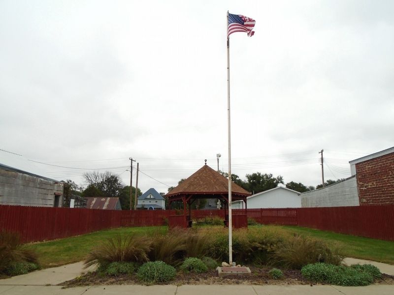
Butte Centennial Park and Marker
1 ► Nebraska, Boyd County, Butte — Butte Centennial Park — 1890 ~ 1990 —  |
| On Thayer Street north of Wilson Street, on the right when traveling north. | |||
| 2 ► Nebraska, Boyd County, Butte — Marvin and Alice Humpal — (1922-2019) • (1929-2021) — This Flagpole Honors The Legacy Of — |
| On Thayer Street north of Gale Street, on the right when traveling north. | |||
| 3 ► Nebraska, Boyd County, Butte — World War Memorial — 1917 • 1918 — |
| On Thayer Street north of Butte Street, on the right when traveling north. | |||
| 4 ► Nebraska, Boyd County, Lynch — 346 — Lewis and Clark Campsite — September 7, 1804 — |
| On Sampson Street just north of Outlaw Trail Scenic Byway (State Highway 12), on the right when traveling north. | |||
| 5 ► Nebraska, Boyd County, Naper — Lost Airmen — Aug. 3, 1944 — |
| On State Highway 12, on the right when traveling west. | |||
| 6 ► Nebraska, Boyd County, Naper — 453 — Lost Airmen of World War II — |
| On State Highway 12, on the right when traveling west. | |||
| 7 ► Nebraska, Boyd County, Naper — Naper Area Veterans Memorial — |
| On State Highway 12, on the right when traveling west. | |||
| 8 ► Nebraska, Boyd County, Spencer — Elwin W. "Smoke" Reed — 1909 - 1994 — In Memory of — |
| On Thayer Street (U.S. 281) at Main Street, on the right when traveling north on Thayer Street. | |||
| 9 ► Nebraska, Boyd County, Spencer — Veterans Memorial — In Honor of Our Area Veterans — Freedom Is Not Free — |
| On Thayer Street (U.S. 281) at Main Street, on the right when traveling north on Thayer Street. | |||
| 10 ► Nebraska, Brown County, Ainsworth — 380 — Ainsworth Army Air Field — |
| On U.S. 20 at milepost 235, on the right when traveling west. | |||
| 11 ► Nebraska, Brown County, Johnstown — 236 — Lakeland Sod High School — |
| On US 20 (U.S. 20), on the left when traveling east. | |||
| 12 ► Nebraska, Brown County, Long Pine — 557 — Long Pine — A Railroad Town — |
| On North Main Street 0.1 miles south of East 3rd Street, on the left when traveling south. | |||
| 13 ► Nebraska, Cherry County, Bayonne — 4 — Opening the Sandhills — |
| On U.S. 20, on the right when traveling east. | |||
| 14 ► Nebraska, Cherry County, Merriman — 493 — Survey Valley — Cherry County, Nebraska — |
| On State Highway 61 0.2 miles north of Survey Valley Road, on the left when traveling north. | |||
| 15 ► Nebraska, Cherry County, Valentine — "American Heroes" — |
| On Green Street at 7th Street, on the right when traveling north on Green Street. | |||
| 16 ► Nebraska, Cherry County, Valentine — 378 — Bryan Bridge — |
| On U.S. 20 3 miles west of U.S. 83, on the left when traveling west. | |||
| 17 ► Nebraska, Cherry County, Valentine — Centennial Hall — Built 1897 — |
| On Macomb Street at 3rd Street, on the right when traveling north on Macomb Street. | |||
| 18 ► Nebraska, Cherry County, Valentine — Colburn Park — |
| On Macomb Street at 3rd Street, on the right when traveling north on Macomb Street. | |||
| 19 ► Nebraska, Cherry County, Valentine — David Y. Mears Cabin — |
| On Main Street (U.S. 83) north of C Street (U.S. 20), on the left when traveling north. | |||
| 20 ► Nebraska, Cherry County, Valentine — Deer Park Hotel — |
| On Highway 12, on the right when traveling east. | |||
| 21 ► Nebraska, Cherry County, Valentine — DeWitty — An African American Settlement in the Sandhills — |
| Near no nearby street. | |||
| 22 ► Nebraska, Cherry County, Valentine — 87 — Fort Niobrara — |
| On U.S. 20 at milepost 198, on the right when traveling west. | |||
| 23 ► Nebraska, Cherry County, Valentine — Korean War Memorial — |
| On Main Street north of 3rd Street, on the left when traveling north. | |||
| 24 ► Nebraska, Cherry County, Valentine — Vietnam War Memorial — |
| On Main Street north of 3rd Street, on the left when traveling north. | |||
| 25 ► Nebraska, Cherry County, Valentine — War Memorial Honored Dead — |
| On Main Street north of 3rd Street, on the left when traveling north. | |||
| 26 ► Nebraska, Cherry County, Valentine — World War II Memorial — Because Of Them We Are Free — |
| On Main Street north of 3rd Street, on the left when traveling north. | |||
| 27 ► Nebraska, Cherry County, Valentine — World War Roll of Honor — |
| On Main Street (U.S. 83) north of 3rd Street, on the left when traveling north. | |||
| 28 ► Nebraska, Cherry County, Wood Lake — 483 — Midair Collision of P-47 "Thunderbolt" Fighter Planes, 1944 — |
| On U.S. 20 at milepost 221 east of Main Street, on the right when traveling west. | |||
| 29 ► Nebraska, Holt County, Atkinson — After 3 Tries, Atkinson Started — 1875 — |
| Near Railroad Street just east of North Main Street, on the left when traveling east. | |||
| 30 ► Nebraska, Holt County, Atkinson — Diamond Anniversary Event Leads to Hay Days — 1940 — |
| Near Railroad Street just east of North Main Street, on the left when traveling east. | |||
| 31 ► Nebraska, Holt County, Ewing — 76 — The Savidge Brothers, Aviation Pioneers — |
| On U.S. 275 at South Spruce Street, on the right when traveling south on U.S. 275. | |||
| 32 ► Nebraska, Holt County, Ewing — These Flags Fly — |
| On Front Street, on the right when traveling north. | |||
| 33 ► Nebraska, Holt County, O’Neill — 78 — O’Neill — |
| On U.S. 20 2.5 miles east of O’Neill, on the right when traveling east. | |||
| 34 ► Nebraska, Holt County, O'Neill — 129 — O'Neill — Irish Capital of Nebraska — |
| On North 4th Street at East Clay Street, on the right when traveling north on North 4th Street. | |||
| 35 ► Nebraska, Holt County, O'Neill — 228 — U. S. Highway 281 — |
| On American Legion Memorial Highway (U.S. 281) 8.6 miles south of U.S. 20, on the right when traveling south. | |||
| 36 ► Nebraska, Holt County, Page — 504 — Page Base Line — |
| On 5th Street (State Highway 45A Spur) at Main Street, on the left when traveling south on 5th Street. | |||
| 37 ► Nebraska, Holt County, Page — Page School — |
| On 5th Street (State Highway 45A Spur) at Main Street, on the left when traveling south on 5th Street. | |||
| 38 ► Nebraska, Keya Paha County, Springview — Homestead of David and Kate Clopton — |
| On U.S. 183 2.1 miles south of Nebraska Route 12, on the left when traveling south. | |||
| 39 ► Nebraska, Keya Paha County, Springview — Keya Paha — 1885-1985 — |
| On Nash Street at L Street, on the right when traveling north on Nash Street. | |||
| 40 ► Nebraska, Keya Paha County, Springview — Keya Paha County War Memorial — |
| On L Street (East Turbine Avenue) just east of North Ash Street, on the left when traveling east. | |||
| 41 ► Nebraska, Keya Paha County, Springview — Keya Paha County War Memorial — |
| On L Street (East Turbine Avenue) east of North Ash Street, on the left when traveling east. | |||
| 42 ► Nebraska, Keya Paha County, Springview — 563 — Norden Dance Hall — |
| On Norden Road 0.3 miles south of State Highway 12. | |||
| 43 ► Nebraska, Knox County, Crofton — Council at Calumet — |
| Near State Highway 121 near Powerpland Road, on the left when traveling west. | |||
| 44 ► Nebraska, Knox County, Crofton — From Dinosaurs to a Prairie Dog — George Shannon Trail — Lewis and Clark National Historic Trail — |
| On Main Street just east of West 3rd Street, on the right when traveling east. | |||
| 45 ► Nebraska, Knox County, Crofton — Gavins Point Dam and Powerplant — |
| On Powerplant Road (State Highway 121), on the left when traveling west. | |||
| 46 ► Nebraska, Knox County, Crofton — Honor. Celebrate. Grow. — Crofton's Q125 Mural — |
| On Main Street just east of West 3rd Street, on the right when traveling east. | |||
| 47 ► Nebraska, Knox County, Crofton — The Lewis & Clark Expedition — |
| On State Highway 121 near Poweplant Road, on the left when traveling west. | |||
| 48 ► Nebraska, Knox County, Crofton — Up the Missouri — |
| Near State Highway 121 near Powerplant Road, on the left when traveling west. | |||
| 49 ► Nebraska, Knox County, Lindy — 345 — Lewis and Clark Campsite — September 2, 1804 — |
| On Main Street 0.1 miles west of 539 Avenue, on the right when traveling west. | |||
| 50 ► Nebraska, Knox County, Lindy — Reunited with Shannon! — Lewis and Clark National History Trail — George Shannon Trail — |
| On Main Street 0.1 miles west of 539 Avenue, on the right when traveling west. | |||
| 51 ► Nebraska, Knox County, Niobrara — "mouth of the Qui Courre (rapid)" — |
| Near no nearby street. | |||
| 52 ► Nebraska, Knox County, Niobrara — "We Proceeded On" — |
| Near no nearby street. | |||
| 53 ► Nebraska, Knox County, Niobrara — 1846-47 Mormon Winter Camp — |
| Near no nearby street. | |||
| 54 ► Nebraska, Knox County, Niobrara — An Ocean of Grass — Ponca and the Prairie Environment — |
| Near 521st Avenue at 890th Road, on the left when traveling north. | |||
| 55 ► Nebraska, Knox County, Niobrara — Early Fur Trade and Fort Mitchell — |
| Near no nearby street. | |||
| 56 ► Nebraska, Knox County, Niobrara — I Carry My Home With Me — The Ponca Tipi — |
| Near 521st Avenue at 890th Road, on the left when traveling north. | |||
| 57 ► Nebraska, Knox County, Niobrara — J. Alan Cramer Interpretive Shelter — |
| Near no nearby street. | |||
| 58 ► Nebraska, Knox County, Niobrara — Lewis and Clark Expedition — |
| Near no nearby street. | |||
| 59 ► Nebraska, Knox County, Niobrara — Life After the Expedition — Lewis and Clark National History Trail — George Shannon Trail — |
| Near Walnut Street (Outlaw Trail Scenic Byway) (State Highway 12) at Spruce Avenue, on the right when traveling east. | |||
| 60 ► Nebraska, Knox County, Niobrara — Managing For Biodiversity — |
| Near no nearby street. | |||
| 61 ► Nebraska, Knox County, Niobrara — Newel Knight — Mormon Monument — |
| Near 522 Avenue 0.4 miles south of State Highway 12, on the left when traveling south. | |||
| 62 ► Nebraska, Knox County, Niobrara — Niobrara — |
| Near no nearby street. | |||
| 63 ► Nebraska, Knox County, Niobrara — Our Ponca Tribal Community Building — A Social Hub, Then and Now — |
| Near 521st Avenue at 890th Road, on the left when traveling north. | |||
| 64 ► Nebraska, Knox County, Niobrara — Our Village Homes — The Ponca Earthlodge: Maithi — |
| Near 521st Avenue at 890th Road, on the left when traveling north. | |||
| 65 ► Nebraska, Knox County, Niobrara — Pow Wow! — Celebrating Our Native Culture — |
| Near 521st Avenue at 890th Road, on the left when traveling north. | |||
| 66 ► Nebraska, Knox County, Niobrara — Standing Bear's Return — |
| Near no nearby street. | |||
| 67 ► Nebraska, Knox County, Niobrara — Symbol of Our Spirit — The Ponca and the Buffalo — |
| Near 521st Avenue at 890th Road, on the left when traveling north. | |||
| 68 ► Nebraska, Knox County, Niobrara — The Buffalo's Gift — Maize and Early Ponca Agriculture — |
| Near 521st Avenue at 890th Road, on the left when traveling north. | |||
| 69 ► Nebraska, Knox County, Niobrara — The Forced Removal — |
| Near no nearby street. | |||
| 70 ► Nebraska, Knox County, Niobrara — The Land is Sacred to the Ponca People as is Water — |
| Near 521st Avenue at 890th Road, on the left when traveling north. | |||
| 71 ► Nebraska, Knox County, Niobrara — The Peaceful Ponca — |
| Near no nearby street. | |||
| 72 ► Nebraska, Knox County, Niobrara — 62 — The Ponca Tribe — |
| On State Highway 12 at 522 Avenue, on the right when traveling west on State Highway 12. | |||
| 73 ► Nebraska, Knox County, Niobrara — 101 — The Sage Brothers — |
| Near Walnut Street (Outlaw Trail Scenic Byway) (State Highway 12) at Spruce Avenue, on the right when traveling east. | |||
| 74 ► Nebraska, Knox County, Niobrara — They Opened The West — |
| Near no nearby street. | |||
| 75 ► Nebraska, Knox County, Niobrara — Water Invites Reflection — Ponca Perspective on Water and Life — |
| Near 521st Avenue at 890th Road, on the left when traveling north. | |||
| 76 ► Nebraska, Knox County, Niobrara — Water's Edge — Flow of life in the Riparian Habitat — |
| Near 521st Avenue at 890th Road, on the left when traveling north. | |||
| 77 ► Nebraska, Knox County, Verdel — George Shannon's Final Years — George Shannon Trail — |
| On Main Street (State Highway 12) at 516th/Glick Avenue, on the right when traveling west on Main Street. | |||
| 78 ► Nebraska, Rock County, Bassett — Rock County Courthouse — |
| On State Street just north of Caroline Street, on the right when traveling north. | |||
| 79 ► Nebraska, Rock County, Newport — 106 — Spring Valley Park — |
| On U.S. 20 0.1 miles east of 457th Avenue, on the right when traveling east. | |||