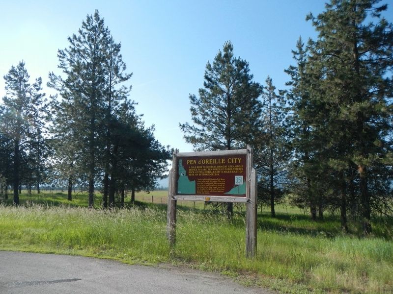
By Barry Swackhamer, May 8, 2018
Pen d'Oreille City Marker
GEOGRAPHIC SORT Title Sort Marker Number Sort Marker Number Sort for Trails Publication Order Sort Publication Order Sort A Erected Year Sort Most Viewed Sort Most Recent-Interest Sort Most Recently Changed Sort SEE FAQ #33 FOR DESCRIPTIONS
On Smylie Boulevard (State Highway 54 at milepost 8) near East Howard Road, on the right when traveling east.
On Smylie Boulevard (State Highway 54 at milepost 15) near Locust Grove Road, on the left when traveling east.
Near Smylie Boulevard (State Highway 54 at milepost 12) near North Perimeter Road, on the right when traveling east.
On Smylie Boulevard (State Highway 54 at milepost 12) near North Perimeter Road, on the right when traveling east.
Near Whitetail Trail near S Road.
On South Mission Road near U.S. 90.
On South Mission Road near Interstate 90.
Near South Mission Road near Interstate 90.
Near South Mission Road near Interstate 90.
Near South Mission Road near Interstate 90.
Near South Mission Road near Interstate 90.
Near South Mission Road at Dredge Road, on the left when traveling west.
Near South Mission Road at Dredge Road, on the left when traveling west.
On Dredge Road near Interstate 90.
Near South Mission Road near Interstate 90.
Paid Advertisement
Near South Mission Road near Interstate 90.
Near South Mission Road near Interstate 90.
On North College Drive 0.1 miles south of River Avenue.
On State Highway 97 at milepost 96 near East Wolf Lodge Bay Road, on the left when traveling north.
On West Fort Grounds Drive at East Rosenberry Drive on West Fort Grounds Drive.
On Hubbard Street at West Woodland Drive, on the left when traveling south on Hubbard Street.
On North College Drive 0.1 miles south of River Avenue, on the left when traveling south.
On East Coeur d'Alene Lake Drive near South Silver Beach Road.
On Copper Road (Forest Road 3098) near Interstate 90, on the right when traveling west.
On Forest Road N 3098 near Interstate 90.
On Harrison Road (State Highway 97 at milepost 67) near East O'Gara Road, on the left when traveling north.
On State Highway 53 near North Beck Road, on the left when traveling west.
On North Spokane Street, on the right when traveling north.
Near North Compton Street near West Seltice Way, on the left when traveling south.
On West 2nd Street, on the right when traveling east.
Paid Advertisement
Near Railroad Avenue near Main Street and Park Avenue.
On Main Street at East 2nd Street, on the right when traveling north on Main Street.
On U.S. 95 0.1 miles south of Cameron Road, on the right when traveling north.
On State Highway 6 at Onaway Road, on the left when traveling west on State Highway 6.
On State Highway 6 at Travis Road, on the left when traveling west on State Highway 6.
On State Highway 6 at Onaway Road, on the left when traveling west on State Highway 6.
On West Main Avenue at Adams Street on West Main Avenue.
On West Railroad Street at North Adams Street, on the right when traveling south on West Railroad Street.
On West Main Avenue at North Washington Street, on the right when traveling south on West Main Avenue.
On West Main Avenue at North Washington Street, on the left when traveling south on West Main Avenue.
On East Main Avenue at N Division Street, on the left when traveling east on East Main Avenue.
On West Main Avenue at North Adams Street, on the right when traveling south on West Main Avenue.
On East Main Avenue at North Division Street, on the left when traveling east on East Main Avenue.
On Washington Route 26 3.5 miles east of Route 261, on the left when traveling east.
On Main Street at N Tucannon Lane, on the left when traveling north on Main Street.
On Maxwell Road, on the right when traveling north.
Paid Advertisement
Near Washington Route 25 0.1 miles north of Miles Road, on the left when traveling west.
On Fort Spokane Road 0.2 miles west of Route 25.
Near Washington Route 25 0.1 miles north of Miles Road, on the left when traveling west.
On Tramm Road North 0.1 miles east of Route 231, on the right when traveling east.
On North B Street at Corner of North B & Alder, on the right when traveling north on North B Street.
Near Interstate 90 11 miles east of Danekas Road, on the right when traveling east.
On National Forest Development Road 1137.
On International Selkirk Loop (State Road 31) south of Box Canyon Dam Road.
On Box Canyon Dam Road east of International Selkirk Loop ( Highway 31), on the right when traveling east.
On International Selkirk Loop (State Road 31) south of Box Canyon Dam Road.
Near International Selkirk Loop (Washington Route 31) 0.6 miles south of Box Canyon Dam Road, on the left when traveling south.
Near International Selkirk Loop (Washington Route 31) 0.6 miles south of Box Canyon Dam Road, on the left when traveling south.
Near Boundary Dam Access Road.
On Boundary Dam Access Road.
On U.S. 2 at South Washington Avenue, on the right when traveling west on U.S. 2.
On 4th Street at S Scott Ave, on the right when traveling east on 4th Street.
Paid Advertisement
On Coulee Hite Road, on the right when traveling west.
Near West Mason Road, on the left when traveling west.
On South Dover Road near U.S. 2, on the right when traveling south.
On S. Electric Ave. near West 1st Street, on the right when traveling south.
On U.S. 2 near S. Coulee Hite Road.
On N Harvest Parkway at East Nora Avenue, on the left when traveling north on N Harvest Parkway.
On North Washington Street at East Barker Street, on the left when traveling north on North Washington Street.
On North Washington Street.
Near South Ritchey Road north of West Espanola Road, on the right when traveling north.
On East Empire Avenue at North Argonne Road, on the right when traveling west on East Empire Avenue.
Near North Spokane Falls Court 0.1 miles north of West Spokane Falls Boulevard.
On West Main Avenue at North Monroe Street, on the right when traveling west on West Main Avenue.
Near Government Way north of Greenwood Road, on the left when traveling north.
Near North Spokane Falls Court 0.1 miles north of West Spokane Falls Boulevard.
Paid Advertisement
Near North Division Street (U.S. 395) (U.S. 2) at East Olive Avenue, on the left when traveling north.
Near West Wellesley Avenue west of N Hartley St.
Near West Broadway Avenue at North Post Street.
On West Spokane Falls Boulevard at North Post Road, on the right when traveling west on West Spokane Falls Boulevard.
Near North Howard Street at West Spokane Falls Boulevard when traveling north.
On North Government Way north of W Greenwood Road.
Near West Wellesley Avenue.
Near North Spokane Falls Court 0.1 miles north of West Spokane Falls Boulevard.
Near North Government Way, on the right when traveling south.
Near North Howard Street 0.1 miles north of West Spokane Falls Boulevard, on the right when traveling north.
Near North Howard Street 0.3 miles south of West Mallon Avenue, on the right when traveling south.
On West College Avenue at N Nettleton Street, on the right when traveling east on West College Avenue.
Near North Spokane Falls Court 0.1 miles north of West Spokane Falls Boulevard.
Near North Spokane Falls Court 0.1 miles north of West Spokane Falls Boulevard.
Near Government Way north of W Greenwood Road.
On West Wellesley Avenue west of N Hartley Street.
Paid Advertisement
On North Monroe Street at West Riverside Avenue, on the right when traveling south on North Monroe Street.
On West Broadway Avenue just west of North Madison Street, on the right when traveling west.
On North Monroe Street 0.1 miles north of West Main Avenue, on the right when traveling north.
On West Spokane Falls Boulevard west of North Lincoln Street, on the right when traveling west.
On North Lincoln Street (North Post Street) at West Bridge Avenue (West Summit Parkway), on the left when traveling south on North Lincoln Street (North Post Street).
︽
175 entries matched your criteria. The first 100 are listed above.
The final 75 ⊳