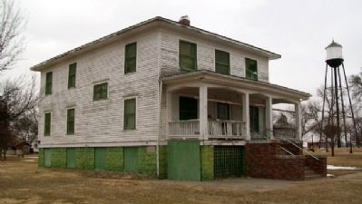
By William Fischer, Jr., February 19, 2012
Dupee Hall of Music and Marker
| On P Street near 14th Avenue, on the right when traveling west. |
| On 16th Avenue (U.S. 136) near Q Street, on the right when traveling south. |
| On 15th Avenue at N Street, on the left when traveling north on 15th Avenue. |
| On 16th Avenue (U.S. 136) near Q Street, on the right when traveling south. |
| On 16th Avenue (U.S. 136) near Q Street, on the right when traveling south. |
| On Q Street, on the left when traveling west. |
| On State Highway 18 0.8 miles west of Wellington Street, on the left when traveling west. |
| On State Highway 18 at Road 402, on the right when traveling east on State Highway 18. |
| On West Street south of Chestnut Street (U.S. 34), on the left when traveling south. |
| On Nebraska Route 89 east of Route 428, on the right when traveling east. |
| On Penn Street north of Nasby Street (U.S. 6), on the right when traveling north. |
| On Penn Street north of Nasby Street (U.S. 6), on the right when traveling north. |
| On U.S. 6/34 0.1 miles west of Center Avenue, on the right when traveling west. |
| On Grand Army of the Republic Highway (U.S. 6/34) 1 mile west of Benson Street, on the right when traveling west. |
| On U.S. 136, on the right when traveling west. |
| On South John Street at 2nd Street, on the left when traveling north on South John Street. |
| On W. South Street 0.3 miles east of U.S. 183, on the left when traveling west. |
| On W. South Street 0.3 miles east of U.S. 183, on the left when traveling west. |
| On Great Plains Indian Highway (Nebraska Route 25) 1 mile north of Morton Street, on the left when traveling north. |
| On Taylor Avenue near Arizona Street. |
| On North Main Street (Nebraska Route 25A) north of East Carrigan Street, on the right when traveling north. |
| On Howard Street (U.S. 34) near Texas Avenue, on the left when traveling east. |
| On U.S. 34 near Old Highway 34, on the right when traveling east. |
| On State Highway 34 near County Route 363, on the left when traveling east. |
| Near 4th Street west of E Street (568th Avenue), on the right when traveling west. |
| Near 5th Street just west of E Street (568th Avenue), on the left when traveling west. |
| Near 710th Road east of 574th Avenue, on the right when traveling east. |
| On D Street north of 4th Street, on the right when traveling north. |
| On 571st Avenue at 712th Road, on the left when traveling west on 571st Avenue. |
| On River Road 4 miles north of U.S. 136, on the right when traveling north. |
| On 568th Avenue (Nebraska Route 15) 4 miles north of U.S. 136, on the left when traveling north. |
| On 573rd Avenue at U.S. 136, on the right when traveling south on 573rd Avenue. |
| On 723rd Road (State Highway 4), on the right when traveling east on 723rd Road. |
| On Washington Street (State Highway 4), on the right when traveling east. |
| On County Route V east of County Route 4200, on the left when traveling west. |
| On Nebraska Route 14 near County Route AA, on the left when traveling north. |
| On State Highway 14 1.6 miles north of State Highway 4, on the left when traveling north. |
| On County Route V south of Route 4, on the right when traveling south. |
| On Road R, on the right when traveling east. |
| On Maple Street at Clay Street, on the right when traveling east on Maple Street. |
| On Road South east of County Route 4600, on the right when traveling east. |
| On County Route 4400 north of Road Street, on the right when traveling south. |
| On Nebraska Route 65a Spur at County Route S, on the left when traveling south on Nebraska Route 65a. |
| On County Route 4600 south of County Route S, on the right when traveling south. |
| Near 7th Street (State Highway 8/50) at P Street (623 Avenue), on the right when traveling east. |
| On 7th Street (Nebraska Route 8) just west of G Street, on the right when traveling west. |
| On Main Street just south of 3rd Street, on the right when traveling north. |
| On Main Street just north of 2nd Street, on the right when traveling north. |
| On Hickory Street just south of 4th Street, on the right when traveling north. |
| On 2nd Street just east of Main Street, on the right when traveling east. |
| On 3rd Street west of Main Street, on the right when traveling west. |
| On 3rd Street at Oak Street, on the right when traveling west on 3rd Street. |
| On 3rd Street just east of Main Street, on the right when traveling east. |
| On 3rd Street west of Hickory Street, on the right when traveling west. |
| On 2nd Street just west of Main Street, on the left when traveling west. |
| On Main Street at 3rd Street, on the left when traveling north on Main Street. |
| On Nebraska Route 67B Spur just west of Route 50, on the left when traveling east. |
| On Luzerne Street just west of 5th Street, on the left when traveling west. |
| On U.S. 6/34 1.5 miles east of State Highway 403, on the left when traveling east. |
| On Commercial Street north of Walnut Street, on the right when traveling north. |
| On Nebraska Route 89 1 mile east of Road 391, on the right when traveling east. |
| On U.S. 6/34 at Drive 391, on the right when traveling west on U.S. 6/34. |
| On Drive 391 just north of U.S. 6/34, on the left when traveling north. |
| On D Street (U.S. 6/34) just east of 4th Street, on the left when traveling east. |
| On U.S. 34 0.1 miles west of 7th Street, on the right when traveling west. |
| On Norris Avenue south of West G Street, on the right when traveling south. |
| Near George Norris Avenue just north of East G Street, on the right when traveling north. |
| On East H Street just east of George Norris Avenue, on the left when traveling east. |
| On George Norris Avenue near East G Street, on the left when traveling north. |
| On George Norris Avenue near East G Street, on the right when traveling north. |
| On George Norris Avenue at East H Street, on the right when traveling north on George Norris Avenue. |
| On Nebraska Route 53 north of County Route R, on the right when traveling south. |
| On Nebraska Route 53 near 717 Road, on the right when traveling north. |
| On County Route 6500 south of County Route R, on the left when traveling south. |
| On 9th Street just west of C Street, on the right when traveling west. |
| On State Highway 4 6.8 miles east of U.S. 81, on the left when traveling east. |
| On State Highway 4 6.8 miles east of U.S. 81, on the left when traveling east. |
| On State Highway 4 6.8 miles east of U.S. 81, on the left when traveling east. |
| On Meridian Road 0.1 miles south of Highway 8, on the right when traveling south. |
| On Thayer Avenue at Howard Street, on the left when traveling south on Thayer Avenue. |
| On US Highway 136 (U.S. 136) at Road 5600, on the left when traveling west on US Highway 136. |
| On County Route R at County Route 5200, on the right when traveling west on County Route R. |
| On County Route Q at County Route 5600, on the right when traveling west on County Route Q. |
| On South Main Street south of South Railroad Street, on the right when traveling south. |
| On 4th Street at Jefferson Avenue, on the left when traveling south on 4th Street. |
| On Road Q just east of U.S. 81, on the left when traveling east. |
| On County Route Q just east of U.S. 81, on the right when traveling east. |
| On 4th Street north of Olive Avenue, on the left when traveling north. |
| On Holdredge Avenue west of South Avenue, on the left when traveling west. |
| On 4th Street north of Olive Avenue, on the left when traveling north. |
| On Jefferson Avenue at 5th Street, on the right when traveling west on Jefferson Avenue. |
| On West County Road (County Route R) at County Route 4900, on the right when traveling west on West County Road. |
| On American Legion Memorial Highway (State Highway 4) just west of U.S. 281, on the left when traveling west. |
| On Adams Street east of 5th Street, on the left when traveling east. |
| On Cowles Main Street east of 4th Street, on the right when traveling west. |
| On Welsch Street at South Seward Street, on the right when traveling west on Welsch Street. |
| On North Cedar Street at West 3rd Avenue, on the right when traveling south on North Cedar Street. |
| Near West 3rd Street at Arch Street. |
| On W. 4th Avenue (U.S. 136) at N. Cedar Street, on the right when traveling east on W. 4th Avenue. |
110 entries matched your criteria. The first 100 are listed above.
The final 10 ⊳
