Marker Logo
THE HISTORICAL
MARKER DATABASE
“Bite-Size Bits of Local, National, and Global History”


61 entries match your criteria.  


The Nez Perce Trail Historical Markers

The Nez Perce War of 1877 saw the Niimíipuu leave their home near Enterprise, Oregon and flee through Idaho and Wyoming in order to avoid being put on a new reservation, before their defeat in northwestern Montana and exile. Nez Perce National Historic Park has 38 separate sites dedicated to the Nez Perce flight, to which are added numerous state and local monuments.
 
By Barry Swackhamer, May 13, 2018
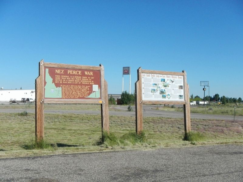
Nez Perce War Marker, on left
1 ► Idaho, Clark County, Dubois — 427 — Nez Perce War —
On A-2 Clark County Road (Main Street) near Interstate 15, on the left when traveling east.
2 ► Idaho, Idaho County, Cottonwood — 38 — Nez Perce War —
On U.S. 95 at Airport Road, on the right when traveling north on U.S. 95.
3 ► Idaho, Idaho County, Cottonwood — 500 — Nez Perce War - Foster''s Gravesite —
On U.S. 95 at Airport Road, on the right when traveling north on U.S. 95.
4 ► Idaho, Idaho County, Cottonwood — Seventeen Volunteers —
On U.S. 95 at Airport Road, on the right when traveling north on U.S. 95.
5 ► Idaho, Idaho County, Glenwood — Gass Creek — The Land Lewis and Clark Traveled —
On Lolo Motorway (Forest Road 500) near Weites Butte Lookout Road, on the left when traveling west.
6 ► Idaho, Idaho County, Grangeville — 100 — Camas Prairie —
On U.S. 95 near Lake Road, on the left when traveling north.
7 ► Idaho, Idaho County, Grangeville — Gathering at Tipahxlee’whum (Tepahlewam) —
Near Lake Road near Tolo Lake Road, on the left when traveling south.
8 ► Idaho, Idaho County, Grangeville — 294 — Nez Perce War —
On U.S. 95 at milepost 227, on the right when traveling north.
9 ► Idaho, Idaho County, Kooskia — Kooskia Crossing Kiosk —
On U.S. 12 at State Highway 13, on the left when traveling east on U.S. 12.
10 ► Idaho, Idaho County, Kooskia — 347 — Looking Glass — During General O. O. Howard's 1877 Nez Perce Campaign — Looking Glass and his band were camped up Clear Creek here —
On U.S. 12 0.5 miles east of State Highway 13, on the right when traveling east.
11 ► Idaho, Idaho County, Kooskia — Nez Perce Trail —
Near U.S. 12 at Elk Meadows Road, on the left when traveling east.
12 ► Idaho, Idaho County, Kooskia — Songs Of Sadness On This Sacred Path — Nez Perce Flight of 1877 —
On U.S. 12 at milepost 158 near Forest Road 1684, on the left when traveling west.
13 ► Idaho, Idaho County, Kooskia — The Lolo Trail — "I belong to the land from which I came." Toohoolhoolzote —
Near U.S. 12 at milepost 121, on the right when traveling west.
14 ► Idaho, Idaho County, Stites — 259 — Nez Perce War —
On State Highway 13 at milepost 21 near Stites Grade Road, on the left when traveling north.
15 ► Idaho, Idaho County, Syringa — Howard Camp — "...none of us will ever forget... the Lolo Trail..." —
On Lolo Motorway (Forest Road 500) near Horseshoe Lake Lookout Road, on the left when traveling south.
Paid Advertisement
16 ► Idaho, Idaho County, White Bird — June 17, 1877 —
Near Old Highway 95 near Two Moon Trail, on the left when traveling north.
17 ► Idaho, Idaho County, White Bird — Truce or War —
Near Old Highway 95 near Two Moon Trail, on the left when traveling north.
18 ► Idaho, Idaho County, White Bird — White Bird Battlefield —
On U.S. 95 near Trueblood Lane, on the right when traveling north.
19 ► Idaho, Lemhi County, Leadore — Massacred by Nez Perce —
Near Idaho Route 28, on the right when traveling north.
20 ► Idaho, Lemhi County, North Fork — 448 — Nez Perce Trail —
On Casey Road (U.S. 93) near Hughs Creek Road (Forest Road 091), on the left when traveling north.
21 ► Idaho, Lewis County, Kamiah — Nez Perce National Historical Park —
On U.S. 12 0.3 miles north of Corbett Lane, on the left when traveling west.
22 ► Idaho, Lewis County, Kamiah — Trails at Heart of the Monster —
On U.S. 12 0.3 miles north of Corbett Lane, on the left when traveling west.
23 ► Idaho, Nez Perce County, Lenore — Nimiipuu Daily Life —
On U.S. 12 0.6 miles west of Lenore Grade, on the right when traveling west.
24 ► Idaho, Nez Perce County, Lewiston — 332 — Nez Perce Village —
On U.S. 12 1 mile east of Nez Perce Road, on the right when traveling east.
25 ► Idaho, Nez Perce County, Lewiston — Northwest Passage Scenic Byway —
On U.S. 12 1 mile east of Nez Perce Road, on the right when traveling east.
26 ► Idaho, Washington County, Cambridge — The Cuddy Mill —
On North Superior Street (U.S. 95) near West Hopper Avenue, on the left when traveling north.
27 ► Montana, Beaverhead County, Dillon — Nez Perce Camp —
Near Bannack Road.
28 ► Montana, Beaverhead County, Wisdom — Battlefield Landscape —
Near Park Entrance Road near State Highway 43, on the left when traveling east.
29 ► Montana, Beaverhead County, Wisdom — Big Hole National Battlefield Monument —
On Park Entrance Road near State Highway 43, on the left when traveling north.
30 ► Montana, Beaverhead County, Wisdom — Brave Warriors —
Near Park Entrance Road near State Highway 43, on the left when traveling north.
31 ► Montana, Beaverhead County, Wisdom — Natural Travel Corridor — On the Eve of Tragedy — Trail Creek —
On State Highway 43 at Bitterroot-Big Hole Road, on the left when traveling east on State Highway 43.
Paid Advertisement
32 ► Montana, Beaverhead County, Wisdom — Siege Site —
Near Park Entrance Road near State Highway 43, on the left when traveling east.
33 ► Montana, Blaine County, Chinook — ćáynim?a•lika?spe — Bear Paw Battlefield Trail —
On Cleveland Road (County Road 240) near S-B Road, on the left when traveling south.
34 ► Montana, Blaine County, Chinook — We will stand our ground! — Roaring Eagle: tipiyeléhne?iléseniń (George Comedown) —
Near Cleveland Road (County Road 240) near S-B Road.
35 ► Montana, Blaine County, Chinook — Bear Paw Battlefield — C'Aynnim 'Alikinwaaspa —
On Cleveland Road (County Road 240) near S-B Road, on the left when traveling south.
36 ► Montana, Blaine County, Chinook — Bear's Paw Battleground —
On Cleveland Road (County Road 240) near S-B Road, on the right when traveling south.
37 ► Montana, Blaine County, Chinook — Brave Warriors Chief Joseph's Band —
Near Cleveland Road (County Road 240) near S-B Road.
38 ► Montana, Blaine County, Chinook — Chief Joseph’s Surrender — October 5, 1887 11:00 a.m. —
Near Cleveland Road (County Road 240) near S-B Road.
39 ► Montana, Blaine County, Chinook — Last Battle —
On Cleveland Road (County Road 240) near S-B Road, on the left when traveling south.
40 ► Montana, Blaine County, Chinook — Nez Perce Encampment —
Near Cleveland Road (County Road 240) near S-B Road.
41 ► Montana, Blaine County, Chinook — Nez Perce National Historical Park —
On Cleveland Road (County Road 240) near S-B Road, on the left when traveling south.
42 ► Montana, Blaine County, Chinook — No Place to Hide —
Near Cleveland Road (County Road 240) near S-B Road.
43 ► Montana, Blaine County, Chinook — Soldier Burials —
Near Cleveland Road (County Road 240) near S-B Road.
44 ► Montana, Blaine County, Chinook — Surrender of Chief Joseph —
On Cleveland Road (County Road 240) near S-B Road, on the left when traveling north.
45 ► Montana, Blaine County, Chinook — The Battle of Bears Paw —
On 1st Street (U.S. 2) near Cleveland Road West, on the right when traveling east.
46 ► Montana, Chouteau County, Fort Benton — Nez Perce War —
On Front Street near 18th Street, on the right when traveling east.
47 ► Montana, Golden Valley County, Ryegate — Chief Joseph —
On Railway Avenue East (U.S. 12) near Third Street North, on the right when traveling west.
Paid Advertisement
48 ► Montana, Missoula County, Lolo — Fort Fizzle —
Near U.S. 12, on the left when traveling west.
49 ► Montana, Missoula County, Lolo — Outwitted and Outflanked —
Near Lolo Creek Road (U.S. 12) near Sun Ray Lane, on the left when traveling west.
50 ► Montana, Missoula County, Lolo — Pauses and Parleys —
Near Lolo Creek Road (U.S. 12) near Sun Ray Lane, on the left when traveling west.
51 ► Montana, Missoula County, Lolo — Taking Cover… —
Near Lolo Creek Road (U.S. 12) near Sun Ray Lane, on the left when traveling west.
52 ► Montana, Missoula County, Lolo — The "Soldiers' Corral" —
Near Lolo Creek Road (U.S. 12) near Sun Ray Lane, on the left when traveling west.
53 ► Montana, Yellowstone County, Laurel — The Battle at Canyon Creek — on the Nez Perce (Nee-Me-Poo) Trail —
On East Main Street (Old U.S. 10) near 1st Avenue, on the left when traveling west.
54 ► Oklahoma, Kay County, Tonkawa — Chief Joseph of the Nez Perce —
On U.S. 60/177, on the right when traveling east.
55 ► Oregon, Wallowa County, Imnaha — The Nez Perce War of 1877 —
On Hat Point Road east of Upper Imnaha Road, on the right when traveling east.
56 ► Oregon, Wallowa County, Joseph — "Only the sounds of the horses..." —
On Wallowa Lake Highway (Oregon Route 351) near South East Street.
57 ► Oregon, Wallowa County, Joseph — Iwetemlaykin State Heritage Site — Welcome —
On Wallowa Lake Highway (Oregon Route 351) near South East Street, on the right when traveling south.
58 ► Oregon, Wallowa County, Joseph — tiwi∙teqis (Old Chief Joseph) —
On Wallowa Lake Highway (Oregon Route 351), on the right when traveling south.
59 ► Wyoming, Park County, Yellowstone National Park, Mammoth — Captive Tourists — The Nez Perce Encounter —
On Grand Loop Road (U.S. 20) 0.4 miles east of Fountain Flat Drive, on the right when traveling south.
60 ► Wyoming, Park County, Yellowstone National Park, Mammoth — Chance Encounter — Nez Perce War —
On Lower Grand Loop Road (U.S. 20), on the right when traveling south.
61 ► Wyoming, Teton County, Yellowstone National Park — Nez Perce War —
On Grand Loop Road (U.S. 89) 0.5 miles south of Fountain Flat Drive, on the left when traveling north.
 
 
CeraNet Cloud Computing sponsors the Historical Marker Database.
This website earns income from purchases you make after using our links to Amazon.com. We appreciate your support.
Paid Advertisement
Nov. 19, 2026