1934 entries match your criteria. The first 100 are listed. ⊳
Historical Markers and War Memorials in Delaware
By Pete Skillman, October 5, 2026
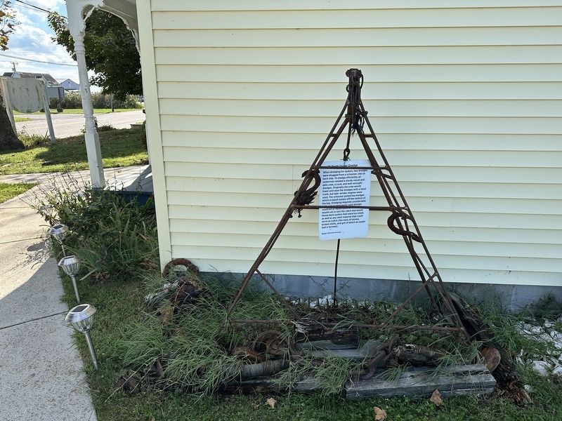
20 Tooth Oyster Dredge Marker - wide view
1 ► Delaware, Kent County, Bowers, South Murderkill Hundred — 20 Tooth Oyster Dredge —  |
| On Main Street, on the right when traveling west. | |||
| 2 ► Delaware, Kent County, Bowers, South Murderkill Hundred — KC-140 — Bowers Beach Maritime Museum — |
| On Main Street, on the right when traveling west. | |||
| 3 ► Delaware, Kent County, Bowers, South Murderkill Hundred — The Bayview Garage and General Store as it was on this site. — |
| On Main Street (Road 122) east of Hubbard Avenue (Road 121), on the right when traveling west. | |||
| 4 ► Delaware, Kent County, Bowers, South Murderkill Hundred — KC-121 — Town of Bowers — |
| On Main Street, on the left when traveling east. | |||
| 5 ► Delaware, Kent County, Camden, North Murderkill Hundred — KC-134 — Banning Meeting House — |
| On South State Street, on the right when traveling north. | |||
| 6 ► Delaware, Kent County, Camden, North Murderkill Hundred — K-55 — Brecknock — |
| On Old Camden Road (U.S. 113A) 0.1 miles south of U.S. 13. | |||
| 7 ► Delaware, Kent County, Camden, North Murderkill Hundred — KC-133 — Brinkley Hill — |
| On Old Camden Road (Alternate U.S. 13), on the right when traveling south. | |||
| 8 ► Delaware, Kent County, Camden, North Murderkill Hundred — KC-62 — Caesar Rodney — |
| On Old North Road. | |||
| 9 ► Delaware, Kent County, Camden, North Murderkill Hundred — KC-41 — Camden — |
| On U.S. 13 at E. Camden-Wyoming Ave. (Delaware Route 10) on U.S. 13. | |||
| 10 ► Delaware, Kent County, Camden, North Murderkill Hundred — KC-72 — Camden — |
| On Camden-Wyoming Ave. (Delaware Route 10) at Alternate U.S. 13 on Camden-Wyoming Ave.. | |||
| 11 ► Delaware, Kent County, Camden, North Murderkill Hundred — KC-73 — Camden Friends Meeting — Burial Place of John Hunn — |
| On East Camden-Wyoming Ave.. | |||
| 12 ► Delaware, Kent County, Camden, North Murderkill Hundred — Gov. George Truitt Home — Circa 1750 — 12 South Main Street — |
| On South Main Street near East Camden Wyoming Avenue. | |||
| 13 ► Delaware, Kent County, Camden, North Murderkill Hundred — John Hunn — 1814 - 1894 — Quaker Abolitionist — |
| On East Camden-Wyoming Ave.. | |||
| 14 ► Delaware, Kent County, Camden, North Murderkill Hundred — KC-82 — Morning Star Institutional Church of God in Christ, Inc. — |
| On Camden-Wyoming Ave. close to Main Street. | |||
| 15 ► Delaware, Kent County, Camden, North Murderkill Hundred — Operation Silent Witness — |
| Near Old Camden Road (Alternate U.S. 13) 0.5 miles south of South Dupont Highway (U.S. 13), on the right when traveling south. | |||
| 16 ► Delaware, Kent County, Camden, North Murderkill Hundred — KC-100 — Site of Whatcoat Church — |
| On South Main Street close to South Street. | |||
| 17 ► Delaware, Kent County, Camden, North Murderkill Hundred — K-50 — Star Hill A.M.E. Church — |
| On Voshells Mill Star Hill Road at Lingo Drive on Voshells Mill Star Hill Road. | |||
| 18 ► Delaware, Kent County, Camden, North Murderkill Hundred — The History of the Howell Mill Site — |
| Near Old Camden Road (Alternate U.S. 13) 0.2 miles north of Chapel Drive (Caboose Road), on the left when traveling north. | |||
| 19 ► Delaware, Kent County, Camden, North Murderkill Hundred — KC-110 — Zion African Methodist Episcopal Church — |
| On Center Street. | |||
| 20 ► Delaware, Kent County, Cheswold, Kenton Hundred — Floyd Durham (1918-2010) — "A Founding Father of Delaware Aviation" — |
| On Durham Lane north of 7 Hickories Road ( Route 42), on the right when traveling north. | |||
| 21 ► Delaware, Kent County, Cheswold, Kenton Hundred — KC-6 — Kenton Hundred — |
| On 7 Hickories Road west of Moorton Street. | |||
| 22 ► Delaware, Kent County, Cheswold, Kenton Hundred — Lenape Indian Tribe of Delaware — The People Who Stayed Behind — |
| On Durham Lane north of 7 Hickories Road ( Route 42), on the right when traveling north. | |||
| 23 ► Delaware, Kent County, Cheswold, Little Creek Hundred — KC-83 — Cheswold Volunteer Fire Company — |
| On Main Street (Delaware Route 42). | |||
| 24 ► Delaware, Kent County, Cheswold, Little Creek Hundred — KC-4 — Little Creek Hundred — |
| On U.S. 13. | |||
| 25 ► Delaware, Kent County, Cheswold, Little Creek Hundred — KC-5 — Little Creek Hundred — |
| On Main Street close to Moorton Road. | |||
| 26 ► Delaware, Kent County, Clayton, Duck Creek Hundred — KC-112 — Byrd's African Methodist Episcopal Church — |
| On Dickerson Street. | |||
| 27 ► Delaware, Kent County, Clayton, Duck Creek Hundred — Clayton Veterans Park — |
| On Main Street (Delaware Route 6) at North Bassett Street, on the right when traveling west on Main Street. | |||
| 28 ► Delaware, Kent County, Clayton, Duck Creek Hundred — KC-59 — Town of Clayton — |
| On Main Street at North Bassett Street, on the right when traveling west on Main Street. | |||
| 29 ► Delaware, Kent County, Clayton, Kenton Hundred — Former Site Blackiston M.E. Church — 1787 — |
| On Blackiston Church Road, on the right when traveling north. | |||
| 30 ► Delaware, Kent County, Clayton, Kenton Hundred — KC-74 — Site of Blackiston Methodist Church — |
| On Millington Road (Delaware Route 6) at Blackiston Church Road ( Route 131), on the right when traveling east on Millington Road. | |||
| 31 ► Delaware, Kent County, Dover, Dover Air Force Base — 148th Fighter Interceptor Squadron — |
| Near Heritage Road 0.7 miles west of Bayside Drive ( Route 9), on the left when traveling west. | |||
| 32 ► Delaware, Kent County, Dover, Dover Air Force Base — 2nd Ferrying Group — |
| Near Perimeter Road 0.7 miles west of Bayside Drive ( Route 9), on the left when traveling west. | |||
| 33 ► Delaware, Kent County, Dover, Dover Air Force Base — 61st Troop Carrier Squadron — |
| Near Heritage Road 0.7 miles west of Bayside Drive ( Route 9), on the left when traveling west. | |||
| 34 ► Delaware, Kent County, Dover, Dover Air Force Base — 9/11 Memorial — |
| Near Heritage Road 0.8 miles north of Bayside Drive ( Route 9), on the left when traveling north. | |||
| 35 ► Delaware, Kent County, Dover, Dover Air Force Base — A-10C — Thunderbolt II — S/N 79-0088 — |
| Near Reno Street. | |||
| 36 ► Delaware, Kent County, Dover, Dover Air Force Base — A-26C — Invader — S/N 44-35523 — |
| Near Heritage Road 0.7 miles west of Bayside Drive ( Route 9), on the left when traveling west. | |||
| 37 ► Delaware, Kent County, Dover, Dover Air Force Base — AN/GPN-20 Airport Surveillance Radar — |
| Near Heritage Road 0.7 miles west of Bayside Drive ( Route 9), on the left when traveling west. | |||
| 38 ► Delaware, Kent County, Dover, Dover Air Force Base — Asian American and Pacific Islander U.S. Air Force Memorial — |
| Near Heritage Road 0.7 miles west of Bayside Drive ( Route 9), on the left when traveling west. | |||
| 39 ► Delaware, Kent County, Dover, Dover Air Force Base — Berlin Airlift Memorial — |
| Near Heritage Road 0.7 miles west of Bayside Drive ( Route 9), on the left when traveling west. | |||
| 40 ► Delaware, Kent County, Dover, Dover Air Force Base — C-119C — Flying Boxcar — S/N 48-0352 — |
| Near Heritage Road 0.8 miles north of Bayside Drive ( Route 9), on the left when traveling north. | |||
| 41 ► Delaware, Kent County, Dover, Dover Air Force Base — C-119G — Flying Boxcar — S/N 10-870 — |
| Near Heritage Road 0.7 miles west of Bayside Drive ( Route 9), on the left when traveling west. | |||
| 42 ► Delaware, Kent County, Dover, Dover Air Force Base — C-121C — Super Constellation — S/N 4557 — |
| Near Heritage Road 0.7 miles west of Bayside Drive ( Route 9), on the left when traveling west. | |||
| 43 ► Delaware, Kent County, Dover, Dover Air Force Base — C-123K — Provider — S/N 54-658 — |
| Near Heritage Road 0.7 miles west of Bayside Drive ( Route 9), on the left when traveling west. | |||
| 44 ► Delaware, Kent County, Dover, Dover Air Force Base — C-124A — Globemaster II — S/N 49-0258 — |
| Near Heritage Road 0.8 miles north of Bayside Drive ( Route 9), on the left when traveling north. | |||
| 45 ► Delaware, Kent County, Dover, Dover Air Force Base — C-130E — Hercules — S/N 69-6580 — |
| Near Heritage Road 0.7 miles west of Bayside Drive ( Route 9), on the left when traveling west. | |||
| 46 ► Delaware, Kent County, Dover, Dover Air Force Base — C-131D — Samaritan — S/N 55-295 — |
| Near Heritage Road 0.7 miles west of Bayside Drive ( Route 9), on the left when traveling west. | |||
| 47 ► Delaware, Kent County, Dover, Dover Air Force Base — C-133 Cargomaster — 1957 - 1971 — |
| Near Heritage Road 0.7 miles west of Bayside Drive ( Route 9), on the left when traveling west. | |||
| 48 ► Delaware, Kent County, Dover, Dover Air Force Base — C-133B — Cargomaster — S/N 59-0536 — |
| Near Heritage Road 0.7 miles west of Bayside Drive ( Route 9), on the left when traveling west. | |||
| 49 ► Delaware, Kent County, Dover, Dover Air Force Base — C-141A — Starlifter — S/N 61-2775 — |
| Near Heritage Road 0.7 miles west of Bayside Drive ( Route 9), on the left when traveling west. | |||
| 50 ► Delaware, Kent County, Dover, Dover Air Force Base — C-141B — Starlifter — S/N 64-0626 — |
| Near Heritage Road 0.7 miles west of Bayside Drive ( Route 9), on the left when traveling west. | |||
| 51 ► Delaware, Kent County, Dover, Dover Air Force Base — C-45G — Expeditor — S/N 51-11795 — |
| Near Heritage Road 0.7 miles west of Bayside Drive ( Route 9), on the left when traveling west. | |||
| 52 ► Delaware, Kent County, Dover, Dover Air Force Base — C-5 — Outboard Wing Section — |
| Near Heritage Road 0.8 miles north of Bayside Drive ( Route 9), on the left when traveling north. | |||
| 53 ► Delaware, Kent County, Dover, Dover Air Force Base — C-54M — Skymaster — S/N 44-9030 — |
| Near Heritage Road 0.7 miles west of Bayside Drive ( Route 9), on the left when traveling west. | |||
| 54 ► Delaware, Kent County, Dover, Dover Air Force Base — C-5A — Galaxy — S/N 69-0014 — |
| Near Heritage Road 0.7 miles west of Bayside Drive ( Route 9), on the left when traveling west. | |||
| 55 ► Delaware, Kent County, Dover, Dover Air Force Base — C-60 — Lodestar — S/N 42-55918 — |
| Near Heritage Road 0.7 miles west of Bayside Drive ( Route 9), on the left when traveling west. | |||
| 56 ► Delaware, Kent County, Dover, Dover Air Force Base — C-7A — Caribou — S/N 63-9760 — |
| Near Heritage Road 0.7 miles west of Bayside Drive ( Route 9), on the left when traveling west. | |||
| 57 ► Delaware, Kent County, Dover, Dover Air Force Base — C-9A/C — Nightingale — S/N 67-22584 — |
| Near Heritage Road 0.7 miles west of Bayside Drive ( Route 9), on the left when traveling west. | |||
| 58 ► Delaware, Kent County, Dover, Dover Air Force Base — Commemoration Park — |
| On Heritage Road close to Reno Street. | |||
| 59 ► Delaware, Kent County, Dover, Dover Air Force Base — F-101B — Voodoo — S/N 59-428 — |
| Near Heritage Road 0.7 miles west of Bayside Drive ( Route 9), on the left when traveling west. | |||
| 60 ► Delaware, Kent County, Dover, Dover Air Force Base — F-106A — Delta Dart — S/N 59-0023 — |
| Near Heritage Road 0.7 miles west of Bayside Drive ( Route 9), on the left when traveling west. | |||
| 61 ► Delaware, Kent County, Dover, Dover Air Force Base — KC-68 — Hangar 1301 — |
| On Heritage Road 0.7 miles west of Bayside Drive ( Route 9). | |||
| 62 ► Delaware, Kent County, Dover, Dover Air Force Base — KB-50J — Superfortress — S/N 49-0389 — |
| Near Heritage Road 0.7 miles west of Bayside Drive ( Route 9), on the left when traveling west. | |||
| 63 ► Delaware, Kent County, Dover, Dover Air Force Base — KC-10A — Extender — S/N 79-0433 — |
| On Heritage Road 0.5 miles east of Bayside Drive ( Route 9), on the left when traveling east. | |||
| 64 ► Delaware, Kent County, Dover, Dover Air Force Base — KC-135E — Stratotanker — S/N 57-1507 — |
| Near Heritage Road 0.7 miles west of Bayside Drive ( Route 9), on the left when traveling west. | |||
| 65 ► Delaware, Kent County, Dover, Dover Air Force Base — KC-97L — Stratofreighter — S/N 53-230 — |
| Near Heritage Road 0.8 miles north of Bayside Drive ( Route 9), on the left when traveling north. | |||
| 66 ► Delaware, Kent County, Dover, Dover Air Force Base — LGM-30 — Minuteman Missile — |
| Near Heritage Road 0.7 miles west of Bayside Drive ( Route 9), on the left when traveling west. | |||
| 67 ► Delaware, Kent County, Dover, Dover Air Force Base — P-51 Mustang — |
| Near Heritage Road 0.1 miles west of Bayside Drive ( Route 9), on the left when traveling west. | |||
| 68 ► Delaware, Kent County, Dover, Dover Air Force Base — POW★MIA — |
| Near Heritage Road 0.7 miles west of Bayside Drive ( Route 9), on the left when traveling west. | |||
| 69 ► Delaware, Kent County, Dover, Dover Air Force Base — Special Ops Memorial — |
| Near Heritage Road north of Bayside Drive, on the left when traveling north. | |||
| 70 ► Delaware, Kent County, Dover, Dover Air Force Base — T-33A — Shooting Star — S/N 52-9497 — |
| On Heritage Road 0.7 miles west of Bayside Drive ( Route 9), on the left when traveling west. | |||
| 71 ► Delaware, Kent County, Dover, Dover Air Force Base — T-33A Shooting Star |
| On Heritage Drive. Reported permanently removed. | |||
| 72 ► Delaware, Kent County, Dover, Dover Air Force Base — U-3A — "Blue Canoe" — S/N 82126 — |
| Near Heritage Road 0.7 miles west of Bayside Drive ( Route 9), on the left when traveling west. | |||
| 73 ► Delaware, Kent County, Dover, Dover Air Force Base — UH-1H — Iroquois — S/N 69-15475 — |
| Near Heritage Road 0.7 miles west of Bayside Drive ( Route 9), on the left when traveling west. | |||
| 74 ► Delaware, Kent County, Dover, Dover Air Force Base — VC-9C — S/N 73-1682 — |
| Near Heritage Road 0.7 miles west of Bayside Drive ( Route 9), on the left when traveling west. | |||
| 75 ► Delaware, Kent County, Dover, Dover Air Force Base — Women in the Military Memorial — |
| Near Heritage Road 0.7 miles west of Bayside Drive ( Route 9), on the left when traveling west. | |||
| 76 ► Delaware, Kent County, Dover, East Dover Hundred — "So Others May Live." — |
| On Levy Court Lane near South Little Creek Road (County Road 67). | |||
| 77 ► Delaware, Kent County, Dover, East Dover Hundred — …and His Accomplishments — |
| On Loockerman Plaza west of Federal Plaza, on the right when traveling west. | |||
| 78 ► Delaware, Kent County, Dover, East Dover Hundred — Afghanistan-Iraq Memorial — |
| On Martin Luther King Boulevard North. | |||
| 79 ► Delaware, Kent County, Dover, East Dover Hundred — American Legion Veterans Memorial — |
| On South Bay Road 0.1 miles east of Stover Boulevard, on the right when traveling west. | |||
| 80 ► Delaware, Kent County, Dover, East Dover Hundred — An Army of Restoration (CCC) — |
| Near The Green, on the right when traveling east. | |||
| 81 ► Delaware, Kent County, Dover, East Dover Hundred — KC-119 — Annie Jump Cannon — |
| On South State Street 0.1 miles south of East Division Street, on the right when traveling south. | |||
| 82 ► Delaware, Kent County, Dover, East Dover Hundred — Armed Forces Memorial — |
| On Legislative Avenue at Loockerman Street on Legislative Avenue. | |||
| 83 ► Delaware, Kent County, Dover, East Dover Hundred — Battles and Engagements of the Delaware Regiment — |
| On Liberty Street. | |||
| 84 ► Delaware, Kent County, Dover, East Dover Hundred — Bell UH-1 Iroquois Helicopter — "Huey." — Dedicated May 26, 2014 — |
| On Levy Court Lane at South Little Creek Road (County Road 67), on the right when traveling south on Levy Court Lane. | |||
| 85 ► Delaware, Kent County, Dover, East Dover Hundred — Bioretention — |
| Near Duke of York Street. | |||
| 86 ► Delaware, Kent County, Dover, East Dover Hundred — K-43 — Bishop Richard Allen — Founder of the A.M.E. Church — |
| On Easr Loockerman Street at Federal Street, in the median on Easr Loockerman Street. | |||
| 87 ► Delaware, Kent County, Dover, East Dover Hundred — KC-88 — Booker T. Washington School — |
| On Forest Street (Delaware Route 8) west of Gibbs Drive, on the right when traveling west. | |||
| 88 ► Delaware, Kent County, Dover, East Dover Hundred — KC-53 — Byfield — |
| On Delaware Route 9 at Bergold Lane, on the right when traveling north on Delaware Route 9. | |||
| 89 ► Delaware, Kent County, Dover, East Dover Hundred — KC-A2 — Caesar Rodney — |
| On South State Street at East Water Street on South State Street. | |||
| 90 ► Delaware, Kent County, Dover, East Dover Hundred — KC-87 — Calvary Baptist Church — |
| On N. Queen Street at Fulton Street on N. Queen Street. | |||
| 91 ► Delaware, Kent County, Dover, East Dover Hundred — Charles Inglis — |
| On Water Street. | |||
| 92 ► Delaware, Kent County, Dover, East Dover Hundred — KC-A7 — Colonel John Haslet — |
| Near South Governors Avenue 0.1 miles south of W North Street, on the right when traveling south. | |||
| 93 ► Delaware, Kent County, Dover, East Dover Hundred — Constitution Park — |
| On South State Street at East North Street, on the left when traveling south on South State Street. | |||
| 94 ► Delaware, Kent County, Dover, East Dover Hundred — Continuity & Progress — Historically Happening — Dover, Delaware — |
| On West North Street just east of South Governors Avenue (Alternate U.S. 13), on the left when traveling east. | |||
| 95 ► Delaware, Kent County, Dover, East Dover Hundred — Crawford Carroll, the Man… — |
| On Loockerman Plaza just west of Federal Plaza, on the right when traveling west. | |||
| 96 ► Delaware, Kent County, Dover, East Dover Hundred — D.A.R. Garden — |
| On Federal Street at Martin Luther King Jr. Boulevard North, on the right when traveling north on Federal Street. | |||
| 97 ► Delaware, Kent County, Dover, East Dover Hundred — Delaware 9/11 Memorial — |
| On Legislative Avenue, on the right when traveling north. | |||
| 98 ► Delaware, Kent County, Dover, East Dover Hundred — Delaware Decides — First State National Historical Park — |
| On The Green east of South State Street, on the right when traveling west. | |||
| 99 ► Delaware, Kent County, Dover, East Dover Hundred — Delaware Desegregation Monument — |
| On Legislative Avenue, on the right when traveling north. | |||
| 100 ► Delaware, Kent County, Dover, East Dover Hundred — Delaware Public Archives — Who Are We? — |
| On M.L.K. Jr. Boulevard North at Legislative Avenue, on the right when traveling west on M.L.K. Jr. Boulevard North. | |||
1934 entries matched your criteria. The first 100 are listed above. Next 100 ⊳