Near County Route 1361 0.5 miles west of Tsali Boulevard (U.S. 441).
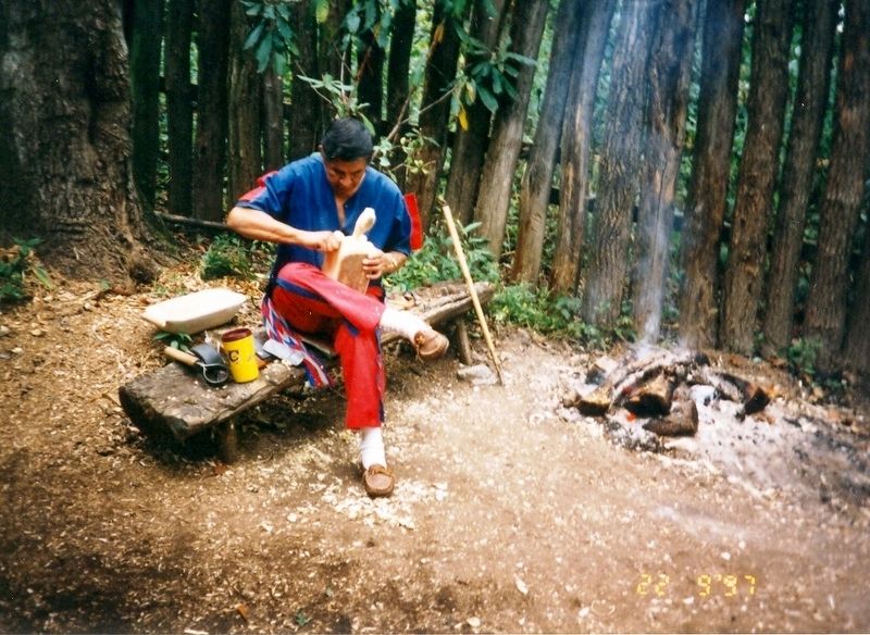
Oconaluftee Indian Village is an authentic replica of a Cherokee Indian Town of 1750. Here you will see life as it was carried on 200 years ago. Ancient arts of the Red Man such as basket weaving, wood-carving, finger-weaving, pottery, weapon making . . . — — Map (db m96642) HM
On Tsali Boulevard (U.S. 441) at Drama Road, on the right when traveling south on Tsali Boulevard. Reported unreadable.
Wodi refers to the paint made from red ochre. In the legend of monster Stoneman, a lump of this paint remained when the monster burned up. When the medicine man painted people with it, their wishes came true: to be a great hunter, or . . . — — Map (db m305012) HM
The rugged terrain of the Smoky Mountains determined patterns of human settlement. Residents of the Smokies - be they native Cherokees or European emigrants and their descendants - gravitated to valleys or coves. Settlement was confined to areas far . . . — — Map (db m20054) HM
On Drama Road (County Highway 1361) just west of Tsali Boulevard (U.S. 441), on the right when traveling west.
Qualla Arts and Crafts Mutual, Inc. was founded in 1946, with the goal of promoting the development, production, and marketing of unique and authentic Cherokee arts and crafts. Known locally as the "co-op," Qualla Arts and Crafts is one of the . . . — — Map (db m140706) HM
This statue honoring Sequoyah. The Cherokee genius who invented the Cherokee Alphabet. was sculpted from a single great California Sequoia (Redwood) Log which was donated and shipped by Georgia-Pacific.
This is sculptor Peter wolf Toth's 63rd . . . — — Map (db m19736) HM
Near Newfound Gap Road (U.S. 441) 0.7 miles north of Blue Ridge Parkway, on the right when traveling north.
Sorghum cane descended from wild grasses that are native to parts of Africa and Asia where humans have cultivated it for more than 4000 years. It was introduced to this country in the 1700s. Through the centuries, various types of sorghum have been . . . — — Map (db m190510) HM
Near Newfound Gap Road (U.S. 441) 0.7 miles north of Blue Ridge Parkway, on the right when traveling north.
A reliable source of drinking water was important in selecting a house site. A good spring met that need and also provided a means for keeping perishable foods.
Water from a spring flowed through the springhouse in a rock-lined channel in the . . . — — Map (db m190525) HM
You are standing alongside the Appalachian Trail, one of the longest continuous footpaths in the world. The trail winds more than 2,150 miles through 14 states. Few stretches are more remote or difficult than the section through the Great Smokies. . . . — — Map (db m20064) HM
(Side One):
The Great Smokies: scenic, diverse, culturally rich.
The scenic view here are well known; lesser known is the abundance of life. The Smokies' rugged topography creates a diversity of species found in few other places in North . . . — — Map (db m20066) HM
Near Clingmans Dome Road 7.2 miles west of U.S. 441.
At 6,643 feet, Clingmans Dome is the highest mountain in Great Smokey Mountains National Park and is one of the highest peaks in the eastern United States.
An observation tower at the summit takes you above the treetops for a panoramic view. . . . — — Map (db m43856) HM
On Tsali Boulevard (U.S. 441) at Drama Road, on the left when traveling north on Tsali Boulevard.
In 1838, the United States government deported more than 16,000 Cherokee Indian people from their homelands in Tennessee, Alabama, North Carolina and Georgia, and sent them to Indian Territory (now Oklahoma). Thousands of Cherokees perished during . . . — — Map (db m73923) HM
In front of you is a very special place - part of the park's "backcountry," a place without roads, wires, houses...
Here you - or your children, or theirs - may walk for days, largely free of the sights, sounds, and smells of the everyday world. . . . — — Map (db m20049) HM
On Tsali Boulevard (U.S. 441) 0.1 miles north of Drama Road (County Highway 1361), on the right when traveling north.
The wild potato refers to a native plant whose root is a good food source, also known as the Jerusalem artichoke. Some oral traditions say there were originally fourteen clans, including the Savannah and Wild Holly, whose members all became part of . . . — — Map (db m134821) HM
On Blue Ridge Parkway (at milepost 467.9), 1.2 miles north of U.S. 441, on the left when traveling north.
The Blue Ridge Parkway is a collection of diverse and inspiring places. The 469-mile road links Shenandoah National Park to Great Smoky Mountains National Park. Like a long beautiful ribbon connecting distinctive gems, the Parkway joins high . . . — — Map (db m150299) HM
On Tsali Boulevard (U.S. 441) 0.1 miles north of Drama Road (County Highway 1361), on the left when traveling north.
The Wolf Clan was known for its medicine people and its warriors.
(Cherokee language translation)
Clan Masks:
In the early twentieth century, Cherokee artists began carving masks representing the clans. These also symbolized . . . — — Map (db m134820) HM
On U.S. 441 near Bureau of Indian Affairs Highway 1411.
on Southern Boundary Line of lands allotted to the earl of Granville, one of the lords proprietors, in 1743 by the British Crown.
The dividing line between Burke and Rutherford counties ran here until after 1792.
Beginning corner of grants 501 . . . — — Map (db m61479) HM
Near State Highway 28 7.8 miles east of U.S. 129, on the left when traveling east.
Fontana DamFontana Dam, a multi-purpose dam on the Little Tennessee River, is 480 feet high, TVA’s highest. Begun soon after Pearl Harbor, it was completed in less than three years. Water stored here helps control floods. Released water . . . — — Map (db m160563) HM
Near State Highway 28 7.8 miles east of U.S. 129, on the left when traveling east.
• Fontana is the highest concrete dam east of the Rocky Mountains. • Construction of Fontana Dam began in 1942 and was completed in 1944. • Fontana provides 238 miles of shoreline and 10,230 acres of water surface for recreation activities. • . . . — — Map (db m160573) HM
Near Clingmans Dome Road 7 miles west of U.S. 441, on the right when traveling west.
On a clear day you can see Mount Mitchell, the highest peak in the eastern United States, 73 miles (117km) away in North Carolina's Black Mountains. Can you see Mount Mitchell today? clear days can allow views that exceed 100 miles (161km). On other . . . — — Map (db m107193) HM
Near Clingmans Dome Road 7 miles west of U.S. 441, on the right when traveling west.
People come to Clingmans Dome to experience the 360-degree view but how does the view today compare to centuries ago? We really don't know, but we do know that haze, largely caused by air pollution, can greatly diminish your view.
Records show . . . — — Map (db m107194) HM
Near Clingmans Dome Road 7 miles west of U.S. 441, on the right when traveling west.
Notice the forest that surrounds the tower. This is a spruce (Picea rubens) and Fraser fir (Abies fraseri). It is a forest under stress. The dead trees you see are Fraser fir, victims of a European insect. Another threat, with far . . . — — Map (db m107192) HM
Near Clingmans Dome Road 7 miles west of U.S. 441, on the right when traveling west.
Looking west you can track the course of the North Carolina-Tennessee boundary. Through most of Great Smoky Mountains National Park, the state boundary also marks the course of the Appalachian Trail, which passes just below this tower. The trail . . . — — Map (db m107196) HM
On Route 441 0.5 miles north of Blue Ridge Parkway.
For the mountain family, apples were a staple-eaten raw and used to make cider, vinegar, apple sauce, apple butter, and pies. Storing them was important, as evidenced by this substantial apple house. Summer apples were stored on the upper floor; . . . — — Map (db m311796) HM
On Route 441 0.5 miles north of Blue Ridge Parkway.
This shop was used by the farmer to make repairs to tools or to forge his own ironwork. Iron could be scarce, so a worn-out horseshoe might become part of a door hinge, as you can see here. This blacksmith shop was brought here from Cades Cove, . . . — — Map (db m12818) HM
On Newfound Gap Road (U.S. 441), on the left when traveling east.
In Honor of the Civilian Conservation Corps 1933 – 1942 whose hands built roads, trails, bridges, buildings, campgrounds, and picnic areas in Great Smoky Mountains National Park for the benefit and enjoyment of the people. . . . — — Map (db m58439) HM
On Route 441 0.5 miles north of Blue Ridge Parkway.
Corn cribs housed the family's most important crop. Corn fed humans and livestock. Families consumed it both fresh and as cornmeal cooked into dishes such as mush and cornbread. After allowing corn to dry on the stalk, farmers stored it on the cob. . . . — — Map (db m12815) HM
Nature forged the Great Smokies, but the hands of the Civilian Conservation Corps (CCC) helped shape the national park we know today. During the 1930s, enrollment peaked as 4,300 men worked here, building roads, campgrounds, trails, and buildings. . . . — — Map (db m99065) HM
On this spot
Horace Kephart - Dean of American Campers
and one of the Principal Founders of the
Great Smoky Mountains National Park -
pitched his last permanent camp. — — Map (db m12751) HM
Near U.S. 441 1.2 miles north of Blue Ridge Parkway, on the left when traveling north.
For over fifty years the mill you are approaching ground corn into meal and wheat into flour for the mountain community near Mingus Creek. In place of wooden water wheel, a small steel turbine provided power to run the mill's stones and machinery. . . . — — Map (db m43850) HM
On U.S. 441 0.5 miles north of Blue Ridge Parkway.
Most of the buildings on a mountain farm related
to the most basic of all needs; preserving food.
The historic buildings at the Mountain Farm
Museum were moved here from throughout the
national park in the early 1950s. These buildings
reflect . . . — — Map (db m12747) HM
Sorghum cane, a corp grown on many mountain
farms, was used to produce sorghum molasses.
The cane fed between the rollers of the
animal-powered cane mill, which squeezed out
the juice.The juice was then boiled over the
furnace until it turned . . . — — Map (db m12814) HM
On U.S. 441 at milepost 17, 2 miles south of Clingman's Dome Road, on the right when traveling south.
Look out across the forested mountains of Great Smoky Mountains National Park. The mountains are ancient, but much of the forest is young. Very little is old-growth, or ancient—never cut. But the time the park was established, as much as 80 . . . — — Map (db m99067) HM
On Route 441 0.5 miles north of Blue Ridge Parkway.
This building protected one of the most valuable commodities on a mountain farm: the meat supply. The most common meat was pork. Without refrigeration, salting and smoking were the most common means of preserving meat and protecting it from insects . . . — — Map (db m12753) HM
On Blue Ridge Parkway (at milepost 458.9), on the right when traveling south.
Today, members of the Eastern Band of Cherokee Indians continue to honor and cultivate the traditions which have guided their culture for thousands of years. The Qualla Boundary, as it has been known for generations, is a small fragment of the . . . — — Map (db m99076) HM
On Andrew Jackson Highway (U.S. 19/74) 0.1 miles north of Hewitts Road, on the right when traveling south.
(preface)
In 1838, the United States government deported more than 16,000 Cherokee Indian people from the homelands in Tennessee, Alabama, North Carolina, and Georgia, and sent them to Indian Territory (now Oklahoma). Thousands of Cherokees . . . — — Map (db m190503) HM
On Springbrook Road at East Edison Street, on the right when traveling north on Springbrook Road.
In the 1940s, the City of Alcoa established a fire hall independent from the Aluminum Company of America (ALCOA). The City acquired its first fire truck in 1942, an open-cab 1940 Ford. The first fire hall, near the intersection of Springbrook Road . . . — — Map (db m274810) HM
On North Wright Road at East Edison Street on North Wright Road.
In 1916, the Babcock Lumber & Land Company acquired 350 acres along Pistol Creek where saw and planing mills were constructed to process lumber the Company was timbering in Monroe County. At the time, Babcock was the nation's leading producer of . . . — — Map (db m195377) HM
On Joule Street at Carrel Street, on the right when traveling east on Joule Street.
Bassel School was constructed in 1923 to provide a new school for children in the Bassel community. The new school was dedicated February 1, 1924. The school contained eight grades.
Captions (clockwise from top left)
• Bassel School . . . — — Map (db m195403) HM
On U.S. 129 north of Tesla Blvd, on the right when traveling south.
Two miles west, the second Monday of September 1795, the County Court of Pleas and Quarter Sessions
first met at the home of Abram Wear. William Wallace was chairman, John McKee, clerk and Littlepage
Sims, sheriff. Nine justices attended the first . . . — — Map (db m279850) HM
On East Howe Street 0.1 miles north of North Hall Road (Tennessee Route 35), on the left when traveling north.
Alcoa schools for black citizens played a vital role in the growth and development of Alcoa. From 1916 to 1926, classes were held in one-room buildings and on the top floor of the Commercial Building. The first building on this site was completed . . . — — Map (db m195398) HM
Near Dalton Street south of Alcoa Road, on the right when traveling south.
Alcoa High School began participating in athletics, as the Red Tornadoes, in the fall of 1924. The gymnasium was added in 1927. Alcoa High School played its home basketball games there until 1954.
Captions (clockwise from top . . . — — Map (db m195370) HM
On Dalton Street at Perkins Street, on the left when traveling north on Dalton Street.
The Aluminum Company of America (ALCOA) had completed about 300 homes in the Springbrook community by September 1920, and another 14 deluxe homes for Company officials. These homes were built to provide housing for workers in the new Sheet Mill, . . . — — Map (db m300810) HM
Near Springbrook Road north of Murdock Street, on the right when traveling north.
The V. J. Hultquist family home was constructed in 1925. The same year, the Aluminum Company of America (ALCOA) constructed a home for the family of E. M. Chandler, who supervised the Sheet Mill from 1924 to 1946. He also managed the North Plant . . . — — Map (db m195372) HM
On East Hunt Road (Tennessee Route 335) east of Russell Road, on the right when traveling east.
Hunt Field was the home of the Maryville-Alcoa
Twins baseball team that won the 1953 Class-D
Mountain States League Pennant. This 1,750-seat
ballpark, built in the 1940s, averaged an
attendance of about 1,550 for 62 home games.
Major league . . . — — Map (db m195413) HM
Near Associates Boulevard west of Fountaine View Circle, on the left when traveling west.
By Tennessee Private Act Chapter No. 510, the City of Alcoa was incorporated effective July 1, 1919. Initially, there were three city commissioners, C. L. Babcock, mayor; S. A. Copp, and W. V. Arnold. V. J. Hultquist was appointed city manager, . . . — — Map (db m195396) HM
On South Rankin Road at West Lincoln Street, on the left when traveling south on South Rankin Road.
Initial Plant & Town Site Construction In 1913, the Aluminum Company of America (ALCOA) began construction of a reduction plant for the production of aluminum. A townsite, including the Bassel community, was also constructed for Company workers . . . — — Map (db m195405) HM
On Harding Street at North Wright Road, on the right when traveling west on Harding Street.
Millennium
Manor
This property
is listed in the
National Register
of Historic Places
by the United States
Department of the Interior
1937 — — Map (db m195410) HM
Near Vose Road at North Wright Road, on the right when traveling east.
The Nicely's Grocery Store building, built in 1939, stands as a proud reminder of the neighborhood grocery store where customers could purchase groceries on a credit account, and the store made home deliveries. When the building was new, the Masonic . . . — — Map (db m195376) HM
On Alcoa Road at Nobel Street, on the right when traveling west on Alcoa Road.
When the Aluminum Company of America (ALCOA) established the City of Alcoa, a commitment was made to establish one acre of park for each 100 residents. Springbrook Park was established in 1925. More than 3,000 shade trees and 6,000 flowering shrubs . . . — — Map (db m195363) HM
Near Vose Road west of Perkins Street, on the left when traveling west.
Springbrook Pool, originally known as Alcoa Swimming Pool, opened June 13, 1931. Unemployed residents were allowed to work on construction of the pool in lieu of paying street tax, and the Aluminum Company of America (ALCOA) provided pipe and . . . — — Map (db m195375) HM
Near Dalton Street south of Alcoa Road, on the right when traveling south.
Springbrook School was built in 1921 for grades 1-12, including, until 1939, Alcoa High
School. The school was the City's first major school construction project. Today's park
grounds lying between the concrete pad and the creek were the school's . . . — — Map (db m195367) HM
On East Howe Street 0.1 miles U.S. 23, on the right when traveling north.
The Charles M. Hall School, constructed on East Howe Street in 1926, provided education to African American students in grades one through twelve until 1968, when it closed due to desegregation. It was part of the new City of Alcoa's efforts to . . . — — Map (db m263878) HM
On East Howe Street 0.1 miles north of North Hall Road ( Route 35), on the left when traveling north.
The Commercial Building was constructed by the Aluminum Company of America (ALCOA) in 1919. Commercial businesses for the Hall community were located there, and until Charles M. Hall School was opened in 1926, the school for African American youth . . . — — Map (db m195399) HM
Near Springbrook Road 0.1 miles north of Marconi Road, on the right when traveling north.
In March 1931, City Manager V. J. Hultquist, informed city .commissioners that work had begun on a proposed lake in Springbrook Park to be located adjacent to the swimming pool. Initially known as Mirror Lake, it was later named the Lily Pond. . . . — — Map (db m195373) HM
On East Howe Street 0.1 miles north of North Hall Road ( Route 35), on the left when traveling north.
The Hall community, earlier known as Peniel, then Walnut Hill, was established in 1916 when the Aluminum Company of America (ALCOA) built 137 two- and three-room homes for African American workers who had been recruited and hired to build the local . . . — — Map (db m195401) HM
On North Wright Road south of Cusick Road, on the right when traveling north.
The Aluminum Company of America (ALCOA) constructed the North Plant in 1941 to support the nation’s war effort during World War II. At the time the plant opened it was the world’s largest aluminum sheet mill and the world’s largest factory under . . . — — Map (db m300812) HM
On Faraday Street at Lodge Street, on the left when traveling north on Faraday Street.
The West Plant
The Aluminum Company of America (ALCOA) opened the Sheet Mill, later known as the West Plant, on this property in 1920. It was the nation’s largest aluminum fabrication plant. At one time, the nation’s entire supply of ALCOA . . . — — Map (db m300809) HM
On West College Avenue close to North Farnum Street ( Highway 333), on the right when traveling west.
This village, 8 mi. W., was founded by a colony of Quakers from New Garden,
N. C., in the 1790's. The Newberry Meeting officially recognized it in 1808. The first Friends' organization in the county, it is the only one surviving. Friendsville . . . — — Map (db m150763) HM
On West College Avenue west of North Farnum Street ( Highway 333), on the right when traveling west.
The city of Friendsville hereby recognizes the Friendsville community for contributing their talents to the stone profession.
Tennessee pink marble is a historic reminder of days past when the railroad ran through
Friendsville. This block of . . . — — Map (db m150767) HM
On West Hill Avenue at Church Street, on the right when traveling east on West Hill Avenue.
Members of the Religious Society of Friends (Quakers) came to Blount County in the 1790s looking for a place to worship in peace. Hardworking and industrious, opposing war and slavery, they developed the land and founded the prosperous settlements . . . — — Map (db m81361) HM
On Salem Road south of Lambert Road, on the right when traveling south.
In 1807, Sam Houston arrived at this 419-acre site with his widowed mother and eight brothers and sisters. The homesite was located just above the spring on the hill. Sam Houston served as general, President of Texas, Governor of Tennessee and . . . — — Map (db m150793) HM
On Alcoa highway (Tennessee Route 129) at Cusick Road, on the right when traveling north on Alcoa highway.
About 2 miles northeast. Attacked Oct. 13, 1788, by 300 Indians under John Watts, the half breed. Defenders held out until ammunition was exhausted. 28 were taken prisoner; 17 slaughtered and bodies burned. Thereafter the locality was called the . . . — — Map (db m90458) HM
On Court Street south of Court Circle, on the right when traveling south.
Lane, John E (KIA) • Hearon, Marlow M • Henry, Walter S • Hester, Thurman O • Hipsher, Henry N • Hollingshead, Denver KIA • Huffstetler, John H • Huskey, Eugene E • Hutson, Luther C • Ingram, John J Jr • Ivey, Charles K • Jackson, Taylor G • . . . — — Map (db m150832) WM
On Caldenwood Highway (U.S. 129) at 6 Mile Road ( Route 336), on the left when traveling south on Caldenwood Highway. Reported missing.
Yellow Sulphur Springs was developed on a modest scale by Jesse Kerr in 1859. In 1885, Nathan McCoy, of Indiana, built an elaborate hotel here. John Hanlon took it over in 1900, and operated it until the outbreak of World War I. It burned in 1933. — — Map (db m107919) HM
On Old Niles Ferry Road at Nine Mile Road, on the left when traveling west on Old Niles Ferry Road.
This Presbyterian church was
established in 1786. Its first pastor
was the Rev. Gideon Blackburn
who served an extensive circuit
in the area. Elizabeth Paxton
Houston, mother of Sam Houston,
is buried here. — — Map (db m150789) HM
On Court Street south of Court Circle, on the right when traveling south.
In memory of soldiers and patriots
of the American Revolution
who settled in Blount County George Berry • Thomas Berry • John Biggs • Benjamin Bingham • Joseph Black Sr. • Andrew Bogle • Joseph Bogle Sr. • Joseph Bogle Jr. • John Boyd Sr. • . . . — — Map (db m150826) WM
On Court Street south of Court Circle, on the right when traveling south.
In honored glory
Lest we forget: This monument dedicated to all those gallant heroes of Blount County , living and dead, who have fought in all wars to preserve the American way of life.
The people who have no interest in the past have no hope . . . — — Map (db m150798) WM
On U.S. 129 0.5 miles east of Happy Valley Road, on the left when traveling east.
On Abram’s Creek, near the site of the early Cherokee village, Chilhowee, William and Robert James established a water-powered cotton and woolen spinning and weaving factory. A charter for the business was issued in 1846 and the mill was evidently . . . — — Map (db m58501) HM
On South Washington Street (Tennessee Route 411) at Neff Street, on the right when traveling south on South Washington Street.
Stockade enclosing about two acres extending southwest to large spring at base of bluff. Scene of many privations, perils and heroic encounters. — — Map (db m107578) HM
On East Broadway Avenue at College Street, on the right when traveling north on East Broadway Avenue.
Maryville and Blount County were both founded on July 11, 1795 – nearly a year before Tennessee became a state. Maryville was founded around John Craig’s Fort (Fort Craig), which was built in the 1780s for protection from Indian attacks. The fort . . . — — Map (db m299703) HM
On South Cedar Street at West Broadway Avenue (U.S. 411), on the right when traveling north on South Cedar Street.
A three-story brick building was erected 1872-74 on this site to train blacks as teachers. Institute was begun in 1867, in a log house ½ mile north, and later moved into a new building, financed mainly by friends. By 1879, it had trained 80 . . . — — Map (db m81362) HM
March 2, 1793 – July 26, 1863
Born In Rockbridge County VA
Moved To TN in 1807
Taught At This Schoolhouse In 1812
Attended Porter Academy In 1813
Joined Army In 1813 In Maryville, TN
Studied Law In Nashville, TN In 1818
U.S. . . . — — Map (db m1733) HM
On Court Street just south of Ellis Avenue, on the right when traveling south.
Citizen of Blount County 1806-1818
Enlisted at Maryville in War 1812
Congressman from Tennessee 1823-1827
Governor of Tennessee 1827-1829
Liberator of Texas San Jacinto April 21,1836
President Republic of Texas 1836-1838, 1841-1844 . . . — — Map (db m150794) HM
On Calderwood Highway (U.S. 129) 0.1 miles south of Hutton Ridge Road, on the left when traveling south.
Established by James Houston in 1785, it stood about 300 yards east on Little Nine Mile Creek. From here, in 1786, John Sevier led 160 horsemen against the Cherokee towns. In 1788, the Kirk family was massacred about three miles south; shortly . . . — — Map (db m58500) HM
On South Washington Street (State Highway 35) at Sevierville Road, on the right when traveling south on South Washington Street.
Site of the original settlement of Maryville. Here Captain John Craig in 1785 erected a fort on Pistol Creek to protect settlers from Indian raids. In 1793 as many as 280 men, women, and children lived within its walls for several months, surviving . . . — — Map (db m58839) HM
On East Broadway Avenue (U.S. 411) south of North Court Street, on the right when traveling south.
Louis Philippe, Duke of Orleans
and later king of France, lived in
exile in the United States in 1797.
Following a route designed by
President George Washington he
toured the South in that year. On
April 29 he spent the night here
at Woods . . . — — Map (db m150836) HM
On E. Lamar Alexander Pkwy (Route 321), on the right when traveling east.
Founded in 1819 by the Synod of Tennessee, Presbyterian Church in the USA, as The Southern and Western Theological Seminary, its first president was Rev. Isaac Anderson, D.D. Its original buildings were on Broadway at College Street. Receiving its . . . — — Map (db m36993) HM
Near McCammon Avenue at McGhee Street, on the left when traveling east.
During the antebellum period, Blount County supported abolitionism. In 1822, local Quakers and other residents formed an abolitionist society, and in the decades following, local clergymen preached against the evils of slavery. When the county . . . — — Map (db m69452) HM
On West Broadway Avenue (Tennessee Route 411), on the right when traveling east.
Dedicated with great affection and esteem by former students to the memory of Professor Charles William ("Bill Joe") Henry (1878-1935) and Mrs. Leola Landon Henry (1884-1966). Married January 1904. Founders and operators of Maryville Polytechnic . . . — — Map (db m107920) HM
On Broadway Avenue (State Highway 33), on the right when traveling east.
7 ½ mi. S, this resort was termed the Saratoga of the South in stagecoach days. First advertised in 1832; Daniel Foute built a log hotel there in 1837. In 1853, Asa Watson, of Mississippi, built the Seven Gable Hotel. Sidney Lanier spent much . . . — — Map (db m81363) HM
On Montvale Road 0.3 miles south of Deer Run Drive, on the right when traveling south.
Montvale Springs and Chihowee Mountain, eight miles south of Maryville, were inhabited by Native Americans for thousands of years. In 1832 Dantel Foute constructed a road from Maryville and built Montvale Springs Hotel, one of Tennessee's first . . . — — Map (db m293476) HM
On West Broadway Avenue at Cates Street, on the left when traveling west on West Broadway Avenue.
This Presbyterian church was founded in 1786 by Rev. Archibald Scott, of Virginia. In 1792, Rev. Gideon Blackburn built a log church here; the stones in the present wall are from a church which replaced it in 1829; the brick church replaced it in . . . — — Map (db m28733) HM
On Wildwood Springs Road at Wildwood Road, on the right when traveling east on Wildwood Springs Road.
Chartered in 1806. Opened in 1808. Occupied two Maryville sites from 1808 to the Civil War. Reopened at Wildwood in 1872 on a five acre tract donated by Thomas J. Pritchett and wife Mary. Academy land and buildings were deeded to Blount County in . . . — — Map (db m150839) HM
On West Broadway Avenue (U.S. 411) at West Lamar Alexander Parkway (U.S. 321), on the right when traveling north on West Broadway Avenue.
Dr. Samuel Pride, first Worthy Master of the New Providence Masonic Lodge, built his house here. Maj. Gen. W. T. Sherman, enroute to the relief of Burnside at Knoxville, billeted himself here. From 1878 to 1900 it was the Friends’ Normal Institute. . . . — — Map (db m58509) HM
On Broadway Avenue (State Highway 33), on the right when traveling east.
Maj. Gen. W. T. Sherman, U.S.A., arrived in Blount County with 25,000 men, Dec. 5, 1863, to relieve Gen. Ambrose Burnside besieged at Knoxville by Gen. James Longstreet. The 15th Corps camped around Maryville, the 11th around Louisville and the 4th . . . — — Map (db m58836) HM
On East Broadway Avenue (Tennessee Route 33) at East Lincoln Road, on the left when traveling north on East Broadway Avenue. Reported missing.
Three miles south is the school-house built in 1796 by Andrew Kennedy and Henry McCulloch for their children. Sam Houston taught here in 1811 or 1812. He later became Governor of Tennessee, Commander-in-Chief of the Texas Army, President of the . . . — — Map (db m273812) HM
On U.S. 411 0.5 miles north of Henry Lane, on the right when traveling north.
On the hill to the south, beside the Great War and Trading Path, later the Federal Road, Samuel Henry, Sr., built a fort by 1792. The half-breed John Watts and 200 followers attacked it in August, 1793. Henry’s first mill was authorized in 1795. He . . . — — Map (db m58508) HM
On Tuckaleechee Pike east of Walland Gap Drive, on the right when traveling east.
Erected near Indian
War Path
1790
Gift of descendants of
Josias Gamble
and Ann Gamwell
Marker placed by
Mary Blount Chapter
DAR 1940 — — Map (db m195414) HM
On Montvale Road (State Road 336) 0.3 miles south of Blockhouse Road, on the right when traveling south.
For more than 200 years the Black Sulfur Spring has been a landmark location in Blount County. The spring and 215 acres was bought from David Delzell in 1834 to become one of three primary mineral springs for Daniel Foute's 6,500 acre Montvale . . . — — Map (db m164837) HM
On East Broadway Avenue at Patton Street, on the left when traveling north on East Broadway Avenue.
Methodism began in Maryville with Camp Meetings on "Methodist Hill" by 1804 and included visits by Bishop Francis Asbury in 1809 and 1813. Mount Gilead Methodist Meeting House began around 1811 and was chartered as a Methodist Church on November . . . — — Map (db m299701) HM
On West Broadway Avenue at South Cedar Street, on the right when traveling south on West Broadway Avenue.
Built by Mr. Pete Hood c. 1910
has been placed on the
National Register
of Historic Places
by the United States
Department of the Interior — — Map (db m184598) HM
On East Broadway Avenue at College Street, on the left when traveling north on East Broadway Avenue.
In April 2017, a crack was discovered in the original Broadway bell. Because the bell could not be repaired, a historically accurate replacement bell was purchased from Lower Bells, Loudon, TN.
The new bell was installed in November 2018. Once . . . — — Map (db m299702) HM
On Broadway Ave. at Cusick St., on the right when traveling west on Broadway Ave..
Here, where Blount County's first courthouse stood, Sam Houston "took a dollar from the drum", thus marking his first enlistment in the United States Army, March 24, 1813. This culminated in his command of the Army of Texas, which decisively . . . — — Map (db m28579) HM
On West Broadway Avenue at Gary H. Hensley Drive, on the right when traveling east on West Broadway Avenue.
William B. Scott, Sr., a free Black, migrated to East Tennessee in 1847 after increased racial tension in North Carolina. He made harnesses and saddles in Blount County’s Quaker community of Friendsville until the Civil War. In Knoxville, during . . . — — Map (db m107600) HM
On Old Knoxville Highway (Tennessee Route 33), on the right when traveling north.
Nicholas Bartlett built a mill 300 ft. downstream about 1785. When Blount County was created in 1795, its mill-pond was a turning point from the Stock Creek boundary to run toward Bay's Mountain. The mill was used as a fort in the Indian troubles . . . — — Map (db m109333) HM
408 entries matched your criteria. Entries 101 through 200 are listed above. ⊲ Previous 100 — Next 100 ⊳