396 entries match your criteria. Entries 301 through 396 are listed.⊲ Previous 100
California Trail Historical Markers
This Trail carried people to California following the discovery of gold at Sutter's Mill. Westward to western Wyoming it shares much of its route with the Pony Express Trail, the Oregon Trail, the Mormon Pioneer Trail, and the Union Pacific route of the Transcontinental Railroad. This series includes California Road markers that highlight the southern routes from Arkansas through Indian Territory westward to the California gold fields.
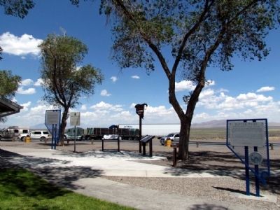
Near Interstate 80 at milepost 187, on the right when traveling west.
Whichever direction your travels take you, you're going to have a similar experience to what the California-bound emigrants had. You're going to see the same country, except for the towns and the ranch meadows. The big difference, though, is that . . . — — Map (db m67431) HM
Near Interstate 80 at milepost 187, on the right when traveling west.
"The water is warm and tastes but little better than soap suds. We use acid in all the water we drink, by that means we manage to get along, although we are all anxious to get off this river" - Ephriam Brandiff, Aug. 16, 1852 — — Map (db m70354) HM
Near West Winnemucca Boulevard 173 miles Interstate 80.
"The road still continues on the south side of the river, there is also one on the north side and I believe it is the old one. The one on the south side is said to be the best." - Joseph Middleton, Sep 18, 1849
Guidebook available
Trails . . . — — Map (db m138455) HM
On Melarkey Street (U.S. 95) at W. Winnemucca Boulevard (Nevada Route 289), on the right when traveling north on Melarkey Street.
"Saw in this distance a flag flying denoting a trading post, rode over to it but found the most they had to sell was very poor whiskey. ... These traders get a great price for everything they sell." - Henry S. Anable, Aug. 25, 1852 — — Map (db m70355) HM
On Museum Avenue near Maple Avenue, on the left when traveling west.
Between 1841 and 1869, up to 250,000 emigrants followed the California Trail along the Humboldt River to California. in 1846, the Donner Party traveled along this trail and Donner Party teamster, John Snyder was killed in a dispute with wagon . . . — — Map (db m141453) HM
"Went on up the canyon [Simpson Park] which is very wide and
not very steep... on going over the summit the descent was
more abrupt down into the valley... we came to the
Reasses [Reese] River" - Lumin A. Scott, Aug 25, 1859
For guidebook . . . — — Map (db m263656) HM
"Crossed the river... to avoid some very high bluffs which here come to the river. One is very high, leaving a foot path under it. The country is very mountainous-the hills bare and rocky... the valley very narrow."-Byron N. McKinstry, Sep 4, . . . — — Map (db m264924) HM
"I met an Indian with a little tin bucket containing
about a gallon of water He offered me a drink, but
I refused, stating that there were men behind dying
for water". James William Evans, Aug 10, 1850
Guidebook Available
Trails West . . . — — Map (db m263653) HM
"There was deep sand for eight miles, and the road
on both sides was strewn with dead cattle. A number of
our train succumbed to the heavy travel and heat".
- Helen Carpenter, Sep 18, 1857
Guidebook Available
Trails West, Inc.
P.O. . . . — — Map (db m263654) HM
"Grass the best I ever saw. Better than any meadow in the
states. There are a large number of campers around us all
cutting grass with sythis" - William R. Brown, Sep 7, 1853
M.E.0. 1996
Guidebook available
Trails West Inc. P.O. Box . . . — — Map (db m263865) HM
"Came to the Sink of St Marys a dreary road, dessolate
as a frozen lake" - William Chamberlain, Aug 4, 1849
M.E.O. 1996
Guidebook available
Trails West Inc. P. O. Box 12035 Reno, Nevada 89510
Emigrant Trail-Humboldt River Route . . . — — Map (db m264103) HM
“Passed down the valley near the slough... the slough water
is considerably impregnated with alkali, but is used for
animals & all other purposes.... No good water below this
slough, nor grass.” - Augustus Ripley Burbank, Aug 30, 1849
. . . — — Map (db m263930) HM
On North Red Rock Road at Silver Lake Road on North Red Rock Road.
"We travelled about 17 miles and encamped near the Peavine
Springs, with good grass and water, but no fuel except
buffalo chips. Our road stony and bad evening fine." -
Harriet Sherrill Ward, Sep 29, 1853
Guidebook available
Trails . . . — — Map (db m263650) HM
Near Interstate 80, on the right when traveling east.
"We crossed the river 3 times ... which has become almost a perfect torrent ... our men have had all kinds of sport at the crossings, the water sometimes taking them off their feet and rolling them over like a barrel." - James Godfrey, Aug 7, 1849 — — Map (db m149927) HM
On East Peckham Lane east of Coliseum Way, on the right when traveling east.
(front plaque)
Marker No.T.R.R. 13-A -- Truckee Meadows
the California bound emigrants rested here
before ascending the Sierras to the west
(back plaque)
This marker is No 13-A of a total of 70 placed along
the Humbolt, . . . — — Map (db m113027) HM
On Rio Poco Road at Creekside Circle, on the right when traveling south on Rio Poco Road.
Upon entering the Truckee Meadows along the Truckee River, thousands of California-bound emigrants turned their wagons southwest to avoid extensive marshes and uncrossable sloughs. Here at the base of Rattlesnake Mountain the emigrants established a . . . — — Map (db m94434) HM
On Tahoe Pyramid Bikeway, on the right when traveling west.
“Came to another crossing of the river (here from the...left flows down into the river one of the finest spring rivulets...). The 23rd crossing...is quite difficult. Made so by the large round bolder rocks...in its bed.” —Augustus Burbank, Sep 6, . . . — — Map (db m149982) HM
Beckwourth Trail - Golden Valley
"Here the trail leads around the western slope
of the red buttes and... over a sandy, stony and
rolling country". - Jacob S. Hayden, Aug 18, 1852
Guidebook Available
Trails West Inc. P.O. Box . . . — — Map (db m263652) HM
On Riverside Drive, on the right when traveling west.
On the Trail Today
Whichever direction your travels take you, you are going to have a similar experience to what the California-bound emigrants had. You are going to see the same country, except for the towns and the ranch meadows. The big . . . — — Map (db m308270) HM
On Riverside Drive, on the right when traveling west.
The historic California Trail was traversed by emigrants from the eastern United States en route to the gold fields or agricultural lands of California. On the trail, they traveled some 2,000 miles from the Missouri River to the Central Valley of . . . — — Map (db m308268) HM
On C Street west of Victorian Plaza Circle, on the right when traveling west.
"Leaving the [Truckee] river bore off to the right over a sage plain near a mile with rather sandy road to the base of a low ridge." - D. B. Andrews, Aug 9, 1852 — — Map (db m263531) HM
Truckee Trail - North Side of River
"Crossed to the north side of river,... keeping on N. side of this crossing the right hand road is the Beckworth route, we keep up river fifteen miles here by taking [a new] dim road to the left and . . . — — Map (db m263931) HM
On Tahoe Pyramid Bikeway, on the left when traveling east.
[Just before fording to the north side of Truckee River]" the road forks the left hand one is the old Truckee Route to Sacramento...The right hand one and the one we traveled is Beckwiths Cutoff [Beckwourth Trail]" - East S. Owen, Aug 22, 1852 — — Map (db m263932) HM
"Drove over a hill and came through a most beautiful pine forest to the [Truckee] river and crossed it for the last - 27th time. Camped on the opposite side by a spring." - Joseph Curtis Buffum, Aug 7, 1849 — — Map (db m149990) HM
The Truckee River you can see on the other side of the Interstate highway provided the first drink of life-saving water California-bound emigrants had after
crossing the Forty-Mile Desert. Emigrants and animals staggered to the Truckee,
half dead . . . — — Map (db m143783) HM
"Following up the Truckee, on a sandy road, in four miles an abrupt mountain shut out the valley, compelling us to cross the stream, which we found quite dangerous, because of the swift current and deep water." John Steele, Sep 10, 1850 — — Map (db m149892) HM
Passed Antelope to Rock Springs, where coming out of a rock is a stream of the coldest, purest water. Some one has driven a spigot into the crevice, making a spout…the most desirable camp of the journey." - William Carter Moss, Aug 2, 1861 — — Map (db m249470) HM
On State Highway 34 - 0.5 miles north of Road N2050, on the right when traveling south.
Near here on May 28, 1849, was the camp of a large party of gold seekers en route to California with a military escort under the command of Captain R. B. Marcy. The California Road was used by travelers for over 50 years. East of here about 4 miles . . . — — Map (db m39802) HM
On State Highway 59 at U.S. 77, on the right when traveling west on State Highway 59.
Caravans of gold seekers in the Rush for California traveled this Trail in spring, 1849, under military escort commanded by Capt. R.B. Marcy. Route lay west from Ft. Smith, south side of Arkansas and Canadian rivers, across Oklahoma. Camp ground . . . — — Map (db m144810) HM
On Oklahoma Route 33 at U.S. 283, on the left when traveling south on Oklahoma Route 33.
California Road, crossed here. First traveled by gold seekers in Rush for California spring 1849, under military escort commanded by Captain R.B. Marcy, west from Fort Smith, Arkansas. Antelope Hills, 8 miles northwest, once landmark for . . . — — Map (db m113944) HM
On East Main Street, on the right when traveling west.
"The valley opens and we pass some very pretty
locations. Timber in a great many varieties, some
entirely new to me." Virgil K. Pringle, Oct 11, 1846 — — Map (db m152440) HM
On E Hersey Street, on the right when traveling west.
"Make 10 miles and camp at a considerable sized creek
[Ashland Creek], the best camp we have had for several
[days.] Road very good. High mountains around."
- Virgil K. Pringle, Oct 11, 1846 — — Map (db m152442) HM
On Old Stage Road, on the right when traveling north.
"Father and I rode down to Jacksonville about 10 miles
from Wagner's Fort. The country is very fine. The town is
wedged up into the mountain but the mines are all stopped
Business is very dull" - Welborn Beeson, Sep 4, 1853 — — Map (db m149048) HM
On South Pacific Hwy (U.S. 99), on the right when traveling north.
"The roads today were excellent and the face of nature
appeared full as interesting as yesterday Followed
down Rogue River [Bear Creek] about 12 mi[le]s & camp"
-Lester Hulin, Oct 15, 1847 — — Map (db m152444) HM
We continued our journey towards Jacksonville this morning,
designing to find a suitable place to graze our cattle until we
can find a shelter for our families...we then proceeded across
a prairie...where we encamped" - William Hoffman, Oct . . . — — Map (db m152446) HM
On Talent Avenue, on the left when traveling west.
"The valley is about 3 miles wide here. It is not the main Rogue
River Valley, but a branch of it called Bear Creek...The first
tomatoes and melon patch I found I helped myself to as many as
I could eat being very hungary" - Wellborn Beeson, . . . — — Map (db m152443) HM
On South Sunset Drive, on the left when traveling north.
Hensley - Salt Lake City Cutoff
In August 1848, ten men with a mule pack train under the leadership of Samuel Hensley pioneered a trail near California Road at City of Idaho Utah border. Traveling Humboldt River, Hensley met and gave . . . — — Map (db m273065) HM
On Pony Express Road, on the left when traveling west.
"Having reached the plain the road ran for eight miles over a broken surface...it then forked. The left, which is about six miles the longer of the two, must be taken after rains, and leads to Devil's Hole.... We chose the
shorter cut and after . . . — — Map (db m249726) HM
On Pony Express Road, on the right when traveling west.
"Course nearly southwest across desert to 'Short Cut Pass'. Through this pass Chorpenning & Company, the mail contractors, have made a road, but it is so crooked and steep as to scarcely permit our wagons to get up it."
Capt. James H. Simpson, . . . — — Map (db m249722) HM
On Watchable Wildlife Area Access, on the left when traveling south.
"A rude stage station was established at Fish Springs, and the lonesome keeper greeted us warmly. The spring was a large pool of water lying
at the base of a low mountain. For three or four miles it sent out a large and copious stream, but the . . . — — Map (db m249730) HM
On East Pony Express Road, on the right when traveling west.
"At Boyd Station is a well 12 feet deep."
Cornelius Prather July 31, 1862
"Left camp [at Fish Springs] at seven o'clock. Drove on to the first station [Boyd Station] and nooned."
Albert Jefferson Young August 12, 1862
2017 Utah . . . — — Map (db m249756) HM
On Wilson Cutoff Road, on the right when traveling west.
"Soon after starting it commenced to rain, which softened the road so much as to cause the wagons to stall... At this point the road doubles the point of the range along which we have been traveling."
Captain James H. Simpson, May 7, 1859 . . . — — Map (db m249752) HM
On North Pony Express Road, on the right when traveling west.
"At sunup came to Willow Springs and camped. This is quite an extensive valley. These springs are deep holes like wells and some so deep there can be no bottom found. Some run over, others stand level full. Every year some stock is lost here by . . . — — Map (db m249496) HM
On Cove Fort Road, on the right when traveling east.
"16th Passed over some beautiful rich bottoms covered with green grass which is uncommon at this season of the year on this route. Passed over a high divide into a beautiful round valley [Cove Fort]. I shot the largest hare in this valley I have . . . — — Map (db m257255) HM
"Two miles farther on, we arrived at the foot of the mountain.... In this vicinity stood an immense, isolated rock under which was a cave, and those going into it found a human skeleton."
Heinrich Lienhard August 9, 1846 . . . — — Map (db m314290) HM
On Frontage Road, on the right when traveling east.
"Coming to the point of the ridge [Timpie Point]... I saw an expanse of water extending far to the North and East...The Salt Lake a joyful sight was spread before us. ...I had traveled so much in the vicinity of the Salt Lake that it had become . . . — — Map (db m254732) HM
"Left camp late this day on acct. of having to find a good road or pass through the Swamps of the utah outlet finally succeeded and encamped on the East Bank of Utah outlet making 5 [miles]"
James F. Reed, August 23, 1846 — — Map (db m154074) HM
Near Interstate 80 at milepost 171, on the right when traveling east.
Historic Corridor
Modern roads and highways often follow historic transportation corridors. In the mid 1800s, the California, Mormon Pioneer, and Pony Express Trails all passed through this canyon. Today, Interstate 80 in Echo Canyon . . . — — Map (db m67627) HM
On North Cooley Street, on the left when traveling north.
The Cherokee Trail is the longest branch
of the California National Historic Trail
It originates in Arkansas and Oklahoma.
The Trail crosses Kansas and Wyoming
East to West, and in Colorado, South to
North. In 1849, the Evans/Cherokee . . . — — Map (db m301548) HM
On East Pony Express Road, on the left when traveling west.
"Started out again across the desert, drove 6 miles, found water for our horses then drove on up the mountains for 9 miles of an upward grade. Reached the summit, then drove down into the Deep Creek Canyon."
- Abbey Fulkerth June 26, 1863 . . . — — Map (db m249753) HM
On Horseshoe Springs Road, on the right when traveling north.
First Explorations to the Great Salt Desert
Prior to May of 1841, no wagon roads to Oregon or California existed - only long-distance Indian footpaths worn deeper by fur trade caravans hauling supplies into the Rocky Mountains. In the early . . . — — Map (db m301588) HM
"This morning it is raining it seams so plesent to see it rain as we have not seen it rane since we came in the valey before we now noon near a salt spring [Horseshoe Springs] we then went on to elbow spring [Hope Wells] fresh water it is very good . . . — — Map (db m301553) HM
On Horseshoe Springs Road, on the left when traveling west.
"Seven miles brought us where the road forked - the left hand one leading up a ravine towards the mountain. We took it..."
Madison Berryman Moorman, July 27, 1850 — — Map (db m301554) HM
On Pony Express Road, on the left when traveling west.
"We struck the stage road in 5 miles. Good water here. Drove on to the summit of Point Lookout. Here we nooned and drove 1 miles farther to water and camped" Albert Jefferson Young, August 9, 1862 — — Map (db m249524) HM
On East Pony Express Road, on the left when traveling west.
"We were off at seven A. M. and marching 16 ½ miles camped at Pleasant (or Simpson's) Spring, where there is a mail station, getting into camp about one o'clock. We are now on the eastern rim of the Great American Desert."
William Lee (member of . . . — — Map (db m249633) HM
Near Unnamed Road near Leppy Pass Road, on the left when traveling north.
"The roads were gravelly round the end of some high rocks. Barren mountains (Silver Island)." -- Robert Chalmers, July 27, 1850 — — Map (db m105241) HM
On Silver Island Road near Crater Island Road, on the right when traveling west.
passed this way on the 2nd of September 1846, having lost 36 oxen, several wagons, and suffered much.
"Don't look for SHORT-CUTS" — — Map (db m105246) HM
“...a considerable Portion of the land between the Spanish Fork and F.P. [Fort Peteetneet] is low and marshy and Bad to cross especially with heaby loade waggons...some of the waggons required 9 yokes of oxen to get them through the sloughs 0 this . . . — — Map (db m272747) HM
An arduous 1,200-mile route between Santa Fe and Los Angeles, the "Old Spanish Trail" passed through Mountain Meadows during its heyday, between 1830 and 1848. The trail served traders who loaded their pack mules with woolen goods from Santa Fe each . . . — — Map (db m114259) HM
Near Natural Bridge Road (County Road 13) 2.5 miles south of Spring Canyon Road (County Road 11).
The Oregon Trail crosses LaPrele Creek about one mile downstream from Natural Bridge. Before the modern road was built into the gorge, Natural Bridge was difficult to access, and it was only rarely visited by emigrants of the covered wagon era. From . . . — — Map (db m71495) HM
On U.S. 287 1.7 miles west of Happy Springs Rd, on the right when traveling west.
Ice Slough is a small stream that flows into the Sweetwater River five miles east of here. In front of this point is a slough (i.e. a marsh or shallow un-drained depression). This slough gave the name to the stream east of here. In the "Ice Slough" . . . — — Map (db m62076) HM
Near U.S. 287 1 mile west of California Emigrant Rd, on the right when traveling west.
Originally called the Emigrant Road, the Oregon Trail was the main route of westward expansion from 1812 to 1869. An estimated 500,000 people journeyed past here in search of new lands and new lives in the West.
Because of its unique shape, . . . — — Map (db m62092) HM
Near U.S. 287 1 mile west of California Emigrant Road, on the right when traveling west.
Split Rock was a relay station during the turbulent 18 month life of the Pony Express. The Express operated at a gallop, speeding mail across the West in only 10 days. However, because of the "talking wire," its days were numbered. The telegraph . . . — — Map (db m69603) HM
Near U.S. 287 1 mile west of California Emigrant Road, on the right when traveling west.
Shoshone, Arapaho, Crow and Sioux Indians occupied this pleasant valley long before the Oregon Trail, which changed their cultures and life styles forever. This led to tragic warfare and the eventual loss of country they had called their own.
. . . — — Map (db m69602) HM
Near State Highway 28 0.7 miles south of Lander-Pinedale Stage Road.
From where you're standing South Pass doesn't look all that remarkable. But compared to the rugged Wind River Mountains, it can easily be recognized as a type of gateway.
Nevertheless, crossing the Continental Divide into "Oregon Country" was a . . . — — Map (db m67020) HM
Near State Highway 28 0.7 miles south of Lander-Pinedale Stage Road.
Even after the discovery of South Pass in 1824, it was years before the route was used extensively. Fur trapper/trader William Sublette brought a small caravan of wagons to South Pass in 1828. While his party did not take wagons over the pass, they . . . — — Map (db m67021) HM
Near State Highway 28 0.7 miles south of Lander-Pinedale Stage Road.
The trail over South Pass is a transportation corridor which served many purposes. In addition to being the route to Oregon and California, it was used by Mormon pioneers and by the Pony Express.
A great exodus to the Salt Lake Valley in 1847 . . . — — Map (db m67019) HM
Near State Highway 28 0.7 miles south of Lander-Pinedale Stage Road.
With South Pass behind them, Oregon and California-bound travelers faced the second half of their journey. The roughest travel was yet to come. From Missouri to South Pass, emigrants were able to follow rivers. But from South Pass to Oregon and . . . — — Map (db m67018) HM
On U.S. 189 12.8 miles north of State Highway 372, on the right when traveling north.
To the Shoshone Indian, this river was the Seeds-Kee-Dee Agie (Prairie Chicken River). On Sept. 16 1811, the Astorians near its headwaters termed it the Spanish River. To the Spaniards, far to the south, it was the Rio Verde (Green River). Jedediah . . . — — Map (db m36659) HM
On Sun Ranch Road 0.7 miles east of Martin Cove Road, on the right when traveling east.
The grave of F.R. Fulkerson was noted by forty-niner J.G. Bruff on July 26, 1849, as he traveled through what he termed "Pass of the Rattle-Snake Mountain to the left of Devil's Gate." The survival of the large granite boulder used as the Fulkerson . . . — — Map (db m66997) HM
Near State Highway 220 at milepost 63, 2.5 miles south of Buzzard Rd (County Route 410).
Thousands who traveled the Oregon Trail in central Wyoming were unaware that they were the beneficiaries of a long series of geological events. The granite peaks around you are mountains that rose, sank and then were buried in sand and ashy . . . — — Map (db m62149) HM
On Guernsey Road north of Tank Farm Road, on the right when traveling south.
Historic wagon ruts and swales mark this landscape, making it possible to envision wagon trains journeying westward through the grassy hills. Some travelers sought land in Oregon, many sought gold in California, while others pursued a place to . . . — — Map (db m314860) HM
On U.S. 191 1.9 miles north of State Highway 351, on the left when traveling north.
As the first federally funded road built west of the Mississippi, the Lander Road played an important role in emigrant travel. Beginning in 1859, emigrants used this 256-mile alternate route. This saved them up to seven days of travel, bypassed . . . — — Map (db m314935) HM
Near State Highway 28 7 miles north of Sqaw Road (Route BLM4106).
This marks a fork in the trail, right to Oregon, left to Utah and California.
1812, Robert Stuart and eastbound Astorians used South Pass gateway.
1824, Eleven westbound Ashley-Henry men led by Jedediah Smith and Thomas Fitzpatrick.
. . . — — Map (db m67035) HM
Near State Highway 28 7 miles north of Sqaw Road (Route BLM4106).
Trail ruts at this site were mistakenly identified as the Parting-of-the-Ways where emigrant parties separated on their journeys to Oregon, California, or Utah.
The actual Parting-of-the-Ways is approximately 10 miles west of this spot. . . . — — Map (db m237433) HM
Near State Highway 28 7 miles north of Sqaw Road (Route BLM4106).
In July 1844 the California bound Stevens-Townsend-Murphy wagon train, guided by Isaac Hitchcock and 81-year old Caleb Greenwood, passed this point and continued nine and one half miles southwest from here, to a place destined to become prominent . . . — — Map (db m67036) HM
Near State Highway 28 11.5 miles west of U.S. 191, on the left when traveling west.
Graves were an all-to-frequent reminder of the dangers of overland travel. Most emigrant journals record death, burial, or passing graves during the day's travel. Most burials along the trail were hasty affairs.
The official Company Journal of . . . — — Map (db m67045) HM
Near State Highway 28 11.5 miles west of U.S. 191, on the left when traveling west.
Death on the trail did not allow for the fineries of the funerals back home. Emigrants made do with materials available. Black would adorn the clothes of mourners, and care would be taken to provide the best funeral possible. The most travelers . . . — — Map (db m67044) HM
Near State Highway 28 11.5 miles west of U.S. 191, on the left when traveling west.
Just a few miles from where you're standing, the emigrants would come to the first of several trail "splits" that would take them to a crossing on the Green River where they would camp for the evening.
Even with South Pass behind them, Oregon . . . — — Map (db m67043) HM
Near State Highway 28 11.5 miles west of U.S. 191, on the left when traveling west.
Death was a constant companion for emigrants headed west. It is estimated that 10,000 to 30,000 people died and were buried along the trails between 1843 and 1869.
Cholera and other diseases were the most common cause of death. People didn't . . . — — Map (db m67046) HM
Near State Highway 28 11.5 miles west of U.S. 191, on the left when traveling west.
Relations between emigrants using the trails and the Indians were inconsistent during the migration period. While hostile acts and violent confrontation did occur, they have been overemphasized in trail history. During the early migration period of . . . — — Map (db m67049) HM
Near State Highway 28 11.5 miles west of U.S. 191, on the left when traveling west.
Welcome to the Pilot Butte Emigrant Trails Interpretive Site. The purpose of the site is to help you gain a sense of what life was like for the 400,000 emigrants who left their homes to seek a new life in the West. They were seeking wealth, . . . — — Map (db m67042) HM
Near State Highway 28 at milepost 102 near State Highway 372, on the left when traveling west.
This site of the Lombard Ferry was one of the most used crossings on the Green River, lasting from about 1843 into the early 1900s. First established by mountain men, it was operated by Mormons in the 1850s during the peak years of the westward . . . — — Map (db m88473) HM
396 entries matched your criteria. Entries 301 through 396 are listed above. ⊲ Previous 100