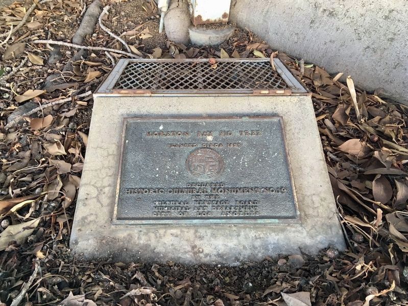
On National Boulevard at Military Avenue, on the right when traveling east on National Boulevard.
Planted circa 1875. Declared Historic Cultural Monument No. 19 by the Cultural Heritage Board, Municipal Art Department, City of Los Angeles. — — Map (db m188853) HM
On Normandie Avenue just north of 15th Street, on the right when traveling north.
St. Sophia
Greek Orthodox
Cathedral
Cultural Heritage Board
Monument No. 120
City of Los Angeles
Greek Orthodox Church
Cathedral of St. Sophia
Los Angeles California
Dedicated to the holy wisdom . . . — — Map (db m283829) HM
On Delgany Avenue 0.2 miles north of Manchester Avenue, on the left when traveling north.
Spanish Colonial Revival style. William J. Dodd, architect. Dickinson & Gillespie, contractor. Fritz B. Burns, developer. Built 1930. Declared 2019, Historic-Cultural Monument No. 1195, Cultural Heritage Commission, City of Los Angeles. . . . — — Map (db m292144) HM
Near Culver Boulevard at Pershing Drive, on the right when traveling west.
The varied habitats of Guashna, which includes the Ballona Wetlands, nurtures the Gabrielino-Tongva people
of the past, present, and future. Discover how this biodiversity contributes to their rich culture and survival.
Ti'at (Plank . . . — — Map (db m216623) HM
Near Tampa Avenue at Valerio Street, on the right when traveling north.
Adams Residence. Modern Style. Architect — Lloyd Wright. Built 1939. Declared 1996, Historic-Cultural Monument No. 629, City of Los Angeles, Cultural Heritage Commission, Cultural Affairs Department. — — Map (db m130146) HM
Near Leavenworth Drive west of Gaffey Street, on the left when traveling west.
War of 1812
Fort Nelson, VA. - June 22, 1813
Fort Oswego, NY. - May 5-6, 1814
Mexican War
Palo Alto - May 8. 1846
Resaca de la Palma - May 9, 1846
Monterey (sic) - Sept. 21-23, 1846
Vera Cruz - March 9-28, 1847 . . . — — Map (db m81750) HM
On Stephen M White Drive 0.3 miles east of Pacific Avenue.
Mediterranean style. Architect - David Berniker. Built 1932. Declared 1992, Historic-Cultural Monument No. 571,
City of Los Angeles, Cultural Heritage Commission, Cultural Affairs Department. — — Map (db m179817) HM
Fort MacArthur: Beginnings
1888
September 14,
Executive order by President
Grover Cleveland assigns
unnamed Military Reservation
to improve the defenses of the
Los Angeles Harbor.
1897 & 1910
Additional . . . — — Map (db m248112) HM
On Gaffey Street south of Leavenworth Drive, on the right when traveling south.
The friendship bell, overlooking the Pacific Ocean, was presented as a gift from the people of the Republic of Korea to the people of the United States of America on the occasion of the American Bicentennial Jubilee to further the . . . — — Map (db m51064) HM
On Beacon Street at 16th Street, on the left when traveling south on Beacon Street.
Colonial Revival style. Circa 1899. Declared 1982,
Historic-Cultural Monument No. 253,
City of Los Angeles, Cultural Heritage Commission, Cultural Affairs Department.
Muller House, a gift
of
the Muller family.
Restored by the
San . . . — — Map (db m179843) HM
Point Fermin Light House, dedicated by Stephen M. White and Rudecinda Parlors Native Sons and Native Daughters of the Golden West, San Pedro, California, May 2, 1940. Built 1874.
Point Fermin Lighthouse, erected 1874. Honored as a . . . — — Map (db m51006) HM
Los Angeles City
Fireboat 2 - Ralph J. Scott - commissioned 1925,
has been designated a
National Historic Landmark.
This vessel possesses national significance
in commemorating the history of the
United States of America. . . . — — Map (db m247914) HM
Commonly referred to as the Great White Steamer, the ship was specially built by William Wrigley to serve his Catalina Island as a passenger ferry. She was christened on May 23, 1924. During World War II, she was requisitioned for use as a troop . . . — — Map (db m113426) HM
On Beacon Street at 7th Street, on the left when traveling south on Beacon Street.
Beaux Arts style. Designer - City of Los Angeles. Built 1928. Declared 2002, Historic-Cultural Monument No. 732, City of Los Angeles,
Cultural Heritage Commission, Cultural Affairs Department. — — Map (db m180601) HM
Opened as the Warner Brothers Theatre on January 20, 1931, it was designed by architect B. Marcus Priteca and interior designer Anthony B. Heinsbergen and was the first sound-equipped theater in the South Bay. Jack Warner called it "The castle of . . . — — Map (db m81922) HM
On Harbor Boulevard at Signal Place, on the left when traveling south on Harbor Boulevard.
In 1852 German immigrant Augustus W. Timms obtained Sepulveda's Landing on the mudflats near here. He built a wharf, added a warehouse, corral and other facilities to service shipping and running of stages to Los Angeles. Timms was a pioneer in . . . — — Map (db m50976) HM
On Harbor Boulevard north of 6th Street, on the right when traveling north.
U.S.S. Los Angeles Naval Monument
Heavy Cruiser CA-135
To the personnel and ships
of the United States Navy
Anchors - loan United States Navy
Mainmast & mooring bitts - donated by Joseph S. Schapiro
Capstan cover - donated by San . . . — — Map (db m71839) HM WM
On Wilshire Boulevard at Plymouth Boulevard, on the left when traveling west on Wilshire Boulevard.
Romanesque Gothic style, 1924.
The tower,
modeled after the Moorish La Giralda,
Sevilla,
lends visual, cultural focus to the boulevard.
Declared
Historic Cultural Monument No. 114 by the Cultural Heritage Board, Municipal Arts Department, . . . — — Map (db m183317) HM
On Santa Monica Boulevard at Wellesley Avenue, on the right when traveling east on Santa Monica Boulevard.
Modern style. Architects - A. Quincy Jones & Frederick R. Emmons. Built 1954. Declared 2001,
Historic-Cultural Monument No. 696,
City of Los Angeles, Cultural Heritage Commission, Cultural Affairs Department. — — Map (db m230734) HM
On Sunnyslope Avenue at Contour Drive, on the left when traveling south on Sunnyslope Avenue.
Modern Style. R.M. Schindler, Architect. Built 1938.
Declared 2005, Historic-Cultural Monument No. 828,
City of Los Angeles, Cultural Heritage Commission. — — Map (db m164228) HM
On Van Nuys Boulevard 0.4 miles north of the Ventura Freeway (U.S. 101), on the left when traveling north.
In 1958, Stanley Burke's Coffee Shop opened its doors along Van Nuys
Boulevard, becoming a gathering place where neighbors shared stories
over coffee and food. Today, through Chick-fil-A's partnership with
local historic preservation experts, . . . — — Map (db m307981) HM
Near Micheltorena Street north of Carnation Avenue, on the left when traveling north.
Canfield-Moreno Estate,
later Canfield Home for Girls.
Built 1923,
Robert D. Farquhar - architect.
Historic-Cultural Monument No. 391,
declared October 4, 1988,
City of Los Angeles,
Cultural Heritage Commission,
Cultural Affairs . . . — — Map (db m250355) HM
On Silver Ridge Avenue 0.4 miles north of Alesandro Avenue, on the right when traveling north.
International style.
Rudolph M. Schindler, architect.
J.H. Heckman, builder.
Built 1926. Declared 2007,
Historic-Cultural
Monument No. 895,
Cultural Heritage Commission,
City of Los Angeles — — Map (db m230130) HM
Near Cove Avenue east of Silver Lake Boulevard, on the right when traveling east.
International style.
Rodney A. Walker,
architect and builder.
Built 1953.
Declared 2007,
Historic-Cultural
Monument No. 868,
Cultural Heritage Commission,
City of Los Angeles. — — Map (db m266727) HM
On Tesla Avenue at West Silver Lake Drive, on the left when traveling west on Tesla Avenue.
Where Does Your Water Come From?
Discover the history of water in Los Angeles and learn how the future of water is our future.
The Los Angeles River
About 15,000 years ago, people began moving into the Los Angeles Basin . . . — — Map (db m188162) HM
Near Tesla Avenue west of Armstrong Avenue, on the left when traveling west.
Silver Lake & Ivanhoe Reservoirs.
Engineer - William Mulholland.
Built 1906. Declared 1989,
Historic-Cultural
Monument No. 422,
City of Los Angeles,
Cultural Heritage Commission,
Cultural Affairs Department.
Donated by
the Silver . . . — — Map (db m231685) HM
On Sunset Boulevard just west of Hyperion Avenue, on the right when traveling west.
Site of the first documented LGBT civil rights demonstration in the nation, held on February 11, 1967.
Declared 2008, Historic-Cultural Monument No. 939, Cultural Heritage Commission, City of Los Angeles. — — Map (db m180370) HM
On 28th Street west of Central Avenue, on the left when traveling west.
The YMCA "Colored Branch"
The 28th Street Young Men's Christian
Association (YMCA) of Los Angeles,
also known as the "Colored Branch or
"Colored Y," opened its new building
in November 1926 at the corner of
East 28th Street and . . . — — Map (db m229206) HM
On Trousdale Parkway north of Hellman Way, on the left when traveling north.
For Old College, USC’s second-oldest building,
September 20, 1948 marked the beginning of
the end. Exactly 64 years to the day alter its cornerstone was laid, USC President Fred Fagg announced that the structure had outlived its usefulness. . . . — — Map (db m130178) HM
On Childs Way at Trousdale Parkway, on the right when traveling west on Childs Way.
His given name is the Trojan Shrine, but he is best-known by his nickname: Tommy Trojan. Probably the most popular and
recognizable member of the Trojan Family, he is a physical and symbolic rallying point for the entire university.
Tommy . . . — — Map (db m129746) HM
On Monmouth Avenue north of 27th Street, on the left when traveling north.
Site of the birthplace of Adlai E. Stevenson, statesman. February 5, 1900 - July 14, 1965. Declared a Historic Cultural Monument by the Cultural Heritage Board, Municipal Art Department, City of Los Angeles. — — Map (db m187045) HM
On Jefferson Boulevard west of Central Avenue, on the left when traveling west.
"Morticians of Distinction"
In A Man in Our Community, a 1937 biography
of L.G. Robinson, Baxter S. Scruggs wrote of
Robinson and other founders of Angelus Funeral
Home: "These men pledged themselves to the
task of . . . — — Map (db m229204) HM
On Watt Way at Hellman Way, on the right when traveling north on Watt Way.
One day in 1954, 350
students arrived at USC to take a
final exam. Most of them had never
before set foot on campus or even
seen their instructor in person.
Housewives, truck drivers, doctors,
businessmen, actors, schoolteachers and even . . . — — Map (db m229334) HM
On 25th Street at Arlington Avenue, on the right when traveling west on 25th Street.
Filipino Federation of America. Eclectic Victorian style. Built 1904.
Declared 1994, Historic-Cultural Monument No. 602,
City of Los Angeles, Cultural Heritage Commission, Cultural Affairs Department. — — Map (db m230134) HM
Near Figueroa Street south of Adams Boulevard, on the right when traveling south.
Automobile Club of Southern California. Headquarters building of the pioneer motoring club. Founded 1900. Built in Spanish Colonial style.
Declared Historic Cultural Monument No. 72 by the Cultural Heritage Board, Municipal Arts . . . — — Map (db m131042) HM
On Adams Boulevard at Grammercy Place, on the right when traveling west on Adams Boulevard.
Classical Revival style. Architect - Alfred F. Rosenheim. Built 1910. Declared 1978, Historic-Cultural Monument No. 197, City of Los Angeles, Cultural Heritage Commission, Cultural Affairs Department.
This property, Eugene W. Britt House, . . . — — Map (db m185094) HM
On Scarff Street 0.2 miles north of Adams Boulevard, on the left when traveling north.
Queen Anne style. Built 1895. Declared 1989, Historic-Cultural
Monument No. 409,
Cultural Heritage Commission, City of Los Angeles. — — Map (db m227405) HM
On 41st Street at Central Avenue, on the right when traveling west on 41st Street.
From Owl to Eagle
Starting in 1827, African American-owned
newspapers began popping up throughout the
United States, giving a voice to people who had
been largely voiceless. From the late 1800s until
1964, the California
Eagle . . . — — Map (db m229278) HM
On Hoover Street at Adams Boulevard, on the right when traveling north on Hoover Street.
Offering Light Amid California Sunshine
An amazing variety of people have called
this place home: turn-of-the-century
debutantes, science fiction writer and
Scientology founder L. Ron Hubbard, luckless women - and an evangelist . . . — — Map (db m239657) HM
On Cimarron Street just north of Adams Boulevard, on the right when traveling north.
William Andrews Clark Memorial Library, 1926.
Declared Historic Cultural Monument No. 28 by the Cultural Heritage Board, Municipal Art Department, City of Los Angeles. — — Map (db m185087) HM
On Trousdale Parkway 0.2 miles north of Exposition Boulevard, on the right when traveling north.
Edward L. Doheny Jr. Memorial Library
In the years leading up to the University
of Southern California's 50th anniversary in 1930,
a top fundraising priority was the construction
of a library. Even though USC by then had . . . — — Map (db m229312) HM
On Trousdale Parkway at Hellman Way, on the right when traveling north on Trousdale Parkway.
Building Bridges Between Cultures
To advance the love, peace, and unity he sought in the world, Dr. Joseph Medicine Crow enlisted education as his instrument of change. He was a historian, scholar, and ambassador for the Apsdalooke . . . — — Map (db m229405) HM
On Central Avenue at 42nd Place, on the right when traveling south on Central Avenue.
Luxury Digs for the NAACP
When W.E.B. Du Bois, a prominent African American intellectual and activist, first saw the luxurious new Somerville Hotel in the summer of 1928, he described it as "a jewel done with loving hands... all full . . . — — Map (db m191377) HM
On 24th Street near Toberman Street, on the left when traveling east.
Eastlake style, circa 1885. Declared 1984, Historic-Cultural Monument No. 273, City of Los Angeles, Cultural Heritage Commission, Cultural Affairs Department.
This property contributes to the St. James Park Historic District. Placed on . . . — — Map (db m227376) HM
On 103rd Street at Graham Avenue, on the right when traveling east on 103rd Street.
Egyptian Hieroglyphics are a style of writing that uses symbols or pictures to represent an idea,
a word, or a sound. Many of these emblems were based on hand signs that were used as an unspoken language.
Scarab - Represents the Sun God . . . — — Map (db m198219) HM
On Hobart Boulevard south of Adams Boulevard, on the left when traveling south.
This property, Engine House Number 18, has been placed on the National Register of Historic Places by the United States Department of the Interior.
This building was erected by the City of Los Angeles A.D. 1904 under the administration . . . — — Map (db m227338) HM
On Bill Robertson Lane north of Martin Luther King Jr Boulevard.
A picturesque Spanish-Colonial Revival
building which has served the community
since the 1920's. Declared
Historic Cultural Monument No. 127
by the Cultural Heritage Board,
Municipal Arts Department, City of Los Angeles. — — Map (db m190615) HM
On Van Buren Place at 27th Street, on the left when traveling north on Van Buren Place.
Tudor Craftsman style.
Architect - Frank Tyler.
Built 1910. Declared 2000, Historic-Cultural Monument No. 678, City of Los Angeles, Cultural Heritage Commission, Cultural Affairs Department.
This property has been
placed on the . . . — — Map (db m227403) HM
On Western Avenue at Adams Boulevard, on the left when traveling east on Western Avenue.
The Golden State Mutual Life Insurance Company was the largest African American owned insurance
company in the Western United States, and a central pillar in
the Los Angeles African American community for much of the
20th century. . . . — — Map (db m185110) HM
On 24th Street at Grammercy Park, on the right when traveling east on 24th Street.
Transitional Craftsman style. Architect - William E. Blaikie. Built 1910. Declared 1994, Historic-Cultural Monument No. 601, City of Los Angeles, Cultural Heritage Commission, Cultural Affairs Department. — — Map (db m186942) HM
On Trousdale Parkway at Childs Way, on the right when traveling south on Trousdale Parkway.
Gwynn Wilson, an exemplary student who graduated in 1921, has enhanced the University in many ways. He served USC with great distinction as a student body president and as president of the General Alumni Association. As general manager of the . . . — — Map (db m128482) HM
On Trousdale Parkway 0.1 miles north of Exposition Boulevard, on the right when traveling north.
Allan Hancock Foundation,
the University of Southern California, 1940.
Rufus B. Von KleinSmid, president of the university.
Allan Hancock, director of the foundation.
Building committee: Frank F. Barham, Henry W. Bruce, Addison B. Day, Elizabeth . . . — — Map (db m229921) HM
On 23rd Street 0.2 miles east of Hoover Street, on the left when traveling east.
Queen Anne style. Architect - August Wackerbarth. Built 1896. Declared 1987, Historic-Cultural Monument No. 335, City of Los Angeles, Cultural Heritage Commission, Cultural Affairs Department.
This property contributes to the St. James . . . — — Map (db m227471) HM
On Catalina Street just south of Jefferson Boulevard, on the right when traveling south.
Craftsman style.
Significant as the first
permanent headquarters for
the Young Korean Academy.
Built 1910. Declared 2023,
Historic-Cultural
Monument No. 1274,
Cultural Heritage Commission,
City of Los Angeles. — — Map (db m231682) HM
On 54th Street 0.1 miles east of Crenshaw Boulevard, on the right when traveling east.
A site with significant musical history.
Declared February 23, 1988, Historic-Cultural Monument No. 344
by the City of Los Angeles Cultural Heritage Commission -
Cultural Affairs Department. — — Map (db m206187) HM
On Central Avenue at 24th Street, on the right when traveling north on Central Avenue.
West Coast Apollo
When the Lincoln Theatre opened
on South Central Avenue at 23rd
Street in 1927 — resplendent, at a cost
of $500,000, with Moorish Revival
architecture, a 25-foot-wide marque, a big stage, an orchestra pit, . . . — — Map (db m228980) HM
On 27th Street at Magnolia Avenue, on the right when traveling west on 27th Street.
Miller and Herriott House,
Eastlake style,
circa 1890. Declared 1981,
Historic-Cultural Monument No. 242,
City of Los Angeles,
Cultural Heritage Commission,
Cultural Affairs Department.
This property has been
placed on the National . . . — — Map (db m238284) HM
On Trousdale Parkway at Exposition Boulevard, on the left when traveling north on Trousdale Parkway.
Seeley Wintersmith Mudd Memorial Hall.
University of Southern California.
Erected 1929.
Rufus B. Von Kleinsmid,
president of the university.
Ralph Tyler Flewelling,
director of the School of Philosophy.
Building committee:
Charles E. . . . — — Map (db m229811) HM
On Van Buren Place north of 27th Street, on the left when traveling north.
This property has been
placed on the National Register of Historic Places by the United States Department of the Interior.
Percy H. Clark Residence,
Craftsman style,
built 1903. Declared 1999,
Historic-Cultural Monument No. 672, City . . . — — Map (db m227375) HM
On Watt Way just north of Childs Way, on the right when traveling north.
Physical Education Building,
University of Southern California,
erected 1930.
Rufus B. Von Kleinsmid,
president of the university.
William Ralph La Porte,
director of the Division of Physical Education.
Building committee:
Charles E. . . . — — Map (db m230110) HM
On 40th Place 0.2 miles east of Central Avenue, on the left when traveling east.
First African American
to win the Nobel Peace Prize.
Built 1908. Declared 1976, Historic-Cultural Monument No. 159, City of Los Angeles, Cultural Heritage Commission, Cultural Affairs Department.
Built in 1908, this was the childhood . . . — — Map (db m174655) HM
On Harvard Boulevard at 25th Street, on the left when traveling north on Harvard Boulevard.
Frederick Hastings Rindge House, built 1902, has been placed on the National Register of Historic Places by the United States Department of the Interior.
Rindge House, Chateauesque style. Frederick Louis Roehrig, architect. Built 1902. . . . — — Map (db m185642) HM
On Hoover Street at 27th Street, on the right when traveling south on Hoover Street.
2703 S. Hoover, Los Angeles. Historic Cultural Monument #240. Contributing property of the North University Park National Register Historic District. This historic area is located within the boundaries of the North University Park Specific Plan. — — Map (db m220231) HM
On Scarff Street 0.1 miles north of Adams Boulevard, on the left when traveling north.
Queen Ann - Eastlake.
Joseph Cather Newsom, architect.
National Register of Historic Places - 1988.
L.A. Historic-Cultural Monument #408 - 1989.
St. James Park National Register Historic District - 1991.
University Park . . . — — Map (db m227382) HM
On 24th Street at Griffith Avenue, on the right when traveling east on 24th Street.
Second Baptist Church
of Los Angeles
has been placed on the
National Register
of Historic Places
by the United States
Department of the Interior, March 17, 2009. — — Map (db m177395) HM
On Adams Boulevard east of Hoover Street, on the right when traveling east.
Italian Renaissance architecture, 1907. Declared
Historic Cultural Monument No. 57
by the Cultural Heritage Board, Municipal Arts Department, City of
Los Angeles. — — Map (db m187044) HM
On Scarff Street 0.2 miles north of Adams Boulevard, on the left when traveling north.
Queen Anne style. Architect - Abraham M. Edelman. Built 1894. Declared 1989, Historic-Cultural Monument No. 407, City of Los Angeles, Cultural Heritage Commission, Cultural Affairs Department.
This property contributes to the St. James . . . — — Map (db m227466) HM
On West Jefferson Boulevard at Royal Street, on the left when traveling west on West Jefferson Boulevard.
A Shrine To Entertainment And Service
When the original Shrine Auditorium opened in 1906, the movies that would make it internationally recognizable were in their infancy; the first dramatic film made entirely in Los Angeles was being . . . — — Map (db m138639) HM
Near Adams Boulevard at Flower Street, on the right when traveling east.
Romanesque style. Architects: Pierpont and Walter Davis. Built 1924. Declared 1991, Historic-Cultural Monument No. 516, City of Los Angeles, Cultural Heritage Commission, Cultural Affairs Department. — — Map (db m189274) HM
On St James Park West at St James Park, on the right when traveling west on St James Park West.
Colonel John E. Stearns Residence.
Classical Revival style. Architect - John Parkinson. Built 1900. Declared 1989, Historic-Cultural Monument No. 434, City of Los Angeles, Cultural Heritage Commission, Cultural Affairs Department.
This . . . — — Map (db m229095) HM
On 34th Street 0.2 miles west of Figueroa Street, on the right when traveling west.
This house was residence to the wife and five children of Ahn Chang Ho (1878-1938),
Korean patriot, educator, social reformer and statesman. Ahn and his wife Helen were
the first Koreans to legally immigrate to America as a married couple. . . . — — Map (db m229279) HM
On Childs Way at Pardee Way, on the right when traveling west on Childs Way.
Dedicated on September 4, 1880, this original building of the University of Southern California has been continuously in use for educational purposes since its doors were first opened to students on October 6, 1880, by the university's first . . . — — Map (db m126924) HM
On 34th Street 0.3 miles west of Figueroa Street, on the right when traveling west.
University of Southern California.
Erected 1964.
Norman Topping, President of the University.
Leonard K. Firestone, Chairman of the Board.
Killingsworth, Brady & Associates, Architects. — — Map (db m229305) HM
On Obama Boulevard at Cloverdale Avenue, on the right when traveling east on Obama Boulevard.
Baldwin Hills Village
has been designated a
National Historic Landmark.
This residential complex possesses national significance
in commemorating the history of the
United States of America.
Reginald Johnson with Lewis Wilson, Edwin . . . — — Map (db m175168) HM
On 107th Street east of Graham Avenue, on the left when traveling east.
Watts Towers
California Historical Landmark No. 993
Unconventional Life, Unconventional Art
Simon Rodia has been referred to as a visionary and a man of great passion. A self-taught laborer from Italy, he had a singular goal in . . . — — Map (db m51953) HM
On Flower Street at 38th Street, on the left when traveling south on Flower Street.
Mediterranean style.
Architect - W. L. Schmolle.
Built 1937.
Declared 1993,
Historic-Cultural Monument No. 583,
City of Los Angeles,
Cultural Heritage Commission,
Cultural Affairs Department. — — Map (db m230340) HM
Near Lankershim Boulevard 0.1 miles north of the Hollywood Freeway (U.S. 101), on the left when traveling north.
Beneath this park rest the stone foundations and floor tiles of the historic adobe where Mexican General Andres Pico and U.S. Lieutenant Colonel John C. Fremont signed the Treaty of Cahuenga on January 13, 1847. Signing the Treaty ended the . . . — — Map (db m126025) HM
On Multiview Drive 0.7 miles west of Broadlawn Drive.
Mid-Century Modern style, R.M. Schindler, architect. Built 1946. Declared 2007, Historic-Cultural Monument No. 860, Cultural Heritage Commission, City of Los Angeles. — — Map (db m167894) HM
Near Coldwater Canyon Avenue 0.4 miles south of Ventura Boulevard, on the left when traveling south.
St. Saviour's Chapel, 1914.
Declared Historic Cultural Monument No. 32 by the Cultural Heritage Board, Municipal Art Department, City of Los Angeles. — — Map (db m175149) HM
On Cahuenga Boulevard at Universal Studios Boulevard, on the right when traveling south on Cahuenga Boulevard.
Birthplace of Modern Dance
in Los Angeles.
Built 1945. Declared 2003, Historic-Cultural Monument No. 763, City of Los Angeles, Cultural Heritage Commission. — — Map (db m163632) HM
On Wrightwood Court north of Wrightwood Lane, on the right when traveling north.
Contemporary Custom Ranch Style. Benton and Park, Architects. Built 1959. Declared 2024, Historic-Cultural Monument No. 1303, Cultural Heritage Commission, City of Los Angeles. — — Map (db m264761) HM
On Mulholland Drive 1.3 miles east of Laurel Canyon Boulevard, on the left when traveling east.
The Entertainment Capital
In 1912, Carl Laemmle bought a 230-acre chicken ranch and started Universal Studios. He kept the chickens just in case the movie business failed. He could not foresee that Los Angeles would become the world's . . . — — Map (db m129933) HM
Constructed by Indian stone mason Montelongo, circa 1930. Declared 1977, Historic-Cultural Monument No. 172, City of Los Angeles, Cultural Heritage Commission, Cultural Affairs Department. — — Map (db m187456) HM
Settling Basin built by San Fernando Mission Indians about 1800. Mission water supply came from these wells.
panel 2:
Original water supply system, San Fernando Mission, circa 1800. Declared Historic Cultural Monument No. 50 . . . — — Map (db m111907) HM
On Foothill Boulevard 0.1 miles west of Balboa Boulevard, on the right when traveling west.
On November 5, 1913, 40,000 people gathered here to witness the dedication of the Los Angeles - Owens River Aqueduct. The terminus of a 233-mile long engineering marvel, the Cascades were the site of William Mulholland‘s famous speech: “There it is, . . . — — Map (db m165409) HM
On Foothill Boulevard at Bledsoe Street, on the right when traveling east on Foothill Boulevard.
This Cemetery, earlier known as Morningside Cemetery, is the oldest non-sectarian cemetery in San Fernando Valley. It was used from the early 1800's until 1939. It was legally abandoned in 1959. In this same year Mrs. Nellis S. Noble donated the . . . — — Map (db m157885) HM
On Commerce Avenue at Valmont Street, on the right when traveling north on Commerce Avenue.
Bolton Hall, 1913. Declared Historic Cultural Monument No. 2 by the
Cultural Heritage Board, Municipal Art Department, City of Los Angeles. — — Map (db m163740) HM
McGroarty Home and Grounds,
built in 1929 for John Steven McGroarty,
famed California Poet Laureate, historian,
journalist and congressman.
Declared February 4, 1970
Historic-Cultural Monument No. 63
by the City of Los Angeles,
Cultural . . . — — Map (db m232358) HM
Verdugo Hills of Peace
Pioneer Cemetery,
established in 1922 by
Marshall Valentine Hartranft.
Declared 2009,
Historic-Cultural
Monument No. 946, Cultural Heritage Commission, City of Los Angeles. — — Map (db m195257) HM
On Laurel Canyon Boulevard just south of Burbank Boulevard, on the left when traveling south.
The first structure built as a synagogue in the San Fernando Valley on land donated by the family of Nathan and Vera Blumberg. The modern
Georgian building, designed by
architect Herman Light, was the gift of
George and Isadore Familian in . . . — — Map (db m170171) HM
On Hamlin Street at Vesper Avenue, on the right when traveling west on Hamlin Street.
Built in 1921 by Robert J. Baird, owner of a pioneering gardening business specializing in fruit and walnut trees. The Baird House was
declared Los Angeles Historical Monument Number 203 in 1978. — — Map (db m127624) HM