THE HISTORICAL
MARKER DATABASE
“Bite-Size Bits of Local, National, and Global History”


3998 entries match your criteria. Entries 301 through 400 are listed. ⊲ Previous 100 — Next 100 ⊳


National Register of Historic Places (NRHP) Historical Markers

This is a collection of buildings and places listed on the National Register of Historic Places (NRHP) that is administered by the U.S. Department of the Interior. This series showcases America’s notable historical and archeological resources.
 
By Cosmos Mariner, July 25, 2025
Christ Episcopal Church Marker
301 ► Colorado, Fremont County, Cañon City — Christ Episcopal Church —
On Harrison Avenue just east of North 8th Street, on the right when traveling east.
This property has been placed on the National Register of Historic Places by the United States Department of the Interior — — Map (db m281999) HM
302 ► Colorado, Fremont County, Cañon City — First United Methodist Church / Christ First Community Church —
On Main Street at North 8th Street, on the right when traveling west on Main Street.
This property has been placed on the National Register of Historic Places by the United States Department of the Interior — — Map (db m294300) HM
303 ► Colorado, Fremont County, Cañon City — General Jos. H. Maupin — (1856-1929) —
On North 5th Street just south of Macon Avenue, on the right when traveling south.
General Jos. H. Maupin (1856-1929) was responsible for construction of this building — done in two phases from 1903-1907. His name is inscribed at the northeast corner along with another inscription just above — “The Post Office Block.” The Post . . . — — Map (db m281697) HM
304 ► Colorado, Fremont County, Cañon City — Greenwood Cemetery —
Near South 1st Street (County Road 3) 0.2 miles south of West New York Avenue, on the right when traveling south.
This property has been placed on the National Register of Historic Places by the United States Department of the Interior — — Map (db m282344) HM
305 ► Colorado, Fremont County, Cañon City — Holy Cross Abbey Monastery —
Near Abbey Parkway North 0.1 miles north of U.S. 50, on the left when traveling north.
Has been placed on the National Register of Historic Places by the United States Department of the Interior August 18, 1983 — — Map (db m282000) HM
306 ► Colorado, Fremont County, Cañon City — Raynolds-McGee Block (1883) / McClure/Strathmore Hotel (1874) —
On South 4th Street at Main Street, on the right when traveling north on South 4th Street.
Raynolds-McGee Block (1883) Construction of this two-story Gothic Revival building was completed in 1883. Frederick A. Raynolds owned the east half which housed the Fremont County Bank. William B. McGee owned the west half, occupied . . . — — Map (db m281698) HM
307 ► Colorado, Fremont County, Cañon City — Robison Mansion — Built c. 1884 —
On Riverside Avenue at South 1st Street, on the left when traveling west on Riverside Avenue.
Robison Mansion Built c. 1884 has been placed on the National Register of Historic Places by the United States Department of the Interior — — Map (db m294000) HM
308 ► Colorado, Fremont County, Cañon City — Samuel H. Atwater House —
On Macon Avenue just west of North 9th Street, on the right when traveling west.
This property has been placed on the National Register of Historic Places by the United States Department of the Interior — — Map (db m281998) HM
Paid Advertisement
309 ► Colorado, Fremont County, Cañon City — W. C. Catlin — 1888 —
On Main Street at 3rd Street, on the left when traveling west on Main Street.
W. C. Catlin 1888 contributes to the Cañon City Downtown Historic District — — Map (db m294379) HM
310 ► Colorado, Fremont County, Cañon City — Ward/Graves Hospital Building —
On Macon Avenue at North 6th Street, on the left when traveling west on Macon Avenue.
This property has been placed on the National Register of Historic Places by the United States Department of the Interior — — Map (db m294381) HM
311 ► Colorado, Fremont County, Florence — Florence High School —
On Maple Avenue just north of West 2nd Street, on the left when traveling north.
This property has been listed in the National Register of Historic Places by the United States Department of the Interior — — Map (db m295000) HM
312 ► Colorado, Grand County, Winter Park — Cozens Ranch — 1874 —
On Zerex Street (U.S. 40) 0.1 miles north of Grand Park Drive, on the right when traveling north.
Homestead, ranch, stagecoach stop, post office, hotel, Jesuit retreat, museum Placed on the National Register of Historic Places by the United States Department of the Interior June 9, 1988 — — Map (db m288200) HM
313 ► Colorado, Grand County, Winter Park — Cozens Ranch Museum — Gateway to Grand County Heritage — Grand County History • Experience Our Heritage —
On Zerex Street (U.S. 40) 0.1 miles north of Grand Park Drive, on the right when traveling north.
Cozens Ranch Museum Welcome to historic Grand County, known by early explorers as Middle Park. Connect with history by visiting the Heritage Coalition's many historic and cultural sites - from the top of Berthoud Pass, west along Highway 40 to . . . — — Map (db m288193) HM
314 ► Colorado, Hinsdale County, Lake City — Armory Hall — Built 1883 —
On 3rd Street just east of Bluff Street, on the right when traveling east.
Lake City is to have an opera house! Those exciting words echoed up and down Silver Street in June, 1883, when it was announced that a select group of Lake City businessmen and capitalists had formed the Lake City Building Association with . . . — — Map (db m292091) HM
315 ► Colorado, Hinsdale County, Lake City — Crystal Lake Lodge No. 34 A.F. & A.M. — Lodge Built 1908 —
On Silver Street just north of 2nd Street (County Road 20), on the left when traveling north.
In September, 1875, members of the Masonic fraternity proposed the establishment of a lodge in Lake City. Twenty Masons, who felt themselves to be sufficiently permanent residents to affiliate with a local lodge, met on December 4, 1875. To provide . . . — — Map (db m292097) HM
316 ► Colorado, Hinsdale County, Lake City — Finley Block — Built 1877 —
On Silver Street at 2nd Street (County Road 20), on the right when traveling north on Silver Street.
Two of Lake City's earliest cabins were built near this location in August, 1874, by Enos Hotchkiss and John Bartholf. The men were part of a road building party which passed through the area while constructing the Saguache & San Juan Toll Road . . . — — Map (db m292188) HM
317 ► Colorado, Hinsdale County, Lake City — First Baptist Church — Built 1891 —
On Bluff Street at 4th Street, on the right when traveling south on Bluff Street.
Recalling the pastorate of her father, Rev. Waller Lile Pierce, at the First Baptist Church of Lake City in 1901 and 1902, Annie Pierce McNally exclaimed, “... if the walls of that church could cry out, what a story of redemption they would tell!” . . . — — Map (db m292173) HM
Paid Advertisement
318 ► Colorado, Hinsdale County, Lake City — Henry Kohler House — Built 1880-81 —
On Silver Street at 5th Street, on the left when traveling south on Silver Street.
“The Metropolis of San Juan,” as Lake City was already calling itself in the mid-1870's, was in the midst of a building boom when two young, college-educated men decided to open the city's first drug store in the spring of 1876. The two . . . — — Map (db m292198) HM
319 ► Colorado, Hinsdale County, Lake City — Hough Block — Built 1880-82 —
On Silver Street at 3rd Street, on the left when traveling south on Silver Street.
Both adversity and opportunity were the result of the Great Fire of 1879 which destroyed the major business district of Lake City. The fire started during the early morning hours of November 8 in a one-room saloon known as "Billy's Place" on Third . . . — — Map (db m292185) HM
320 ► Colorado, Hinsdale County, Lake City — Hughes Cabin — 1876 —
On 3rd Street just west of Silver Street, on the right when traveling west.
After being acquired for public offices in 2000, succeeding layers of stucco and clapboard siding were removed from the exterior of the historic Hughes cabin to reveal hand-hewn log beams of the original small, one-room structure which is now . . . — — Map (db m292099) HM
321 ► Colorado, Hinsdale County, Lake City — John S. Hough House — Built 1877 —
On Gunnison Avenue (State Highway 149) at 5th Street, on the left when traveling south on Gunnison Avenue.
Writing in 1937, Lake City newspaper editor William C. Blair observed that the San Juan region had “contributed its share of tragedy, romance and pathos to the history which records the incidents of all mining discovery and development, but in . . . — — Map (db m292290) HM
322 ► Colorado, Hinsdale County, Lake City — Presbyterian Church and Manse — 1876 —
On 5th Street just west of Gunnison Avenue (State Highway 149), on the left when traveling west.
Lake City was just beginning to boom when the Rev. Alexander Darley arrived from Del Norte, Colorado Territory, in June of 1876. Within a few weeks, Darley gathered the signatures necessary to charter a congregation, making Lake City's Presbyterian . . . — — Map (db m292199) HM
323 ► Colorado, Hinsdale County, Lake City — St. James Episcopal Chapel — 1876 —
On Gunnison Avenue (State Highway 149) at 5th Street, on the right when traveling south on Gunnison Avenue.
St. James Episcopal Chapel occupies one of Lake City's oldest surviving frame structures, a carpenter shop with vertical board and bat siding which was built in 1875 by a building and contracting firm owned by H.E. Turner and J.B. Lyons. Turner & . . . — — Map (db m292196) HM
324 ► Colorado, Hinsdale County, Lake City — Stone Bank Block — Built 1877 —
On Silver Street at 3rd Street, on the left when traveling north on Silver Street.
Western Colorado's first banking house, the Hinsdale County Bank, opened in Lake City in June of 1876. The bank was a branch of the First National Bank of Colorado Springs and boasted prominent banker H.A. McIntire as president and H.J. Alexander . . . — — Map (db m292157) HM
325 ► Colorado, Hinsdale County, Lake City — Susan B. Anthony Speaks at Courthouse on September 20, 1877 —
On Henson Street north of 3rd Street, on the left when traveling north.
The Hinsdale County Courthouse is a two-story, front-gabled frame building that was built in Italianate style and completed in June of 1877. It is Colorado's oldest courthouse which continues to function as a courthouse and is a rare surviving . . . — — Map (db m292100) HM
326 ► Colorado, Jackson County, Gould — The Colorado State Forest Management Complex —
Near State Highway 14 at milepost 59.2, 0.1 miles east of Ranger Lakes Campground, on the right when traveling east.
The Colorado State Forest Management Complex has been placed on the National Register of Historic Places by the United States Department of the Interior January 2017 — — Map (db m293600) HM
Paid Advertisement
327 ► Colorado, Kit Carson County, Flagler — Flagler Hospital 1937-63 — Built in 1909 as Hotel Flagler —
On Main Avenue just north of West 3rd Street, on the left when traveling north.
has been placed on the National Register of Historic Places by the United States Department of the Interior — — Map (db m257638) HM
328 ► Colorado, La Plata County, Durango — 8 — Durango skyscraper, circa 1896 —
On East 2nd Avenue at East 8th Street, on the right when traveling north on East 2nd Avenue.
The three-story building, center left, was Durango’s skyscraper, the Newman Building. It had the only elevator in the whole region. Built by Charles Newman, an early Durango druggist and politician, the structure indicated Durangoans had a great . . . — — Map (db m267896) HM
329 ► Colorado, La Plata County, Durango — Electric Revolution —
Near West 14th Street just west of Camino Del Rio (U.S. 550).
“Durango has electric lights for her workers, an advantage to the city’s conveniences which is far more than pleasing.” ~Durango Herald, 1888 The first electric power plant, the Durango Light Company, produced Direct Current (DC) . . . — — Map (db m267898) HM
330 ► Colorado, La Plata County, Durango — 1 — Main Avenue/Strater Hotel circa 1891 —
On Main Avenue just north of East 7th Street, on the right when traveling north.
Every community wished to have an outstanding hotel. The Strater, opening in 1888, provided that facility. The horse drawn trolley, coming up Main Avenue, operated from 1891 to 1893. It ran from the depot, north to the Main Avenue Bridge. The . . . — — Map (db m267890) HM
331 ► Colorado, La Plata County, Durango — The Gardenswartz Building — 1883 —
On West 9th Street at Main Avenue, on the right when traveling east on West 9th Street.
Listed in The National Register of Historic Places in Recognition of its Contribution to Durango’s Main Avenue Historic District — — Map (db m267982) HM
332 ► Colorado, La Plata County, Durango — The Rochester Hotel — Built in 1892 —
On East 2nd Avenue just north of East 7th Street, on the right when traveling north.
Has been placed on the National Register of Historic Places by the United States Department of the Interior — — Map (db m268000) HM
333 ► Colorado, Lake County, Leadville — Annunciation Church — Historic Landmark —
On Poplar Street at East 7th Street, on the left when traveling north on Poplar Street.
Under Fr. Henry Robinson’s initiative, the building of this lovely church was begun in 1879. The first mass was celebrated on January 1, 1880, before construction was finished. — — Map (db m289860) HM
334 ► Colorado, Lake County, Leadville — Golden Burro Cafe —
On Harrison Avenue (U.S. 24) just north of East 7th Street, on the right when traveling north.
This property has been listed in the National Register of Historic Places by the United States Department of the Interior — — Map (db m289893) HM
335 ► Colorado, Lake County, Leadville — Leadville City Hall —
On Harrison Avenue (U.S. 24) at East 8th Street, on the right when traveling north on Harrison Avenue.
[English]  Leadville City Hall was built in 1905 as a federal building, it was used as the US Post Office until 1973. As the story goes, the postmaster used the small attic windows to spy on his employees as they . . . — — Map (db m289799) HM
Paid Advertisement
336 ► Colorado, Lake County, Leadville — Tabor Grand Hotel —
On West 7th Street at Harrison Avenue (U.S. 24), on the left when traveling east on West 7th Street.
Has been designated a National Historic Landmark This building possesses national significance in commemorating the history of the State of Colorado. In the early 1880’s when the Leadville Hotel Company came up short-funded for . . . — — Map (db m289883) HM
337 ► Colorado, Lake County, Leadville — Tabor Opera House — Historic Landmark —
On Harrison Avenue (U.S. 24) just north of East 3rd Street, on the right when traveling north.
Horace Tabor’s Opera House was considered to be one of the finest west of the Mississippi. It opened to the public on November 20, 1879. — — Map (db m282899) HM
338 ► Colorado, Larimer County, Bellvue — Arrowhead Visitor Center — Pancakes, Pies, and Pinochle —
On Poudre Canyon Road (State Highway 14 at milepost 88) at Forest Road 296.12, on the left when traveling east on Poudre Canyon Road.
“The 39 years we owned and operated Arrowhead Lodge brought us hundreds of lifetime friendships and experiences in community development that we will cherish forever.” — Stanley R. Case The Arrowhead Visitor Center is at the site of the . . . — — Map (db m281001) HM
339 ► Colorado, Larimer County, Loveland — Rialto Theater —
On East 4th Street.
Built in 1920 National Register of Historic Places — — Map (db m222007) HM
340 ► Colorado, Las Animas County, Trinidad — Carnegie Public Library — 1904 —
On North Animas Street at Church Street, on the left when traveling south on North Animas Street.
has been placed on the National Register of Historic Places by the United States Department of the Interior — — Map (db m280500) HM
341 ► Colorado, Las Animas County, Trinidad — Corazón de Trinidad National Historic District —
On West Main Street (Business Interstate 25) just west of North Commercial Street, on the left when traveling east.
Established in 1973, this National Historic District encompasses about 40 irregularly shaped city blocks in the Heart of Trinidad. The first log cabins and adobe houses were built here in 1861. Most of the existing buildings were constructed . . . — — Map (db m282383) HM
342 ► Colorado, Las Animas County, Trinidad — The Methodist Church of Trinidad —
On Broom Street at State Street, on the left when traveling west on Broom Street.
One of the oldest churches in Colorado, and the first of the Protestant faith to be established in this community, was founded by E. J. Rice, pioneer Methodist preacher from Kansas, in October of 1869. The first edifice was erected on what is now . . . — — Map (db m280700) HM
343 ► Colorado, Las Animas County, Trinidad — Trinidad History Museum Complex —
On East Main Street (Business Interstate 25) just east of North Chambers Street, on the left when traveling east.
The entire block across Main Street from you is the Trinidad History Museum, a complex of three museums and historic gardens overlooking the Mountain Route of the Santa Fe Trail. The Baca House, on the right, was built in 1870 by John Hough, a . . . — — Map (db m282400) HM
344 ► Colorado, Las Animas County, Trinidad — Zion's German Lutheran Church — 1889 —
Near Pine Street at Prospect Street, on the right when traveling east.
This property is listed in the National Register of Historic Places by the United States Department of the Interior — — Map (db m282500) HM
Paid Advertisement
345 ► Colorado, Lincoln County, Limon — Limon Railroad Depot — Former Rock Island Line and Union Pacific Station —
Near 1st Street near Civic Center Drive, on the right when traveling east.
This property has been placed on the National Register of Historic Places by the United States Department of the Interior — — Map (db m257700) HM
346 ► Colorado, Lincoln County, Limon — Rock Island Snow Plow No. 95580 —
Near 1st Street near D Avenue, on the right when traveling east.
This property has been placed on the National Register of Historic Places by the United States Department of the Interior — — Map (db m257747) HM
347 ► Colorado, Logan County, Sterling — I & M Building —
On Main Street at South 3rd Street, on the left when traveling west on Main Street.
This property has been placed on the National Register of Historic Places by the United States Department of the Interior — — Map (db m289097) HM
348 ► Colorado, Logan County, Sterling — Logan County Courthouse — 1910 —
On Main Street just east of South 4th Street, on the right when traveling east.
Has been listed in the National Register of Historic Places by the United States Department of the Interior — — Map (db m289012) HM
349 ► Colorado, Logan County, Sterling — Sterling Public Library — 1916 —
On South 4th Street at Ash Street, on the left when traveling north on South 4th Street.
This property has been placed on the National Register of Historic Places by the United States Department of the Interior — — Map (db m289039) HM
350 ► Colorado, Logan County, Sterling — Sterling Union Pacific Railroad Depot —
On North Front Street just north of Main Street, on the left when traveling north.
This property has been placed on the National Register of Historic Places by the United States Department of the Interior — — Map (db m289001) HM
351 ► Colorado, Montezuma County, Dolores — Exon Mercantile — 315 Central Avenue —
On Central Avenue just west of North 4th Street, on the right when traveling west.
Built 1905-1907 Dolores Historical Registry Designation 1998 — — Map (db m290599) HM
352 ► Colorado, Montezuma County, Dolores — The Southern Hotel — Built 1893 —
On South 5th Street at Central Avenue, on the right when traveling north on South 5th Street.
National Register of Historic Places 1989 — — Map (db m290681) HM
353 ► Colorado, Montezuma County, Mancos — Bauer Bank Building — Built by George Bauer in 1905 —
On Grand Avenue (Business U.S. 160) at South Main Street, on the right when traveling east on Grand Avenue.
Restored by Charlie Mitchell 1998 In grateful recognition for outstanding effort and dedication to this restoration project Architect, Michael Bell, Durango • Bldg. Preparation, Shane Jarboe, Mancos • Bldg. Preparation, Daniel Towne, Mancos . . . — — Map (db m289196) HM
Paid Advertisement
354 ► Colorado, Montezuma County, Pleasant View — Lowry Ruin — Lowry Pueblo National Historic Landmark — Canyons of the Ancients National Monument —
On County Road 7.25 0.3 miles south of County Road CC.
Has been designated a Registered National Historic Landmark Under the provisions of the Historic Sites Act of August 21, 1935 this site possesses exceptional value in commemorating and illustrating the History of the United States. . . . — — Map (db m283800) HM
355 ► Colorado, Montrose County, Montrose — Elks Lodge —
On South Cascade Avenue at South 1st Street, on the right when traveling north on South Cascade Avenue.
This property has been placed on the National Register of Historic Places by the United States Department of the Interior — — Map (db m290997) HM
356 ► Colorado, Montrose County, Montrose — Montrose City Hall —
On South 1st Street just south of South Uncompahgre Avenue, on the right when traveling south.
This property has been placed on the National Register of Historic Places by the United States Department of the Interior — — Map (db m291200) HM
357 ► Colorado, Montrose County, Montrose — The Lathrop House — 1902 —
On East Main Street just east of South Mesa Avenue, on the right when traveling east.
Has been placed on the National Register of Historic Places by the United States Department of the Interior — — Map (db m283700) HM
358 ► Colorado, Montrose County, Montrose — Townsend House — Circa 1887 —
On South 5th Street at South Townsend Avenue (U.S. 550), on the right when traveling north on South 5th Street.
This property has been placed on the National Register of Historic Places by the United States Department of the Interior — — Map (db m283600) HM
359 ► Colorado, Morgan County, Fort Morgan — Farmers State Bank Building — Donated by Bloedorn Family —
On Main Street at East Kiowa Avenue, on the left when traveling south on Main Street.
Has been placed on the National Register of Historic Places by the United States Department of the Interior — — Map (db m289497) HM
360 ► Colorado, Morgan County, Fort Morgan — Fort Morgan City Hall — Built in 1908 —
On Main Street just south of East Railroad Avenue, on the left when traveling south.
Has been placed on the National Register of Historic Places by the United States Department of the Interior First City Superintendent: George Cox — — Map (db m289400) HM
361 ► Colorado, Ouray County, Ouray — Beaumont — Built 1886 —
On Main Street (U.S. 550) at 5th Avenue, on the right when traveling north on Main Street.
Has been placed on the National Register of Historic Places by the United States Department of the Interior 1973 — — Map (db m294913) HM
362 ► Colorado, Ouray County, Ouray — Block 12: 400-447 Main Street — Lots 13-24 — Ouray National Historic District —
On Main Street (U.S. 550) just north of 4th Avenue, on the right when traveling north.
Imagine being an early pioneer here and building a cabin on the main trail through town. You are fascinated by the passing bands of Ute Indians, and admire the cascading falls, and magnificent amphitheatre high above you to the east. Uncompahgre . . . — — Map (db m294690) HM
Paid Advertisement
363 ► Colorado, Ouray County, Ouray — Block 18: 601-647 Main Street — Lots 1-12 — Ouray National Historic District —
On Main Street (U.S. 550) just south of 7th Avenue, on the right when traveling south.
Picture yourself walking along the east side of Main Street between 6th and 7th Avenues during Ouray’s early times. You will meet some of Ouray's important businessmen. These men — Otto Mears, David Day, and Dr. William Rowan — were also colorful . . . — — Map (db m294939) HM
364 ► Colorado, Ouray County, Ouray — Block 19: 501-545 Main Street — Lots 1-12 — Ouray National Historic District —
On Main Street (U.S. 550) just south of 6th Avenue, on the right when traveling south.
Illustrated here are two early periods of structural development across Main Street from this location. There were only four buildings occupying four of the twelve lots on the block, circa 1880-1883. The one-story building at 515 Main is thought to . . . — — Map (db m294812) HM
365 ► Colorado, Ouray County, Ouray — Block 8: 800-848 Main Street — Lots 13-24 — Ouray National Historic District —
On Main Street (U.S. 550) just north of 8th Avenue, on the right when traveling north.
Looking across Main Street at part of the notorious “red light district,” called the Vanoli Block, try to visualize how it looked and hear how it sounded in the late 1890s and early 1900s. On the alley at the back of lots 23 and 24 was freighter . . . — — Map (db m294983) HM
366 ► Colorado, Ouray County, Ouray — Block 9: 700-746 Main Street — Lots 13-24 — Ouray National Historic District —
On Main Street (U.S. 550) just north of 7th Avenue, on the right when traveling north.
Substantial brick buildings replaced wooden structures on this block by the 1890s. Louis King's two-story wagon and carriage shop dominated the south end when a wooden structure in the 1880s and as a brick beauty in the '90s. James Pierson's . . . — — Map (db m294976) HM
367 ► Colorado, Ouray County, Ouray — The Walsh Bell —
On 6th Avenue just east of Main Street, on the left when traveling east.
Presented to the City of Ouray in 1900 A.D. by Thos. F. Walsh, original owner of the Camp Bird Mine. The bell hung in the City Hall bell tower until 1950, when it was cracked by fire. — — Map (db m294499) HM
368 ► Colorado, Park County, Fairplay — The Sheldon Jackson Memorial Chapel —
Near 6th Street (County Road 3) at Hathaway Street, on the right when traveling north.
This historic little frame church, in the heart of the Rockies and 10,000 feet above sea level, was built under great handicaps and difficulties, by Dr. Sheldon Jackson, famous missionary, lecturer, and explorer, in 1874 — while Colorado was still . . . — — Map (db m283398) HM
369 ► Colorado, Prowers County, Lamar — Pike's Tower —
On Rotary Way just north of Memorial Drive, on the left when traveling north.
Pike’s Tower is dedicated to the explorer, Brigadier General Zebulon Pike, for whom Pike’s Peak was named. He camped at this site on November 13, 1806 with his expedition group while heading west across Colorado. He was a U.S. Army officer who led . . . — — Map (db m289663) HM
370 ► Colorado, Prowers County, Lamar — Prowers County Courthouse — National Register of Historic Places —
On East Elm Street just east of South Main Street (U.S. 287/385), on the right when traveling east.
This property has been placed on the National Register of Historic Places by the United States Department of the Interior — — Map (db m213794) HM
371 ► Colorado, Pueblo County, Pueblo, Downtown — 25 — Gold Dust Block — 130-132 South Union Avenue — ca. 1889 - Architectural Style: Italianate —
On South Union Street at East D Street, on the left when traveling south on South Union Street.
Edward Home owned this property in 1879. In 1881, Daniel Kelly sold the property to C. A. Dimmick for $7,500. A year later, Dimmick sold the property to Andrew McGovern for $8,000. In 1889, the Sanborn Insurance Maps listed four businesses . . . — — Map (db m281671) HM
Paid Advertisement
372 ► Colorado, Rio Grande County, Monte Vista — Carnegie Public Library, Monte Vista Branch —
On Jefferson Street just south of U.S. 160/285, on the left when traveling south.
This property has been placed on the National Register of Historic Places by the United States Department of the Interior — — Map (db m252997) HM
373 ► Colorado, Rio Grande County, Monte Vista — First Library Building — 1895 —
On Jefferson Street just south of U.S. 160/285, on the left when traveling south.
Built of Native Stone By The Woman’s Literary Club – 1885 Mrs. H. H. Marsh, Pres; Mrs. L. L. Fassett, Librarian — — Map (db m253174) HM
374 ► Colorado, Saguache County, Sargents — Sargents Water Tank — Denver & Rio Grande Western Railroad —
On Front Street just east of Means Avenue (County Road 31XX), on the right when traveling east.
Originally established as Marshalltown in 1880, the little narrow-gauge railroad town was renamed in 1882 after Local Rancher, Postmaster and Merchant, Joseph Sargent. By 1881 Sargents had become the site of a D&RGW helper station. Many helper . . . — — Map (db m281900) HM
375 ► Colorado, San Juan County, Silverton — Miner's Union Hospital —
On Snowden Street just north of 13th Street, on the left when traveling north.
The Architecture and the Architect The Miner's Union Hospital Building was completed in 1908 at a cost of approximately $35,000. The building is of great importance to Silverton's architectural heritage, designated as a contributing structure . . . — — Map (db m283000) HM
376 ► Colorado, San Juan County, Silverton — Preservation of the Courthouse —
On Greene Street (County Road 2) just south of East 16th Street, on the right when traveling south.
In June 1906, San Juan County commissioned the design and construction of its courthouse, selecting architect James Murdoch to develop the plans. The foundation was completed by David Ramsay of Durango, Colorado, in August 1906, and in February . . . — — Map (db m282876) HM
377 ► Colorado, San Miguel County, Telluride — Courthouse — Telluride Historical Museum —
On West Colorado Avenue at Oak Street (now a pedestrian walkway), on the left when traveling east on West Colorado Avenue.
In the fall of 1887, work on the San Miguel County Courthouse was completed. This was just nine months after the original courthouse, located on the southeast corner of Fir and Colorado burned to the ground on January 13, 1887. The bricks from the . . . — — Map (db m283094) HM
378 ► Colorado, San Miguel County, Telluride — New Sheridan Hotel — Telluride Local History Series —
On West Colorado Avenue at Oak Street (now a pedestrian walkway), on the right when traveling east on West Colorado Avenue.
Telluride's grand New Sheridan Hotel and bar was built in 1897 by Brickson and Kippler. The hotel was famous for its elaborate decor and gourmet cuisine. The original hotel had only two floors and a west side annex. In 1899 a third floor was added. . . . — — Map (db m282995) HM
379 ► Colorado, San Miguel County, Telluride — New Sheridan Hotel —
On West Colorado Avenue just west of North Fir Street, on the right when traveling west.
The New Sheridan Hotel figured prominently in the life and times of early Telluride. In 1903, William Jennings Bryan, while running for President, gave his “Cross of Gold” speech in front of the hotel. The building withstood the fire of . . . — — Map (db m292698) HM
380 ► Colorado, San Miguel County, Telluride — Sheridan Pool Hall — Telluride Historical Museum —
On East Colorado Avenue just west of North Willow Street, on the right when traveling west.
Built before 1886, this is one of Telluride's oldest commercial buildings, and one of eight structures in Town that has a conventional false front. This building is significant because it is a standing example of Telluride's early boomtown . . . — — Map (db m292699) HM
Paid Advertisement
381 ► Colorado, San Miguel County, Telluride — Telluride —
On West Colorado Avenue at Oak Street (now a pedestrian walkway), on the right when traveling east on West Colorado Avenue.
Has been designated a Registered National Historic Landmark Under the provisions of the Historic Sites Act of August 21, 1935 this site possesses exceptional value in commemorating and illustrating the History of the United States. . . . — — Map (db m283206) HM
382 ► Colorado, San Miguel County, Telluride — Tomboy Mine Office — Telluride Historical Museum —
On West Colorado Avenue just east of South Aspen Street, on the right when traveling east.
In 1904, this building housed the Tomboy Gold Mine's company office, and was reportedly later used as the law offices of Congressman Herschel Hogg. In the early 1900's, the Western Colorado Company became the San Miguel Power Association. SMPA used . . . — — Map (db m292886) HM
383 ► Colorado, Summit County, Frisco — Schoolhouse — Circa 1899 — Town of Frisco —
On East Main Street (Business Interstate 70) at 2nd Avenue, on the right when traveling east on East Main Street.
Listed on National Register of Historic Places. The only building in the Historic Park located on its original site, this structure was first built as the Swanson Saloon and features a rock-walled wine cellar. After a year of business, the saloon . . . — — Map (db m288700) HM
384 ► Connecticut, Capitol Region, Hartford, Downtown — Hartford Municipal Building —
On Main Street at Arch Street, on the right when traveling north on Main Street.
This Property Has been placed on the National Register Of Historic Places By the United States Department of the Interior — — Map (db m52430) HM
385 ► Connecticut, Capitol Region, Hartford, Downtown — McKone Block — 357-367 Main Street — Buckingham Square District —
On Main Street just north of Buckingham Street, on the right when traveling south.
The National Register of Historic Places Historic District Property — — Map (db m230429) HM
386 ► Connecticut, Capitol Region, Hartford, Downtown — The Stark Building — 750 Main Street — Historic Downtown Hartford —
On Main Street just south of Pearl Street, on the right when traveling south.
This property has been placed on the National Register of Historic Places by the United States Department of the Interior — — Map (db m151935) HM
387 ► Connecticut, Capitol Region, Hartford, South Green — Engine Company 1 Fire Station — 197 Main Street —
On Main Street north of Park Street, on the right when traveling south.
The National Register of Historic Places Recorded Property — — Map (db m230418) HM
388 ► Connecticut, Capitol Region, Hartford, South Green — Second Church of Christ — South Congregational Church — 307 Main Street —
On Main Street south of Buckingham Street, on the right when traveling south.
This property has been placed on the National Register of Historic Places by the United States Department of the Interior South Church Congregational Founded 1670 . . . — — Map (db m230421) HM
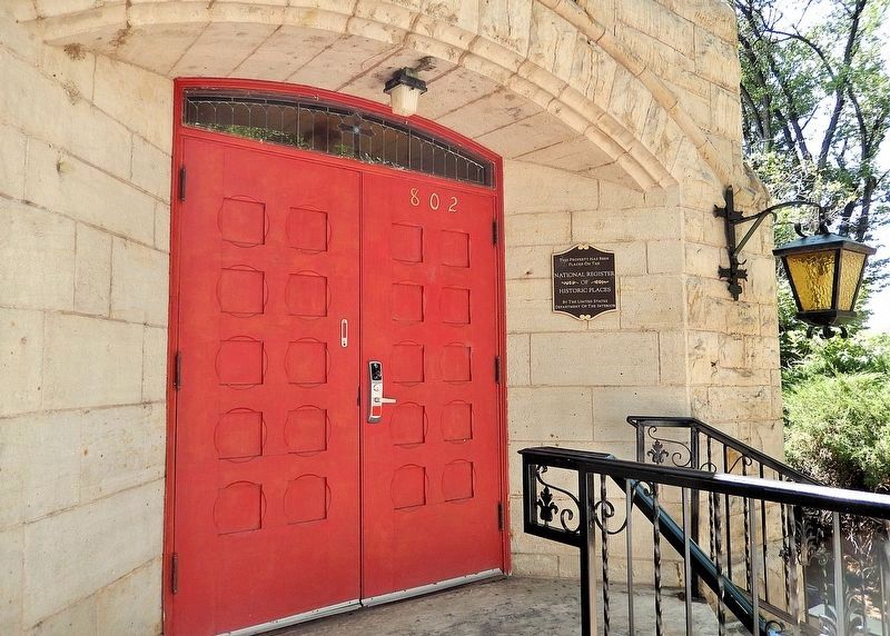
389 ► Connecticut, Capitol Region, Hartford, West End — 915-917 West Boulevard — West Boulevard Historic District —
On West Boulevard east of Rodney Street, on the right when traveling east.
The National Register of Historic Places Historic District Property — — Map (db m230308) HM
390 ► Connecticut, Capitol Region, Hartford, West End — 919-921 West Boulevard — West Boulevard Historic District —
On West Boulevard at Rodney Street, on the right when traveling east on West Boulevard.
The National Register of Historic Places Historic District Property — — Map (db m230311) HM
391 ► Connecticut, Capitol Region, Hartford, West End — 927-929 West Boulevard — West Boulevard Historic District —
On West Boulevard west of Rodney Street, on the right when traveling east.
The National Register of Historic Places Historic District Property — — Map (db m230315) HM
392 ► Connecticut, Capitol Region, Hartford, West End — 92-94 Beacon Street — West End South Historic District —
On Beacon Street south of West Boulevard when traveling north.
The National Register of Historic Places Historic District Property — — Map (db m230299) HM
393 ► Connecticut, Capitol Region, Hartford, West End — 935-937 West Boulevard — West Boulevard Historic District —
On West Boulevard west of Rodney Street, on the right when traveling east.
The National Register of Historic Places Historic District Property — — Map (db m230316) HM
394 ► Connecticut, Capitol Region, Hartford, West End — 939-941 West Boulevard —
On West Boulevard east of Regent Street, on the right when traveling east.
The National Register of Historic Places Historic District Property — — Map (db m230317) HM
395 ► Connecticut, Capitol Region, Hartford, West End — 943-945 West Boulevard — West Boulevard Historic District —
On West Boulevard east of Regent Street, on the right when traveling east.
The National Register of Historic Places Historic District Property — — Map (db m230319) HM
396 ► Connecticut, Capitol Region, Hartford, West End — 947-949 West Boulevard — West Boulevard Historic District —
On West Boulevard just east of Regent Street.
The National Register of Historic Places Historic District Property — — Map (db m230321) HM
397 ► Connecticut, Capitol Region, Hartford, West End — 951-953 West Boulevard — West Boulevard Historic District —
On West Boulevard east of Regent Street, on the right when traveling east.
The National Register of Historic Places Historic District Property — — Map (db m230322) HM
398 ► Connecticut, Capitol Region, Hartford, West End — 959-961 West Boulevard — West Boulevard Historic District —
On West Boulevard west of Regent Street, on the right when traveling east.
The National Register of Historic Places Historic District Property — — Map (db m230300) HM
399 ► Connecticut, Capitol Region, Hartford, West End — 963-965 West Boulevard — West Boulevard Historic District —
On West Boulevard west of Regent Street, on the right when traveling east.
The National Register of Historic Places Historic District Property — — Map (db m230302) HM
400 ► Connecticut, Capitol Region, Hartford, West End — 971-973 West Boulevard — West Boulevard Historic District —
On West Boulevard west of Regent Street, on the right when traveling east.
The National Register of Historic Places Historic District Property — — Map (db m230306) HM

3998 entries matched your criteria. Entries 301 through 400 are listed above. ⊲ Previous 100 — Next 100 ⊳
 
 
CeraNet Cloud Computing sponsors the Historical Marker Database.
This website earns income from purchases you make after using our links to Amazon.com. We appreciate your support.
Paid Advertisement
Nov. 11, 2026
