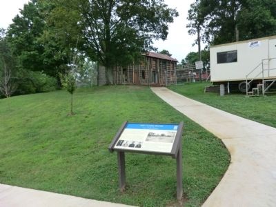
On Long Hollow Pike east of Upper Station Camp Creek Road, on the right when traveling east.
This is the home of four brothers who served in the Confederate army, as did many of Sumner County’s young men. Their father, William F. Clark, a Protestant minister, died in 1847 at the age of forty-one, leaving his wife, Emma Douglass Clark, to . . . — — Map (db m82973) WM
On West Main Street (Tennessee Route 25) at South Locust Avenue, on the right when traveling east on West Main Street.
This was the home of William Trousdale (1790-1872), governor of Tennessee (1849-1851) and U.S. minister to Brazil (1853-1857). During the Union army’s occupation of Gallatin from 1862 to 1870, its commanders regarded former governor Trousdale as the . . . — — Map (db m68416) HM
Near Caldwell Drive at Indian Hills Mound, on the right when traveling east.
The Louisville and Nashville Railroad, among Tennessee’s most strategically important lines, closely followed Mansker Creek here, and a railroad bridge stood two miles downstream. To protect the railroad and the bridge, several companies of Union . . . — — Map (db m74324) HM
On Hazel Path Court east of Hazel Path, on the right when traveling east.
Hazel Path Mansion is associated with the beginnings and legacies of the Civil War in Tennessee. The home of Confederate Gen. Daniel Smith Donelson, completed in 1857, became a camp for escaped slaves (“contrabands") during the war. . . . — — Map (db m149950) HM
Near Antebellum Circle 0.1 miles west of Monthaven Boulevard, on the right when traveling north.
During the Civil War, the hand of occupation landed heavily on farms, houses, and towns along the Louisville & Nashville (L&N) Railroad. This two-story brick Greek Revival-style house, first called Liberty Hall and then renamed Monthaven in 1953, . . . — — Map (db m149363) HM
The war years here at Rock Castle, located between the Cumberland River and the Nashville and Gallatin Turnpike, were typical of many other plantations in Middle Tennessee. In the 1790s, Gen. Daniel Smith established the plantation. Rock Castle . . . — — Map (db m149321) HM
On Spring Haven Court at Carrington Road, on the left when traveling south on Spring Haven Court.
Spring Haven, the home of Joseph Edwards during the war, was in the path of Confederate Gen. John Hunt Morgan in August 1862. Morgan was leading a raid on the Louisville & Nashville Railroad and burning trestles to slow the Union army's movement . . . — — Map (db m210185) HM
Near Portland Boulevard at 2nd Street, on the right when traveling north.
In May 1861, the Tennessee General Assembly passed legislation to raise and equip the Provisional Army of Tennessee and train the units at camps throughout the state. Camp Trousdale was established—initially at Richland (present-day . . . — — Map (db m82978) HM
Near U.S. 31W south of College Street, on the left when traveling south.
Thousands of soldiers with their wagons, livestock, and equipment travelled on the Louisville and Nashville Turnpike (present-day U.S. Hwy. 31 W) during the Civil War. Early in 1862, Union Gen. Don Carlos Buell's Army of the Ohio used this major . . . — — Map (db m151839) HM
On East Pleasant Avenue (Tennessee Route 54) at East Court Square, on the left when traveling east on East Pleasant Avenue.
"The end of an evil year in the history of America—what another year will bring forth remained to be seen—perhaps and most likely the bloodiest war ever known in America, God forbid!" — Tipton County Court Clerk John T. Douglas, . . . — — Map (db m74738) HM
On Ballard Slough Road 0.1 miles north of Randolph Road, on the left when traveling north.
The village of Randolph played a significant early role in the Confederate defense of the Mississippi River. Here in April 1861, the state built training camps for the Provisional Army of Tennessee that Gov. Isham G. Harris had established. As part . . . — — Map (db m74747) HM
On McMurry Boulevard (State Highway 10) west of Hayes Street, on the right when traveling west.
Col. John Hunt Morgan led his brigade into Hartsville during August 1862. He intended to use the town as a base to attack the Louisville and Nashville Railroad near Gallatin. Morgan's goal was to destroy the 800-foot-long Big South Tunnel, which . . . — — Map (db m157312) HM
On the morning of December 7, 1862, the Confederates attacked the Union garrison camped on a bluff overlooking the Cumberland River two miles south of here. Under cover of darkness and falling snow, Morgan and 1,300 men had crossed the icy . . . — — Map (db m68491) HM
On East Main Street at River Street ( Highway 141), on the right when traveling east on East Main Street.
Preface:Following the defeat of Confederate Gen. Braxton Bragg's invasion of Kentucky (Aug.-Oct. 1862), in which Col. John Hunt Morgan's cavalry played an active role, the Confederates retreated to Tennessee. Bragg ordered Morgan to . . . — — Map (db m157303) HM
On Maynardville Highway (Tennessee Route 33/61) at Spring Strret, on the right when traveling east on Maynardville Highway.
The Civil War made civilian life in Union County difficult and dangerous. Most residents opposed secession and were staunch Unionists. men joined such Federal regiments as the 1st Tennessee Infantry and the 2nd and 9th Tennessee Cavalry. Others . . . — — Map (db m100481) HM
On Walker's Ford Road south of Wild Turkey Lane, on the left when traveling north.
(preface)
On November 4, 1863, to divert Federal forces from Chattanooga, Confederate General James Longstreet led two reinforced divisions from the city to attack Union Gen. Ambrose E. Burnside's garrison in Knoxville. Burnside confronted . . . — — Map (db m100482) HM
On College Street (State Highway 30) west of Webster Street, on the right when traveling west.
The Civil War first touched Van Buren County in 1861 when Confederates under James Randals began mining Big Bone Cave's saltpeter deposits. By 1863, 4,017 pounds of nitre—essential to the manufacture of gunpowder—had been produced.
During . . . — — Map (db m153750) HM
On Cumberland Caverns Road 0.7 miles north of Ballard Drive, on the right when traveling north.
Even before Tennessee joined the Confederacy in 1861, officials examined the state’s caves for the nitrogen-containing compound called saltpeter, an essential ingredient in gunpowder. The soil at Cumberland Caverns was ideal—saltpeter had been . . . — — Map (db m83053) HM
On West Court Square south of East Morford Street ( Route 380), on the left when traveling south.
Benjamin Jefferson Hill was nicknamed the "Lion of Ben Lomond" (for Ben Lomond Mountain, near which he lived as a boy). His affection for his home inspired his battle cry, "Come on Boys, recollect the mountains."
Hill became a merchant and the . . . — — Map (db m153638) HM
On West Court Square at East Main Street ( Route 380), on the left when traveling south on West Court Square.
Early in 1861, when the state first voted on secession, Warren County residents, like many Tennesseans, opposed it. When balloting next occurred in June 1861, however, sentiment overwhelmingly favored secession, and county residents voted nearly 100 . . . — — Map (db m83055) HM
Near Old Morrison Road west of South Chancery Street ( Highway 55), on the right when traveling west.
McMinnville's location at the end of the Manchester and McMinnville Railroad shaped the town's Civil War experiences. Strategically important industries here included pork and mule breeding, fruit and apple brandy production, a textile mill, and . . . — — Map (db m153647) HM
Near South Roan Street 0.1 miles south of Bonita Drive, on the right when traveling south.
This was the home of Landon Carter Haynes, a distinguished lawyer and politician who ran unsuccessfully for the U.S. House of Representatives before the onset of the Civil War. Haynes was born in Carter County on December 2, 1816. He attended nearby . . . — — Map (db m69684) HM
From the fall of Fort Donelson to the war’s end, Clifton experienced significant military activity. It was an important port on the Tennessee River and a primary ferry-crossing between Middle and West Tennessee.
During his famous West Tennessee . . . — — Map (db m83157) HM
On East Water Street at Main Street on East Water Street.
Gen. Nathan Bedford Forrest led his cavalry brigade on a raid through west Tennessee, Dec. 15, 1862- Jan 3, 1863, destroying railroads and severing Gen. Ulysses S. Grant’s supply line between Columbus, Kentucky, and Vicksburg, Mississippi. . . . — — Map (db m182831) HM
On East Broadway Street at 3rd Avenue, on the right when traveling west on East Broadway Street.
The residents of Wayne County supported the Union almost unanimously until the fighting began. After the Confederate bombardment of Fort Sumter in April 1861, the majority in the northern portion of the county shifted their allegiance to the . . . — — Map (db m83160) HM
On North High Street at Water Street, on the right when traveling north on North High Street.
Wayne County’s residents were divided in sentiment when the Civil War began. Although they had voted more than two to one to remain in the Union, many people who lived in the northern portion, including the county seat of Waynesboro, had strong . . . — — Map (db m83161) HM
In November 1863, military governor Andrew Johnson ordered Union Maj. John Murphy, 5th Tennessee Cavalry, to take charges of two companies of Union Guards in Nashville. These 200 newly mustered men were from Wayne County and vicinity and were not . . . — — Map (db m53557) HM
On West Main Street (Tennessee Route 54) west of North Wilson Street, on the right when traveling west.
Weakley County's residents voted to stay with the Union in June 1861 while most of West Tennessee supported the Confederacy. Local farmer and slave owner John Drewry spoke passionately against secession here at the courthouse. On June 8, he . . . — — Map (db m274280) HM
On Monterey Highway (State Highway 84) 1.4 miles north of Mack Floyd Road, on the right when traveling north.
Champ Ferguson (1821–1865) was born in Kentucky, the oldest of ten children. He moved to White County, Tennessee, in the 1850s. During the Civil War, he showed passionate loyalty to the Southern cause and extreme hatred for the Union. The alleged . . . — — Map (db m157780) HM
Near Country Club Road (County Route 2200) at Bockman Way (U.S. 70), on the left when traveling south.
This building, constructed late in the 1830s, was a rest stop and tollhouse for travelers and wagoners on the Wilderness Trail Road. During the Civil War, such roads through the rugged Cumberland Plateau were the focus of clashes between Union . . . — — Map (db m150186) HM
On West Maple Street near South Main Street, on the right when traveling west.
“Brother against brother” sums up the divided loyalties families faced in White County during the Civil War. In 1862, Confederate Gen. Braxton Bragg’s troops marched through the Sparta town square en route north to invade Kentucky. . . . — — Map (db m83165) HM
Near Eastern Flank Circle 0.4 miles south of Lewisburg Pike (Business U.S. 431), on the right when traveling west.
(preface)
This walkway traces the route that the men of Confederate Gen. Thomas M. Scott’s brigade took in the Battle of Franklin. Read below to see what it was like then and to follow in their footsteps
Distance to Union Lines: 1,200 . . . — — Map (db m103665) HM
Near Eastern Flank Circle 0.4 miles south of Lewisburg Pike (Business U.S. 431), on the right when traveling west.
(preface)
This walkway traces the route that the men of Confederate Gen. Thomas M. Scott’s brigade took in the Battle of Franklin. Read below to see what it was like then and to follow in their footsteps
Distance to Union Lines: 1,500 . . . — — Map (db m103667) HM
Near Eastern Flank Circle south of Lewsburg Pike (Business U.S. 431), on the right when traveling north.
(preface)
This walkway traces the route that the men of Confederate Gen. Thomas Scott’s brigade took in the Battle of Franklin. Read below to see what it was like then and to follow in their footsteps
Distance to Union Main Line: 1,000 . . . — — Map (db m105086) HM
Near Eastern Flank Circle 0.4 miles south of Lewisburg Pike (Business U.S. 431), on the right when traveling west.
Several Federal gun crews delivered relentless fire to this portion of the Franklin battlefield late in the afternoon of November 30, 1864. At least fourteen of the Union’s thirty-six fieldpieces engaged at Franklin could hit the Eastern flank here. . . . — — Map (db m103508) HM
Near Eastern Flank Circle 0.4 miles south of Lewsiburg Pike (Business U.S. 431), on the right when traveling west.
Visibility was always a critical factor in Civil War battles. Officers and enlisted men needed clear lines of sight to know where to move, when to stay in place, and in which direction to shoot. At the Battle of Franklin, two important factors . . . — — Map (db m103685) HM
Near Eastern Flank Circle 0.4 miles south of Lewsiburg Pike (Business U.S. 431), on the right when traveling west.
During the Civil War, topography played a major role in shaping events. The Battle of Franklin was a prime example.
When Confederate Gen. John Bell Hood’s 20,000 men charged across these fields, the steep hills to their left and the angling . . . — — Map (db m103686) HM
Near Eastern Flank Circle 0.4 miles south of Lewisburg Pike (Business U.S. 431), on the right when traveling west.
More than 700 Union soldiers were made prisoners before, during, and after the Battle of Franklin. Although the war was almost over, many of them would never see their homes again. The vast majority were taken to prison camps in Cahaba, Alabama, and . . . — — Map (db m103505) HM
Near Eastern Flank Circle 0.4 miles south of Lewisburg Pike (Business U.S. 431), on the right when traveling west.
Confederate Gen. Willaim Loring’s division marched across the McGavock plantation during the battle. Anticipating heavy casualties, his officers chose Carnton for a hospital.
The main house was a sound choice. Less than a mile (.6 km) from . . . — — Map (db m103442) HM
Near Eastern Flank Circle 0.4 miles south of Lewsiburg Pike (Business U.S. 431), on the right when traveling west.
On September 28, 1861, local men sympathetic to the Confederacy gathered in this field to form the Williamson County Cavalry (Co. F, 4th Tennessee Cavalry). The local newspaper pronounced the company composed of “about 100 of the finest . . . — — Map (db m103480) HM
Near Eastern Flank Circle 0.4 miles south of Lewsiburg Pike (Business U.S. 431), on the right when traveling west.
In the Battle of Franklin, Confederate Gen. William W. Loring’s division formed the far right flank of the Confederate assault line. Numbering approximately 3,500 men, it marched across these fields and smashed into the Federal lines. The attempt . . . — — Map (db m103482) HM
Near Eastern Flank Circle 0.4 miles south of Lewsiburg Pike (Business U.S. 431), on the right when traveling west.
About 600 yards (550 meters) in front of you is the Nashville & Decatur Railroad. During the war, this line was only a few years old, but it was the most direct north-south transportation route through Middle Tennessee. Consequently, it was one . . . — — Map (db m103635) HM
Near Eastern Flank Circle 0.4 miles south of Lewsiburg Pike (Business U.S. 431), on the right when traveling west.
Whether in the Union or Confederate ranks, the typical Civil War soldier at Franklin came from a rural world. More than likely, he lived in the countryside or in a town about the size of Franklin, which had a population of about 750 at the time. . . . — — Map (db m103636) HM
Near Eastern Flank Circle 0.4 miles south of Lewsiburg Pike (Business U.S. 431), on the right when traveling west.
About one mile (1.6 km) directly north of you stands Fort Granger, a large earthen fortification that provided the Union army a commanding view over much of this area. Built in the spring of 1863, Fort Granger sat on top of Figuers’ Bluff . . . — — Map (db m103637) HM
Near Eastern Flank Circle 0.4 miles Lewisburg Pike (Business U.S. 431), on the right when traveling west.
Road construction boomed in Tennessee during the mid-1800s, and the Nashville area was the state’s primary highway hub. Private companies built most of the roads, and they placed tollhouses along the routes to collect fees to cover costs and create . . . — — Map (db m103666) HM
Near Eastern Flank Circle south of Lewsburg Pike (Business U.S. 431), on the right when traveling north.
During the battle, Confederate forces charged a gristmill and sawmill that stood directly in front of you on the Lewisburg Pike. In antebellum Middle Tennessee, tobacco grew well in the north, while cotton blossomed in the south. Corn, wheat, and . . . — — Map (db m103960) HM
Near Eastern Flank Circle 0.4 miles south of Lewsiburg Pike (Business U.S. 431), on the right when traveling west.
Of Tennessee’s 83 counties in 1860, only in three did slaves outnumber whites. Two were near the Mississippi River, where large plantations flourished. The third was Williamson County.
The McGavocks of Carnton, who owned 39 people in 1860, were . . . — — Map (db m188574) HM
Near Eastern Flank Circle 0.4 miles south of Lewisburg Pike (Business U.S. 431), on the right when traveling west.
Today’s Carnton presents a quiet pastoral setting, but before the Civil War, John and Carrie McGavock’s farm would have looked more like a bustling agricultural factory.
Their plantation encompassed 700 acres, more than three times the amount . . . — — Map (db m188613) HM
Near Eastern Flank Circle 0.4 miles south of Lewsiburg Pike (Business U.S. 431), on the right when traveling west.
How costly was the Battle of Franklin? More Americans became casualties in this five-hour battle than were lost in the first twenty-four hours of the Invasion of Normandy on June 6, 1944, the largest amphibious assault in history.
In both . . . — — Map (db m189005) HM
Near Carnton Lane 0.6 miles south of Brandon Drive. Reported permanently removed.
Preface:
In September 1864, after Union Gen. William T. Sherman defeated Confederate Gen. John Bell Hood at Atlanta, Hood led the Army of Tennessee northwest against Sherman’s supply lines. Rather than contest Sherman’s “March to . . . — — Map (db m135448) HM
On Cleburne Street, on the right when traveling west. Reported missing.
(Preface): In September 1864, after Union Gen. William T. Sherman defeated Confederate Gen. John Bell Hood at Atlanta, Hood let the Army of Tennessee northwest against Sherman's supply lines. Rather than contest Sherman's "March to . . . — — Map (db m137247) HM WM
According to a Nashville newspaper, by 1863 the ravages of war had made once-prosperous Franklin "but the ruin of its former greatness. Desolation and decay have passed over it."
The Union occupation in the spring of 1863 was followed by a . . . — — Map (db m120382) HM
On Eastern Flank Circle 0.4 miles south of Lewisburg Pike (Business U.S. 431), on the left when traveling west.
In 1860, African-Americans — both enslaved and free — made up more than half of Franklin's residents, as well as half of Williamson County's population. When the Federal army arrived late in 1862, many slaves freed themselves by . . . — — Map (db m120385) HM
On West Main Street (State Highway 246) at Columbia Avenue (U.S. 31), on the left when traveling west on West Main Street.
Preface:In September 1864, after Union Gen. William T. Sherman defeated Confederate Gen. John Bell Hood at Atlanta, Hood led the Army of Tennessee northwest against Sherman's supply lines. Rather than contest Sherman's "March to the . . . — — Map (db m193536) HM WM
On Davenport Boulevard at Danton Boulevard, in the median on Davenport Boulevard.
(Prelude) In September 1864, after Union Gen. William T. Sherman defeated Confederate Gen. John Bell Hood at Atlanta, Hood led the Army of Tennessee northwest against Sherman's supply lines. Rather than contest Sherman's "March to the . . . — — Map (db m149830) HM
In September 1864, after Union Gen. William T. Sherman defeated Confederate Gen. John Bell Hood at Atlanta, Hood led the Army of Tennessee northwest against Sherman’s supply lines. Rather than contest Sherman’s “March to the Sea,” Hood . . . — — Map (db m41119) HM
Near Eddy Lane 0.1 miles south of Fort Granger Drive, on the right when traveling south.
Welcome to Fort Granger. The fort’s position atop Figuers Bluff allowed the Union army to command the town of Franklin as well as the road and railroad that served Nashville. The 84th Indiana Infantry was among the regiments that improved and manned . . . — — Map (db m208599) HM
On West Main Street at 3rd Avenue South, on the right when traveling east on West Main Street.
(prelude)
In September 1864, after Union Gen. William T. Sherman defeated Confederate Gen. John Bell Hood at Atlanta, Hood led the Army of Tennessee northwest against Sherman’s supply lines. Rather than contest Sherman’s “March to . . . — — Map (db m141977) HM
Near 2nd Avenue South south of East Main Street (Business U.S. 31), on the left when traveling south.
As the Civil War approached, Masons urged peace. James McCullum, Grand Master of Tennessee, encouraged "the brethren engaged in the lawful contest to remember that a fallen foe is a brother, and as such is entitled to warmest sympathies and . . . — — Map (db m147247) HM
On Columbia Avenue south of East Fowlkes Street, on the right when traveling north.
(Preface): In September 1864, after Union Gen. William T. Sherman defeated Confederate Gen. John Bell Hood at Atlanta, Hood let the Army of Tennessee northwest against Sherman's supply lines. Rather than contest Sherman's "March to . . . — — Map (db m188516) HM WM
On Carnton Lane 0.3 miles south of Brandon Drive, on the left when traveling south.
In the spring of 1866, the bodies of Confederate soldiers killed at the Battle of Franklin were exhumed from their temporary graves and reburied here, on this two-acre plot adjacent to Carnton, home of John and Carrie McGavock. Over about ten weeks, . . . — — Map (db m83183) HM
Near Franklin Road (Business U.S. 31) at Harpeth Industrial Court, on the right when traveling south.
(prelude)
In September 1864, after Union Gen. William T. Sherman defeated Confederate Gen. John Bell Hood at Atlanta, Hood led the Army of Tennessee northwest against Sherman's supply lines. Rather than contest Sherman's "March to the Sea." . . . — — Map (db m150917) HM
On 3rd Avenue South at Public Square, on the left when traveling north on 3rd Avenue South.
On November 30, 1864, one of the last major battles of the American Civil War exploded across the rolling farmland just south of Franklin. Approximately 20,000 United States soldiers under Gen. John M. Schofield barely held off a massive attack by . . . — — Map (db m145948) HM
On Lewisburg Pike (Business U.S. 431) west of Carriage Park Drive, on the right when traveling west. Reported permanently removed.
On the morning of November 30, 1864, some 5,000 Federal cavalrymen under Gen. James H. Wilson were in this area. Most were located to your right front, east of the Harpeth River, but Gen. John T. Croxton’s brigade remained west of the river. By . . . — — Map (db m300444) HM
Near Columbia Avenue (Business U.S. 31) north of Strahl Street, on the left when traveling north.
(preface)
In September 1864, after Union Gen. William T. Sherman defeated Confederate Gen. John Bell Hood at Atlanta, Hood let the Army of Tennessee northwest against Sherman's supply lines. Rather than contest Sherman's "March to the Sea," . . . — — Map (db m188356) HM
(Preface):In September 1864, after Union Gen. William T. Sherman defeated Confederate Gen. John Bell Hood at Atlanta, Hood led the Army of Tennessee northwest against Sherman's supply lines. Rather than contest Sherman's "March to the . . . — — Map (db m164302) HM WM
On Columbia Pike (U.S. 31), on the right when traveling south.
(Preface): In September 1864, after Union Gen. William T. Sherman defeated Confederate Gen. John Bell Hood at Atlanta, Hood led the Army of Tennessee northwest against Sherman's supply lines. Rather than contest Sherman's "March to . . . — — Map (db m135822) HM
On Thompson's Station Road West at School Street, on the right when traveling west on Thompson's Station Road West.
(preface)
In September 1864, after Union Gen. William T. Sherman defeated Confederate Gen. John Bell Hood at Atlanta, Hood led the Army of Tennessee northwest against Sherman’s supply lines. Rather than contest Sherman’s “March to . . . — — Map (db m75122) HM
Near South Maple Street south of West Adams Street, on the left when traveling south.
The city of Lebanon purchased the land for this beautiful cemetery in 1846. Beneath its trees lie more than 150 soldiers who served in the Confederate army during the Civil War, including many Wilson County men who enlisted in the 7th Tennessee . . . — — Map (db m100111) HM
On Cumberland Street at Main Street, on the right when traveling south on Cumberland Street.
In April 1862, after the Battle of Shiloh, Confederate Col. John Hunt Morgan planned a raid through Tennessee and Kentucky to sever Union supply lines. Morgan let the 2nd Kentucky Cavalry from Corinth, Mississippi, into Tennessee and engaged with . . . — — Map (db m266424) HM
On North Castle Heights Avenue at Hill Street on North Castle Heights Avenue.
You are standing on Seawell Hill, where Confederate Gen. Joseph Wheeler’s cavalrymen camped during their raid through Tennessee. They had destroyed parts of the railroad to Chattanooga then moved north up the Tennessee River Valley, damaging the . . . — — Map (db m68381) HM
On West Main Street at Hatton Road, on the right when traveling west on West Main Street.
On this site was the home of Robert H. Hatton that was unfortunately destroyed by fire after the war. He was born in October in 1826, but early in his life his family moved to Lebanon. He graduated from Cumberland University and then studied law at . . . — — Map (db m268193) HM
Lebanon, because of its proximity to the Cumberland River and its position as a turnpike crossroads, was soon caught in the crossfire of the Civil War. Federal troops first appeared early in 1862. An engagement on the Lebanon Square in May . . . — — Map (db m248884) HM
374 entries matched your criteria. Entries 301 through 374 are listed above. ⊲ Previous 100