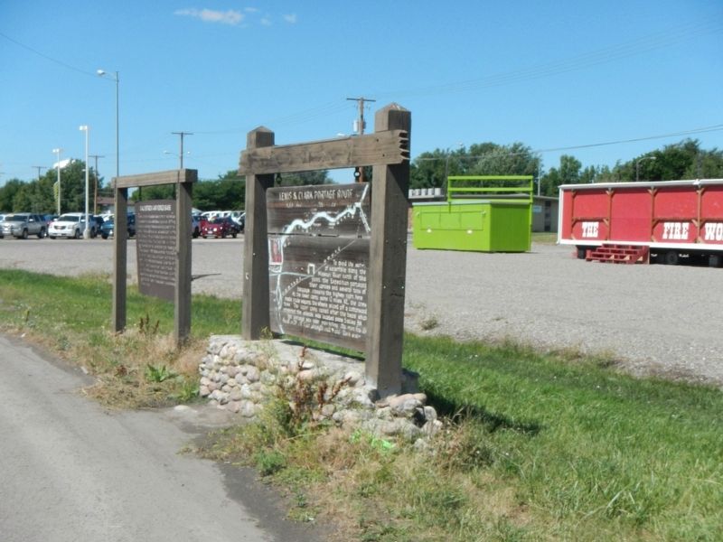
To avoid the series of waterfalls along the Missouri River north of this point, the Expedition portaged their canoes and several tons of baggage, crossing the highway right here. At the lower camp, some 12 miles NE, the crew made crude wagons, the . . . — — Map (db m143667) HM
While Clark directed the portage, Lewis supervised the laborious process of assembling a boat they had hauled in pieces from Harpers Ferry, Virginia. Although it was regarded as an "experiment" the iron frame represented cutting-edge . . . — — Map (db m314297) HM
Thirty-six hundred people watched Nomads of the North at the grand opening of the Liberty Theatre in August 1921. A musical score, played on a $47,000 Wurlitzer organ, accompanied the silent film. An overflow crowd of two thousand toured the . . . — — Map (db m143756) HM
Since 1942, Malmstrom Air Force Base has been on the frontline of America's national defense. Known locally as East Base during World War II. B-17 Flying Fortress pilots trained here and the base served as a staging area for military planes flown to . . . — — Map (db m143664) HM
Freemasons trace their history to the stonemasons of Medieval Europe, an association referenced in the design for the Great Falls Masonic Temple. Constructed in 1914, the three-story building features a dramatic central tower and steep gable bays . . . — — Map (db m143771) HM
Carroll B. McCulloh and his wife Ella constructed this elegant two-story brick home in 1911, raising their two children here. Its two-and-one-half stories, simple box shape, low-hipped roof, large central dormer, wide overhanging eaves, and offset . . . — — Map (db m143855) HM
Regimented Routine
The men followed military protocol, receiving orders from the captains and sergeants. The daily chores became second nature and never-ending.
They hunted, cooked for today, or dried meat for tomorrow.
They prepared . . . — — Map (db m143874) HM
In the 1880s Murphy, Maclay and Co. sold everything from flour and fine teas to window glass and blasting powder. Edgar Maclay and John Murphy established the firm with stores in Helena and Fort Benton in 1882. Two years later they sent Worden Wren . . . — — Map (db m143754) HM
Town founders Paris Gibson and Herbert Chowen built the original Park Hotel in 1892 to serve travelers disembarking at the nearby Great Northern Depot. When the hundred-room hotel burned in a 1913 fire, Park Hotel owners hired prominent Great Falls . . . — — Map (db m143753) HM
Great Falls founder Paris Gibson was drawn to the power of the falls of the Missouri where he vowed to found an industrial center of “unsurpassed beauty.” Backed by railroad magnate James J. Hill, Gibson hired H. P. Rolfe to plat the . . . — — Map (db m143857) HM
Meriwether Lewis recorded the first scientific observations of the westslope cutthroat trout while he ate one for dinner. Once abundant, the fish has been listed as a species of special concern since 1979.
"These trout...precisely resemble our . . . — — Map (db m143908) HM
The narrowleaf cottonwood, a tree "with a leaf like that of the wild cherry" was first described for modern science by Lewis on June 12, 1805. Other expedition first near Great Falls include documenting the cutthroat trout, thirteen-lined . . . — — Map (db m143875) HM
Over 150 million gallons of water flow from Giant Springs everyday and cascade into the Missouri River.
The springs occur where cracks in the rocks above the Madison Limestone allow water to leak upward to the land surface. It is similar to a . . . — — Map (db m127798) HM
By 1908, Montana’s agricultural boom was in full swing, and real estate agents like John Quigley, whose firm offered farms “on 20 years payments,” seemed poised to make a fortune. That year forty-eight-year-old Quigley built this large . . . — — Map (db m143807) HM
...the river appears here to have woarn (sic) a channel in the process of time through a solid rocks." -- Meriwether Lewis, June 13, 1805.
The Early Cretaceous world
The layered sedimentary rocks in the falls and gorge walls . . . — — Map (db m246025) HM
Thirty-six hundred people watched Nomads of the North at the grand opening of the Liberty Theatre in August 1921. A musical score, played on a $47,000 Wurlitzer organ, accompanied the silent film. An overflow crowd of two thousand toured the . . . — — Map (db m143757) HM
On July 3, 1984 this island was named in honor of Sacajawea, the Shoshoni Indian girl who accompanied the Lewis and Clark expedition from the Mandan villages to the Pacific Coast.
Sacajawea was born about 1788 in southwest Montana, At 12 . . . — — Map (db m143877) HM
On his way down the Ohio River in 1803, Captain Meriwether Lewis purchased a Newfoundland dog for twenty dollars. It was a perfect choice of breed for the impending exploration; powerful swimmer, strong guarding instinct, gentle disposition and a . . . — — Map (db m143860) HM
Shortly after Pope Pius X established the Diocese of Great Falls in 1904, Great Falls’ first bishop, Matthias Lenihan, hired Montana architect John Hackett Kent to design a cathedral equal to those in Europe. Kent, who helped design the Montana . . . — — Map (db m141924) HM
Irish-born Timothy Collins followed the gold stampedes to Montana but soon turned to law and politics. For a time in the 1870s he was the only attorney practicing in Meagher County. Elected to the territorial legislature several times, Collins was a . . . — — Map (db m143677) HM
Apartment buildings were good investments in rapidly expanding communities like Great Falls, which grew from 17,000 to 26,000 between 1910 and 1920. Owners reported waiting lists for units, which ranged from rooms in old-fashioned “apartment . . . — — Map (db m143824) HM
Lewis and Clark Trail markers follow today's highways, but rivers actually determined most of their route. By the Great Falls, over 2500 miles of Missouri "roadway" had been navigated.
Keeping the Expedition Afloat
During three seasons . . . — — Map (db m143674) HM
Designed to be Portable
In 1803, Captain Meriwether Lewis led an expedition to map a water route west to the Pacific Ocean. Along the way, the Lewis and Clark Expedition uses 26 different boats, but one deserves special mention. . . . — — Map (db m143669) HM
Although Lewis and Clark saw the waterfalls as an obstruction, a century later others viewed it as a way to meet the region's energy needs. The natural rapid drop in river elevation provided a ready-made source of water power to spin turbines and . . . — — Map (db m246037) HM
For Meriwether Lewis in 1805, the falls were an obstacle on the journey to the Pacific. To Paris Gibson (near right) the falls were a source of great opportunity. As Gibson laid out the townsite of Great Falls he envisioned dams to harness the falls . . . — — Map (db m126545) HM
On June, 13, 1805 Captain Meriwether Lewis confirmed the existence of what had been just a legend to many - the Great Falls of the Missouri River. Earlier that day, Lewis, who as suspected the falls were in the area based on what the Minnetaree . . . — — Map (db m141983) HM
”…the men has to haul with all their Strength Wate & art, catching grass & knobes and Stones with their hands to give them more force in drawing on the Canoes & Loads, at every halt, those not employed in repairing the Course, are asleep . . . — — Map (db m126558) HM
Across the hillside in front of you, deeply pocked with the hardened imprints of bison, came the Corps of Discovery's struggling portage crews - limping, faint, exhausted. Four times at the Lower Portage Camp they loaded baggage into six canoes laid . . . — — Map (db m314285) HM
From here you can witness one of the shortest rivers in the country flowing into the longest river. The Roe River ranks as one of the shortest rivers at only 201 feet in length. The Missouri River is the longest in the country stretching 2,540 . . . — — Map (db m82765)
In Grateful Memory of
316 High School Boys
Who Enlisted in the World War
1914 - 1919
All but ten returned to serve as
Citizens in the Arts of Peace
The Ten Who Died in Service
for Whom the Elm Trees about this plat are . . . — — Map (db m143789) WM
Native American tribes followed the buffalo through this area and camped at Giant Springs. The temperature of the spring water stays a consistent 54 degrees all year long, making this a good site for winter camps.
Lewis and Clark Corps of . . . — — Map (db m127799) HM
The front canted bay window hints at the modest one-story Queen Anne style residence that lies at the core of this elegant home. In 1891, the house was one of only two on the block. A small back addition had been added by 1900, when Mandeville . . . — — Map (db m143822) HM
Lieutenant John Mullan built a wagon road through this area in late July 1860. The 624-mile road connected the head of navigation on the Columbia River at Walla Walla, Washington Territory and Fort Benton, the world's innermost steamboat port on the . . . — — Map (db m245997) HM
At the center of the African American community in Great Falls for more than a century, the Union Bethel AME Church began holding regular services in the first fire station in 1890. The following year African American residents gathered with white . . . — — Map (db m143792) HM
Bustling with activity, the Lewis and Clark Expedition made its home here for weeks. Clark chose the site on June 18, 1805, and the expedition based here unit July 13, when Lewis, Sacagawea and her baby became the last to leave. Here, the Corps . . . — — Map (db m314328) HM
The Sisters of the Order of St. Ursula came to Montana in 1884 to establish schools for Indians. When the homestead movement created a need for more urban educational facilities, the Great Falls Townsite Company offered the sisters any two city . . . — — Map (db m143791) HM
A grand home on a large corner lot, this Colonial Revival residence bespeaks the prominence of its first owners. Banker, rancher, and state senator William Floweree and his wife, Norma, built this brick two-and-one-half-story home in 1916. Its . . . — — Map (db m143806) HM
The views before you have changed significantly since 1805, when members of the Lewis and Clark Expedition based their lives here for more than three weeks. Massive herds of buffalo once grazed all around this area, using a place just to the north . . . — — Map (db m314280) HM
Geologists have determined that water seeps into the ground southeast of Great Falls in the Little Belt Mountains, where the Madison Limestone formation is exposed at the land surface. The water then travels through the formation toward Giant . . . — — Map (db m82764)
At the time of Lewis and Clark, with thousands of bison crossing the in this area, the riverbanks and islands were a predator's feast ground. Many of the bison perished in the rushing waters. Their rotting carcasses attracted so many wolves and . . . — — Map (db m314352) HM
William and Isabel Shea built this cozy one-story brick home in 1929. With its distinctive low profile, clipped-gable shingle roof, stucco siding, exposed rafter tails, and multi-pane windows, the inviting residence is a classic Craftsman style . . . — — Map (db m143670) HM
With little information about what animals and people the Expedition would encounter Lewis gathered an array of weapons. Each soldier brought the musket he had already been issued by the army. Additionally, the Expedition has large caliber rifles, . . . — — Map (db m314606) HM
Captain Lewis went up Belt Creek until he found a place they could pull their canoes up the canyon wall to the prairie above.
I employed them in taking five of the small canoes up the creek which we now call portage creek about 1 3/4 . . . — — Map (db m314626) HM
Once the Expedition reached this area, they were faced with how to portage around the five waterfalls, a distance of about eighteen miles. The south side would be the shortest way, however, two men who were sent to explore this area gave a very . . . — — Map (db m314605) HM
With all the work of portaging the falls going on the men of the Expedition still took time to observe their surroundings.
At the Upper Portage Camp, the men caught a rat that had been in their stores. This resulted in the first scientific . . . — — Map (db m314608) HM
Lewis recorded the start of the portage on June 21, 1805, "This morning I employed the greater part of the men in transporting apart of the baggage over Portage Creek to the top of the high plains about three miles in advance on the portage . . . — — Map (db m314629) HM
In 1804-1806, Captains Meriwether Lewis and William Clark led the Corps of Discovery on an epic journey. Charged by President Thomas Jefferson to find a water route to the Pacific Ocean through the newly acquired Louisiana territory, they mapped the . . . — — Map (db m314635) HM
Near this site canoes and baggage to be transported overland to the Upper Portage Camp were assembled and readied for the next day's portage. By staging loads the day before the men could make the eighteen-mile trip to the Upper Portage in one day. . . . — — Map (db m314632) HM
The discovery of silver in 1879 in Galena Creek southwest of here created a real transportation challenge for the miners of the early 1880's - how to bring in mining supplies and how to haul their precious ore out to distant railroads and markets.
. . . — — Map (db m108776) HM
Montana may seem a long way from international events, yet it was once in the forefront of a confrontation between the United States and Soviet Union. In October 1962, American President John F. Kennedy and Soviet Premier Nikita Khrushchev stood . . . — — Map (db m127800) HM
Rich veins of silver were mined in the Historic Neihart Mining District for a fifty-year period beginning in July 1881. Remnants of the first claim, the Queen of the Hills mine, are located just a few hundred yards north of where you are standing. . . . — — Map (db m128300) HM
The ore-extraction process also carries the legacy of pollution. In particular, tailings are leftovers from crushing and chemically treating ore to extract valuable metals such as silver. This fine-grained material, which has been found in isolated . . . — — Map (db m128351) HM
While not as glamorous as gold, coal plated a critical part in Montana's history. It fueled the railroads, fired the smelters. and heated Montana homes. Much of the state's economy was once based on coal. Extensive bituminous coal deposits were . . . — — Map (db m246261) HM
Bird Tail Rock to the southeast was one of the most prominent landmarks along the Benton Road between Fort Benton and Helena. An igneous intrusion about 55 million years old, it acquired its name because it resembled a "bird's tail" erect and spread . . . — — Map (db m144027) HM
When John Mullan built a wagon road across western Montana in 1860, he utilized a ford across the Sun River just a few yards west of here that had been used by the Indians for generations.
In 1862, the crossing was the site of a government . . . — — Map (db m101870) HM
Born in Wales, Robert Vaughn farmed and mined coal in the Midwest before leaving Illinois in 1864 for the Montana goldfields. Observing how his ponies and oxen “fattened readily on weathered bunch grass,” even in winter, he filed for a . . . — — Map (db m143905) HM
The Mullan Road left the Sun River Valley here at a place called "The Leaving." After 1864, the road was better known a the Benton Road, connecting Fort Benton to Helena. Traffic on the road peaked during the late spring and early summers when high . . . — — Map (db m143904) HM
Fifty-five to thirty-four million years ago, volcanoes erupted in several areas of central Montana. The upwelling of magma which fed these volcanoes was largely responsible for the Bears Paw Uplift and for several other isolated mountain ranges in . . . — — Map (db m142530) HM
According to legend, the town and the creek got their name from the muleskinner "Big Sandy" Lane. The creek was flooded during one of his long treks from Cow Island to Fort Benton. When "Big Sandy" fluently bewailed his bad luck in superlatives . . . — — Map (db m142531) HM
July 10, 1866 - March 31, 1870
Near this spot soldiers of the 13th Infantry of the U.S. Army built the first permanent Army post in the Montana Territory, where the Judith and Missouri Rivers join together. — — Map (db m161911) HM
Freight was unloaded at Cow Island when water dropped so low that steamboats could not travers the upper river to Fort Benton. For 130 miles the Cow Island Trail wound along the southern foothills of the Bear's Paw to the junction at Big Sandy then . . . — — Map (db m142562) HM
In the spring of 1844, American Fur Company traders, Francis Chardon and Alexander Harvey constructed a trading post near here. Chardon had a reputation as an able and unscrupulous individual, while Harvey was "one of the most abandoned desperados . . . — — Map (db m161839) HM
Another wagon road headed northeast from Fort Bento to the Cypress Hills and Medicine Hat, Alberta. It passed through Big Sandy, on north near Havre and into the Cypress Hills. In 1873 Fort Benton whiskey traders massacred Indians in the Cypress . . . — — Map (db m142558) HM
The road to the southeast leads to the mouth of the Judith River. An early fur post, Fort Chardon was built there in 1844. In 1866 Camp Cooke, the first miliary (sic) post in Montana, was constructed of cottonwood logs, and endured four years of . . . — — Map (db m142559) HM
Like much of Montana, the lands of the Wortman Ranch still look largely as they did even before the days of Lewis and Clark. Except for the irrigated farmland next to the river, the landscapes here haven't changed in character or appearance for . . . — — Map (db m161903) HM
Gaze out over the lands around you and imagine them filled with 2,000 tidies and 15,000 Indians-it has happened at least twice. Here, enormous gatherings were called to negotiate treaties that transformed relations between Indian tribes and opened . . . — — Map (db m161905) HM
You stand now in an area that was one of the first to feel the rapid growth of immigration that began about 60 years after Lewis and Clark camped here. Steamboats in the late 1800s chose this area as a key stopping point, because the trees needed . . . — — Map (db m161840) HM
In 1855, geologist Ferdinand V. Hayden explored the upper Missouri River for the United States Geologic Service. At that time, the area was the hunting grounds of the Lakota, Blackfeet, Atsina, and River Crow Indians. A lone white man in Indian . . . — — Map (db m161838) HM
Once home to grazing dinosaurs, the lands surrounding you still exhibit the qualities that have mad the Judith Landing area an important crossroads thought human history. Here, at the confluence of two rivers, trees grow more densely than elsewhere . . . — — Map (db m161936) HM
On June 4, 1805 while Captain Lewis was exploring Maria's River, Captain Clark explored the Missouri up form the Carter Ferry site. In Clarks's small party were Sgt. Glass, the Field brothers, G. Shannon and York.
Captain Clarke noted that . . . — — Map (db m245917) HM
On June 12, 1805 Captain Lewis left Grog Springs, climbed up to the plains and headed "West of S.W." with Drewyer, Gibson, Goodrich and Joseph Field. After a twelve-mile hike, they returned to the river for water were they killed tow large grizzlies . . . — — Map (db m245896) HM
George Montgomery, youngest of 15 siblings, was born on a homestead near Brady, Montana. Following graduation for Great Falls High School, and one quarter at the University of Montana, he headed for . . . — — Map (db m142336) HM
The bank was established June 1, 1880, by T. E. Collins, Charles Duer and L. H. Hershfield and Brother. It was first located in the Benton Record Building, then moved to this location in October 1881. The bank remained here until the large . . . — — Map (db m142100) HM
"It's a tough town. Walk in the center of the street and keep your mouth shut," Gunslingers walked this street; few earned a reputation but more earned eternity here than in other fabled western towns.
Indians were fair game. Their corpses . . . — — Map (db m142304) HM
This is a replica of the buffalo robe press that was used at Old Fort Benton. It was big and awkward, but robes were so bulky and heavy that it took equipment like this to handle them. Robes were pressed hair-side out after the four sides were . . . — — Map (db m142212) HM
I.G. Baker and T. C. Power built the original Thwing House in 1868. Under the watchful eye of Mrs. Thwing, this “downtown” hotel competed with the Overland. The hotel closed in 1870 and was rented as military officers’ quarters. It . . . — — Map (db m142134) HM
When Lewis and Clark found this land of mountains, river valley and plains, it was so full of buffalo and other grazing animals that it seemed like Paradise. In the1880's the area became vast open cattle ranges, and today Montana's greatest wheat . . . — — Map (db m142014) HM
Chouteau County was one of the nine original counties created February 2. 1865. At that time there was a sporting disregard for assessors, taxes and the law. For example, in 1872 when the jail burned, all the peace officers were in Canada trading . . . — — Map (db m142450) HM
Minneapolis architects Kees and Fisk drew the plans for this magnificent Queen Anne style courthouse which opened in 1884. As the seat of one of Montana's nine original counties, its grand appearance represents the early affluence of this "Chicago . . . — — Map (db m142451) HM
The Roman Catholic faith came to Fort Benton even before the walls of the fort were erected. Father Jean Pierre de Smet and Nicholas Point celebrated the first mass on Sept. 27, 1846. "Black Robes" continued to serve the area irregularly until Fr. . . . — — Map (db m142452) HM
When fire destroyed the original Church of the Immaculate Conception in 1905, this beautiful Tudor style structure of rough cut stone and ornamental half-timbered gables replaced it in 1907. Salvaged from the blaze was a bell christened in 1880 for . . . — — Map (db m142454) HM
The Coulson Steamboat Headquarters once stood here. The Coulson Line was the largest early company on the upper river. It ran some of the most immense boats, like the Montana and the Dakota, that were over 250 feet long. Coulson . . . — — Map (db m161592) HM
On September 21, 1877, Fort Benton commander Major Guido Ilges got word that the Nimíipuu (Nez Perce) had traveled across the Judith Basin headed for Canada. Thirteen members of Company F, Seventh Infantry Regiment and to civilians . . . — — Map (db m161479) HM
Solomon's Medicine Lodge Saloon was remodeled in 1875 and became the Centennial Hotel. This frame building was moved to the back of the lot by Robert S. and Lydian Smith Culbertson for living quarters, while a new two-story brick hotel was built . . . — — Map (db m142303) HM
Originally this site was occupied by a wooden frame building that housed Mose Solomon’s Medicine Lodge. This legendary saloon was open twenty-four hours a day from spring thaw to first snow. When the building burned, prominent lawyer, customs . . . — — Map (db m161662) HM
Fort Benton’s building boom of 1887-1884 saw the construction of many commercial buildings made of locally produced soft brick. This fine example was built in 1881 as a saddlery by Davidson and Moffitt of Helena. The River Press Company, publisher . . . — — Map (db m142064) HM
Thomas Francis Meagher was born in Ireland in 1823. An Irish Revolutionary, he was caught and sentenced to death. Meagher's sentence was commuted to exile in Tasmania but he escaped to the United States. As a Brigadier General, Meagher commanded the . . . — — Map (db m142253) HM
The threat of fire haunted Fort Benton's businessmen. They took several steps to minimize this risk before incorporating in 1883. A volunteer fire department of three companies of men was organized. Ten strategically located wells were placed along . . . — — Map (db m161663) HM
"Fire" was a cry dreaded by any Westerner, and early Fort Benton was no exception. Flimsy wooden buildings, haystacks, kerosene lamps and primitive stoves created major fire hazards. When city government was organized in 1883, the first steps in . . . — — Map (db m142424) HM
Founded in 1846 as a fur post, Fort Benton is the oldest continuously inhabited settlement in Montana. From its palisaded walls grew the most important transportation center in the Northwest. Trails led to all points of the compass, carrying goods . . . — — Map (db m141987) HM
Alexander Culbertson established Fort Benton in 1846 as an American Fur Company trading post. The remote settlement prospered in the 1850s, but it wasn't until the following decade that it really boomed. The arrival of the steamboat Chippewa at the . . . — — Map (db m142483) HM
The Fort Benton to Fort MacLeod or "Whoop-up" Trail into Canada was the main artery of commerce in the 1869-1883 era. Twenty yoke of oxen was a team and each team hauled three of the heavy freight wagons loaded with trade goods, calico and whiskey. . . . — — Map (db m142216) HM
This three-inch ordinance rifle came to Fort Benton sometime after the Civil War, probably during the time it was a military port, 1869-1881. It has remained here since its arrival, and was here during the Indian Wars of 1876-1877. It has seen no . . . — — Map (db m168229) HM
Fort Benton was the eastern terminus of the Mullan Military Road. Construction of the road began in the summer of 1859 at Fort Walla Walla, the head of navigation on the Columbia River. Lieutenant John Mullan of the U.S. Topographical Engineers . . . — — Map (db m142484) HM
When railroads replaced steamboats, Fort Benton's importance as a trade center declined. In response, Fort Benton businessmen formed the Benton Bridge Company to construct a bridge across the Missouri River to capture the trade of the rapidly . . . — — Map (db m142414) HM
The Fort Benton Engine House, built in 1883, and the Grand Union Hotel are two of only a few structures remaining to remind us of the rapid expansion here during the flourishing steamboat days. When Fort Benton incorporated in 1883, a volunteer fire . . . — — Map (db m142417) HM
Founded in 1846 as the fur trade transitioned fro furs to buffalo robes, Fort Benton was both a trading post and a center for distribution of Indian annuities. In the early 1860s, Montana's gold rush and the initiation of steamboat traffic made the . . . — — Map (db m142173) HM
2388 entries matched your criteria. Entries 301 through 400 are listed above. ⊲ Previous 100 — Next 100 ⊳