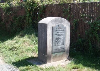
On the beach west of here the U.S. Transport Captain Lincoln was beached at high tide during a storm. The soldiers and crew built a camp from the sails under the trees across the bay from this spot and made a flag pole from a mast from which Old . . . — — Map (db m241038) HM
Travel by land was difficult until about 1915.
The road between Marshfield and North Bend was not completed until 1912. Most people continued to travel by small boats around Coos Bay for several more years.
Mosquito Fleet
. . . — — Map (db m114148) HM
Most travel was on water;
roads and rail lines were limited in the early days.
Passenger ships called at the Port of Coos Bay regularly.
Travel by water was faster, and much more predictable than by land.
In the early . . . — — Map (db m114149) HM
In 1872, the Coos Bay Wagon Road was completed.
The road, which connected Coos Bay Roseburg, was 58 miles long. A stagecoach could make the trip in about 28 hours in good weather.
Another route to the interior was the stage . . . — — Map (db m114150) HM
First Came Steam -
The first tugboats in the Coos Bay area had steam engines, and steam powered tugs were in service up to the 1950s.
Steam power had some advantages: wood and coal to burn to make steam were abundant and cheap, and . . . — — Map (db m114189) HM
The first tugs on Coos Bay were steam-powered, usually towing log rafts or piloting sailing ships in and out of port.
Gasoline and diesel internal combustion engines arrived in the early 1900s and began to replace steam engines. By . . . — — Map (db m114182) HM
(panel 1)
The Oregon Coast boasts forested headlands, towering dunes of sand, and sparkling lakes and rivers. From the Columbia River south to Bandon, the picturesque coastline is bordered to the east by the peaks of . . . — — Map (db m113658) HM
A boat designed to push or tow.
Tugboats have a lot of power and are versatile. A tug can push or tow something a lot bigger than itself and can go backward or sideways almost as well as forward.
Screw propellers are designed for . . . — — Map (db m114183) HM
In November, 1937, Buzz Holmstrom, a service station attendant from Coquille, became the first person to run the Green and Colorado Rivers alone. His eleven-hundred-mile solo journey in a handmade wooden boat brought him national acclaim. After . . . — — Map (db m120641) HM
Aircraft proved their military worth during World War I—initially for observation purposes, and later for the support of ground troops and bombing. When the United States entered the war in 1917, air supremacy was hotly contested and airplane . . . — — Map (db m120619) HM
Monument 1 (far left):
He that doeth the will of God abideth forever. — 1 John 2:17
Monument 2 (second from left):
Offer me not your pity / it is understanding that I seek / for once I stood for something / I stood for you. — . . . — — Map (db m176960) WM
Stein's Pillar, 350 feet high and 120 feet wide, is a modern day clue to this area's ancient past.
Around forty-four million years ago, avalanches of hot ash, pumice and volcanic dust flowing from local volcanic centers filled this ancient . . . — — Map (db m64448) HM
This Memorial
was dedicated August 7, 1938
by the
Crook County Pioneer Association
in grateful remembrance of
the heroic early settlers of
the Central Oregon Country
whose bravery, intelligence and industry
blazed the trail . . . — — Map (db m114268) HM
On March 10, 2011 at 9:54pm (Pacific Standard Time), a 9.0 magnitude earthquake struck off the northeast coast of Japan creating a major tsunami event for the entire Pacific Ocean, including the West Coast of North America. Approximately nine hours . . . — — Map (db m128328) HM
To Samuel N. Dicken, founder of the Oregon Coast Trail. Through his vision, enthusiasm and promotion, the Coast Trail became a reality. This section of the trail is named in Mr. Dicken's honor as a lasting tribute of his support for the Oregon coast . . . — — Map (db m195040) HM
Prior to the attack on Pearl Harbor, a contingent of Japanese I-Class submarines sailed from Yokosuka via the Marshall Islands to take up positions off Hawaii and the coast of North America. Five of these vessels carried midget two-man submarines . . . — — Map (db m112537) HM
Spanish navigators were the first to explore the North American Pacific Coast, beginning fifty years after Columbus discovered the western continents. Sebastian Vizciano saw this cape in 1603 and named it after the patron saint of the day of his . . . — — Map (db m113292) HM
1877 .4 miles up this creek
R.D. Hume started the
first fish hatchery
in Oregon.
1906 Frank Colvin Mgr.
1.6 million fish released.
1926 The state took over the hatchery
1935 The state closed the hatchery
1939 Bob Knox bought . . . — — Map (db m150606) HM
Gold discovered on the beaches at the mouth of Rogue River in the mid-1800s brought miners here; resulted in the Rogue River Indian Wars of 1855-56.
Prattsville, Ellensburg, officially becoming Gold Beach in 1890.
In the 60’s returns from . . . — — Map (db m113220) HM
Gold Beach Ranger Station constructed 1936–37 placed on the National Register of Historic Places April 8, 1986 The nine original buildings on this site were designed by W.I. Turner and constructed by Civilian Conservation Corps . . . — — Map (db m113206) HM
In 1876 Mr. R.D. Hume of Astoria, Oregon, decided to move his commercial salmon fishing, processing and shipping business to the mouth of the Rogue River. Mr. Hume anticipated huge profits due to the large run of "King" Salmon which entered the . . . — — Map (db m73202) HM
Native people call this cape Daa-ghvsh-ne’. European
explorers noted the landmark because of its elevation rising 668 feet above the Pacific Ocean; the name Cape San Sebastian was later given in 1603 by Spanish
explorer Sabastian Vizciano. In the . . . — — Map (db m304196) HM
Patterson Bridge
(Rogue River Bridge)
Completed January 21, 1932 and dedicated In Memory to the Governor of Oregon Isaac Lee Patterson (1926-died in office 1929)
1932.... The bridge was considered the most advanced concrete . . . — — Map (db m113391) HM
The Chetco people are the earliest known inhabitants of the Brookings-Harbor area. The Athabaskan-speaking people of Chit-xu and eight other Chetco group villages originally lived along this river and on the adjacent coast between the Winchuck River . . . — — Map (db m176835) HM
"From the numerous miners and settlers that are pressing into their country they are suffering many grievous wrongs that call for the immediate interference of the Government. Within the last six months four of their villages have . . . — — Map (db m176836) HM
During the early 1850s hundreds of miners and settlers poured into southwest Oregon and onto Indian lands staking claims and establishing farms. The clash of cultural attitudes toward the ownership and use of natural resources led to the Rogue River . . . — — Map (db m113293) HM
The Tututní people lived along the Southern Oregon coast, including this site, and the lower Rogue River for thousands of years before first contact with explorers, miners, and settlers.
In 1792, George Vancouver was among the first outsiders to . . . — — Map (db m176841) HM
Battle Rock City Park has been dedicated in memory of the ancient people (Dene Tsut Dah) and the pioneer founders of this townsite. In 1850, the U.S. Congress passed the Oregon Donation Land Act. This act allowed white settlers to file claims on . . . — — Map (db m176821) HM
Patrick and Jane Hughes' strong support of education and religion helped their children and community flourish.
John Hughes
The third Hughes son, John, studied in the east for the priesthood and was ordained in . . . — — Map (db m113408) HM
While you're in the Port Orford area, we invite you to visit three historic sites — Cape Blanco Light Station, Historic Hughes House, and Port Orford Lifeboat Station. All three are on the National Register of Historic Places. Together they tell the . . . — — Map (db m176850) HM
While you're in the Port Orford area, we invite you to visit three historic sites — Cape Blanco Light Station, Historic Hughes House, and Port Orford Lifeboat Station. All three are on the National Register of Historic Places. Together they tell the . . . — — Map (db m176952) HM
Imagine starting a farm from scratch on isolated, raw land, with no running water, refrigeration or electricity. Everything was hard; everything was physical.
The family cleared great stands of spruce, rooting out the stumps with teams of horses, . . . — — Map (db m176853) HM
As American life modernized in the early 1900s, the Hughes family adapted by making improvements to their farm.
When their father, Patrick Hughes, died from a tragic horse accident in 1901, the three bachelor sons took over the farm. The quiet, . . . — — Map (db m176857) HM
For thousands of years, the Sixes River has been a source of food, transportation, and fun for all who have lived here.
They called the river and the village at its mouth "Sekwetse," according to Coquille and Siletz Tribal sources. Sekwetse means . . . — — Map (db m176860) HM
On Feb. 10, 1937, winds over 75 M.P.H. caused the 190 foot steam schooner "Cottoneva" to run aground at Battle Rock. It was in port loading lumber. The captain and all 26 seamen were rescued by the Coast Guard crew using a breeches body. The . . . — — Map (db m73203) HM
In 1852, gold was found in the beach sands at Whiskey Run, about ten miles north of Bandon. Gold was also found on beaches at South Slough, Bandon, Cape Blanco, Port Orford, Ophir, Pistol River and Gold Beach>
Gold was washed onto the beaches by . . . — — Map (db m176822) HM
"Klondike Kate" (Kitty Rockwell) was also known as the "Queen of the Yukon" during the Klondike Gold Rush and came to Bend in 1914. She made a small fortune in the Yukon as the region's leading singer and dancer but fell in love with Alex Pantages, . . . — — Map (db m157837) HM
Pilot Butte was a beacon for travelers.
On a day sometime in the year 1813, and Indian lookout, from one of several tribes summering in this vicinity, might have “hiked the butte” and from here observed an exploration party . . . — — Map (db m63090) HM
A.J. Tucker came to Bend in 1916 with $180.00 in his pocket. His first work in Bend was building boats and guiding hunting parties from the eastern United States.
Tucker soon set his sights on building, and went on to create several of . . . — — Map (db m157707) HM
A.M. Drake and his wife Florence set camp at the bank of the Deschutes River in June 1900 enticed by the 1894 Federal Carey Act, which encouraged private enterprise to reclaim and develop desert land by building irrigation systems and . . . — — Map (db m157945) HM
In 1905, the Aune brothers opened a livery stable and feed store on Bond Street and soon expanded it sot that by 1908, their large barn occupied one-half of the block on the east side of the street. The Aune brothers specialized in providing heavy . . . — — Map (db m157556) HM
The dam and powerhouse were built in 1910 and 1913 respectfully by the privately-owned Bend Water, Light and Power Company. and were subsequently sold to the Pacific Power and Light Company. The dam, which holds back the waters of the Deschutes . . . — — Map (db m157894) HM
Frontier towns had a long way to go before achieving the fire fighting capabilities of more established communities and fires were an ever-present threat; firefighters had their hands full just getting to the scene. In 1918, Tom Carlon took over as . . . — — Map (db m157911) HM
Partners Floyd Dement and George Childs started a hardware business in 1912 and relocated to this building in 1918. The two worked together until 1935 when they had a falling out and dissolved their partnership. Neither one ventured too far, . . . — — Map (db m157560) HM
Honoring the men and women of Bend who have served, are serving and will serve to defend our freedom during times of peace and war. Remembering the POW, the MIA, and those named below who have made the supreme sacrifice. They will not be forgotten. . . . — — Map (db m113347) WM
The R.N.Bushwalter's Sport Store was the first full-service sporting goods business in Central Oregon. "Buck" -as he was known, offered auto accessories, a large selection of guns, ammunition and fishing tackle, The first pair of skies sold in . . . — — Map (db m157626) HM
The Capitol Theatre was built as the "Carmody Theatre" in 1914 by Dennis Carmody, who placed a "C" on the back of each seat. B.A. "Dutch" Stover bought the theatre in the 192-s and to avoid purchasing new seats, changed the name of the theatre to . . . — — Map (db m157914) HM
This plaque is all that is left of the homesite of Clyde McKay, a man who irrevocably shaped the destiny of Bend. McKay persuaded Eastern lumber interests to expand operations in Bend and join him in forming The Bend Company. This company purchased . . . — — Map (db m157705) HM
Built by A.C. Lucas in 1904 at the corner of Wall Street and Newport Avenue, the Colonial Inn began life as the Pilot Butte Inn. It was move north of its original site in 1916 to make room for a new, larger Inn and was re-named the "Colonial Inn." . . . — — Map (db m157890) HM
For ladies traveling alone, the Cozy Hotel was the only respectable hotel in town. In those days, The Bend Bulletin printed the guest list of the three "higher class" hotels in town; the Cozy was among them. With its twenty-foot ceilings in . . . — — Map (db m157562) HM
The county court was created along with the establishment of Deschutes County in 1916. For the first nineteen years, county offices and the courthouse leased space in the O'Kane Building, then county rented the former Central School from the school . . . — — Map (db m157846) HM
William P. Downing arrived in Bend in 1902, traveling from Bemidji, Minnesota. He got the idea of selling lunches to millworkers, and parlayed the operation into a restaurant on Bond Street. Following the American dream of expansion, he set his . . . — — Map (db m157558) HM
Height: 80+ feet
Circumference: Approximately 80 feet
Age: 300+ years
This grove of old-growth Ponderosa Pines shaded the extensive lawn of the 1901 A.M. Drake home in the future sited of Bend. Drake's Pilot Butte Development Co. . . . — — Map (db m157654) HM
Water flowed across the high desert country during glacial times carving the Dry River Canyon visible beyond the marker. Near this part of Hwy 20, the canyon deepens from about 20 to 200 feet in less than half a mile. It continues northwest for two . . . — — Map (db m283956) HM
Eddie Williamson was Bend's first major auto dealer. He arrived in Bend with his family as youngster in 1916. When he was still young, his family moved to Eugene, but Eddie stayed behind and learned the automobile business. After owning several . . . — — Map (db m157913) HM
The original First Baptist church, erected on this site in 1904, was the first church building constructed in Bend. It was built on land obtained on May, 7, 1904, form A.M. Drake, Bend's founder, for $1.00 on the condition that no liquor would be . . . — — Map (db m157835) HM
Covered wagons poured into the Willamette Valley for over a quarter of a century before Euro-American settlers arrived here in great numbers. Alexander M. Drake, who arrived at the spot in 1900, was one of the first to realize the high prospects . . . — — Map (db m157706) HM
The Goodwillie-Allen-Rademacher House, built in 1904, is one of the oldest Craftsman Bungalow style homes in Oregon, and is the last remaining house from that era on the east side of Mirror Pond. This house was officially listed in the National . . . — — Map (db m157653) HM
On This Site
stood Oregon's
Historic
Pilot Butte Inn
1917 - 1973
This gate was one quaint feature of a Bavarian-style hotel described by author Irvin Cobb as "the finest little hotel in America." It was a popular stopping place . . . — — Map (db m157891) HM
This site marks the home of Kathleen "Klondike Kate" Rockwell, about whom the book "The Life & Legend of Kitty Rockwell, Queen of the Yukon" was written. Much of that legend was made here in Central Oregon, where she took up a homestead in 1914. . . . — — Map (db m157838) HM
To supply the lumber mills with logs, entire mobile towns were created in the woods to house the men and their families who cut down the trees. The towns were movable camps conveyed by railroad cars. From 1916, these temporary towns, or logging . . . — — Map (db m113935) HM
Purportedly the largest outdoor swimming tank in the state in the 1920s was located in Bend on the banks of the Deschutes River, just downstream from Pioneer Park. The 50 x 150 foot steel tank held 330,000 gallons of water. The water came directly . . . — — Map (db m157950) HM
Geologists say the volcanic activity of this area occurred less than 6000 years ago. Lava which exuded from the south side of this butte flowed to the west and blocked the Deschutes River, deflecting it from its former channel. This formed the . . . — — Map (db m68673) HM
(Marker #1) Welcome LAVA RIVER CAVE is one of Oregon's longest (5466 feet) uncollapsed lava tubes. About 100,000 years ago, this conduit carried 2000° F. (1100° C.) lava from an upslope vent to lower areas on the flanks of the Newberry . . . — — Map (db m92909)
The original facade on the Liberty Theater was a dazzling white stucco adorned with musical instruments in relief. The theater had a combined seating capacity of five hundred on the ground floor and balcony. This is the oldest movie theatre left . . . — — Map (db m157612) HM
The bustling marketplace you see today, filled with shops, theaters, restaurants, entertainment and recreation was once the site of the largest pine sawmills in the country.
Back in the 1920s, they were busy, noisy and dusty mills, each . . . — — Map (db m113931) HM
Trees were felled in the woods and hauled to the Deschutes River where they floated downstream to the mills.
The final steps of this log-to-lumber journey occurred as the wet lumber, known as green wood, exited the mill on the green chain.
As . . . — — Map (db m113933) HM
Nicholas Paul Smith's hardware store was a welcome sight in Bend because up until then supplies has to be brought in from Shaniko by stagecoach. Quick to spot a trend, Smith was the first to sell gasoline to the increasing number of automobile . . . — — Map (db m157652) HM
The facade styling of this building was ambitious for the time and it helped to popularize the unique brick used as the building material. The bricks were made of clay for the Bend Brickyard west of town and fire white sand from the Ice Caves south . . . — — Map (db m157651) HM
In its time, O'Donnell Field was one of the largest outdoor arenas in the state and was used for baseball and football games, track and field meets, rodeos, and by traveling carnivals and the Clyde Beatty Circus. It was built in 1916 for $400 and . . . — — Map (db m157844) HM
Hugh O'Kane, an illegal immigrant from Ireland, built the magnificent O'Kane Building. Regarded as the finest example of the Chicago Mercantile Style in Bend, it is still the largest commercial structure in downtown Bend.
O'Kane's role, as a . . . — — Map (db m157557) HM
The Bend Bulletin occupied several buildings over the years, but this building is perhaps the most historically significant since The Bend Bulletin operated from this site from 1940 to 1966. On May 15, 1963, the newspaper changed it's . . . — — Map (db m157610) HM
Construction of the Old Post Office established the presence of the federal government in this area.
It was a project of the Public Buildings Program, a federal agency created by President Herbert Hoover.
As one of the first buildings with . . . — — Map (db m113264) HM
This complex ecosystem nurtures a variety of plants and animals.
Vast, sage-covered plains begin at the eastern foot of the Pilot Butte and stretch dramatically to the east and south. This is Oregon’s fabled “High Desert”. The . . . — — Map (db m63094) HM
Although Pete Pierson was the original blacksmith, he soon sold his business to Joe Egg, who ran the business for fifty years. As late as 1973, Egg was well-known in Bend and Redmond as an ace blacksmith. In that year, Egg told The Bulletin . . . — — Map (db m157708) HM
This is the site of the Pilot Butte Inn, which was known far and wide as an excellent small hotel. Built by Philips Brooks of the Brooks Mill Family, the Inn was the focal point for community activities for many years. A massive lava rock fireplace, . . . — — Map (db m157947) HM
In 1936, partners Maren Gribskov and Eleanor Bechen were looking to expand their restaurant operation and build their own facility in the English Tavern style. They found the perfect location overlooking the Deschutes River. The named for the large . . . — — Map (db m157944) HM
Clyde McKay first came to Bend in 1900 and returned every year thereafter until he moved his family to Bend in 1911. That same year he formed the Bend Company, which purchased the Drake holdings, including the original townsite, a sawmill and power . . . — — Map (db m157655) HM
Although named for A.M. Pringle, it was Maurice Cashman who purchased the half-finished building and who is most associated with it. Cashman turned the building into a premier retail space that housed several stores. Al Eriksen bought the building . . . — — Map (db m157942) HM
This cableway was installed in 1905 by the United States Geological Survey to measure the river's flow.
Today instruments sense and record the elevation of the water surface.
This information is relayed by satellite into computers of water . . . — — Map (db m114253) HM
Evan A. Sather opened this two-story mercantile business and called it the Pine Tree Store because of a pine tree that grew through the front sidewalk. The upstairs was known a Sather Hall and became a popular gathering place for civic and social . . . — — Map (db m157625) HM
You may already know about pipelines. Oil, water and gas, chemicals, medicine and food flow to us through pipes and tubes. Pipelines are a naturally efficient way to move fluid from one place to another. Nature constructs marvelous . . . — — Map (db m92910)
Huge trees were felled in the woods and the logs were transported by railroad to town. They were then dropped into the Deschutes River to await their turn in the mill. The river was a perfect storage place for the logs. The natural flow of the . . . — — Map (db m113936) HM
In the beginning...there were old growth trees.
The small community, first called Farewell Bend from the nearby big bend in the Deschutes River, could have been called “Pilot Butte” if the 1901 recommendation of Postmaster William . . . — — Map (db m63089) HM
From the woods to the Deschutes River, the log was hoisted by the bull chain into the mill from the river to the log deck.
It was then directed to the band saw in one of the three head rigs, where the process began.
It was the head sawyer's . . . — — Map (db m113919) HM
The mills may be gone, but their legacy is apparent all around us. The lumber companies spurred Bend's growth and they helped a lot of folks raise their families in this area. Today we see evidence of Mill B every time we look at the three iconic . . . — — Map (db m113932) HM
The original Tower Theatre was built in 1940 in about three months by two shifts of workers employed by local contractor, Fred Van Matre. The building was dominated by the large "Tower" sign that rose 40 feet above the building to a height of 78 . . . — — Map (db m157624) HM
The railroad brought the outside world to Bend's doorstep, and the builders of what was then the Taggert Hotel knew exactly how to capitalize on it. Located just one block from the depot, the hotel was a modern, fireproof structure with electricity . . . — — Map (db m157946) HM
In 1897 a multi-purpose log cabin was built on this site by the Deschutes River. It was nicknamed the Trappers Cabin because trappers often used it for storage. Church services were sometimes held in the cabin and it was the original office of . . . — — Map (db m266539) HM
Frank T. Johns—Social Labor Party candidate for the presidency of the United States finished his address near this memorial then responded to a call for help from two boys who had fallen into the river from the footbridge upstream. Here Frank T. . . . — — Map (db m266536) HM
A double tragedy occurred in the Deschutes River beside Drake Park on May 21, 1928. Frank T. Johns, a candidate for United States President, was on the campaign trail in Bend delivering a speech when he heard cries for help. Jack Rhodes, a local . . . — — Map (db m266537) HM
With an ingenious mechanism, horses lifted and pulled huge, heavy logs over rugged terrain.
Photo caption 1
Use your imagination for a moment and step back in time. From 1916 to 1929, the nearby forest was bustling with more than 200 . . . — — Map (db m266540) HM
The petrified portions of Dawn Redwood (Metasequoia) trees were donated to the city of Bend by “Klondike Kate” Rockwell (1876-1957). An avid rockhound, she discovered these petrified wood stumps on her homestead near Brothers, Oregon, and they were . . . — — Map (db m266538) HM
In 1851 the immigrant trains used this spot to ford the Deschutes River on their trek to western Oregon. Upon departing, the earliest known train named it Farewell Bend and it is from this origin that the present City of Bend derived its name . . . — — Map (db m266533) HM
Where people lived near obsidian, their lives and cultures were transformed. They used and celebrated the glassy gift of volcanoes to manufacture tools, weapons, jewelry, sculptures, and ceremonial objects. To ancient Central American people, the . . . — — Map (db m72437) HM
The furnaces of the earth brought spectacular change to this land 1300 years ago. A new, rough, glassy environment offered a harsh home for the heartiest plants and animals. Past cultures prized the shiny black rock for their survival. Today, the . . . — — Map (db m72434)
This majestic pine is the biggest of its species ever recorded. It was a giant before the Oregon Territory was established, enduring centuries of fire, insects, disease, and human impact.
Recently half of its crown was lost to weather, . . . — — Map (db m114266) HM
The entire surface of this remarkable flow is glass, a liquid that cooled without crystallizing. The striking differences you see from rock to rock are due to the number and size of bubbles.
Why is everything glass?
Whether natural or . . . — — Map (db m72435)
1437 entries matched your criteria. Entries 301 through 400 are listed above. ⊲ Previous 100 — Next 100 ⊳